An American Visitor to the Rock - Day 8
Summer 2009.
Day 8 - Home to Frenchman's Cove (480mi/770km - http://tinyurl.com/yfuyk9o)
Thursday eventually came and I was able to relieve Kristen of her apartment life involving making meals out of my healthy food items and trying to find something to do (sleeping to noon helped, I would imagine :) ).
This weekend's plans would involve the East Coast of the Island, so we had to get an early start Thursday.
By 9a.m. we were on the road and we reached our highway exit sometime around 1:00.
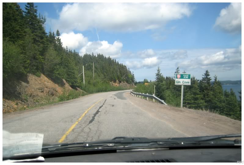
Driving for another 45 minutes on the secondary Route 233 & 230, Kristen was starting to question where I was going on this shoddy road.
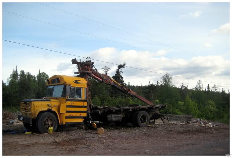
Her puzzlement grew as we came to the end of Route 232 and continued onto a gravel road into the woods. The gravel road was about 15 minutes long with the above monstrosity, bogs, curving roads next to the ocean and the startling of a moose from the shrubs, across the road, and about 10 feet in front of my car (which was screeching to a halt at my sight of the moose).
There's even a sign denoting our destination, but I sped by it and scoffed at Kristen's mention of what we were about to see.
"What did you think that sign said? Pfft! Noooooooo. I wish!"
(If you haven't determined already, yes, I have an unwholesome obsession with surprising people.)
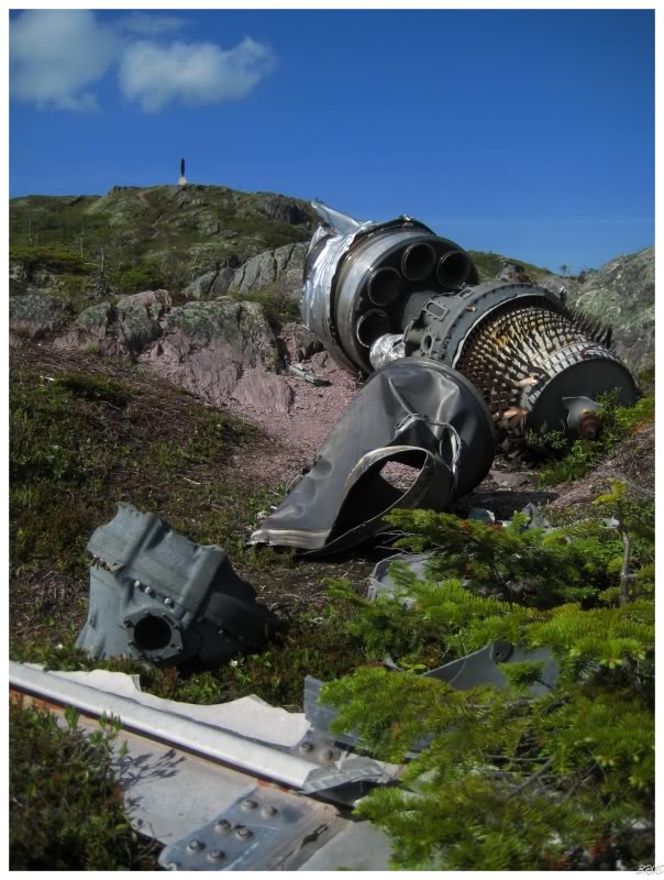
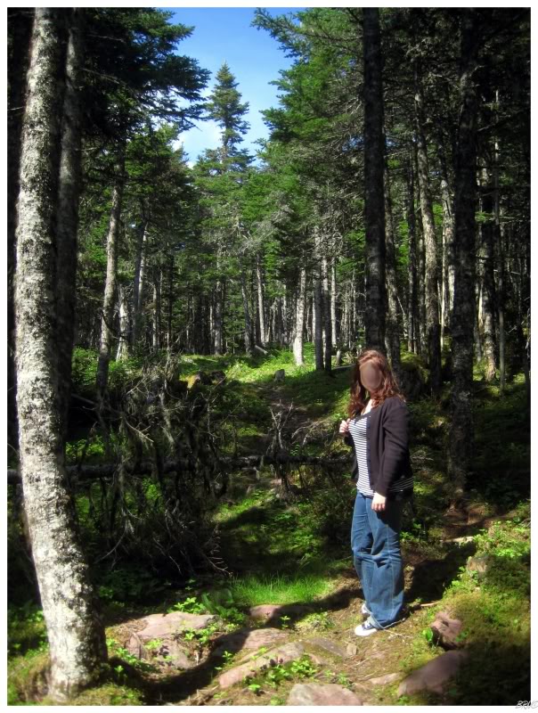
A 45 minute hike and we finally broke through the woods and into some barrens...
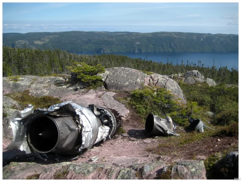
There it was, the J47-GE-19 General Electric, 5200 lb thrust jet engine of the B-36 Peacemaker.
The Peacemaker was originally designed to drop bombs in Germany from home bases in America. It started out with 6 engines, but 4 jet engines were later added, giving the Peacemaker monster a total of 10 engines by the time it came into service in 1948. By then, its purpose was to retaliate against a Soviet Union attack by being able to travel far and drop enormous MK 17 hydrogen bombs into the heart of Soviet Russia (this would have been the largest bomb ever deployed by the U.S. military).
The B-36's 230 ft. wingspan (about 2/3rds of a football field) and 162 ft. length gave it the nickname of the "Aluminum Overcast" as it seemed to blot out the sun when it flew overhead. No other American bomber ever approached the B-36 when it came to size, weight and bomb carrying capacity. It sometimes conducted up to 40 hour missions.
On March 14, 1953, Brigadier General Richard E. Ellsworth led an 18 aircraft training mission from the Rapid City Air Force Base to the Azores, about 70% of the way to Europe, off the western coast of Portugal. The plan was to fly from the Canary Islands to the coast of Maine and over several strategic American cities without being detected by radar. Since this was to test the American's ability to detect the aircraft, no one except Ellsworth knew when the aircraft would depart on the 23 hour mission.
The mission occurred on March 17th with the planes leaving the Canary Islands in 15 minute intervals. The planes were to fly at 500 ft to avoid radar detection, then rise to 40000 ft once at the coast of Maine. Since they couldn't use their radar, they relied on dead reckoning and celestial-getting. The rainy, cloudy day meant that celestial-getting was impossible and the dead reckoning meant they were completely reliant on the weather. The only way to see the stars would have been to rise above the clouds, but the commander ordered that they continue at their height - even as their emergency radar system wasn't working.
The weather continued to do them zero favours as there was a low pressure system in the middle of the Atlantic, which was forecasted to move north. The low pressure system didn't move north at the forecasted time and the crewmen had no idea. The navigator aboard the plane ordered a northern correction of a few degrees to negate the southern drift caused by the low pressure system supposedly to their south. Since the low pressure system was actually south of them, the northern correction plus the northern drift caused by the low pressure system caused them to come upon North America 400 miles north of their planned destination off Maine.
At 4:10 a.m. Newfoundland time, General Ellsworth's aircraft flew into the ridge here in Trinity Bay. Spilled fuel ignited a giant fireball, killing all 23 men aboard.
The second aircraft in the 18 plane convoy brushed a spruce tree about 120 miles / 200 kilometers south of here, before performing an emergency climb. The weather improved as the night went on and each of the 16 remaining aircraft had slightly better conditions than the last one.
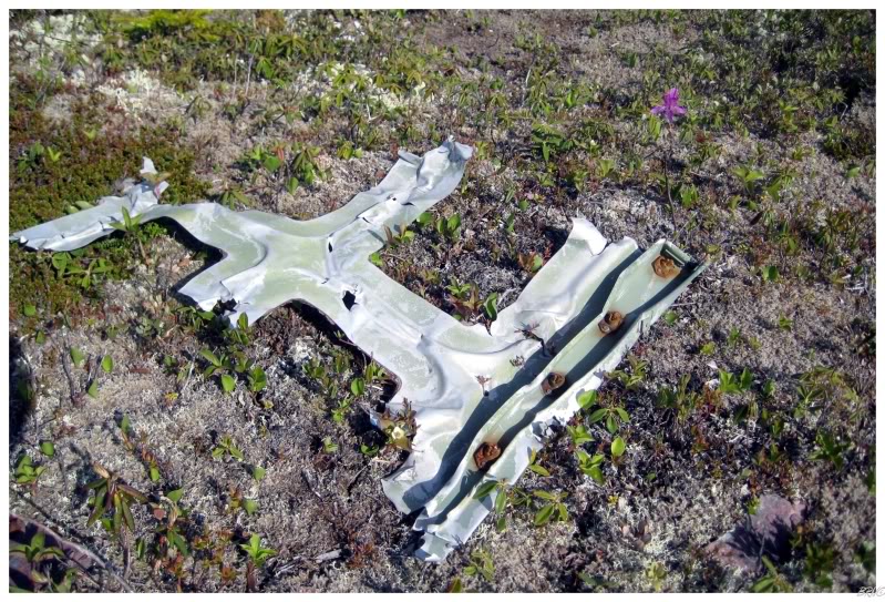
Walking around the crash site, there were little pieces of plane everywhere.
I read somewhere that there used to be a LOT more stuff up there as the military came and only removed the bodies, personal items and ammunition - but locals have taken souvenirs and scrap from the location for years.
It'd definitely be interesting if you knew people in the area and you would see random artifacts in people's houses.
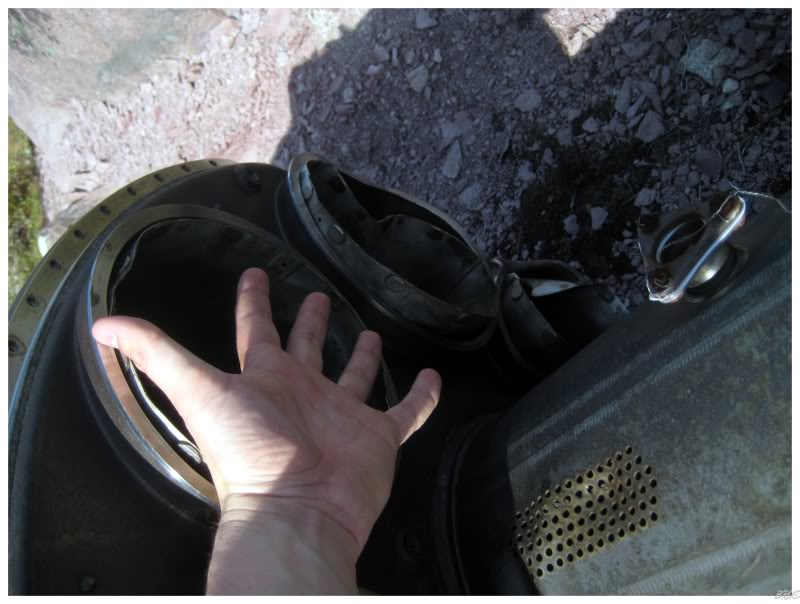
While moving about and doing goofy things like comparing the size of my hands to the jet engine cylinder, I heard Kristen yell "Holy shit!!! Hey come over here! Hurry up!"
Since I only skim over pictures before visiting a place, I didn't know what to expect; so I hurriedly moved across the barrens and to the top of a ridge.
^(Notice wing Kristen)
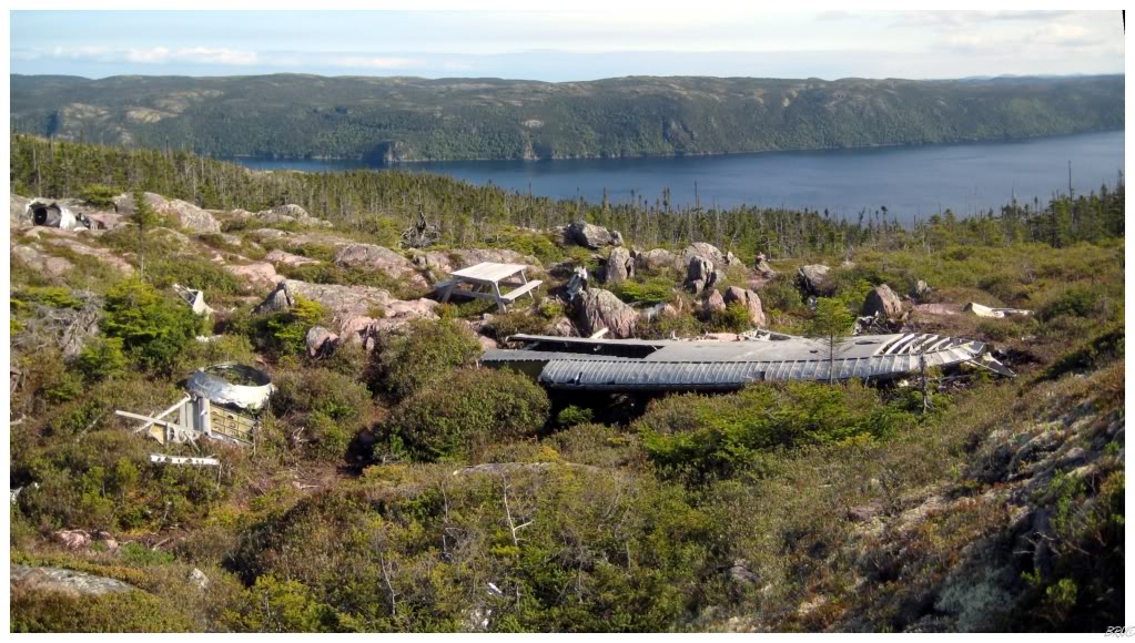
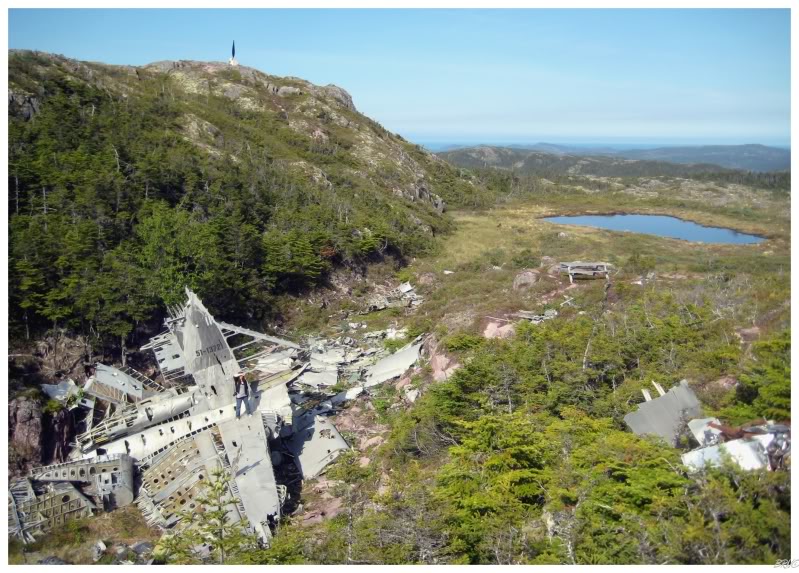
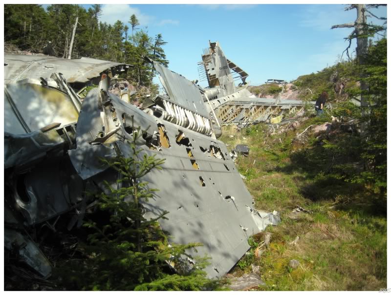
Holy crow! While I was moved by finding one of the four jet engines, this was a whole other story.
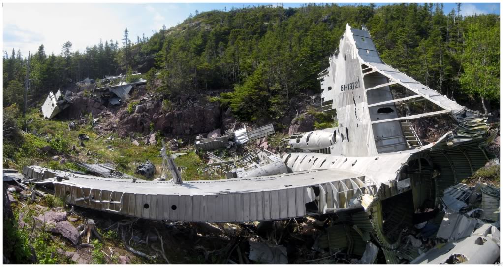
The tail portion with vertical fin and horizontal stabilizing wing sat before me.
(This isn't the 'middle' portion of the plane but instead the tail. Compare the above to this image: http://www.fas.org/nuke/guide/usa/bomber/b-36-1949.jpg)
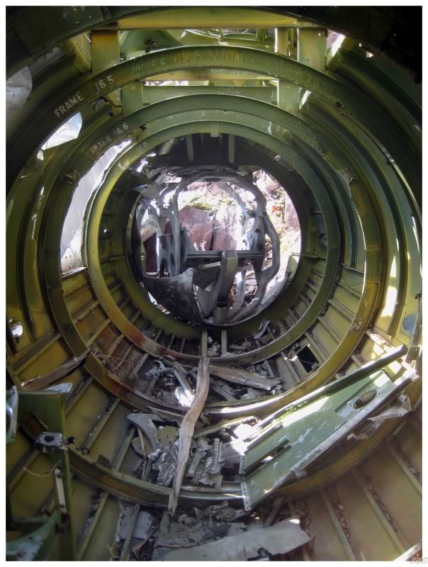
As I moved down the hill, the brainy Kristen encouraged me over to see the wing and the fuselage. I knew the word prior, but it would never had occurred to me to use it.
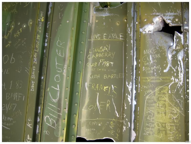
We took portraits of each other in the strange looking, cylindrical, ribbed chamber before taking ten minutes to examine all of the key graffiti which marked nearly every inch of available space within the fuselage.
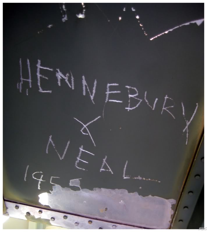
^From less than two years after the plane crashed.
It would be really interesting to be able to compare their shots with present day.
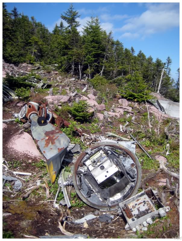
Plane propeller with my Pirates hat for scale.
Remember I have the size 8 head though...that plane propeller is actually about the size of a canoe paddle.
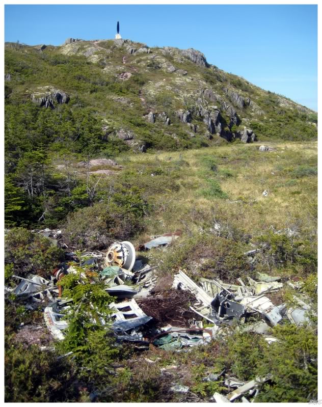
(Also, if you were wondering what that black thing was at the top of the hill in several pictures; it is one of the plane propellers which the U.S. Army found to be in the best condition to create a memorial to the fallen.)
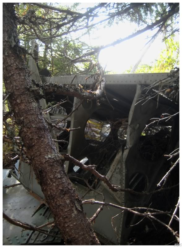
Walking into the woods, you would find other pieces of wing, engine cylinders and countless other unidentifiable amorphous masses.
In the official crash report, it is stated that wreckage can be found for 3/4 of a mile (1.2 km) throughout the hillside.
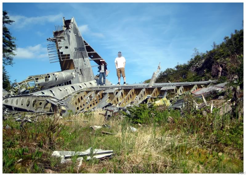
Walking back towards the fuselage, Kristen was on the stabilizing wing and I realized what a great group shot it would make.
Since I knew I wouldn't encounter any low light situations, I had left my tripod in the car (yes I realize the fuselage picture is blurry); so I started to gather up plane pieces into a bootleg tripod.
Setting up the 10 second shutter timer, I jutted forward and juked through the random metal pieces towards the wing to make it on time. As I got near the wing I heard Kristen yell, "It's safe! Run up!", which didn't even occur to me until she mentioned it.
I didn't like the look of my face in the first one, so after a 2nd time, I acquired one I liked - even if it makes me look Yao Mingish in height and makes Kristen look Danny Devotoish (in height).
Kristen & I set down atop the tail stabilizer for about 15 or 20 minutes, enjoying the perfect day and taking in our surroundings.
I hated to be the wet blanket, but we still had a 5 hour drive ahead of us and I try to avoid driving in Newfoundland at night (plus we had to get to the campground at a reasonable time).
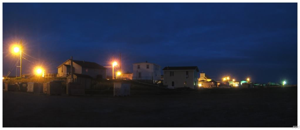
I forget what we ate for dinner or anything interesting except for getting off the main Burin Peninsula highway for a short drive through a town named Garnish. This little highway only ran about 7 kilometres (~4 miles), but I liked the look of Garnish, so we turned into the town.
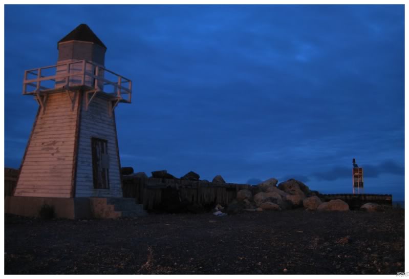
Garnish was by no means large, but we both enjoyed this boarded up lighthouse and proceeded to photograph it. About 10 minutes passed (I was doing long exposures even if the mediocre picture doesn't convey it), before we drove the shore highway to the nearby campground.
Setting up the tent using the Intrepid headlights, we both noticed it was already getting cold. We hurriedly assembled the structure and dived beneath the covers. Even though it was mid-June, we were blessed with a night of temperatures into the low 40s.
Kristen questioned how it could be so cold in June and I reminded her that we were out on a piece of land with the Atlantic mere metres (feet) away.
We would make it through the night and onto the ferry the next day.
Navi
Sources:
1 - Flickr - Burgoynes Cove Peacemaker Wreck
2 - Goleta Air and Space Museum - Convair B-36 Crash Reports and Wrecks