Gap Filler Stéphenville.
Summer 2009.
I've covered 1 and 2 of the 44 Pinetree Radar Defense sites here before.
Reading the Pinetree website (which is down right now & I pray comes back), I learned that Newfoundland & Labrador also had 'gap filler' locations. Long story short, once they set up and constructed the 44 Pinetree sites across the bottom of Canada - to protect North America from the Soviets - they found that the Newfoundland & Labrador sites were too far apart. The government's solution to this problem was to create gap filler sites between the already existing Pinetree line locations.
So whereas you had one of the primary 44 Pinetree sites in places like St. John's, Gander & St. Anthony; you also had gap filler sites in places like La Scie, St. Lewis & Stéphenville.
I knew about the site in Stéphenville for nearly a year, but I left it until one weekend where I didn't feel like driving very far.
Getting up around 8:30, I was eventually onto Highway 460, then Highway 462, pulling over where my notes instructed by 10 o'clock.
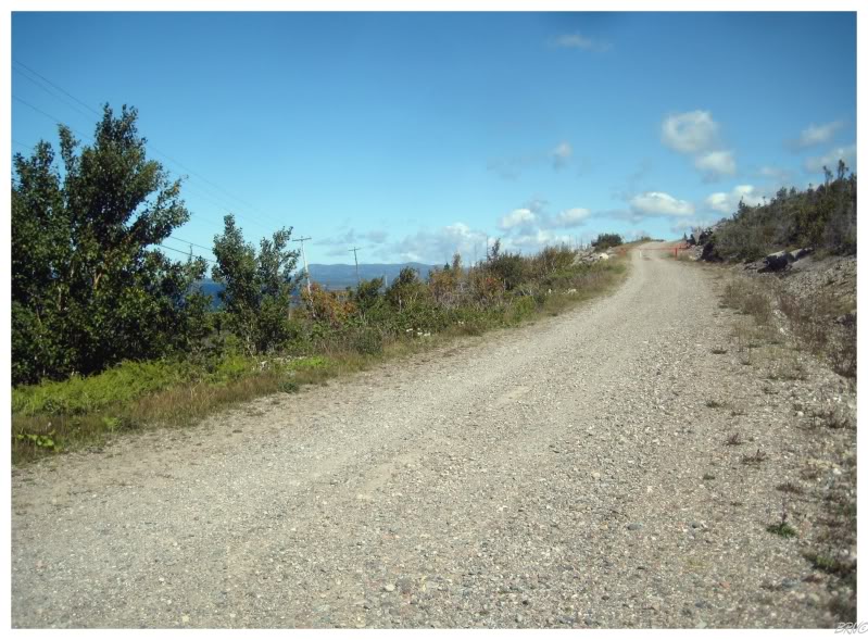
The site is located atop a substantial hill and I read that the gate is sometimes open, allowing you to drive to the top; but unfortunately the gate was locked and I was forced to leave my car at the bottom this day. The above picture shows me about half way up the road to the gap filler site. I was surprisingly tired as I underestimated the length and effort associated with the walk to the top.
I was cursing that damn gate.
I'm not about to exaggerate and boast about how insane the hike up was, when in fact it wasn't that crazy at all. It took about 45 minutes and while it was a bit of a workout, I wasn't close to death by any stretch of the imagination.
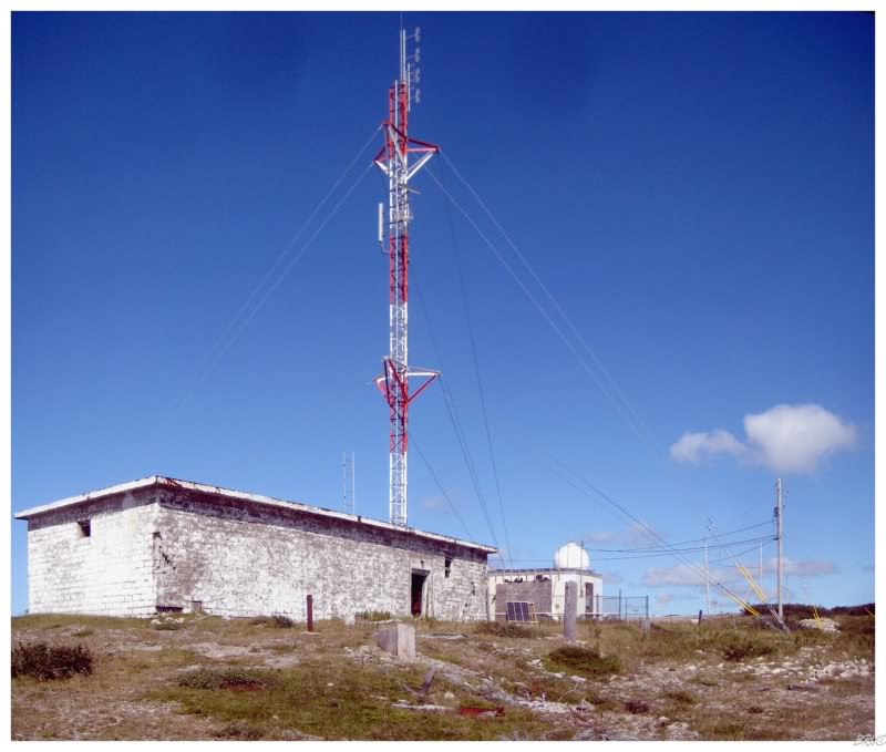
Once at the top of the hill, I surveyed the moonscape before me and found one structure still standing.
That one structure was the definition of excitement.
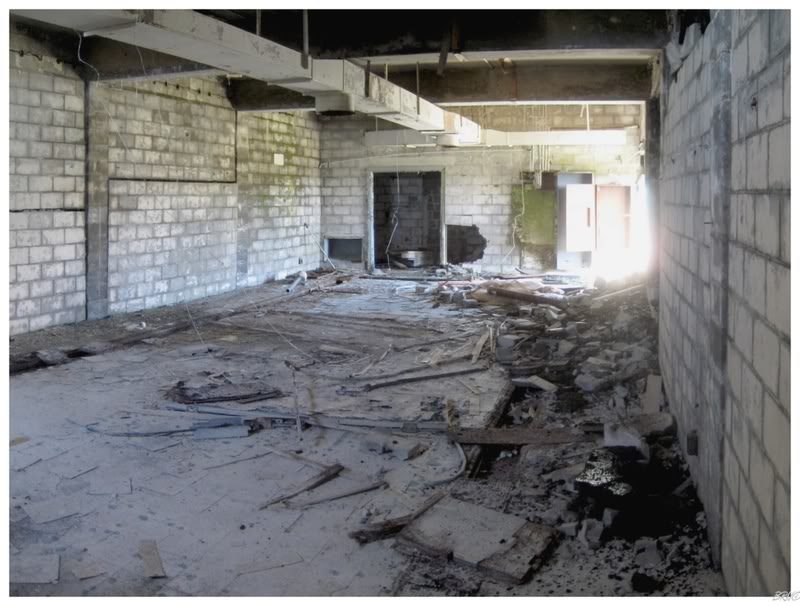
It had been a long time since I had been inside anything, and I had nothing else going on this day, so I actually sat down and relaxed for a bit.
An added incentive in taking shelter was that the winds still had some bite atop this mountain - even though it was August. Ten or fifteen minutes holed up in this shell worked wonders for warming up after having the Atlantic winds steal so much warmth.
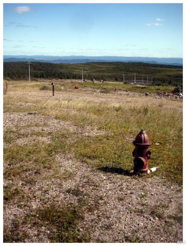
Walking outside of the one remaining building, the area in front of you is dotted with foundations and a few hydrants.
Without the Pinetree website telling me the exact facts, you have to assume this area was where the typical gap filler buildings such as the dorms, shops, dining halls, common buildings, as well as the radar operations centre, were located.
These buildings were all necessary as the harsh weather conditions of this location dictated that the community was able to support itself for extended periods of time.
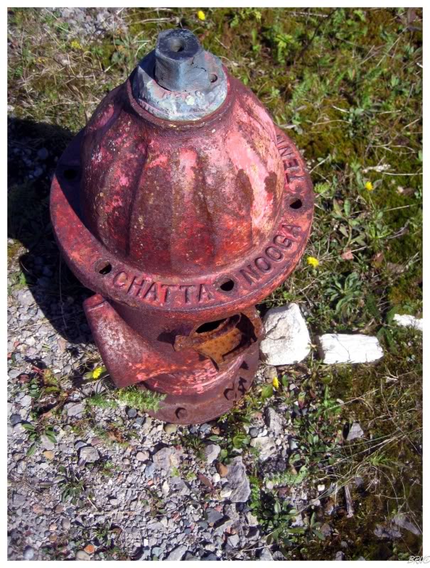
Walking over to the hydrants, it put a smile on my face to see them imported from Chattanooga. I don't know who made the hydrants for Port Aux Basques, Corner Brook or Grand Falls, but seeing Chattanooga hydrants does make me curious about the cost of shipping these.
There are random fire hydrants around Stéphenville from the former Air Force base and now I'm curious if they're Chattanooga's as well (you have to assume they are).
There were other hydrants and foundations far off in the distance, but that wind was too bothersome for me to wander about and meddle.
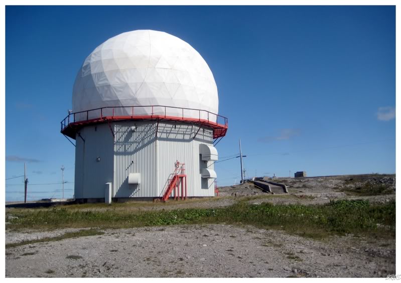
Instead I went back to the first area I encountered, wrought with more foundations and a radar dome.
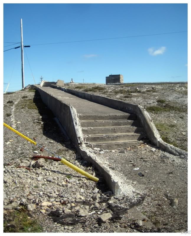
The most exciting foundation was that for the main radar installation.
Perfect to film a line for a bike section? You know it!
Although, it would be one hell of a pain in the backside to push a bike up here. Nevertheless, I probably would whenever I get around to finally making a biking section.
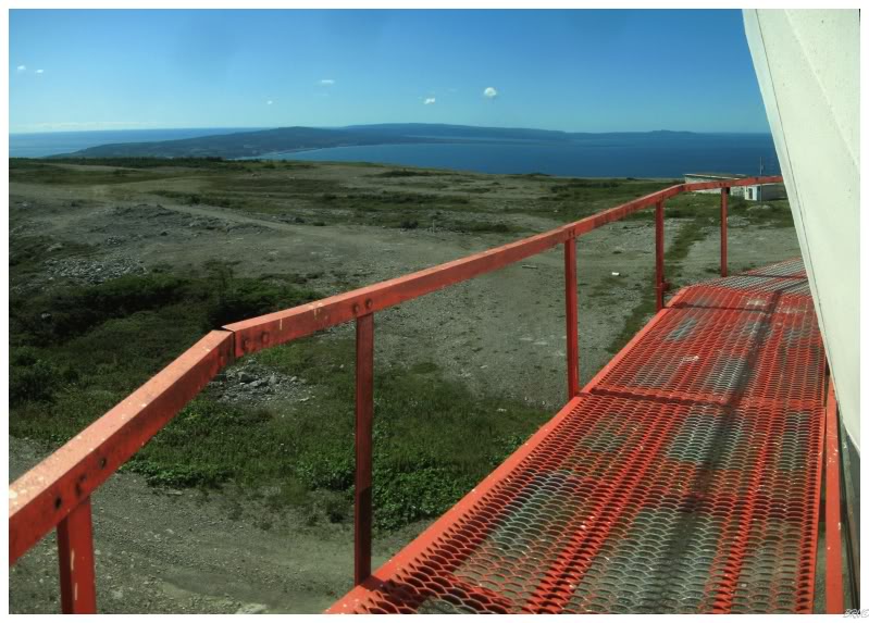
Over at the radome, there was an enclosed vertical ladder up to the elevated walking platform, so I figured why not help myself.
I know you're going to think I'm soft, but I didn't particularly care for the fact of being 20 or 30 feet up in the air, leading me to quickly take pictures and then make my way back down.
Although I can't dispel the fact that the view was fantastic.
Time to head back down to the car.
If I just wore something a little warmer, then I couldn't have picked a better day.
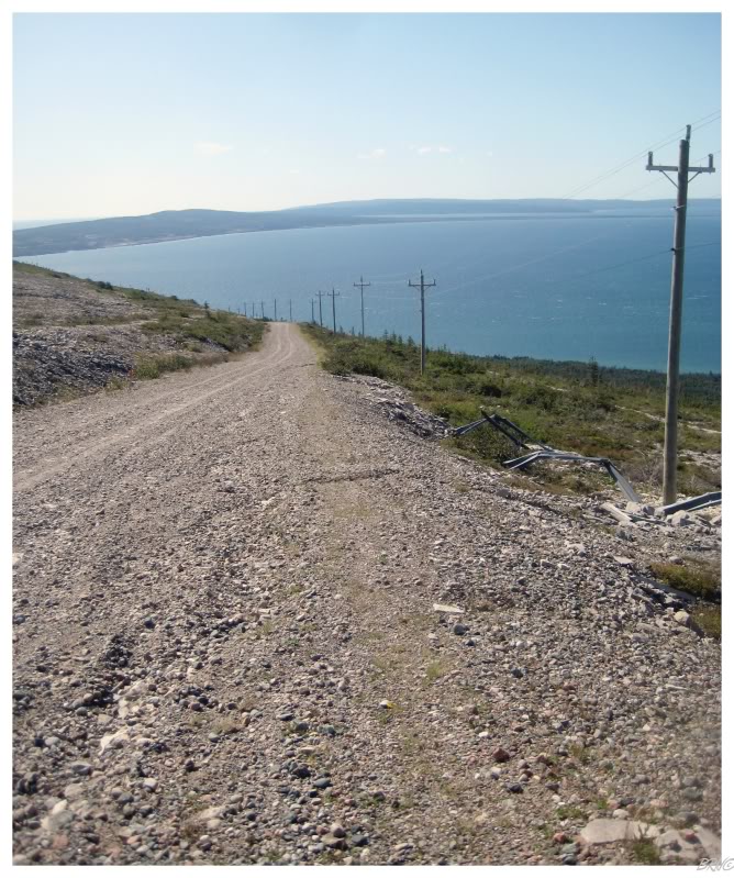
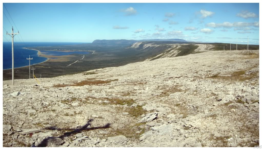
Anyway, the above view shows the town of Fox Island River off in the distance. The thin strip of land around the lake is a provincial park.
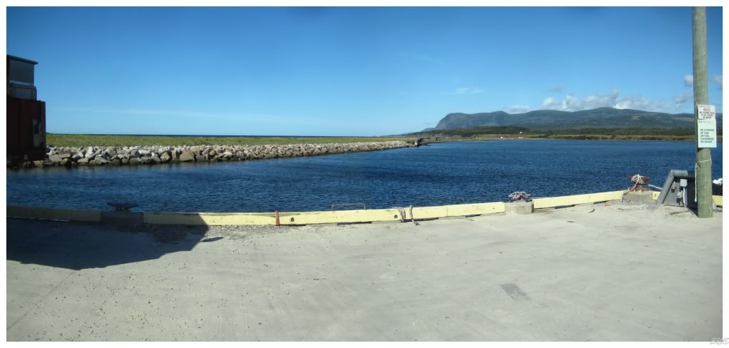
Since I was only 5 minutes from Fox Island River, I decided to take a drive down and peer off into the distance from their wharf.
There's a lighthouse 8km from this point, but that will have to wait for another day.
I'm just glad I didn't try to lump together these two things - the Pinetree ruins hike and an 8km hike of unknown difficulty would have likely been biting off more than I can chew.
Sources:
1 - Stéphenville, Newfoundland, Canada - Pine Tree Radar Site
Navi