Boston 2010 (Map)
Waking up in a Jooze-induced fog, I was happy that we were quickly off to the International House of Pancakes in Dedham.
After a much needed Philly cheesesteak, it was still early in the day & not everyone had to go home yet.
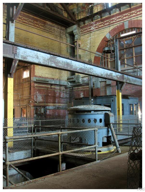
A few of us went into the city to check out the Calf Pasture Pumping Station.
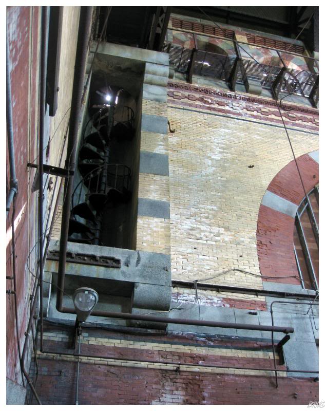
Exiting the highway, it was strange to find this Romanesque gem hidden amongst a bunch of boring condos & townhouses.
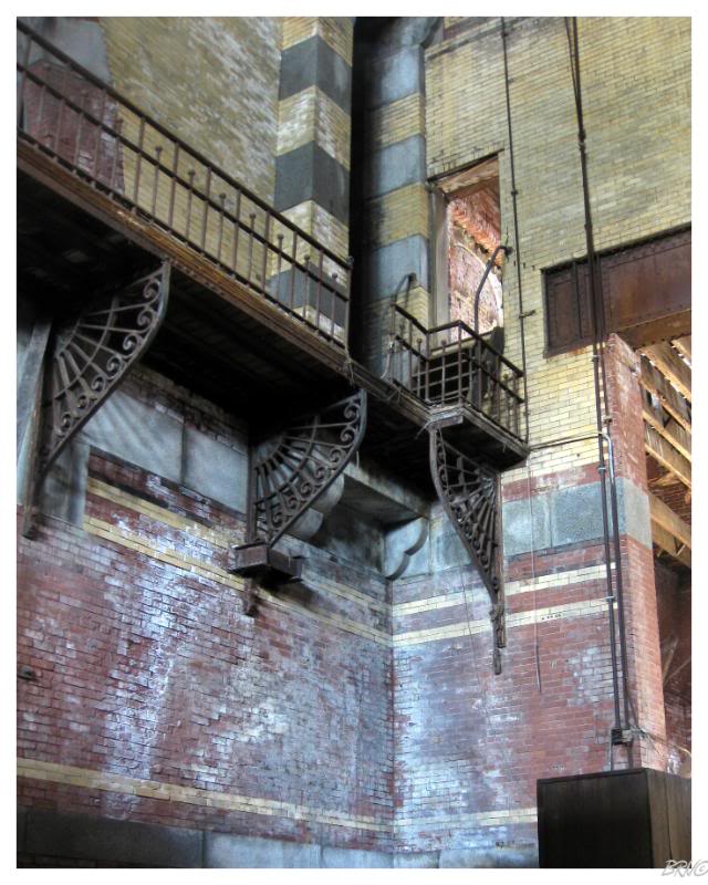
The beauty of the elegant catwalk supports, intricate brick patterns and burgundy arches, reminded me of these pictures of an English sewage treatment plant I once found on the internet. The two locations were similar in the fact that it would be so outlandish today to build such a stunning building that a miniscule number of people would see.
There is a small separate office area at Calf Pasture, but you don't go over there. Instead, you stand in the main hall area and admire your surroundings, as it is a better way to spend your time than exploring wood paneled empty offices.
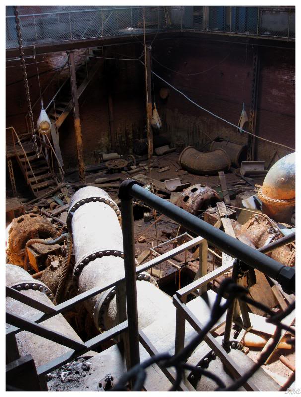
The Calf Pasture Station was built in 1883 and is on the National Register of Historic Places. Apparently, nearby Dot residents used to set their cows out to pasture in this area during the 17th, 18th and part of the 19th century - hence the name Calf Pasture Station.
I had to laugh at how Detroit had seasoned me when I asked Arntz when they were tearing this down - surprised to hear that there are no imminent plans and that he thought the owners were actually planning to one day do something useful with the building.
After the pumping station we parted ways with our 3 friends as Arntz and I were on our way again. Two other friends were still in town and we made plans to meet up with them as our other friends were headed home.
After quickly checking out the mill complex in Lowell, the four of us set our sights on an abandonment in a nearby town. This abandonment involved parking a fair distance away & briefly walking through town, before hitting some train tracks to the building.
Anyway, the four of us park, get walking and everything is going fine - until right as we are about to cut left from the busy road onto the railroad tracks, I notice a cop car just ahead of the bend in the road before us.
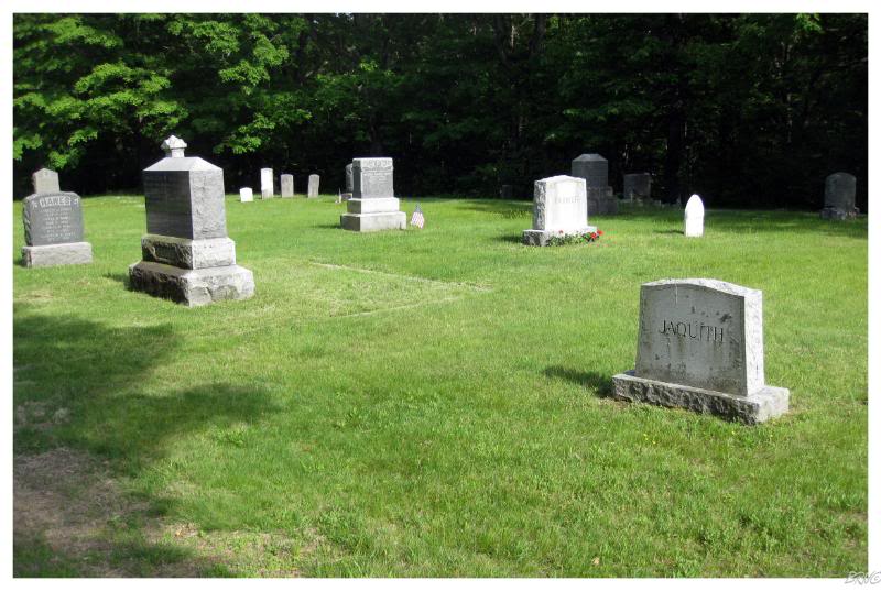
As smoothly as possible, but certainly not completely smoothly, I informed the other three and we continued walking forward instead of going up the train tracks. Since none of us knew where the road ahead of us went, we went into the graveyard directly next to the tracks instead.
As expected, the 5-0 pulled into the cemetery and called us over, wondering what the heck we were up to. After some questioning, I had to wonder what they thought of my Seatlleite friend coming all the way to their 30,000 person town to check out the modern cemetery...but since we weren't doing anything besides apparently being weird, they had to leave us alone and go on their way. (I stood far back and they never asked where I was from...I was actually half hoping to bust out the Newfoundland ID for them to run).
The cemetery was unremarkable, so it was funny for the four of us to have to stroll around looking at modern tombstones.
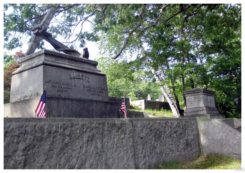
I have to admit Mr. Ranlett (above) had a pretty crazy anchor tomb though.
We decided it wouldn't be in our best interests to further risk ourselves for what was supposedly an easy abandonment, so our two friends went downtown to check out touristy Boston stuff; while Arntz & I drove back to his house so I could get in the Intrepid and bring an end to his hosting responsibilities.
It was already 5 o'clock by the time I finally got my car and I needed to start making progress towards home.
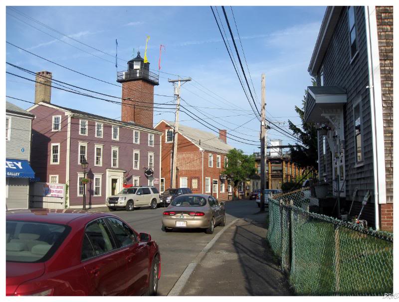
I wanted to stop at a thousand places in Massachusetts and Maine, but it was already getting late & I had a lot of tired driving ahead of me. I chose to only stop in one of my last Massachusetts towns, Newburyport0, as it was very close to the highway and my point of interest was along the major road.
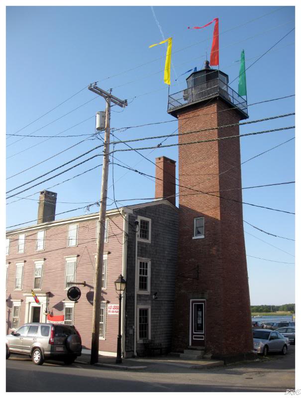
I was initially excited for Newburyport, but by the time I got there I really had to use the washroom and eat some food - so I was in a less than a cheery mood. Although sour, it was hard to remain unimpressed with the fine 1873 redbrick light tower in front of me.
I was pleased with my first lighthouse in Massachusetts (of 66).
Maybe next time I'll spend the $350 and have a romantic evening up there (it was decommissioned in 1961 and recently they have renovated & installed heat pumps so that you can have dinner up there and nuzzle by the city lights).
Googling Newburyport, MA to Bangor, ME, I found that I only drove 3 hours more this night; which doesn't surprise me as I was damn tired and could go no further - giving up & getting a room at the Colony Motel.
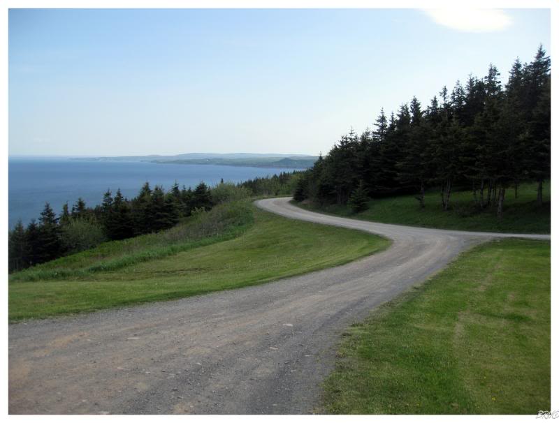
Waking up early because I went to bed early, I only had 11 hours of driving ahead of me this day while trying to make it to North Sydney to catch the ferry. I knew this afforded me a brief side trip, so I decided to drive north from Antigonish, Nova Scotia to explore Cape George.
The drive from Antigonish to Cape George was pleasant; comprised of that Nova Scotia land cover I love: an interesting mixture of Newfoundland (cliffs and light forest cover) with Ontario (farmlands, farm houses).
Of course I'll drive somewhere simply because it's on the map, but with time constraints in a land where I don't spend enough time (Nova Scotia), you better believe I'm going to target something abandoned, an interesting community or a lighthouse.
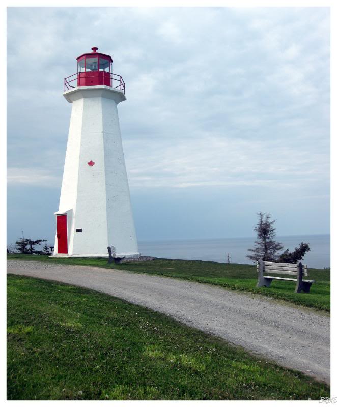
Cape George Lighthouse was at the end of this drive, situated far above the surrounding waters. I wasn't overly excited about this one because it's one of those cookie-cut 1960s lighthouses that Nova Scotia is riddled with, but the lay of the land and the obvious time spent carefully grounds keeping added to the experience and really made it enjoyable.
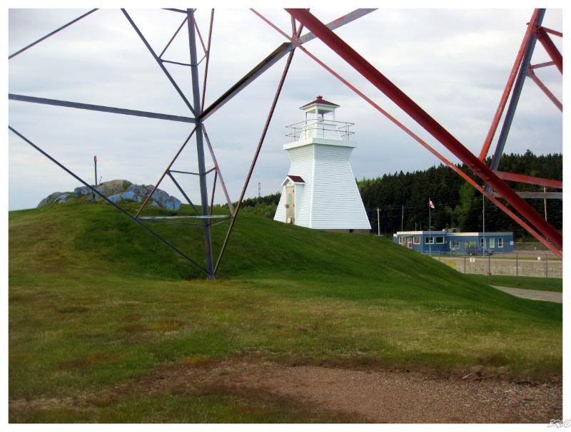
I also stopped at the Balache Point Range Rear light because it was a matter of parking on the side of the road & walking fifty metres.
The fact that the lighthouse was almost directly under the hydro tower made it memorable.
(This one is located right as you reach Cape Breton Island by crossing the Canso Canal Bridge.)
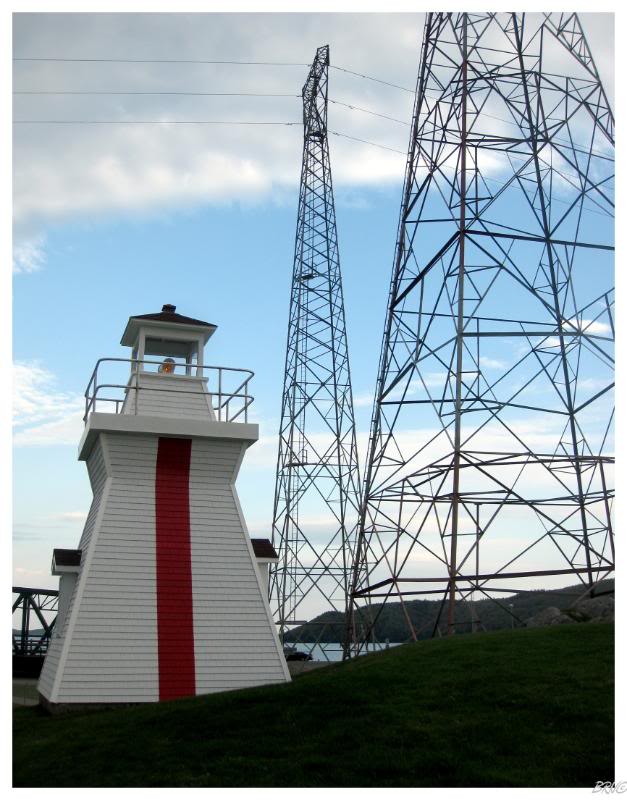
The 'Range Rear' in 'Balache Point Range Rear' is because this light is the back light in a pair of lighthouses - having a pair of them allows mariners to line up the two lights and then follow this as a guide which will ensure their ship remains in the deepest waters of the waterway.
The thick, red vertical line is so they can see the lighthouse from a distance and line up the two beacons.
(If you're wondering why I didn't take a picture of the 'front lighthouse', it's because it doesn't even count as a lighthouse: it's a beacon on a 20ft. skeletal tower.)
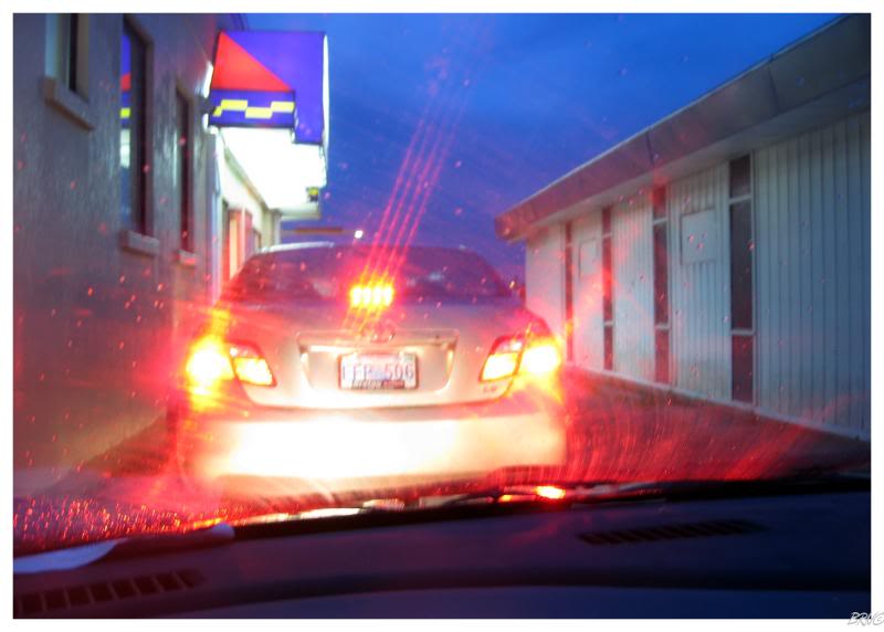
Another hour & a half and of course I had to end my trip with Taco Bell.
I was cutting the ferry deadline close (and the slow North Sydney food service wasn't helping) but I did make my boat and quickly fell asleep.
End.