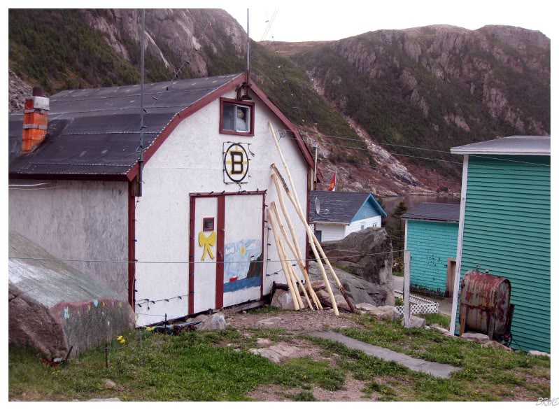
Franceway, Newfoundland
View the Southern Coast in a larger map
The Southern Coast of Newfoundland used to hold many fishing villages, but that number has crashed in recent years. Today, only a handful of isolated fishing villages sparsely dot the coastline.
Near the Southwestern point of the Island of Newfoundland you have Port-Aux-Basques. If you take the NL-470 eastward from there, after 40km you will reach the end of the highway in Rose Blanche. Of course only the highway ends there and Newfoundland continues.
For you to continue eastward, you need to board a ferry so you can reach La Poile ('L' above), you used to be able to reach Grand Bruit ('B' above) as well (until it was abandoned this year) and once a week you can reach Burgeo ('B').
Burgeo is actually reachable from other places on the island as it is connected to the Trans-Canada Highway by the 148 km(85mi)
NL-480 (the middle gray highway above). From Burgeo, one can ferry east to Grey River ('R') and Francois ('F') normally; and onto McCallum ('M') once a week. Conversely, one could drive the Bay D'Espoir Highway (the rightmost gray highway) south to Hermitage and ferry to Gaultois ('G') and onto McCallum.
Summary: You have 5 communities upon this portion of the coast which you can only reach by government-run ferry.
I left work early on a Friday, speeding the 200km (130mi) to Burgeo to catch the early afternoon ferry east.
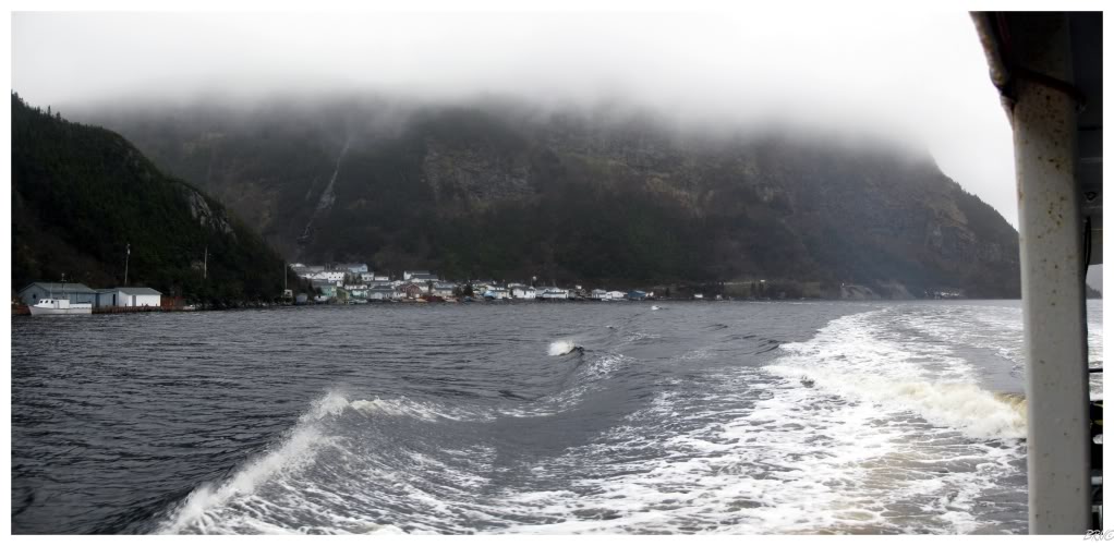
When I parked at the ferry ramp and watched the boat come in, I was amazed at how tiny it was. Unfortunately it wasn't a pleasant day either, so I was particularly concerned with how we would fare out on the sea.
Once we got going, I was amazed at how soon the boat started to sway heavily, where all you could see was water on one side, then water on the other side, then water on the one side...
This wind, boat rocking & rain forced me to stay inside the whole time; while my friend spent most of her 2 hour ferry ride upchucking outside. Sitting inside the 15 seat ferry, the locals expressed their amazement that she was actually going out on the deck of the boat in such nasty weather conditions.
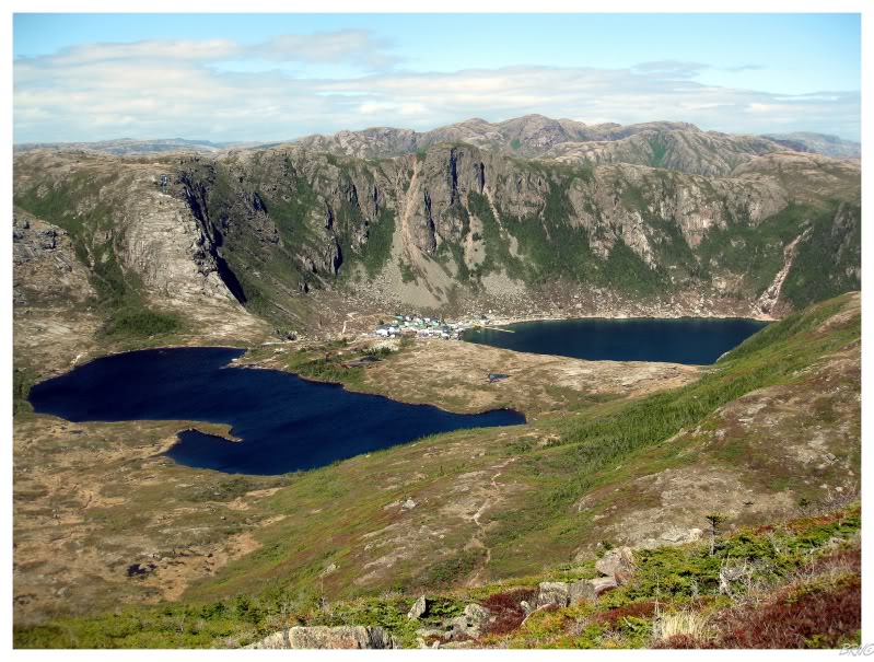
The weather was so rough, that a quality harbour was really showcased when we reached the community of Grey River. The constant and relentless boat swaying quickly dissipated and suddenly the seas were relatively calm.
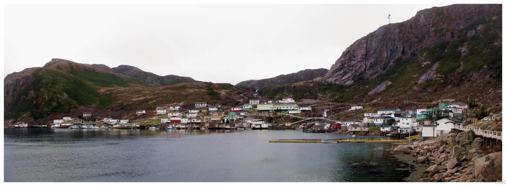
As we approached the village, it was impossible not to be awestruck at the sight of these 100 structures plunked down, surrounded by intimidating, fog shrouded, mountains.
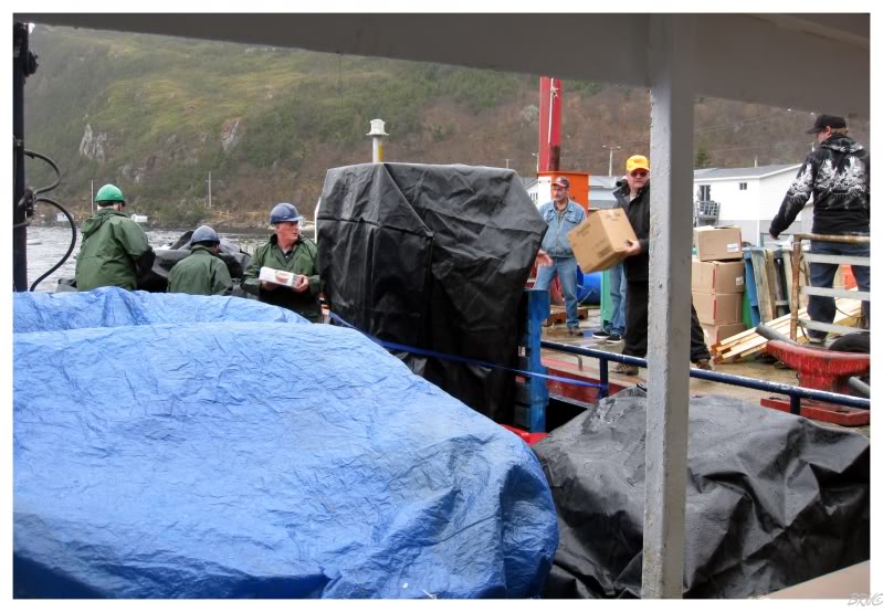
Grey River wasn't our destination and there wasn't going to be any stopover either - just enough time for people to get off & on.
Therefore I couldn't get off the boat and check out the community...or so I thought.
As I was sitting there, I was wondering what the hold up was...when I looked to the back of the boat and realized that the 4 ferrymen were helping unload supplies for this outport - supplies that were being passed to another fellow on a 4-wheeler and would be distributed to everyone.
I definitely wasn't in Corner Brook anymore.
Also, Grey River must love their chow-chow (it's a type of relish), because there was a giant case of it being delivered; something which I wouldn't expect much more than a jar to be required for a community of 100.
Random aside: Grey River became Grey River in the early 1900s when it was known prior as Little River. Grey River had a problem with measles and sent to St. John's for help, but St. John's sent the help to the other Little River in Newfoundland and people died as a result in the Little River on the South Coast. These deaths would soon cause the Little River of the South Coast to adopt Grey River as its name.
I'm thinking this never happened in Cappahayden, Dildo or Little Heart's Ease.
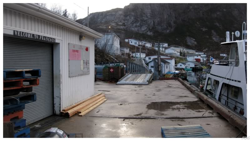
Anyway, we would not be staying in Grey River this weekend and we returned to the sea - which welcomed us back with the same boat rocking and swaying for another 90 minutes until we reached our destination of Francois.
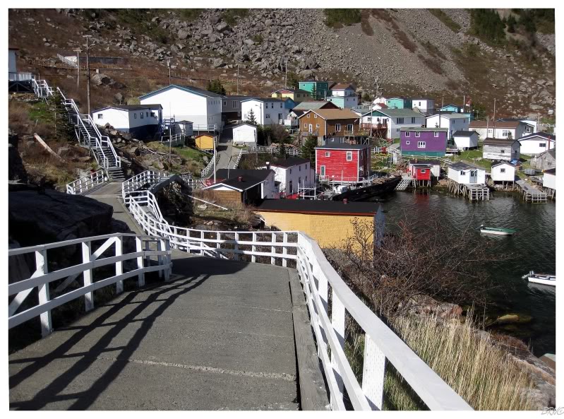
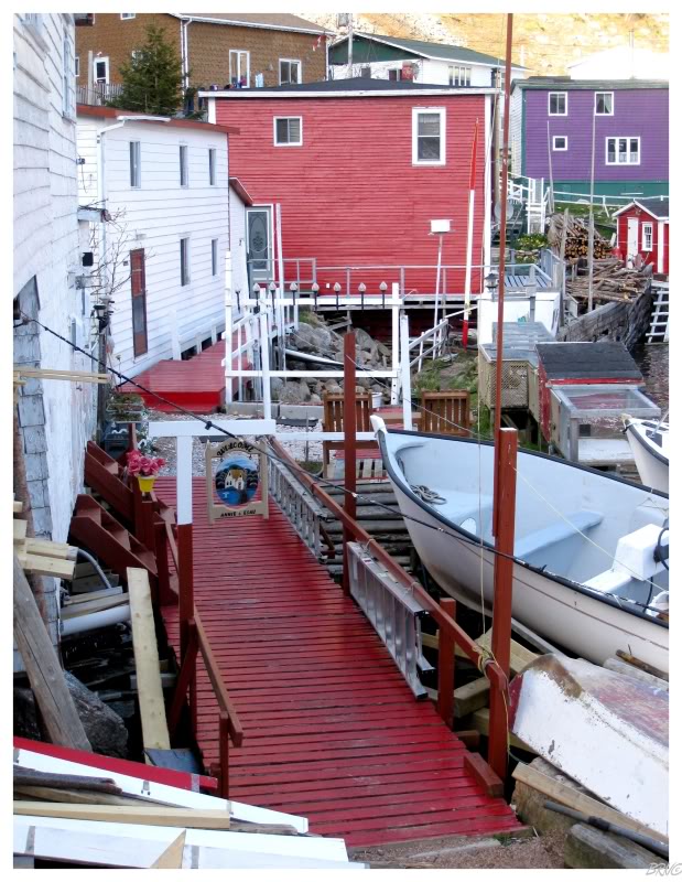
Francois is definitely an interesting place and the uniqueness encouraged our visit.
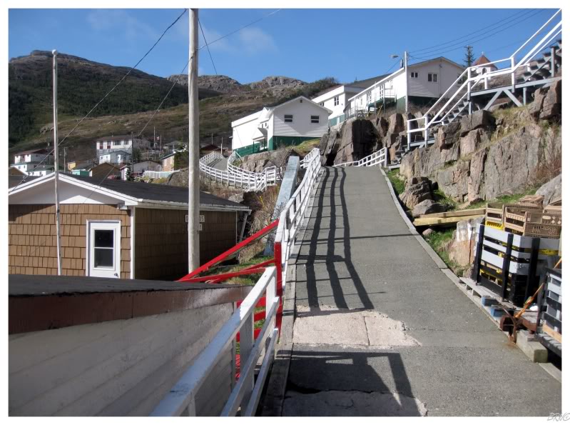
Francois has grown up as a fishing village and never changed from that. No cars have ever reached Francois and instead of roads you have 4-wheeler/walking paths which crisscrossed throughout town.
Also, the effort required to visit Francois means that there aren't any hotels, motels or inns - the accommodations listed on the town's website, is a list of residents with which you can arrange to stay at their house. In fact, the town's website wasn't even working, so I had to use a saved Google cache of the website to get the phone numbers of the accommodating houses.
The website listed a total of 5 phone numbers & after 2 unsuccessful calls, I was starting to get worried. Thankfully, the next person was able to accommodate me & told me that there would be no problem finding room as long as I didn't come on the weekend when they host their popular Francois-Days.
The lady I talked to on the phone was waiting at the wharf when our ferry pulled into Francois. She explained how she lived on the other side of town, but jokingly let us know that she expected us to be able to handle the 5 minute walk.
Along the way we were passed by some of those 4-wheelers; while Nicole & I gave each other the wow-look-at-this-amazing-place wide eyes facial gesture.
We were led along the cement paths until nearly the end of town, before cutting down a grass path past another house and into our harbour side home. Our host guessed that we were excited to explore Francois, so we didn't stay long after dropping off our backpacks.
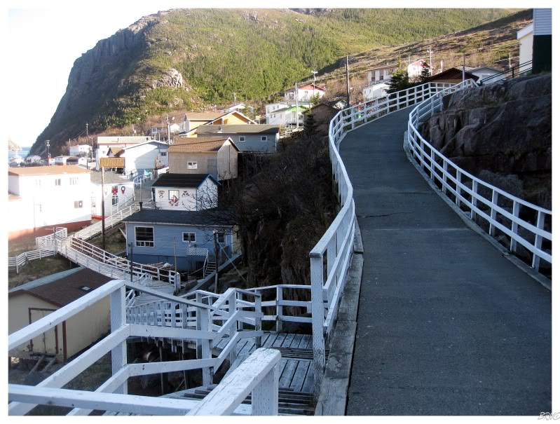
Walking along, I would say there are approximately 4 town-length pathways which cut through the community. Basically, the amount of roads belonging to a 100 person normal village, would be equaled with cement 4-wheeler paths in Francois.
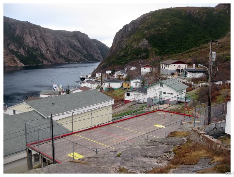
Nicole & I climbed up some rocks and stairs near the church (& the surprisingly shiny school), so that we could gaze down on Francois. I admired the playground with what looked similar to a basketball court's hardwood floor beneath. Walking down to the hardwood playground, there was a good 20 foot drop behind the fence on the one side. In addition to the oddness of this elevated flat ground, the feeling of being in an old school gym while outside in overcast conditions...was well, odd.
I really liked it though. If it was a starry night, I would want to come back and swing the night away.
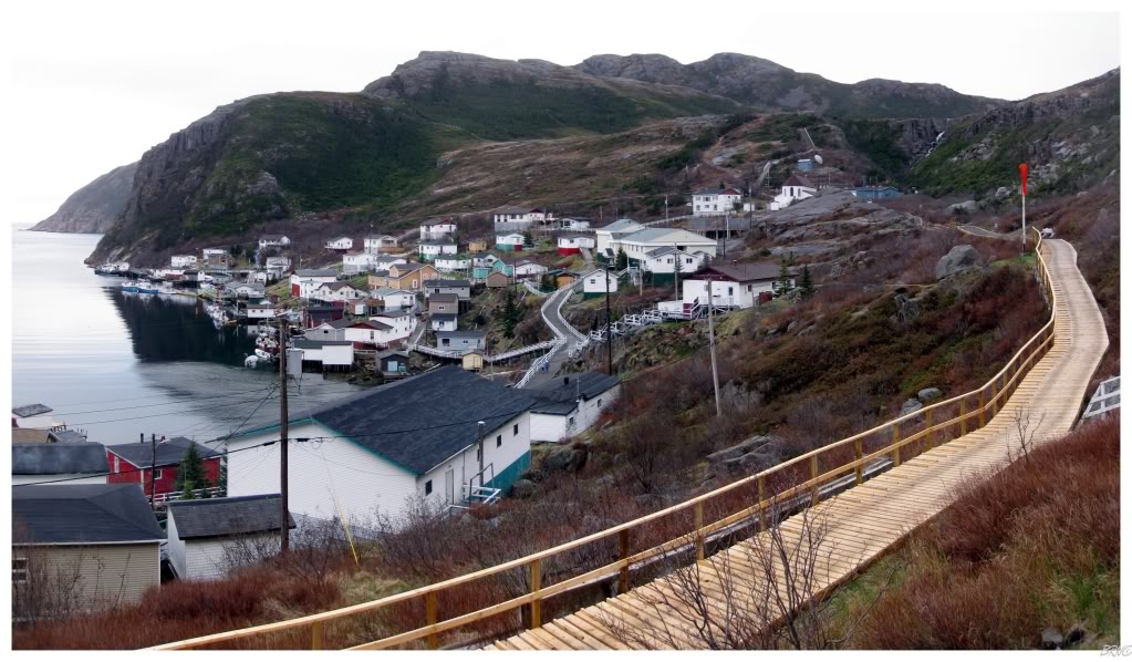
We continued past the town waterfalls on the uppermost path...to the abandoned helipad!
It was captivating...even if Nicole stared at me like I was a weirdo for having this fascination with an abandoned helipad...
At the end of the town is the dump, far separated from Francois by the last path.
Looking back you can see everything in town (well except for the dump). The ferry we rode sat overnight at left and our house was in that jumble on the right.
Returning to the house, I asked our host if rock falls caused a lot of damage in the community. Surprisingly, she said it only happens once every 6 to 10 years and thankfully they've always hit sheds. She also mentioned that the rock fall question was one of the questions she gets asked the most...which popped my balloon as I thought I had an intelligent & unique question.
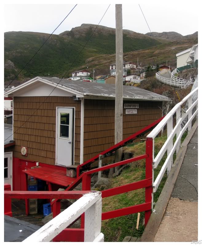
All of this conversation happened over dinner. Another thing about Francois is that there are only 2 general stores & no restaurants. Therefore, all meals come with your accommodations.
Now I'm a big man, so I was a bit concerned with relying on a stranger for my fat & carb requirements. I made sure to bring more than enough fibre bars to Francois to supplement any calorie deficiencies - but they ended up being completely unnecessary!
Where I was concerned that we would be fed cod tongues and salt beef, we actually had normal food which was unbelievably tasty and elaborate! There were about 4 different food items at each meal and everything was tremendous! I specifically remember the amazing mac & cheese! Mmmmm!
I ate so much that I probably should have went for another walk after dinner...
^There was a Bruins playoff game this night & I seriously contemplated approaching this shed
with a case of Blue Stars later on in the night to see if I could watch the game.
Our host's husband came home shortly after dinner and settled down with some rum and traditional Newfoundland music - if I wasn't feeling Newfoundland yet, this was certainly doing it. The husband worked on the ferry and it was funny to now be in his home. We conversed about various things like work, the typical 'what brought me to Newfoundland' topic and the quality of dinner. Amidst this conversation, his brother would call and suddenly it was crystal clear that his mainland accent was being put on for us...because I didn't understand a lick of what he was saying to his brother! It sounded like one big mash of words with frequent pitches and lows like a horse racing announcer.
Once he was off the phone with his brother, with some reservation, I asked about the lighthouse in town. I say 'with some reservation', because I studied a topographic map before coming here, not finding anything conclusive saying that I couldn't hike out to the lighthouse...but I know how things can be sometimes & where I think nothing of hiking 5km(3mi) round trip for a lighthouse, others see it as an unnecessary risk and unnecessary use of energy, to hike to something which is only there to keep you away from the rocks.
While I read on the old town website that you could hike to the lighthouse, I didn't know if it would be possible anymore (thinking maybe this was from a hiking trail in the 90s or something - after not finding any pictures from the hike anywhere on the internet).
My spirits instantly jumped and joy reached my body as I was told that you could certainly reach the lighthouse on foot. Apparently back in the day, when the weather was too bad to reach the lighthouse by boat, the keeper who lived in Francois had a path he would take leading from the village to the West Point Lighthouse.
My host told me that she would ask the local children about the lighthouse in the morning since they've been all around everywhere surrounding Francois, and that she would report back to me whenever we awoke.
In the morning it was again confirmed that you could reach the lighthouse by foot. The kids said that you simply take the trail above the town which leads out towards the lighthouse (we passed the lighthouse on the way into town, so we had an understanding of where it stood - even if the sea was too rough to actually see it).
I was specifically instructed not to take the leftmost trail which only led to an overlook of Francois, but to the next trail over, which led to the barrens where one should find a rough path leading us out to West Point.
In addition to this fortuitous predicament, this day was amazingly beautiful in contrast to our rainy, drizzly & foggy Friday. It was amazing how night & day the two days were in comparison.
Nicole & I set off at our goal...telling our host that we likely wouldn't make it back for lunch.
The above picture shows one of the town's convenience stores where we stopped for a last few supplies to fill our backpacks up.
The town roads led upwards past the church, school & cemetery. Without signage, we guessed where to turnoff onto what seemed like a likely footpath to lead us out to the lighthouse.
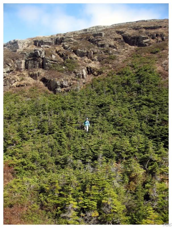
The first portion involved steep brush climbs with plenty of foot-snatching tree roots, as well as a scurry up a small boulder field - if the entire 5 km (3mi) was going to be like this, then we surely had a long day ahead of ourselves (I was previously thinking that the barrens of the South Coast wouldn't be that hard to hike over - it's mostly barren rock & small shrubs).
After this first laborious portion, I was already hot enough to leave my heavy ice fishing jacket behind.
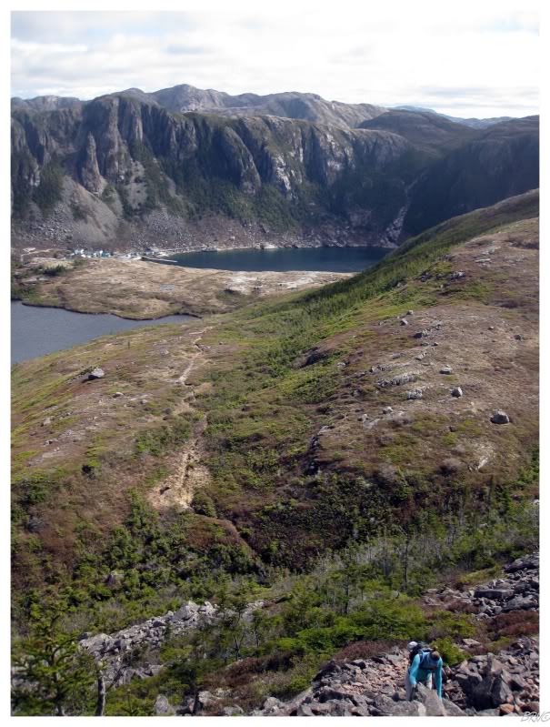
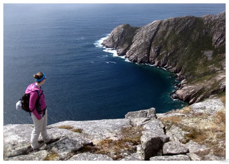
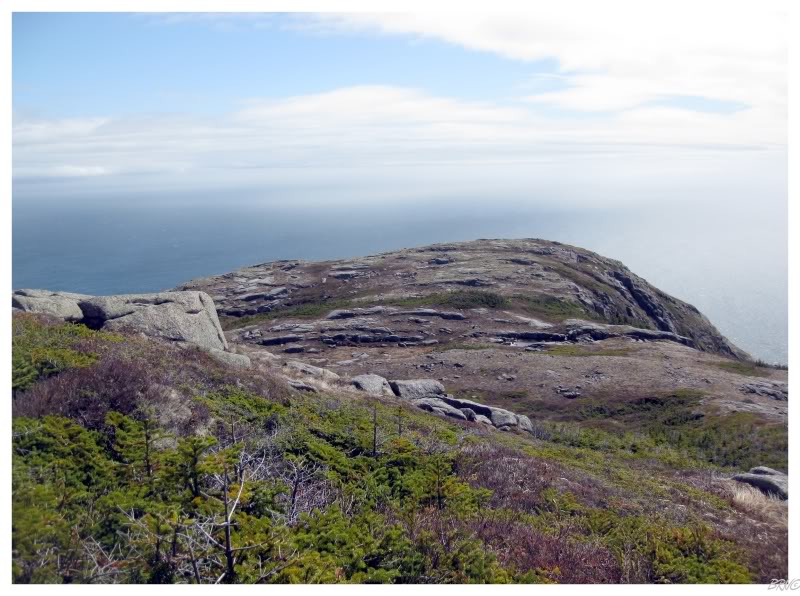
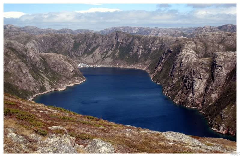
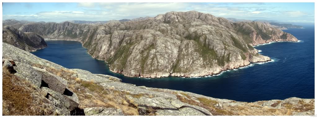
At the top of the boulder field we were instantly rewarded with a fantastic view back towards the hamlet of Francois.
The views from this first peak were already worth the price of admission.
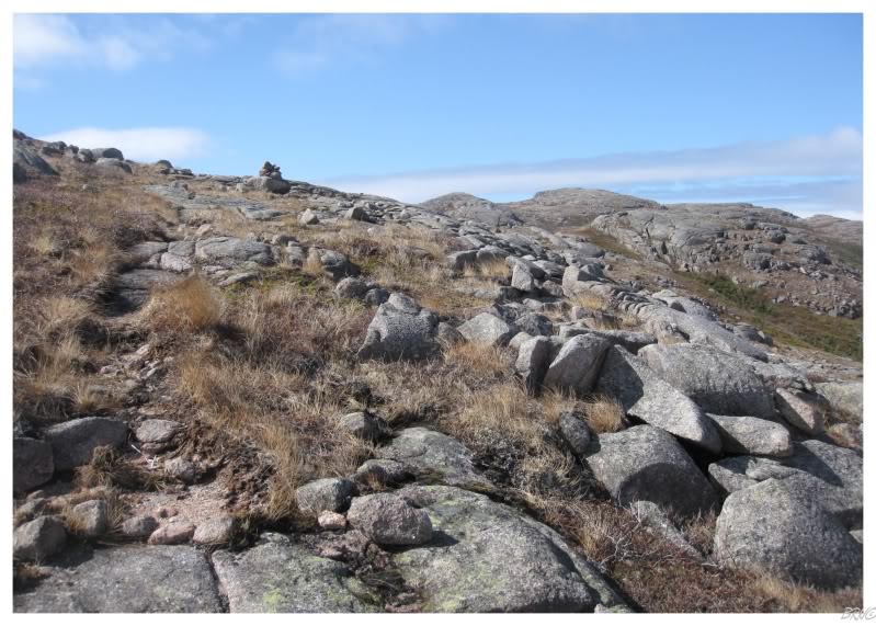
The instructions for following our path were basically, "follow that trail you see leading up the mountain over there, then you will find rock piles in the barrens - follow them."
While it was easy in cases like the above picture, there were other times where I stood at a rock pile & scanned the surrounding barrens for the next rock pile - sometimes laughing at the silliness of criticizing a pile of three rocks and wondering if it was coincidence or if it was an actual trail indicator.
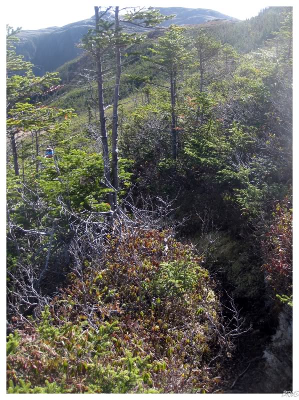
Also, the above picture shows that we left the trees and boulder fields behind - and we were happy too, as barrens hiking is some of the best (& easiest) in Newfoundland.
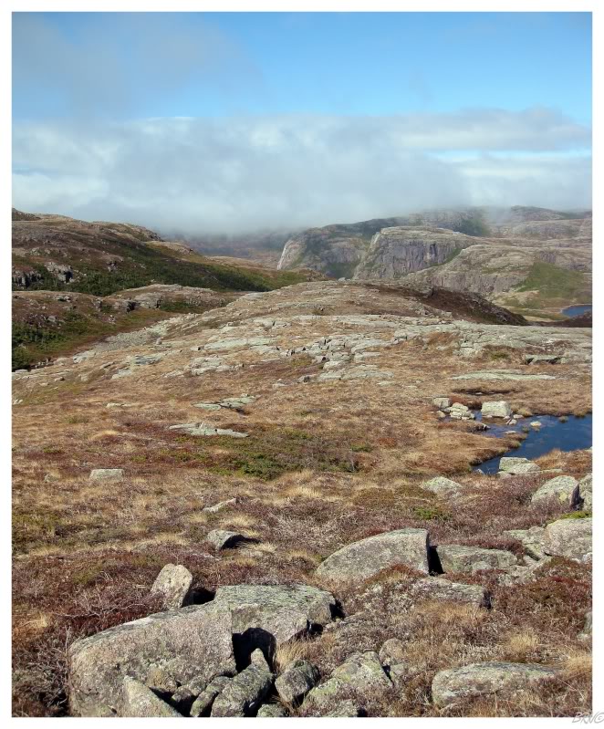
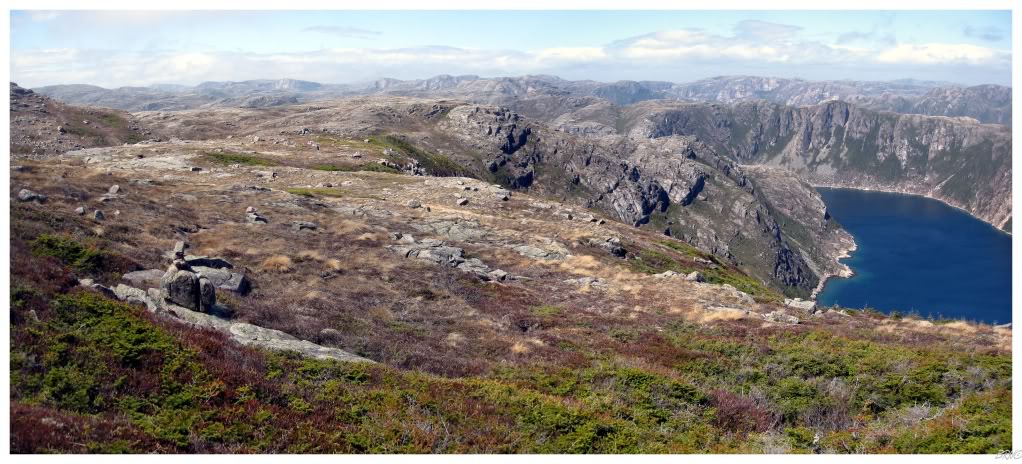
Another observation from the top of the boulder field was that now we could see forever and noticed clouds appearing to approach from the western horizon. They were still a far distance away, but there was some concern and deliberation about turning around.
We decided to keep a good eye on the situation and if the clouds closed in on us, that we would return to town - a very poorly defined hiking trail - flanked by giant cliffs - is not the place you want to be when clouds enshroud your mountain and you can't see but 5 feet in front of you.
Referring to the topographic map in my mind, it seemed like the rock piles were leading us more west than we wanted to go. I knew that we wanted to basically follow the western edge of Francois Bay out to West Point, but the rocks were seemingly cutting further west than necessary.
Nevertheless, we followed the rocks because I know there can be hazards not shown on topographic maps - the locals know better than any map & here was hoping that their path would actually lead us to the lighthouse.
Continuing along, the rock piles led to a canyon and continued on the other side. My skepticism grew, but I continued to ignore my internal navigation while Nicole and I slid down the slopes into the trees and through the canyon.
I should also mention that my skepticism of this path wasn't the only thing causing my confidence to decline. I had failed at quite a few lighthouses recently & this unmarked path, the weather and the overall uncertainty whether it was even possible, were all infesting any positive reassurance I had that we would actually reach and be able to check off this lighthouse today.
On the bright side, the weather had seemed to have stopped in place, the sun was shining and I was full of fibre; we continued on, hoping this lighthouse was actually reachable.
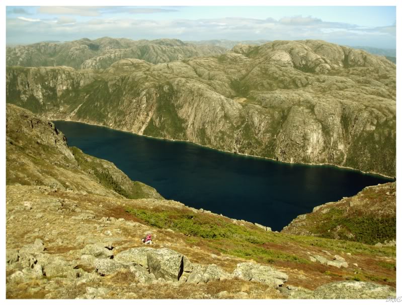
Once through the canyon, we quickly arrived at the above scene.
Now Nicole completely leaves the navigation up to me (Navi)...so I thoroughly analyzed the situation. Could the land beneath us have simply seemed to curve & the lighthouse was actually even further west than this?
Nooooooo, that can't be right. If it was, it would only be at this cape we see before us...it couldn't be any further west along the coast. The lighthouse does indicate where the Francois Bay is located, so therefore it's not just going to be along the ocean...it's going to be at the opening to Francois Bay!
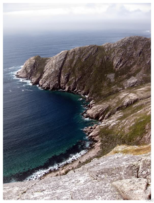
I decided that what we were looking at had to be Brandy Head - the Francois lighthouse must be behind us, to the east.
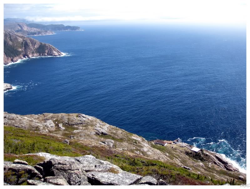
Outside of this decision, the view over Brandy Head was not something to complain about. The two of us admired the coastline before us & I tried to think of somewhere I had been that was more spectacular than this. The teal water crashing upon the beach below, it felt as if we'd be returning to Honolulu tonight instead of Francois.
Two other thoughts of note:
1. Look at that marvelous beach down there. I've read blogs from people who've kayaked around Newfoundland & I've always been jealous of the South Coast places where they've set up for the night with bonfires and their tents.
2. Look at Brandy Head! How in the hell would we reach a lighthouse if it was out on that promontory?!? Looking at this, I was certain that we would reach a point where the cliffs would seem to disappear into the water & I would be left sitting there, knowing better than to risk life to climb down them to a lighthouse.
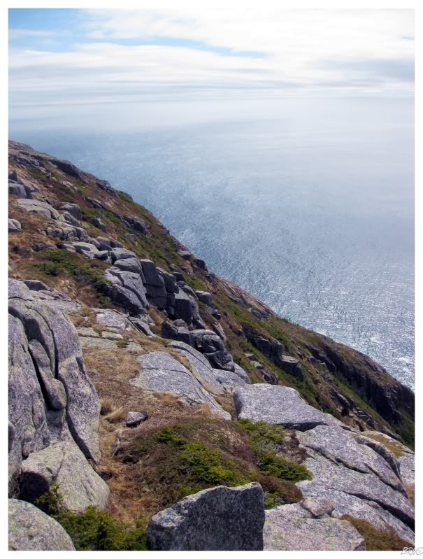
Turning about-face and heading east, the cliffs we found weren't helping my opinion on this mission resulting in success.
Since Nicole has shorter legs & is therefore slower, I would hike in almost an s-pattern so that I could eye the cliffs occasionally and conclude to myself whether I would attempt climbing down them.
As we reached another small peak, it was evident that my postulation was correct - we had been looking at Brandy Head before and West Point was now before us.
It looked as if we could walk out to that edge, but what would be found once we got there?
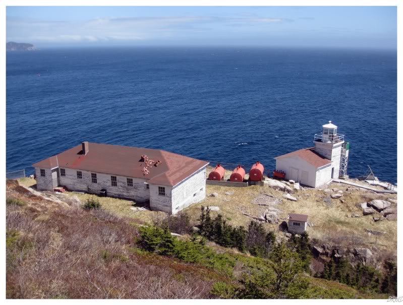
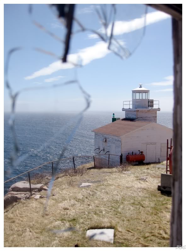
A ma'frigging lighthouse! That's what!
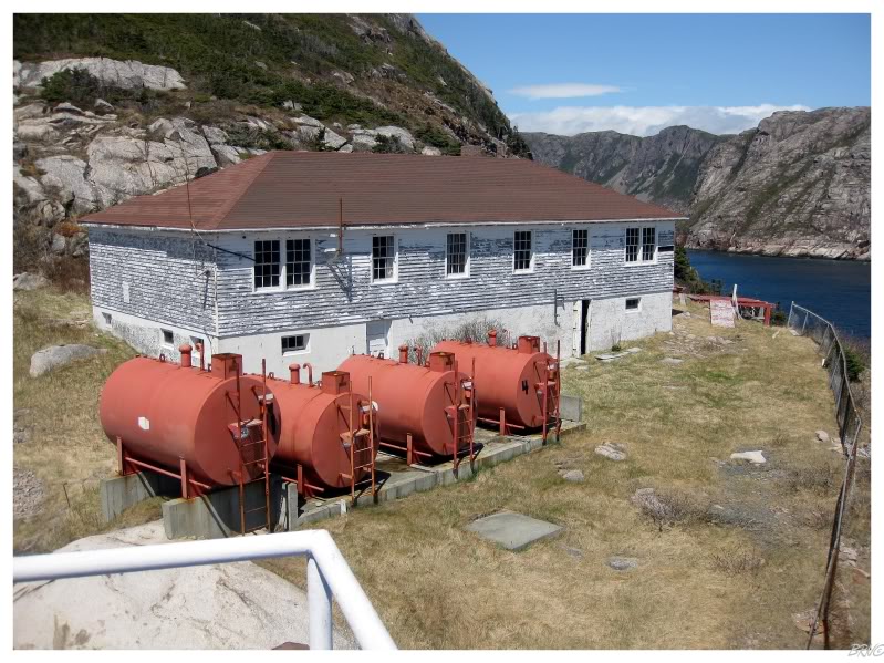
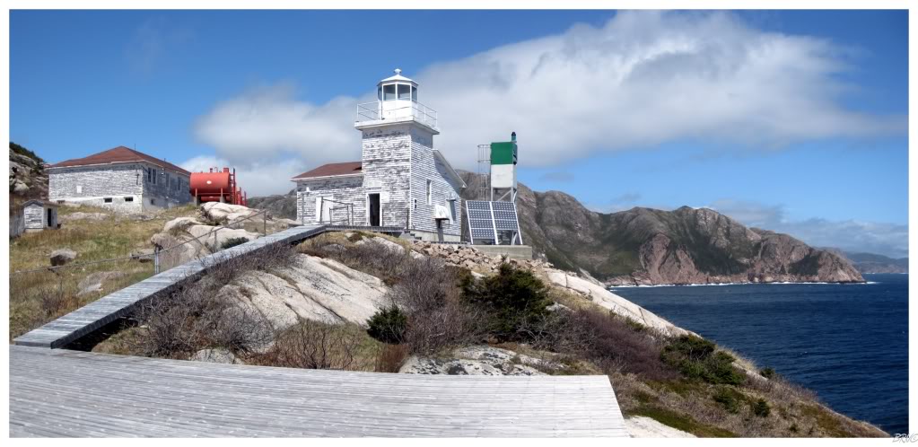
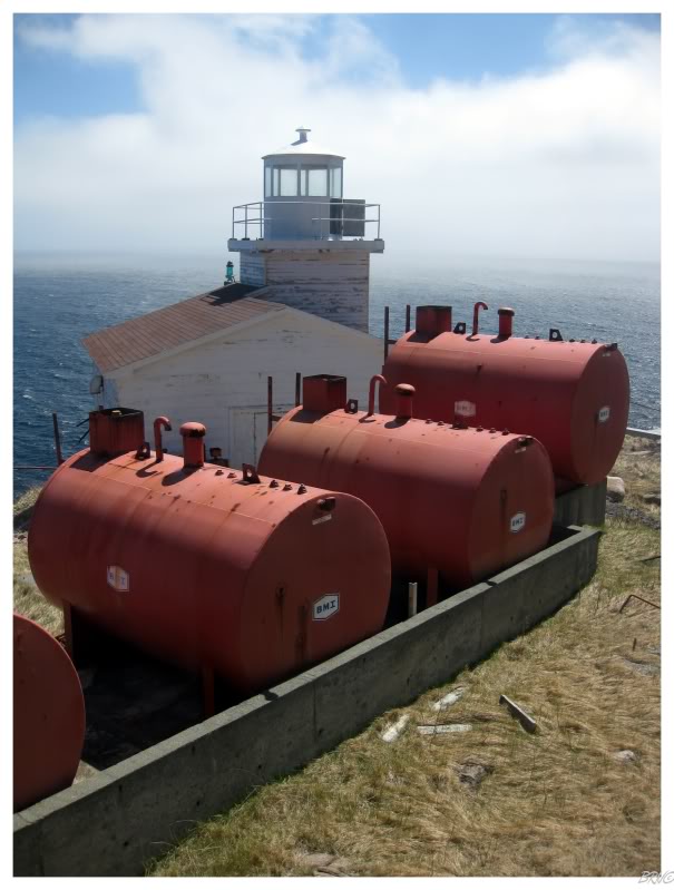
I couldn't believe my eyes, but there she was...the 1966 tower and the keeper's house and the helipad and the ocean!
...and the best thing was that the angled land before me didn't seem that terrifying.
I popped back up to Nicole with a smile from ear to ear as I told her that we were going to get our lighthouse! All of the doubt and negativity had escaped like air from a released balloon - I couldn't believe what was before me & that we were actually going to do it!
The climb down the embankment was trying, but not at all terrifying. The trees actually grabbed you & you were more worried with getting your body to move downward, then you were with losing control of your body's movement & toppling downward.
Through rocks, trees and muddy foot holes; I climbed, stepped and fell down the banked land towards the buildings.
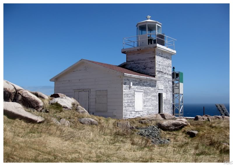
My first order of business when I reached the station was a victorious fist pump on the catwalk beside the lighthouse lantern.
...and a pucker-lipped scowl at the newfangled beacon which caused the abandonment of my lighthouse, keeper's quarters and the staff who used to work here.
The simple construction and small size of this lighthouse meant that the interior wasn't the most captivating...
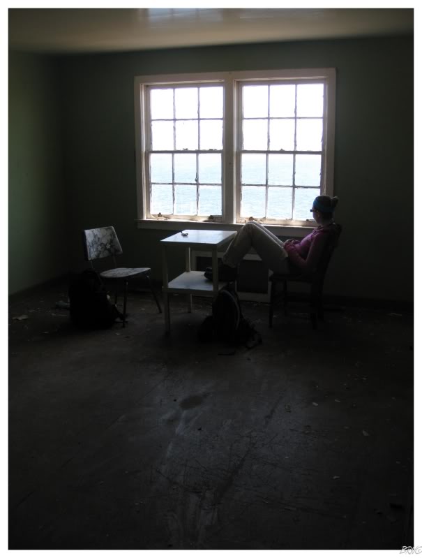
...although the keeper's house did prove to be compelling and enjoyable inside.
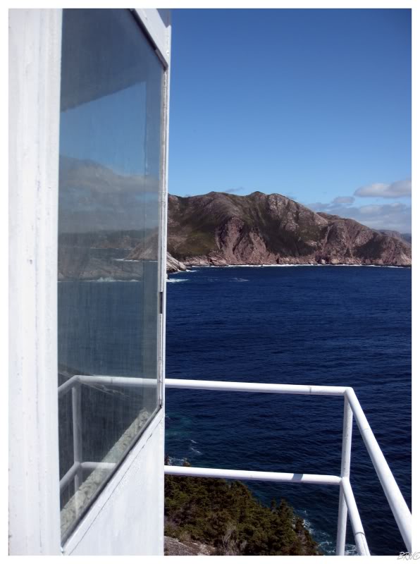
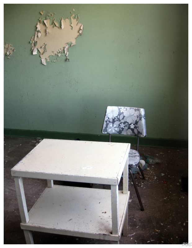
Proud of ourselves, I collected a couple of chairs and placed them next to a window side table so we could enjoy our lunch - during which we both admired the fantastic view the family must have had out of the window and upon the ocean. The only thing you could see out of the window was that characteristic blue & white of the ocean for miles & miles.
My crumby photography skills don't allow me to take quality pictures inside of structures showing the view outside...
Speaking of crumby photo skills, I didn't even expect there to be any exploring to be had, so I hadn't brought my tripod along with me.
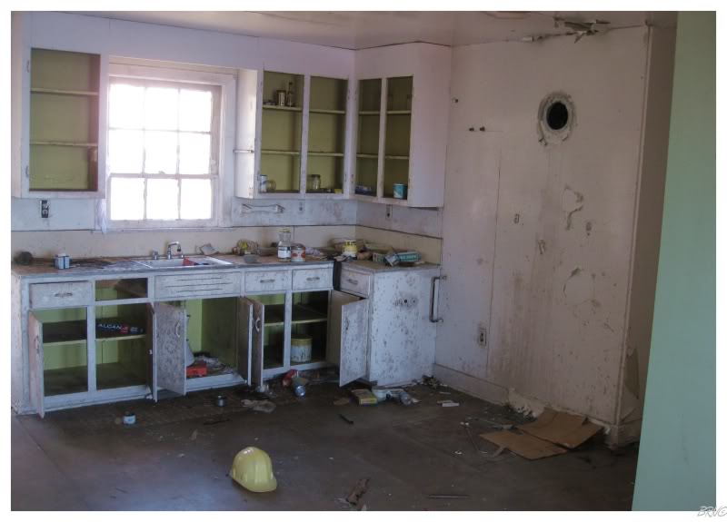
Therefore, I was relegated to using doorframes & tables to steady my shots of the various rooms.
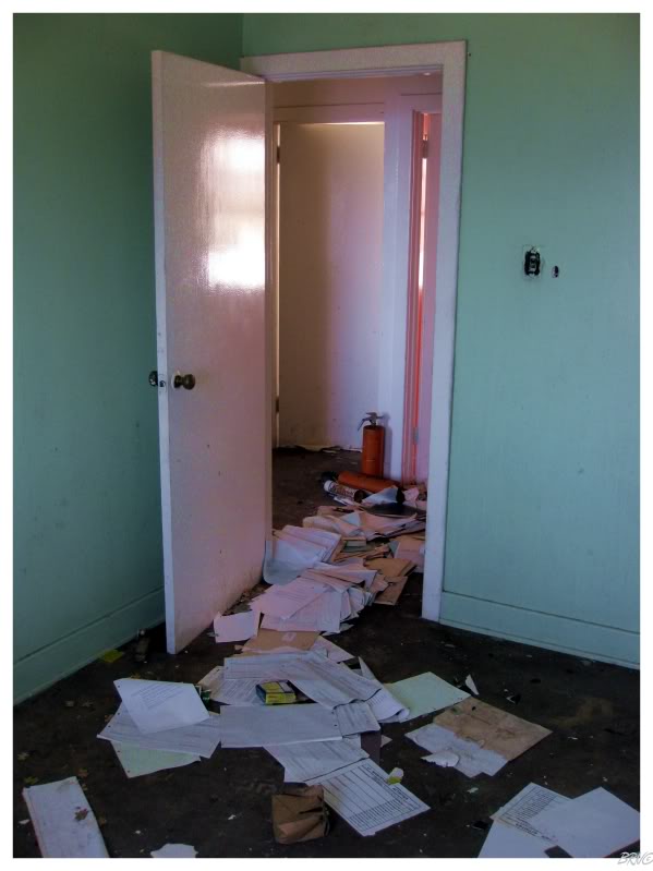
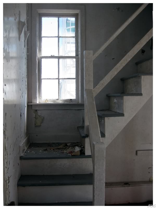
Outside of the kitchen there wasn't a whole lot left behind in the house.
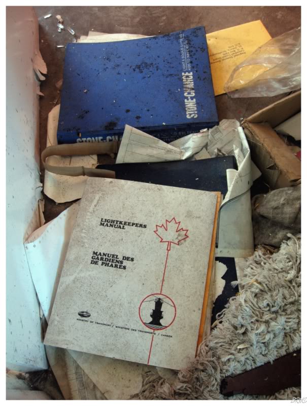
The keeper's manual was quite interesting though. I never knew they had so many maintenance tasks...
Also of note were the bright colours which I suspect they used to combat the depression of spending February 14th out on an icy, windy and lonely point in the Atlantic.
Then again, the coast guard is always belly moaning about how much everything costs. I'm actually surprised they lugged all of these colours here - you would think they'd just paint everything institutional green and be done with it.
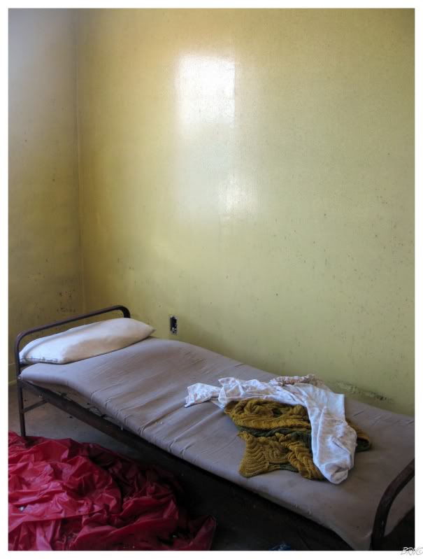
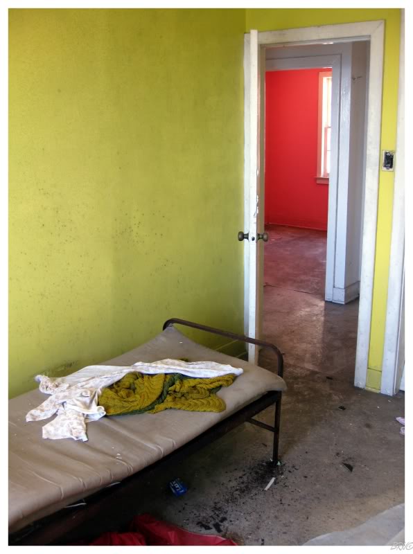
I was also amazed at the beds they had - paints a less glamorous picture of their lives.
(It's not that I thought lightkeepers had king-sized beds draped with 300-thread count sheets, I just thought they had better than the ABOVE! I know I'd be cursing the stupid 'apricot cheeriness' and 'super sensational sun yellow' paint if I was sleeping on a shoddy cot and it was clear the coast guard spent far more on the paint then the bed.)
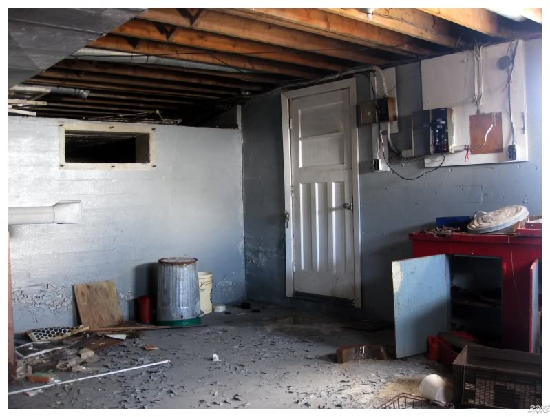
The keeper's house was divided into two separate homes and while trying to find my way into the second, I found that both of the homes had workshops in the basement.
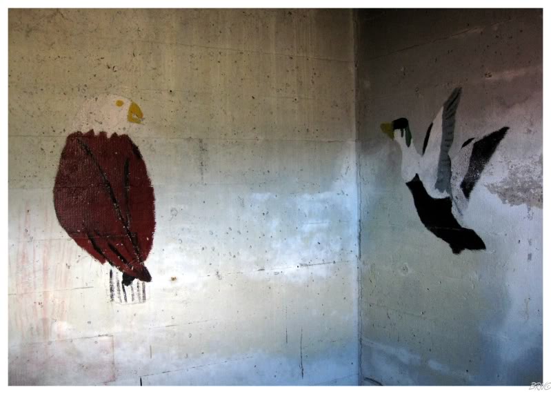
One of the workshops had paintings of eagles, ducks, roses & other randomness on the walls...
Outdoors again, I basically did 30 continuous loops of the buildings, taking in everything I could knowing that I would never return to this place.
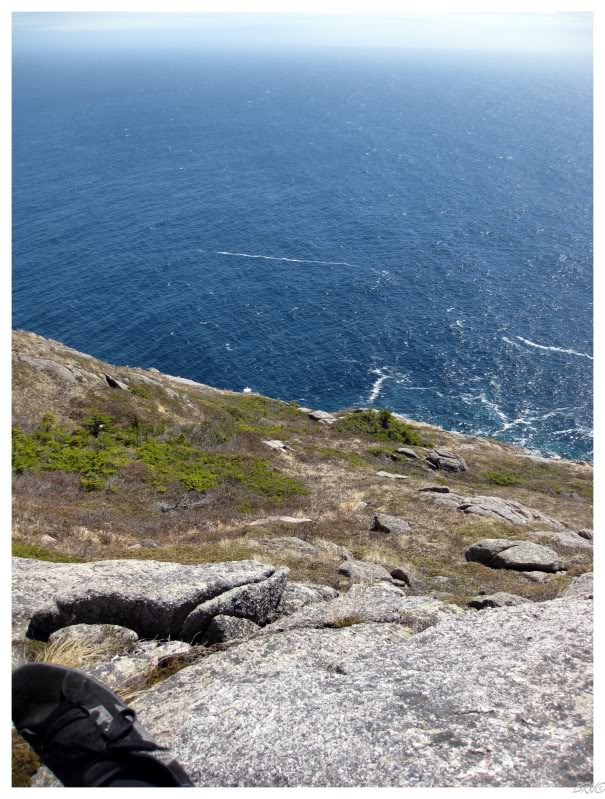
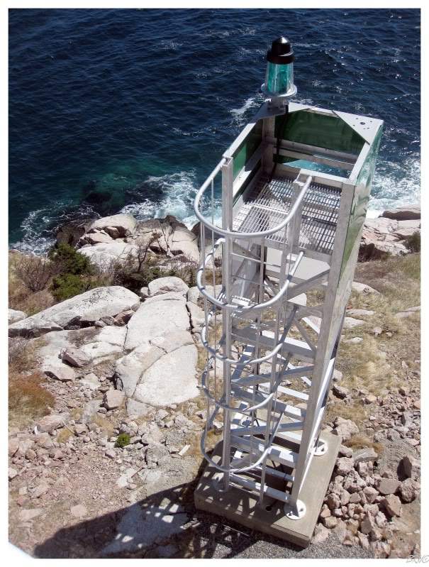
This resulted in me going out on the helipad, which wasn't that exciting, but did provide the most excellent view above.
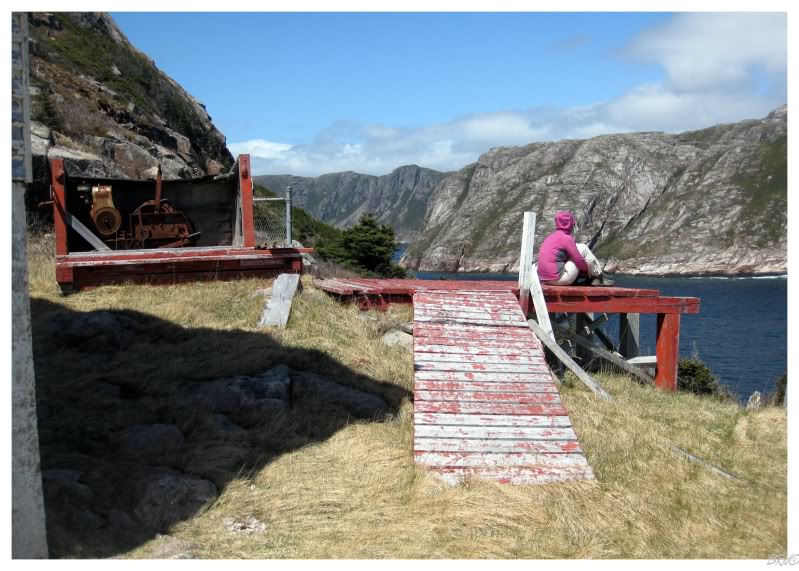
Meanwhile, Nicole sat on the winch deck and did the Newfoundland-girl-thing of sitting and staring at the ocean.
By the way, the winch is a motor which turns a belt, which is attached to freight & subsequently pulls the freight up a plank from the ocean up to the deck at the keeper house - this is necessary because it's quite hard to deliver a month's worth of food on slippery rocks where you're still 100 feet below your house.
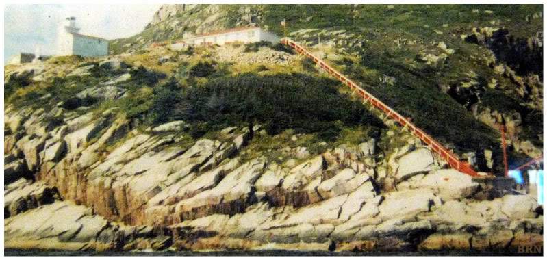
Here is a better picture of the winch for your understanding.
(I took this picture of a picture showing the lighthouse in the local convenience store).
Eventually Nicole was cold, we knew we couldn't stay here all day & we didn't want the weather to turn on us, so we had to leave.
The only difference on the way back was the fact that we simply hiked beside Francois Bay instead of that loop out to Brandy Head.
This afforded us spectacular views of Francois Bay, even though it was hard to argue with that Brandy Head view either - I'm thinking you could pretty much hike anywhere around here and find it breathtaking.
It also afforded me with the ability to strike an item off my Newfoundland list...
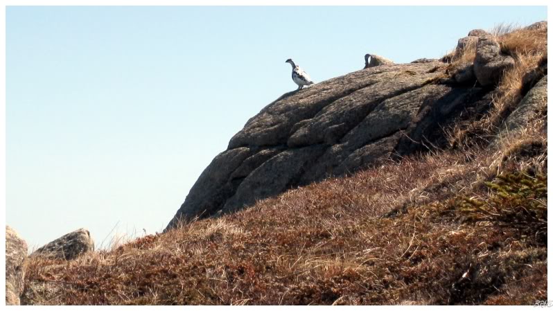
As my friend and I were hiking along, I was a bit ahead as I usually am, when I flushed out a bird which I quickly recognized as a ptarmigan! With my obsession with strange names, I have long wanted to see this semi-popular Newfoundland bird!
I turned around with another vigorous fist pump...confusing Nicole as to what I was so excited about.
The three ptarmigans would fly to a rock at the top of a small foothill and I sighed at their elevation as I needed a closer picture. Testing my resolve, I climbed my way up and the birds stuck around long enough for me to get a marginal picture with my point & shoot camera.
Looking back down at Nicole from the top of ptarmigan mountain...
The hike back was tiring, as we knew it would be.
Once we got back to our host's home, Nicole tiredly collapsed, but I told her I was going back out because I needed pictures of Francois on this sunny day.
She couldn't believe my resolve, but quickly I was back out on the 4-wheeler paths...
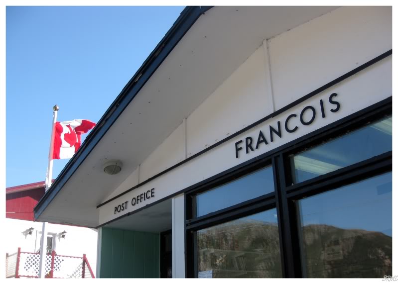
Francois had one of those cool, 1950's-ish post offices that I love so much...
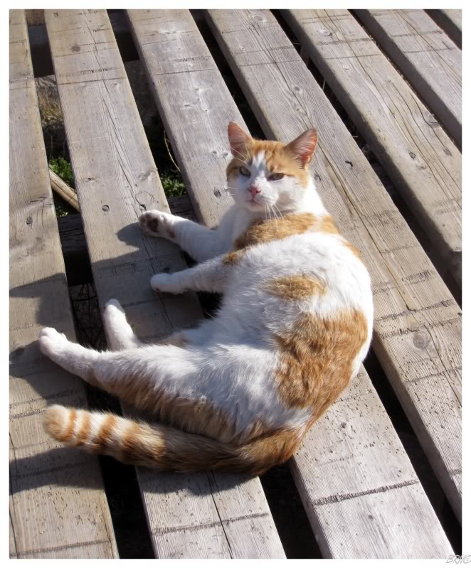
After another hour of walking around, I finally sat down to rest on a bench located at the town dump.
As I sat down I scared away a songbird, and the feral cat who was stalking the bird didn't seem impressed with me.
The cat didn't seem impressed when I would break from petting to take a picture of him either.
Eventually leaving the feral cat & returning home, I could have fell asleep at 8 o'clock, but I fought it off until 10.
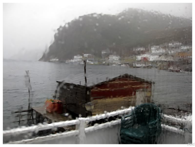
The next morning was a lot like the day we boated out to Francois.
Apparently the boat only goes if the wind is below 30 knots...and it was 28 knots this day. This meant we wouldn't be forced to stay in Francois for another day instead of going to work.
The ride back felt like deja vu in terms of how similar the boat rocking and the conditions were. To add to our misfortune, this wasn't even the regular ferry, this was the replacement ferry as the other boat was in for repairs - meaning we rocked more because the boat was smaller.
Oh well, we had a spectacular day for our hike & I would lay out our rain, sun & rain exactly like this if I had the choice beforehand.
After we returned to Burgeo, we decided to take another ferry to Ramea. Click here to read about that.
End.
Go Back to the Main Page of this Website