More Baie Verte (Map)
Baie Verte, Northwestern Newfoundland
Summer 2010.
The Baie Verte Peninsula is one of my favourites on the island & when I found myself there with a day to kill, I took advantage by driving down several highways towards new communities.
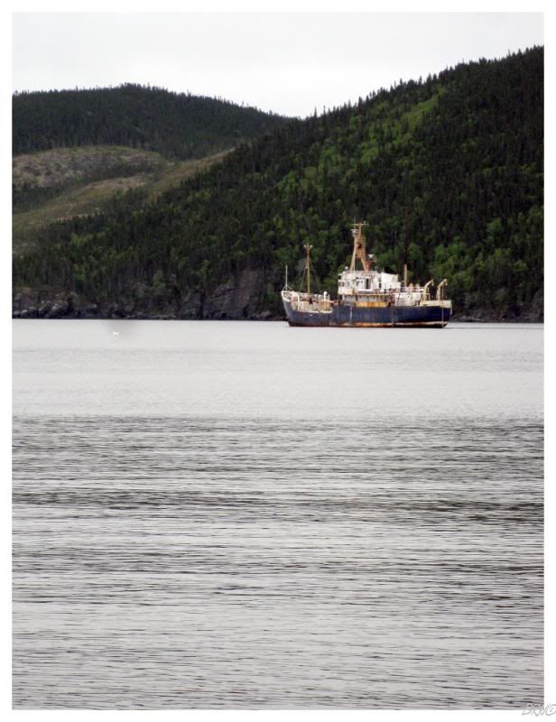
Highway 413 is a 30km(18mi) road which leads to the communities of Smith's Harbour, Middle Arm & Rex Goudie's hometown of Burlington. We encountered a moose along the way, along with an interesting house in Middle Arm; but the most interesting scene came from the shipwreck resting in the bay at Middle Arm.
Without ice or a kayak I wasn't getting anywhere near her, but I still found her interesting.

Since I had already been down the rest of the Baie Verte highways, we tackled the 52km(31mi) Highway 414 next; a daunting task because of the 8 roads which branch off towards various communities.
While it had been foggy & drizzly this morning, the day was turning for the better by the time we reached the end of Highway 414 at La Scie. We drove throughout the community, including the road which I thought would lead to an old radar site. On the contrary, it led to a tourist area with fantastic views of the nasty cliffs which protect the ground supporting La Scie.
We were both surprised with the size of La Scie, and with a population near 1000, it was quite the surprise when we were expecting a sleepy fishing village.

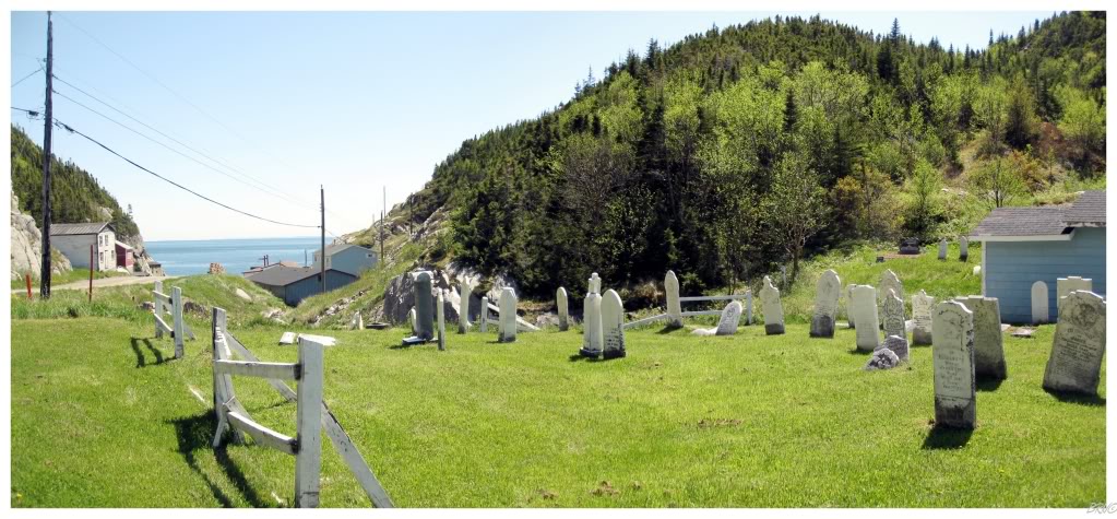
A mere 15 minutes from La Scie is the village of Shoe Cove (pop.180). An attractive community around a great circular harbour, the abandoned convenience store & home foundations told a tale where this place has lost 20% of its population in the last 5 years and 40% of its population since it held 300 people in 1991.
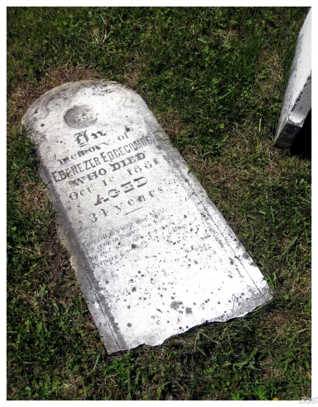
Shoe Cove does have one of the most scenic cemeteries though; as old stone headstones angle towards the ground, next to a loud brook which empties into the ocean soon after.
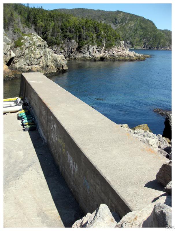
Just past the cemetery was the town wharf which ended with a large breakwall.
We both scaled the 6 foot monster for a great view of the ocean, the nearby loons and the community of Shoe Cove.
My friend was a bit nervous on the breakwall, while it was wide enough that I felt relaxed.
Surrounding us was a monstrous sea plant, swirling and encompassing all of the water below the surface. I asked her what it would cost for her to jump in if she knew that there were no rocks below...when she replied that there wasn't enough money & I replied that I'd do it for $100; I had to laugh.
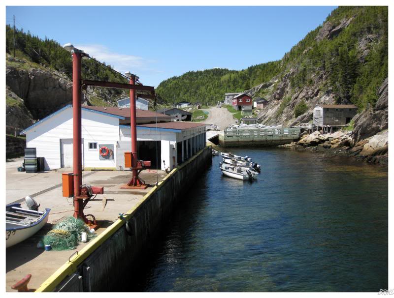
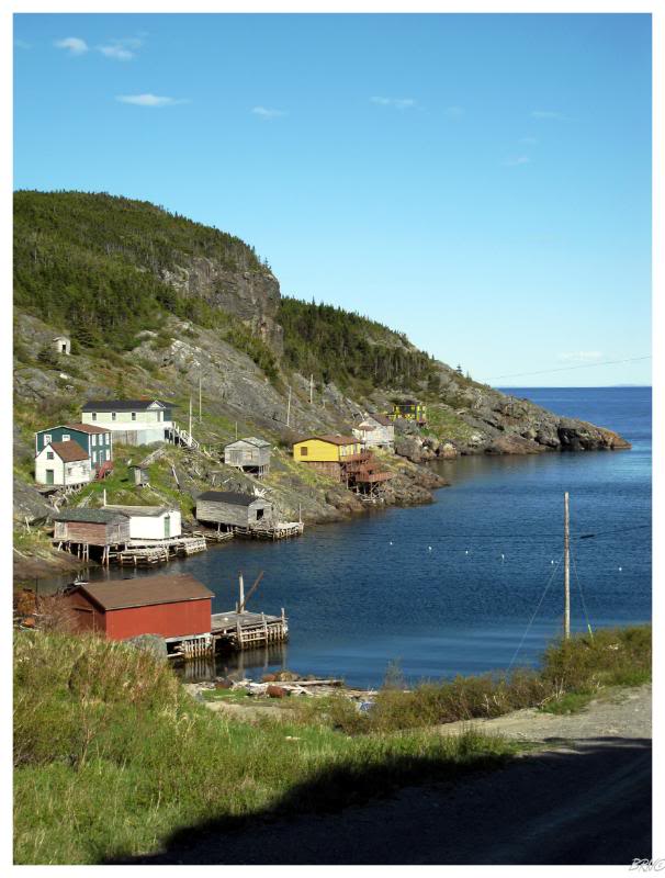
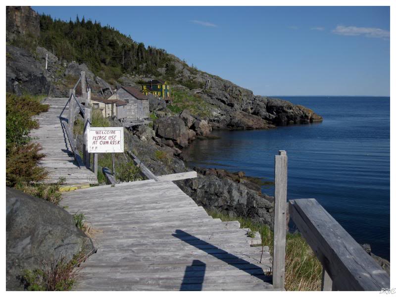
After leaving Shoe Cove, next up was the 6km(4mi) gravel road towards the hamlet of Tilt Cove.
First, please compare the above picture with the postcard found here.
Tilt Cove started out just like any other simple fishing village in Newfoundland. That was until 1857, when prospector Smith McKay came to town and discovered a copper-rich rock atop a resident's mantle. This led to McKay claiming the land and a mine being opened in 1864.
The Tilt Cove Copper Mine would prosper for the first 20 years under proper management, with the population swelling towards 1000. After some poor management, the mine returned to prosperity and the population furthered swelled towards 1500 by 1916 - a size commanding a doctor, teacher, blacksmith, tailor and mail delivery by dogsled.
Tilt Cove was depicted on Newfoundland stamps in 1896 - the first mining scenes depicted on stamps in the World.
The mine would decline again with the onset of WWI.
Shipping costs would eventually close the Tilt Cove Mine in 1920, as managers spent their profit to build on-site copper smelters instead of sending the rocks to the Swansea Smelters in Wales.
These on-site smelters broke down and left the managers without options.
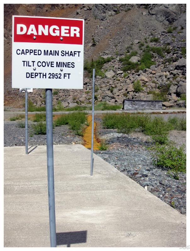
The population would fall to 100 with the closure of the mine. A brief reopening in 1957 revived the community, but permanent closure in 1967 has succeeded in crippling the community.
The 2006 Census population of Tilt Cove was 5 people.
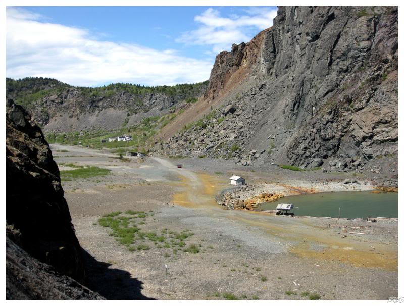
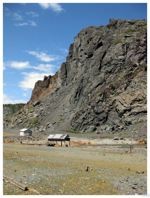
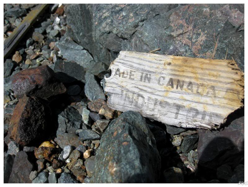
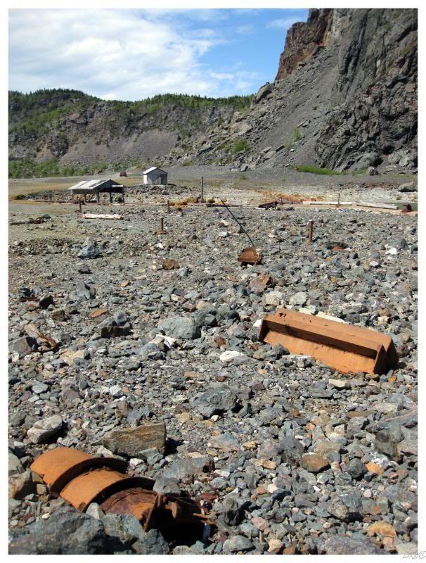
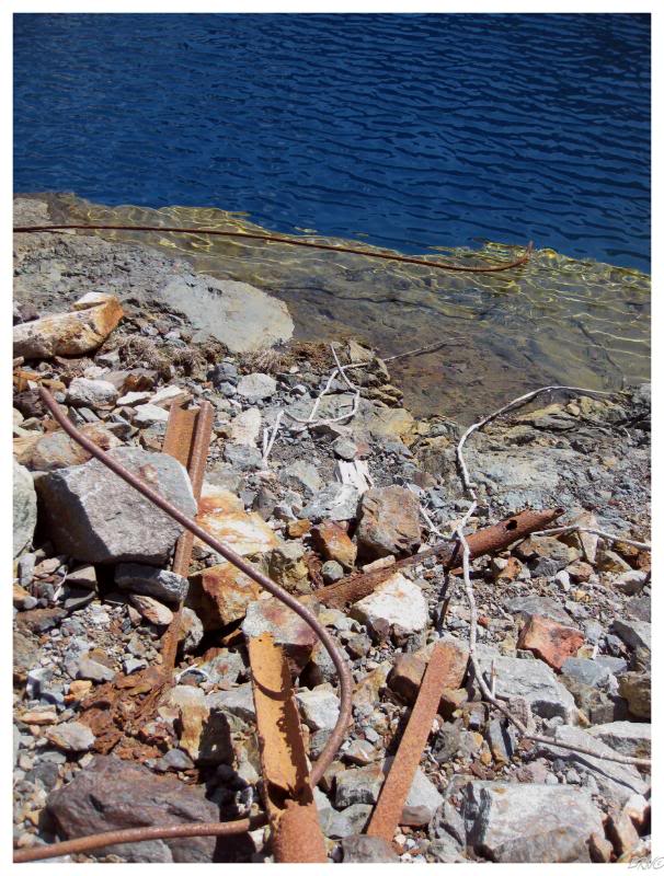
As you can see, by the time we got there, there wasn't much left for mining buildings. I had seen pictures from 2004 showing a surface building, but it was obviously nowhere to be found.
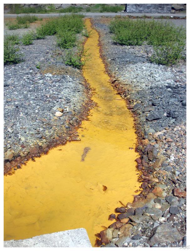
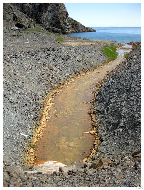
Nevertheless, the site was still interesting with the building shrapnel & the toxic orange water oozing from the mine shafts towards the ocean.
It was also a case of seeing something different than a fishing village in Newfoundland - always a pleasant surprise.
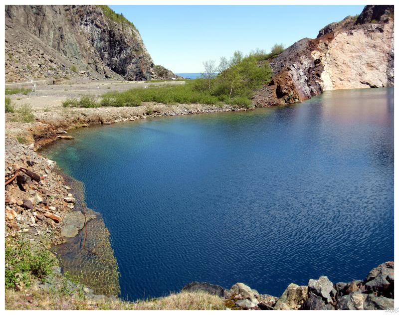
Another interesting feature was the flooded pit.
We sat by the edge staring at the seemingly endless depths; with water so blue that we had to work to convince ourselves we weren't somehow transported into the Caribbean.
Then again, the jagged metal and the fact that you couldn't pay me to jump into that water, worked quite well to remind me that I was in Tilt Cove, Newfoundland and not the Netherlands Antilles.

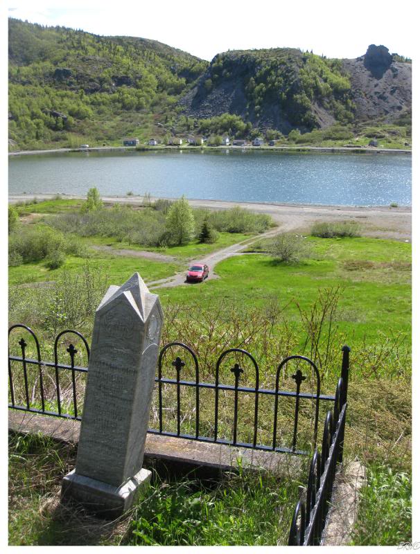
To add to this list of interesting Tilt Cove features, a 40-step set of stairs leads from the community road up to the cemetery atop the East Hills overlooking town.
You could tell that someone had tried to clean up the cemetery within the last few years, but thick bushes and fallen signs indicate that it may be more challenging of a task than can be expected of the 5 remaining residents.

One obelisk stood out with its size & its own explanatory sign - I assumed it to be built for some rich dude & moved along.
When I returned home, I came to learn that the obelisk was actually a memorial for 15 departed Tilt Covers.
On December 6th, 1867, the Queen of Swansea left St. John's for Tilt Cove with 15 passengers. The boat would come within 12 miles of Tilt Cove before running aground on nearby Gull Island. Everyone survived the grounding & they set fires in an attempt to be rescued. When no one came to rescue them and hunger set in, the survivors took to drawing straws - where the person with the shortest straw would be eaten by the other survivors.
This continued until the last person died of starvation.
Fishermen would come to Gull Island during the next year and find the Queen of Swansea vessel, some bones and a journal from the man who was to become Tilt Cove's doctor, this journal transcribing the events which occurred on Gull Island.
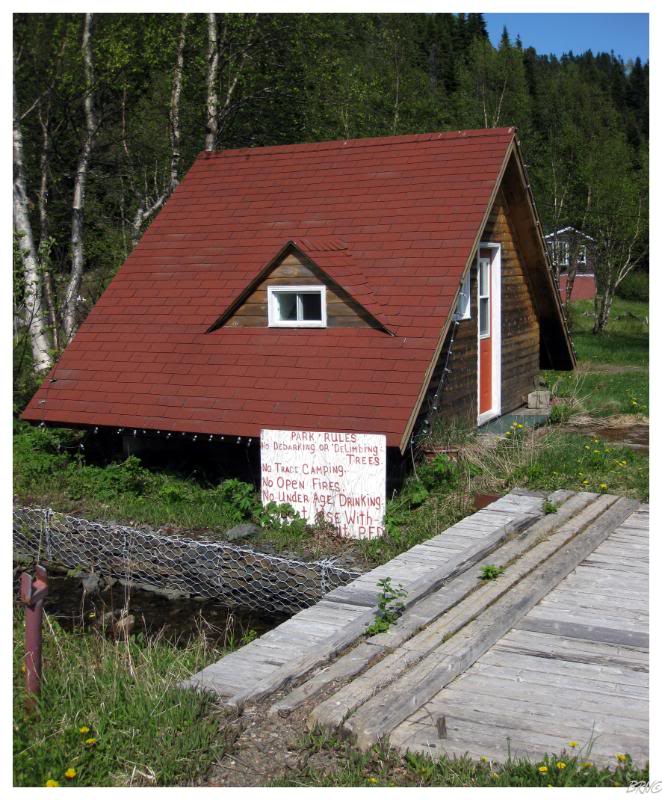
Unless we wanted to check out an abandoned delivery truck, we had now exhausted all of the sights in Tilt Cove and now returned to the gravel road to exit town.
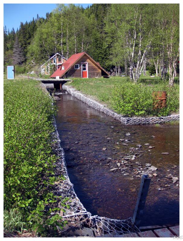
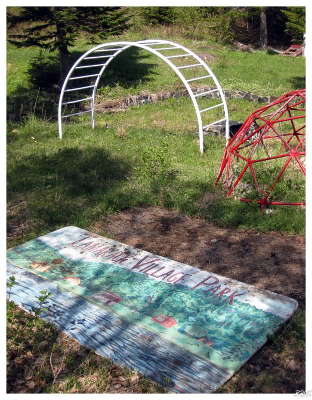
A few hundred yards outside of town was the Tamarack Village Park: a children's campground which looked pretty damn fun with paddle boats and a zip line over the camp's lake!
I wondered when the park closed, saddened by the fact that the area's constant emigration will eventually leave this park truly forgotten, on a road no longer maintained by the provincial government.
It will be interesting to find that jungle equipment in the middle of a forest in 200 years though!
Leaving Tilt Cove, we checked Brent's Cove & Harbour Round from the list, before returning to the highway and taking NL-416 towards Round Harbour.
Yes you read that right, we left Harbour Round and went to Round Harbour.
Clearly original names were at a peak in the 1800s!
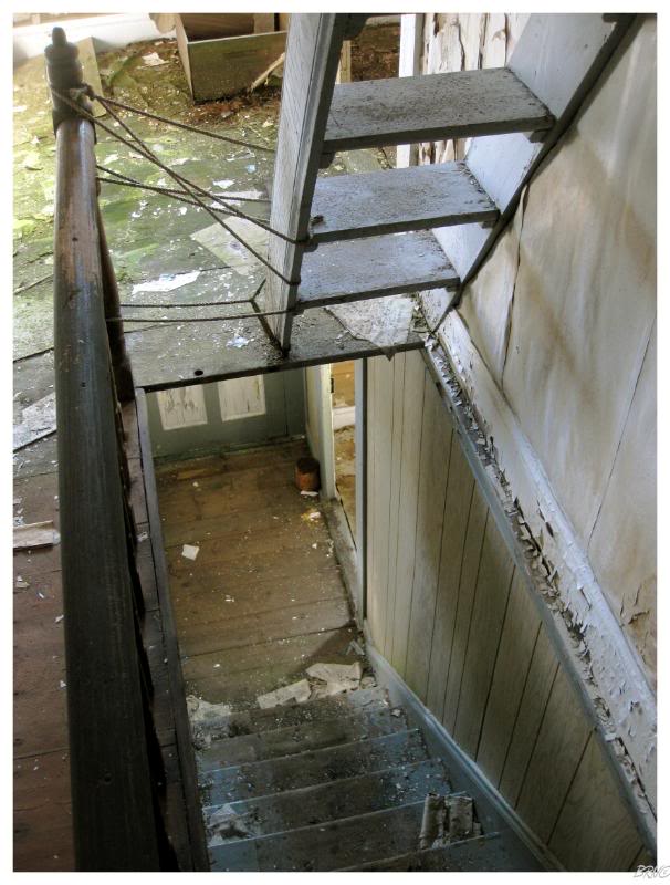
We parked the car because the road dipped down to Round Harbour and only went to the south. I was curious about the boardwalk through the houses to the north, so we decided to walk the 2x4s and pallets through the approximately 10 structures to the north.
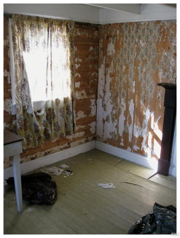
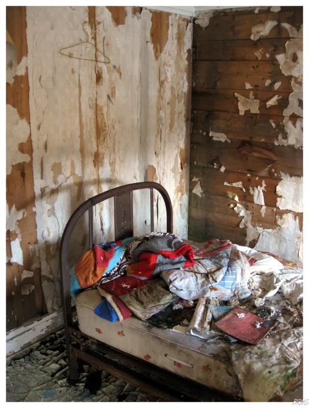
We wandered into an abandoned house & it was a complete time capsule.
Although I don't know how safe of a time capsule it was!
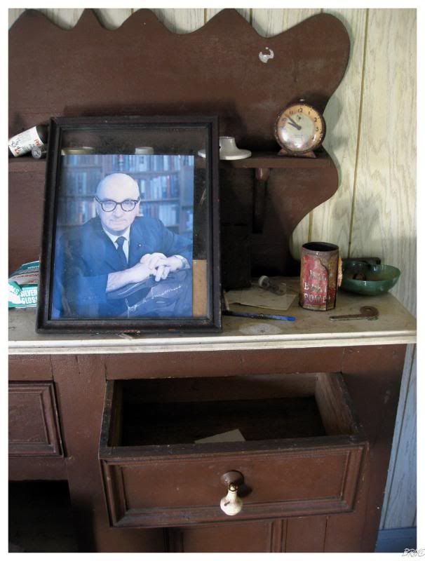
The living room picture of Newfoundland's most beloved premier, Joey Smallwood, added to the Newfoundland saltbox ambience.
The unique boardwalk, small community size, church overlooking the community and scenic beauty made Round Harbour a worthwhile destination.
Although we had only completed five of the eight highway branches, it was getting late in the day & we decided to get on our horse towards home since we had a 2 hour drive ahead of us.
End.
Sources:
1 - Once Upon a Mine: Chapter 6 & Chapter 8 - HeritageNF
2- 2006 Communities Census - StatsNL
Go Back to the Main Page of this Website