Ringa Ding Dong
Bell Island/Irish Loop/Point Verde, NL
Summer 2010.
A friend of Nicole's was having a going away party & that was a good enough excuse to drive the 7 hours across the island.
We had two unseen lighthouses near the highway & initially planned on stopping at the Brigus one, which involved a 6km(4mi) round trip hike.
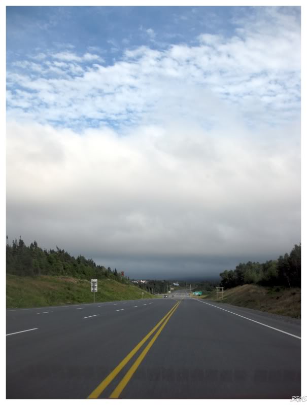
Unfortunately, the above picture is what we encountered as we neared Clarenville (about 2 hours outside of St. John's). The storm clouds at the bottom of the picture meant light drizzle in Clarenville, which meant that I couldn't ride their skatepark for the fifth time I've tried.
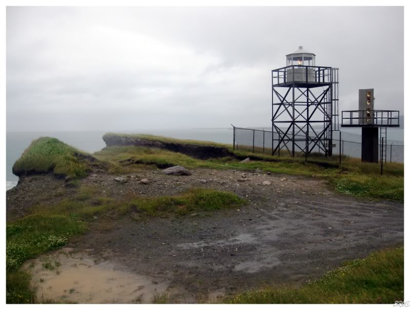
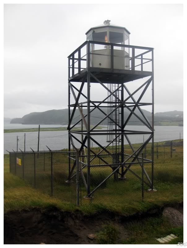
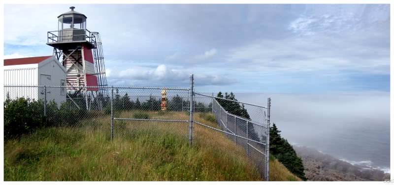
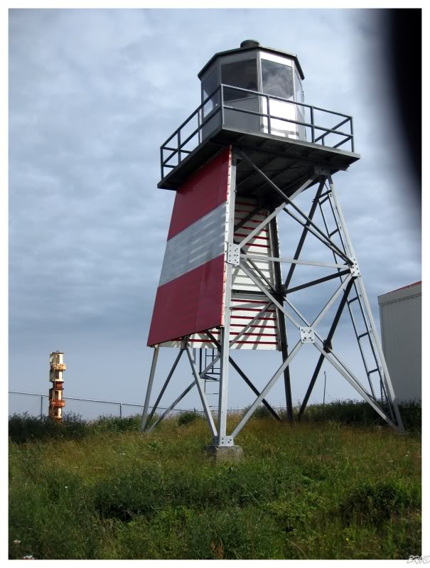
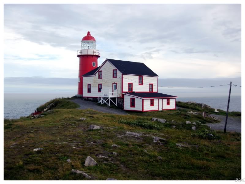
The dark clouds ahead eventually delivered rain and therefore we had to settle for our backup lighthouse: the skeletal tower at Point Verde (near Placentia).
We both commented how pleasant the cliffs of Point Verde were, even as we were exploring them in the wind and the rain. As with so many others, it is a shame that they don't have a classical lighthouse at this point anymore.
Leaving Point Verde & after dinner in the capital, we caught the ferry to Bell Island for the night. This is possible as the ferry terminal is only 20 minutes from St. John's, and once there, it is only 20 minutes by boat.
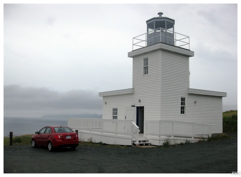
The first order of the next morning was obviously to visit Bell Island's lighthouse...
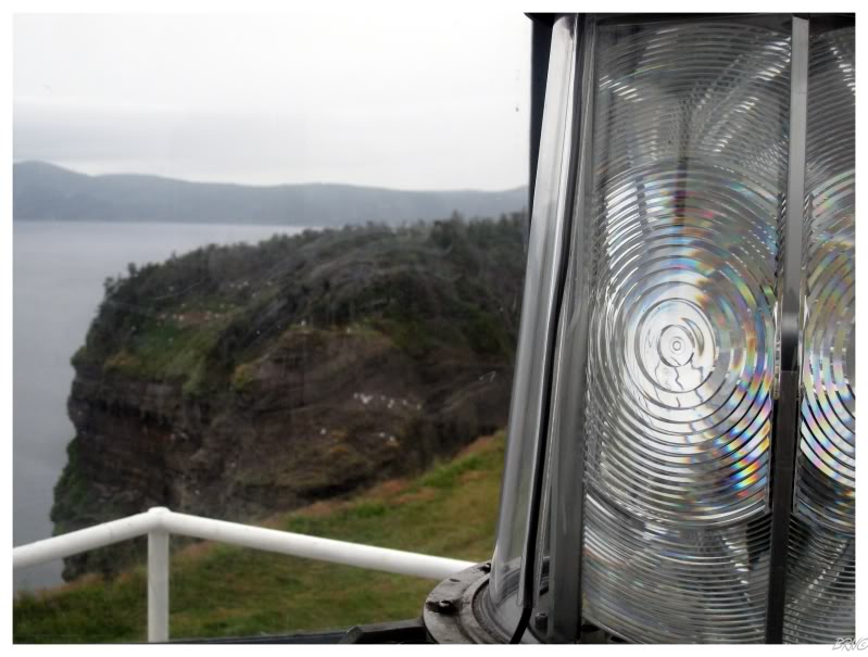
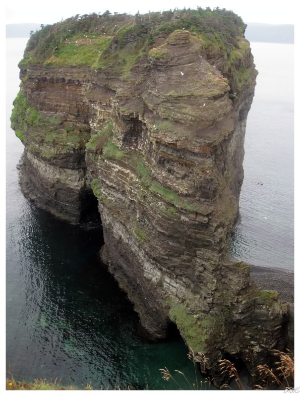
...even though the cliffs surrounding Bell Island are far more impressive than their run-of-the-mill lighthouse.
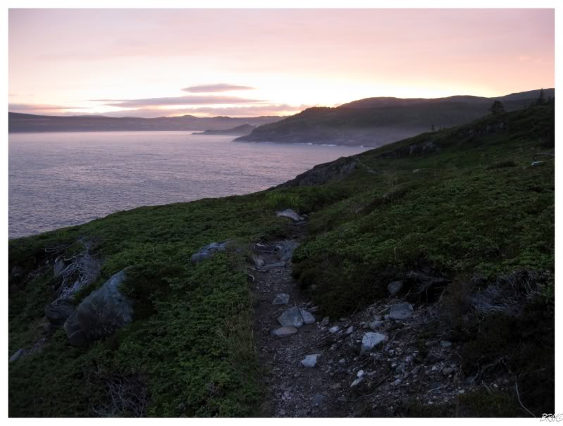
There are parts of Bell Island were you can go down to the ocean by these great cliffs & it is a shame that we didn't have more free time this Saturday.

We didn't have that much free time because we planned on visiting the Bell Island Mine #2 Museum.
Bell Island's economy grew exponentially when iron ore was discovered and mining began in the 1890s. Over the next two decades, another surface mine was started, in addition to 4 submarine iron mines.
The mines would all close by 1966, and the island's community of Wabana, which was once the second largest community in the Colony of Newfoundland, was now seeing substantial population declines.
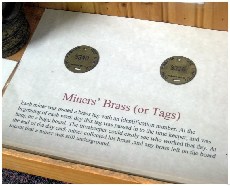
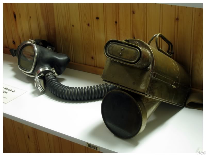
In the year 2000, a museum would be built outside the entrance to the Bell Island #2 Mine. The two of us were both very impressed with the quality of the artifacts and their great explanation cards.
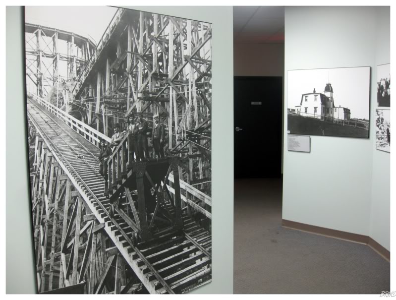
A collection of old photos lined the hallways.
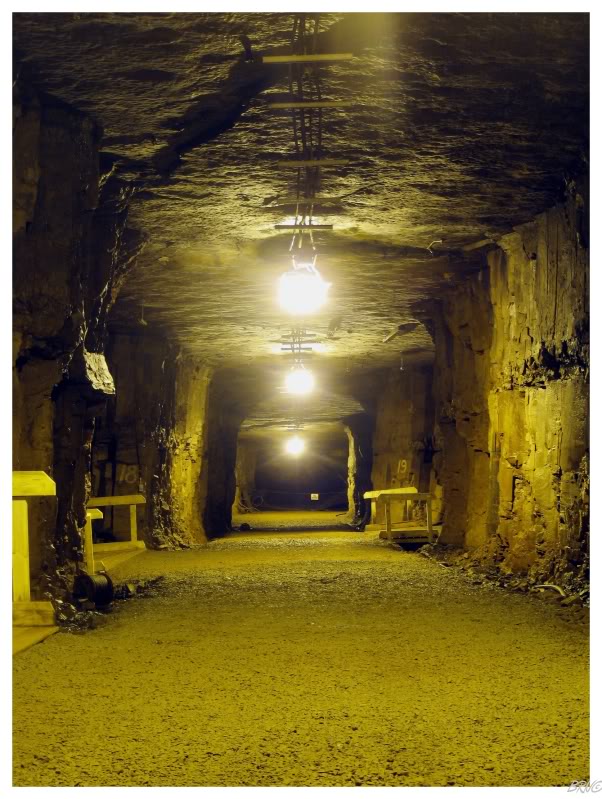
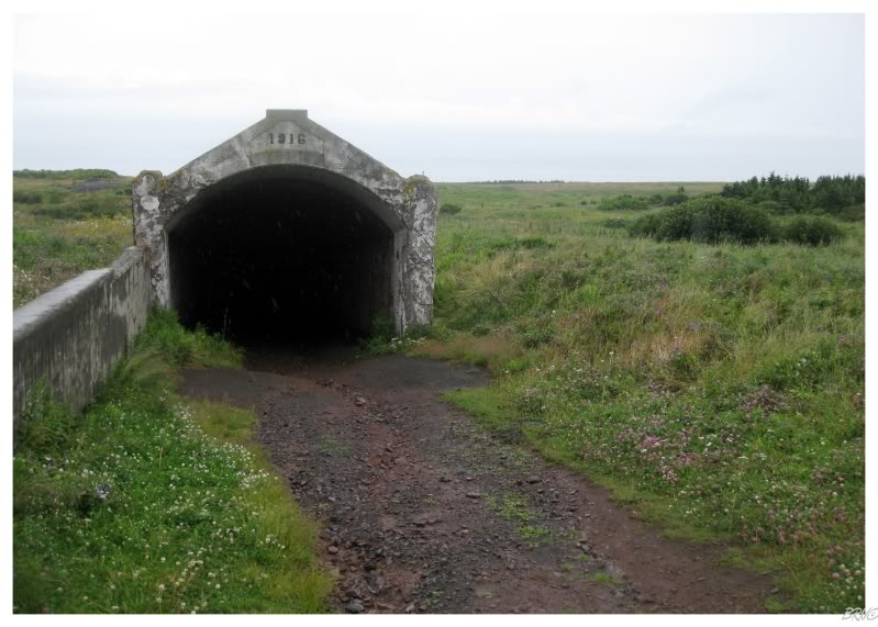
The above picture shows the crazy structure they constructed to get ore from the island, down to the shipping boats in the ocean. I can't even imagine what that monstrosity looked like after a few years of abandonment.
Four of those shipping boats were sunk in WWII by the Germans & one errant German torpedo struck Bell Island and marked the only German land attack on North America.
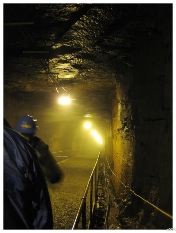
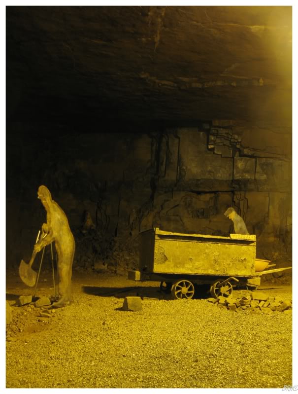
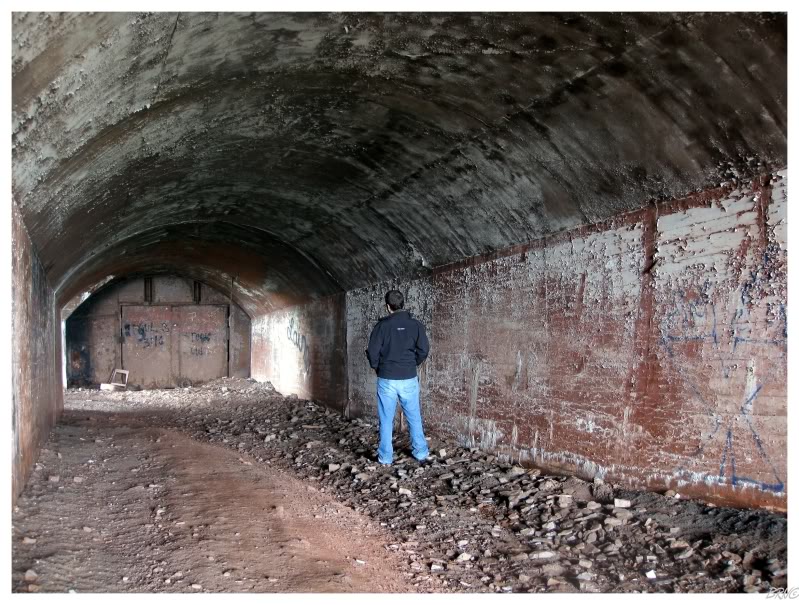
Of course the main draw of the Bell Island #2 Mine Museum...is the actual mine tour!
Lead by a man who spearheaded the creation of the museum, we walked past a rollup door & down a gradient until he started leading us left & right. The tour lasted an hour and the amount of knowledge offered by the tour guide was amazing.
The story which I remember the most, was how these mines were so old that they used horses to pull the iron ore carts back towards the surface. These horses would spend their lives underground in stables, stables which were now in ruin. He told us of how when they stopped using the horses, a few residents adopted them & they were clearly blind for about a week - their eyes had to adjust to sunlight after spending years where they only saw candle & flashlight.
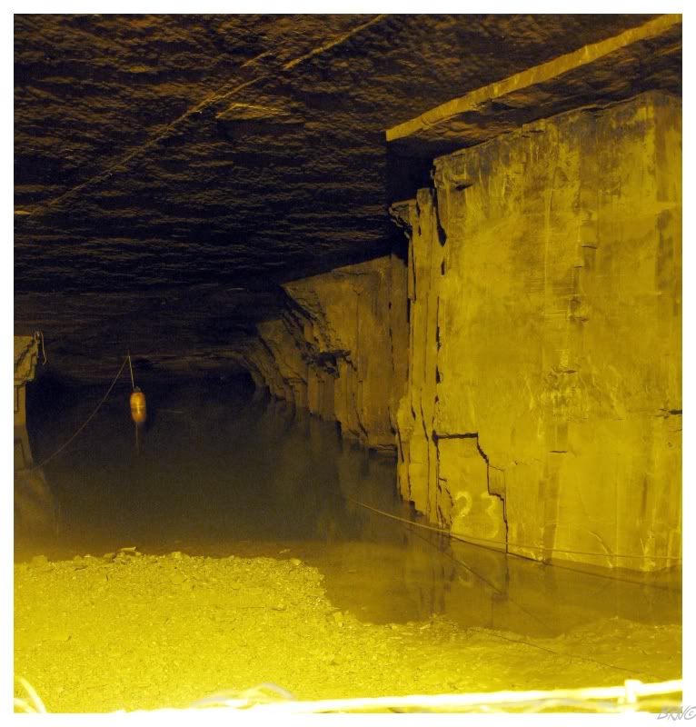
The tour ended once we were 650 feet down, where the mine shaft meets the water. When the water pumps used to run, these mines ran dry for 2-3 miles under the ocean floor; but now water has seeped in & flooded up to level 23. I asked the tour guide if the water boundary changes much & learned that he's only seen it change by about 1 or 2 feet - it mostly stays right at level 23.
It should also be said that the above picture gives the impression of much more light. I actually had my tripod out for a 2.5 minute exposure, while the rest of the tour group started angling back up the incline.
Eventually the tour guide hollered at us to keep up and therefore I only had one shot at a picture capturing the water level.
Also, apparently divers have come to Bell Island and dove the flooded portion; but that probably won't open to the public anytime soon, as an experienced diver lost his life during the initial expedition into these waters.
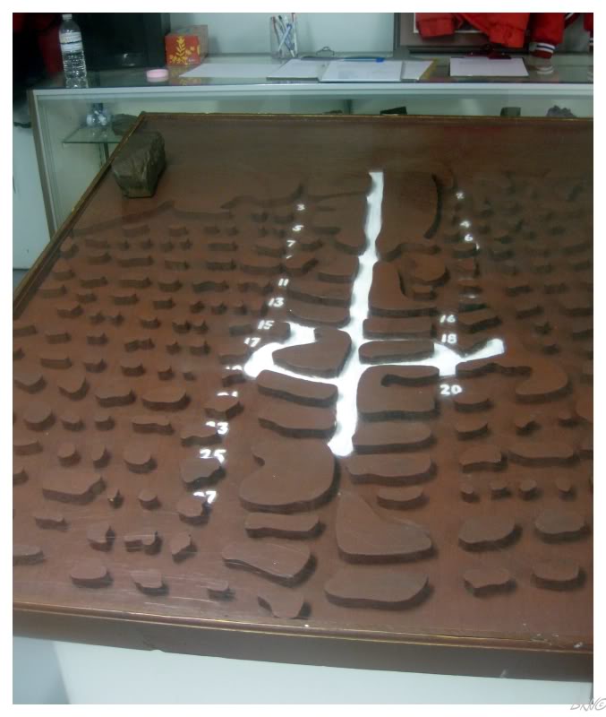
Back aboveground, the tour guide showed us maps & dioramas of the mine we just explored. The above diorama shows our path in white & also shows just how massive the mine is (...and this was only 1 of the 4 submarine mines!)
The tour guide also explained his role where he has to go into the mine to look for artifacts & that he's still finding new stuff all the time.
While he was telling us this, it invoked a severe level of jealousy which I haven't experienced in a while.
The entrances to the other submarine mines are still there on Bell Island...but unfortunately they are guarded with steel doors welded shut.
I still liked the little underground portions that they've left open.
We were running low on gasoline, so it was time to go down to the ferry terminal & catch the next boat back to Portugal Cove.
After lunch in the capital, we had a free afternoon. We decided to spend the time cleaning up the remainder of the Irish Loop lighthouses we had left.
(aside: If you're wondering why there was all of this eating in the capital, realize that Corner Brook only has Canadian & Chinese restaurants...whereas St. John's at least has Greek, Thai & Japanese in addition - hell, St. John's even has proper pubs to eat at. Every interesting person I know from Corner Brook makes sure to consume plenty, whenever they get some actual dining choices in St. John's.)
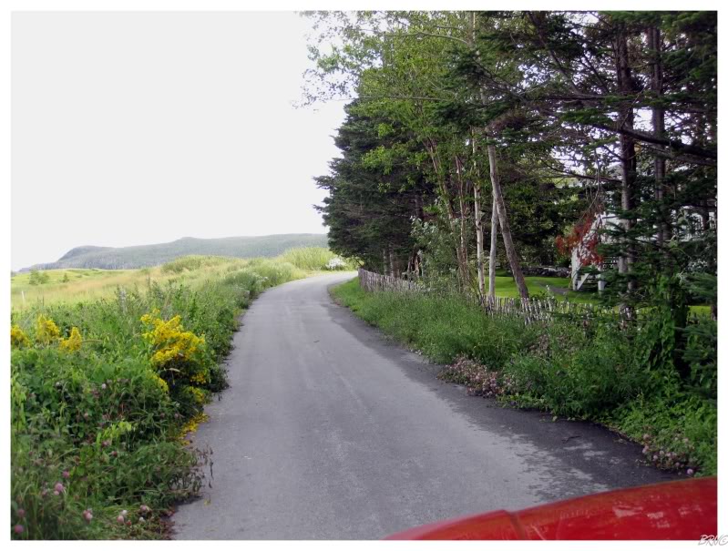
Anyway, the above picture is from the back roads of Renews, as we tried to find the road to Bear Cove Point. The road felt more like England or Wales, with the narrow width, short shrubs & weathered fence...or at least what I imagine England or Wales to feel like.
Nicole's car endured a portion of the rough Bear Cove Point Rd, but I eventually decided to play it safe and parked the car.
She would grow a bit salty at the length of the hike, but thankfully we found the lighthouse right as her spirits were fading.
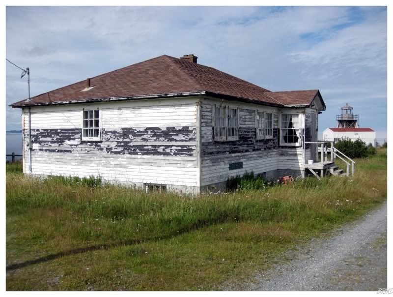
The first thing we encountered was a weather beaten keepers house; but after peering inside, I realized that it wasn't abandoned.
Nicole dislikes skeletal towers, so I didn't think it would go well to encourage hiking & then end up at one of her despised beacons.
Oddly enough she liked Bear Cove Point though. While I thought the daymarks0 made the skeletal tower look goofy, in her eyes it was enough to make the lighthouse unique & gain her favour.
A minivan pulled up as we were leaving; the occupants being a foursome of 50-something tourists out lighthousing. As we walked back along the path, it was relieving, and also humourous, for them to pick us up as we continued back to our car.
They ended up being from British Columbia & they were circling the Irish Loop.
Renews (the town with Bear Cove Point) was the furthest south we went this day.
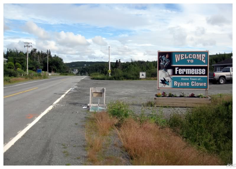
On the way to Bear Cove Point, we went through Fermeuse & passed the Ryan Clowe sign - I had to get a picture as we returned.
Note that I didn't stop for a picture of the Red Wings' Danny Cleary's road sign in Harbour Grace when I was there.
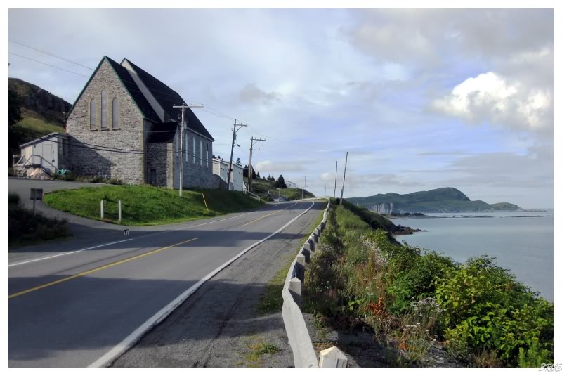
We continued along and came to Ferryland, home to a Newfoundland rarity (a stone church).
It was truly a pleasing vista with the stone church next to the sea & grassy islands interspersed throughout the water.
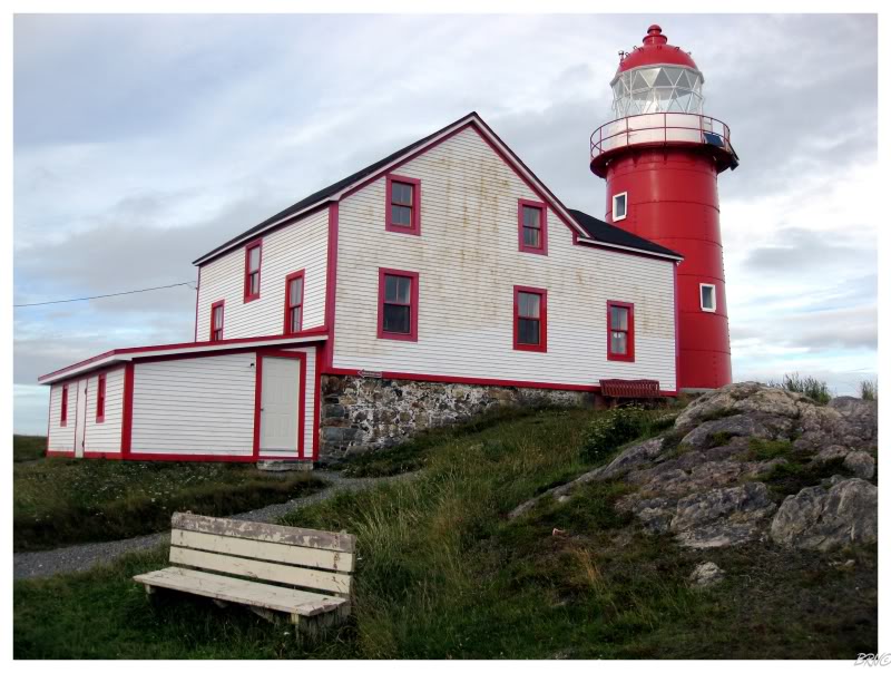
We drove on an average gravel trail to reach the parking lot for the 1871 Ferryland Lighthouse - a building visible from main street & not all that hard to reach. The two of us managed to hike the 1.5 km gravel path in no time.
Along the way we came across a woman who asked if we had seen any of the whales in the nearby waters - whereupon I look at her confused, because who would be looking for whales with this spectacular lighthouse in view?!?
Silly woman.
Ferryland stands as my favourite Newfoundland lighthouse.
Ferryland is unique because the keeper's house is home to Lighthouse Picnics: you simply show up & they provide a blanket, basket, food & books. It sounded great to me, but unfortunately they were closed when we were at Ferryland this day.
We were also in a bit of a hurry because we were trying to clean up the last Irish Loop lighthouse we had to do.
Unfortunately, we only made it 2.5 or 3km out of the 3.5km involved in the Bay Bulls Lighthouse hike.
With cliffs & rustic trails, we decided to turn around and play it safe. The trails out here aren't bubble wrapped & it wouldn't be smart to be hiking without a flashlight - one wouldn't want to walk off a cliff into the Atlantic.
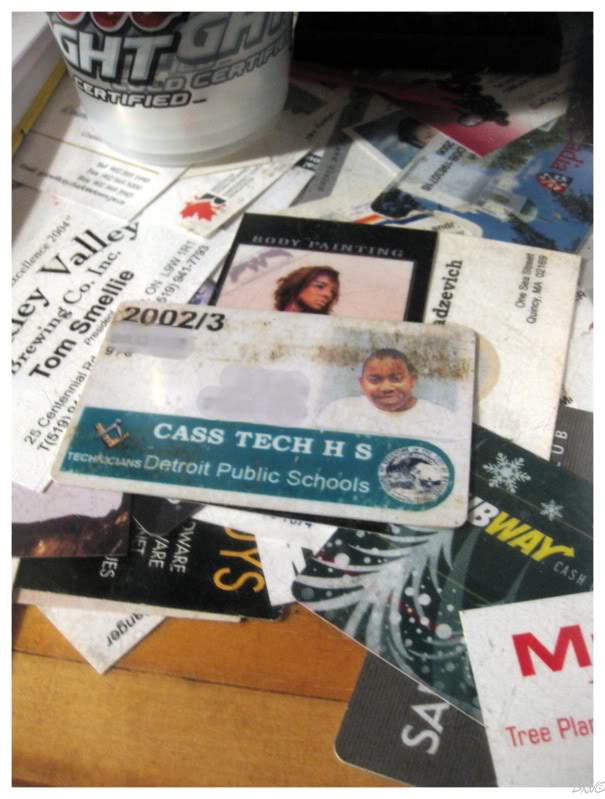
We went out that night for Nicole's friend's going away party & I really enjoyed the bar. It was in a simple house with a ton of knickknacks, the married couple were friendly and everything was great. The bar itself was covered with plexiglas atop the wood & people had added personal cards underneath.
Even though I loved the above card, I had to add it.
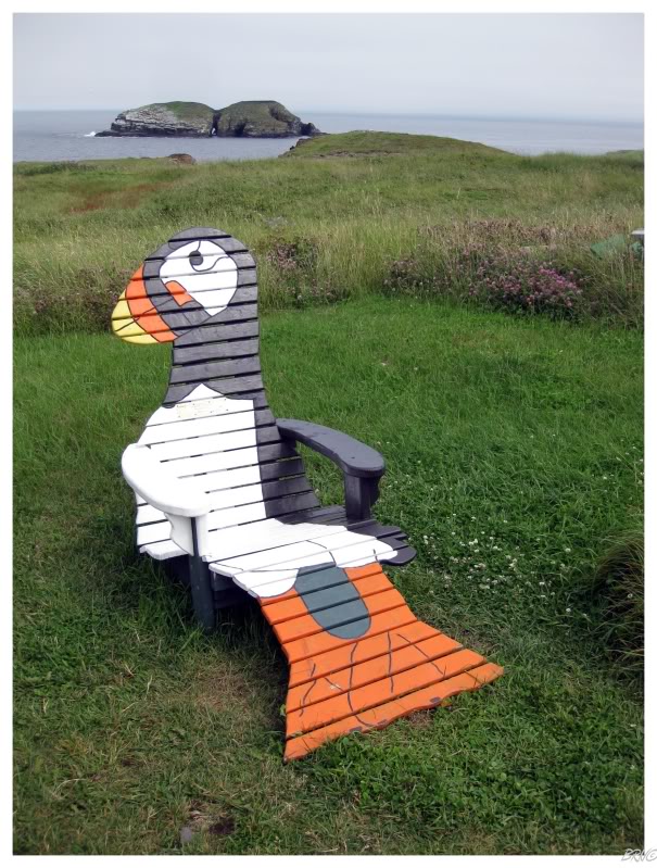
We had all day to get home; so we decided to stop at bird rock in Elliston because the puffins would actually be there this time.
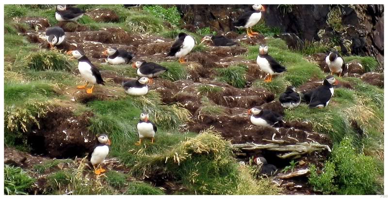
"See a puffin" was high up on the Newfoundland Checklist & I was very happy as I approached the channel across to Bird Rock.
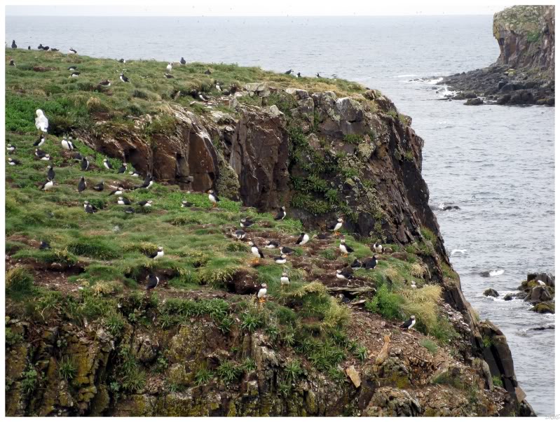
Crazy sea parrots!
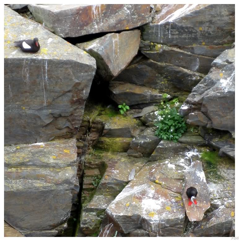
Speaking of sea parrots, there were also sea pigeons - or Black Guillemots as they're known outside of Atlantic Canada.
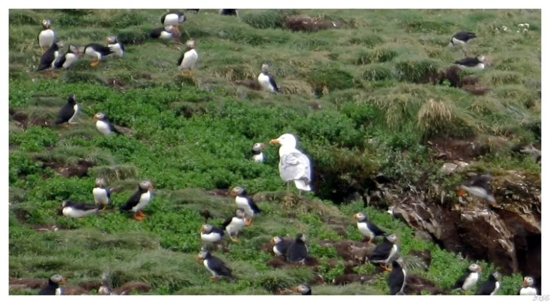
I was also amused by the odd out-of-place seagull.
We saw this island previously with only seagulls, so I guess the gulls couldn't be impressed with the puffin invasion.
After laughing at detouring for over an hour to see sea parrots, the rest of the drive was uneventful.
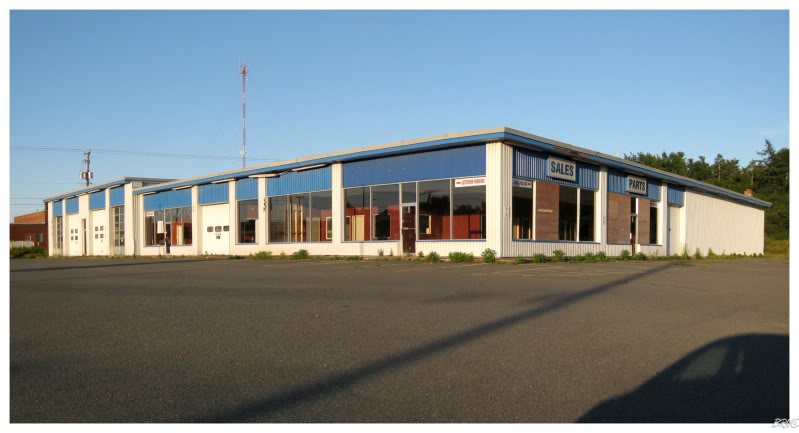
Since we were passing through Grand Falls-Windsor at the golden photography hour before sunset, I stopped briefly to shoot the abandoned Ford dealership, which I like for some odd reason.
Go Back to the Main Page of this Website