I awoke long before anyone else & decided to get going after asking myself when I would be in Salt Lake City again. I could certainly catch up on sleep when I returned home.
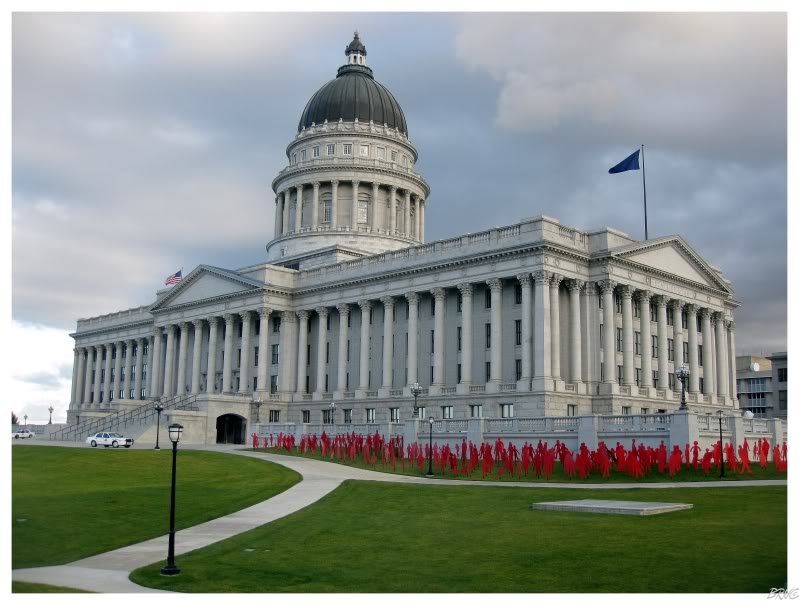
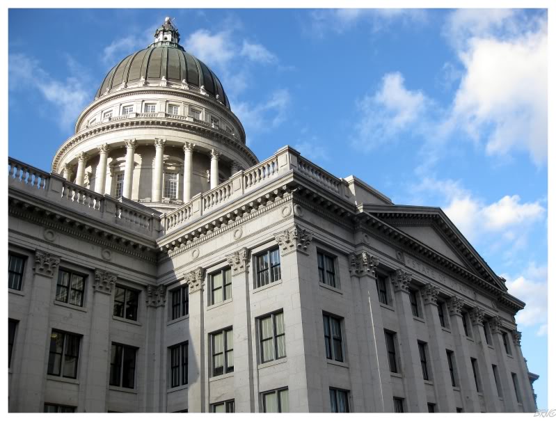
I asked Junix for the car keys and went to check out the State Capitol.
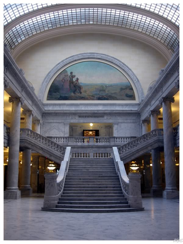
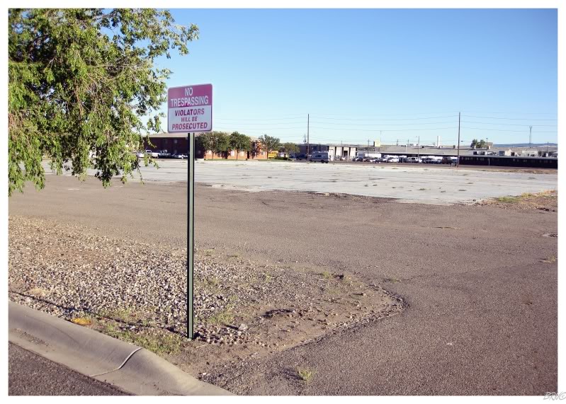
I was surprised to simply stroll into the building after extensive searches at the 3 other state capitols I've visited.
I later learned from the Americans, that apparently it isn't that crazy for a capitol not to have security.
It also might have helped that it was 7 a.m..
After the capitol, I stopped for some Sonic breakfast and returned to the Motel 6. Once everyone was ready, The Dude left us, returning to Boston via Wyoming and the 7 other states along the way. From here, Junix would drive Arntz & I to the airport so we could pick up a rental. You see, Junix had already drove halfway home by driving 8 hours west, so why wouldn't Arntz & I rent a car, so Junix wouldn't have to drive 16 pointless hours, just to bring us back to Eastern Colorado?
After thanking Junix for the lift, Arntz & I would embark on our 8 hour eastward journey in the rental.
The map looked awfully bare once we got out of the Salt Lake region, so we made sure to stop for something to eat before getting too far out into the desert; which meant stopping at a Texas Roadhouse in some bullshit, cookie-cut, sprawl-land Utah 'community'.
The meal actually ended up being pretty good & we both found it peculiar how amazed the waitress was that neither of us had been to a Texas Roadhouse before. The waitress & I chatted for a bit while Arntz was in the washroom, and she actually discerned my accent as she has family in Vancouver. When Arntz returned he joked about interrupting things between us & I joked that the gf might be a little concerned if I added some random Utah girl out of nowhere.
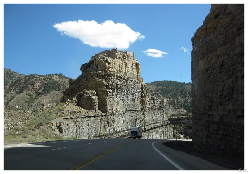
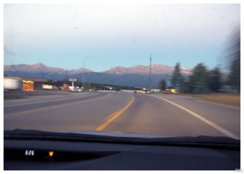
Afterward, yes there were barren, flat areas, but thankfully there were enough towns, nearby hills and weird factories off in the distance to keep us entertained.
When we eventually emerged onto I-70 eastbound towards Colorado, we started to actually enter those hills & the drive got even better.
After 5 hours of driving, we decided to stop in Fort Collins, Colorado - for no better reason then the fact that we needed a break from the road.
We were so desperate for a break, that we actually checked the internet's building database for something to do...but after settling on some empty factory we found on the computer, we approached the destination & found that the building was gone!
I guess the internet isn't that reliable! I am shocked!
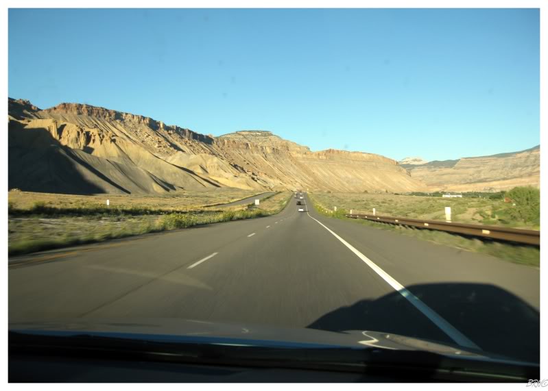
Continuing along, we would drive through some truly remarkable scenery, weaving around swampy creeks surrounded by mountains, traveling between cliffs so steep they blocked the sun long before sunset & moving along a valley so narrow that you were amazed engineers found space for highway exits.
Arntz commented that this was the nicest stretch of interstate that he's ever driven & I completely agreed.
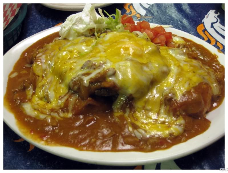
We would reach our destination of Leadville around 8:30 at night. Thankfully, the diner we ate at before Gilman was still open, but they only offered two food options as they were closing soon.
We came to Leadville to climb a mountain, so I went for the gluttonous cheddah salsa burger...which for some reason was going to help me climb a mountain tomorrow.
I think my obese self just wanted something smothered in cheese.
 =
=
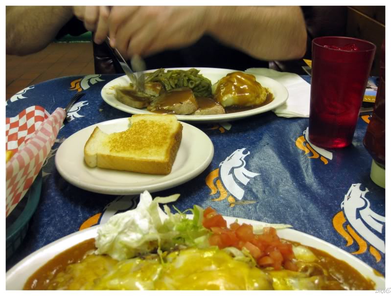
Meanwhile, Arntz chose the weaksauce option of the two.
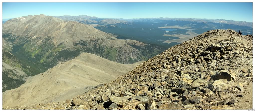
Now the reason we came to Leadville was for Mt. Elbert - the highest point in Colorado & the 2nd highest point in all of the contiguous United States (beneath only California's Mt. Whitney).
We would rest for the night in Leadville before embarking early the next morning. The only problem was that surprisingly, most of the hotels & motels of Leadville were all booked up! The town appeared a bit run down, but apparently they were still doing well with tourists.
Anyway, the only place we could find in this town of 10 hotels/motels was the historic - and therefore costly - Delaware Hotel. I was a bit excited at being forced to stay at the historic hotel, but not after I learned that it would be $138 for the night. Thankfully though, the guy at the counter dropped it down to $113 when I mentioned that we'd be leaving at 6 a.m. in the morning (this was at 10p.m. when I mentioned this).
If you're wondering, the hotel was alright, but I thought it was trying to hard. It seemed like one of those old western towns you see along the highway - fake & played out. Arntz even pondered if the reason the guy behind the counter had an 1800s prospecting beard, was because he was mandated by management to have an 1800s prospecting beard.
6 a.m. would come soon enough.
Now I had previously been fooled by the highpoint difficulty scale. You see, every state highpoint has a rating between 1-10 and the scale grows greatly in intensity, even from difficulty 3/10 to difficulty 4/10. I didn't know this going into Maine's highpoint (Mt. Katahdin), so I sort of scoffed and thought I would simply stroll right up the mountain (since it's only a 4 difficulty out of 10).
I learned quickly that day in Maine.
With that in mind, I was respecting the 6 difficulty score of Mt. Elbert. If 4 was that hard, 6 was going to downright beat me down.
In addition, Drew & Cavemonkey (our Colorado hosts) both learned about our plans to scale Elbert and both warned us of the sizable effort and work that it would require. My favourite moment was when I explained the highpoint difficulty scale to Cavemonkey, and then he scoffed at the notion of a difficult mountain in Maine.
Leadville is the highest incorporated city in the United States at 10,152 feet. The drive to the trail head put us at 10,400 feet and the peak is at 14,433 ft.
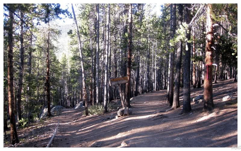
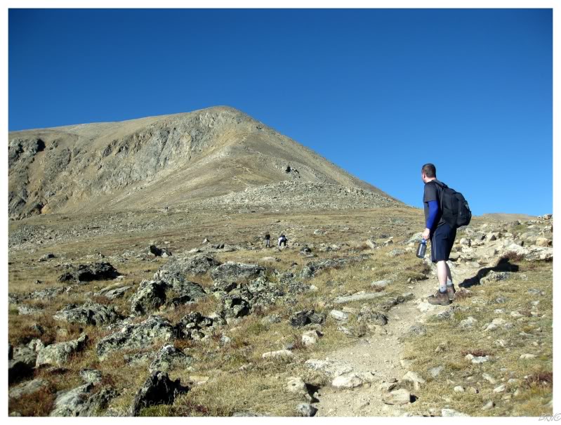
I was certainly nervous about possibly failing to climb up the mountain today, so therefore I was happy with our early progress through the forest. I knew this was the easy portion with rudimentary hiking, but I also knew that every incline upwards was chipping away at that 4,033 foot gain in elevation.
The above sign telling you to veer right for Mt. Elbert was apparently 1/4 of a mile into the trail. Arntz had studied the directions better than me, so I was constantly asking him for the elevation gains and what was upcoming - happy to hear that we were going from 10-4 to 10-6 to 10-8, and so on...
Past the Elbert arrow sign, the incline attained a steeper angle which required occasional staircases. The angle of the trail & the elevation above sea level was starting to eat me up & I needed a few more breaks then we were currently taking - which worked out somewhat well, as Arntz admitted that he often doesn't take enough breaks.
I was still worried about the difference in our fitness levels.
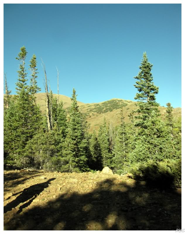
The stairs and this portion of steep climbing ended at 11,400, as we reached the tree line amongst some meadows.
The incline flattened here for a small time and I was happy to have it.
Of course the cakewalk meadows didn't last, as this trail isn't especially long & it is efficient - so therefore you don't walk on flat ground for very long for any amount of time.
We were now at 11,700 and the ground beneath me returned to its previous angle. I was growing quite winded, but couldn't possibly ask Arntz to stop every 30 feet, so I tried to tough it out. Whenever he was ready for a break, I was already sitting on a rock & agreeing that we should break.
One of the worst parts of it all was that I knew I needed fuel in the form of food, but it was hard to take a break from sucking down air to ingest anything. In addition, it was hard to swallow the food & if I managed to do that, the food then felt like a brick in my stomach. It was reassuring to hear Arntz was having the same problem, only being able to eat a small amount of food at each stop.
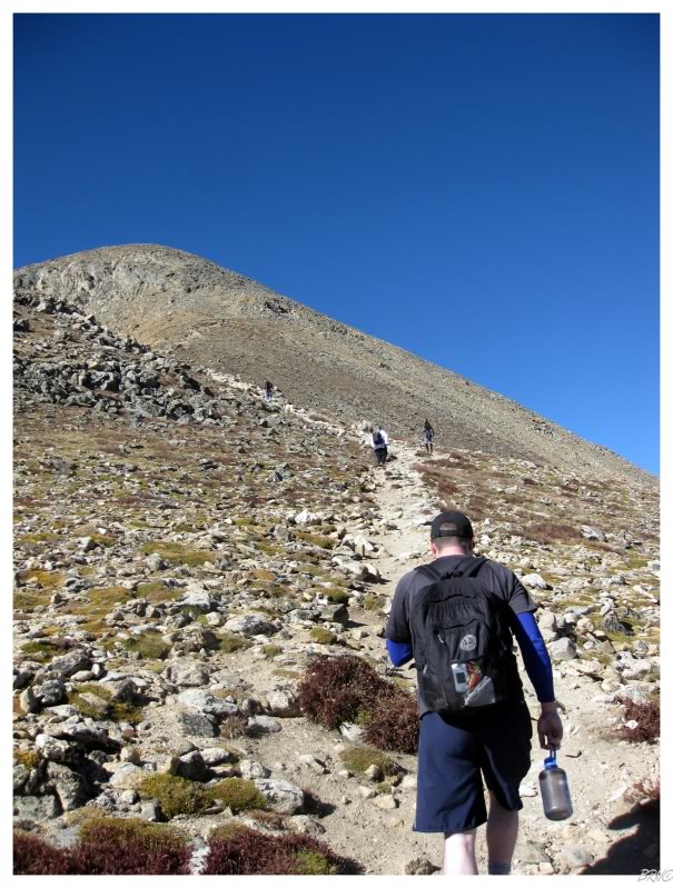
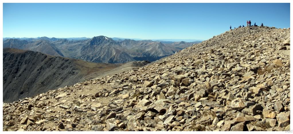
We continued along & I managed to climb another 700ft of elevation. At this point, we hit the East Ridge and another section of (relative) flatness. It wasn't a complete flat ground break, but there was a noticeable difference from those previous angles where I had to consciously pick up my legs and feel the back of my calf work with every major step upward.
At this point, more than ever, I was now thinking about how there was no way I was going to keep up this pace with Arntz.
Although it helped when he mentioned that we had now climbed 2000 feet of elevation - we were now at 12,400 ft.
"Crux - 3. Mountaineering. The most difficult and often decisive part of a climb or pitch."
Halfway to the top was great and all, but I was still concerned with a section called the crux of the climb. I remembered reading about it from Arntz's printout & also had Arntz reminding me about it though his crux jokes. The author stressed that the crux of this journey was the 500ft climb between 13,300 and 13,800 - the point where most people are defeated and turn around, the crux of the journey.
I don't think I've used the word crux more in my life than on this day. I pestered Arntz with questions whether he thought we were at said crux yet, while navigating through knee-high rocks which wore on the knees, thighs, calves, feet, lungs and spirit.
When we eventually reached the crux, it was clear as day. I had already been taking too many breaks and slowing Arntz through the past section...and this upcoming part was to be even worse.
It was at this point that Arntz proposed going ahead so that we could hike at our own paces & it wasn't much of a difficult decision on my part. Arntz went ahead, but not before reminding me that it was an easy trail after 13,900 & that he would see me up there.
Even going slow, it was still incredibly difficult and there was definitely no way I would have kept up with Arntz. At one point in the crux, I was hiking about 25 feet then stopping for air - breathing with an intensity which felt like I just held my breath underwater for several minutes. It was absolutely remarkable, and also pretty ridiculous, that my young ass was getting beat so handedly by this mountain.
There ended up being a 30-something couple that kept more of a Navi pace. The two of them & I switched leads for the remainder, as they had to stop just about as much as me (although they didn't seem to be having so much trouble at each stop). I also made sure to break behind boulders as the girl was sort of a hottie (so that she wouldn't see my pathetic self bent over gasping for air).
The weather this day was immaculate, so I knew Arntz would survive at the summit & that I could take however much time I needed...
...and such, when there's some resolve & some minor amount of physical fitness, you can plod along and eventually you'll make it.
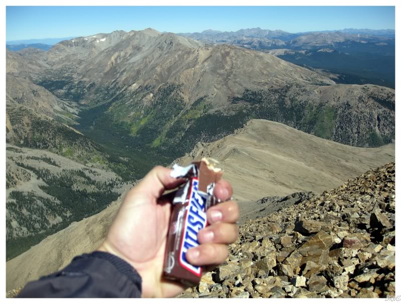
I tell you what though, it was the sweetest Snickers I've ever had.
Arntz beat me to the summit by about 35 minutes and the first question I asked was how his Snickers was, but apparently he was waiting for me to reach the summit. Whoops! Mine was already gone.
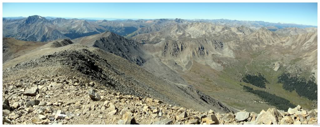
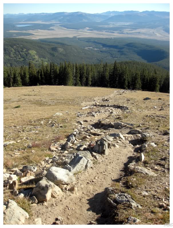
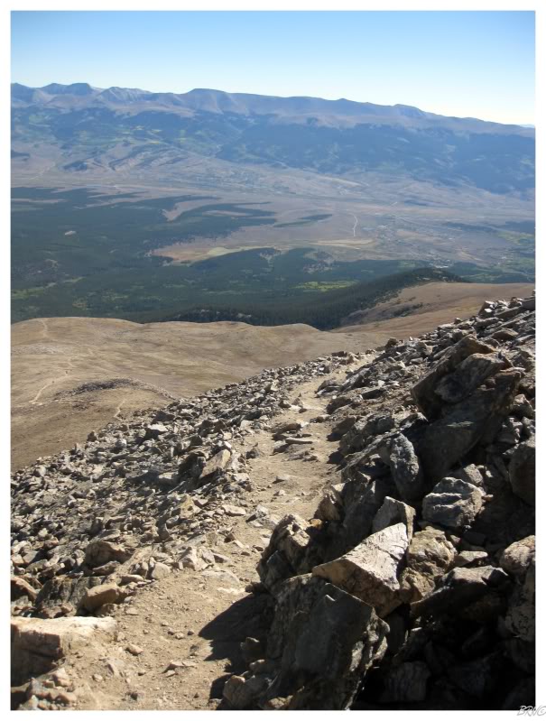
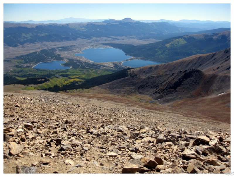
The view from the summit.
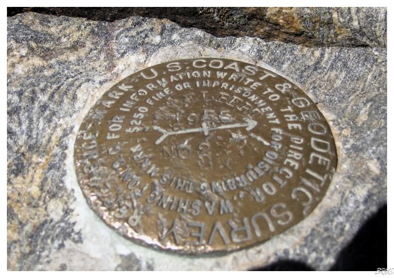
Mt.Elbert geodetic marker.
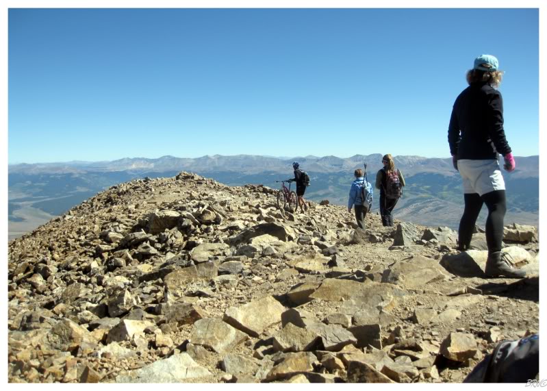
Some couple was up there where the guy had rode his bike up the mountain & his girl had ran up the mountain beside him. There was another guy who had brought a growler of microbrew to the summit & I was definitely relating with that dood more.
Another guy commented about how he couldn't believe the amazing weather at the summit. The reason we started at 6 a.m. was because of the frequent afternoon thunderstorms, but there wasn't a cloud in the sky on this day. The guy mentioned how he had climbed up here in May, June, July, August and September - each several times - and he had never seen weather this nice.
We lucked out.
There were about 25 people at the summit and apparently Arntz was busy taking pictures while waiting for me. I'm not one to dawdle, so we had our picture taken, rested for about 10 minutes & departed the summit.
On the way down we discovered some of the riff raff that Cavemonkey told us about. Now while on the way up, I overheard that hottie talking about how she also climbed Mt. Whitney (meaning that she's pretty serious business)...but on the way down, we encountered plenty of dood-guys wearing those giant DJ headphones, one dood climbing anti-shirt & two dudes laying down at 11,500ft asking how much further it was.
I was also amused when some anti-shirt guy ran past us towards the summit - which really bothered Arntz as he didn't care for the guy's showboating.
Arntz was also amused when we passed four sorority girls - he told me that I probably stood a better chance with them than the 2 cute girls in the morning, since apparently I head nodded the morning girls with non-massaged sunscreen all over my face.
After a completely lame meal at the Golden Burro in Leadville, Arntz drove the remaining 3 hours back to Drew's Lounge. After this tiring day, it was nice to kick back and sip some Joose and relax. Drew & Arntz made me watch Pulp Fiction for the first time and I guess it was pretty good.
We would wake up relatively early the next day and head to the airport after some delicious biscuits & gravy from Carl's Jr.. After a stopover in K.C. & Toronto, I thought the pilot was mistaken when he announced it was 32° Fahrenheit upon landing in Newfoundland. Ugh, back to this.
Anyway, what a spectacular time! Another big thanks to Cavemonkey, YG & Drew!