I landed in Philadelphia in the evening. It was nearly dark by the time I entered the freeway with my rental car.
I came to Philadelphia to hang out with some friends who live in Philly & some friends who were going to Philly - but that would be next weekend. I was here a full week early to head south, to see the Outer Banks & to visit another friend in Charleston (in South Carolina - one of the 5 states I hadn't yet been to).
Knowing I wouldn't have much daylight when I landed, I didn't want to pay the money to stay in Philly, I didn't want to fight the sketchiness to stay in the dangerous cities near Philly & I didn't want to pay the money to stay in the boring suburbs past those dangerous cities near Philly. I needed a U.S. address to give the customs officials, so examining a map, I found Elkton, Maryland & that seemed an interesting enough place to spend the night.
It was a Sunday, so Elkton wasn't the busiest city during my morning walk.
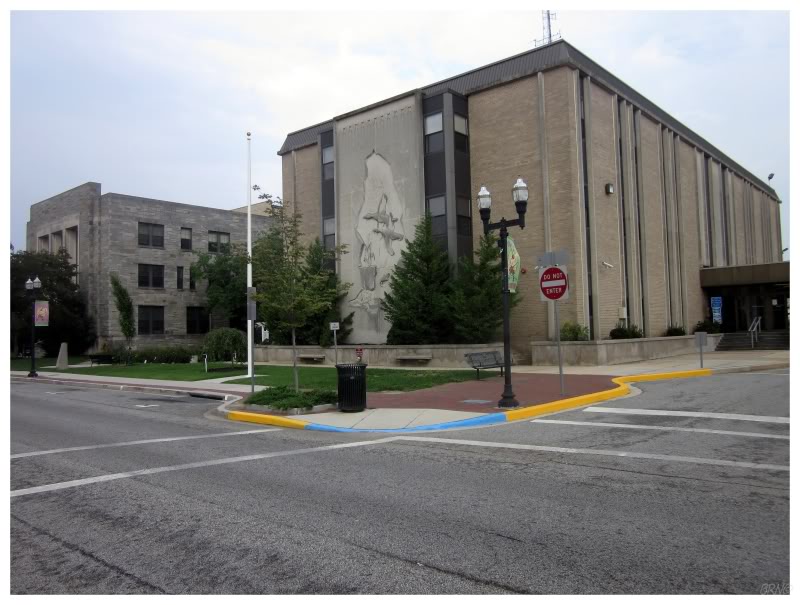
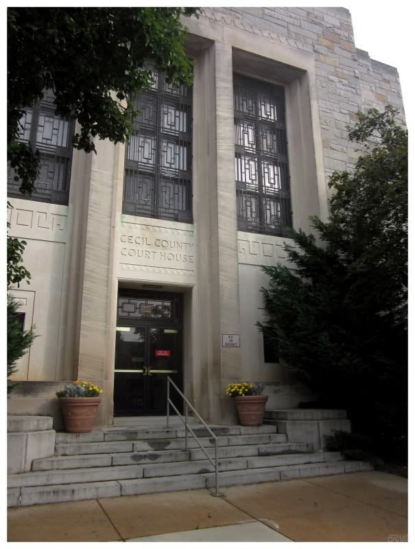
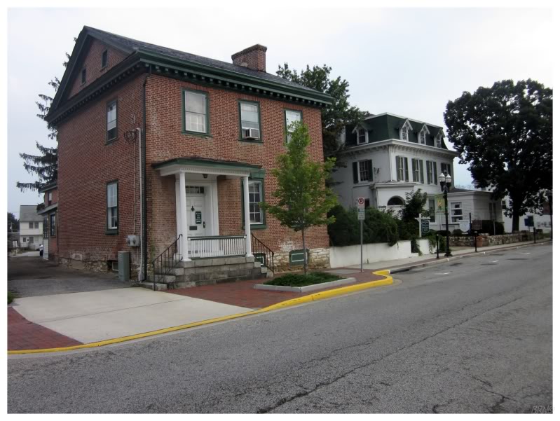
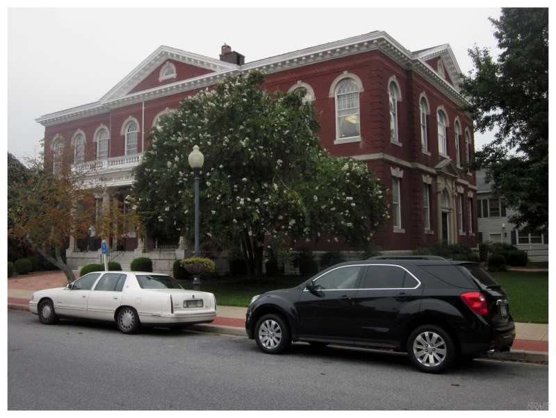
Wandering around the Maryland city went according to how I imagined it would, with colonial architecture, taverns, lots of brick, and well-kept streets. Even though their courthouse was built in 1940, they could easily have had a more modern, glass monstrosity of a courthouse; so the 1940 courthouse wasn't that bad.
Another reason I spent the night in Elkton was because I had an abandonment in Northern Maryland which I wanted to hit this morning. The thing was though, was that I found Yuengling at the local Delaware liquor store and A Time To Kill was on the Elkton television. Watching A Time To Kill for the 35th time was apparently more important than getting some sleep. I still drove to the hilly, abandonment town where I failed with Chad & UJ a few years back, this time failing because I figured I didn't have time for the abandoned building, before making it to Washington for the Nationals' game.
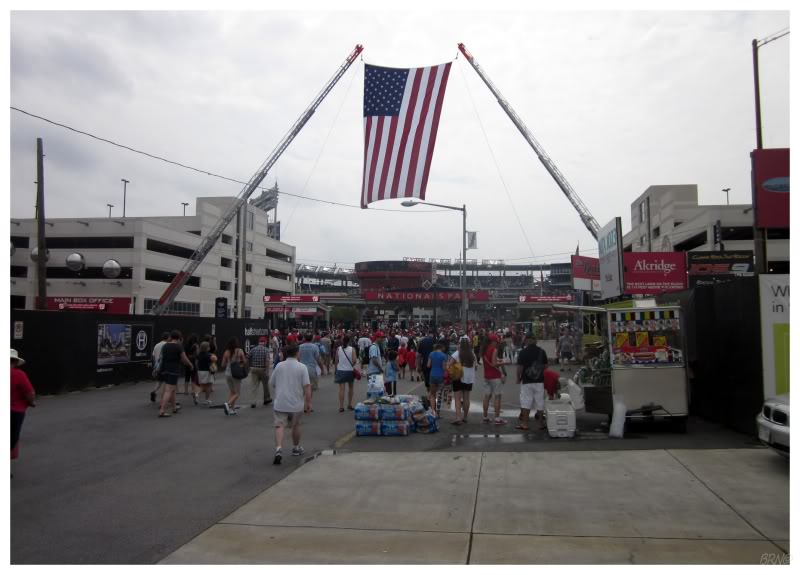
After a quick stop at the Orioles Shop in Baltimore, I made it to Nationals Park in time for the national anthem. In a patriotic city like Washington, there wasn't 1 person talking or moving as we stood beneath the giant, crane-erected American flag.
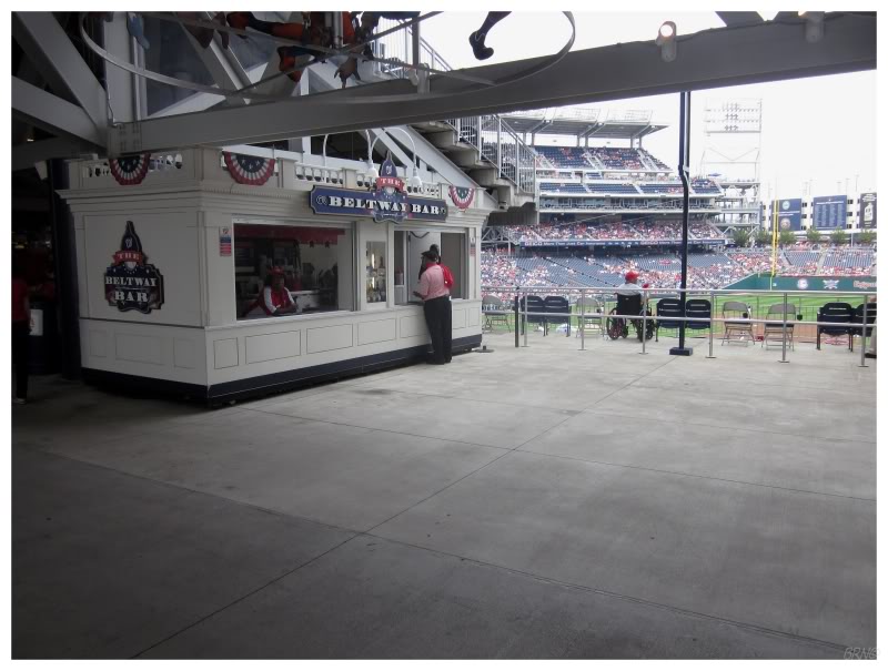
The Nationals were taking on the Dodgers while I was in town. I worked hard to acquire Michael Morse from Fantauzzo to have him in fantasy so I could watch him this day, but my offer simply wasn't enough. Much to my chagrin, Morse smacked a 2-run homer not long after I sat down.
I picked up Wilson Ramos to have someone in the game & he had a couple of hits. It was some consolation.
After a couple of innings I went for a walk to explore the stadium. They were calling for rain & thunder today, so the attendance was low. This was nice in terms of being able to easily walk around the stadium, but it also meant that there weren't that many Washington females out for baseball on this mediocre day. Advantages & disadvantages folks.
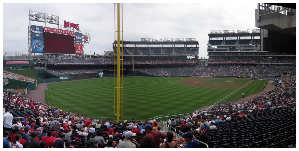
I didn't mind the stadium. The Nationals did a good job integrating a National Capitol theme with things like a presidential mascot race & concession buildings which looked like mini White Houses. The concourses were wide & I enjoyed the views out over the city & the Anacostia River as I rounded the stadium. They advertise that you can see the Capitol Building & the Washington Monument from the stadium, but it is a matter of going up to the upper deck at precise locations.
My purchased seats weren't that great & infested with people. I moved to an empty portion & enjoyed the game much more. The rain held off, allowing the game to be played without delay.
Having driven with Chad in Washington before, I knew that I didn't want to deal with the delays & the cost of parking. This meant that I rode another metro system, one which I would highly recommend. I sat back, while the cheap metro brought me miles away from the stadium, allowing me to see some new subway stations as well. I wanted to shoot pictures in the subway, but there was an incredible amount of police & terrorism security about. It didn't seem worth the hassle.
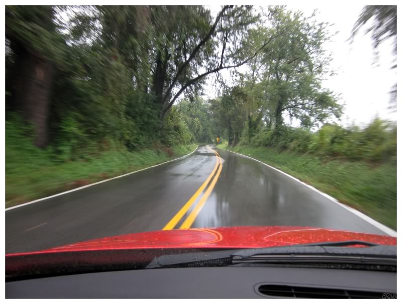
There wasn't a direct highway to my next destination - and I think my GPS was set to avoid extra distance anyway - so this put me on back roads soon after leaving Nationals Park. I passed through maybe 1 or 2 towns in the course of an hour, instead spending most of my time on winding roads, with lush vegetation glimmering from the afternoon rains.
Maryland is one of my favourite states as it's a blend of the south mixed with northern farmland. This time spent driving was memorable & certainly didn't hurt my infatuation with the Old Line State either.
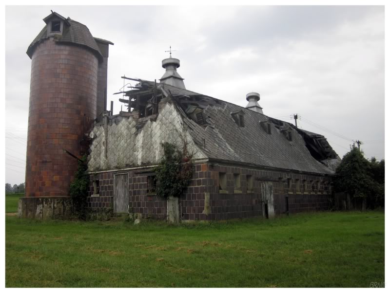
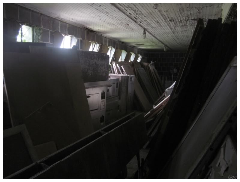
I was driving to an old asylum this afternoon, not because I was going to bust up a foreign asylum by myself in the middle of the day, but because I liked the name of the town & there were peculiar, small outbuildings (the type of buildings I've expressed my love for in previous posts).
I named my fantasy hockey team after this town, my squad that won me $350 last year. I also used an aerial photograph of the above stable for an avatar on a forum, where my friend Amy then started cracking jokes that it was a picture of 'Newfoundland's largest abandonment' (au contraire mon ami! (...mon amy? ))
I suppose I have a small infatuation with this place in my Old Line State.
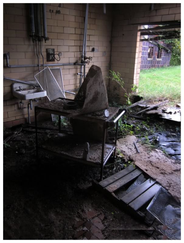
I wandered into a small building, happy with myself for infiltration this object of my affection.
It was crazy good too. I swear the building had 2 or 3 rooms. Woo!
(Judging by the contents of the 2 or 3 rooms, it looked like some kind of food storage building or secondary kitchen?)
I made my way into the barn as well, after giving up on a different building which looked like the campus pig pen. The pig pen didn't have the grass cut around it & I imagined deer ticks, brown recluses & copperheads surely all waiting for me in the grasses...so off to the barn it was!
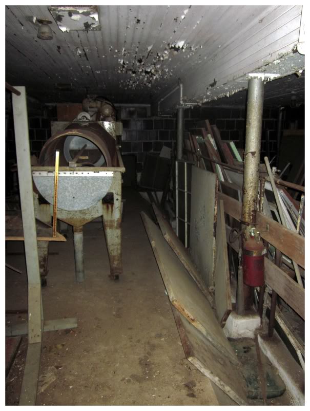
They were using the barn - or at least they were in the past - making the barn a lot more interesting than that tiny kitchen building. I examined the old window frames & tools, enjoying my last afternoon hours in this aging barn.
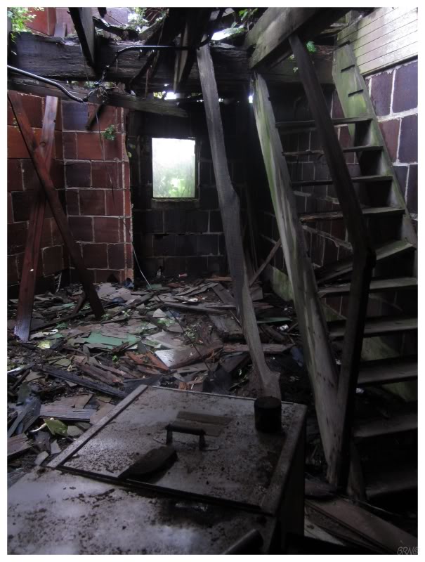
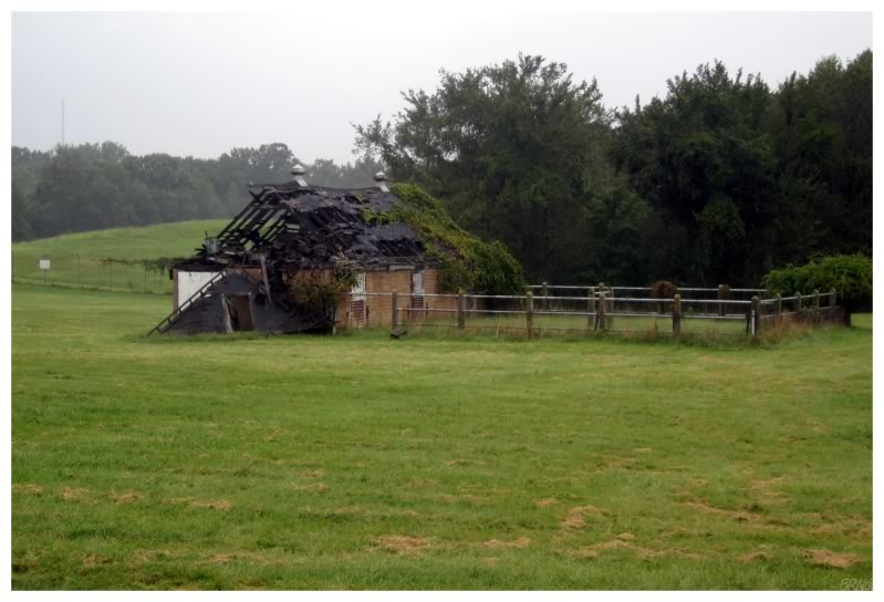
You might have noticed a gaping roof hole in the exterior barn shot, which meant that there would be no going upstairs. The one section of the 2nd floor seemed safe, but the stairs were directly below the roof hole & they felt like wet crackers. I also would have had to navigate on top of soggy 2x6s to get over to the safe portion of the 2nd floor.
I still had 3 hours of driving ahead of me, over on the other side of Chesapeake Bay. I had actually made a campground reservation as this was one of the last summer weekends & I expected it to be packed.
Sure enough, with the time I spent at the asylum barn, I was too late to enter the campground when I got there. All things considered, I lost the $25 I spent on the campground reservation, I drove a 1/2 hour out of my way & I had been driving at night through the Eastern Shore of Maryland (an area which I would have liked to see in the early morning hours instead).
I was ready to go to bed, so I pointed my rental towards the nearest town, angered by the fact that campgrounds lock their gates so early.
In Crisfield, I found Captain Tyler's motel, which was nice & not that expensive. Although in my efforts to save money, I had now spent close to a hundred dollars with the campground fee & Captain Tyler's fee. Fail.
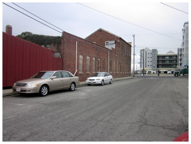
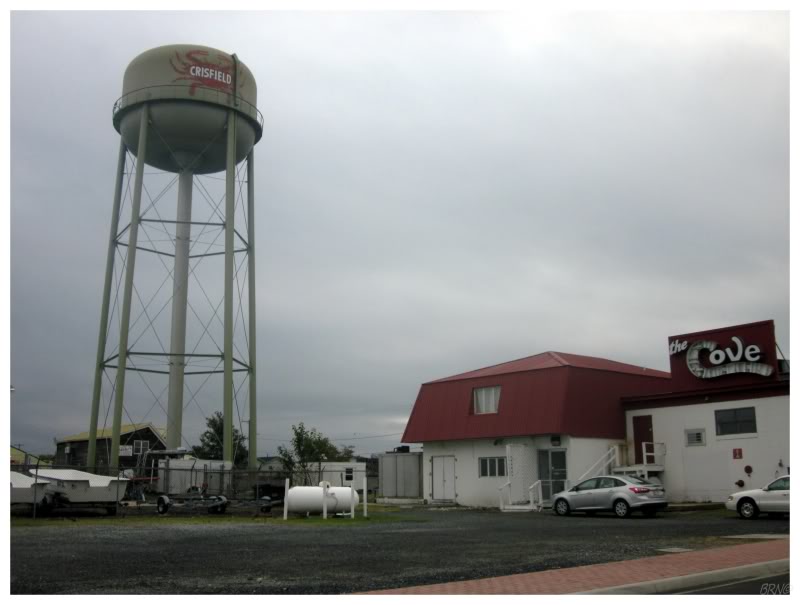
The next morning I saw Crisfield by the light of day & found a gritty port city. The pamphlets in the motel lobby advertised trips out to Smith Island in the Chesapeake Bay, but I didn't have remotely enough time for an island adventure.
Maryland being famous for crabs, I had a crabwich for breakfast. It was sub par & my previous crab cakes in Baltimore were light years ahead.
Afterwards I drove down Crisfield's main street as I went back to the highway. Nothing like a handyman crab for your mascot.
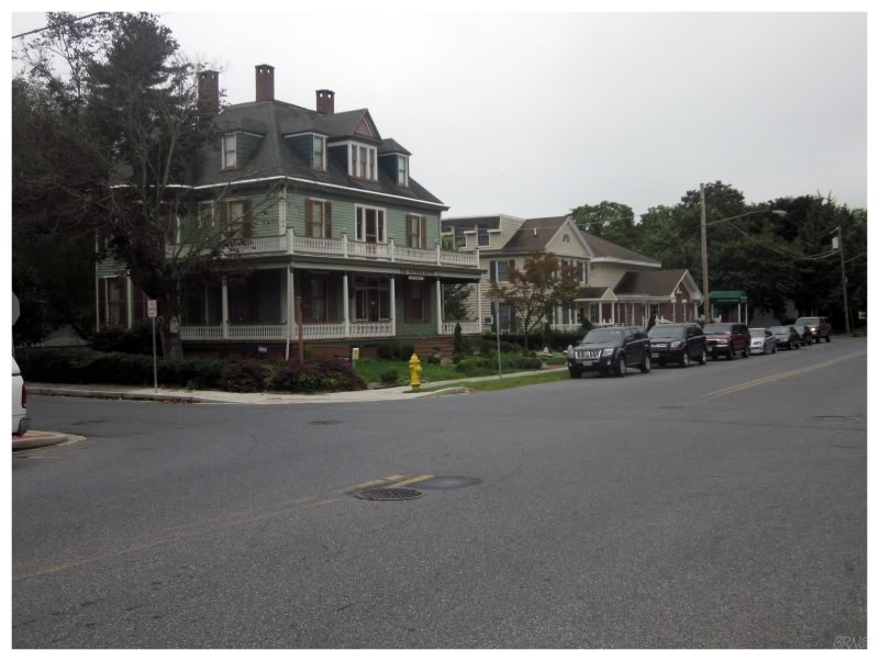
I was in my last Maryland county before Virginia, so I drove a few kilometers out of my way to walk around the county seat of Princess Anne, Maryland. It was another quiet, attractive Maryland town; which furthered my positive opinions of the state.
It was an overcast, muggy day which made pictures poorer0, but I was happy I stopped when I thought about the limited number of times I might find myself upon the Eastern Shore of Maryland.
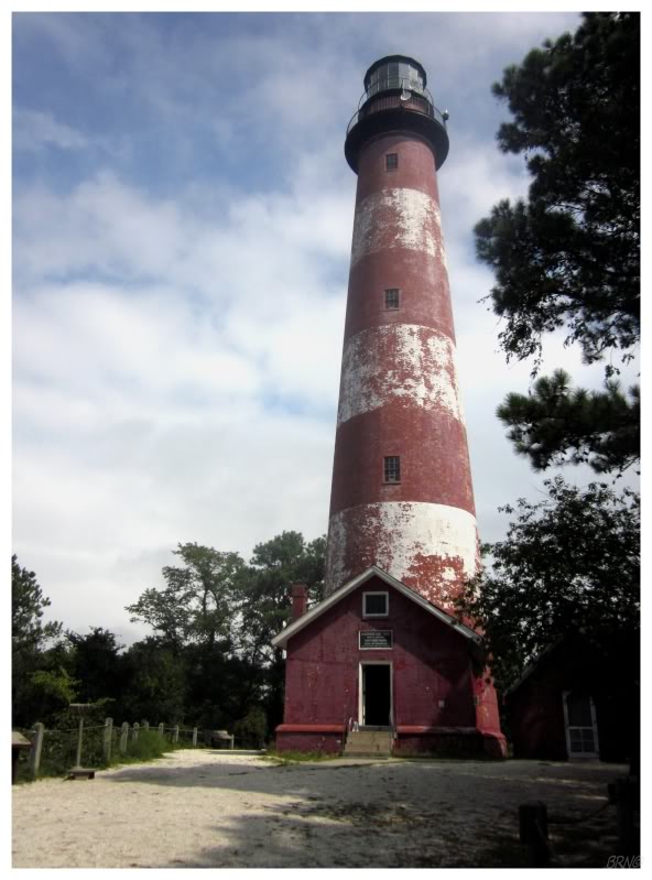
After Princess Anne, I drove east to the shore of the Atlantic Ocean. The thought of seeing a Virginia Lighthouse excited me, and Assateague Lighthouse seemed as good as any of the Virginian collection.
The highway came to an oceanside vacation town with your typical beach cruisers, scooter rentals and cheap clothing shops. This would lead to a causeway over a small waterway bordered by a large marshland. I came to a booth for the Chincoteague National Wildlife Refuge & paid for a day pass. The lighthouse trail wasn't very far into the refuge & I started onto the 200m path after a few last sips of water. Within 20m of entering the wide path surrounded by thick, healthy Virginian vegetation, I felt weird sensations of my calves & looked down to see 15 mosquitoes feasting on my left leg & 25 feasting on the right.
I raced back to the car & spent the next 5 minutes squishing mosquitoes inside the rental. After a trip back into town to the local Ace Pro Hardware for some deet-heavy insect repellant, I was happy that I bought a day pass for the refuge & returned to the trail. The mosquitoes didn't have much interest in me anymore & I was thankful for it.
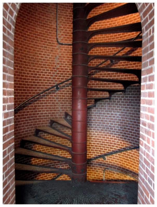
The lighthouse is open for climbing & I asked the older volunteer inside about the mosquitoes (as I was shocked at how bad they were). Whereas I figured that the south must simply have more ferocious mosquitoes, he reasoned that the recent hurricane blew them into the area. I wasn't sure how much truth there was in his hurricane theory, and I couldn't tell if he was pulling my leg either.
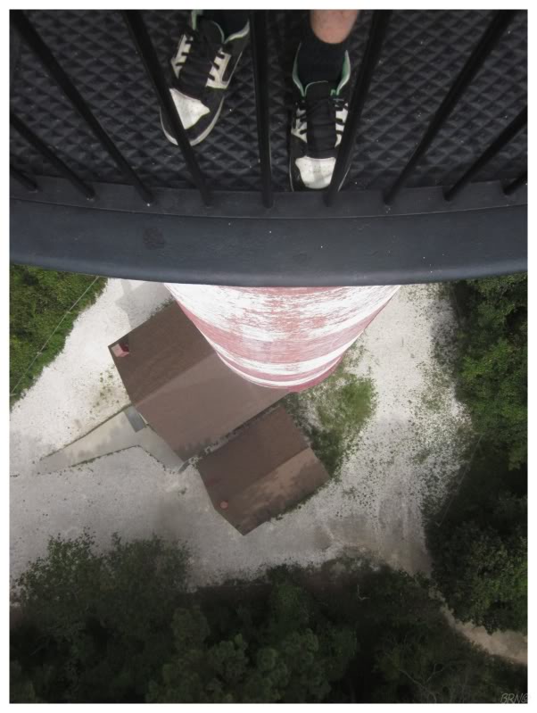
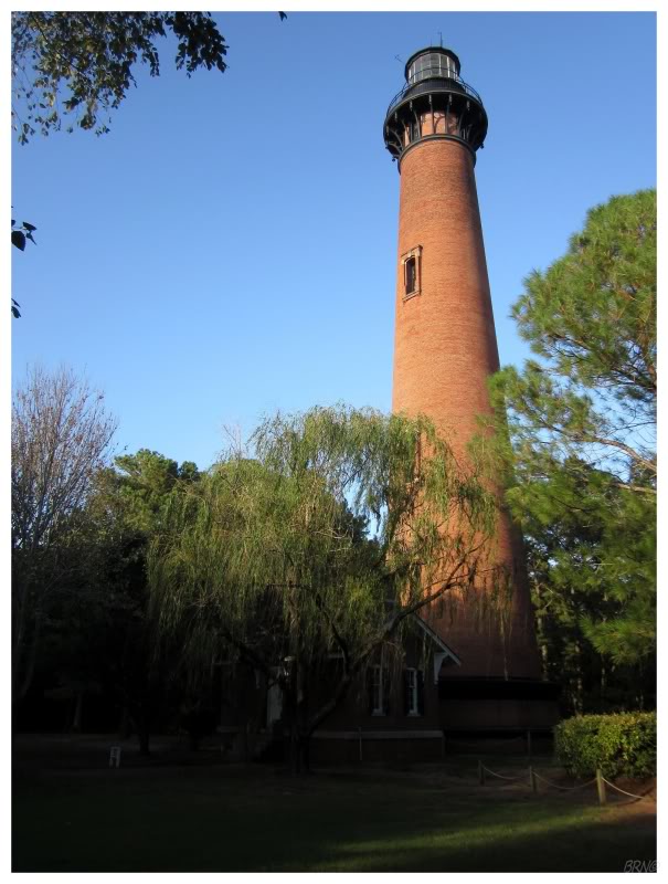
The Assateague Lighthouse was built in 1867 to replace an earlier, insufficient lighthouse. This 1867 lighthouse stands at 142 feet & used to be at the shore of the ocean, but Assateague Island has been moving south during the last few centuries.
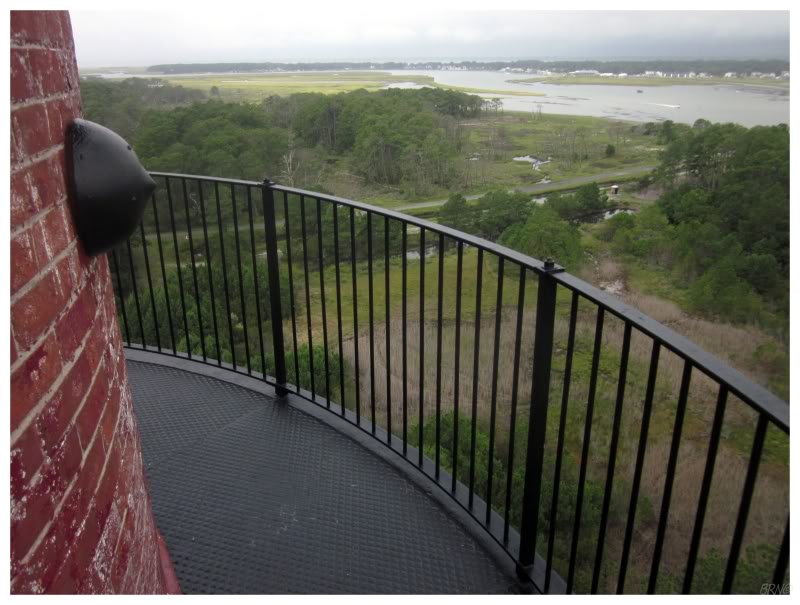
I stood on the balcony of the lighthouse for a while. The young volunteer in the lantern room looked like he was about to take a nap, telling me that they had 250 people yesterday, but that I was the first today. It was quiet up there & I examined the coastline & the cities surrounding me. For 142 feet of height, I couldn't see an immense swath of land. A minor storm was moving to the northeast off in the distance, not threatening me, but not really threatening much by the look of its light gray clouds. There were foundations and cultivated plants of an abandoned community off in the grasses, but the allure of a Virginia ghost town wasn't enough to send me wading in tall, southern grasses.
I thanked the guy in the lantern room & started back towards the rental.
Along with my entrance to the Wildlife Refuge, I was provided with a map of the area. I examined it & noticed "fish factory ruins" out on a sandspit extending into the ocean!
That was good enough for me. I had already been rushing through this trip too much, barely spending any time in Baltimore or Princess Anne or Elkton or anywhere else.
I set off with a small bottle of water. The sun reflecting off the sand hurt my eyes and the sand picked up by the wind didn't help either. On the beach without the trees, it was a hot day where it had to be in the 90s. I found it to be oppressive & muggy - beaches clearly aren't my cup of tea. The beach was packed though, so others seemed to be enjoying the day. As I walked along, many large trucks passed me & I later learned that beyond the parking lot, there is an 'off road beach area'.

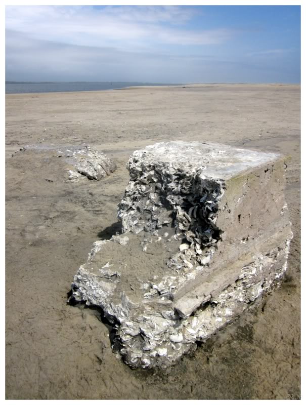
I had to laugh when I finally reached the "fish factory ruins".
Woo-hoo! One chunk of tabby!
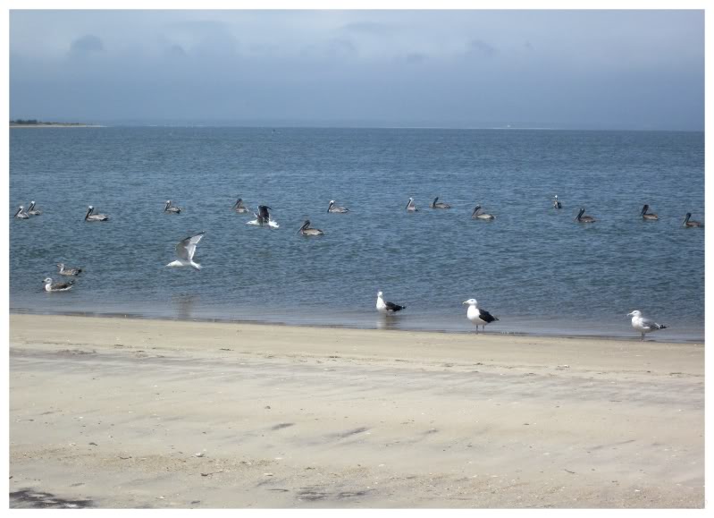
It was so hot & I was running so low on water that I took my shirt off - which is a very rare occurrence. I suppose my casper skin needed some rays anyway. Also, there was a host of birds out here - ruddy turnstones, pelicans, black-backed gulls & my favourite, oystercatchers. I suppose that the exercise, the unique birds & the debrightening of my skin made the excursion worth it.
I was happy to be spending time in Virginia on this trip, as Virginia was always that one state which you could argue that I hadn't truly visited. The fact that I previously only spent 30 minutes driving around the Pentagon & Arlington left me unsure as well.
Unfortunately after the lighthouse, my Virginia experience was driving on an uninspiring highway of fast food chains & grocery stores. I was putting in my Virginia time, but I wanted more than this.
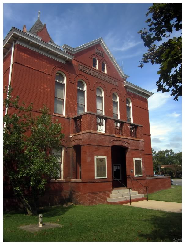
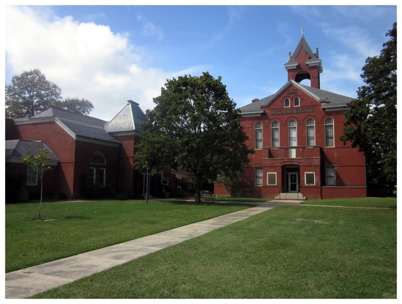
Using my Counties of Virginia map, I noticed the county seat of Accomac wasn't very far off of the highway (I was driving down a peninsula, so really, towns couldn't be that far away).
The tiny village of 550 people was quiet, but the courthouse square succeeded in leaving me with better memories of Virginia than sitting in a Sonic parking lot next to a 4-lane highway (i.e.: how I spent my lunch this day).
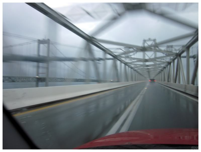
After another hour of driving, I was at the end of the Delmarva Peninsula. I knew I had to cross the 17mi(28km) opening of Chesapeake Bay by bridge, but was shocked when the bridge came to a tunnel and I suddenly went underwater! I later learned that it's actually the Chesapeake Bay Bridge-Tunnel, with 3 bridge portions and 2 tunnel portions! It was an amusing surprise to be traveling along on this bridge & then enter a tunnel portal. I thought about crossing Lake Pontchartrain down by New Orleans & was happy that this bridge-tunnel at least mixed it up & kept me entertained.
After the bridge-tunnel was the city of Norfolk, an actual city, as it's Virginia's 2nd largest. After spending the last day on the quiet 'highways' of Maryland & the Delmarva peninsula, I now found myself driving amongst heavy traffic & surrounded by large concrete retaining walls. I remembered the initial shock of the busier road, but the rest of my time was spent thinking about how the Norfolk Tide (my Baltimore Orioles' AAA farm club) were in town playing. There was no time for the Tide though, I had to speed towards the lighthouses along the Outer Banks, since I wanted to get there before nightfall.
The highway grew less significant at the North Carolina state line, but like most highways in America, they still have reasonable speed limits as they skirt communities. As I reached the bridge which connected me to the Outer Banks barrier islands, it was then that I entered communities and lower speed limit areas. Things looked expensive. This is up there in terms of vacation locales for Americans, as hundreds of thousands of tourists flock here to sun themselves on the beaches & photograph iconic lighthouses.
Speeding along the partially residential road, I watched as the sun set to my left & roads with bird names passed by on my right. I remarked at how they didn't have simple names like "Eagle Lane", but more precise names like "Oystercatcher Lane" and "Snow Geese Drive".
The sun was so low when I finally reached the Currituck Beach Lighthouse, that its lower 1/4 was shrouded in darkness. As I approached the gate, I found that it was locked & apparently the site was closed for the day. I briefly tried to snap pictures beneath the tree canopy, but couldn't manage anything satisfactory without branches covering the lighthouse. I had enough of the stupid 2-foot fence though, so I hopped over and happily snapped lovely, late-evening shots with the lighthouse shining beautifully. The grounds were well-manicured and complimented by other pleasant buildings as well. If there was a donation box I would have gladly donated, but I couldn't find one.
As I was driving away, I noticed a couple at the gate, with the woman trying to shoot pictures of the lighthouse through the trees just like I had attempted. I was going to tell her to go ahead & hop the fence, but her husband looked like a hard-ass who wouldn't have appreciated the suggestion, so I simply drove off.
The sun had set & I knew I wasn't going to reach the next lighthouse during the daylight, but I hoped that it would at least still be dusk.
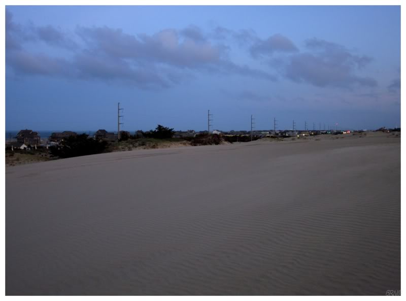
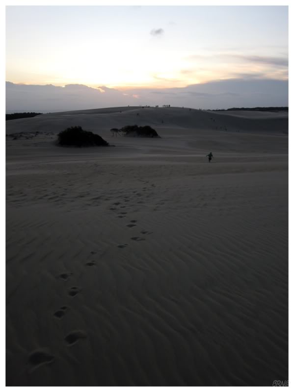
Even with that said, when I noticed some inviting sand dunes along the highway I couldn't help but park the car & go for a walk up/slide down. I felt a bit lonely as I peered off at the rental properties along the ocean, thinking about coming here with someone significant & sharing the experience - it simply seemed like a couple'y situation.
That feeling was quickly dismissed though: I was atop these outward-extending sand dunes, at sunset, on a beautiful autumn night. The heck was I complaining about?
I continued on towards the Bodie Island Lighthouse, but I was skeptical that the road would take me all the way there. You see, Hurricane Irene had come through here & completely washed out portions of this highway the week before I arrived. Where you can normally see 5 or 6 iconic lighthouses by only taking a few ferries, you would now have to take 300km detours if you wanted to accomplish the same trip.
As I came to the end of the town of Nags Head, a zombie-apocolypse-style sign told me that the highway was out 6 miles ahead. I examined my GPS and it said that it was 6.2mi to the lighthouse. I envisioned coming to a washed out road, with concrete spilling into the furious ocean, where I could stand at the edge & the Bodie Island Light would mock & impose over me from the other side...
Back in reality, night had fallen as I arrived at a roadblock across the driveway for the Bodie Island Light. There was a sawhorse saying the lighthouse was closed for renovation, but in hindsight, my friend Radical Ed might have been correct in telling me that they were simply renovating the lighthouse & the highway washout had nothing to do with the closure.
I didn't know this at the time though, as I turned around & cursed my luck at not being able to see the lighthouse. D'oh!
I was running a bit behind and Irene made my schedule even more restricted. I was no longer going to be able to see the Outer Banks properly and driving to the Currituck Beach Lighthouse/sand dunes would be my only taste of this area until I return one day. To drive around the washed out roads would take 8 or 9 hours & I simply didn't have the time. It was time to go inland and drive the North Carolina back roads until I could go south again (the sounds and inlets of North Carolina mean that you need to drive considerably inland if you're looking for a north-south highway).
Once I was off the banks, there was a black bear warning sign, a snake warning sign and a red wolf warning sign all within 5km(3mi). I laughed at their placement so close to one another & imagined trying to tent camp, while the bears, snakes & wolves fought over my capture. It was best to keep going I supposed.
I settled on spending the night in New Bern, having some sort of recollection of it being a halfway decent town.
Boy did I end up on the wrong side of New Bern then!
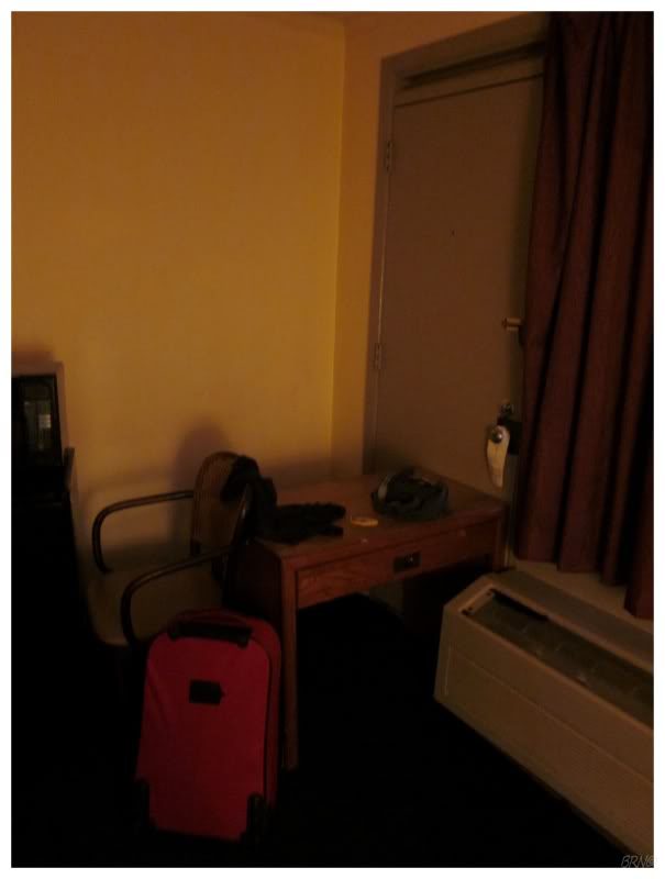
I should have known though, as when I went to inquire about the room the proprietor was behind bulletproof glass (something I've only ever seen at motels in the crime-ridden sections of Detroit). I was tired though, and simply wanted a room, so I didn't say anything & snatched my assigned room key1. As I went to my room, no fewer than 4 different groups of good-ole-boys were out by their rusty cars, following me with their eyes. The room was complete shit in terms of stained bedding & a dirty bathroom as well. I didn't care for this situation.
The TV was on top of a small desk, next to a mini-fridge with a microwave atop. I pushed the other small desk between the mini-fridge & the door, filling the last gap with the office chair. I figured this was enough furniture to hinder anyone attempting akickdoe in the middle of the night.
Checking the internet reviews in hindsight, it wasn't just the fear of a dark, strange place; others have commented on how bad it is as well - apparently I happened upon the one rough section of New Bern.
I had a 5 hour drive to my friend's place in Charleston & I had told him I'd be there this afternoon, meaning there wasn't much time to waste this morning.
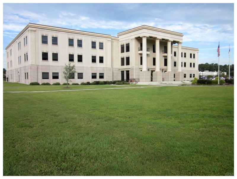
The only place I stopped was Bolivia, North Carolina; after reading about how it was becoming rundown before becoming the county seat. It was doing well now, so all I found was a small, healthy community.
I had to get a picture of their courthouse while in town though, even if it is a forgettable modern thing (this courthouse actually took the most time to get a picture of, as there was a steady parade of people coming & going (and getting in my picture!)).
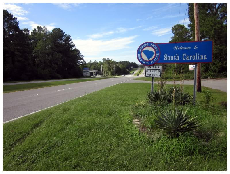
Around noon I moved along into South Carolina...state #46! Only Alabama, Oregon, Hawaii & Alaska to go!
I would continue driving, speeding through places like Myrtle Beach, before soon enough meeting my buddy Yrvelouria in Charleston.
Onto Part 2.