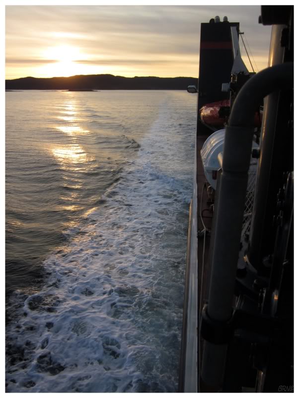
I don't recall much before getting on the ferry since it was early & we were in a rush. Thankfully we had made the 8 o'clock crossing & we were now on our way to Little Bay Islands as planned.
For my birthday I wanted to go somewhere I had never been, and while this ferry crossing is only 2 hours away, I had failed my one other time I tried it, so it remained unconquered.
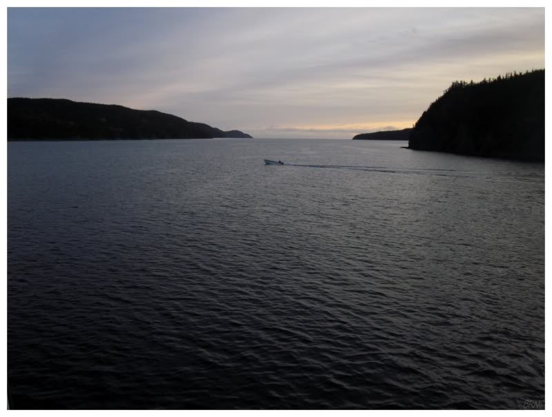
We were the only 2 people on the 40-minute crossing, so as I watched a single fisherman speed across Long Island Tickle, I couldn't help but feel isolation.
The sun would emerge from the treetops shortly after we began to move into open water. This wasn't a particularly early start, but since it was December, the sun still wasn't very high in the sky. This had its advantages as it painted everything in a warm light as we navigated around the islands and their shorelines along our way.
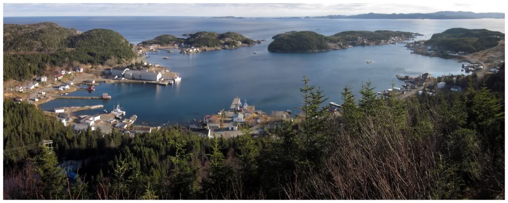
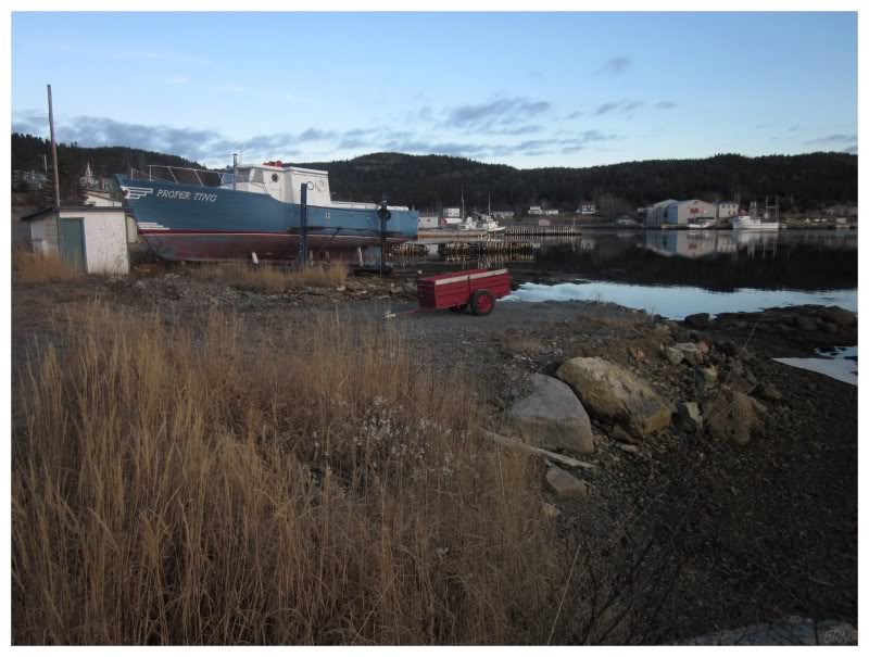
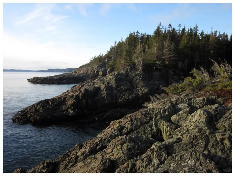
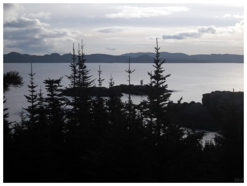
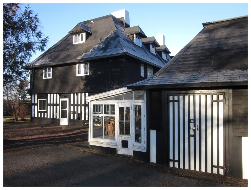
Little Bay Islands is a community upon Little Bay Island (standing upon above), Goat Island, Macks Island (the island at centre, above) & several others.
The cluster of islands is approximately 4km by 4km, and situated 2.5km offshore from the main island of Newfoundland. To connect the island to the road network, they would need to improve a 17km logging road, construct another 3km of road & build a 2.5km causeway - which is likely why the community remains only accessible through the M/V Sound of Islay ferry.
We couldn't have asked for much better of a morning.
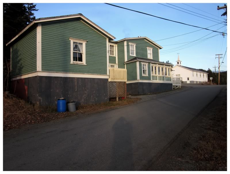
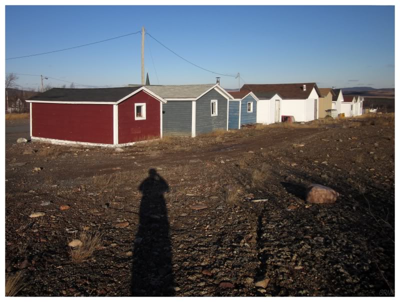
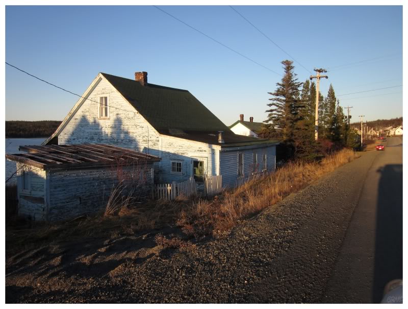
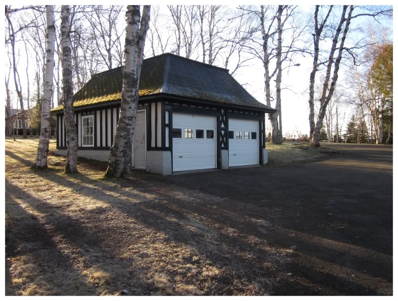
After driving a short highway from the ferry dock, we explored the curving main street which defines Little Bay Island.
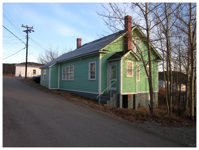
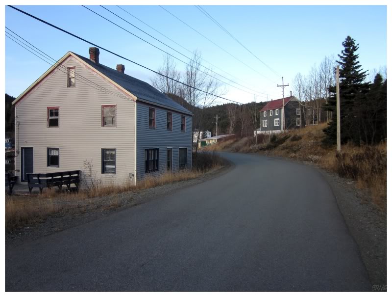
The weather was certainly helping out my opinion of Little Bay Islands. This cool, brisk morning, free of extraneous vegetation, led to stopping every 30 seconds to take yet another picture of some other old, impressive house which I found to my liking.
I was wondering about the past fortunes of this place from the large number of these impressive houses, and it seems that Little Bay Islands did in fact, once have a very prosperous fishery.
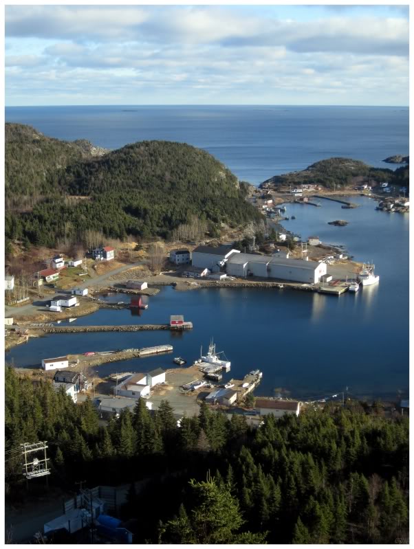
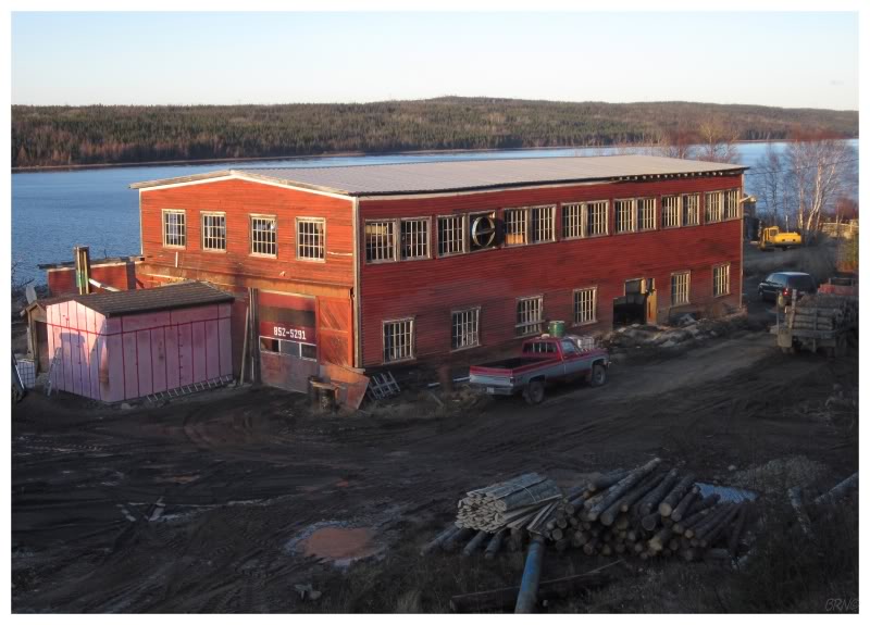
You couldn't help but notice the crab plant during our visit, but it has since closed.
The closing of the crab plant means that there isn't a source of jobs in Little Bay Islands anymore. It wasn't long after we went there, that stories came up on the news with talks of resettling this community - with no job future, people wondered what was the point of living there.
I mean no disrespect to those who voted to resettle, but I was happy to see it wasn't accepted. The two of us really enjoyed our visit & hope that the community sticks around for a bit longer (although I realize that's selfish).
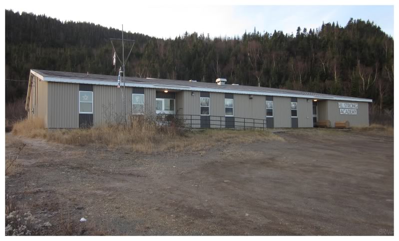
The above picture shows the school, which I read was built for ~100 students in the 1980s, but now is used by the last remaining student in the community. One student has this whole school to himself.
We had 3 hours to enjoy the island and it only takes about 20 minutes to drive all of the roads.
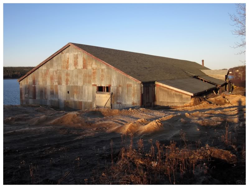
Thankfully there is a good group of hiking trails built on Little Bay Islands though. The first shot over the whole island is from the Overlook Trail & these are the rocks at the east end of Macks Island, compliments of the Lighthouse Trail.
Obviously Lighthouse Trail intrigued me for reasons I needn't mention. I knew there wasn't a lighthouse here today, so I was curious as to the origin of the name.
We found a headstone for a man who was born at this 'Lighthouse Hill', so there had to have been a more significant lighthouse (and keeper's house) here in the past.
My internet searches have turned up nothing. It seems that this must have been a short-lived lighthouse.
We hiked one last trail to a back cove and a view of Goat Island.
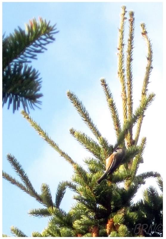
On the way back, we noticed this Red Breasted Nuthatch fluttering about the treetops. I was amused that I saw (or at least recorded) my first Red Breasted Nuthatch in such an obscure location.
I'm happy to go anywhere I haven't been for my birthday, so it was nice that Little Bay Islands wasn't just a new place, but an enjoyable, scenic, new place.
We slept on the ferry & were back on the Island of Newfoundland at noon.
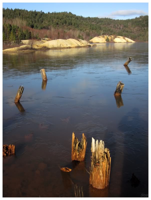
We didn't drive very far, as I wanted to explore some mining ruins left over in Pilley's Island.
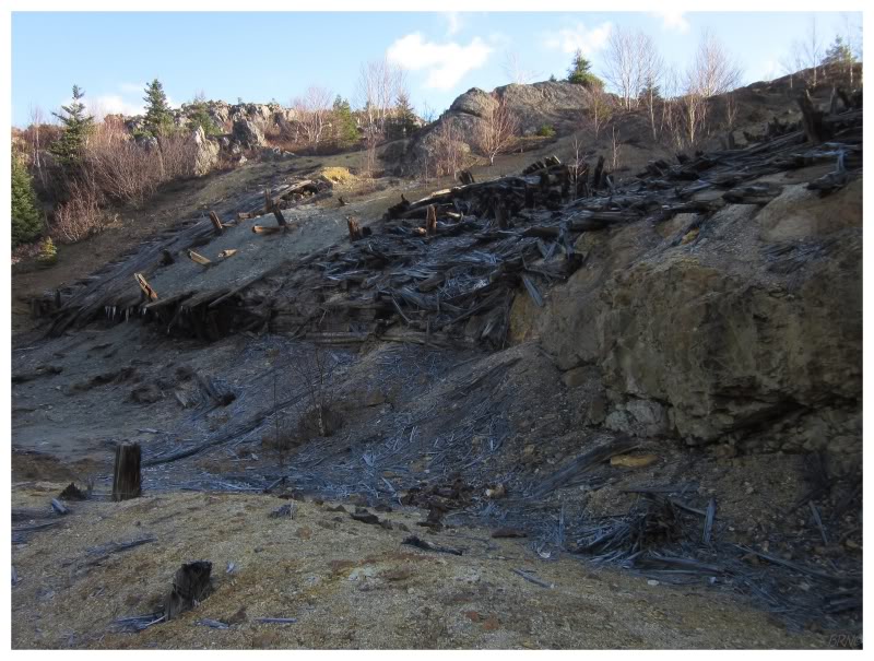
Pilley's Island was home to a pyrite mine from 1887-1908. This mine was run in an amateur fashion for the first few years, but it was then bought by a British firm which installed the first electricity for the purpose of mining in Newfoundland. This allowed the mine to run 24 hours a day. It was sold in 1899 because they encountered an impenetrable hard rock layer, but further operations continued as the mine changed hands into the 20th century. It was finally sold in 1908 to an American businessman, who made a small profit by selling the metal machinery during the wartime scrap efforts of WWI.
All of this information comes from the province's great mining history website: http://www.heritage.nf.ca/environment/mine/ch2p9.html..
I personally love old mines & will put in work to see far less than what you see above; but the nice thing about Pilley's Island is that Shahlene's car was all of 25 feet from where I took these 3 pictures. These are easily accessible mining ruins with an impressive amount of detritus left behind.
The next thing I wanted to do was rent the ice down in Buchans this afternoon.
We drove the 150km to the isolated, Central Newfoundland community in hopes of doing so. Finding the arena doors locked, I walked over to the nearby curling club, only to find out that the arena opens in 1 week. D'oh!
I thought the interior of their curling rink was really neat if that was any consolation.
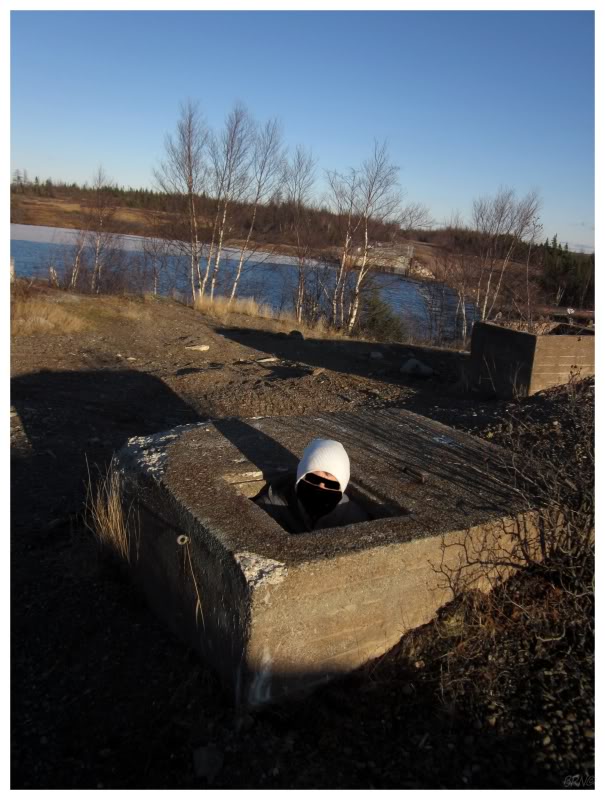
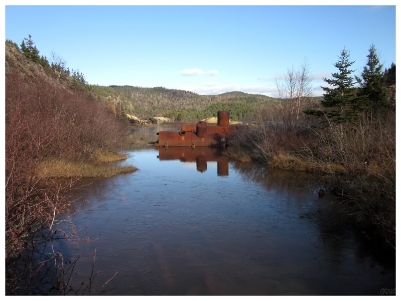
The real consolation was that we went looking for the old Buchans airstrip and stumbled onto their old dam/railroad trestle instead!
This allowed me to get inside something abandoned for my birthday...an old concrete chamber of some sort!! (It wasn't much bigger than what you can see in the picture.)
I actually used to play in one of these chambers back when I was kid in BR. My cousin & I removed hundreds of bricks from one & would hang out in there. This makes me even more curious as to what they're actually for (I always assumed the BR one was an oddity, not something found near all railroads).
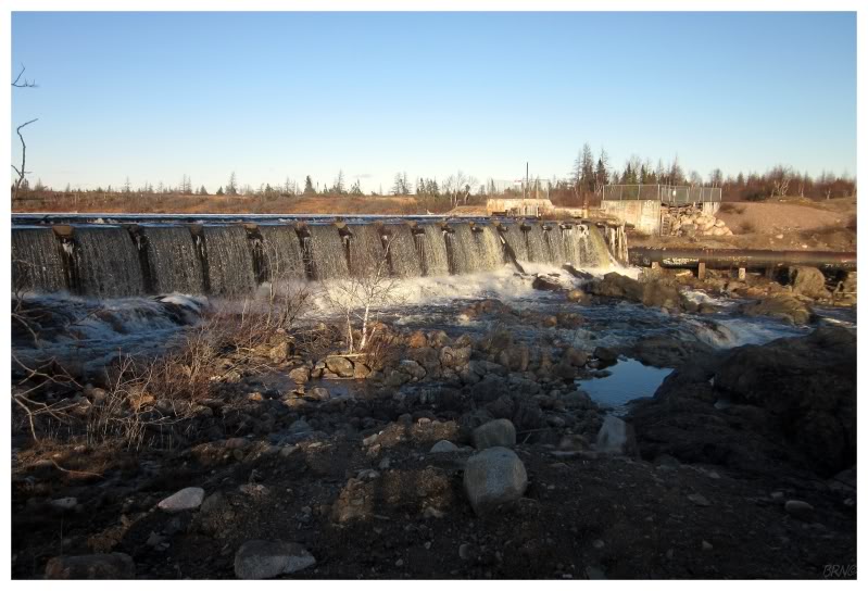
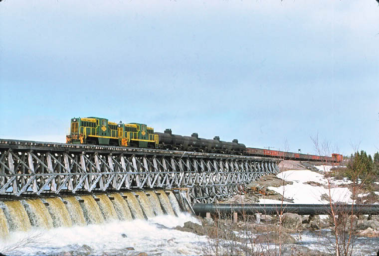
I thought the abandoned dam was neat enough, but then I got home & discovered that there used to be a railway trestle atop of it!
(The picture of the trestle comes from this page: http://www.trainweb.org/oldtimetrains/nfld/ASARCO.htm, which has several great shots of Buchans in 1975.)
While in the Buchans area again, I decided this time to drive the 7km(~4.5mi) to nearby Millertown.
Millertown is still based on a lumber mill, housed in what looks like a very old building. There were houses in the town which looked like company houses & all of this was set upon scenic Red Indian Lake in the late afternoon.
You simply don't see buildings in Newfoundland like the above red beauty. It was certainly an 'oh shit!' situation as I noticed it from afar.
I snapped a picture of another building on the lumber mill property, not thinking much of it. That was until I got home & my friend told me that her dad said this used to be the town hockey arena!
I also learned that there were indeed company houses in Millertown. The community was built as a planned town, with 3 parallel roads and 80 Swedish-style cottages; cottages which were for the 100 Swedish lumbermen/mill workers who were brought here to harvest the white pine.
We explored Millertown thoroughly, to the point where it was getting dark as we drove the NL-370 away from Millertown/Buchans & back towards the Trans Canada Highway.
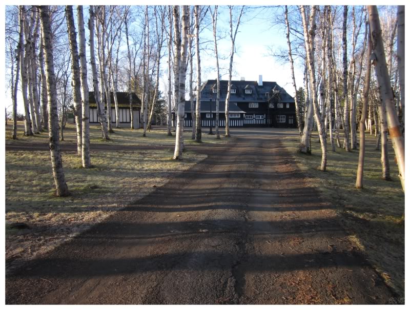
We awoke in Grand Falls the next day & I wanted to check out the Grand Falls House.
This building is separated from the road by jersey barriers, chains & a long driveway. Driving along the road, I have always craned my neck in attempts to see this distant house through the white birch which dot the property.
I always wanted to inspect the house a bit closer, but was put off by the fact that it was built & owned by the local paper mill. The local paper mill which seems to enjoy cordoning off areas & erecting a lot of signs to make its presence known.
This paper mill has since closed during my time here in Newfoundland & this led me to wonder about the Grand Falls House.
Finally, while reading the Grand Falls Advertiser one day, I read plenty of comments and calls for the city to simply demolish this house, because there was clearly no apparent way to maintain such a sizable & inefficient old house. With such close-minded folks loudly voicing their opinions, I decided I needed to snap a few pictures this morning, before I one day read that it mysteriously caught fire or that the building eaters were suddenly feasting.
I really hope the mill owners would simply sell the house to a private individual if the town can't afford it, but I've learned long ago not to be so hopeful. It made me really happy to walk around it this morning & create a few lasting memories.
(If you're wondering, the paper mill had such a nice house because they built it for meetings, social events & political schmoozing.)
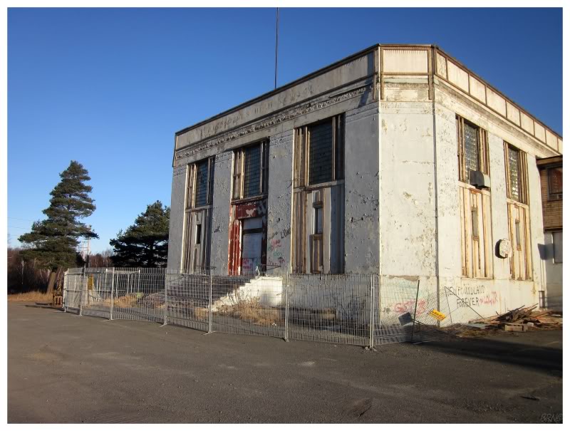
I found the article about the Grand Falls House as I was looking for any news on that school I checked out on a previous trip.
The interesting editorial talked about how this school wasn't long for the GFW world, and sure enough, there were death fences surrounding her the morning I came.
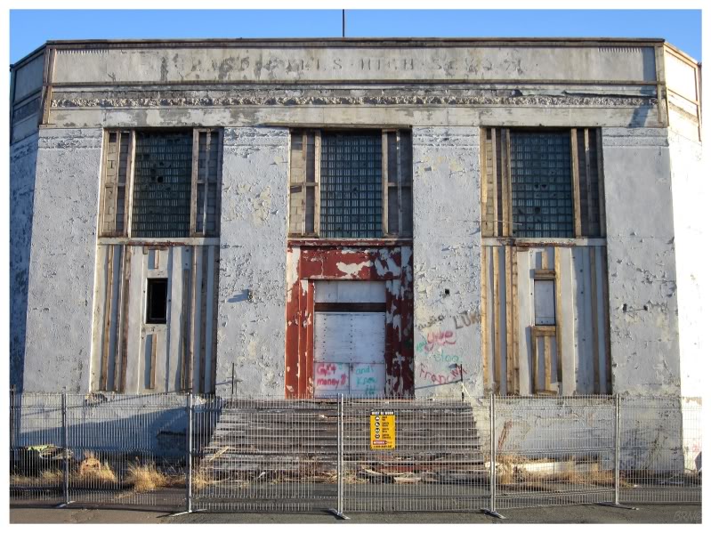
The piece also talked about the peeling paint revealing the original name - the Grand Falls High School - which was neat to see in person.
(I've since been back to Grand Falls-Windsor & this school is flattened.)
Procuring coffee, we went east again, as the closest place to Corner Brook with highways I hadn't yet seen, was now over 320km(200mi) away, starting in Lewisporte.
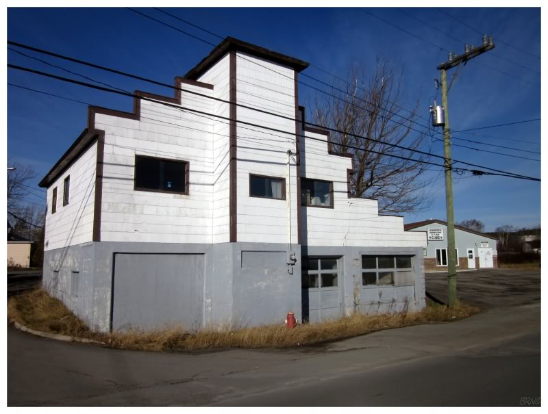
This strange building is in Lewisporte, where I've been before, but which I like for its stock of interesting (strange) buildings.
We drove the 19.6km(12mi) NL-342 first.
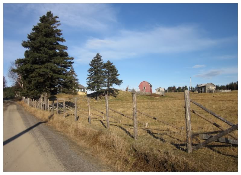
There was a bit of farmland in Little Burnt Bay, which always puts a smile on my midwestern face.
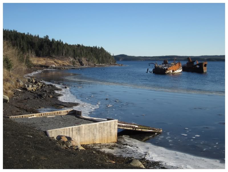
There were also 2 shipwrecks along this coast (if they're big enough to really be called that).
The other day I saw a website whoring pictures of lame shipwrecks & I wondered how much time the author could have saved himself if he simply googled "newfoundland shipwrecks". Haha!
(I can act too cool for school, but if that ice extended further out, I'm sure I would have liked these shipwrecks more.)
The last new highway today was the NL-341; which was a nice surprise as I've never thought much about Laurenceton, Newfoundland.
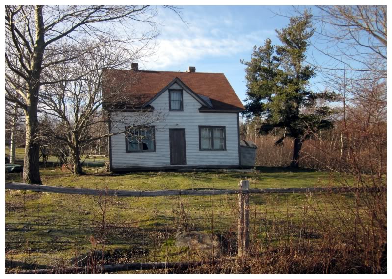
Laurenceton was a surprising enclave of population and abandoned houses. Of course the houses were too close to people's properties to do anything, but I still enjoyed gawking.
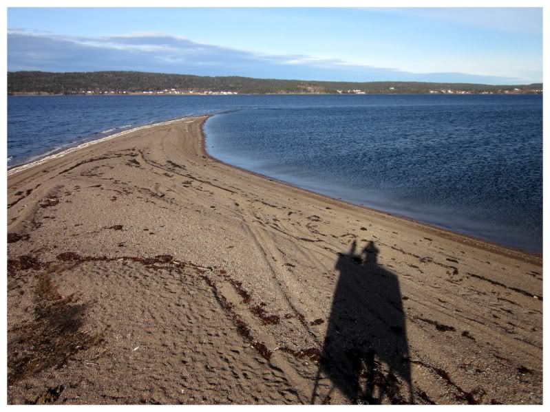
The highway ended in a gravel road which lead out to a sandy beach with a navigational daymark. As you can guess, this discovery didn't hurt my opinion of the NL-341 either!
I helped myself to a climb atop the daymark & a better view over the surrounding landscape. This would have made an awesome place to camp. The land you see across the bay is Phillips Head, where I explored those war ruins with the childish graffiti and log wall supports ("oh those ruins, eh Navi?" - I can't find the link right now, sue me.)
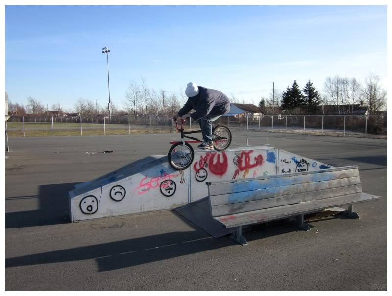
I decided to finish up the weekend by driving another 40km to Gander, reasoning that I'd normally drive 40km to ride far worse skateparks back in Corner Brook. In this case, it was worth it to ride one of my favourite parks in the province.
I finished it up with some delicious Ches's poutine (seasoning salt as a condiment for the win) before spending the rest of my birthday weekend driving home.
The amount of pictures and rambling in proportion to the adventure, should show you that I quite enjoyed this celebratory weekend.