The morning was calm & cold. I was up so early, that the hotel hadn't even served their complimentary breakfast yet. There were a dozen seniors all milling about the lobby awaiting this breakfast, but I'm not frugal enough to waste a half hour waiting when I could just go to McDonald's for $5.
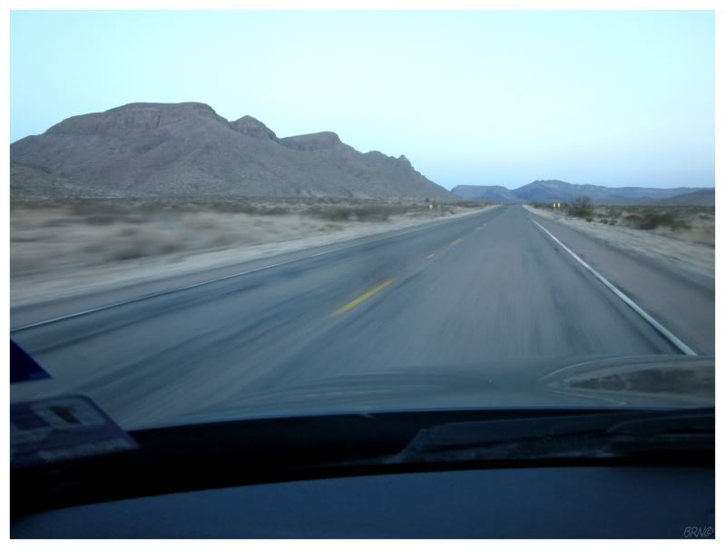
Walking outside, I instantly felt the cold air on my legs and I started to move faster towards my car - it was 42°F0. Being up before the sun generally has some romance attached to it, but I only wanted my car to warm up.
Guadalupe Peak is an hour's drive from Van Horn, a necessary drive for anyone who doesn't want to sleep in a tent before hiking to the peak (Van Horn has the closest motels to the south).
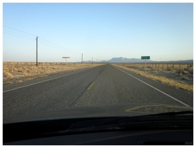
The road and the surrounding scenery was empty & quiet. I passed a few ranches and a few foothills, but mostly it was straight line driving, where one could tie a rope to the steering wheel & doze off for a few minutes.
I wasn't about to drift off; as not only was I appreciating the fine scenery painted with the early morning light, but I was also quite anxious. I'm not a hiker by nature. I randomly hiked to the highest point in Maine, so now I check on state highpoints whenever I find myself in a different state. Therefore, the worry about threatening creatures out here in the desert, was combining with my questions about whether this was worthwhile. Guadalupe Peak isn't a matter of pulling over the car & being at the top of Texas. I was getting up early & committing a considerable chunk of my day to this endeavour. Was it worth it? Could I not spend the day in a better fashion?
I get cold feet whenever I'm about to go hiking. I evaluate everything in terms of the work required vs. the reward. I need to do it less, for it is always enjoyable & never the 6 hours of deplorable work I envision.
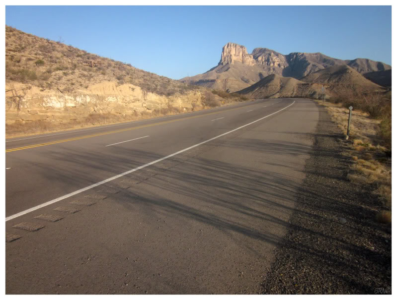
As for Guadalupe Peak this day, things were correcting themselves as the flat desert road elevated away from the floor of the Chihuahuan Desert. The road wound through small hills as El Capitan and the Guadalupe Mountains came into view. The combination of the scenic drive & the music I had playing, did wonders for my enthusiasm. I exited my car and stood by the roadside looking at the small mountain, smiling in the warm sunlight as the music still played from my open car door. I felt very lucky to be standing there, breathing this in, at this particular moment in time.
Texas is a difficulty 5 on the highpoint scale, the same difficulty as Maine's highpoint I did back in 2007. Parking my car, I paid my National Park entry fee into an envelope and marveled at the number of adjacent campers in the campground.
I was standing around thinking about how long Maine's highpoint took to hike, when I suddenly noticed a dude walk past the gate & start on the trail up to Guadalupe Peak. There weren't many people out here on this early March morning, probably on account of the fact that these mountains do suffer occasional snow storms & foggy conditions in the winter. I really thought I would be the only person out here today, so I hurried along to follow a few minutes behind this most-welcomed fellow hiker.
Let him go ahead & scare away the snakes, scorpions, spiders and mountain lions I thought. Ha ha!
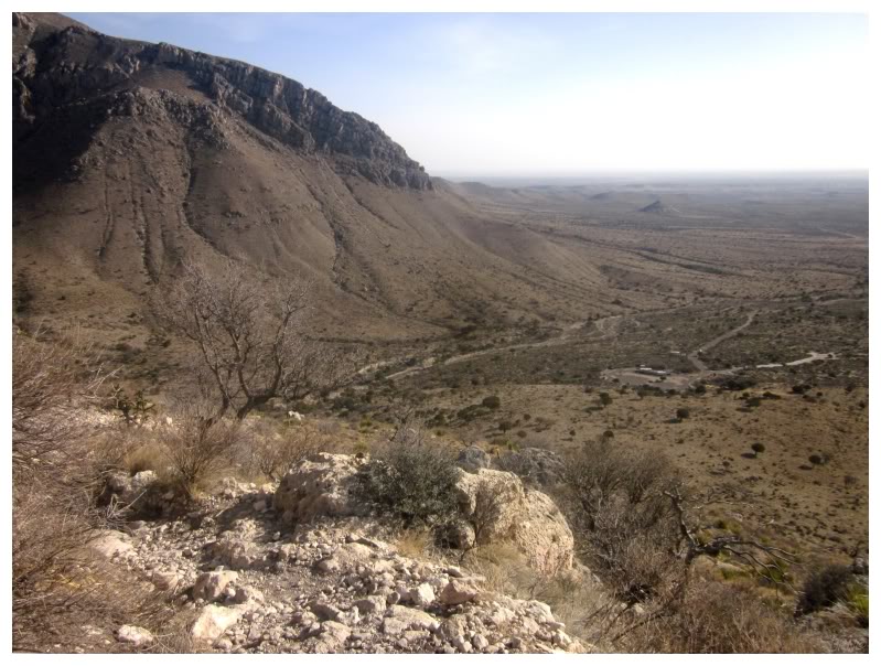
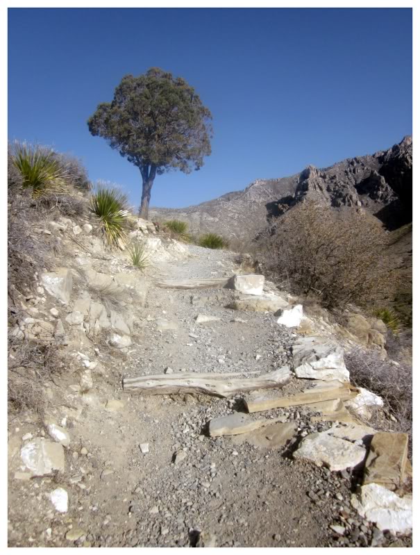
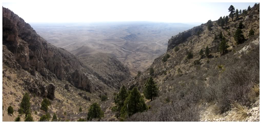
It didn't take very long for the trail to climb and provide a vista over our parking lot & the surrounding desert.
Whereas my previous experience with nature in the American Southwest was almost nonexistent, this meant that walking along this trail was very interesting, because of the strange trees and other foreign vegetation surrounding me.
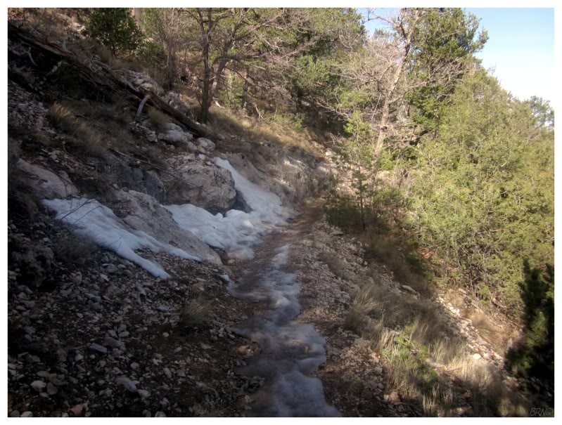
It didn't take very long to finally find snow in Texas either! There were only a few places with the messy stuff, in the long shadows where the sun rarely shines.
During my amusement with finding snow in Texas, I almost fell on my backside after not being careful while walking on the hard-packed, slippery, dense surface. Breaking an ankle on snow in Texas would have been quite the failure.
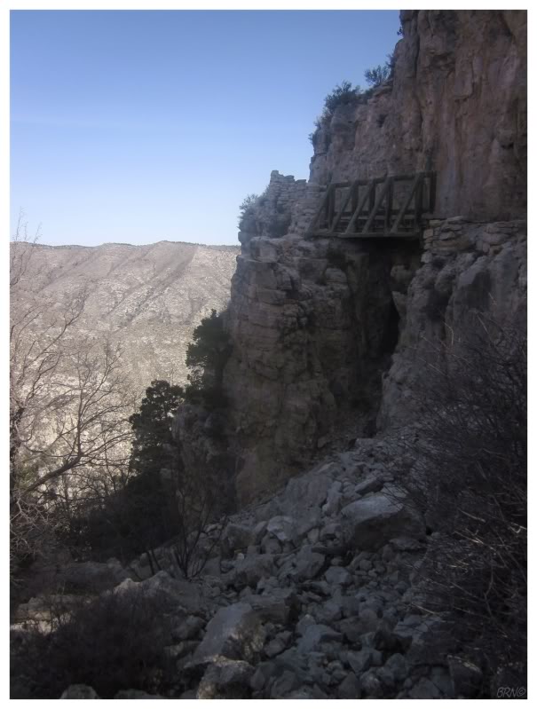
Coming to a bridge, there was a sign to dismount your horse.
I actually forgot that I could encounter a horse up until this point, as you can ride a horse to within a 1/4 mile (400m) of the summit.
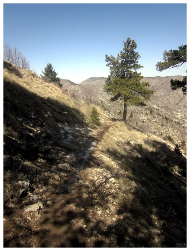
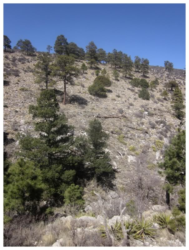
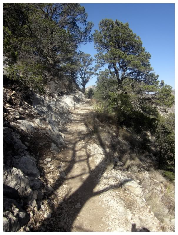
Identifying trees is far from my forté, but as I continued to make forward progress and gains in elevation, even I could notice the ecosystem changing. It now resembled those high forests north of Flagstaff, which I passed through a couple of years ago. I couldn't have told you they were Douglas-Firs or Ponderosa Pines, but where I deeply yearned to stop near Flagstaff and hike through those forests, and where I yearn to hike in similar Californian forests, my indecision to climb to Texas' highpoint was long gone by this point. I was now hiking through this beautiful landscape, extremely happy with my decision.
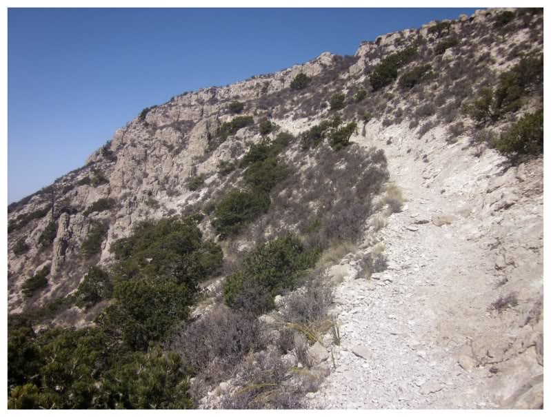
Maine's highpoint had 2 or 3 false summits & as a result, I now expect every hike to have multiple false summits. As I rounded out of the alpine upland forest into a more windswept portion, I could see El Capitan to my south and the Guadalupe Peak Trail leading to...maybe the summit?
I was still imagining an hour of work ahead of me at this point...
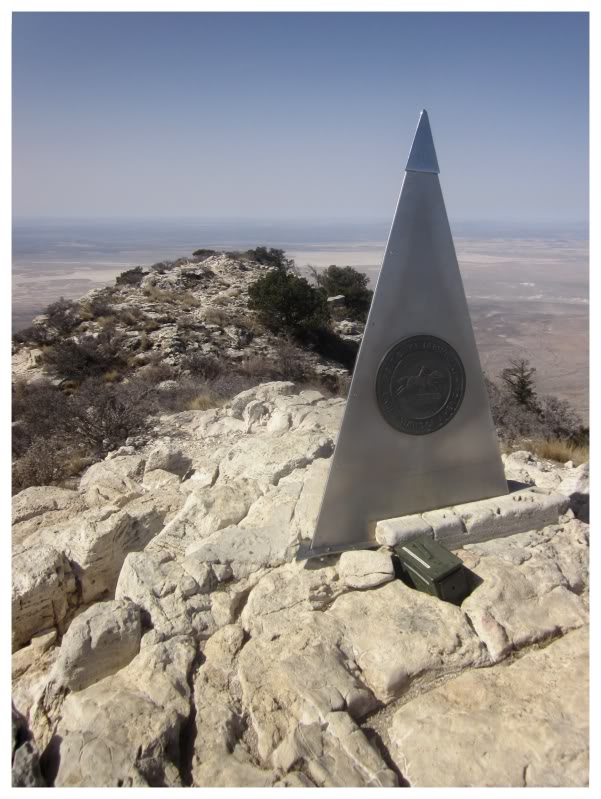
...but as I saw the hiker in front of me pause & sit along a cliff, I knew it had to the summit since he had been keeping my quick, continuous pace all along.
Maine seems to be at the difficult end of the difficulty 5 group of state highpoints, with a elevation gain of 4200 ft and a length of 10.4 miles; whereas Texas was only 2950 ft of elevation gain with 8.4 miles of hiking. I know I probably look back at Maine's Mt. Katahdin as being more difficult than it actually is, but I was surprised with the ease with which I reached the highest point in Texas.
Anyway, this was state highpoint lucky number 13! There are three highpoints with a difficulty of 5 & now I only need New York's Mt. Marcy1 to complete the group!
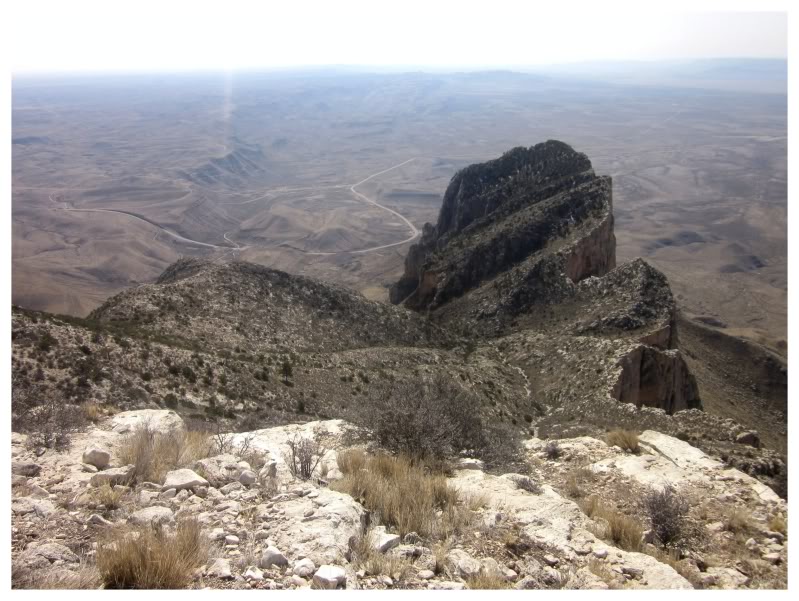
The view of El Capitan from the 8749 ft Guadalupe Peak. El Capitan is the 7th highest mountain in Texas in itself.
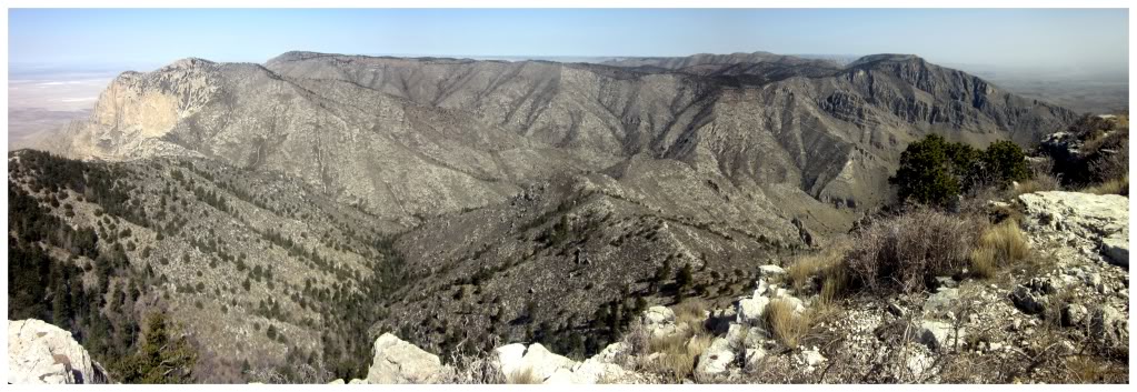
The view north towards the Guadalupe Mountains from the summit of Guadalupe Peak. The parking lot would be on the right edge of this picture.
I spent about 10 minutes at the summit, snapping a collection of pictures & enjoying my congratulatory caramel Milky Way. To my surprise, the other hiker wasn't very chatty & we didn't share a single word. He spent the entire time over on his cliff, peering outward upon the desert before him.
The hike back down went flawlessly. The afternoon heat was starting to make its presence known & I was happy that I woke up for the early morning hike.
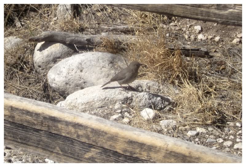
Arriving back at the rental car, I noticed a Canyon Towhee flying around & I stalked the bird for a bit. Clearly my feet were feeling fine & I had plenty of gas left in the tank.
Time to head north.
Go forward to Part 8