The town of Conche is not a convenient place to visit. One must first go to the isolated Northern Peninsula and travel past Gros Morne National Park; which is usually the stopping point for most people after the first 50 kilometres0. The odd person will cover the 230 km up to Port Au Choix, and there are a few people who have enough interest in L'Anse-Aux-Meadows to cover the entirety of the 430 km road.
To reach Conche itself, you need to turn shortly after Port au Choix and take the interior highway for 90 km to the other side of the Northern Peninsula. This is rare enough in that most people don't cover this distance to see St. Anthony or L'Anse-Aux-Meadows.
The topping on the Conche cake is that once you're on the other side of the peninsula, a 23 km road covers the rest of the way, switching from pavement to gravel to pavement and back to gravel again.
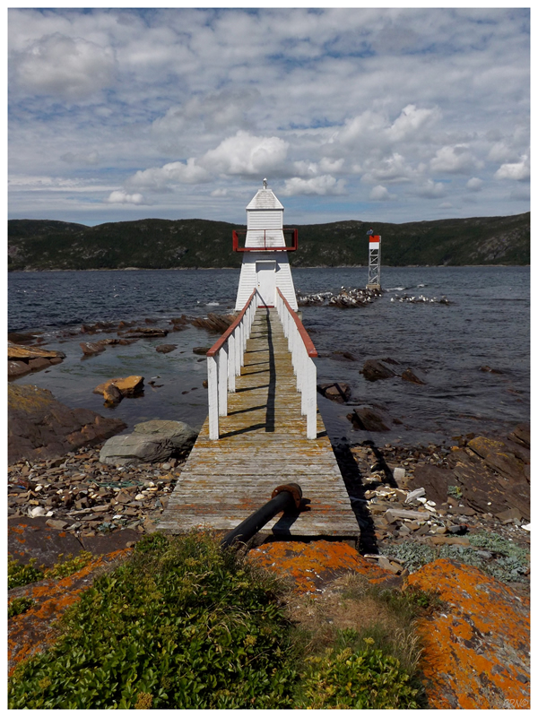
Seeing as there is a Conche Lighthouse, it comes as no surprise that I made it a priority to visit in early 2010.

Today I wasn't coming back for more lighthouse pictures though.
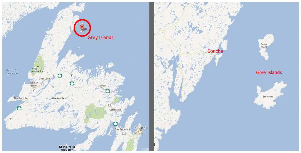
I found myself back in Conche as it is a set-off point for the Grey Islands.
Situated 20 km off the eastern coast of the Northern Peninsula, our journey would be closer to 35 nautical kilometres once we escaped the Conche Peninsula and sailed into Grey Islands Harbour at the very south end of Bell Island (of the Grey Islands chain).
One of my favourite books - one which I love to look at whenever I visit a new place in this province - is Great Britain's Newfoundland and Labrador Pilot, published by the Great Britain Hydrographic Dept in 1887. Inside, the Gray Islands are described as:
"Gray islands is the name by which Newfoundlanders know the two islands Groais and Bell, south of Croc harbor."
Furthermore (about Bell Island, the one island of the two which we were visiting):
"Bell island is separated from the south part of Groais island by a clear channel 5.5 miles wide. It is 8 miles long and about 6 miles wide, is flat, high, and steep on the coast except on the shores of a bay on the southwest side, and steep-to on north and south sides. Northeast rock (ile a Herpin), two thirds of a mile from the northeast point, is a barren islet with several rocks between it and the shore."
The book also has a full page of various hazards one must consider when trying to go ashore at the Grey Islands.
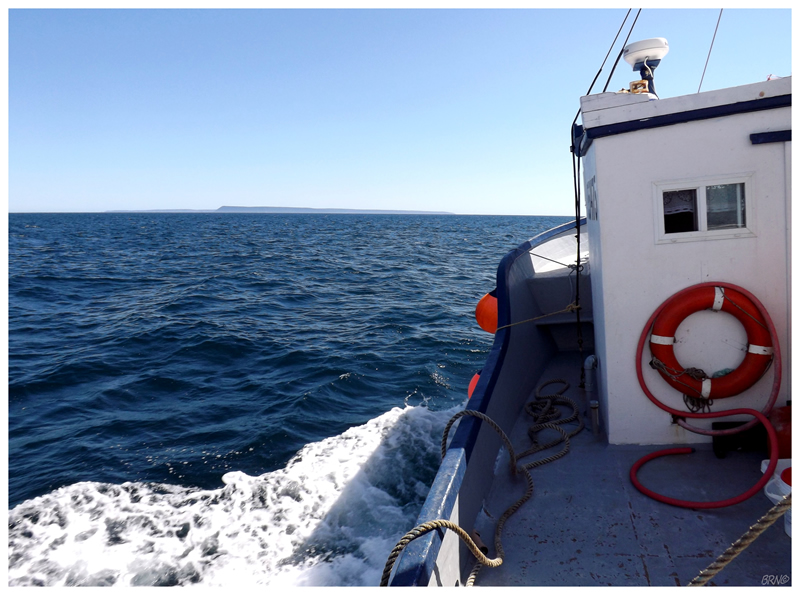
Thankfully we had chartered a longliner with experienced mariners today. The various islands, rock and reef hazards were simple footnotes to observe as we sped about in the Atlantic Ocean.
The journey would take over two hours, but it didn't seem that long as the weather was exquisite.
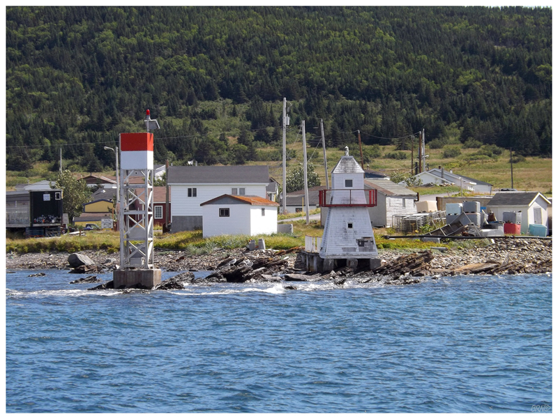
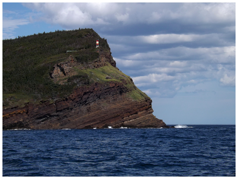
I started out enamored with varying views of the Conche lighthouse; then the (boring, modern) minor skeletal tower in picture #4, once we reached the mouth of Conche Harbour. Moving past the tip of the Conche Peninsula, I could now see the Grey Islands as two flat slabs off in the horizon. Bobbing about in the ocean, it was exhilarating to know that we'd eventually make it to these far-off, obscure, uninhabited islands where we would stay for 3 days and 2 nights.
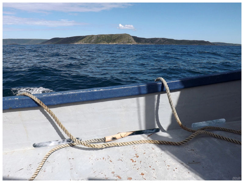
As we moved closer, to the point where the southern Grey Island no longer appeared as a flat slab (and Groais Island (the north one) disappeared), I pulled out my topographic map & geeked out at the various features before me.
One of these features was two nearby bird sanctuaries. Newfoundland bird sanctuaries are off-limits to the public during mating season & not really viewable/reachable anyway. Having always seen them on maps, but never having seen one in person, I studied the horizon to examine Sheppard Island Bird Sanctuary, but couldn't make much of it as Bell Island dwarfed its backside.
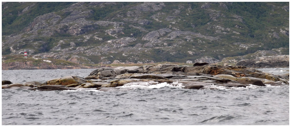
We went right by Île Aux Canes Bird Sanctuary though, with the added bonus of observing a group of seals trying to sun beneath grey skies!
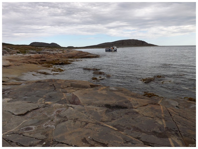
Arriving at our destination, I jumped at the opportunity to go on the first trip off the boat. (Since the harbour was too shallow for our longliner, we towed behind a small speedboat as well.)
Standing on the shore, the only noise was the quiet hum of the speedboat's motor. I watched as it returned to the big boat & another trip of people/luggage was made. Our captain showed us a few brief things to do with the cabin, but he would leave in quite quick fashion.
I watched the two boats move out of the harbour and eventually leave my sight heading west back towards Conche.
And that was that: 3 days on a desolate island out in the Atlantic.

I was excited to immediately explore the island, but I grew distracted by the harbour crabs - especially as we dropped our booze in the water to cool...and one rock crab attacked the rum!
I suppose he picked the correct Kraken to attack during his sea years...
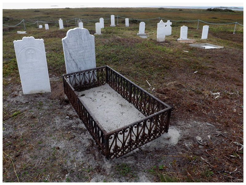
After 15 minutes of giggling at the crabs, I went west to check out the cemetery I saw from the boat.
The walk started with a swampy section with a high probability of soaking shoes, due to water pools hidden behind tall grasses. Thankfully that didn't last long, as I soon moved into a windswept bog with strange pockets of sandy ridges.
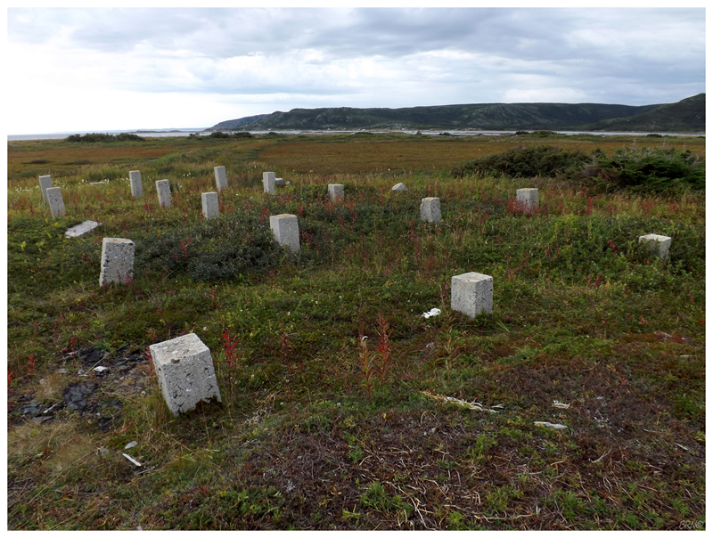
Reaching the cemetery, it was both surprising & pleasing to see that it had seen some recent maintenance. Right beside the cemetery was a section of parallel foundation blocks, and during my time in NF, I've come to learn that these exist in many places where a non-residential building used to stand. I have to imagine the foundation blocks are all that is left of the Grey Islands Harbour church.
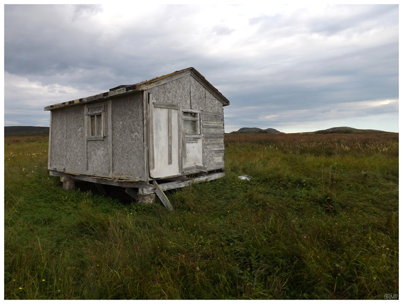
Looking past the cemetery, I could see a lone shack resting near the shoreline.
I was standing in the knee deep grass out here all alone. I was far enough and low enough, that I couldn't see my friends or our cabins back by the harbour. There was no one else around & the only other building I could see was a maintained cabin off to the south.
I stood there for a minute and appreciated the moment, thinking about the privilege of being able to visit the Grey Islands. I loved the obscurity & isolation. The Northern Peninsula is quite rural and empty on its own - to visit a deserted island off of its coast was a whole 'nother thing.
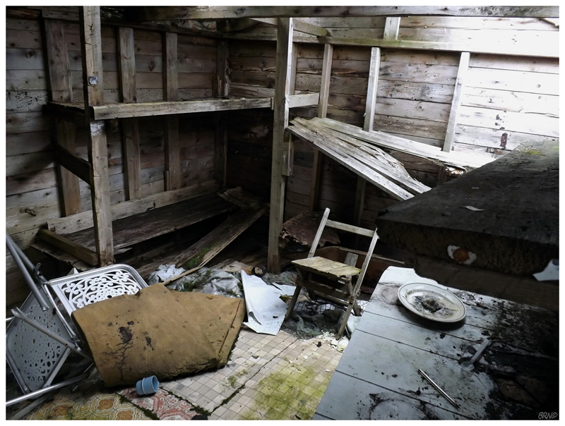
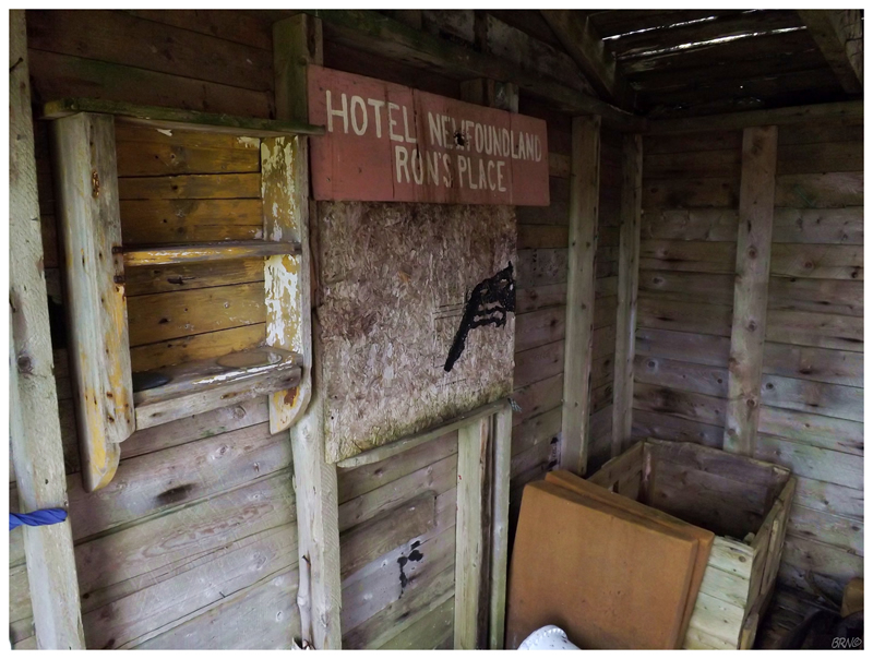
The shack turned out to be cooler than I expected, as it was actually an old caribou hunting cabin. The floor was far from safe, but it was neat to read all the graffiti on the 2x4 ceiling supports, as well as take close-up pictures of old caribou tags from 1994.
I pondered where Ron was for a bit, imagining he must've grown too old to make this trek out here anymore.
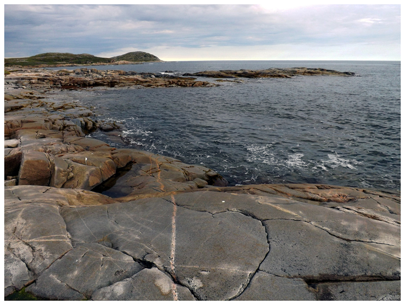
Exhausting all of the 8x12' cabin exploring, I went to the shoreline to snap a picture of Rocky Bay. Walking south along the beach, I followed a stand of 20 Semipalmated Plovers, who would only move once I got into their comfort zone, then land and wait until I moved forward into their comfort zone again, before moving yet again.
They eventually smartened up as I kept following the coastline. I would round the corner and snap the above picture looking east, where our cabins would be up & to the left.
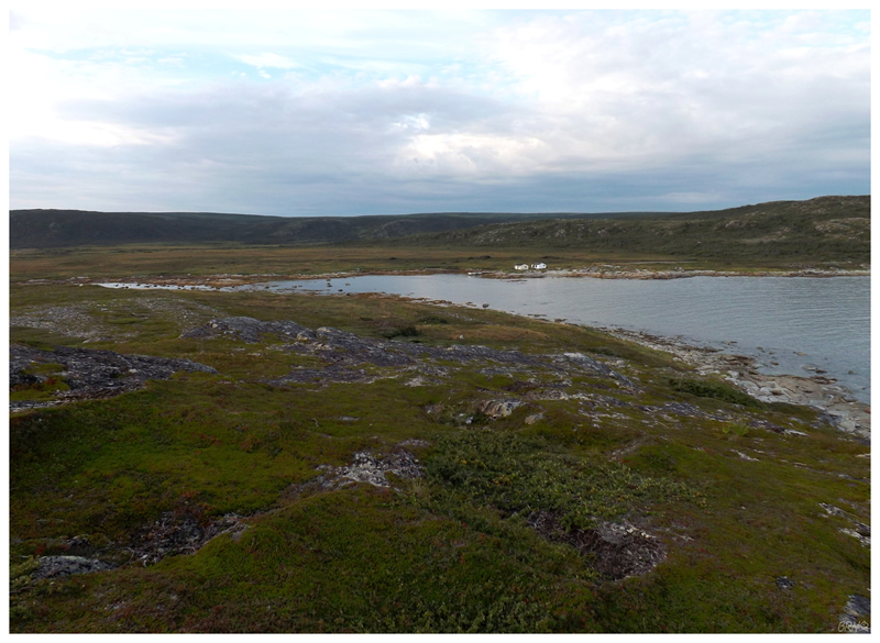
Rounding the coast again, I climbed a small hill which I knew would provide a good view over our home harbour. The friends back at the deck noticed me & apparently yelled, but I only saw them move in silence like lasagna1.
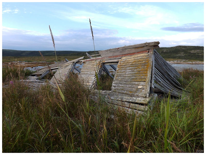
I was thankful I climbed that knoll after I noticed this collapsed house in the weeds (it was completely invisible from the boat & from the harbour).
Whereas the other abandoned building was created for caribou hunting, I figured this was actually from the resettled community of Grey Islands Harbour.
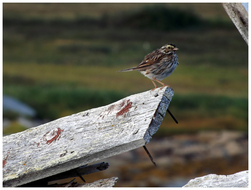
Finding this house also provided me with this Savannah Sparrow shot I'm pretty happy with. This isn't the rarest bird by any stretch of the imagination, but one of the goals I had was to get a picture of something obscure enough for my Grey Islands record.
Eventually I walked through the 35° door hole to rack up another building for the life list. LOL.
(I would later read a poet's book about his experiences on the Grey Islands, based on his visit soon after the last resident left. He wrote about walking along this bay, finding 3 abandoned houses and walking inside of them and examining what was left behind. After reading that, it actually made me think about the poet walking through this same door, but also all of the friends & family who walked through said door in better times, for more important things than some strange hobby.)
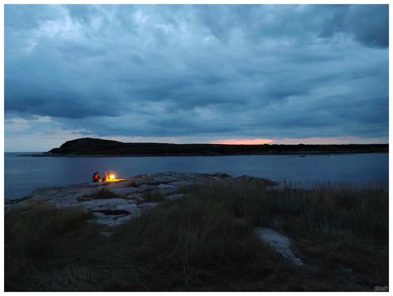
Returning to delicious dinner, we eventually moved out onto the smooth, shallow rocks for after-dinner rums.
It would be an early night as we still had 2 full days ahead of us...