I've driven The Baccalieu Trail before, the combination of Highways 70 & 80 around the shore of the Bay de Verde Peninsula, the most northwestern of the Avalon Peninsula's four divisions.
My companion that day in 2010 wasn't feeling too well, so I was only able to visit Grates Cove at the northern tip, leaving a handful of communities for a return visit.
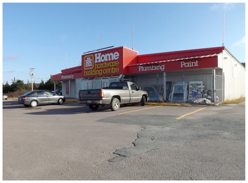
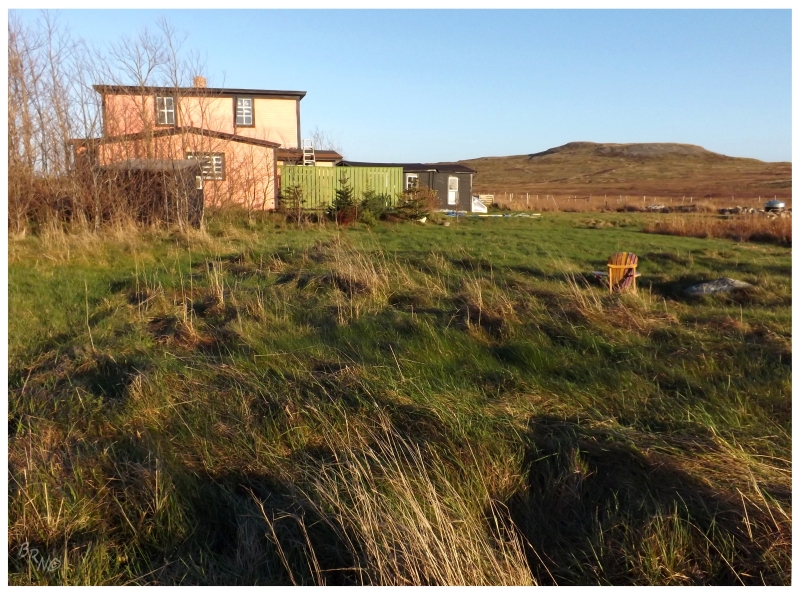
This would also give me an opportunity to photograph Green Harbour's Home Hardware-slash-Pharmacy I found so amusing on my last trip.
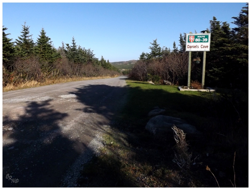
Cutting right to the chase, 111 kilometers were covered before Daniel's Cove. Most of it was very familiar, but a few of the towns like Heart's Content & Old Perlican were more interesting then I remembered them (the last time I did this drive in reverse order, rushing to get the last lighthouses before sundown).

Daniel's Cove turned out to be a cabin community, with 15 to 20 small residences lining the way. There was the odd road down to Daniel's actual cove, but that was about it. It seems Daniel's Cove used to have a school and a post office, but people have slowly trickled away (today there's only 1 full time resident).
That last resident has their life made easy by the fact that the 5 km road from Old Perlican is well maintained. Seeing that the road continued onward on maps, it became clear in real life that the Department of Transportation stopped maintenance after Daniel's Cove. Opting against the glorified sheep path to Grates Cove, it was back to Old Perlican & back to the highway to visit Grates Cove again.
Presented with a choice the first time I was up here in 2010, it was hard to choose between the old stone walls of Grates Cove and the easy jokes of Red Head Cove.
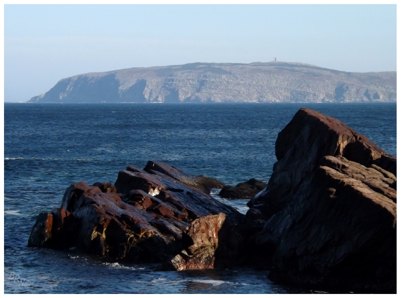
So this time I made it to Red Head Cove as well, enabling cheesy jokes, but also enabling me to walk down to the cove so I could finally peer out at one of the 22 Newfoundland lighthouses I have left over on Baccalieu Island.
(The problem with this one - in addition to Red Head Cove being 725 km (450 mi) from home - is that the island is an ecological reserve closed to the public from April to October. Apparently residents go there for picnics though, so maybe an October/November trip is possible? Time may tell.)
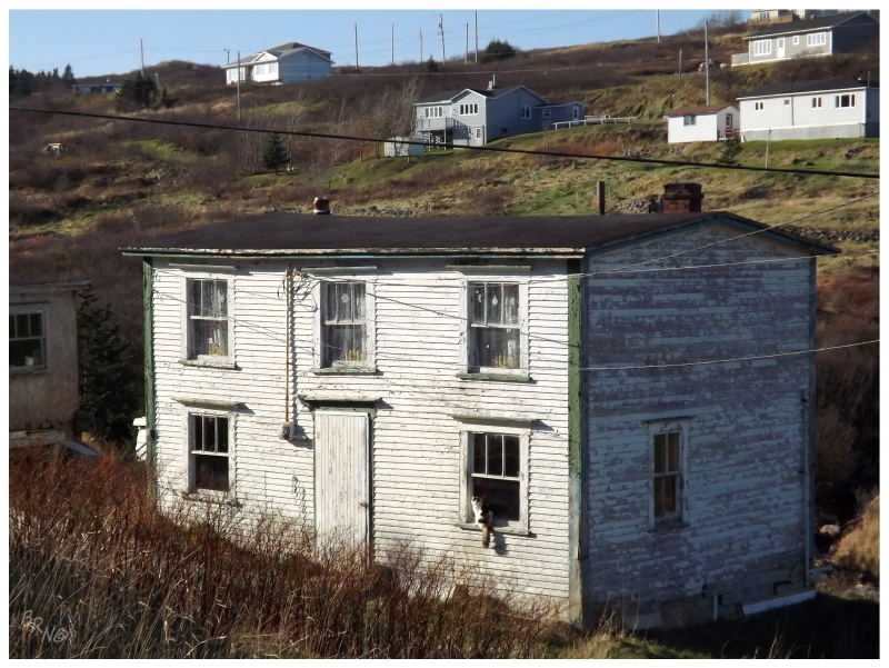

Cats next to dilapidated houses in addition to distant lighthouses? Red Head Cove shot up the rankings as I was leaving town!
FYI, he was staring at me, the second picture isn't a crop of the first picture. Also, amazingly there was smoke coming from the chimney of this place, meaning people(s) still lived inside!
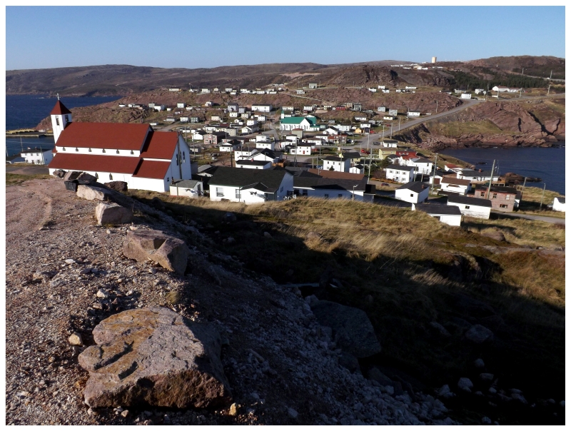
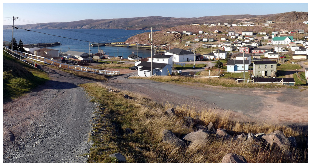
Another new community was 6 km away in Bay de Verde...and what a community it was!
Coming down from highlands as the town opens up around you, you pass over a thin strip of land between two coves, then up to another elevated piece of land if you should choose that neighbourhood.
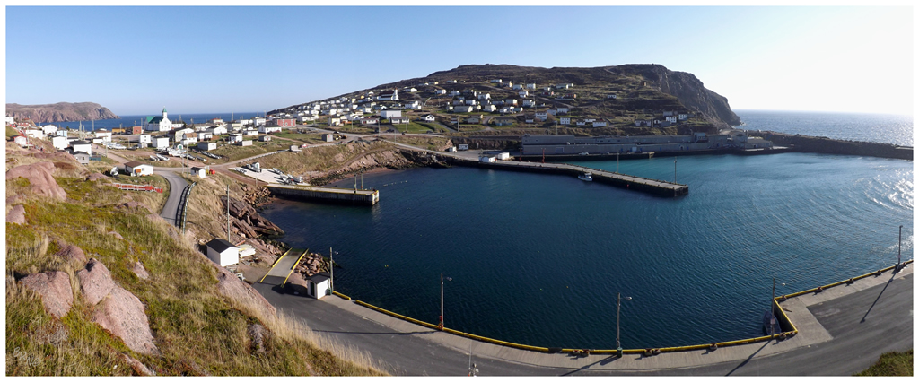
Rose Blanche and Englee used to be my go-to answers for "the most beautiful town in Newfoundland."
Bay de Verde bumped them out of the top spot.
I spent the better part of an hour navigating the same loops, making sure to take as many roads as possible (this is hard in Newfoundland without a grid system, without a knowledge of which roads are nothing more than driveways & which roads are steep, gravel hotbeds of danger.) Even after assuring myself that I think I saw everything, I was still uneasy with leaving such a spectacular place.
Back at Old Perlican, I had now seen all four towns at the very northernmost tip of the Bay de Verde Peninsula. Whereas the Avalon sits at the mid-47th parallel at St. John's, these towns are aligned with Clarenville above the 48th parallel.
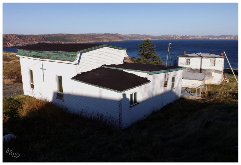
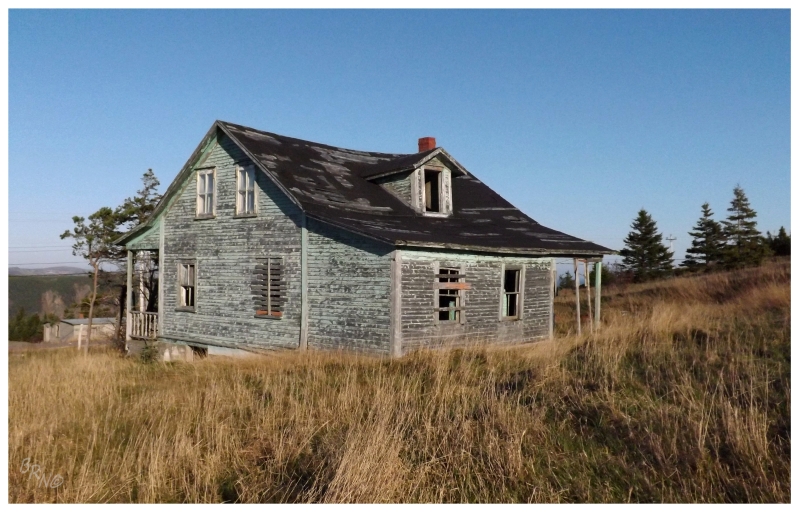
Starting on the backside of the Baccalieu Trail Loop, three kilometers wouldn't pass before the brown sign to the tiny Low Point presented itself, an indication towards a hamlet situated on the Bay de Verde Bight across from Bay de Verde.
There isn't much information on Low Point and it doesn't seem like it was ever a sizable community. (Still sizable enough to have a church I suppose).
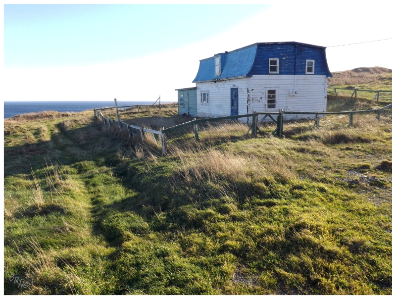
With only three streets, there was one Low Point road which led past the houses to an attractive spot at land's end.
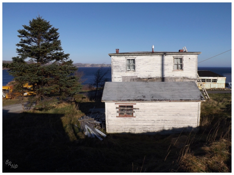
I quite enjoyed this isolated house & wish the afternoon's light wasn't so harsh.
It was getting later in the day and there was still a decent drive before getting back to the Trans Canada Highway.
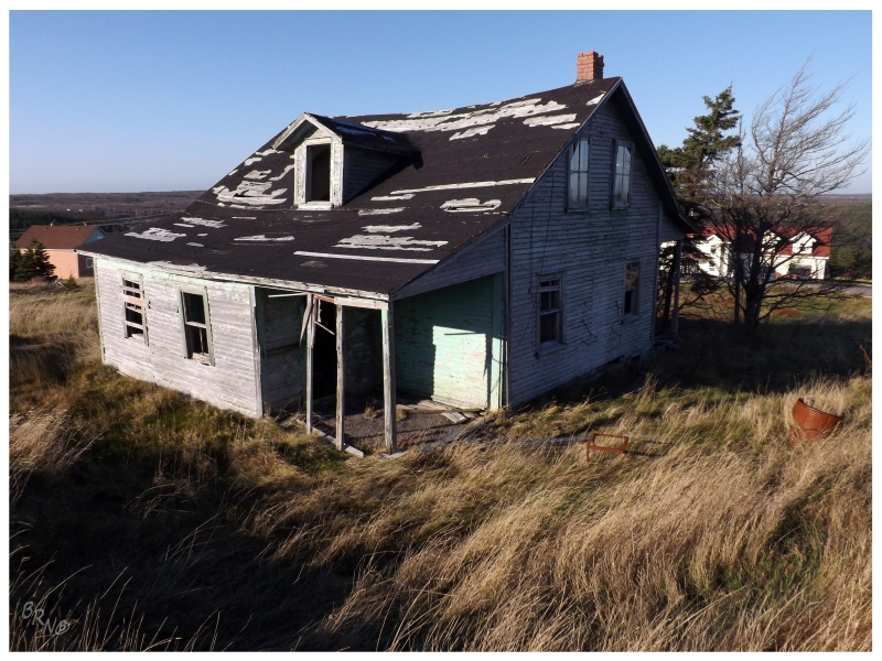
Nevertheless, I couldn't help but stop at this roadside house in Caplin Cove.
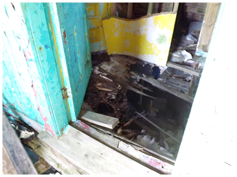
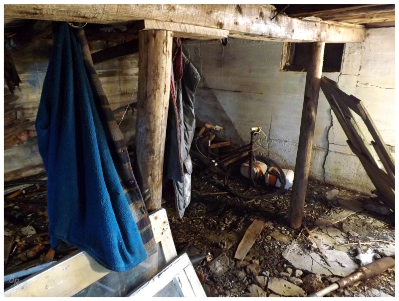
The main floor didn't look very safe, especially as I peered up from the safety of the basement.
The true beauty in this one is the exterior anyway.
In returning to these peninsulas to visit the last communities I never caught the first time, I realized that there are still the odd ones I missed when making my list with (admittedly mediocre resolution) Google Earth, topographic maps and road maps.
"Bradley's Cove. ...Bradley's Cove? That isn't on the list. Western Bay then Small Point. Better hang a left!"
And with that, the 1.2 km road & 20 houses were covered.
Bradley's Cove.
There wasn't that much light left after Bradley's Cove & it was killing me to fly past all of the old houses and interesting street networks up here in some of Newfoundland's oldest villages.
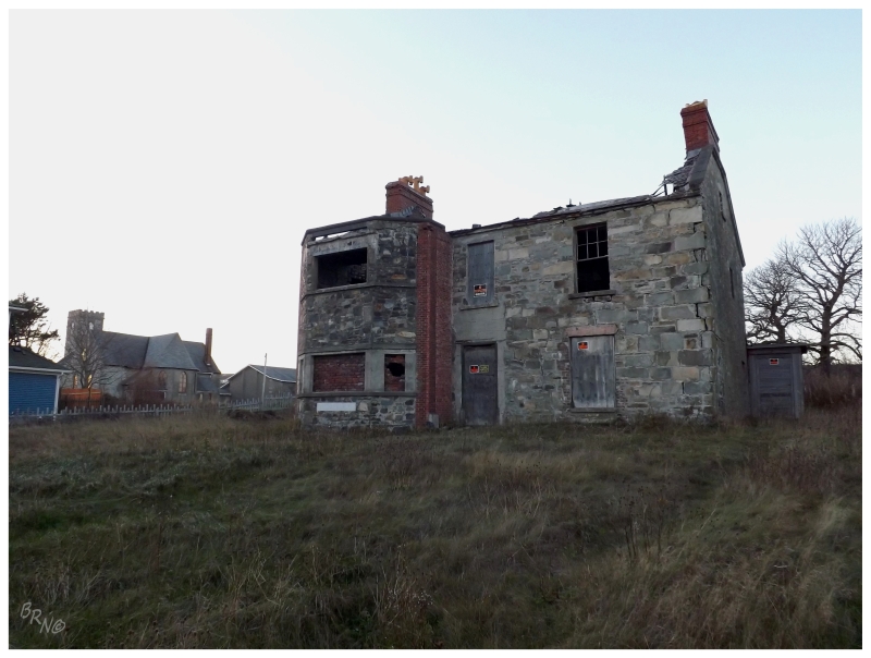
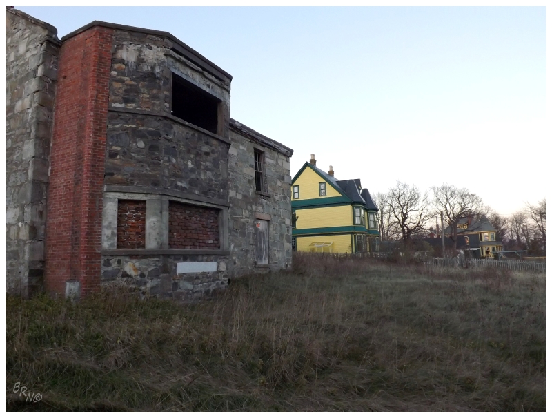
I suppose I decided that I wanted pictures of Ridley Hall more.
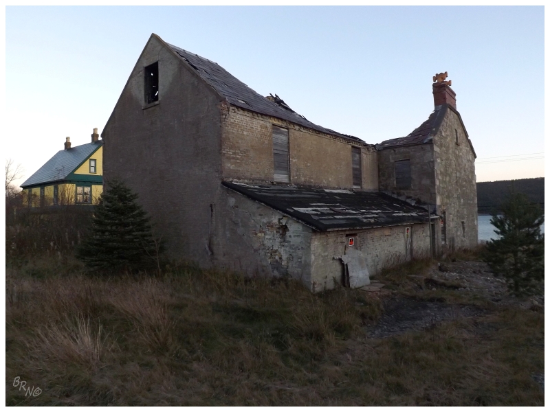
Ridley Hall was built in 1834 by one Thomas Ridley, one of the most prominent merchants in all of Newfoundland at the time. Many of the houses along this road stand as a testament to the wealth of Harbour Grace families at the time and Ridley Hall is no different. As Ridley was such an important citizen then, balls were held at Ridley Hall, where attendees were quoted as saying the event to be "in every respect the most brilliant entertainment that has ever taken place in Newfoundland."
The Ridley family would lose the house in the bank crash of 1894, then passing between several families and even a cable station operation, the house would eventually become abandoned in the 1980s. Of course some yutz would come along and set it on fire in 2003, leaving the gaping hole in the roof you have today.
A picture of Ridley Hall back in all of its beauty is available by scrolling down here.
Demolition has been approved for whenever someone wants to buy the property, but so far there have been no takers.
The mayor of the town has been quoted as asking "how long do you let someone access the building before someone loses a life?"
Who knows when I'll be back in Harbour Grace & who knows if Ridley Hall will still be standing at that time. I was glad to have stopped this day & taken a closer look.
If only this was Scotland or Ireland and we could conceive such a crazy notion as leaving standing stone walls and a hall in ruin.