My first attempt at visiting the resettled community of Grole came in 2010.
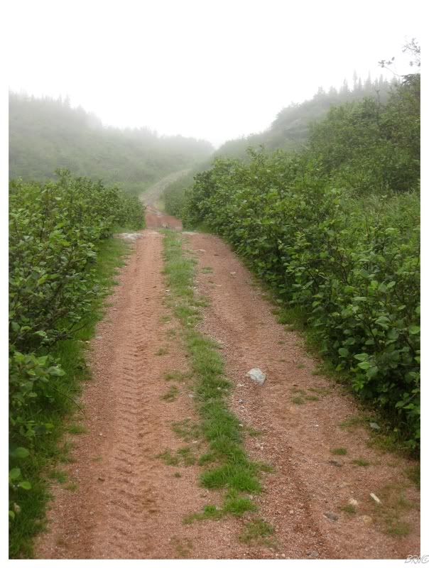
Driving that day, the fog increased through the turn onto the NL-364. There the surrounding landscape obscured by rain clouds while we sped past the last community of Seal Cove. From there, it was along a gravel road no longer maintained by the department of transportation.
The road was better than I had foreseen and we put ourselves within 2.5 km (1.5mi) of Grole. Parking the car and hiking into the drizzly unknown, the problem was that I was unable to gauge the hills and ponds to know if we were truly on the right path. In addition, there were more paths and trails out here than I expected. Should we have taken that one to the right? Should we simply keep going on the rough track of exposed rock and encroaching alders?
Tired and hungry, the decision was made to turn back. With poor Google Maps resolution at the time, I was unsure of where we actually ended up.
In 2012 the attempt would fail due to running out of time.
The car was driven further into the road & a greater distance was covered, but unfortunately there was less than an hour before sunset. Unsure if it was the actual road to Grole, the safe decision was made to return to the car and break camp before darkness fell.
Returning home that weekend in 2012, it was both infuriating and comical to see how close we had come to Grole. With better resolution and coordinates recorded in the GPS, it appeared that it was only 800m (0.5 mi) further to reach Grole. The steep-sided cliffs and curving road gave no indication of a cove being ahead, but it would have been evident if another 2 or 3 minutes been covered.
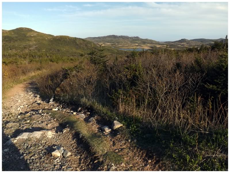
As I wrote about this embarrassing failure in 2012, I stated that I was trying to do better with time management. Parking the car around 1pm on this day in 2013, there was little chance of failure.
Pushing through a tiny portion of land I hadn't yet traversed, the road ahead dipped down and the valley opened up to the right. The Grole Road would meet up with a creek dividing the valley, creating rivulets as it flowed down the ATV and moose-tracked mud and rock trail. I wanted to rush down into the stunning valley and towards the pesky town, but care was required not to roll an ankle or bloody elbows.
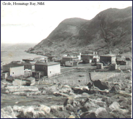
Undated photograph from the Maritime History Archive on Resettlement. Memorial University.
As plenty of French names exist for nearby places along this South Coast, the Newfoundland Encyclopedia proposes that the name Grole might have come from grêlé - a French word meaning pockmarked (the land is much more rocky outside of the lush hills you see in these pictures.)
With excellent fishing grounds almost adjacent to Grole, the area could have seen use by French fisherman even in the 1600s. The Treaty of Paris in 1763 would change the national makeup of the fisherman though, as that treaty seceded St. Pierre et Miquelon to France, resulting in English and Jersey expansion throughout the South Coast.
Settlement in Grole started out seasonally, where people wintered up the coast in lands with more shelter, greater supplies of timber and greater hunting grounds. Eventually Newman and Company, a substantial fishery based in nearby Gaultois, would encourage and lead year round settlement at Grole (the company bought crown land at Grole in 1851).
Having a settlement so close to great fishing grounds proved lucrative as Grole was recorded in the census as producing the most salt fish in the area from 1836 to 1884.
The population of Grole was 188 in 1836, standing as one of the larger communities of Hermitage Bay.
This number would only approach a maximum of 250 persons though, since the small harbour couldn't accommodate a large number of boats and the steep hills and barren land provided a limited amount of arable and available land for newcomers to utilize.
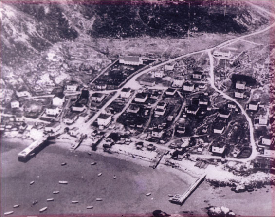
1936 photograph from the Maritime History Archive on Resettlement. Memorial University.
Grole was one of those places without an established road, located far down the shore from the major growth centre of the town of Hermitage. The residents would be offered resettlement money by 1966; and those accepting it, mostly left for Harbour Breton. It was easier and cheaper for the government to pay these people to leave for a bigger centre, than it would have been to build a road, hydro lines, maintain the road, provide school services, health services, etc., etc.
Eventually the last person would leave by 1971. In addition to Harbour Breton, people also moved to Gaultois, Grand Bank, Hermitage, Long Pond, Marystown, Milltown and Stephenville.
(In researching this, I found out that Grole was connected to the road network in 1968, allowing students to bus to Hermitage for high school. This is strange as they finished a road - which is now little more than an ATV trail - in the midst of resettlement? I suppose they wanted those last kids to attend school?)
Often with resettled places in Newfoundland, there weren't any structures constructed of anything besides wood. This leads to the village fading away at an incredible rate, as people salvage wood for nearby cabins and then the weather reeks havoc on what is left.
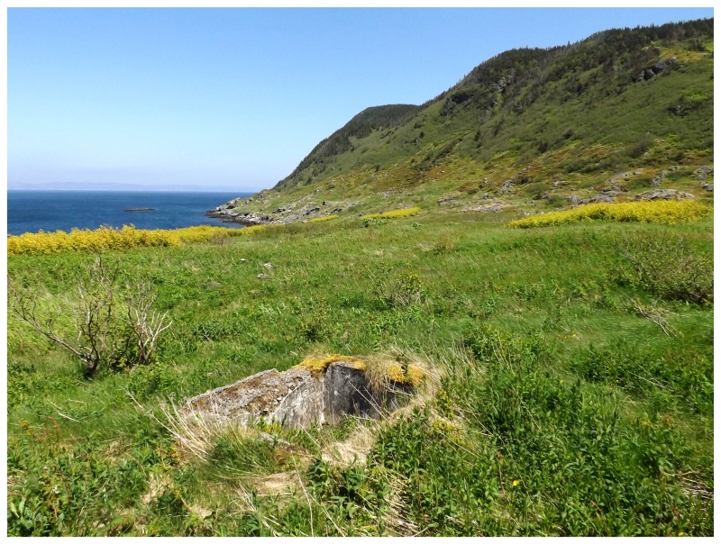
So I didn't hold out the highest hope for what would be left in Grole, but veering to the western edge of townsite, one place must have had somewhat of a foundation (although it could have been from a cabin built in the 70s or 80s. The old homes and fishing stores very rarely have a cement or stone foundation in these places.)
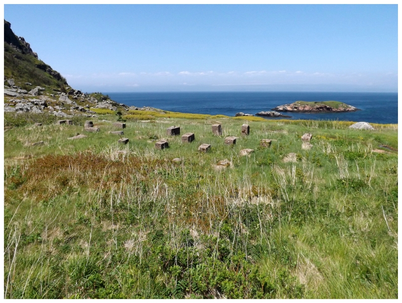
After not expecting much to be left at Grole, I inspected every piece of man-made detritus I came across.
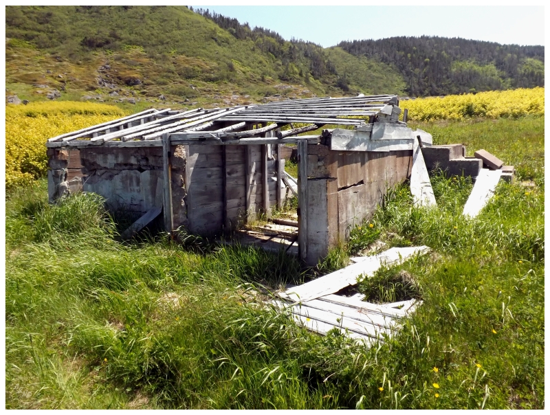
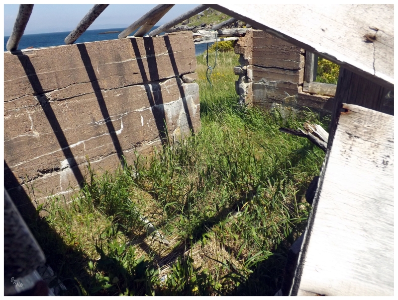
You could see one building still standing - to some extent - as soon as the Grole Road curved and the valley lay ahead.
I've found a rough map of Grole in my research and it looks like this place might be Evan Taylor's Store, although there isn't a doubt in my mind that someone converted it to a cabin or shed in the last 40 years by making good use of the foundation.
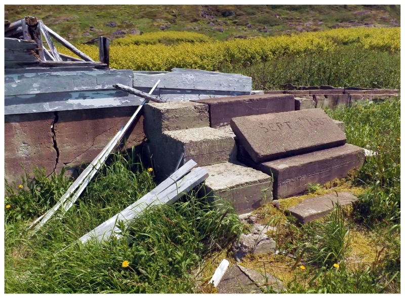
Someone had displayed the cornerstone on the steps of this last standing building - "Sept 5th, 1957".
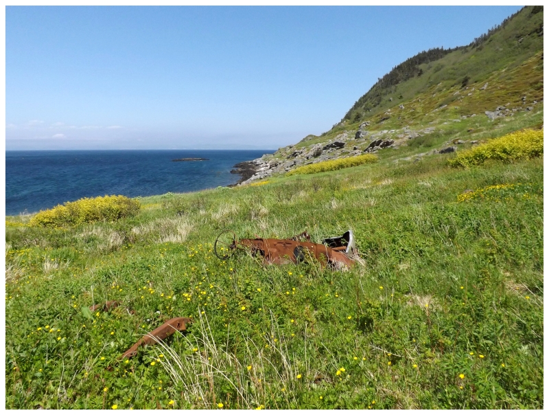
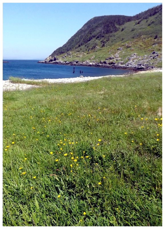
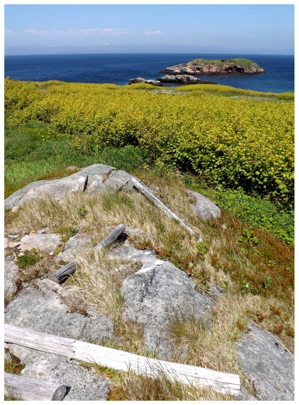
There didn't seem to be much down by the shore, but I wanted to go down to Grole Cove anyway.
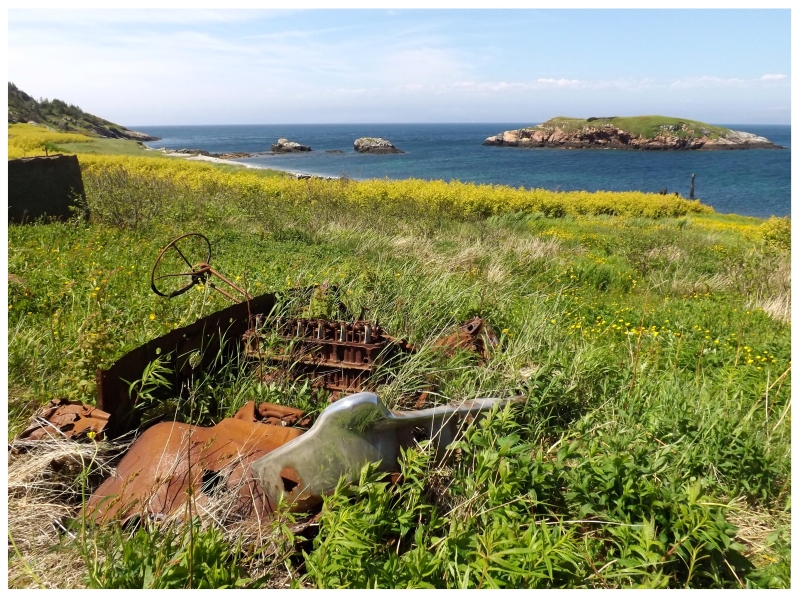
As it turns out, and as much as I'm a geek for ruins and small buildings, I audibly exclaimed at the sight of this car just barely poking up above the buttercups and grasses!
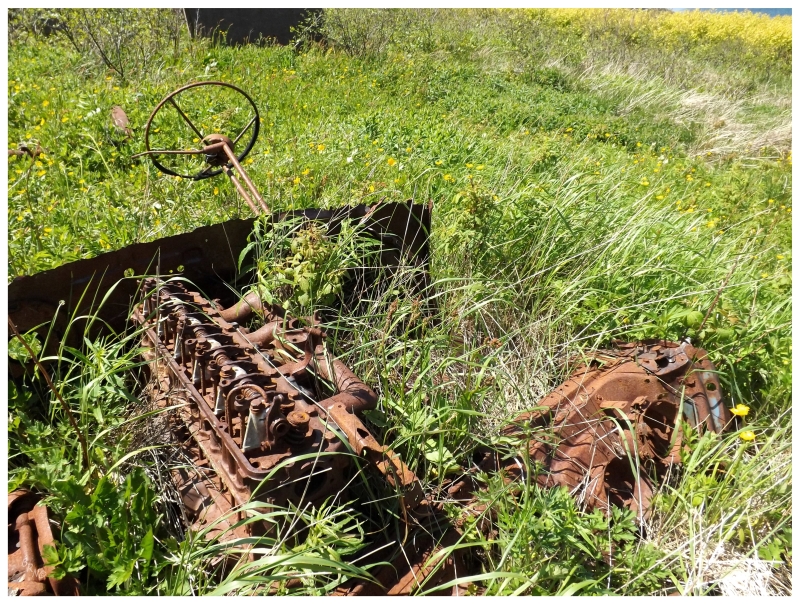
So if the road was built in 1968, was this driven here in the three years the road serviced Grole? Or during that period afterward where a few cabins might have remained? As I said, there's limited land area to Grole, so hopefully someone didn't bring it by boat just to drive the 500m of roads in Grole itself pre 1968!
(I showed my friend - storied car identifier Matt Trakkah - these photos & he says he's 99% sure it was a 1960 Ford Fairlane. Dood is wicked good.)
I subsequently sat in the grass below the steering wheel and pretended I was driving around the two streets of Grole for a while.
Afterwards I sat down for lunch and noticed that I had a text from Steve. He had apparently been watching this show "Land and Sea", asking if I had heard about it - the lifestyle show being so popular in Newfoundland that I cracked up at the question.
The episode featured "this guy from one of those resettled places" and "he was going back to visit the remains of his childhood community."
Seeing as I visit about 3 resettled communities a year, I was amazed that this exchange happened to come up while sitting on the foundation ruins of the minister's residence in a resettled community.
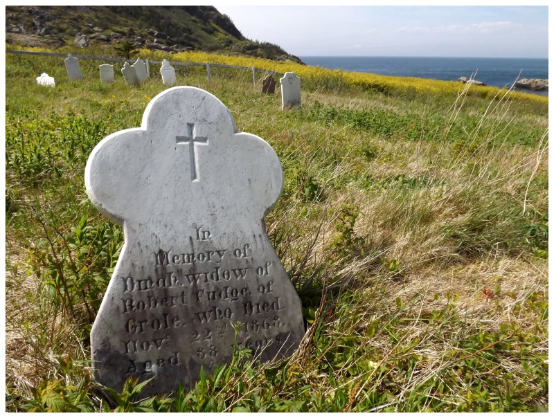
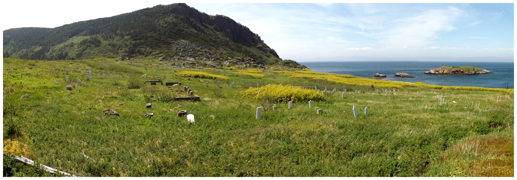
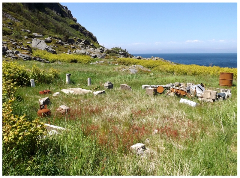
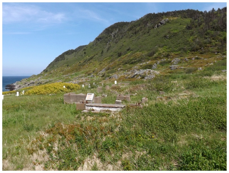
Finishing up my trail mix, I threw my backpack over shoulder and stretched my legs across another small creek; then scurrying up a hill and into the cemetery. I went about my business as usual, checking out the mish-mash of headstones in a variety of orientations, repairs and accessibility.
The oldest one, and one of the older I've seen in these outport communities, was from 1868. There's a certain template to a large swath of headstones in this province, so Dinah Fudge's headstone was quite interesting with its unique Olde English font and simple symbol.
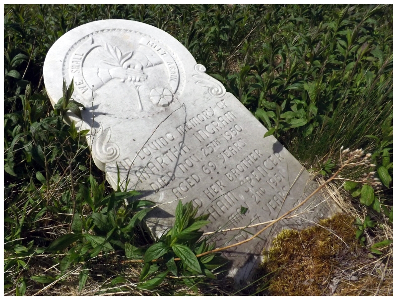
There were sections of the cemetery where the Japanese knotweed left me wondering what headstones I was missing. In fact, there were other portions of the community where I wondered if I was missing ruins because of the plant's presence.
A plant species which spreads wildly and is hard to eradicate, will resettled communities now be shrouded in mystery because of invasive plants covering the last remains?
I suppose it only spreads at a similar rate as which the settlements disappear.
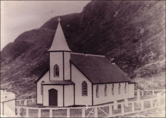
The last thing to check out was the foundation of the old St. John Anglican Church.
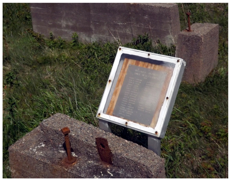
Walking up to the front steps, I noticed something really neat in an engraved listing of former Grole residents who have since passed after resettlement. The list included some 40 people, under the title of "Beloved Departed Since Resettlement 1970."
I was left with a wholesome and intimate feeling, almost as if a family was being remembered more than a village. I suppose you could take any 40 person farm village from back where I came from and most of the people would know each other well enough - but would they be this intertwined? Would they leave a legacy within the village?
I suppose anyone who spent a decade or more in Staples, Blytheswood or Oxley1, Ontario would feel the same way and have similar ties to that section of their life. Even more so if those places ceased to exist outside of encyclopedias and old maps.
Eventually I would have to force myself to stop lingering and wandering about Grole, scared that I missed something or took some overly awful picture.
As it always is, the walk back to the car was far shorter, on account of now knowing the route and knowing what's coming.
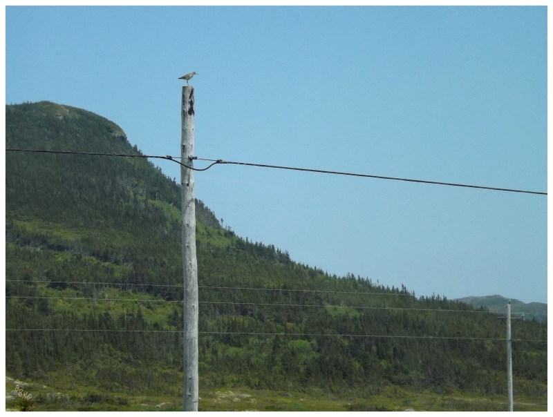
Bumping along the shoddy road back to Seal Cove, I remembered the hydro pole where a shorebird was strangely noticed atop.
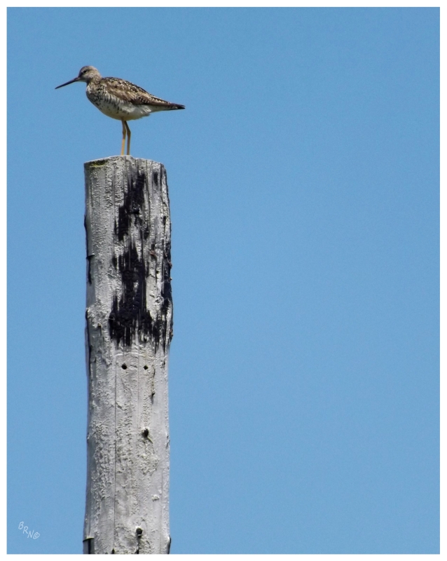
A Greater Yellowlegs
Dinner was again at the only decent restaurant in Hermitage...Sophie's. (I wanted to save money with groceries, but unfortunately they were closed at 5pm on Saturday).
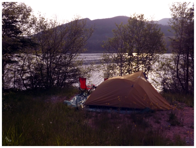
Such efficiency at Grole meant that things were actually running ahead of schedule. The car needed to get to Pools Cove by morning, but with knowing Hermitage had a campground and unsure of what lie ahead for stealth camping, it was time to set up the tent and consume beers a couple hours before sunset - which may be a record for me.
The last question of the day was who to pay for the campsite and whether anyone would come along and exclaim that this was actually their property. Neither would happen.
A Northern Waterthrush landed in the foreground bush as the sun eventually dipped below the far hill and Partridge Cove darkened into night.
Continue to Part 3!