.jpg)
Newfoundland is a place where almost every community came to exist because of the fishery. Settlements of various sizes tucked into coves and harbours of varying quality, with trade and recreation routes traveled atop the Atlantic. Obviously inland trails existed in places, but when it came to eventually establishing a road network, many highways were constructed as straight branches from the main highway (the main highway, the Trans Canada Highway, is shown in red).
Now with the south coast being more rugged and lightly settled, the main highway was instead curved upward to accommodate the populated islands and peninsulas of White Bay, Notre Dame Bay and Bonavista Bay (Northeastern Newfoundland). This left the south coast to a reliance on ferry service.
Only two highways cut through the interior and bring travelers to the south coast: the Burgeo Highway - which cuts inland from the Trans Canada and goes 148km (90mi) to the south coast (the one orange, inland highway to the left on the above map) - and the Bay d'Espoir Highway - which cuts right down the centre of the island to the 25 or 35 communities located around St. Alban's, Hermitage and Harbour Breton.
Indeed there is the Burin Highway which cuts across a portion of the interior, but over there, it's more of the Burin Peninsula than the centre of the island. For the true interior of the island, the Burgeo Highway & Bay d'Espoir Highway are your two highways which delve into the barrens separated from human settlements and pavement.
The new Google Maps, like all new technology, doesn't work right. So zoom out to see a better view which I can't bring you.
So you have this giant tract of land and only two small windows into what exists out there. Having been to most areas of the province, most of the highways & most of the towns, now more than ever, where there's a giant area that I haven't seen, it piques my interest.
That's why I always kept an open ear towards any talk of the woods road to Buchans.
At just about 100km (60mi), this road connects the Burgeo Highway to the interior town of Buchans. The Burgeo Highway holds enough mystique in it being a 148 km road which only goes to Burgeo by going through the interior, so it interested me that I could simply go straight on this road and eventually end up in Central Newfoundland (where I'd normally have to take the mundane Trans Canada Highway for 3 hours).
I had long thought about cycling this road and camping along the way, but as I heard of two separate people who had traveled the road in compact cars, I concluded that I'd drive the road instead of biking it. It was early in the year, so hopefully there weren't any washouts or closed bridges.
Leaving home, the 64km (40mi) along the Trans-Canada Highway is more than familiar. Even turning off onto the Burgeo highway, while not what I'd describe as familiar, it's something that I've done about a dozen times now.
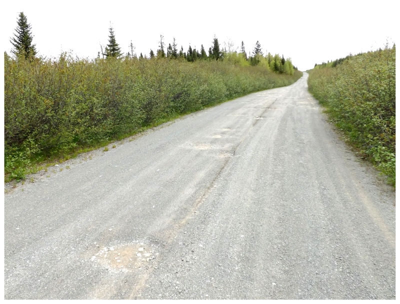
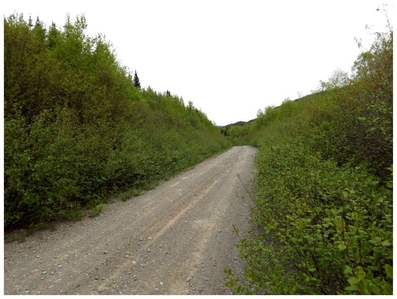
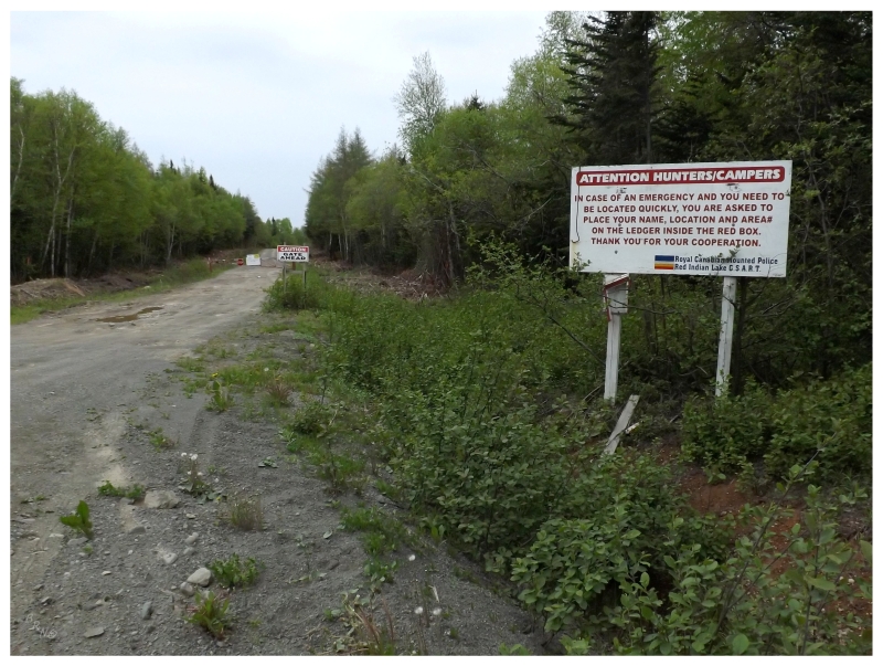
So there was a certain amount of familiarity with driving that Burgeo highway and coming to the single turn at kilometer 50 (mile 30) where you need to slow down. Today I wouldn't be making that turn though, for this was the entrance to the woods road to Buchans. Passing a car-sized sign informing me about unmaintained roads and instructions to yield to woods trucks, I was now on a road not built for communities, but for logging, mining, outfitting and recreation.
This woods road was not entirely foreign though, as I'd traveled the first 20-odd kilometers (~12mi) by snowmobile before, leaving a certain amount of comfort with previously traversed grounds.
Now that I was here without snow, I found the road not terribly rough, but there were enough potholes to keep the travel to 30 or 40km/h (20mph). At this speed, the windows could be rolled down in comfort and the silence could truly be appreciated, as an assortment of bird species sang at various points. One might be able to go a little bit faster if their ultimate goal was simply to get to Buchans, but I had no problem going slow and taking in the Fox Sparrows and Purple Finches songs.
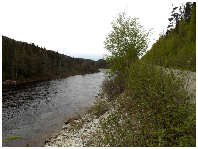
After taking a different turn at a familiar fork in the road, it was now onwards toward new territory. The prominent Lloyd's River, which I had crossed by bridge last time, was now flowing right alongside. Whereas the start of this road seemed like any other woods road, this was a road fitted in the only place they could put it, with the wide Lloyd's River to the right, and steep, rocky hills to the left. I had driven on roads like this leading to towns down on the Burin Peninsula, but never before had I found a road like this out in the trees.
I got out of the car briefly, breaking through a thin layer of alders to view the significant river. Looking across, the hill on the other side didn't look any more welcoming than the hill on my side. Noting that these were still the Annieopsquatch Mountains, having the road here made sense as Lloyd's River cut through a steep-sided canyon.
I rested on a rock. Up ahead, Lloyd's River broke into rapids with large rocks here and there across its breadth. As this was about 30km into the Buchans road, I imagined that I'd be around this area if I had stuck with biking this road one day. Trail mix and a chocolate bar beside the Lloyd's here would make a fine lunch, that's for sure.
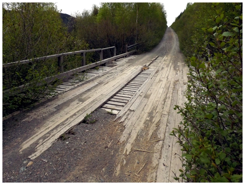
The road would climb away from the river, with steel road barriers so overgrown with vegetation that it was hard to see them. Dicey bridges also started to appear. Thankfully the province is generally on top of inspecting bridges and destroying unsafe ones, so whether that's true or not, it's what I told myself while crawling over and trying to keep the tires on the planks.
I also wondered what used to be back here that warranted having steel road barriers beside the road. Was it just because the hill was so steep and high above Lloyd's River, that you'd tumble down and flip several times before being carried away in the rushing water? This province tends to build safety measures in correlation with usage, so does this road get used much more than I thought?
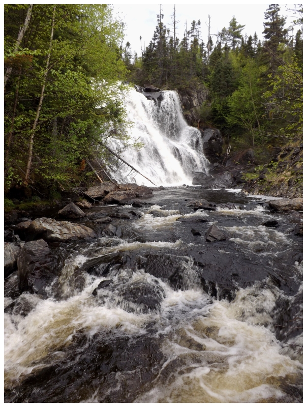
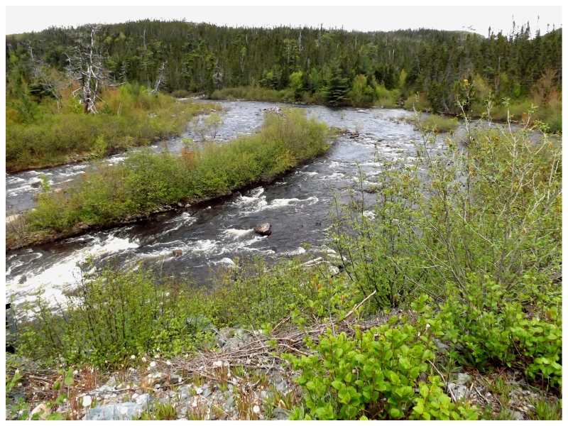
Thankfully, while contemplating all of this and slowing down for the old wooden bridge, dividends were paid as Otter Brook was crossed and a set of falls were noticed.
There seemed to be some sort of path. Surprised that enough people come here to make a path, I sidled down the embankment to the marshy land below. Hopping from rock to rock while mashing alders away from my face, I precariously balanced and tried not to fall in Otter Brook itself (and subsequently become more familiar with the wooden bridge and Lloyd's River).
The water rushed as I inched out on to rocks closer to the centre of Otter Brook. Snapping a few pictures and then crouching to rest, I was infatuated with the obscurity of these falls. To go about counting waterfalls in Newfoundland would be a long journey in only counting the famous ones, so to go out of your way to drive the Buchans road and find Otter Brook Falls? A waterfall I can only find one picture of online? I loved the obscurity and uncharted state of it.
The road would push northward slightly, moving to a point where you could see Lloyd's River but you weren't right next to it. Vegetation crept closer and the road narrowed, making one thankful for the very few other people traveling this road. For the most part, it was only side-by-sides - there like beefier golf carts - that zoomed behind the car or rounded the corner up ahead; and even with those, there were only a handful over this entire journey.
They also served as a wake-up call where you imagined yourself so far off the map, so alone & so out there. You'd park the car to take in your surroundings and take a break from navigating potholes for hours on end, only to let your mind wander before having to move the car because some of the b'ys were up ahead.
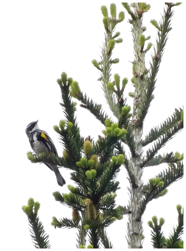
Yellow-rumped warbler.
The road would change again as it dipped down and turned into a causeway between a pond and the rushing river. One slot had recently washed out and after getting out of the car and accessing the situation - while praying that the car didn't have to be turned around after two hours of driving - it was deemed acceptable and the car shot down and out of the depression.
Onward!
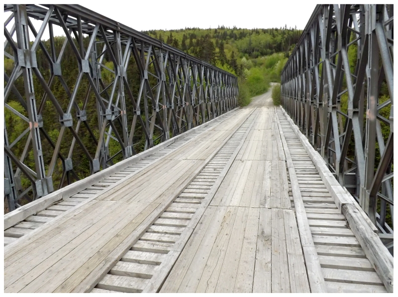
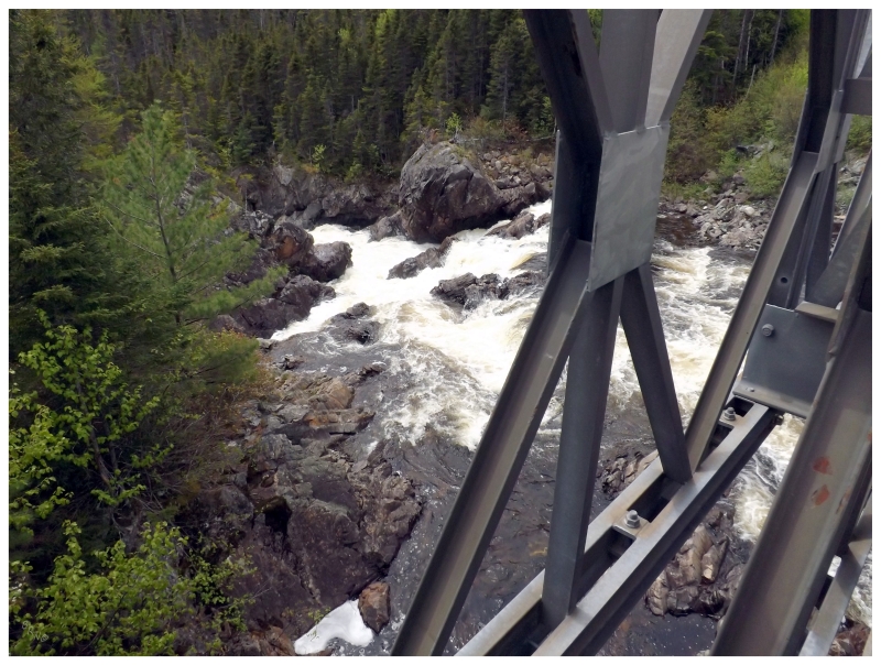
Passing an outfitters camp set beside a well-maintained road, I noticed a sizable bridge over Lloyd's River and parked at the fork to investigate. A handful of cars were parked here - giant SUVs with New York license plates - surely on quite the adventure of their lifetime, to have driven up here and find themselves out fishing or hunting in the Newfoundland wilderness.
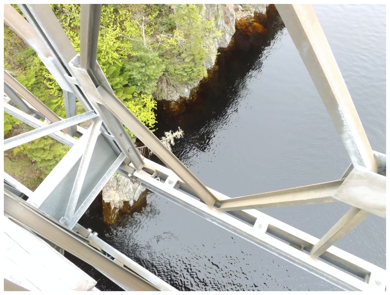
Wandering down their well-maintained road, I rounded the corner and scurried up an incline onto a bridge, where I was shocked by how far above Lloyd's River I suddenly found myself. In addition, there aren't that many easily accessible steel bridges here in Newfoundland, so I had more of that affection for the things you rarely find here.
The road ahead looked well maintained and easily drivable, and of course with my nature, even though I already had my hands full, I wondered about where it went and what secrets it held to the south of Lloyd's River.
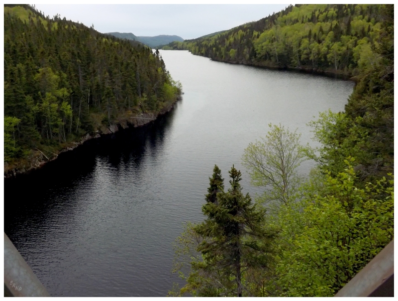
Looking northeast from the Lloyd's River Bridge, this was just about at the point where it opens up into Red Indian Lake.
It was a shame it was such an overcast day or that it wasn't autumn, but I could also have 1000 mosquitoes attacking me, so things could have been better, or indeed they could have been worse.
The second division of the road would come near the Star River Hydroelectric Station, as Red Indian Lake was now visible, while roads curled in various directions and vegetation was no longer scraping the side of the car.
I would have loved to drive the 1200 m (3/4 mi) to the north to see the Star Lake Dam, but I only figured out why all of these manicured roads existed once I arrived home. Bah!
Once the onward route was determined from all of the choices at Star River, another sizable bridge existed to reverse portage our vehicle across the falls at Star River.
Now throughout this trip, I had been doing all of this after having pulled tendons in my foot a couple of days earlier. Whenever I'd step out of the car for bird, waterfall or scenery pictures, I leaned against it and hopped into position. So here, while trying to get a better shot of the Star River Falls, I found myself tangled in the bridge supports, pants riding up, tensor bandage showing, as my appendages stretched for balance and new footholds above the rocks and white water. My left foot was about as good as useless by itself, so there was more butt scuttling and shimmying than there really should've been.
An Astro Van passed over the bridge as I was on all fours trying to get upright; and while comical to me, they didn't even look.
The Star River.
Crossing over the Star River would mark the third division of this drive. The land flattened out slightly, with more trees near the road and cottages and camps along Red Indian Lake. The only reason this part had any level of difficulty is that I truly underestimated how long it would take to drive the Buchans road. All of the water in the car was consumed, coffees were long gone and stomachs rumbled in anticipation of lunch. Truly a first world problem of a couple hours without amenities, but regardless, it led to speeding along this section more so than the other divisions.
The part that helped with speeding was that this roadway was much better maintained. Bridges were in better upkeep, trees were trimmed further back and the road wasn't a washboard. This section felt more like driving to the town of Gallants near Corner Brook, or any other time I've taken a woods road for a few kilometers, passed numerous cabins and casually came to whatever I was searching for.
Indeed, this section of road from Buchans to Star River has always been the best section of the Buchans road, as it was built in the 1960s as a secondary access road - allowing access for logging, recreation, mining and hydroelectric development. It was with the construction of this road that the province actually considered turning this Buchans woods road into a provincial class highway, where those coming from Burgeo or Port-Aux-Basques wouldn't have to go all the way through Corner Brook, Deer Lake and Green Bay to reach Badger.
What an interesting development that would have been to have the choice of two routes when driving across the island!
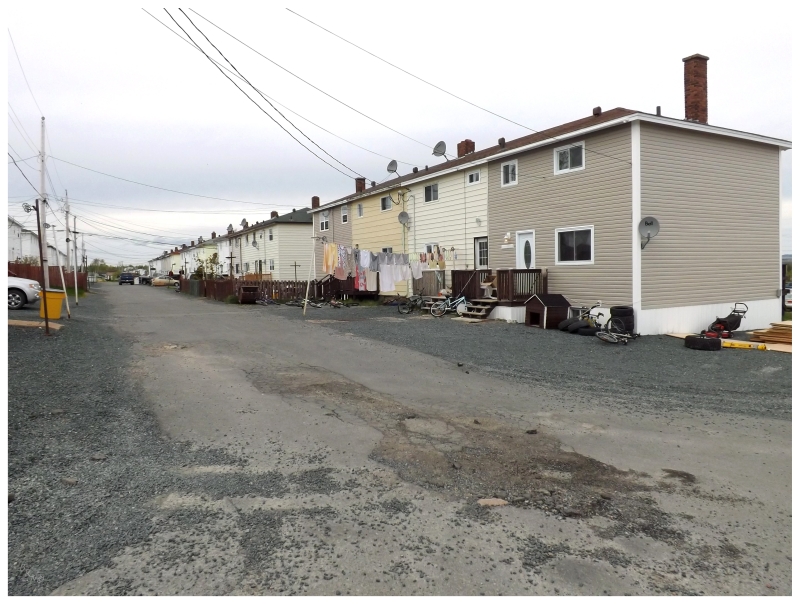
Housing in Buchans.
Anyway, as a wizard of navigation, I rarely, if ever, make a wrong turn; but after one last push through exposed rocks and thick mud, I came to the NL-370 paved highway between Buchans & Badger. Turning right onto the road, it was an unreal feeling to finally roll smoothly and quietly after 4 hours of bouncing around the backcountry.
Driving for a few minutes in a state of bliss and satisfaction, I couldn't believe how far along the woods road had spit the car outside of Buchans. How was it this far along the highway?!
It was with this, that I noticed a familiar landmark and realized I was traveling away from Buchans. The woods road had scrambled my brain to such an extent that I didn't know which way was up (or in this case, west).
Finally finding myself in the mining company town of Buchans, it was time for lunch at a surprisingly good diner, followed by a drive around the interesting community.
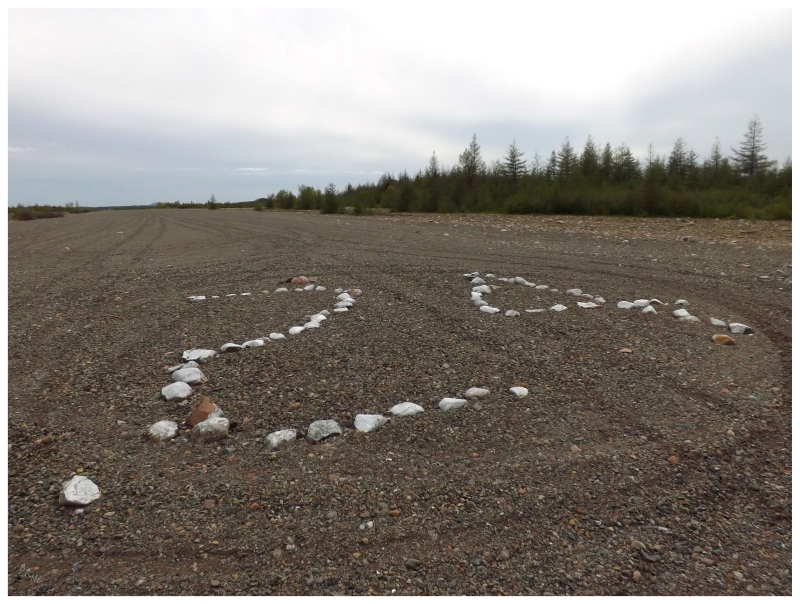
Since I hadn't had enough of driving on rough roads today, I finally went about seeking out the Buchans 'Airport', which I'd always wondered about after seeing it labeled as abandoned on maps.
After bouncing around on the rough backroads of Buchans, which were maybe worse than most of the woods road today, I popped out onto the smooth airstrip. An airport this was not, and it certainly wasn't abandoned either.
The airstrip number was displayed with rocks on the unpaved ground, something I'd never seen while visiting the various airstrips of this island.
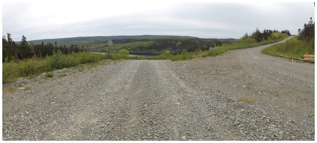
Speaking of not having enough of rough roads, as I was already in Buchans and about to drive the NL-370 out to Badger, I figured I'd go south at Millertown and explore the state of the woods roads which extend into the dead centre of this island.
If I'd now driven the Buchans road, going south at Millertown into the real uncharted, backcountry of this island would have to be next on the list.
The day was growing into the evening, but a small sample of the quality of this road was desired...
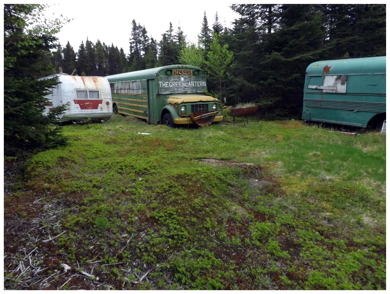
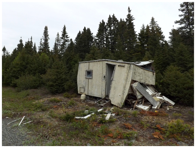
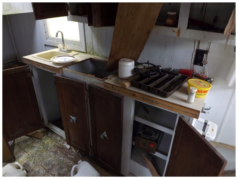
The cabins along this road were much more apparent. Be it the lack of forest cover or how this road dipped towards the lakes and ponds, there wasn't much driving to be done without seeing yet another backcountry abode.
I couldn't help myself. Elite exploring near Lake Ambrose b'y.
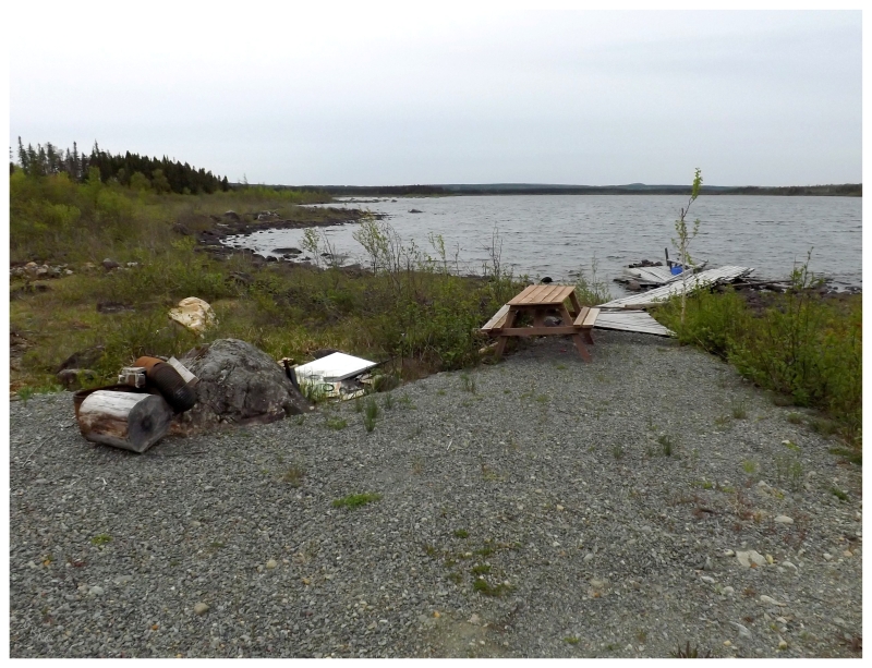
Once a bit of driving was done along Lake Ambrose's northern shore, I waited until there was another section near the road and let it mark my southernmost point, after driving about 30km (18mi) south of Millertown.
The above shot isn't the best picture by any stretch of the imagination, but enough to show that I've dabbled into more of the interior of this island.
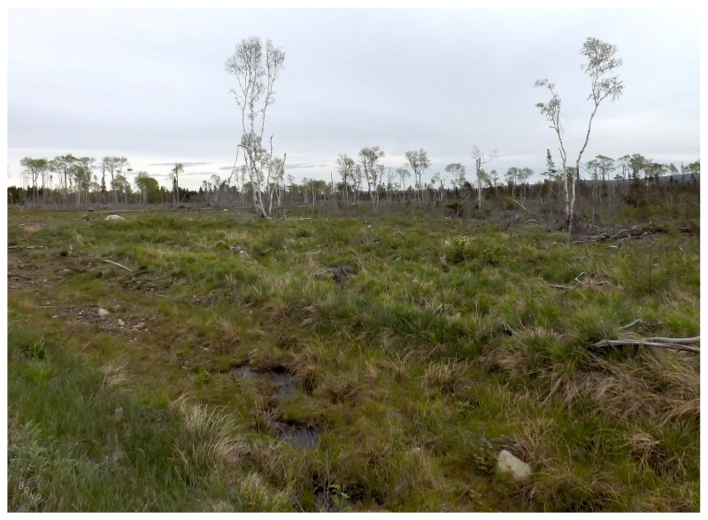
Deforested land about 10km (6mi) into the road.
I would have loved to continue with this progress and explore further into the backcountry, but I was utterly unprepared since I went into this day knowing I'd drive home from Badger in the dark.
That being said, the road quality here was more than agreeable. The future will hold further exploration of this area 280km (175mi) from home.