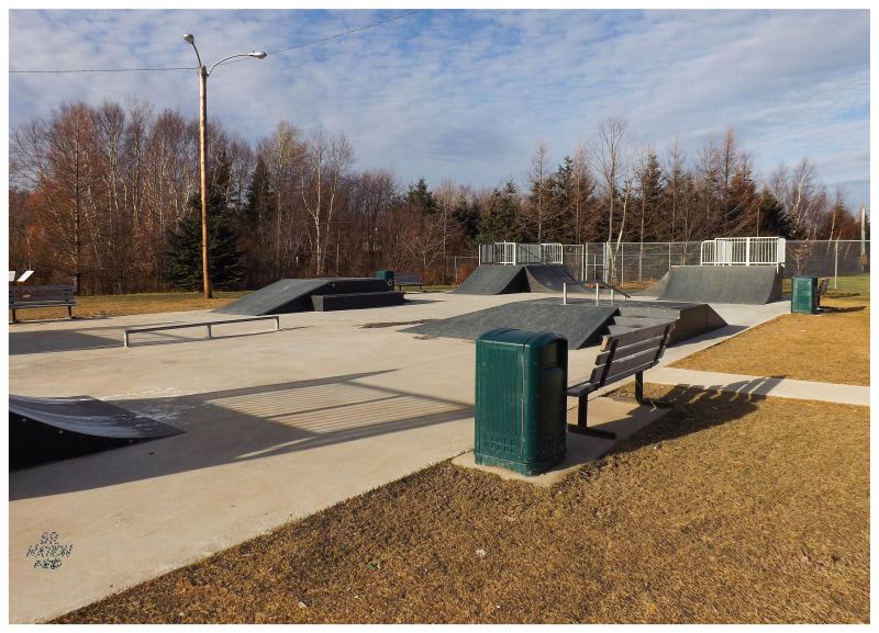
Winter coming to Corner Brook also brings a window to visit nearby towns not yet inundated with snow. It usually comes down to driving 2 hours south to Port-aux-Basques or 2 hours east to Grand Falls, two places which always seem to have shorter winters than us. Since Port-aux-Basques is still in the talking phase of replacing their worn collection of four wooden ramps, I headed to Grand Falls-Windsor to spend gas and food money there instead. There was snow for 90% of the drive, to the point where I wondered if I somehow messed up the Highway Camera website, but thankfully the snow tapered off at Badger. Now the only thing I had to contend with was a minor layer of frost on the shadowy side of the ramps. Scraping that off, the ramps were now warm enough to not land everything in front tire slide and I was happy to be enjoying myself in December, something I find very difficult back where I live. |
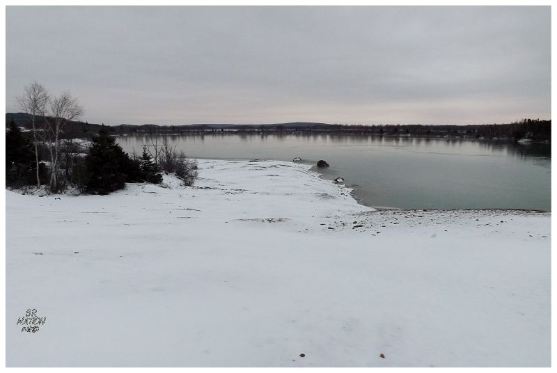
I wasn't going to be at the skatepark all day, especially when it was only a few degrees above freezing. After sitting down for lunch, it was time to head back as the short length of this December day was sneaking up on me. Driving home I passed this mining site I marked on Google Earth and left unvisited for years, especially considering that it's along the Corner Brook-Grand Falls corridor that I must've driven 75 times by now. There's a 5km cabin road leading into Gullbridge, maintained to allow access to the old mine and private cabins amongst the birches that line Great Gull Lake. The cabins weren't gaudy, but well-maintained & seemed to have been around for a while. I almost stopped to photograph them, but the sky was grey & cabins dark down in the trees. |
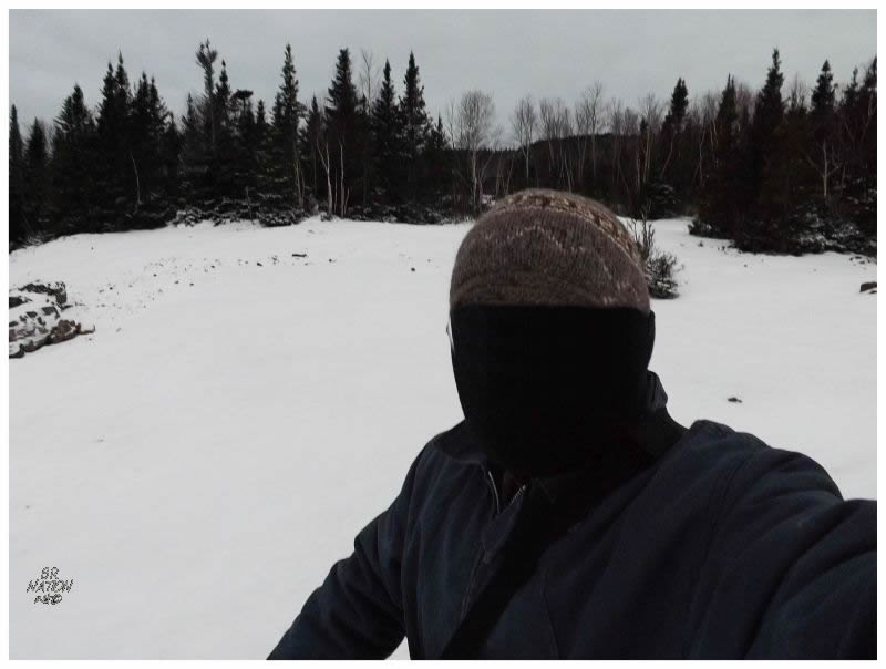
I put the car into park near the end of the 5km mine road, unable to tell if it was a road up ahead or a snow filled ditch. I could see the trademark moonscape left by clearing a hole in the Earth to extract minerals, so I pulled my mountain bike out of the car and donned my winter gear to explore what was left. |
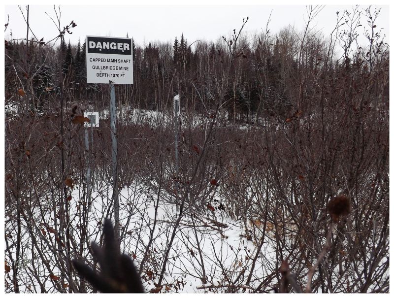
The mining promise of this area was discovered around the same time as Buchans in 1905. Gullbridge wouldn't be developed to the same extent as Buchans, the site here having underground workings built by the Great Gull Lake Mining Company in 1918, but then sitting unmolested until the 1960s. It was with a Smallwood-backed 1951 aeromagnetic survey that the site was mapped better, where mining development was then encouraged and started in 1967. Mining activity here would only last until 1971, producing 2.8 million tonnes of copper ore in its time. In 1999, demolition removed the old surface buildings and the sealing of shafts removed access to the underground. It wasn't very long after I parked my car that I found the sealed shaft that led 1070ft down to bottom of Gullbridge Mine. The surface was now choked with alders, which I had to fight through to even get to the warning sign. |
In 2012 Gullbridge became known to people other than random weirdos who study topographic maps & read old mining guides. This is because the tailings dam had failed and water leaked through the earthen bank towards the water body of South Brook. This river flows from here towards Halls Bay, passing the village of South Brook along the way; a village which acquires its water from underground wells. A water order was issued and the wells were tested, while bottled water was brought in & the town ordered its residents not to use the tap water at all. Eventually the dam would be fixed after a few chilly December days; the South Brook water and a nearby salmon river seemingly no worse for wear. The tap water came back from its testing without any elevated levels of whatever minerals you would find at Gullbridge. During my visit, I didn't understand where the tailings pond or dam was, after thinking that it would be obvious in person. Of course I stood near the shores of Great Gull Lake, with a seemingly manmade bank making a pond before me, but apparently the tailings pond and South Brook were about 1.8km (1.1mi) to the west. This was just another pond with a manmade bank. |
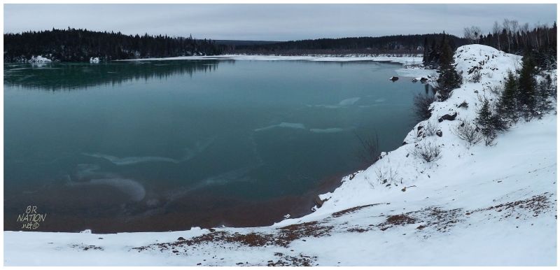
There were a couple of trail options and instead of the wide roadway, I went with the one that was more like an ATV trail, leading south, further from the TCH. This trail would curve into Great Gull Lake at a point further south. |
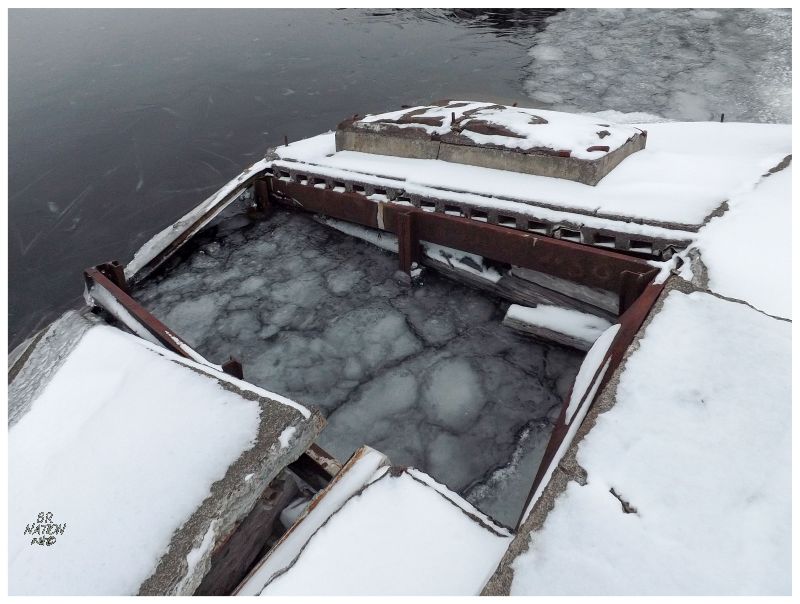
Some sort of dock stood on the edge of the lake, but the snow & ice didn't do me any favours in examining it. The trail I was on had a few offshoots and some metal junk here & there, leading me to believe maybe I was on the hot trail of something. |
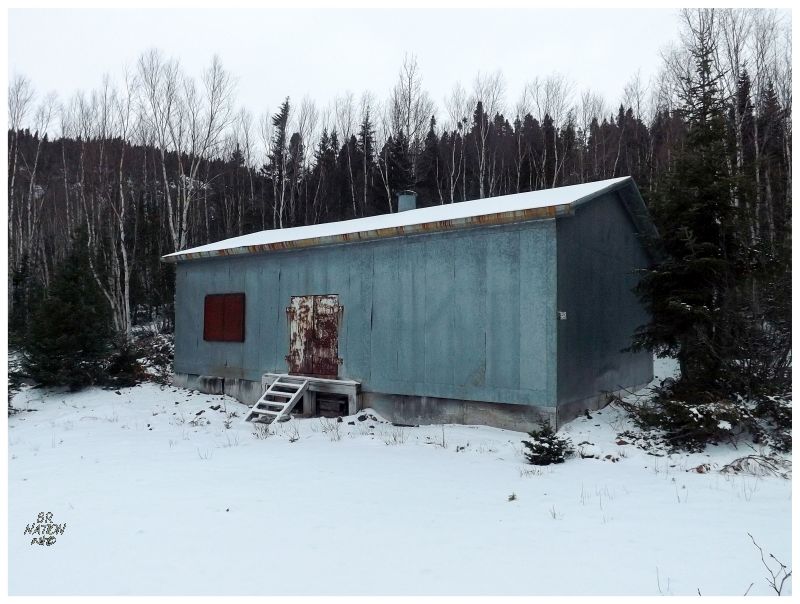
The one thing I found on the south end of the Gullbridge property was this weird cabin - encountering a building sealed in sheet metal for the first time in my life. The stairs had a little space that maybe you could squeeze underneath, so getting onto my knees, I stuck my head into the hole and found that the base of this building looked like every other Newfoundland building built on a dirt foundation. Looking at the floor, there didn't seem to be any way to crawl up inside. It was also intimidating as to what hazard was inside for this building to be sealed so well. The heavy, metal doors and welded window covering did nothing to alleviate my concerns of shafts or toxic heavy metals. |
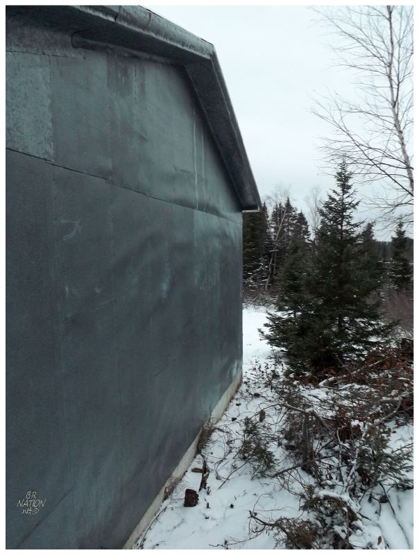
Yep, looks like she's sealed alright. |
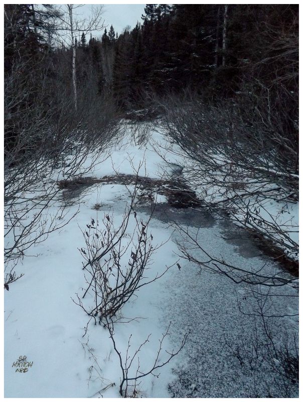
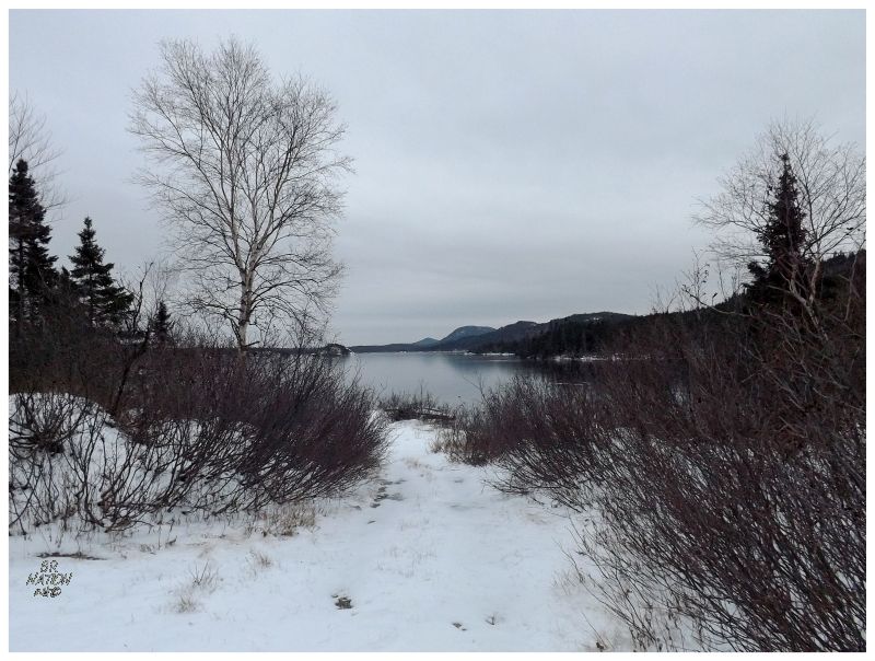
Now that I was out in this overcast, gloomy wilderness, it wasn't as if I'd see the sun set, but the fading light indicated that it was getting near that time. Even in the short time I had walked down here - the trail was too wet and sloppy for my bike - it was growing darker & a small tinge of urgency came towards needing to get back to the car. The trail I was on had split into two options: down to the lake or further alongside the south side. It's this south side trail that I hurried down, but eventually fallen trees and half-frozen puddles led me to give up on finding anything down here. (Looking at Google Earth, it looks like it's nothing but an old ATV trail.) |
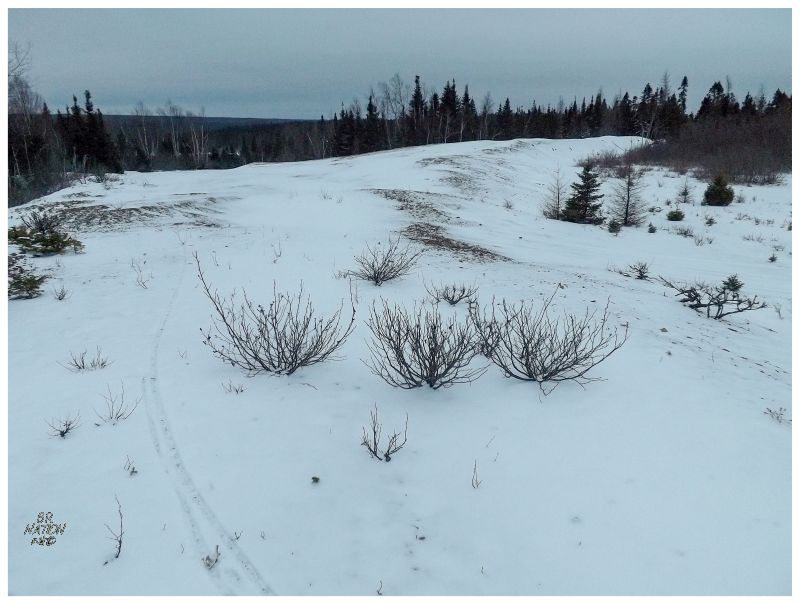
Retrieving my bike, I meandered slightly to the west into what looked like a gravel pit. My bike tires revealed poor rock and a lack of vegetation as I rode on top of the ridge. |
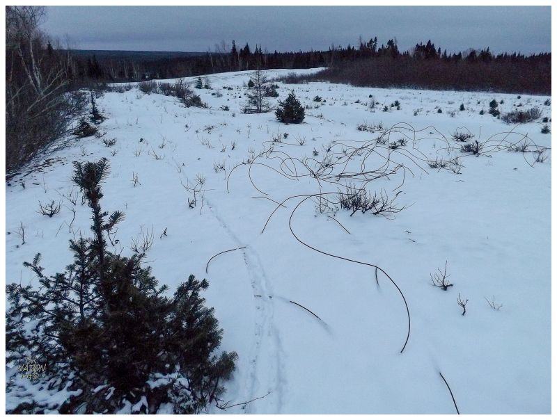
There were bits of metal wire & mining implements around, but time was running out and snow covered much of the hillside and depressions. Winter was closing in & Newfoundland doesn't have much for ruins that still hold prominence amongst abysmal volumes of snow. I obviously write this site about 1.5 years after doing these things, but I haven't since been back to Gullbridge (July 2016). Not finding much on this day, I don't feel any great desire to head back, although I thought the spot where I parked my car would make a decent stealth camping spot. The only problem is that it's so close to home (1.5 hours), that I rarely need a campsite in this area. Oh well. It's usually worthwhile to check out a lead towards something you might want to see, even if there ends up being nothing out there. If anything, it adds to my map of where I've been in this province. |