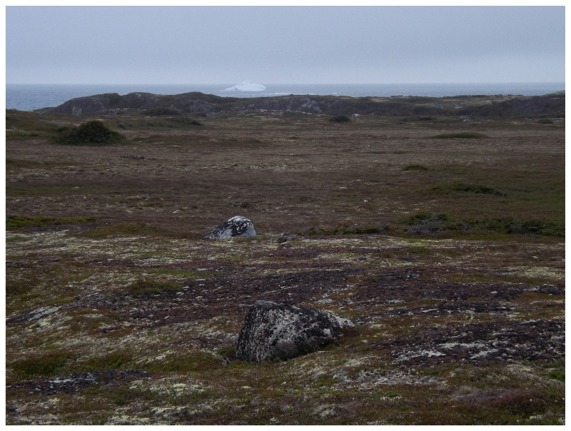
After dinner a few drinks were consumed in the cabin, but as light faded and the time came for what to do in terms of candles or flashlights, we went outside with the flashlights instead. On a cloudy night like this there wasn't going to be a sunset or any sea of stars, but climbing a ridge behind the cabin, it was still satisfying to sit here as darkness consumed the island. Climbing up on this ridge also allowed us to see an iceberg off the western side of the island. Peckford Island isn't so flat that you can see clear across the island from anywhere, so it was a bit of a surprise that climbing up here revealed an iceberg invisible from Japhets Cove. |
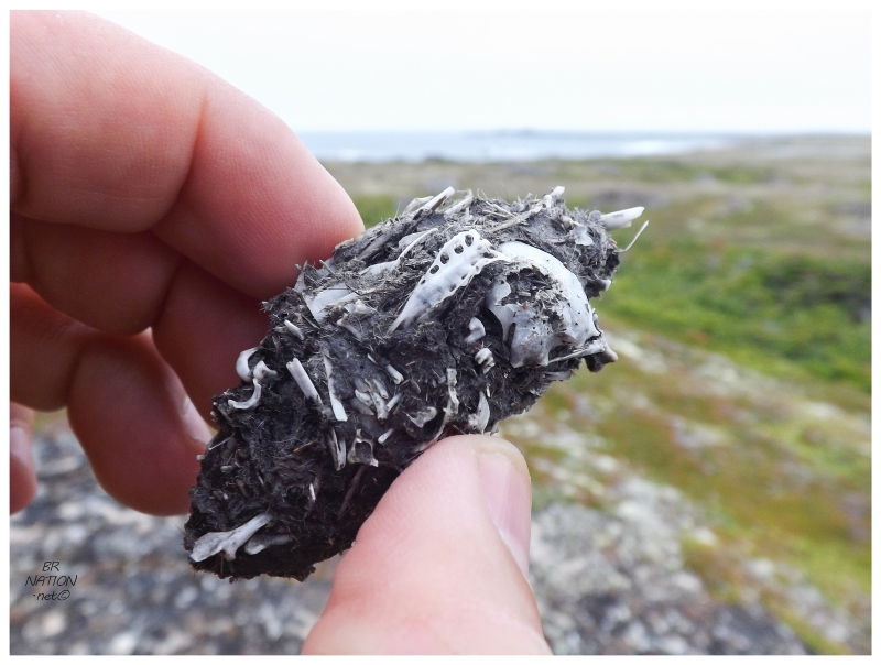
Sitting atop the rough, licheny ridge, one of us looked down and found a glob of bones and feathers – an owl pellet! It's these masses that owls will regurgitate about 6-10 hours after consuming things like shrews, voles & mice. (This was a total learning experience for me, I'd never even heard of an owl pellet before.) The landscape here on Peckford Island seemed like a good place to see owls, but these pellets were the only indication of their presence. Owls were here at one time, but not this evening. |
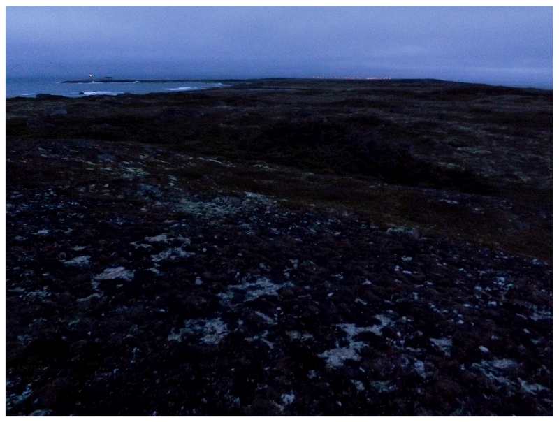
The illuminated lighthouse was the first nighttime change as the glaucous evening dissipated. As my eyes continued to adjust to the darkness, the lights of Musgrave Harbour were the next thing I noticed. The nearby settlement and its civilization felt closer than it had at any point of the exploratory afternoon. It was only a few minutes later that I looked behind me and noticed the light of the Offer Wadham Island Lighthouse out to the northwest. I savoured being this far out, allowed to see Offer Wadham's light even further out. It reminded me of being on the shore of the main island of Newfoundland, looking out at some distant lighthouse I hadn't yet explored. Of course it's not the 1858 lighthouse shining out there anymore, but rather the modern skeleton tower. Regardless of that, I was ecstatic about being able to see the flashing light & continuing to see it into the next couple of relaxing hours out here. |
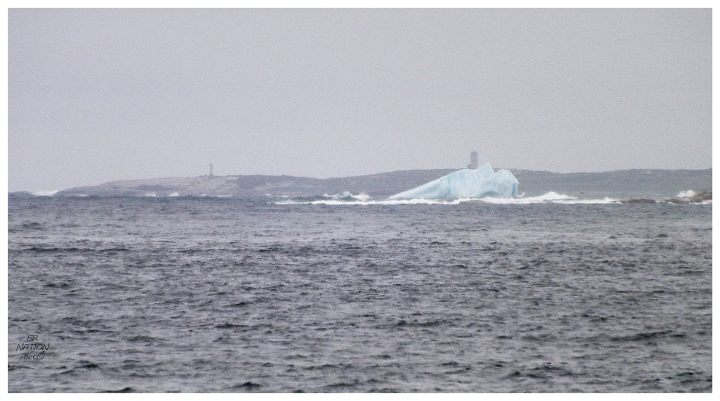
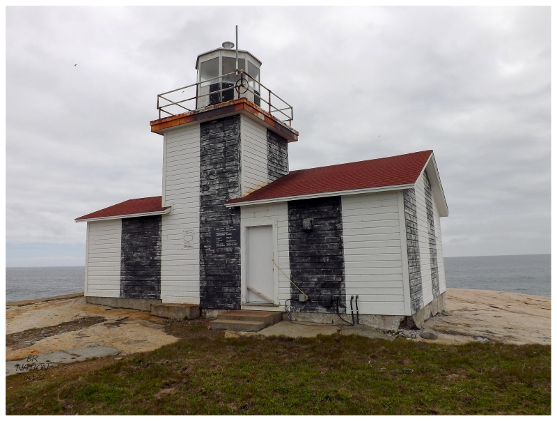
I'm not sure why I didn't think about how Offer Wadham Island's light would be visible once night fell. This is despite the fact that you could see the old concrete-encased lighthouse as soon as you landed on Peckford Island. It wasn't as close as this fully zoomed-in picture from the northern shore would make you believe, but it was still easily visible to the naked eye. |
The next day, Darren knew that the weather would get better and therefore the plan was to come get us in the afternoon to give us more time under sunny skies. In fact, the forecast was so good that Darren double-checked to make sure that we didn't want to stay out here another day – which of course held its appeal, but we also didn't want to risk getting stuck out here and having to call into work the next day. We would stick with the initial plan of only coming out here for 1 night. |
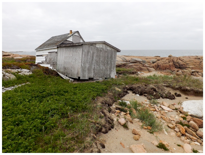
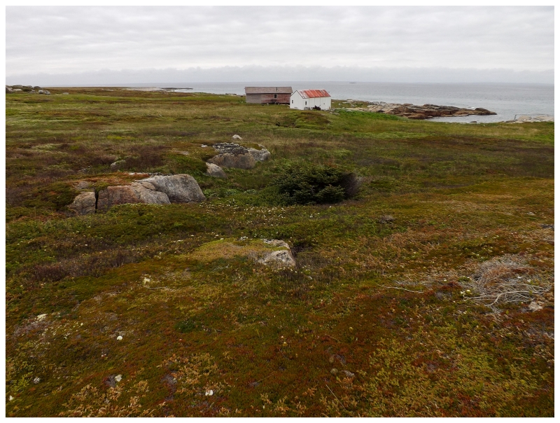
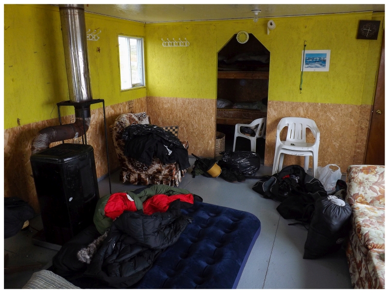
Making sure to get up relatively early to explore the island, the first thing involved stepping into this abandoned cabin that at one time looked quite cozy. There was a soft old couch, sleeping nook up in the attic and a small kitchen to one end of the first floor. It wasn't very hard to picture a group of friends or a family out here enjoying the tranquility of Peckford Island on a nice, summer's day. That is, until Hurricane Igor came along and the sea rushed higher than these cabin owners ever anticipated. There were a couple of other cabins that looked a little rough, but this particular cabin had part of its front ripped off, while also being knocked onto an angle with washed out floor supports. |
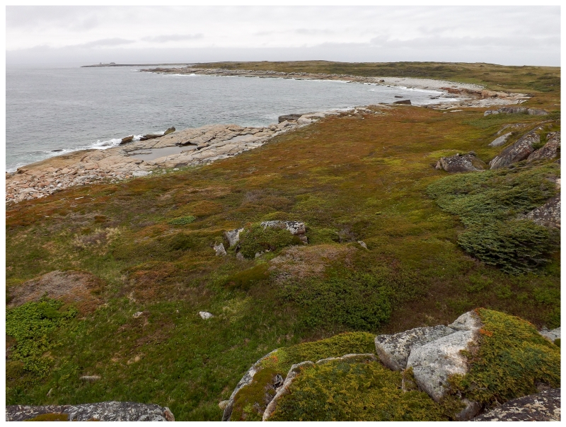
Passing the Igor cabin, I continued north as I wanted to walk the entire shore of the island today (about 7km/4.5mi). On the east side of the island, I found some rock faces and elevation gains that provided a good view back towards the lighthouse, although it wasn't high enough to see the cabins at Japhets Cove. As these were the first substantial hills I found on Peckford Island, I clearly had to climb through the trees and crevasses to get to the view up top. |
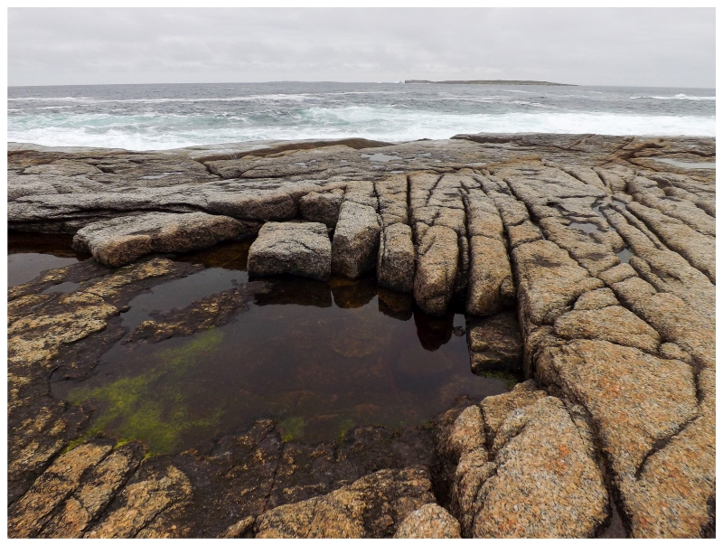
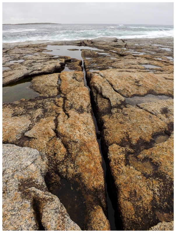
I also had to climb some of the stacked rocks to get around Rocky Cove, but then the north side of the island was one giant slab of angular granite dipping down into the ocean; making for excellent walking on the sprawling, flat stone. The only problem was the need to pay attention and watch for slots or missing rocks, which I then had to pick my way around. Since I didn't know how much bushwhacking or rock climbing would be involved this morning, my friend hadn't came along for this hike. Standing here alone with only the sound of waves breaking on different points of rock, I felt the isolation of being this far out in the Atlantic looking out towards the old world instead of back to close by civilization. |
After feeling isolated and small out on these rocks, it was interesting to read later that these very shores meant quite a bit to a sailing crew back in the 1970s. In 1976, historical explorer Tim Severin started work on his goal to refollow the path of Saint Brendan the Abbot. Saint Brendan is referenced in the text The Voyage of St. Brendan the Abbot, as possibly having sailed an Irish currach from Ireland to Newfoundland and back over 7 years sometime in his 489-583 AD lifetime. Severin started by using traditional tools to build his 36-foot long Irish currach with oak and ash wood framing, ox hides stretched over the frame for buoyancy and then everything sealed with wool grease. Departing in May of 1976, Severin and his crew stopped in the Scottish Herbrides and then Iceland, before reaching this Peckford Island shore in June of 1977. If you look at an aerial view of the Wadhams, it's funny that they happened to land on Peckford Island when their transatlantic path could have dropped them on any of the seven islands. I guess it's good they landed on the island that still had residents (the lightkeepers). |
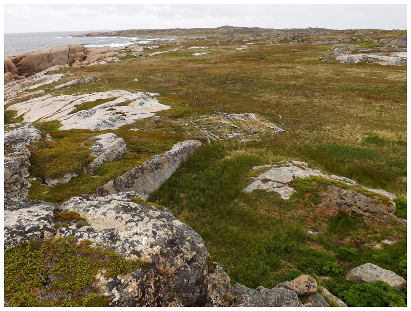
Making a southern turn down the western shore, I don't know what deep recess of my mind regurgitated this fact, but somehow I remembered Mike posting about the remains of an old house out here. Immediately looking around and taking care to climb rocks to acquire better views, it wasn't 5 minutes later that I found the same foundation remains he mentions. I don't remember going down there to examine the foundation ruins though – something that now strikes me as odd. |
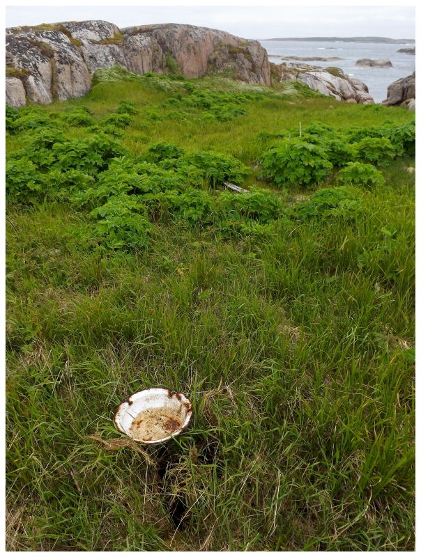
A chamber pot along the way.
The stages and shacks of Peckford Island fishermen were mostly a pre-confederation (1949) thing. The Newfoundland Encyclopedia says that many of the people who came up from Bonavista to build summer camps here would eventually settle in Doting Cove (now part of Musgrave Harbour). With longliners and speedboats coming along and in use in the fishery, there was no longer a need for people to stay out here. The Newfoundland Encyclopedia finishes by saying that since confederation, "only a few fishermen have kept shacks and premises on Peckford's Island." (This quote is in volume 5, which was published in 1994.) |
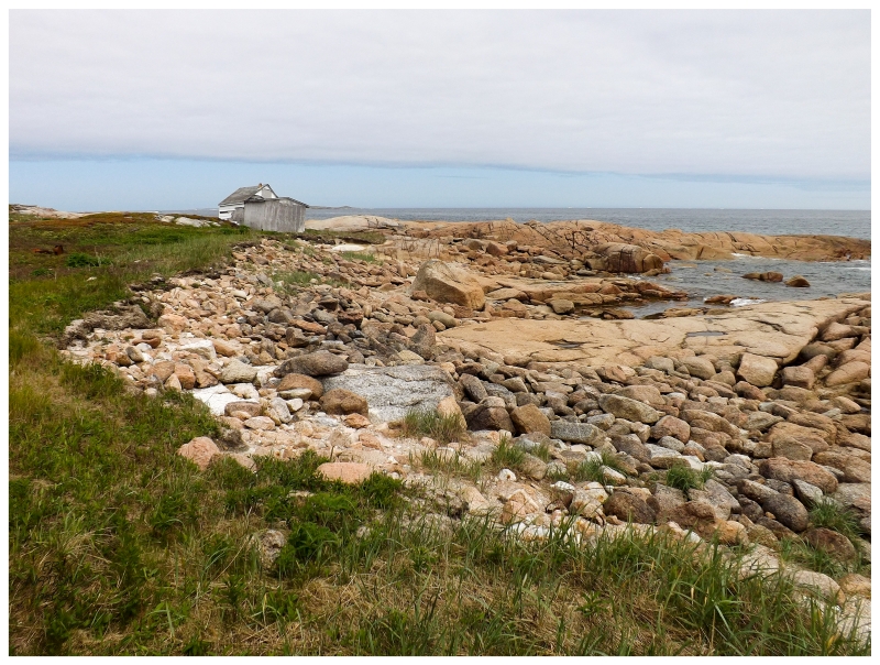
The western side of the island had more coves and headlands to contend with, with even a little sandy beach to the south of one rock wall. Continuing along, I made my way up yet another small hill to excitedly find this cabin and shed at Cuffs Cove. I say excitedly because I'm a sucker for a remote cabin. Although in this case, this was more enjoyment of the solitude and bits of human traces out here, without getting much of a decent picture. |
There isn't much more to Peckford Island once you leave Cuffs Cove and hit the southern shore. There was a small bog along the way, but before I knew it I was back at the lighthouse. |
The comedy wasn't lost on me that just as it was time to get back and pack everything up, the sky was starting to clear and the sun was off in the distance. Regardless of the weather today, our time here had been too short. |
I couldn't believe the line break in the clouds off in the horizon just as we were walking out on the rocks to load the stuff up in the boat. I shouldn't complain though. It was a fantastic privilege to come out here & it was a much easier boat loading operation with these calm conditions. |
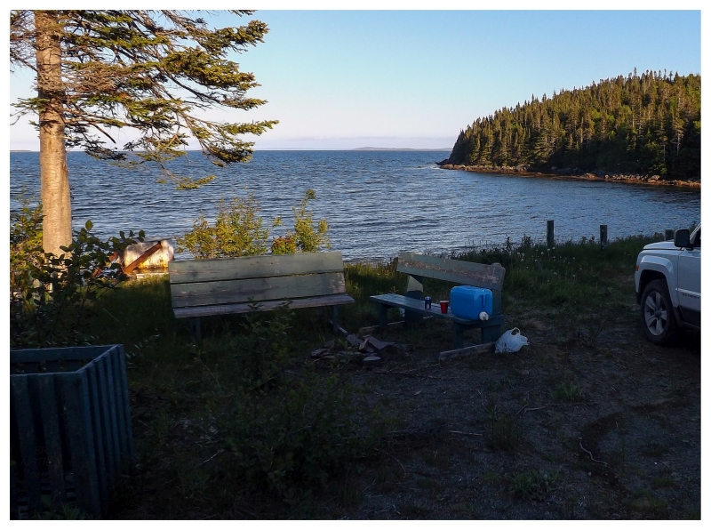
The thing was that, yes we were scared of missing work the next day by being stuck on Peckford Island, but I was also hoping to get another thing done this weekend. Unfortunately that relied on a ferry & calling the tour operator in Fogo, there was no way to go do that thing, then catch the ferry, then get back to Corner Brook at any reasonable hour. So after leaving Peckford Island, when it would have cost the same amount of money to stay another night, we didn't even end up going to Fogo Island for this other thing. At least life threw us a bone here, because after going for a short walk in the area of the Fogo ferry, there was a rundown road and an open gate leading down into the woods. Turning down this road, we found a small abandoned municipal park/camp! Going back to get the vehicle, this stealth camp spot would be a hell of a lot nicer than the gravel pits or woods roads I knew of on the way back to Gander. A nice little cove with not another soul around, some cold beer and a stove for warm dinner. This wasn't the worst consolation and this abandoned camp actually still holds its own in the "best stealth camp spot" discussion. |
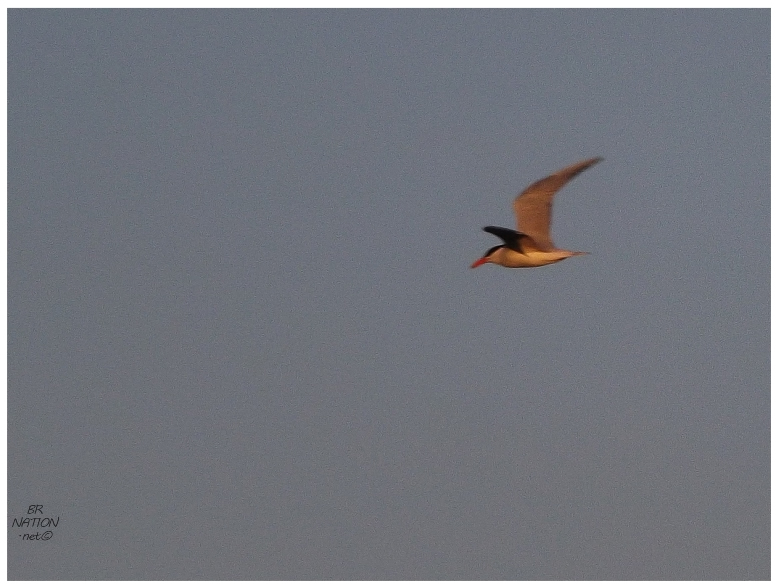
Hearing a strange noise, my friend was the first to notice and point out that the nearby tern looked bigger than usual. Instead of the more common Arctic & Common Terns seen around here, once the bird got closer even I was able to see the size difference and know that it was a Caspian Tern. (A bird I can't recall seeing before!) The tern would make a couple of passes over our cove throughout the evening. There aren't that many breeding locations for Caspian Terns in Newfoundland, but one of them is in the Gander Bay area where maybe this fellow originated. |
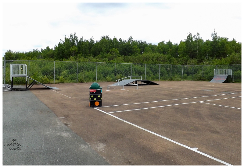
Later in the summer we'd come back for that Fogo thing, but stopping to ride the new Lewisporte skatepark the next morning, we wouldn't ever be coming back for this. The one thing it provided was a laugh because of the distance between the ramps, "hey, we have a whole tennis court here, why are we putting the ramps so close, am I right?" (Ramps should be closer so you keep your speed and shorten the time you use the ramps so more people can use them.) From Lewisporte, we'd get back to Corner Brook at a reasonable evening hour. |