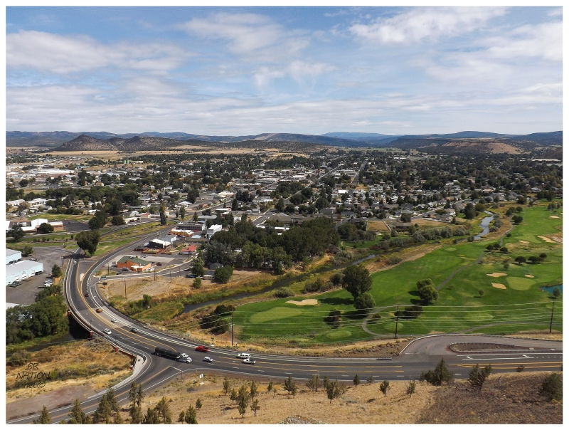
A view of Redmond, where we stopped for coffee.
As Crater Lake is on the eastern edge of the Cascades, it didn't take very long to get away from the mountains. Even as we went mostly north but only slightly west, the mountains moved into the distance, forest appeared, and then an arid landscape took over. In the first couple of hours we went through the three city collection of Bend, Redmond and Prineville. Bend had some decent biking spots, adventures and scenery that made me think about stopping, but today was a full day. Skipping promising places and adventures would be a constant throughout this trip. There's just so much to see and do in the Beaver State. |
At Prineville, I could tell the road ahead dipped down while also noticing a roadside overlook park. Pulling into the parking lot, Prineville's setting provided a nice view over the county seat of Crook County. |
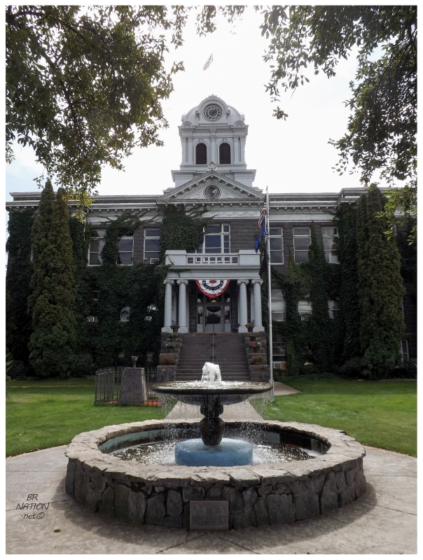
Driving into Prineville, there were old, roadside motels along the strip, along with diners, more elaborate food options and a few taverns. This was the type of town I pictured staying at for my central Oregon day, but alas it was only 11am. In addition to all of those great things along the main street, Prineville's Crook County Courthouse was located right where it belongs: at or very close to the centre of downtown. |
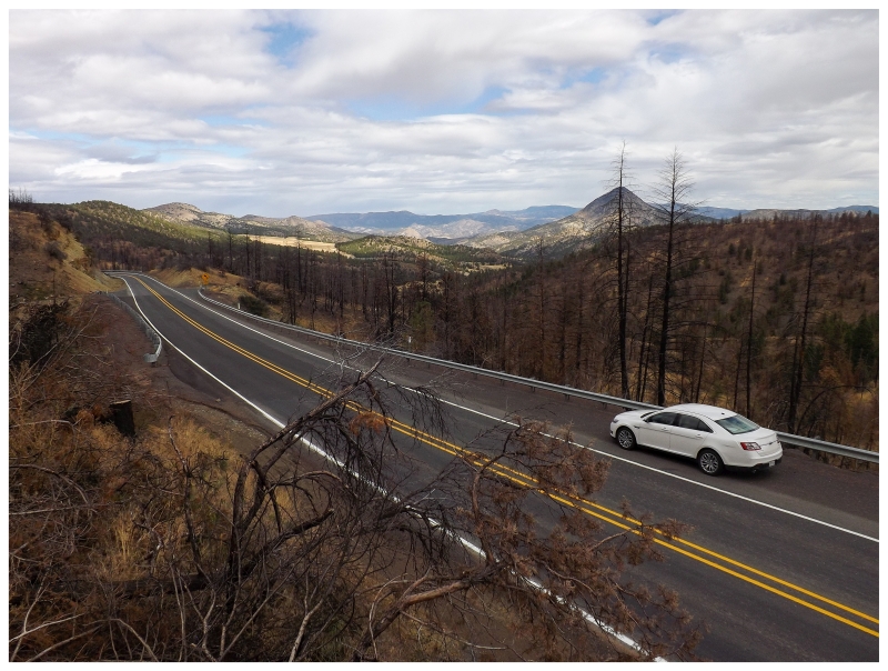
We'd been heading west since Redmond, and now that we left Prineville, we were away from any settlements and into the Ochoco National Forest. This Ochoco Highway brought us through high desert areas with gentle, sparsely treed hills of pine. Some of the areas had suffered from a forest fire, which I found beautiful enough to stop the car, scale a hill and snap a few pictures. |
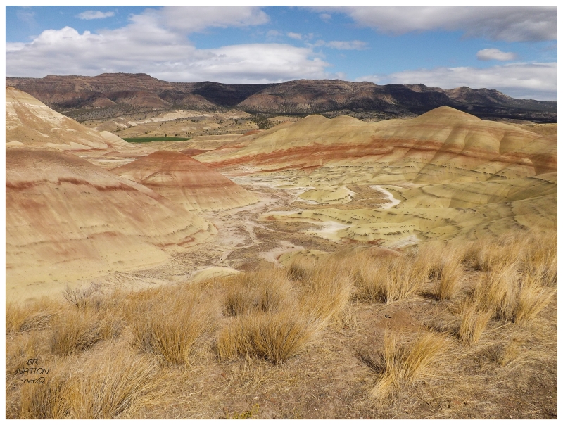
Leaving behind the national forest lands, the landscape dehydrated and up ahead was an 8 mile (13km) detour to the Painted Hills. Once there, short paths led into a landscape of black, yellow & red bands. Unfortunately, the light/colours were harsh under the midday sun, as apparently this is a great spot to go for pictures at sunset. I still found it worthwhile & was happy with the stop. |
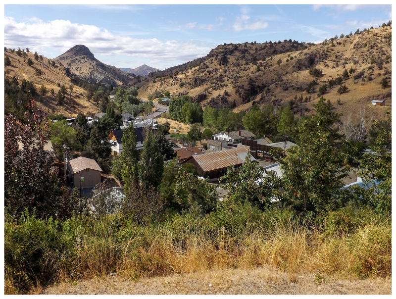
Just up the road we came to the village of Mitchell, with great views over town and weathered buildings along the main street. Now we were getting into the Central/Eastern Oregon that I was excited to see! Needing gas, I parked at a station and questioned its abandoned status while looking around for someone. A woman came out from a nearby building. She opened the store and pumped the gas herself, while talking about how the town was a time capsule because of an old man who'd owned everything; an old man who everyone knew because he still ran the town store late into his years & you'd go inside and find him sleeping on the job. Now that he had passed away, a few things were being renovated. (I'd noticed a couple of dilapidated buildings with people working inside on the drive in.) All of this awesome history - and thinking there wasn't much civilization after Mitchell - led us to grabbing lunch here. Unfortunately this is what doesn't endear my Mitchell memories, as I have trouble forgetting the hour-plus it took for some simple grill items. The restaurant was simply overmatched and it wasn't their fault, but today was a full day with an early September sunset time. I chewed my bottom lip and hoped we could get a move on. |
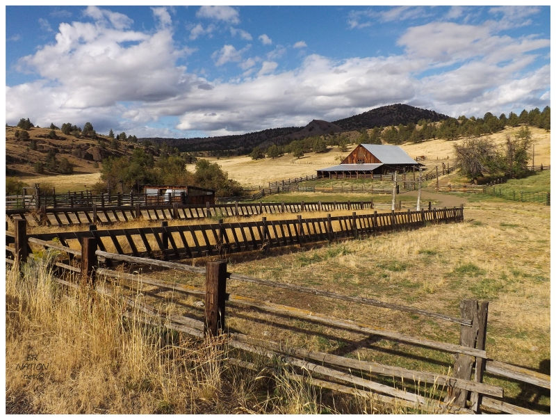
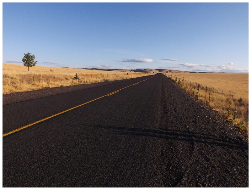
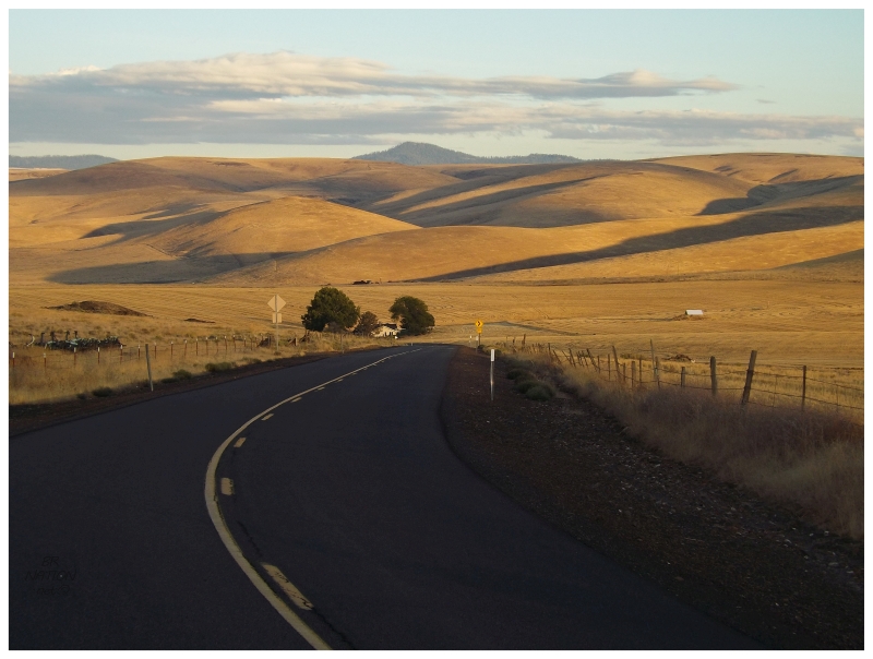
Leaving behind the US-26 at Mitchell, we headed north towards Service Creek. Even with the new concerns about time, I couldn't help but stop at some of the beautiful farms along here. Yellow grasses, dark brown repeating fences and worn farm outbuildings of the same brown colour. All set upon a rolling, golden grassland landscape. I thought this was some of the most gorgeous scenery I'd ever seen. |
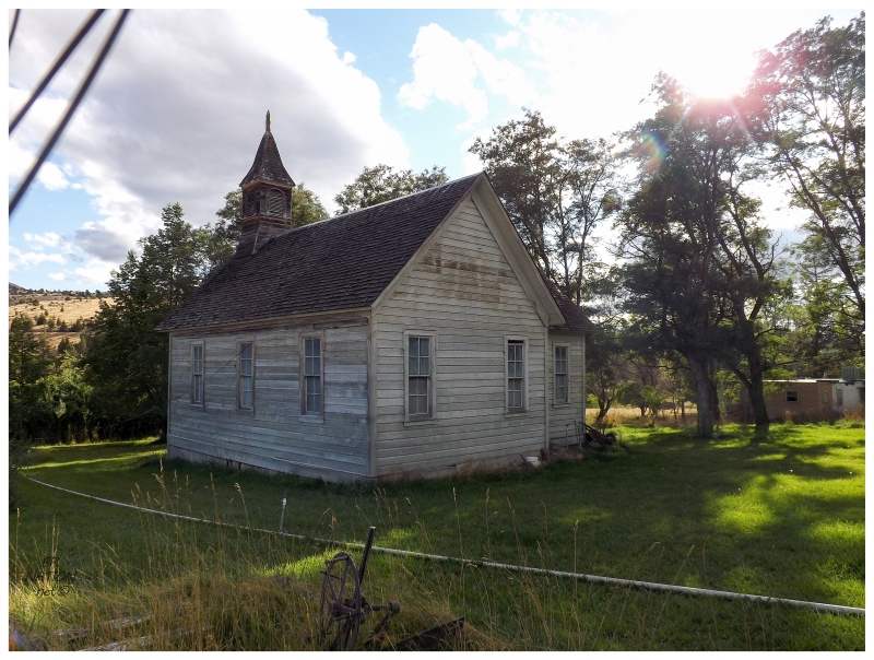
While the Service Creek road was rural enough, a turnoff led to an even more rural road and the "ghost town" of Richmond. As it wasn't very far off the road, I stopped since we were out here. Richmond was one of those ghost towns that appears on lists, but still has people around. There were a few abandoned buildings, but there were also lots of fences and signs indicating private property. |
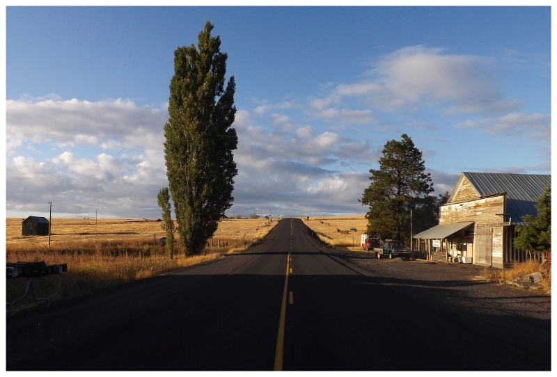
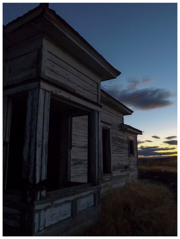
With light fading and my GPS saying we'd arrive right around sunset, I sped past tiny Service Creek & through sizable Spray, in an attempt to get to the ghost town of Hardman before nightfall. All along the road were great campsites and little trails that could eat up days, but I had found Hardman during my pre-trip research & it looked like the most beautiful place that I needed to see. Driving over an hour from Richmond, I pulled out of treed canyons & entered this glowing landscape for only a couple minutes before then reaching Hardman. I was losing my mind at how stunning this area was at this juncture of the day. |
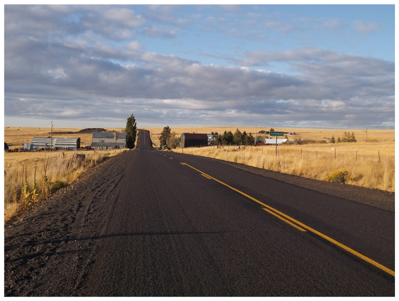
I know I'm supposed to swoon over Mt. Hood or coastal lighthouses or Multnomah Falls or Crater Lake, but Hardman was my favourite part of Oregon. It comes to mind when I think of favourite places amongst all of my trips, conjuring itself up even before whole other trips. Hardman was simply so warm, quiet, peaceful and eerie. There were people around (I think there were people in the houses), but only one or two cars passed, while no dogs barked or people inquired what we were up to. I simply stood in this middle of this highway, gawking at the main street of Hardman, while every distant view was over golden plains stretching off into eternity. The WPA Guide to Oregon beautifully states that Hardman "is a village in a round depression of wheatland that gives the illusion of great isolation." |
Telling my friend Nailhed about this later, he was immediately unimpressed and said he needed a picture of me for a meme saying "Goes to Oregon...seeks out Texan landscapes." Haha. |
The WPA guide goes on to say that two stagecoach villages were originally in the area. Yellow Dog was about 1 mile west, while Raw Dog was at the site of present-day Hardman. Eventually, since Raw Dog had a greater population, it won the competition for a post office and Yellow Dog went away. Hilariously enough, long before the widespread use of condoms, Raw Dog still wasn't a popular name. The town went with Dairyville for a while, before settling on Hardman for local homesteader Dan Hardman. This was all back in the 1870s, but the 1920s would change Hardman as the railway decided to route itself through county seat Heppner instead. For an idea of what Hardman looked like around the time it was bypassed, here's an old picture of Hardman from 1910. |
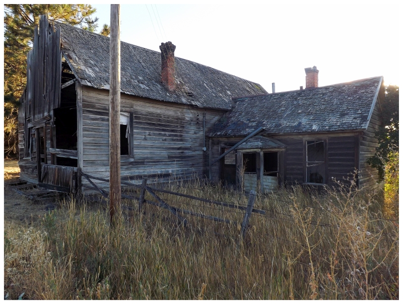
I couldn't find much more information about Hardman, but I did find the interesting blog of a guy doing pretty much the same thing as me, but back in 2006. And in 2006 he was beckoned over by an old man from one of the nearby houses. What makes this blog great is that it has stayed online since 2006 with open comments. Two of the man's daughters and a grandson have since commented and gave insight into Hardman life. As I stood on the silent main road and side streets, I obviously wondered who lived here & how many people were still around. Most internet sources give that number as 20 people (the census no longer counts Hardman residents), but the old man (Melvin) from the blog is an example of Hardman continuing to decline. He lived out here with his wife, but his wife died and left him to live alone in Hardman. Melvin would eventually leave to be cared for his daughter in one of the nearby bigger towns before passing in 2014. |
Melvin's grandson commented on the post about spending some of his early years in Hardman, manufacturing fun by playing in the abandoned houses or "climbing the gravel pit at the edge of town". I always have second thoughts about exploring abandoned houses in the American west, but now I imagine I could have taken a quick look in one or two of the more glaringly abandoned ones. Ah well, it was getting late. |
The scenery didn't quit after a brief jaunt north to Ruggs and then the highway straight west. My road map showed us going through the former town of Eightmile here, but I didn't spot Eminem posted up, liquor stores with old cassette tapes or the Caring Caribou Club. The only thing this Eightmile had was an overgrown and empty farmhouse. (It wasn't worth stopping for, it was very small and rundown.) |
With a motel booked in The Dalles tonight, there were still a couple of hours to drive & I learned why it's easier to head up to the Columbia River Valley when cutting east-west across Oregon. Instead of the Columbia River Valley, I set off west on the state highways, where rivers cut through the plateaus and have created great canyons. With the sun shining in my eyes, I cut down switchbacks with a lack of barriers into the deep Sixmile Canyon, before slowly emerging out the western side. |
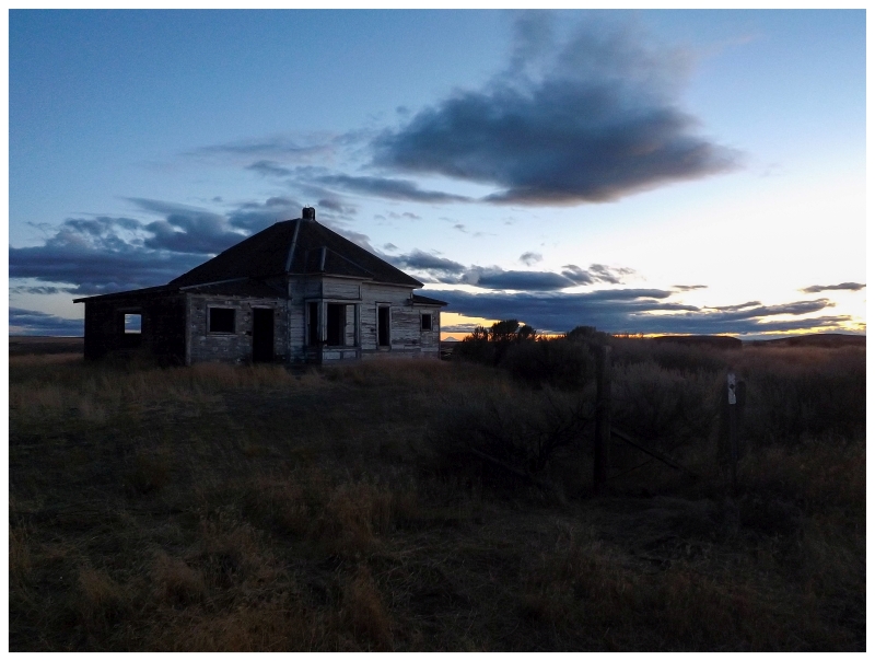
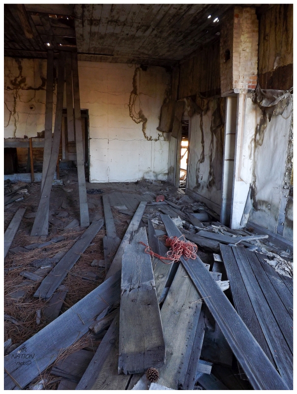
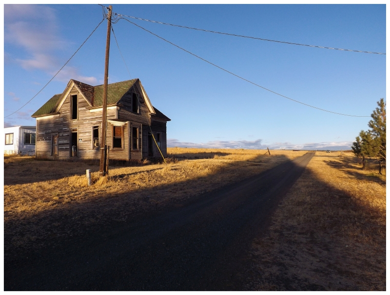
Continuing west atop this new plateau, night was just about to fall as I flew past this abandoned homestead. With these canyons and open prairie, I didn't want to add to my nighttime driving, but this was too good for me to pass up. The inside was gutted to the beams and floorboards, and the only thing left was tons of marker, pen & pencil graffiti from countless visitors over the years. The best part is what you see above - the view towards the setting sun. Leaving the homestead, things would calm down, but then the same feeling played of dipping into a canyon on steep, now pitch-black roads, surrounded by intimidating hills. By the time we got to Biggs Junction at I-84, I laughed at how easy and relaxing it was to drive on a straight, heavily-engineered interstate. As I drove into the night, I thought about how I loved seeing Hardman at sunset, but I also would be interested in returning to those canyon roads in the daytime one day. |