Sandy Point (Newfoundland)
Summer 2009.
Soon after coming to Newfoundland, I learned of resettled communities and grew excited about exploring these sites.
As you can imagine, some Newfoundland communities have naturally been abandoned as a result of emigration and harsh conditions in the past; but the 258 communities abandoned between 1954 and 1975 were aided in their demise and didn't die (solely) of natural causes.
In 1954, the province initially offered to cover the cost of moving - which later changed to a $150 flat rate, then eventually to a sum of $600 - to each family of any community where every family agreed to relocate. This program would abandon 110 communities of 7 500 people over an 11 year period.
Another program would come within the next year, where each family would receive $1000 and an extra $200 for each dependent, plus moving costs and an extra $3000 for a serviced building lot - AND only 90% of the community had to agree to the resettlement! This program would abandon another 148 communities and resettle another 20 000 people over the next 10 years.
With 258 abandoned communities, you would assume I would be excited about exploring these locations. I was, until I learned of two facts: 1. Most are geographically isolated & therefore difficult to reach and 2. The community structures haven't fared very well during 40 years of abandonment: wooden saltbox houses & fishing wharves require some degree of maintenance.
Still though, if I heard about one, and it wasn't that difficult to reach, I fully intended to check it out as foundations and old cemeteries are still interesting.
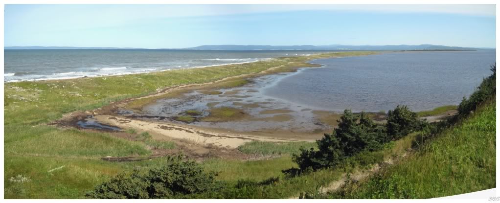
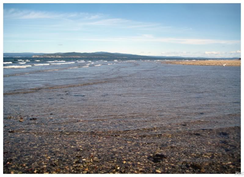
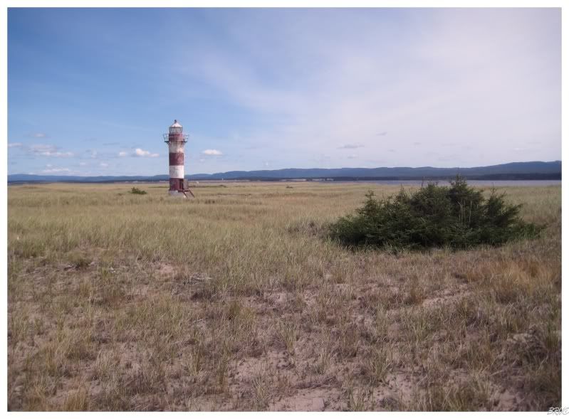
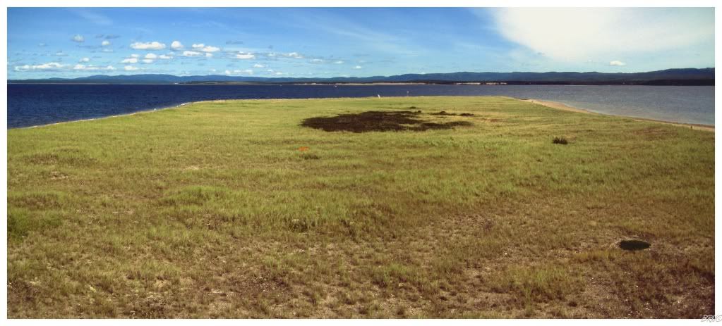
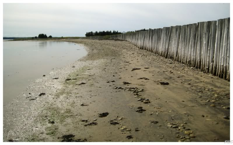
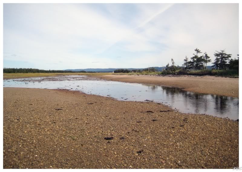
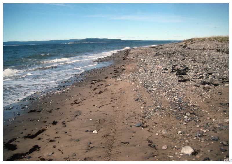
You may remember the above picture from an update chronicling Highway 404 from September 2009. I expressed my interest in the sandbar extending to the distant reaches of my vision, and that I planned to come back and walk out there in the future.
A reader named Morgan e-mailed me soon after and told me about Sandy Point, a resettled community located at the end of the above spit. I knew of Sandy Point prior to her e-mail - from both the internet and the lighthouse located there - but I informed her that you can no longer reach Sandy Point as water has truncated the linear sand feature and produced an island.
The reader was actually from the area and she was quite sure that you could still walk out there. She actually asked some of her family members who confirmed that you could - and therefore, Sandy Point was bumped up a few spots on my to do list.
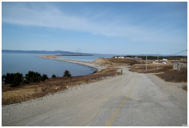
One day, since it was relatively close to my house and it was warm & sunny, I figured the walk would be enjoyable even if I couldn't reach Sandy Point.
I was going to come here and hike to the end without the promise of a resettled community anyway, so anything more was simply icing on the proverbial cake.
Walking along I came across quite a few sandpipers. Since sandpipers have to be up there with orioles and cardinals on my favourite birds list, their presence was all my pleasure. The round trip hike measures 26km (~18mi), so all non life-threatening entertainment was definitely welcomed.
I say 'non life-threatening entertainment' because I also watched nervously as some huge ospreys circled and big birds definitely make me nervous...we don't normally see large birds in Southern Ontario (besides herons).
In addition to the sandpipers and ospreys, I also saw plovers, ducks of some sort, and a few other birds which I can't identify.
I completed understood my bird loving co-worker's jealousy when I told her about this trip - I would imagine any bird lover would quite enjoy this hike. I was also relieved when she told me that I was in no danger from the ospreys, as they're non confrontational.
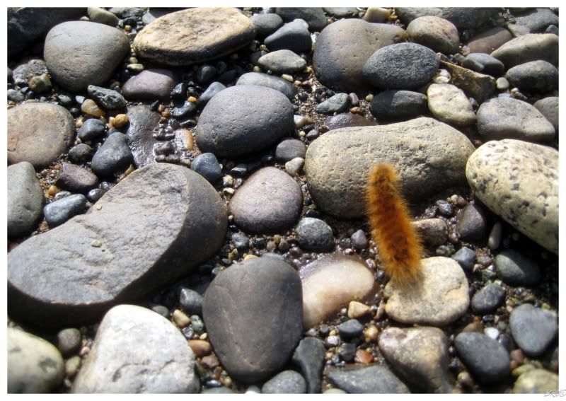
Along with the sandpipers, I also quickly noticed numerous caterpillars - forcing me to watch my step.
I know plenty of people would just walk and shrug their shoulders at killing a measly caterpillar, but I felt that taking a life just because I was too lazy to watch where I was going was quite selfish and inconsiderate.
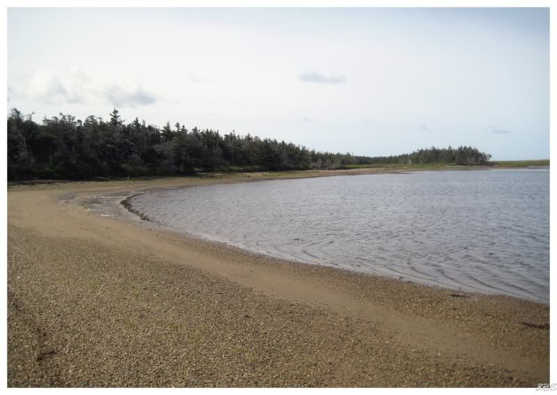
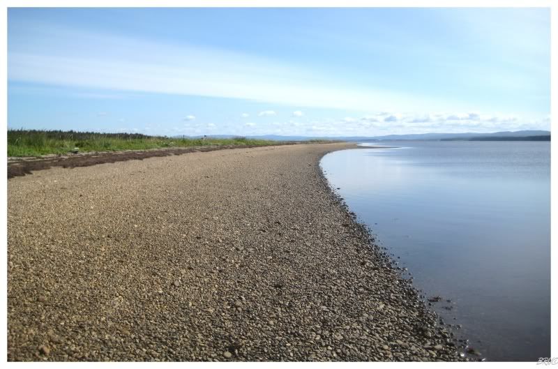
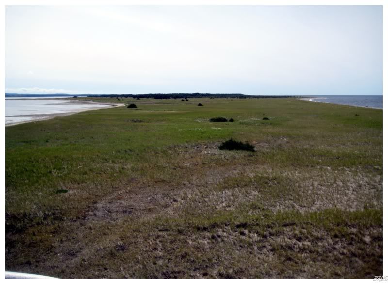
The point where the ocean washed out my path was about halfway; so if we were talking a 26km (~18mi) round trip, then it was about 6 or 7kms (~4mis) before I would even reach that point.
6 or 7kms is a respectable hike in itself and I was already growing a little tired and worn out already. The meandering shoreline wasn't helping either, as the shore would curve in at small coves and move outward at alternating points.
I tried to cut across the coves and capes, but most of the time it ended up being more of an exercise in futility than anything beneficial - the capes were sandy & tiring, while the coves were muddy and wet.
Somewhat tired after having already walked for an hour, I came to this marshy area and pondered if this was the great impassable pass to Sandy Point.
I could make it across this easily, but my shoes still weren't wet, so I opted to follow the marsh's edge for a bit instead.
Eventually it led to a cove where the water wasn't that deep and my shoes finally became wet as I shortcut across and avoided walking 10 minutes out of my way.
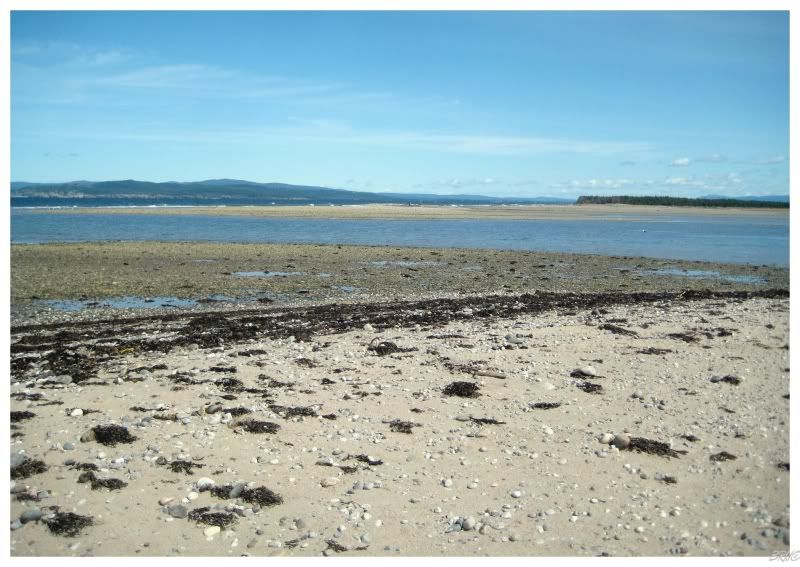
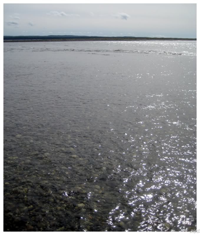
The end of the current sandbar seemed to be just out of sight for a good 20 minutes. After what seemed like forever, I came to the actual end of the sandbar and finally discovered just how much ocean was preventing me from visiting Sandy Point.
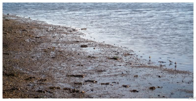
I'm not a fan of water at all; to the point where the completely insignificant danger you see above put me ill at ease. I decided to give it a shot and wander out a bit - hoping that there wouldn't be some deep channel in the middle and that it would be passable at a shallow depth.
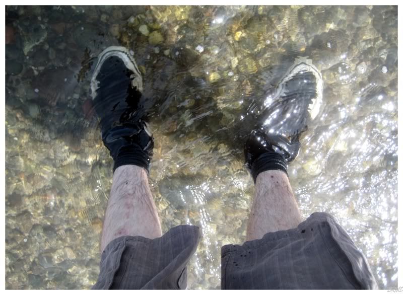
Moving into the water, the cool temperature engulfed my feet, ankles and that's about it. After walking about halfway, I realized that there was no great channel here, and that it would remain about 10 inches in depth all the way to the other side.
I started to slosh about and enjoy myself. After walking on the shore for an hour and a half, the ocean water felt damn good on the feet.
I decided to take the ocean side once past the water gap (I had been walking on the bay side earlier).
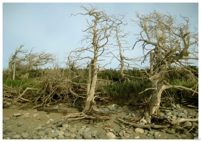
The first portion of the ocean side was mostly dead trees and rocky shore, making me regret the decision to switch sides.
My sore feet weren't feeling any better, so I decided to leave the rocks and see about walking through the trees set about ten or fifteen feet from the shore.
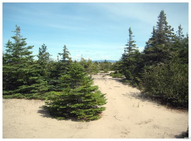
Suddenly the walk became quite enjoyable as the ground was sandy and soft, and the trees were sparse enough where you didn't need to bushwhack. The spruce trees set in sand was another new ecosystem I had yet to discover in Newfoundland, and it further opened my eyes to the diversity you can find here.
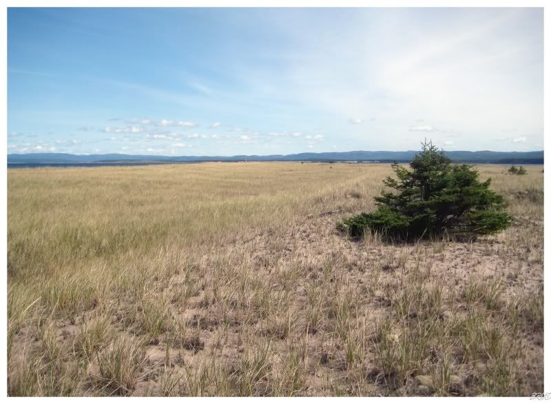
As much as I enjoyed the sand and sparse trees which reminded me of Northern Ontario and Northern Michigan; I was, in fact, growing sore and tired and wanted to come to the tip of the peninsula (which seemed like it would never come).
Walking, walking and walking some more; the trees slowly grew more and more sparse. Originally following a path through the trees, then simply avoiding trees, then eventually using trees in pictures because there only seemed to be one or two left.
Sometime between having to follow a path between the trees and only having so many that you had to simply avoid them, I finally eyed the cape lighthouse far off in the distance. I knew that the end was finally here and a satisfied smile came to my face as I was about to see one of the above average difficulty lighthouses in this province.
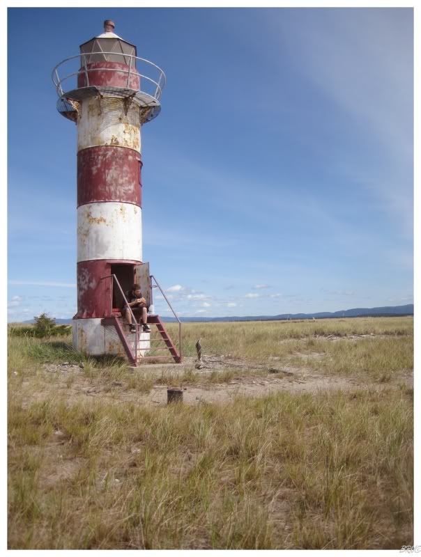
I have a bad habit of pushing onward instead of taking a break, so by the time I reached the lighthouse, I was more than ready to sit down and enjoy some food and water.
(Realize this is only walking a freaking sandbar people; I would break and refuel if I was doing something more difficult than walking a sandy shoreline.)
Anyway, I can't say that I sat back and enjoyed my hot pepper, turkey & mustard sandwich, as I was constantly getting up and re-shooting the above picture; several times unsatisfied with my facial expression or other insignificant details.
(I did eventually take 5 to inhale some water and relax if you're that worried about a young man near the peak of his fitness.)
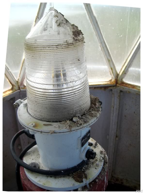
Judging the lighthouse's size in relation to my size, I'm sure you can figure that Western Newfoundland's first lighthouse isn't that big. Two short ladders and I was up in the lantern room; which was neat in that it still had the intact light.
Although, judging by the overall condition of the lighthouse, I wondered how long this lantern would last before someone would come along and see fit to smash it.
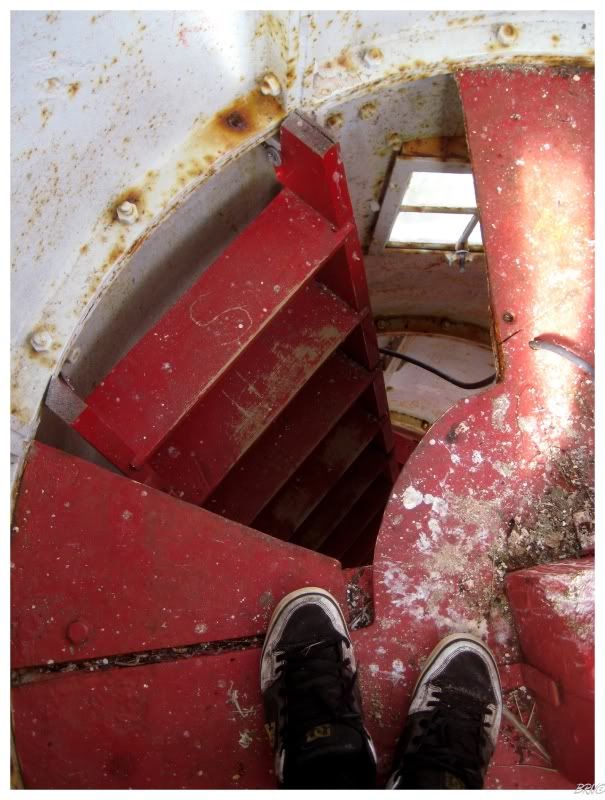
After spending the next 15 minutes sticking my camera out of a little hole attempting to get a shot of the cape, I gave up on that and was on my way.
Walking back down the stairs and out the front door, it didn't make sense to me why there wasn't a way outside.
I decided to go back up in the lantern room.
...and a-ha! I figured it out!
Moving out onto the steel grating ring which you saw earlier, I was a bit nervous, but a bit alive at being a good 30 feet above the ground with a summer breeze blowing through my flowing locks.
Getting a picture of the cape was much easier from here.
Stepping over a solar panel engraved 'property of Canadian Coast Guard', I came to the other side of the lighthouse and took a shot looking back towards where I came.
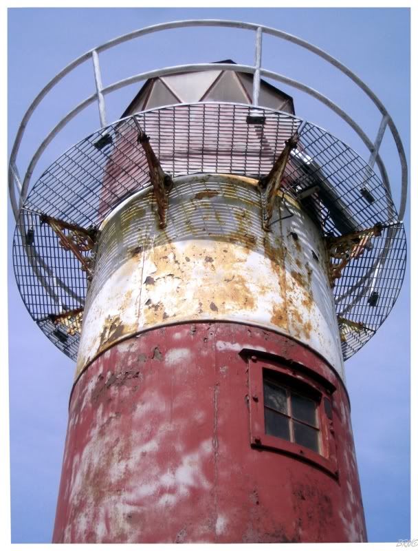
After taking a picture towards the cape and towards the way I came from, I tried vigilantly to capture the awesome Soviet-esque star supports which held up the walkway. I was absolutely in love with them, but I never did end up capturing them very well (see above).
Also, I'm sure there's a reason behind the stars too, as back in 1883 they did everything for a reason...well besides the reason to build the cheapest bullshit they could (see present day).
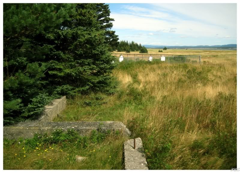
^Ruins of the Anglican Church (keep reading)
After the lighthouse, I walked to the cape, partly because I wanted to make it right to the end; partly because I saw something waving. The waving item was nothing more than a tattered bed sheet, erected in boredom I suppose.
After finding the bed sheet, I began to make my way back towards the car. This time I would take the bay side up to the water gap, as to inspect the former town site of Sandy Point.
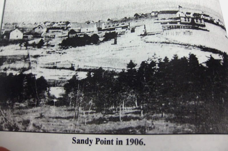
One family was noted as living at Sandy Point in 1760 and a tribe of Micmac Indians were present in 1770; but it wasn't until 1820, that a 20 family settlement was recorded. These people chose Sandy Point because of its superior fishing opportunities and it was said to be the finest harbour on the west coast of Newfoundland. It would become the main shipping port of the west coast and the ships of the Navy were stationed here.
Life was hard at the main community of the west coast, with notes pointing to the consumption of dandelions and porpoise - one because of its nutritional value & one because of the fact that nothing could be wasted. The people would be rewarded with two churches though; the first two churches constructed in Western Newfoundland as Sandy Point would become the head of the Catholic Church on the west coast.
Most of the houses at Sandy Point were constructed of wood, both because of the difficulty of hiring skilled masons, and also, the difficulty in the acquisition of stones. In fact, the wood was even retrieved in the winter when the bay would freeze over and the residents could walk across to St. George's.
Sandy Point's geographic position would also provide hardships, as the shifting of sand and battering from fierce Atlantic storms would wear on the people. In 1872, a major storm washed away wharves and gear; and the lighthouse even had to be moved when another storm shifted the sand so much that the lighthouse was no longer near the new shore.
These storms would eventually cripple Sandy Point. The road which traveled out to the town was never very wide and a storm in 1951 would wash out a portion midway to the Island of Newfoundland. This would become known as 'the gap' to locals and several attempts were made to close it, until everyone realized it was an unachievable goal and they gave up on ever closing the gap.
The railway came to St. George's (the community across the bay from Sandy Point) around this time as well. This would provide St. George's with more facilities and amenities, which Sandy Point never received. It was also about this time, that the Newfoundland Premier Joey Smallwood initiated that controversial resettlement program of paying residents to leave such outports as Sandy Point.
As St. George grew and gained amenities, Sandy Point continued to lose them. A steady stream of people were taking the Liberals' monetary offer to resettle. Some would go just across the bay to St. George's, but others were drawn away by promising futures at the newsprint mill in Corner Brook and the air force base in Stephenville.
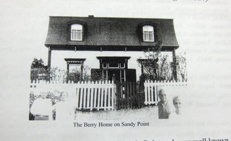
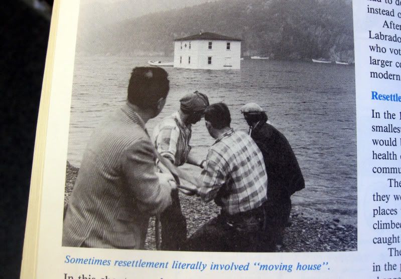
Also, I know you're looking at the above picture and wondering what the hell is going on up there; well I had never heard of it until coming here, but some people floated their houses across bays and harbours when they would abandon one community for another. This seems to have been more popular on the southern coast, but a few houses were floated across the bay from Sandy Point to St. George's. The fantastic book where I'm regurgitating most of this knowledge from, has one example where the house still stands in St. George's today and has had 18 total families living in it during its >100 year history.
The first remnant of Sandy Point I found was the cemetery. The problem was that the mosquitoes were so thick that I had to physically endure them just to take a single picture - they were landing and biting that quickly and viciously.
I only ended up taking about 3 pictures of the first cemetery as a result - cursing the fact that I left my bug spray back in the car.
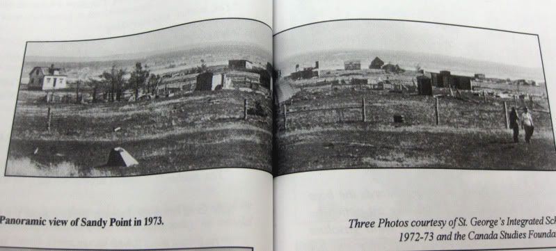
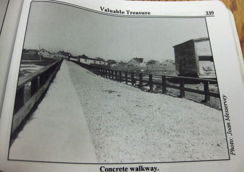
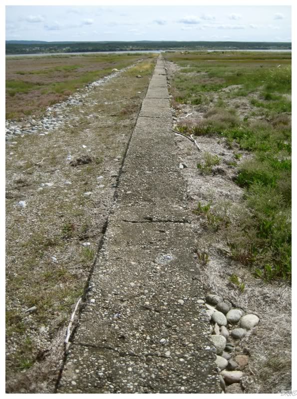
Anyway, as I was trying to escape the mosquitoes by getting back to the shore, I noticed a few foundations and bricks before coming to the impressive concrete walkway you see above.
That's the condition after 35 years of abandonment people. There are many other former outports which are nothing more than 1 foundation and some non-native plants - so this attests to the size and weight of Sandy Point.
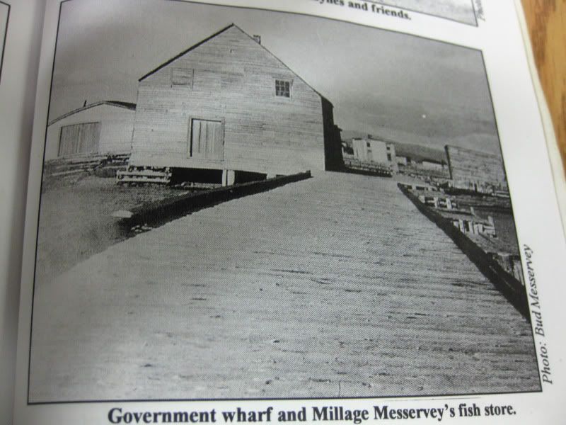
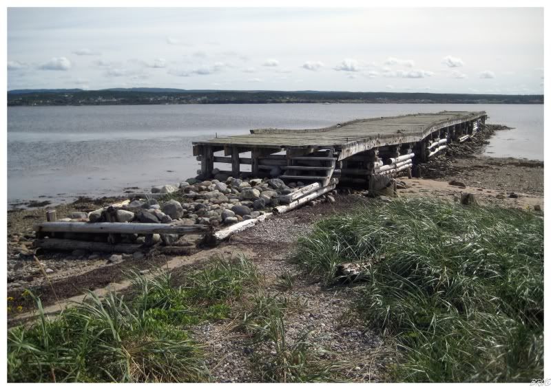
The wharf still stands to some extent.
I believe the portion in the water must have had some maintenance though. Some people had been dropped off here as I was walking earlier, so this wharf does see some use.
After the cemetery sizes, concrete walkway, bricks and the wharf; the last thing I was impressed with was this tree log breakwall.
It has you questioning my 'they crossed the frozen bay for wood' story, doesn't it?
Not one of the breakwall logs was very big though...they could have came from the island/peninsula.
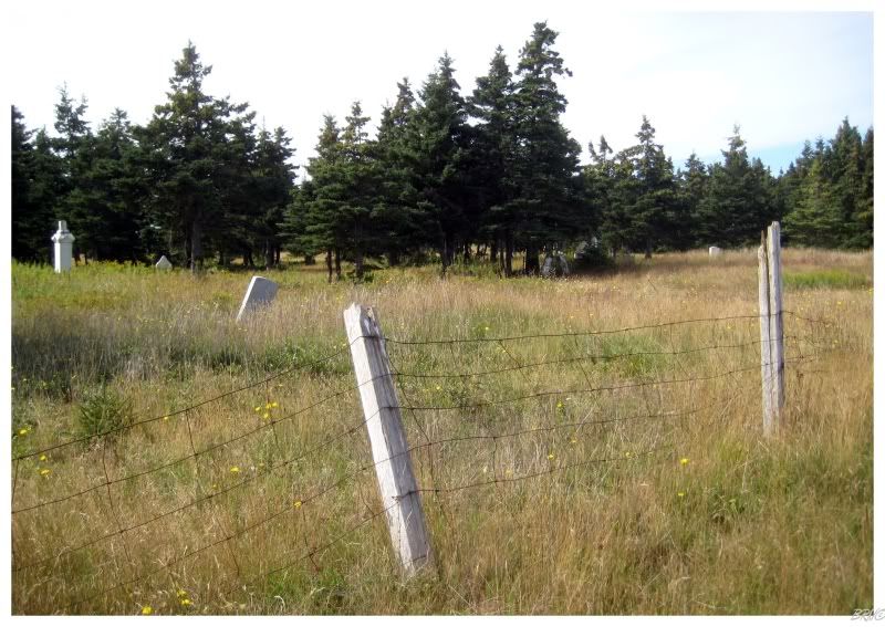
There are three cemeteries left at Sandy Point and as I saw the 2nd one, I made my way over, was swarmed by mosquitoes, then retreated to the shore.
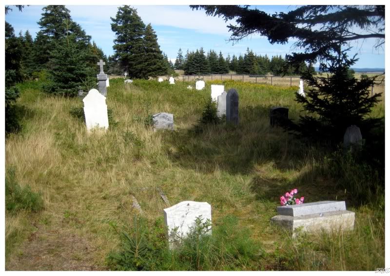
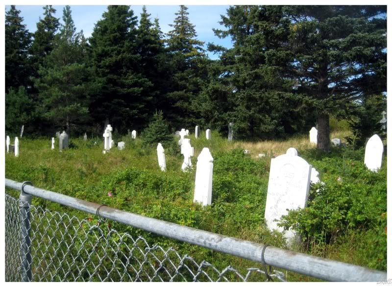
I didn't know there were 3 cemeteries when I was there, so I was surprised to find one more after walking away from the former town site.
The mosquitoes weren't as bad here - to the point where I think I might have been able to get 5 or 6 pictures!
Stupid pesky bastards.
It always seems shorter once you've already been somewhere, so I was quickly across some gentle streams and back towards the mainland...
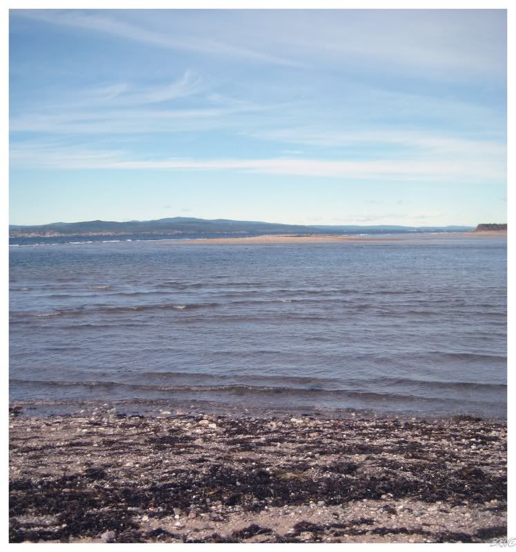
...until...oh shit.
What you see above is what I came to when I was back at the gap. I stood in disbelief and fear at what was before me. I must have miscalculated and crossed the gap at absolute low tide...and now, 2 hours later, quite the tide had come in.
I made the mistake of scoffing at Newfoundland's tide as it's not the same strength as the Bay of Fundy (where I lived in Nova Scotia - the greatest tides in the world).
Although from where I stood, just 2 hours of the tide coming in was quite daunting and oppressive.
The sea clearly didn't enjoy my mockery and derision.
I took my camera and tripod out of the bag and stepped into the water- resolving to turn around if the water went above my chest.
Holding my tripod above my head, with camera atop the tripod, I moved forward. Quickly my knees and thighs became submerged. The next thing I resolved was not to freak out, but the sea was moving through here rapidly and I was swiftly becoming more and more submerged.
Another few steps forward and I went down even further, where something sensitive suddenly went below the water...the cold, cold water. A wave of fear, shock and adrenaline was washing over me. After finding myself up to my waist so quickly, I strained to remember the exact route I took to try and follow the shallowest path - the problem being that the gap looked so different in just 2 hours.
I was exactly halfway when I concluded that it was futile to try and strain to think of the exact path from before. Instead, I angled towards the closest portion of the desired shoreline - glooosh! Down another steppe of the sea floor and suddenly the water was above the nipples. I quickly stepped back and cut right, hoping to find the shallow ground, but deciding that if I were to dip down again, that I should probably stay on the other shore for the next 8 hours until the tide went out again.
Thankfully after my cut right, the water level stayed the same and I found myself moving with a sense of relief towards the desired foreshore. The water would stay at about waist level until a very close distance to the sandbar, then the land quickly angled up and out of the ocean.
I breathed a sigh of relief, put my tripod down and looked back. For how much the ocean scares me, I was impressed that I was able to bring myself to cross this gap.
If you still remember, I mentioned that this was a 26km(~18mi) hike; so by this time I had already hiked about 18km(~11mi). The 18km, in addition to the stress I just put myself through, was all catching up and the last 8km was rough.
Since I took the bay side on the way there, I decided to take the ocean side from here on out.
The fact that the ocean side was rockier and growing increasingly cold did nothing for my tired body. The cold wind was so strong that the crash of the ocean waves was drowning out my mp3 player on full blast. I continued to stumble forward, looking forward to a cold Pineapple Crush and some sort of chocolate bar once I got back to the car.
...and after all of that, the only thing I saw by taking the ocean side was some interesting tree formations.
I eventually made it to the car after a few mosquitoes stole what little blood I had left when I had to cross a marshy area. After stopping at a convenience store in Flat Bay to support the town, it was a long grueling drive back to Corner Brook (because I was so tired).

Anyway, after hiking 26km in a day, I figured I could reward myself with some Chinese food.
Most of my friends have listed The Dragon as their favourite Chinese food here in Corner Brook; but I wasn't impressed.
Maybe I will have to return someday.
Sources:
2 - Turbulent Tides: A Social History of Sandy Point
3 - "No Great Future" Government Sponsored Relocation - MUN Maritime History Archive
Navi