Summer in the Province - Weekend Adventures into Central NL & the Road to the Shore: Day 2.
Summer 2009.
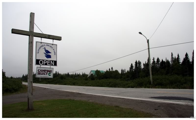
I was up around 6:30, had the tent packed and was on the road by 7.
After driving for 10 kilometres (6mi), there was a sign indicating the upcoming Banting Memorial Park - with a recreated plane of the one which Sir Frederick Banting crashed in 60 years prior.
I really wanted to get to Musgrave Harbour for some coffee, but I thought this might be interesting, so I stopped the car and walked over to the park.

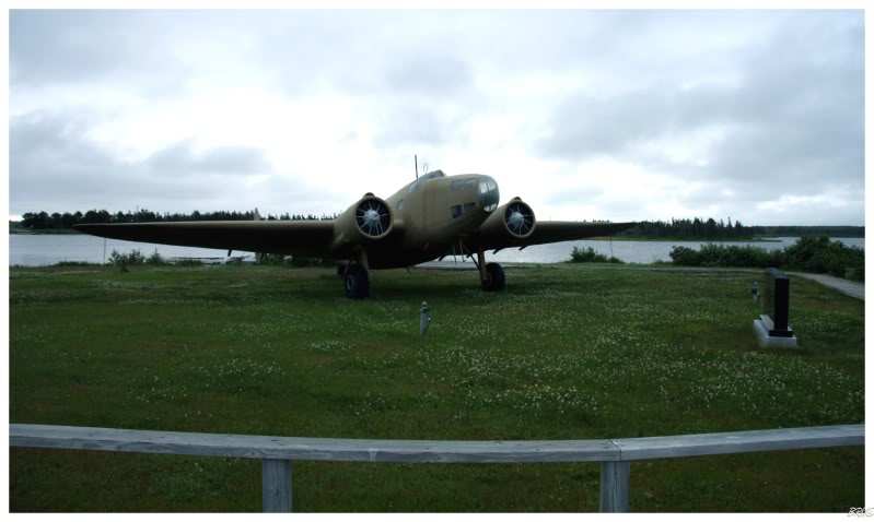
There was an interpretation centre, some campsites, the recreated plane and wreckage of the actual plane Sir Frederick Banting crashed in. I thought it was weird that the town actually purchased the wreckage and brought it here, but whatever.
By the way, Sir Frederick Banting was one of the people who worked on the discovery of insulin. He was working with the government in the war during 1941; when his plane was leaving Gander and the pilot realized he needed to turn back for fuel.
The plane never made it back to Gander and it crashed near here, killing Frederick Banting.
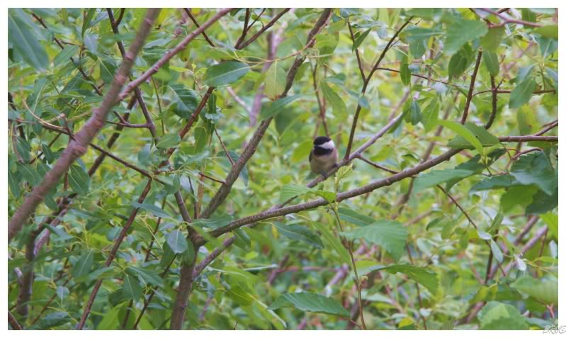
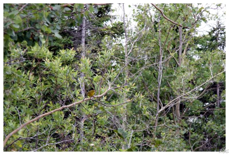
Walking back towards the car, I noticed a couple birds in the trees next to the path.
There are quite a few bird people at my work and checking with one of them, I learned that I had observed a black-capped chickadee in the first picture and a yellow warbler in the second.
It's funny because they have bird lists and check off when they see a new bird, so I sort of give them a hard time by claiming that I've now seen eight - making sure to include things like seagulls and crows, haha...
Quickly in and through Musgrave Harbour, I then found a large stretch of highway devoid of any communities or, anything really. I was making such progress that I was actually concerned that I was moving too quickly.
Exiting the 330 onto the 332, I found a curvy road which slowed my forward progress towards my destination.
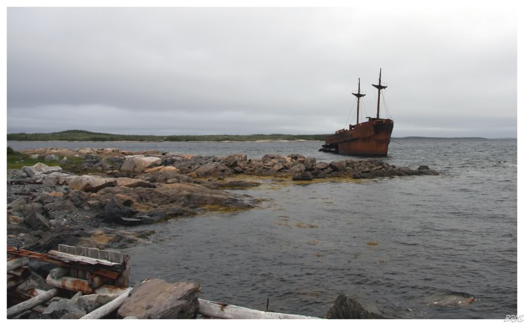
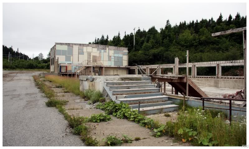
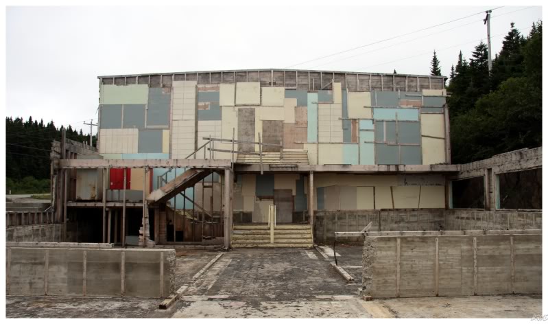
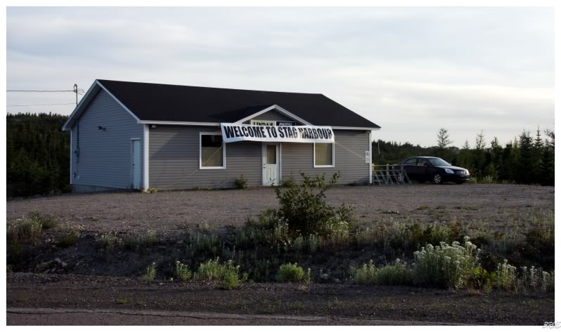
Coming to the small town of Frederickton, I found my first planned destination of the day - the shell of the Ahern Trader.
The Ahern Trader started out as the SS Lurcher in 1922. It was a 207 ft. cargo ship, built in Glasgow, which met its fate on January 9th, 1960. By that time, the SS Lurcher was known as the Ahern Trader and was trying to deliver a load of hay to nearby Gander. The weather was horrendous and the ship was forced to dock in Frederickton where the cargo of hay was offloaded. The ship would remain in Frederickton for 3 days until the crew attempted to leave. The strong winds that day would blow the Ahern Trader ashore, even as the captain anchored in an futile attempt to combat this.
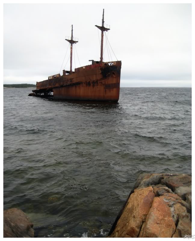
Over the next few days, Frederickton locals helped the crew evacuate the ship. The common crew members all departed for home, while the captain and the chief engineer remained in Frederickton for the next 2 months. They would work constantly to remove ballast and patch holes; while also having a tug boat come to Frederickton and attempt at pulling the Ahern Trader offshore. These attempts failed and the work was a total loss. All valuables were taken off the Ahern Trader and the ship was abandoned.
A great picture of the ship in use can be found here. Another smaller, but stupendous photo can be found here; where the webpage states that the Ahern Trader has greatly deteriorated over the years (quite evidenced by the photo).
Abandoned ships freak me out for some reason, so I was uneasy with the combination of this overcast, windy day and the ominous hulk sitting just 15 feet offshore. I went about my business, took a few photos, then quickly returned to the secondary road.
Just outside Frederickton, the road turned into gravel and I was amused (as I always am) with the random gravel portions of Newfoundland secondary roads.
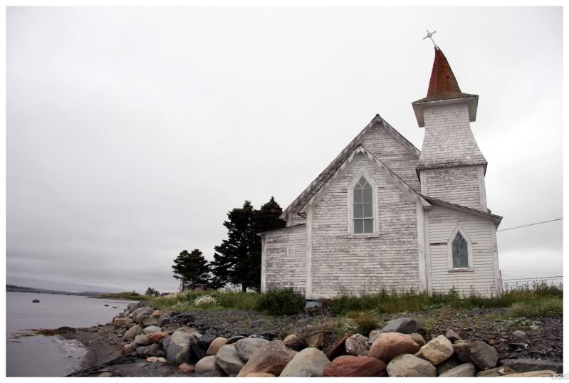
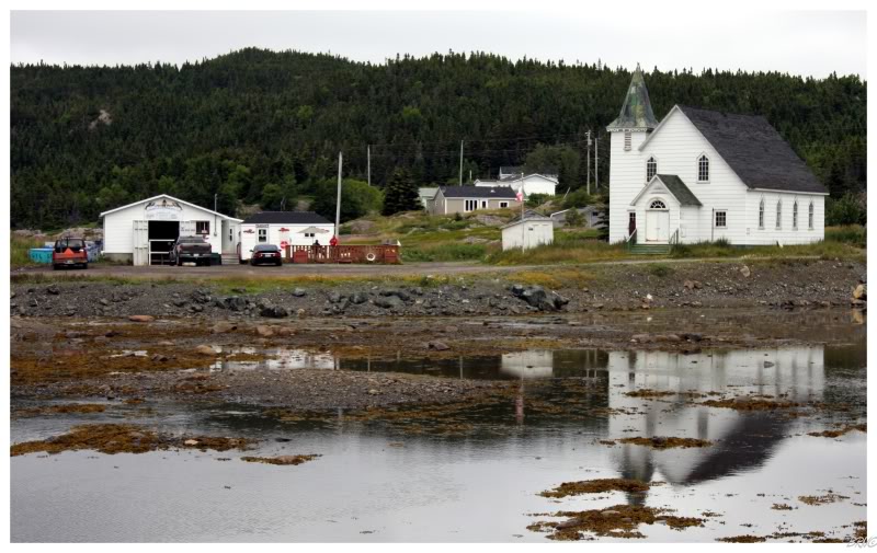
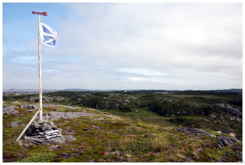
Back onto the main road (330) and I came across this quaint little church; which I was forced to stop and photograph.
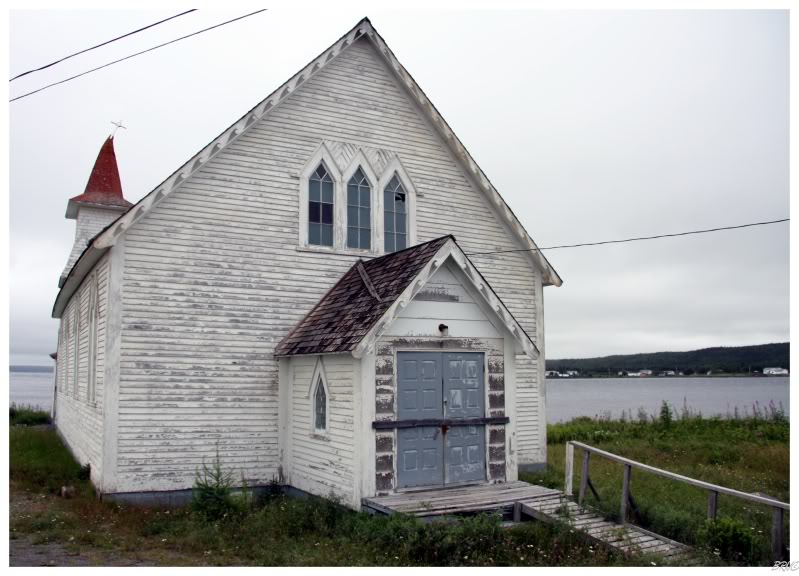
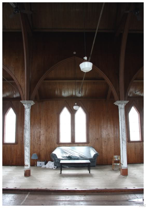
There was a difficult entranceway into the church, but instead of that option, I avoided some spiders while peeking my noggin inside a broken window.
Seeing about the extent of what you would see inside, I decided to simply move on.
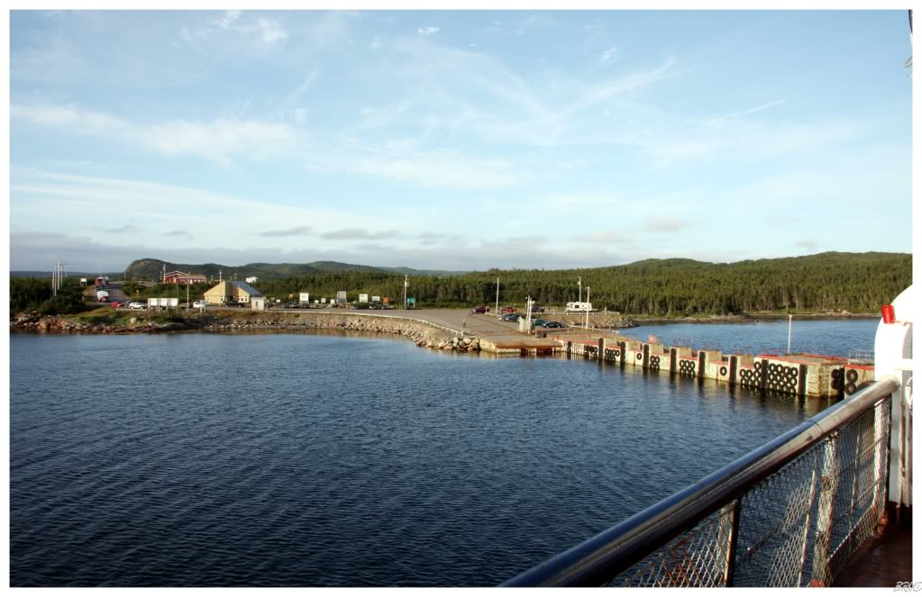
The next planned destination was the ferry to the Change Islands. I pulled up to find a large amount of cars waiting and happily walked up to the grand schedule board - fully expecting a ferry to leave soon. I searched the board and found one leaving in an hour, but that ferry came and was apparently a cargo ferry - the next scheduled boat was in 4 hours.
There was absolutely nothing to do at the ferry terminal, so I quickly u-turned and raced towards (relatively) nearby Twillingate - a place I always wanted to visit because of its lighthouse, historic buildings and the fact that it sits on a 5th of 5 islands connected by causeways and bridges.
Twillingate is somewhat of a Newfie tourist destination, but the climate is so temperate in Newfoundland that the true tourist season doesn't start until August; meaning Twillingate was still somewhat empty during my visit. It's too bad too, this touristy restaurant could have served me up a tasty cod burger and/or squid ring!
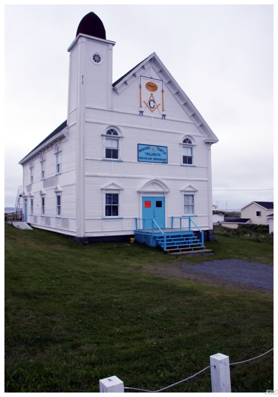
While not as impressive as the Detroit or Philadelphia versions, I still enjoyed Twillingate's Masonic Temple amongst the building stock.
After enduring months of the Corner Brook Soviet Bloc architecture, you really start to appreciate things like this.
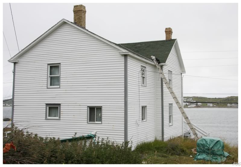
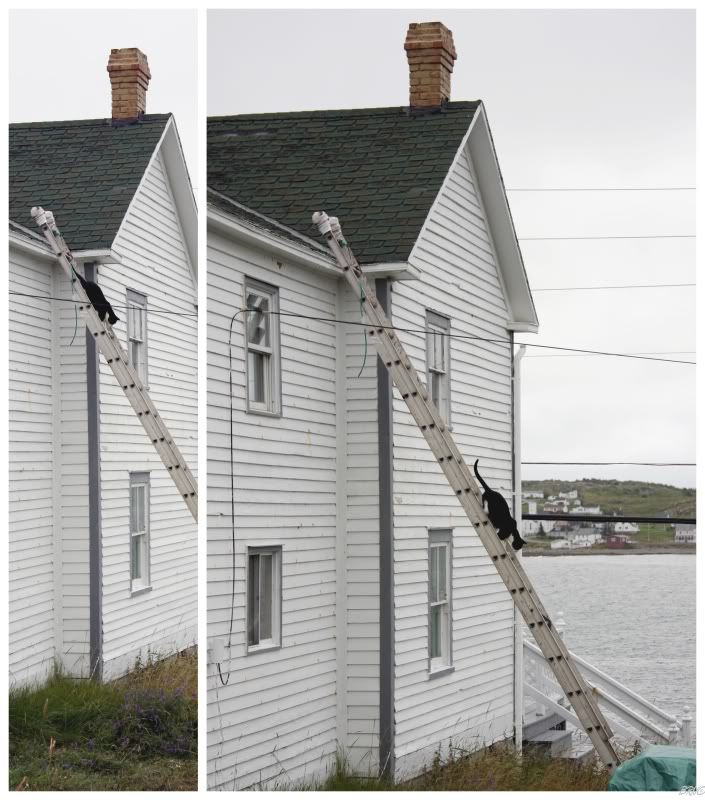
Speaking of impressive, I parked on a hill in Twillingate to get a skyline shot, when I noticed this cat up on a roof...
I hurriedly put my camera into my car as I was going to help it down - when I found out it didn't need any help down!
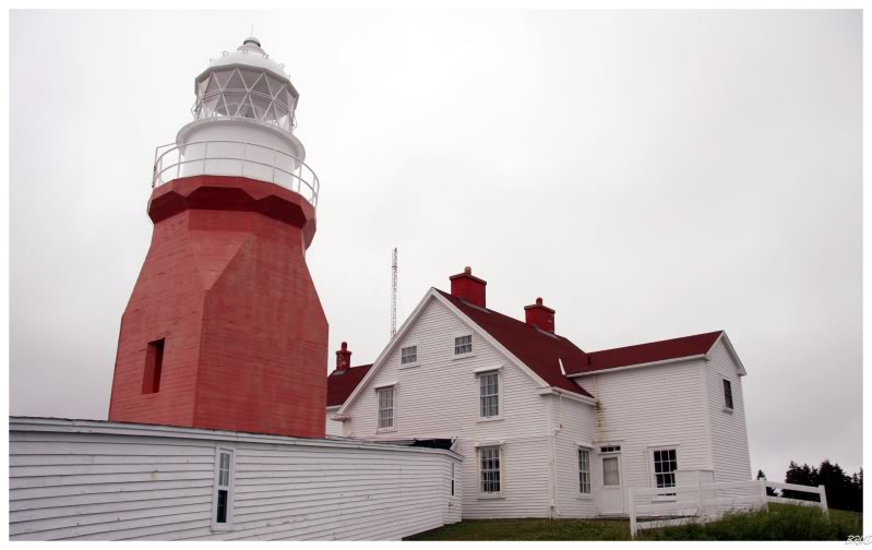
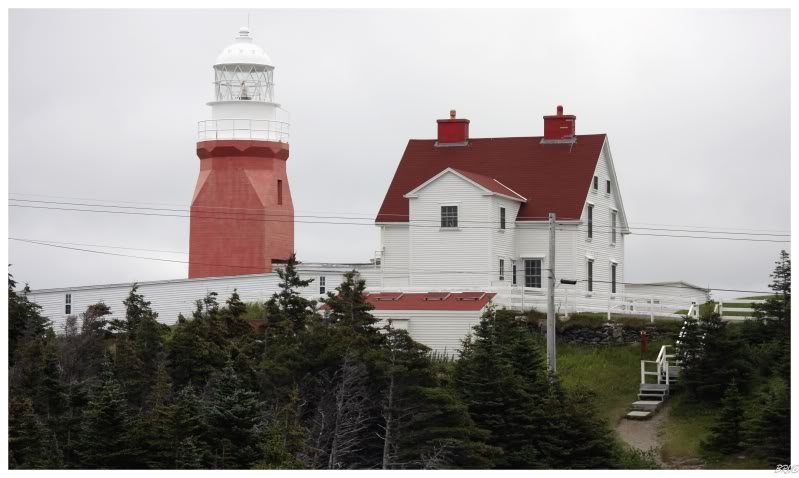
The Newfoundland-famous lighthouse in Twillingate isn't in the actual town, but after a small drive, you come to the heavily developed tourist attraction.
Thankfully a bus of tourists was just leaving, so I had particularly good timing.
Although, after walking to the lighthouse, I found a sign indicating that the keeper had left for lunch: maybe being with those tourists wouldn't have been so bad after all (it would have allowed me to see the lighthouse interior).
Oh well. Twillingate is still impressive from the outside and it gets extra points for uniqueness.
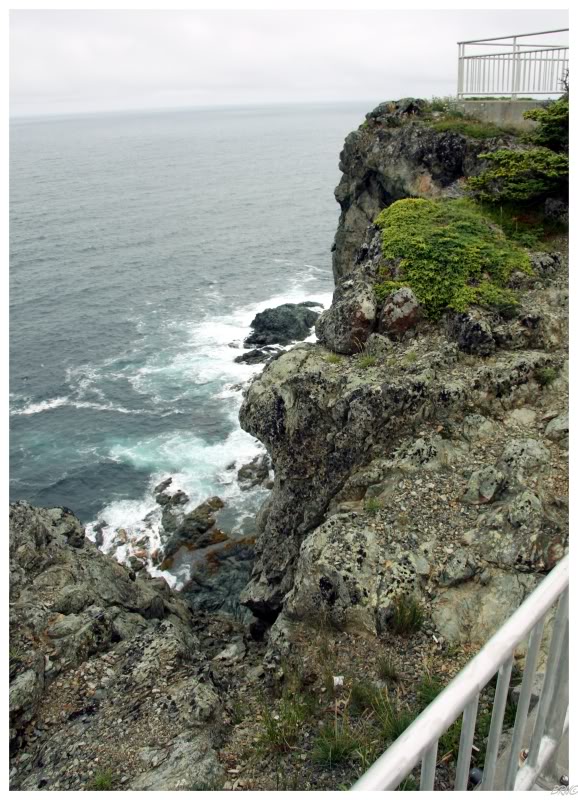
Throughout a great portion of Newfoundland, I've found the coast to be unforgiving and frightening - Twillingate's cliffs being no different.
A paved walkway with large handrails and manicured steps allowed you to partake in the view; without exposing yourself to quite so much danger in the process.
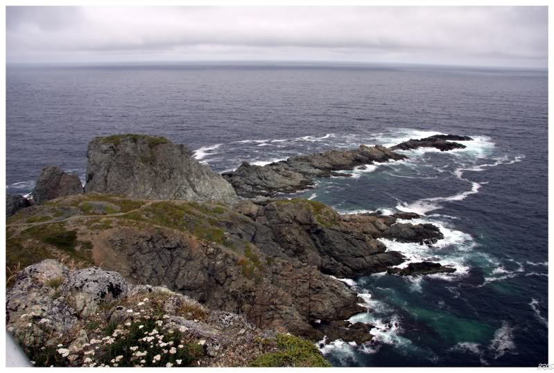
There was also a collection of hiking paths if you chose to escape the concrete, asphalt & aluminum of the tourist lot. To get an idea of scale, I hyperlinked some people in the above picture: you can only make our their yellow shirt faintly, but they're located at left of centre.
I'm not much of a hiker, but these trails looked appealing - it was too bad that I still had to get back to the Change Islands for 1:30...
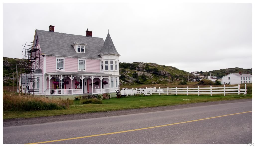
(Attractive house in Twillingate on the way back.)
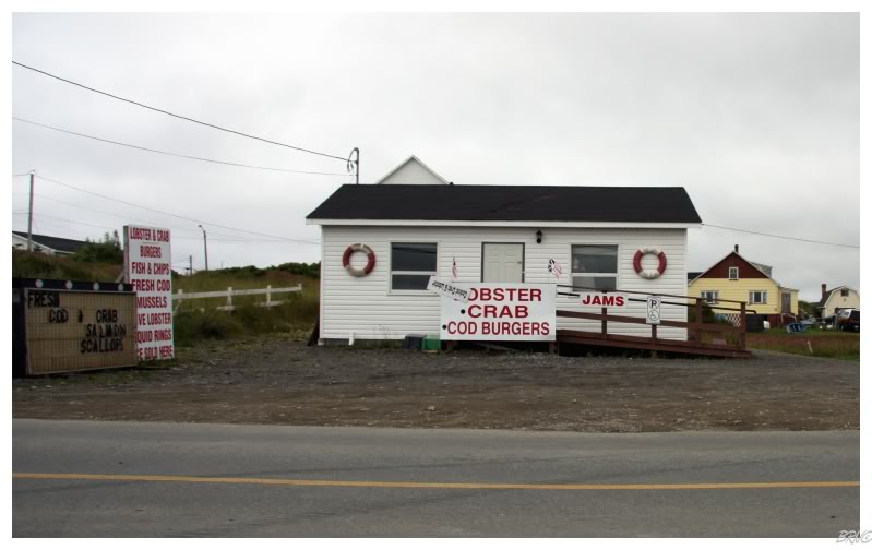
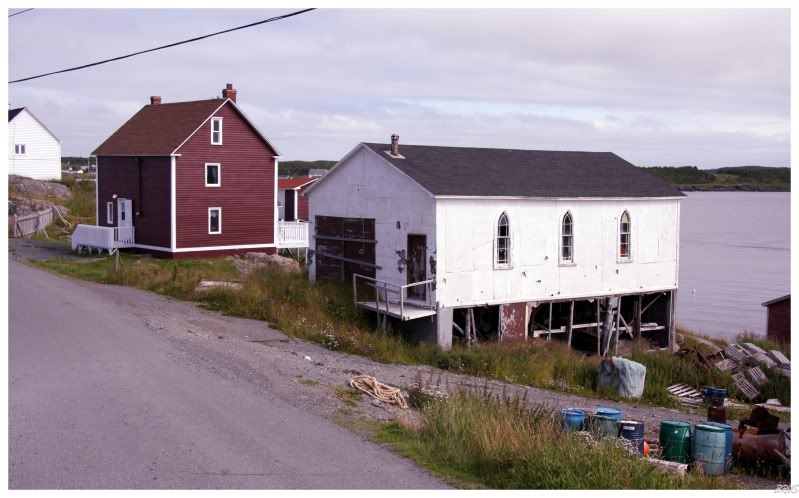
I was running out of time, so I needed to promptly leave Twillingate for the Change Islands ferry terminal. On the way back, I HAD to stop at this scene for a friend who also goes into buildings and enjoys lobster: an abandoned church next to a lobster shack.
If that church was just a bit more forgotten, maybe I'd be able to actually answer that "how's the Newfoundland lobster" question I get so damn often (easily a top 10 question).
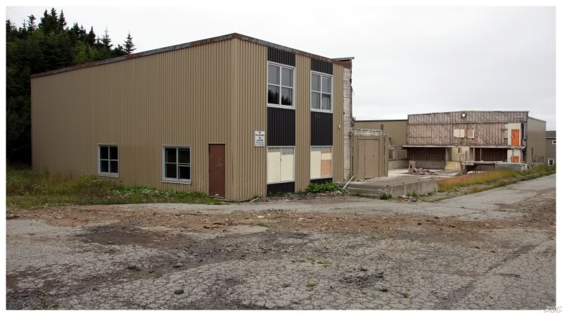
Also on the way back was this interesting structure.
I'm unsure if there was a fire in the centre part, a hazardous chemical present, or if it was just unwanted; but...
...the owners appeared to have simply took out the centre and sealed up the ends for future use.
I've seen only portions of factories used or floors abandoned; but I've never seen a whole centrepiece torn out and hallways sealed with layers of boards.
How strange.
I thought I was going to be late for the ferry departure, so I was forced to resort to heavy speeding. Thankfully I made it back in time and I was once again in Port Albert waiting on a delayed ferry.
Frustrated, I made my emotions disappear with a mediocre poutine from a nearby chip cart (even a mediocre poutine can make most feelings dissipate).
A few minutes after finishing my poutine, it was Change time!
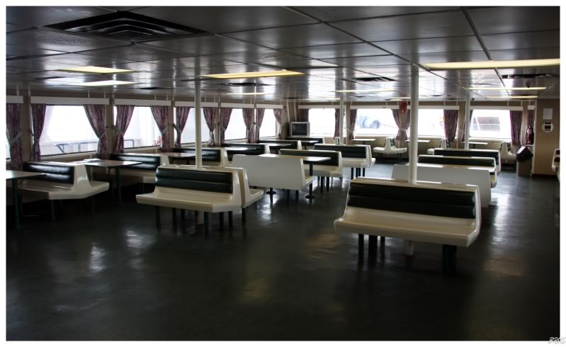
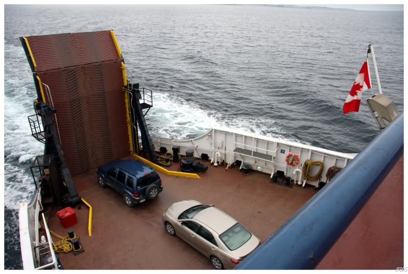
I think most people on the ferry were residents as they were elderly and seemed unimpressed with the nostalgia of the ferry crossing - while I walked around like a airy tourist; snapping pictures of everything.
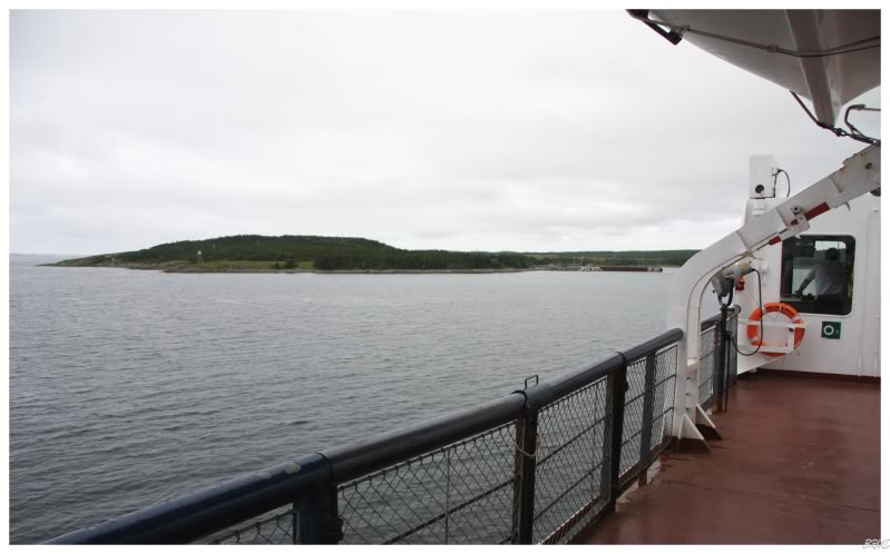
Anyway, the first picture is the boat cafeteria, the second picture is from when the ferry was departing & the third photo shows actual Change Island (you can see the skeleton light which helps navigation of the island).
The ferry crossing is 20 minutes from the Island of Newfoundland to the Island of Change.
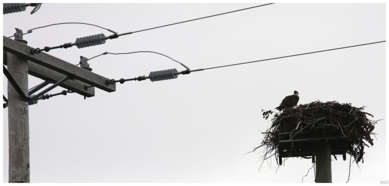
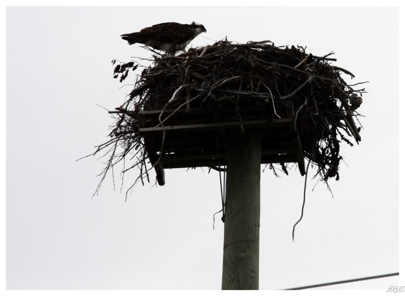
Just a kilometre (1/2mi) onto the island and I noticed a few of my fellow ferry passengers stopped and gawking off the road. When I pulled up, I noticed what they were looking at: this big ole osprey!
The other people quickly left & I was alone with the huge bird. I didn't like size or glare of the bird, so I left the car door open as I moved moderately close; close enough to zoom in and get a few pictures.
I really wish it would have been a sunny day so these would be better.
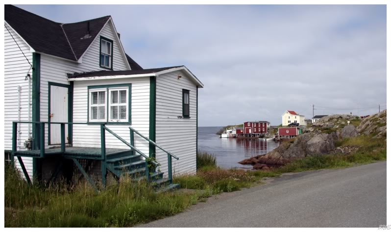
The Change Islands are a narrow chain of two separate masses, approximately 12km long in combination. There isn't much besides forest & bog for the first 11km, until you reach the northern tip of the southern island, where the community of Change Islands is located.
The community itself is divided by a narrow strait; with the majority of the residents being located on the south island and the majority of the businesses on the north island. The community isn't very large by mainland standards, but is surprisingly large for what you would expect on a random 12km island.
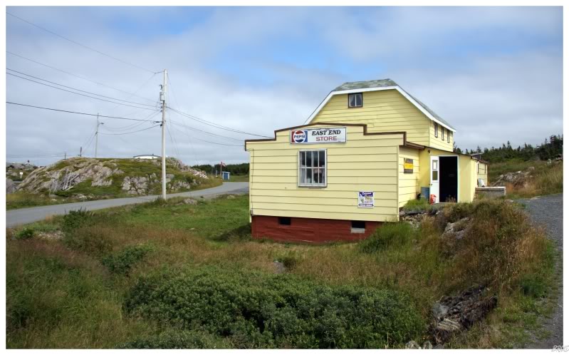
Still though, I knew I would move throughout the community soon enough, so I took my time looking around. When I came upon the above store, I just had to go inside and purchase something because of its small town feel and house-like structure.
Walking inside, I was greeted by 2 workers and 3 residents looking at me like I was wearing a shower cap in public - obviously not too many outsiders come here. Nevertheless, I purchased a Pineapple Crush while admiring the hardwood floor and rural nature of the store.
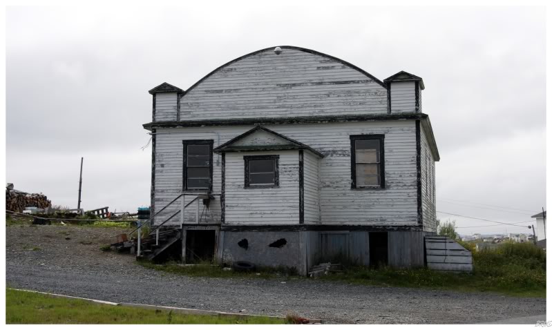
Continuing on, this place stood out to me so I snapped a picture of it.
The Heritage Foundation of Newfoundland and Labrador has a tremendous website with more building coverage then you could ever imagine, but unfortunately I couldn't find a matching record for the above building.
There are a few structures on the Change Islands list which don't have pictures, so it may well be on there without me being able to tell...
Anyway, there were a few residents nearby, so I scuttled along.
(Yes I realized I can utilize locals for knowledge, but these were beer swilling males in their early 20s who I didn't feel like bothering.)
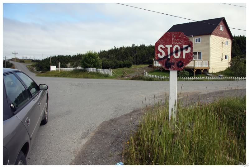
Oh those Change Islands kids and their spraypaint! Oh ho ho!
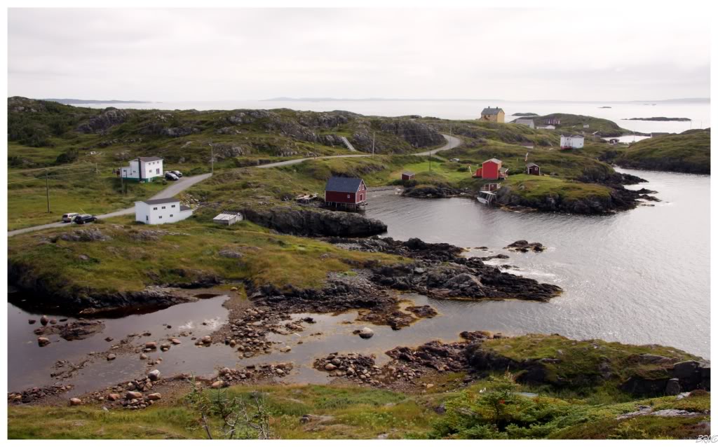
At the northern tip of the northern island was a 3 car parking lot and some rudimentary signs denoting a hiking trail. The day had grew sunnier and attractive, so I decided to partake in the hike and see what I could see of the few residences located here - I ended up pleasantly surprised by the above view.
For a place where people tend to imply there's very little to be seen, I found the Change Islands to have many building picture opportunities, nature picture opportunities and a great little hike here at the northern tip.
It was also here that I passed a foursome of people in their late 50s. I've come to always expect the Newfie accent nowadays, but I was surprised by a very Americanized, "sharr is quite windy up here, ain't it?" Suddenly interested by the foreigners, I asked and found out that they were vacationing from Florida!
There was a hike which extended the maximum 1.5 kilometers (1 mile) of the Northern Island, but I only hiked to the observation point and back to my car.
Into town, I noticed this strange fishing shed that for some reason had gothic arched windows. A man emerged from a house & I would have redeemed my earlier fear of asking locals, but I glanced over and found a mid 30s male draped in only a towel! It was definitely time to get back in the car!
What would be a highlight for most touring women, is unfortunately now forever burnt into my memory.
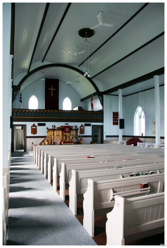
Still with a couple hours to go, I noticed a church and decided to check out the interior.
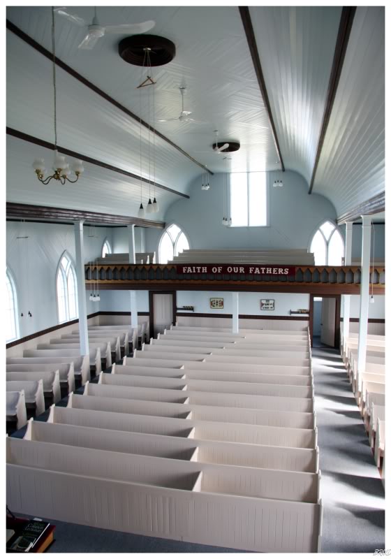
The United Church of Change Islands was constructed in 1896 to serve the growing methodist population. The building sat 500 peoples and portions of the woodwork were hand carved by Joey John Taylor, using a pocket knife!
The church still exists today, but it doesn't appear in the same strength as in the past. As I entered the front doors, there was a can asking for donations to help with church upkeep and in appreciation of your visit.
I went back to the car and grabbed something like $5 in change.
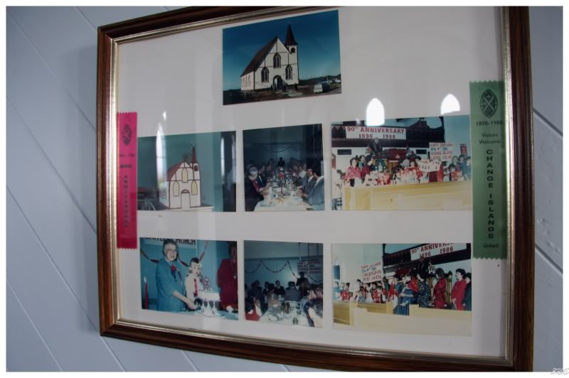
Good times at the church.
I particularly like the church cake at mid left.
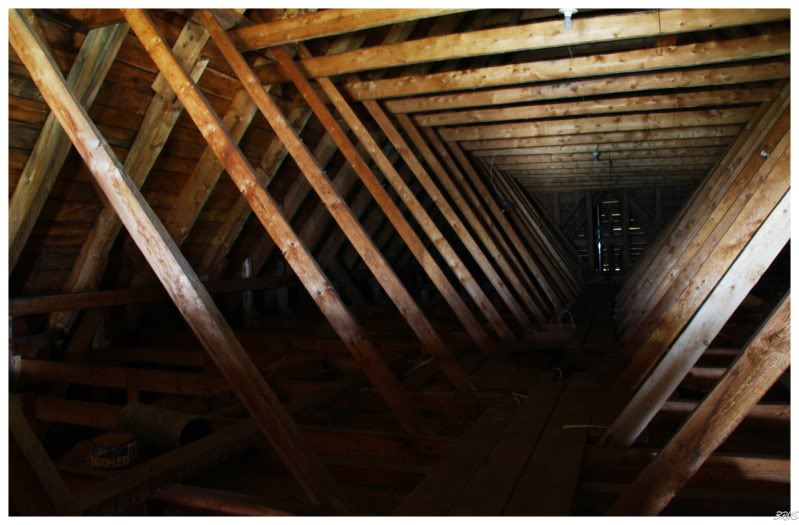

The fun part about showing yourself around such a structure, is that you can show yourself up to the innards of the building without repercussion!
I had traveled all of the 6 roads in Change Islands quite heavily and even purchased some coffee in an attempt to use up time. Since I had messed up the ferry schedule board, I was on the Change Islands for nearly 6 hours versus the two I had planned upon.
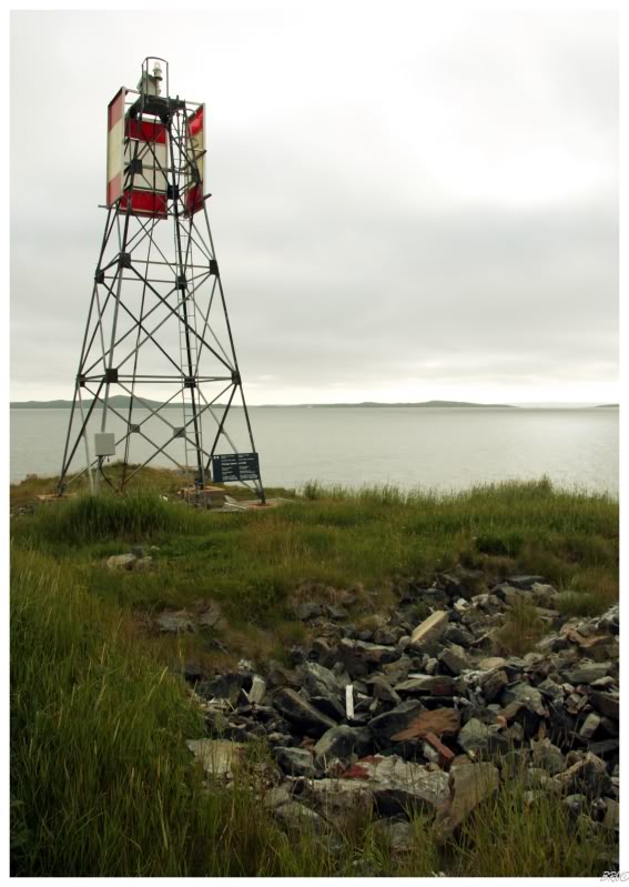
Into the evening and it was finally time to board the ferry back for the (other) island (Newfoundland). The last stop I had in mind was the previously mentioned skeletal light - I had never seen a skeletal tower up close before, and since this one was only a short beach walk away, I figured why not.
A woman who seemed equally bored waiting for the ferry (it's not that the Change Islands are boring, it's that waiting for the ferry is) called for my attention and discussed living in Fogo, living in Corner Brook and quite a few other things - all while I knew the ferry would soon be at the islands and that I had limited time to get to the skeletal tower.
Thankfully, she eventually let me go about my business and I hurriedly moved towards the shore. I scurried as fast as I could down that rock beach, all while I could see the ferry off in the distance headed towards me. It was definitely a funny moment racing a slow moving ferry on foot.
I reached the skeletal tower and it was what it was. A collection of stones and bricks still remained mere feet away from the skeletal tower...these stones & bricks from the previous lighthouse & keeper's house, which stood here until they were destroyed in favour of the current beacon.
I handedly won the race with the ferry back to the car.
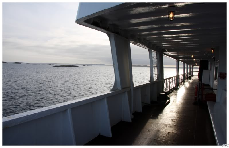
While I was unimpressed with mistaking the schedule, I couldn't complain about a boat ride at sunset - well, except for the biting wind and the loud, out of control children.
If you know me, then you know I sat outside on the deck and dealt with the frigid wind versus the painful children.
The original plan for this day was to visit the Change Islands then to visit Fogo Island (the ferry connects the two islands and the Island of Newfoundland). This is where I screwed up in regards to the schedule and was stuck on the Change all day.
The funny thing was that instead of taking a Change to Newfoundland ferry back, I was forced to go Change-Fogo-Newfoundland...so I ended up actually visiting Fogo Island for all of 10 minutes!
I literally exited the ferry, drove into the first town, took a picture, then high-tailed it back to the line & was back on the ferry in 5 minutes.

Once back on the Island of Newfoundland, I had an hour & a half drive ahead of me - which I was unimpressed with: I was tired and I fear driving in Newfoundland at night because of the moose.
Sure enough, about 5 minutes after getting off the phone with my parents, where my Dad was asking about seeing moose and being careful; I had to do the 'swerve left, swerve right, squeal tires' maneuver around a god damned moose I didn't see until the last minute.
I would learn right there just how good those things blend into the night & to slow my driving even more during dusk/nighttime hours.
Anyway, it may have taken a lot longer while driving 80km/hr (50mi/hr), but I was happy to finally reach the campsite without a moose coming through my front window.
Equidistant to Gander & Grand Falls, I awaited day 3 while watching some movies before collapsing into slumber.
Onto day3.
Sources:
1 - Clydesite - On this day: 10th of January
3 - Change Islands, Newfoundland & Labrador - Wikipedia
4 - ChangeIslands.ca
Navi
