Before we start, you may want to look at these Google Maps images and their location. It is not necessary, but it may improve your experience.
By the summer of 2009, I had already researched the location of every Newfoundland lighthouse & had personally visited nearly a dozen. There was one which I knew was only a 40km (25mi) drive from my house, so I left it for a weekend where I wasn't up for a lengthy drive.
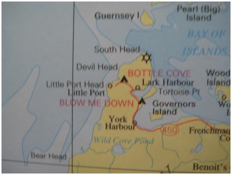
Eventually this weekend would come, and armed with only a blurry picture of my NL wall map, I was prepared to walk for a couple of hours to the lighthouse at South Head (marked by the ship wheel).
Judging by the lack of online South Head pictures, I figured that I might not have such an easy day (there were only a handful from two different sources, all of them taken from sea).
I started out by driving nearly the entire length of Highway 440, before turning off at Bottle Cove. My initial course of action was to hike north from Bottle Cove, since I didn't want to hike out of the town of Lark Harbour and garner unwanted attention.
The trail here is a gentle, pleasant path, where I've previously seen more people than I could shake a stick at.
No one was out today though, and I quickly reached the halfway point of the trail; all the while searching for a place to get down to the sea, or at least a viewpoint to evaluate what was ahead.
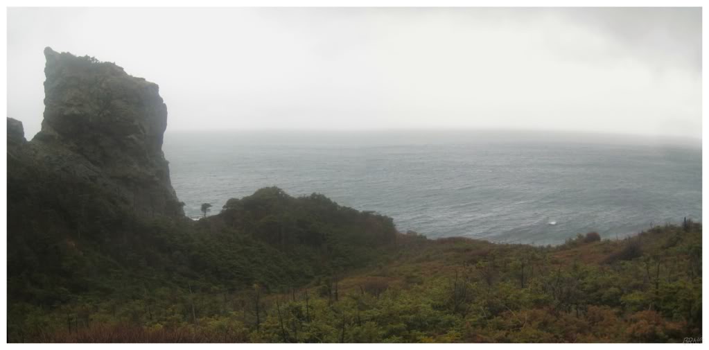
I found the viewpoint I was looking for, but unfortunately it didn't look like there was an inviting shoreline to walk out to the lighthouse.

I continued to follow the trail & eventually started bushwhacking northward, after I realized that the trail was starting to lead me back to my car. It wasn't long before I emerged onto a gravel road at the Devil Head fog horn station.
The fog station was marked on other maps I had seen & I knew this wasn't anywhere close to South Head. I had made very little progress.
I returned to the Lark Harbour side of the peninsula, as the apparent options from Devil Head weren't as inviting.
I found no one outside as I parked my car & walked away from the community wharf. It was a gloomy overcast day, the kind of weather which clearly doesn't motivate many people to go outside.
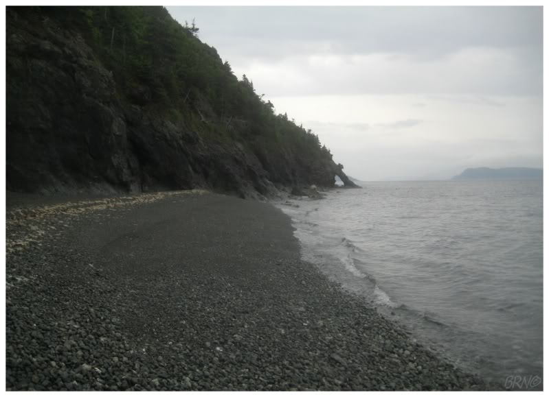
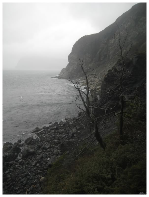
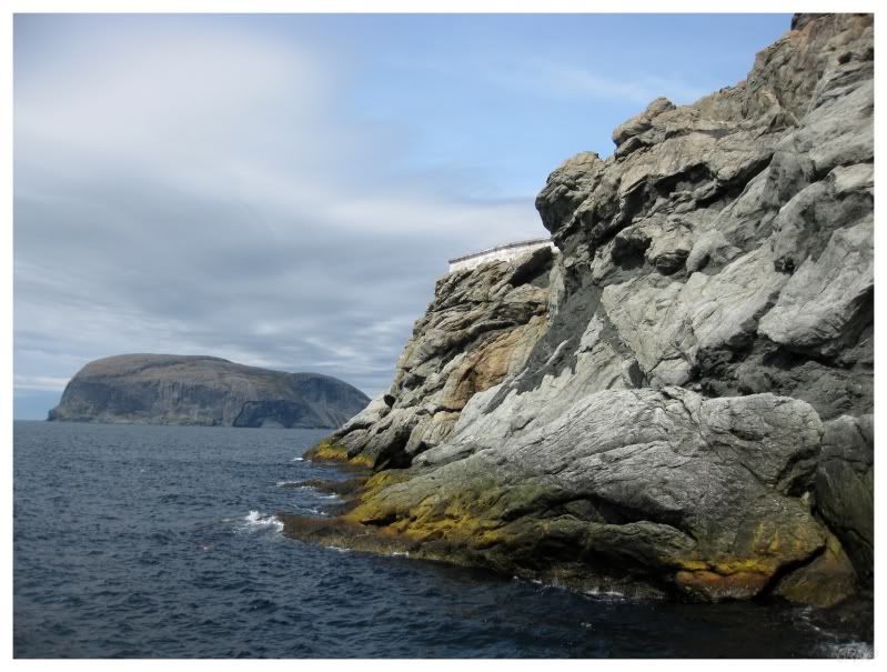
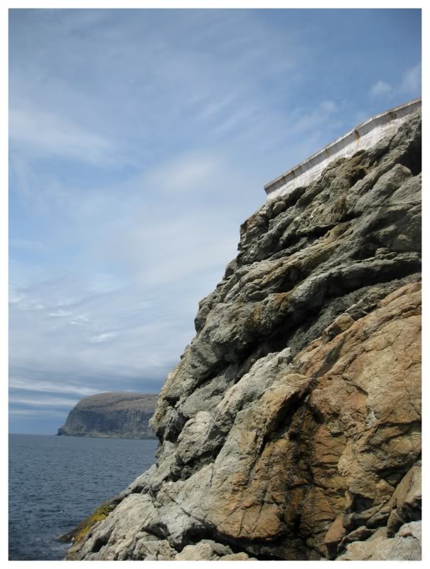
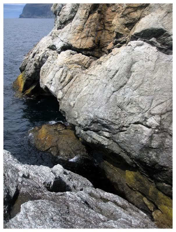
This route to South Head appeared a much better option. Other than my feet sliding out from the loose rock on the beach, I was happy with this route as I was making good progress. I would eventually come to a few coves, but I was able to cling to the sea faces and shimmy along the wall past these coves.
I would eventually come to a cove which was too deep to walk through & had no sea-face path of rocks to clamber across. I had to retreat to find a way up the cliffs beside me, a way up into the thick forest above.
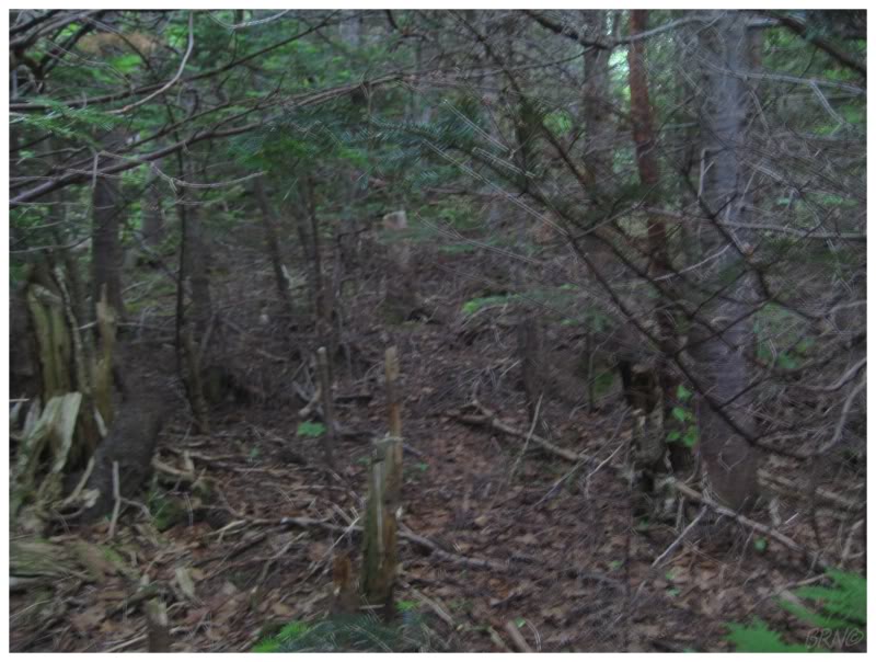
The forest was a mixed bag of thickness, where portions had distanced trees (and therefore easy walking) & other parts had very thick shrubs, tuckamores & pine trees (thick enough to make for a blurry picture in broad daylight). I would walk for a bit through sparse vegetation, but then come to a thick portion which would make me angle towards the cliffs & ponder returning to the beach.
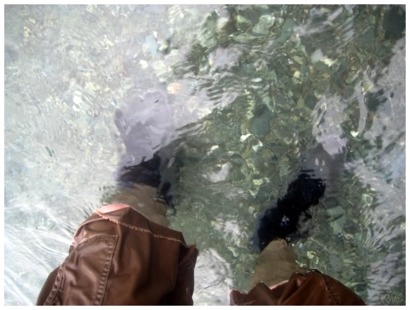
Once I returned to the beach, one of the next coves wasn't very deep. Splashing my hands into the drink, I discovered that surprisingly the water wasn't very cold.
This made passing the coves much easier.
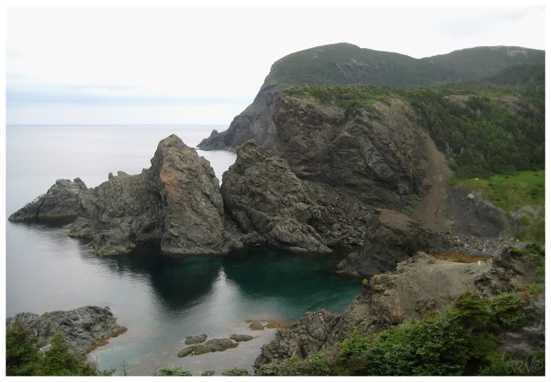
I continued to walk & scramble, while wondering how I couldn't have covered the 3km to the lighthouse yet. I was certain that the above sea arch would be the last spot where I couldn't see South Head, but passing through said sea arch did nothing, but ensure that I've walked through a sea arch during my lifetime (I still couldn't see South Head afterward).
Lark Harbour had long ago disappeared & as a result, I felt more alone out here. It was comforting to make progress, but the cliffs were growing thinner & steeper. I found myself shimmying along & assessing my options at a point, where there didn't seem to be any good options - it looked like there were meadows atop the cliffs, but I would have to jump up & scamper onto the top...
Then it struck me about how ridiculous this all was. To be out here alone & considering the odds of successfully jumping up & pulling myself atop this cliff, while looking down at the ocean below & visualizing myself splashing into the sea.
I gave up & retreated back towards Lark Harbour, deciding that I would need to try an alternative route. I was tired, dejected, hungry and sore, but most of all, I was sour that attempt #1 had failed. It was back to the drawing board.
Attempt #1 is depicted in this map. (Although I'm still unsure of how far I actually made it this day.)
When I would tell the story of these attempts, I would often say there was a half-assed one, which is attempt #2.
For attempt #2, I planned on driving to the Devil Head fog horn, then bushwhacking north until I reached the nearby beach (Parker Beach). Parker Beach would then mark the beginning of easy street, which would lead right to the lighthouse.
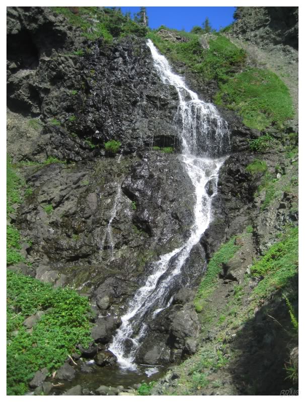
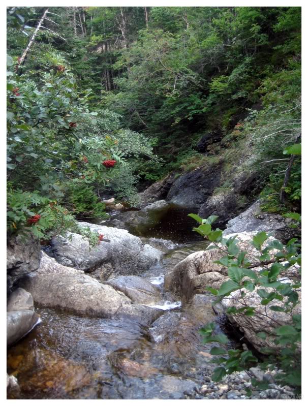
The wheels fell off of this plan awfully quick after stepping in boggy muck within 5 minutes of hiking, then proceeding to try & fight through a sea of tuckamores (stunted balsam trees, blown into their condensed, thick shape by the province's prevailing winds). Tuckamores aren't typically hard to get around because there will only be 1 or 2 of them (which are easy to walk around b'y), but here there was a thick forest. It was unbelievable how much trying to get past these tuckamores reminded me of trying to get to the front row of a concert. I climbed atop the tuckamores & muscled my way into every cavity & crevasse. In the end, I doubt I traveled more than 0.5km (0.3mi), before realizing that this wasn't going to work & that I should detour to this waterfall and cut my losses for the day.
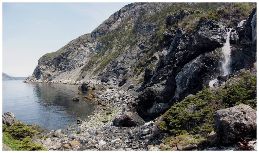
Beneath the waterfall, I followed the rocks & streams that led down to the ocean (I believe this is 'Island Cove' on your maps). This may seem pointless, but I was gaining knowledge of what would work & what wouldn't - and walking along the shore on this side of the peninsula, didn't seem like it would work.
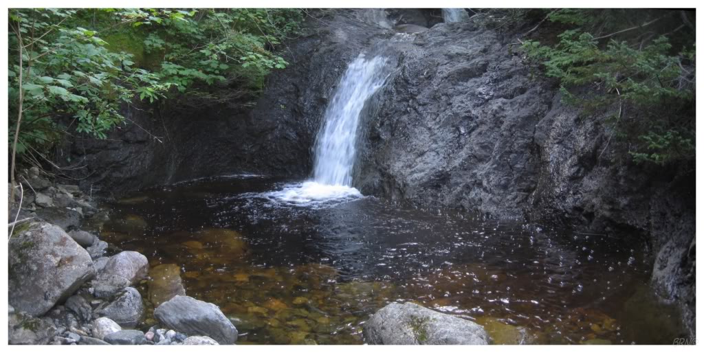
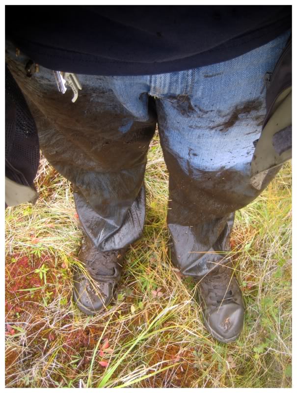
Ready to call it a day, I climbed back up the cascading falls, and in doing so, my day continued to improve as I slipped on a rock & ripped my shorts while submerging my ankles, calves & knees. I'm not talking a minor tear either, I ripped them clean from the knee to the crotch, as it looked like I had one pant leg & some type of loose robe covering the other leg.
I climbed atop a nearby rock & pulled a single Kronenbourg from my backpack. I clearly wasn't meant for South Head today, heck I was barely destined for this waterfall.
On attempt #3, I sought to find a hiking trail I heard about, a hiking trail which supposedly led directly from Lark Harbour to the lighthouse.
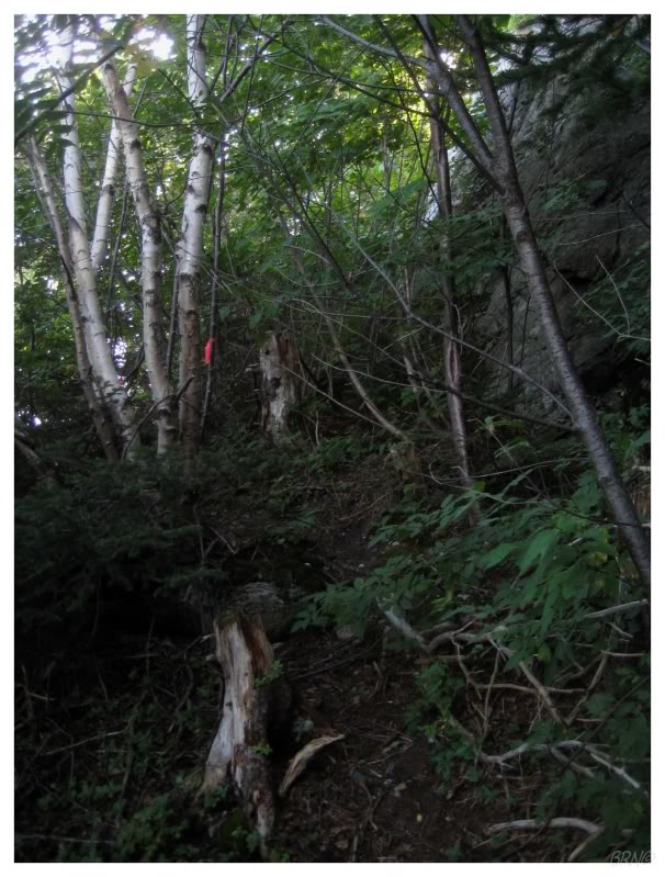
I really doubted the existence of this trail, but decided to give it a shot. Instead of walking the beach, I entered the forest at Lark Harbour and found an ATV trail, which was a good start. I followed it for about 5 minutes, but once it passed a wood pile, the trail started to diminish & I soon found myself pushing aside branches as I stepped around path muck with surgical precision.
The trail would completely disappear, but this forest surprisingly had the intermittent pink flagging-tape markers. I tried to follow them, although it didn't make for casual hiking. It provided me with a direction through the woods, but little else. I would hike through easy portions with floors of leaves and very few trees, but other portions were thick, with multi-directional branches and sloppy, slippery hillsides.
I can't say it wasn't pretty, but it was hard to imagine eventually covering 3km of distance with this zigzagging, meandering path of travel through the woods.
I eventually stopping finding pink flagging tape & abandoned the supposed lightkeeper's trail, returning to my previous seaside trail.
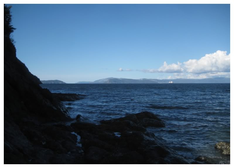
As I was hiking along, tired & wanting to return to Lark Harbour, I paused and looked out at the sailboat sailing into the Bay of Islands (the bay here and in Corner Brook). I thought about how they've seen South Head & about how it would be so easy to sail around & see such awesome sights.
I had never even seen a sailboat in this territory & even if I failed today, I was happy to see something new.
Back to the task at hand though.
I had also hypothesized that I could walk up one of the streams showing on my new topographic map, to reach the inlands of this peninsula (I had now printed out an actual topographic map instead of relying on a blurry picture).

Climbing upwards from boulder to boulder in the stream was hard work, but the forward progress was rewarding.
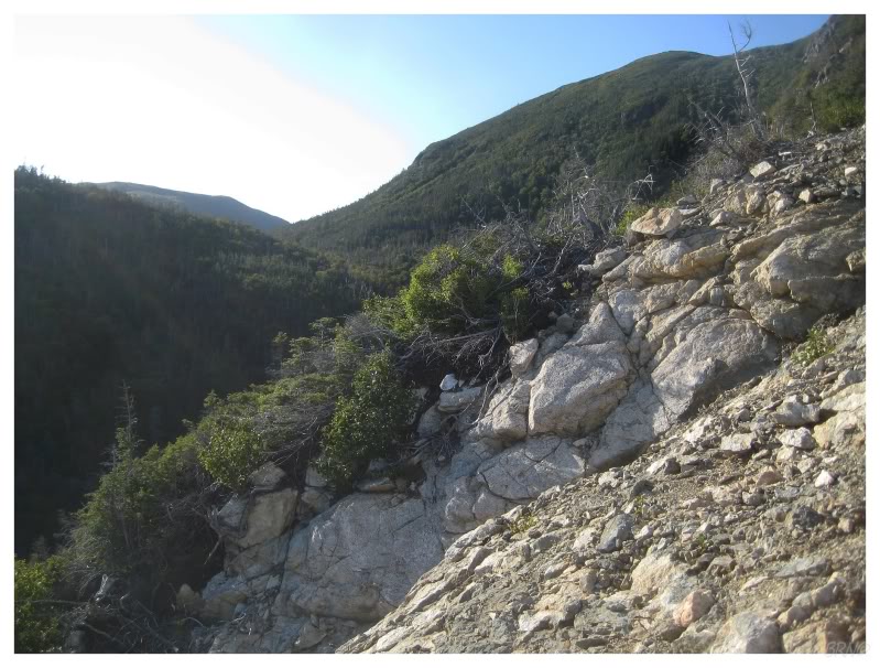
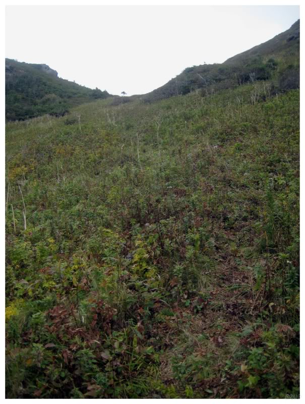
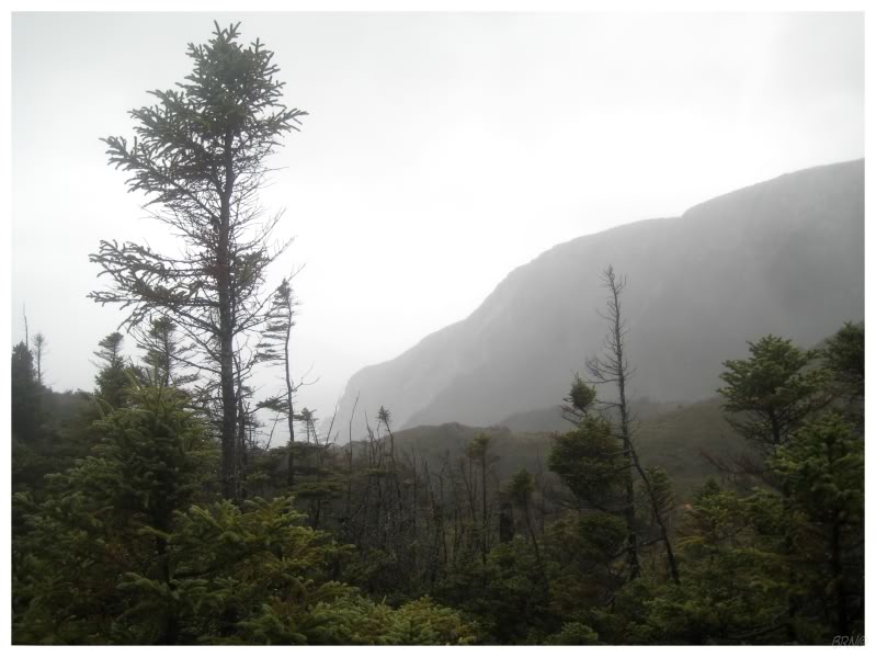
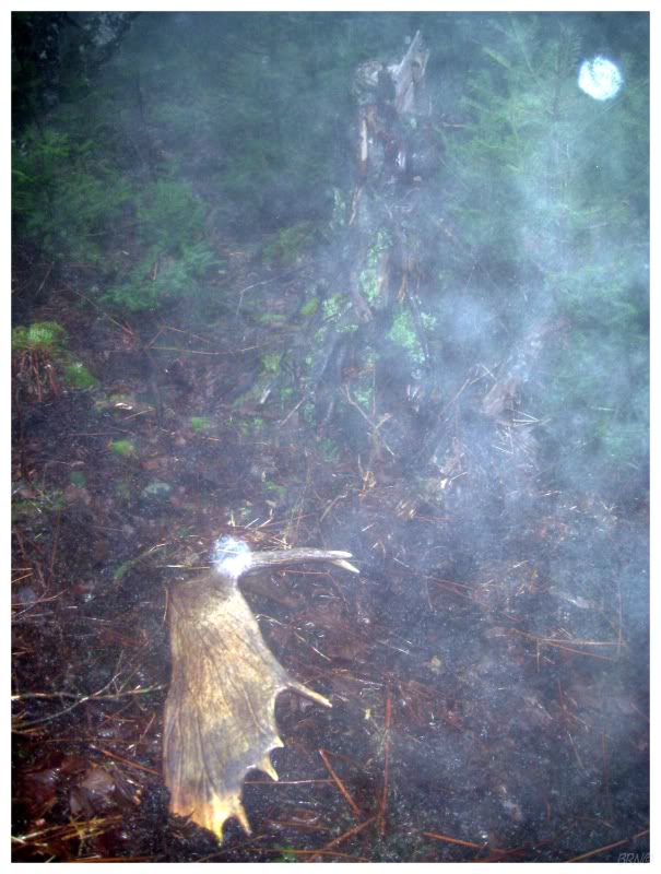
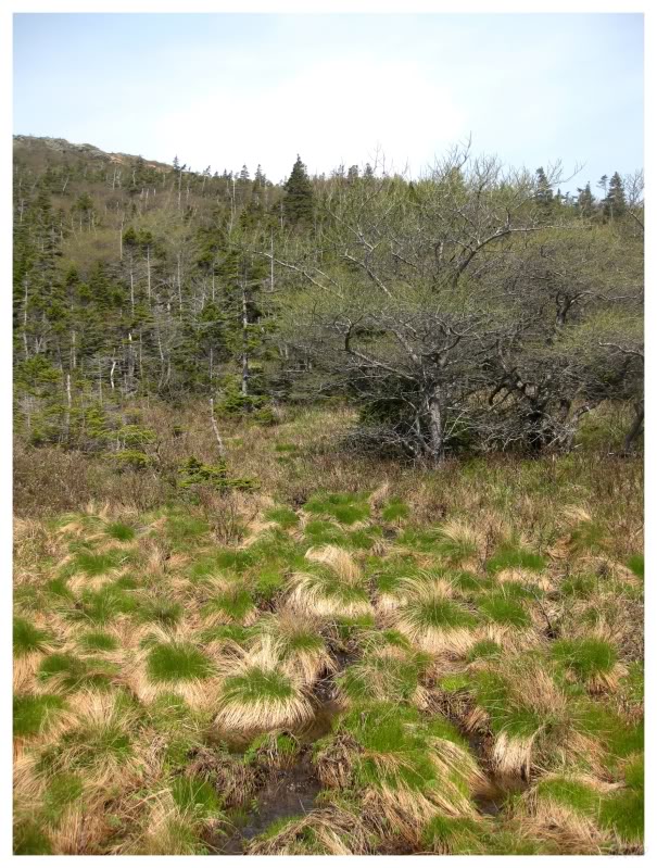
The only problem was when I had to go around waterfalls, as the vegetation was thicker than anywhere else and as a result, my progress would become glacial-paced (note the thick vegetation in the above picture). This experience brought me back to my tuckamore experiences of attempt #2, as the vegetation held me like a jam-packed crowd - during my breaks in fighting, I wondered if the stream fed these plants and made them so damn lush & healthy.
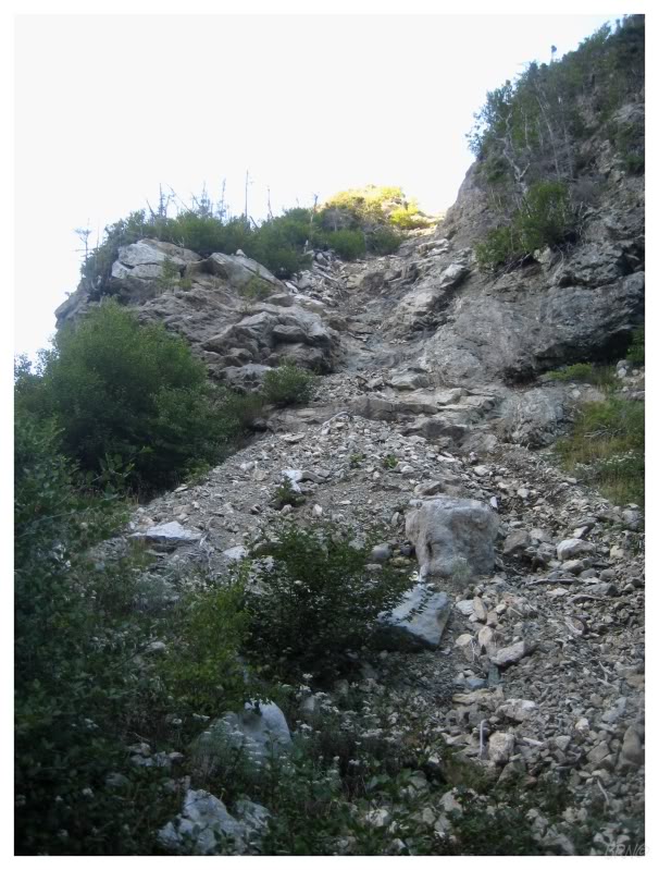
There weren't that many waterfalls though, so after another hour of stream climbing, my progress meant that the elevation flattened out and I noticed a vegetation-free hill beside me. The stream continued off to God-knows-where, so I decided to climb the hill & assess my situation, instead of blindly following the stream.
I believe this might have been my first time scrambling up a legitimate scree hill. I was a bit skittish with the whole experience as the hill was on a steep angle & my feet slipped more than a couple of times. In addition, I continually thought about how I was going to make my way back down from whatever height I would reach.
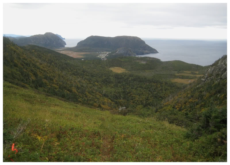
About 200m up, I stopped & evaluated what I could see - there was beauty to the right & nothing but tree covered hills to the left. How in Sam Hell could I not look down on South Head from here?
Instead of continuing up the hill to attain a better vantage point, I succumbed to my fears & got down from the scree hill. One of my faults is that I wig out in precarious positions & simply want to get down - and that fault got the best of me on this day.
I quickly skidded on hands & feet down the scree hill, back to the stream & returned to Lark Harbour.
As for a map, I only passed one legitimate stream on this trip, so I thought I climbed the second one...but looking at the map, I believe I must have climbed up the third stream? This was my failed 3rd attempt, but I still regret going half-assed at this one as well, because I really would have liked to hike atop these hills to further evaluate the surrounding hills (I started this attempt later on in the day because I didn't think the lighthouse trail would lead anywhere).
After attempt #3, I learned of the impending South Head demolition. It wasn't about to get demolished immediately, but it definitely would be eventually demolished.
With all of this work I had put into seeing South Head, there were certainly emotions upon hearing this news - but it was hard to ignore the strongest emotion, where I was annoyed, because I didn't understand why government money was being spent to demolish such an inaccessible lighthouse.
Anyway, this news also led me to get off my ass & get to South Head.
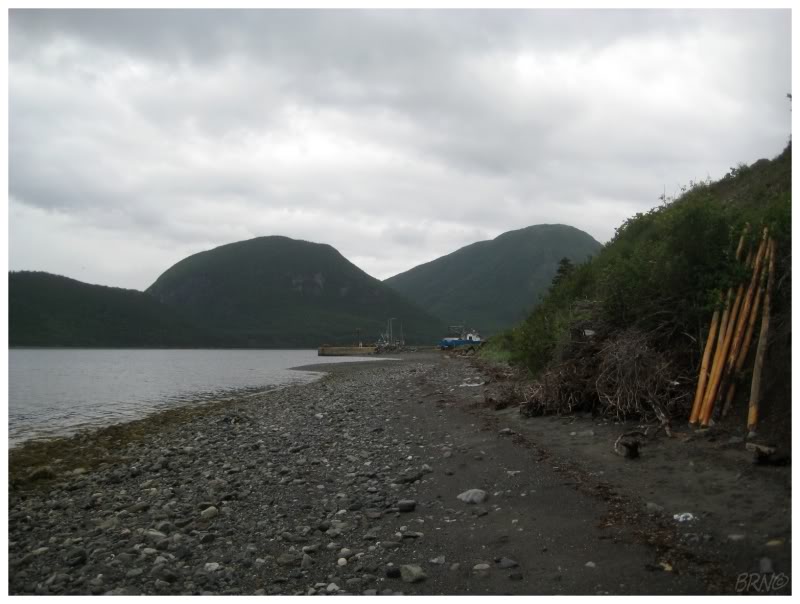
I departed for attempt #4 on a overcast day. This time I set out to follow the ATV trail from the Devil Head fog horn station, as the previous ATV trail from attempt #3 seemed to be alright.
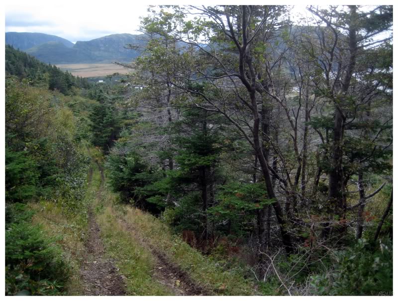
The above picture is already past the fog horn station and at that point, I was pleased with the early returns. As I looked at the forest I was passing, I remembered how much of a pain-in-the-ass the previous bushwhacking was, and here I was comfortably trotting by on this well-traveled ATV trail.

I eventually came to a clearing & studied my map, knowing that I was in the indicated bog & that I should move towards the upcoming fold in the two foothills.
While the path was mucky in places, the area marked as swamp on my map was easily passable as I moved perpendicularly across it & onto another apparent path.
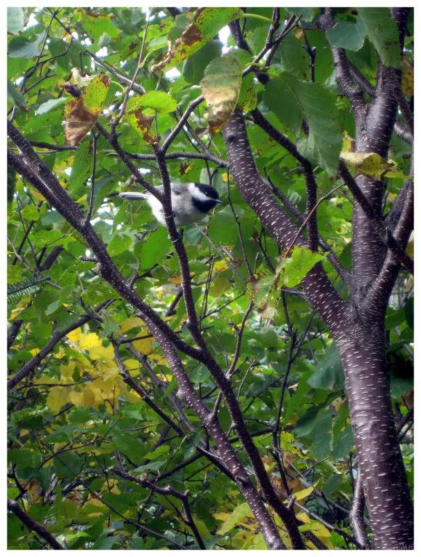
While on this second path, I heard a chickadee calling & noticed it less than 10 feet from me.
I stood there for a few minutes photographing the bird hurriedly hopping from branch to branch.
With a goofy smile I put away my camera, happy with my bird pictures. I turned and continued up the path, but within seconds, I spotted a bull moose walking down the path right towards me! I knew it was a male moose because of its giant rack, but probably could have figured its sex from the imposing stature of the animal as well.
I knew that moose aren't aggressive and I knew that I wasn't to worry or to run - but still though, I had a 1000 lb animal moving down a path towards me. I tried to calmly walk away, but it turned into more of a speed walking. After covering about 100m, I calmed down slightly as I thought I was far enough away, but then within a couple of seconds, I looked to my right and saw that damn moose still strolling down the trail towards me!
I will admit I started to freak out a little more at this point. I moved faster & hurried to the bog clearing, figuring that this moose would bugger off & stop following me if we weren't confined to a path.
Reaching the bog where I had taken precise hiking steps earlier, I was now half-running & not taking nearly enough care...until splat! Right into the bog I went, clean up to my upper thighs in muck. I was completely stuck & started looking back, half expecting the moose to stroll up while I fought to get out of the bog & out of this damn moose's way.
I eventually freed myself, cut my losses & went home. While walking back, I waited in the centre of the bog, but never saw the moose come out of the pathway - I think Mr. Moose must have finally picked up my scent.
(By the way, I find this moose-bog fiasco hilarious now. And as an aside, my Newfie friends who've grown up with moose as backyard visitors their whole lives, have all found this very funny: their mainland friend was scared off by a gentle old moose...and then found himself waist deep in a bog! Although I was quite scared that day, at least I brought some joy to all of their lives (small amount of sarcasm).)
I recruited a couple of friends to help with my 5th attempt.
In no time, we were up the road to the Devil Head fog horn station, past the first trail, through the bog, and then past the second trail. I was worried about the moose from last time, so my friend & I fought to make noise by socializing, even though we really have nothing in common & have trouble keeping basic conversation in our normal day-to-day life (ha ha).
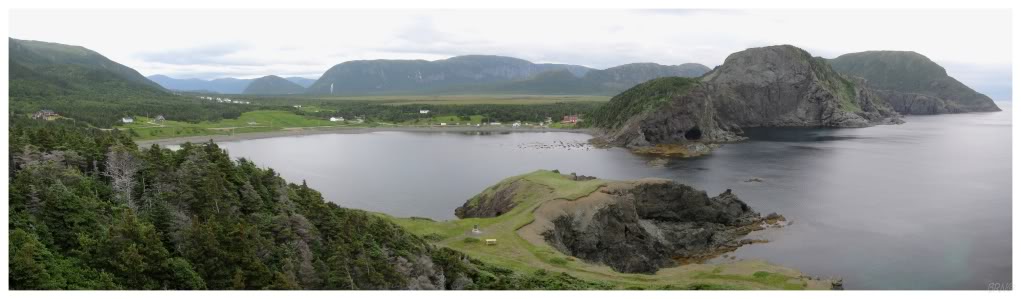
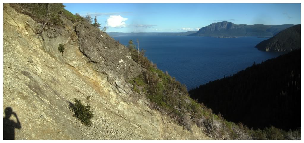
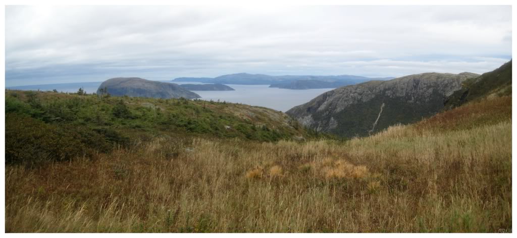
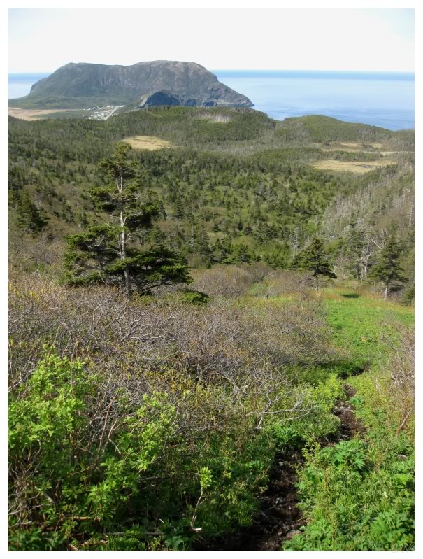
Anyway, this picture is from the grasslands which extend from the second path, between the two foothills & up to the crest of the first hill. This portion was incredibly easy compared to the forest portions, and I took many breaks to absorb the remarkable scenery, which seemed like the alpine meadows I had always envisioned in Switzerland (minus the oceans, obviously).
This was good progress. Over a distance which seemed so long and nerve wracking by myself, we had quickly beaten that forward progress as a group.
I had to leave the group behind for a second, as these grasslands were just too damn exciting. There wasn't any bog or forest limiting my movement anymore; and now there was only easy movement towards the apparent crest in the mountain. What was at the top? What would I be able to see? What was ahead of us?
As I reached the apex of the passage, it was a culmination & it floored me. Suddenly I could see all of the islands on the map, clear as day. There was no more guessing as to what was around, for I could see the panoramic lay of the land. There were forests further down the hills, but there was only grassland around me. I could see what surrounded each of the forests from up here.
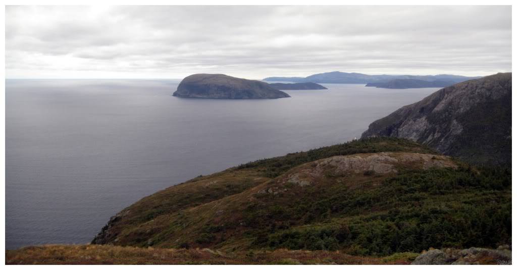
We pushed forward, as we could now see the promontory & we knew we had to veer towards that direction.
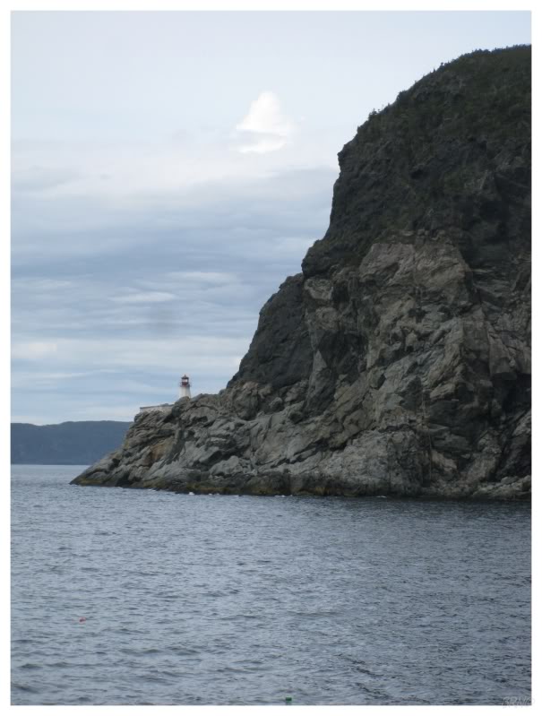
It wasn't long before my friend exclaimed & pointed...and then, there it was, the South Head Lighthouse upon that promontory. I had doubted its existence so strongly by this point, that I didn't believe it was there until I saw it with my own eyes (and I still half-doubted I was seeing what I thought I was seeing).
I stood there for a second & studied the cement structure situated below. It was surreal.
The three of us went forward and very quickly found thick forest as we tried to get to the valley below. There was the occasional clearing, but for the most part, it was an exercise in moving branches out of our ways to move forward - when my friends got me to the grasslands apex I was happy; when I saw them valiantly fighting through this ridiculous forest, I was thankful.
Unfortunately, after fighting for at least an hour, we came to a rock outcrop with a 20-foot drop below. At this point we could have went south & found a way around the small cliff, but it was apparent that we weren't getting to South Head today.
The positive aspect of this attempt is that it really furthered my knowledge of the lay of the land. I now had a plan & a course of action for getting to South Head. I was getting closer & closer with every attempt.
(Map of attempts 4 & 5)
The winter was looming and my one friend moved away. I was dying for another attempt because of this new progress, but the weather wasn't cooperating & co-conspirators weren't either.
I threw caution to the wind & left on a less than ideal October day. The forecast called for light rain & there was some fog.
As I arrived at Devil Head, the fog was present, but the rain was a gentle mist at most. I started into the woods & started singing the song I know most of the words to, which is Wu-Tang Clan's Triumph. I promptly made it through the two path corridors and onto the peak of the grasslands. Thankfully, my rapping scared off all of the moose in my way.
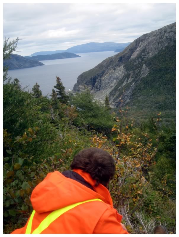
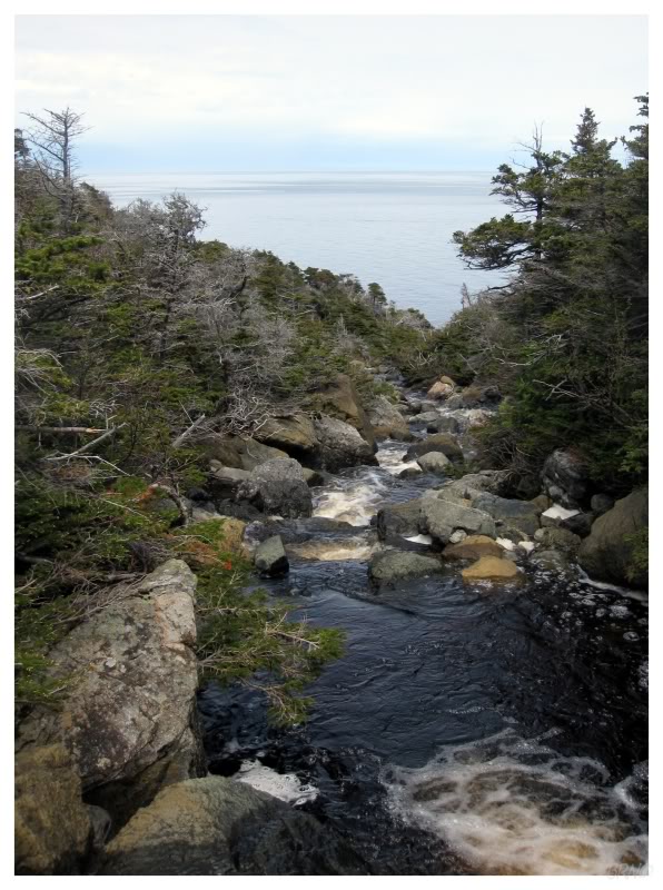
This time I knew to go down the hill to the forest earlier & I even lucked out by happening upon a few forest clearings. It wasn't long before I found myself at a stream which clearly led to the ocean. As I moved along the large boulder stepping-stones in the waterway, I found myself gawking ahead, remarking at how close I was to Trumpet Cove, the last named geographic feature before South Head.
My stream ended with a 15 foot drop to the beach. I looked around in disbelief.
To each side of the stream, the cliffs kept their height & the forest was thick atop said cliffs. I evaluated using a limber tree to let myself down - or trying to bushwhack to a better location - but I further assessed the situation & considered how far I was still from the lighthouse. The rain picked up as well. Mother Newfoundland looked like she was tired of my disrespect for her lands, with thicker fog approaching on the horizon.
With deteriorating conditions I hastily retreated.
The walk back got interesting. As the rain picked up & visibility plummeted, I started to move a bit faster, even falling a couple of times as I was trying to race through the viscous, knee-high shrubs. The fog & rain were growing in intensity at this time, so I paused to note what was in front of me, as visibility was going to be insufficient in no time.
My foresight was correct & the visibility fell to about 10 feet within minutes. Therefore, on this path I had just tried to memorize, I went in the direction I believed to be correct, even though I couldn't see any further than 10 feet in front of me.
Now where you'd think I could simply & swiftly move in the direction that I thought was correct, you have to remember that there are 50-foot cliffs into the ocean at some places here. I had to be absolutely sure that I wasn't about to step off of a cliff.
I began to panic a bit. There couldn't have been more than 3 hours left in the day and the fog/rain wasn't letting up. In addition, under these conditions the daylight would fade considerably sooner. I thought about tonight's predicted low (41°F(5°C)), and the wet, cold clothes I was wearing: if night fell, sleeping out here would certainly mean flirting with hypothermia. On the contrary, nightfall wouldn't lessen my vision to much less than it was right now; so I also thought about continuing to the south until I eventually hit civilization.
Stress & anxiety washed over me for what seemed like hours, although it was more likely around 45 minutes.
...but then I heard it: the Devil Head Fog Horn. Sweet Baby Jesus, a Fog Horn blasting from a location 10 feet from my Intrepid. I thanked my lucky stars and calmed down slightly (I also resolved to smarten up about trip preparation in the future).

Whereas I thought I was walking the right way, the fog horn made me change my path approximately 30° to the left. It was extremely eerie to walk these wet, yellow grasslands with only 10 feet of visibility, but the fog horn was a welcomed comfort.
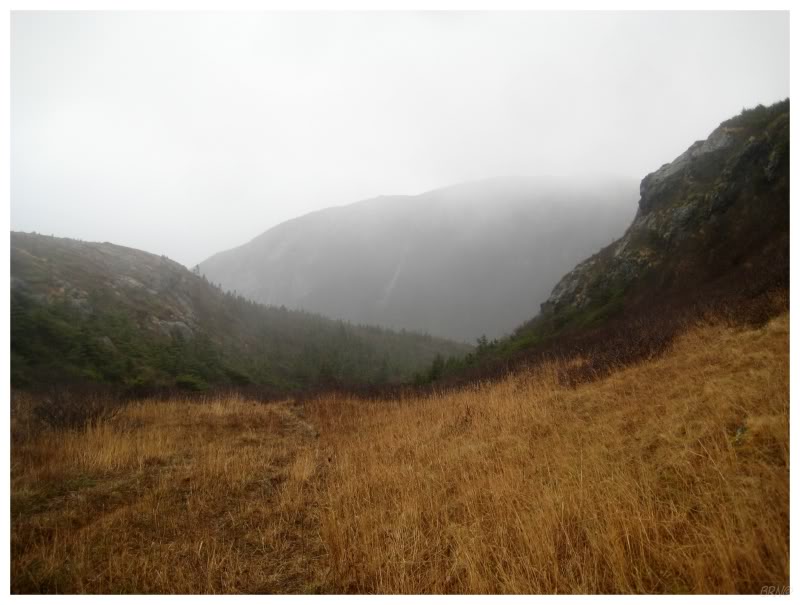
I obviously still paid attention & didn't blindly follow the fog horn (well, I used my eyes as much as I could). I believed that I had already walked down the grasslands path & was now walking in the sparse forest to the left of the path through the second bush crossing. As I continued along, trying to get back to the car before dark, the fog started to dissipate and I froze in place. It was as if I had walked for 30 minutes with my eyes closed and the world around me was a complete mystery about to be revealed.
The crazy thing was that as the fog lifted, I found out that I was on the top of the eastern hill next to the foothills! (You can see what I'm talking about in this picture - I was at the top of that rocky hill that leads up the very right side of the picture). As I was standing there - shocked to find myself where I was, but happy to be somewhere safe, the fog already started to come back & I was quickly back to my 10 foot visibility.
Fortuitously I was at the top of a rocky slope, which I had noted went down to the desired forest below. So instead of backtracking to the grasslands where I came, I simply zigzagged down this rocky hill, using trees to hang on & slide down the loose-rock slope. The hill would give me one last parting gift though, as I was sliding down & a tree branch slid perfectly up my nose in a very intrusive manner. I quickly pulled back and separated myself from the stick, but blood still ran down my face and onto my hands.
It didn't bleed for very long & I found the path a few minutes later. It was starting to get dark as I neared the end of this attempt & while I was roughed up by the excursion, I was also thankful, for it could have been a lot worse.
A map of attempt #6 is here.
I was blessed with one last attempt in 2009.
My friend had come home & we had an unseasonably warm and unseasonably nice weekend. The two of us drove out to Bottle Cove early in the morning, getting there at 9a.m.. This gave us plenty of time to get out to South Head...backhand that son-of-a for being such a foul temptress...and then return to the car before nightfall.
By this time, I had already hiked the first half of this trail three times, so it was starting to feel awfully routine. We made it to the grasslands without incident.
It was a bit wet which did slow us down, but nothing that we couldn't carefully manoeuvre around.
In addition, I was wearing my steel-toe boots now instead of sneakers (I don't have any other boots. Even though they're heavy, they do the job).
I knew how to go over the grasslands, how to avoid bushwhacking through the 3rd stage & how to travel over the land of shrubs. It was a lot like playing Super Mario nowadays, where you've played it so much in your youth, that you speed through the board while hitting all of the secret shortcuts and fire-power flowers.
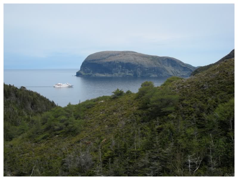
About 2/3rds of the way to the lighthouse, I noticed a cruise ship passing in the sea, obviously headed towards Corner Brook. The two of us took pause at how scenic it was, with the imposing Guernsey Island (Weeball) in the background.
Continuing along, I also knew which stream to traverse to the ocean, after checking out the situation during my last attempt. Therefore, although we had to bushwhack around the odd deepwater portion, this part went by quickly as well.
Even though we were making this incredible progress & the weather was outstanding, I still had this sinking feeling inside. Would this would be just another failure? Would this only bring a long, strenuous walk to the car?
I had to stay positive though.

...and it was easy to stay positive after I got a boost at the end of the stream. Climbing down a few boulders, I finally, after all of these attempts, landed upon the beach at Trumpet Cove.
The amount of work which went into reaching only this Cove of Trumpets, was unbelievable. The scenery is also spectacular, so the whole moment gave me pause. The sea was intimidating, the cliff faces were high & I had worked so hard to reach this point - I was speechless.

After taking in Trumpet Cove for a few minutes, I was chomping at the bit to get going. I could see South Head not far away & I wanted to get over there.
The start was pretty flat with good ankle-rolling stones, but was easy enough compared to the second portion, where the stones quickly turned to chest-sized boulders...

...and then into full-on, larger than your body, incredible chunks of rock.
We could step from boulder-to-boulder for the most part, but there were more than a couple places where hands were required. There was also a time or two, where it got so precarious that my friend even thought about stopping the journey towards South Head.
Thankfully she didn't & we moved further & further out on the cape. Judging by the view from when we first came to Trumpet Cove, I was expecting to be out to South Head in a 1/2 hour, but this was proving to be a lengthy portion of the journey, in and of itself.
We had to take a couple breaks & it was easily over an hour. It was during these breaks that we saw a whale & also a fisherman. I was happy that the fisherman didn't see us & wonder what we're up to; while my friend quipped about asking him for a lift.
Continuing along, we had to be getting close (the lighthouse was tucked out of our sight by this point; behind the cliff to our right).
Although eventually, and finally, the lighthouse's cement foundation peeked out from behind the cliffs.
If it was surreal to stand at Trumpet Cove, then I'm not sure I have a word to describe what finally standing here felt like...
...that surreal feeling was present until I made a most unbelievable discovery: there was a small sea cave & no way to get over to the actual lighthouse.
I didn't believe it at first. I went down towards the sea & reevaluated the situation. I looked at the gap, the water depth, the cliff faces above. I paced back & forth on the edge of the sea cave, finding no pathway even remotely possible. There was no way but to get in the water, but that wasn't happening because of the depth, the turbulence & my lack of swimming skills (it wasn't as close as it looks. I would have had to physically swim from rock to rock).
My friend had been resting below & I came back from the sea cave with a look of defeat. Whereas she thought she had finally made it to South Head, her mood instantly collapsed when she saw my face & I told her that there was no way over to the lighthouse.
I paced back & forth in search of some other option, but there just wasn't enough land out here. I again considered getting into the ocean, but I really am just an awful swimmer (think doggy paddle), and that seemed like a downright awful idea.

The early morning start paid off here, as we didn't have to rush back.
We may have also dawdled out in Trumpet Cove due to our defeat (not to mention the fact that I like obscure places).
Eventually we made it back to the stream portion and I took one last look back from Trumpet Cove. If I was going to return to South Head, it wouldn't be from here, and therefore, this would be my last time seeing the light from Trumpet Cove.
The hike back was slow, as we were tired & disheartened.
Thankfully, the clouds never spit rain & we were making progress.
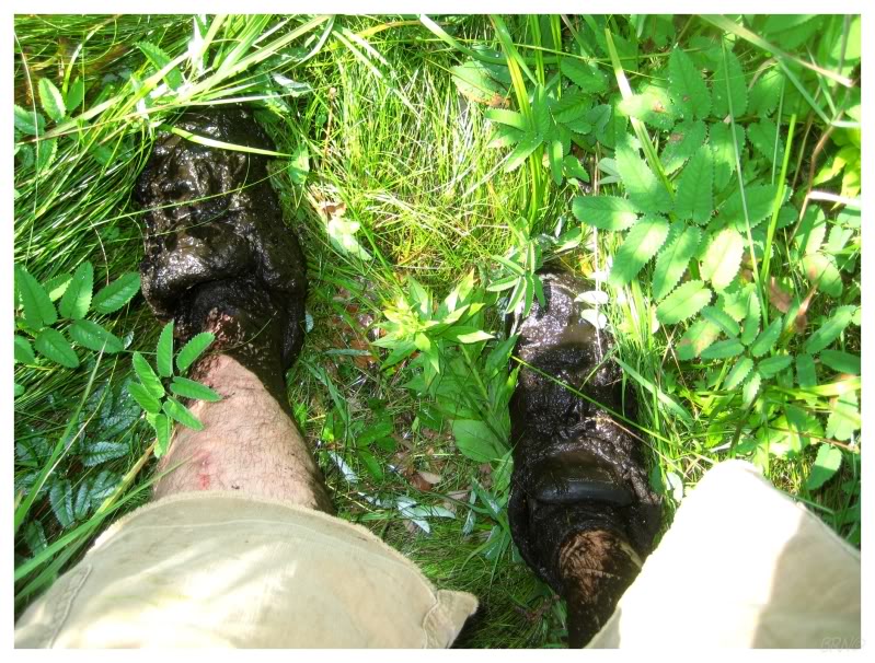
I was moving a bit faster than my friend, which was a good thing after I lost my balance and heard a puncture as I mashed up against a tree..."oh shit! My bear spray!"
The pressurized can quickly spit out all of the mace & it was about as ideal as a can puncture event could be. I got a small amount in my eyes, but not even enough to really bother me. I bent down and washed my eyes with stream water as I was running low on water by this time. This amused my friend, as she cracked jokes about how a mainlander would get down his delicate knees and wash his eyes with non-bottled, dirty stream water.
Two other things of note in the above picture are the fact that I wore a white shirt - which amused my Newfie friend, since who in their right mind wears a white shirt to go hiking? (Even though I almost kept it clean (until the bear mace)). Also, the fact that this picture is taken in the darkness - as yes, after leaving at 9a.m., we got back at an incredible 10p.m.. I obviously realized it was dark when we returned, but I was shocked when I learned that we took 13 hours to (almost) hike to South Head.
It was a good thing I took the time to appreciate South Head from Trumpet Cove, because I would never return.
In mid-2010, my friend came to me & told me that the South Head Lighthouse was being demolished. Coast Guard helicopters were flying over Lark Harbour & had pieces of the lighthouse tied below them. I checked the news sources, but when Lark Harbourians didn't even know about this lighthouse, I doubted that it would get any news coverage.
I drove down to Lark Harbour to find out for myself. There is a Coast Guard station down in Lark Harbour & I found the new lighthouse pieces out back behind the building. I knocked on the window & talked to a staffer, who confirmed to me that they were indeed destroying South Head, "we're crushing the current lighthouse to build a base for the new one."
LighthouseFriends has a picture of the new breathtaking fibreglass tower (You can see my climbing conundrum a bit better from that view).
If were talking hypotheticals, my eighth attempt was going to be an over, across the peaks in the middle of the peninsula, then down the front side, attempt.
I waited a while to post this because I thought I was going to put forth that effort to see the new fiberglass tower, but I've decided that I have better things to do.
I knew an acquaintance who I told these tales to & he brought up facebook account, showing me interior pictures from the abandoned South Head Lighthouse. I couldn't believe what I was seeing. He had casually strolled out to South Head in a boat one afternoon by chance.
It chapped my ass & taught me, that maybe asking for a boat ride is a good idea sometimes.
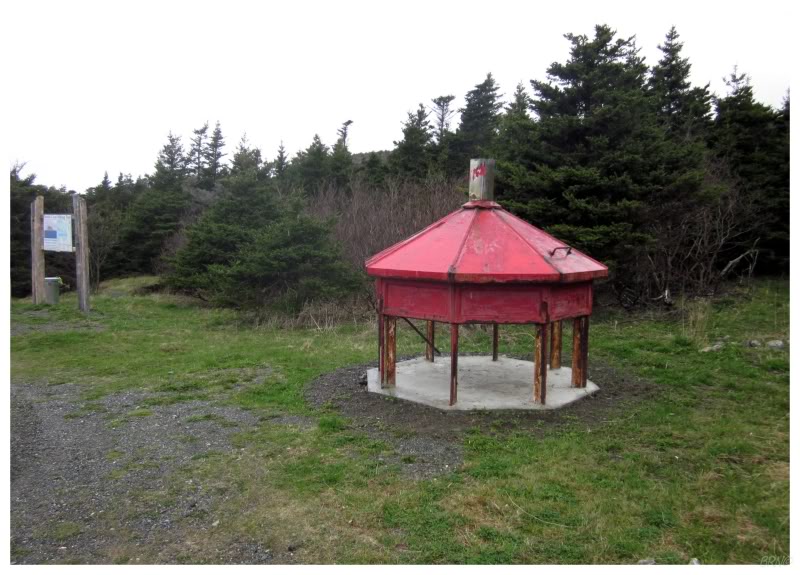
Another thing I couldn't believe is that they chopped the lantern room in half & cemented the top into the ground at the Bottle Cove parking lot.
They didn't bother to remove all of the glass or copper either, so I now have a souvenir copper bracket that was somewhere I could never reach - South Head.