Victoria Day weekend was spent in the Bay d'Espoir region.
Of course I had already been there, but I had no problem returning, as I had missed enough items of interest to warrant a second trip.
It is a 2.5 hour drive from Corner Brook just to reach the Bay d'Espoir exit; then it's 144km (~90mi) along an undivided highway to reach the first town.
Leaving work on a Friday, the sun set before we reached that first Bay d'Espoir town.
Waking in the morning, we drove to St Alban's for coffee and cash money. Next up, I turned down the NL-365 towards Conne River, confused as to why I didn't drive this highway back in 2010. Driving along, I was impressed with the size of Conne River & also impressed with the bald eagle which was flying beside our car. These were memorable moments, but nothing I could capture with my camera skills while driving (the eagle was moving as fast as the car).
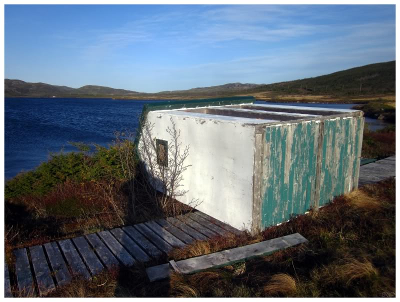
I snapped a picture of an abandoned igloo before bidding Conne River adieu.
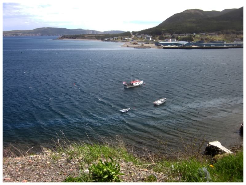
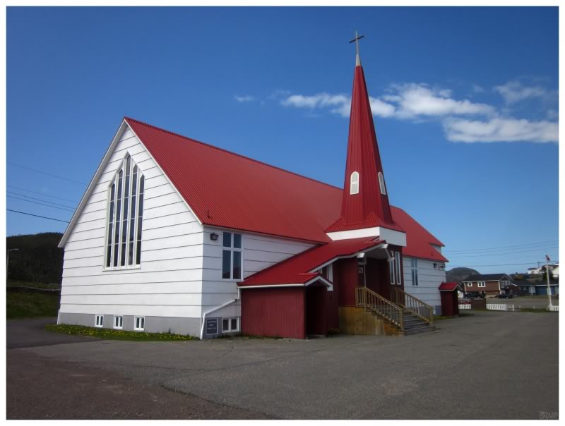
Harbour Breton (like St. Alban's) was another place I had already been, but I felt it was necessary for Shahlene to see it - it's the major community down here & there's an easily accessible lighthouse.
I was happy with the decision as I saw a new Harbour Breton myself on this day. The difference was night & day between rainy, dismal Harbour Breton, and this Harbour Breton of illuminated hills and sunny skies.
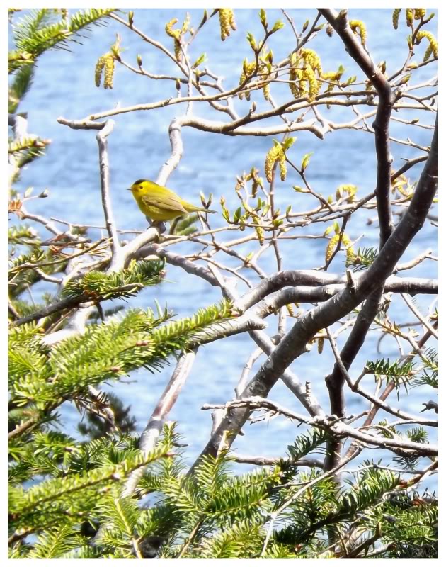
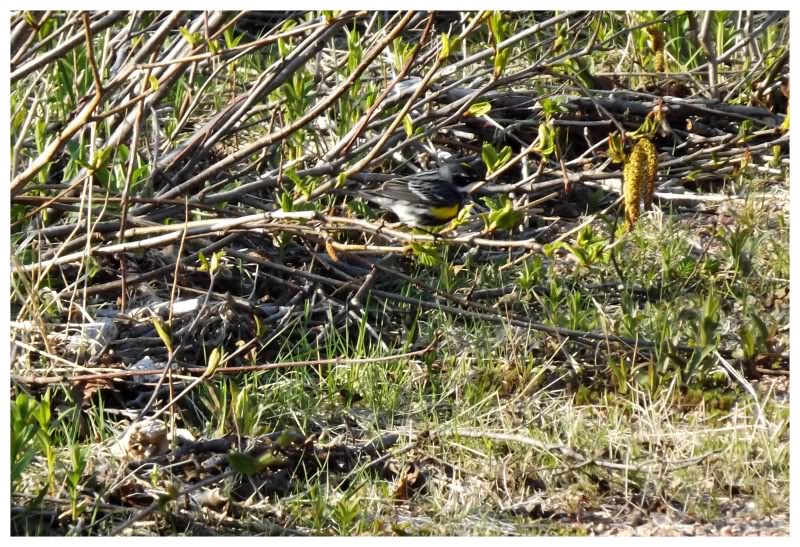
Since I already had pictures of the lighthouse, I stalked a Wilson's Warbler around the nearby bushes instead.
We ran into a little boy and his father near the lighthouse, whereupon Shahlene said "Hi" to the boy, and he said "Hi" right back. When I said my usual, deep, Hitchcock'ian "Hello", the boy shortened up his neck and made an admirable attempt to imitate the deepness with his own "Hello."
I normally don't care too much for children, but that encounter put a smile on my face.
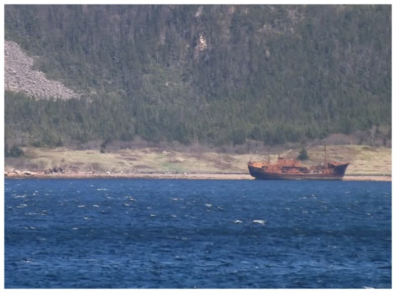
While standing around, I also snapped some pictures of a shipwreck across the bay in Jerseys Harbour.
I know, I know, I should be doing things like going over there, instead of returning to lighthouses I've already seen.
We drove around Harbour Breton just like last time, because I still couldn't believe that they don't have a restaurant. There's a chip shack/pizza type of place, but I remained surprised with their lack of dining options.
We ended up with Doritos and Pineapple Crush from the local Ultramar.
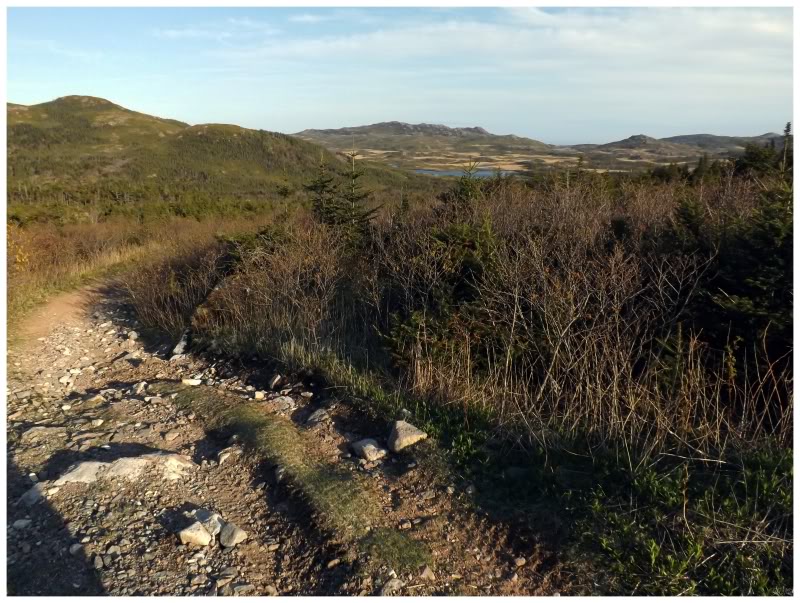
Leaving Harbour Breton, we returned north to the turnoff for the NL-364, which leads to Hermitage. 11km along the highway there is a sign for Furby's Cove with a right arrow. I had skipped this one on my last trip as I knew of nothing in Furby's Cove, but now I've realized the errors in my way & that I really enjoy these tiny communities.
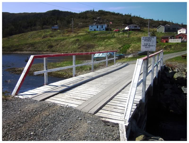
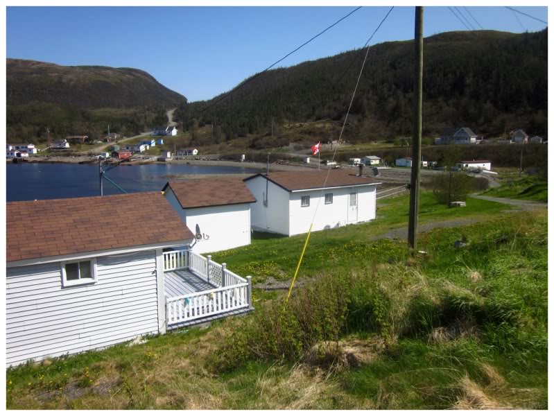
The gravel road to Furby's Cove is only 1.5km (1mi) as it falls from the highway up in the foothills, down to the water of the cove for which the town is named. The second picture shows about 70% of the town, as it seems to be little more than a group of cabins nowadays. We saw one man while driving through the town, and he gave us a confused look as to why we were in his Furby's Cove. After driving over the "Cars/Light Trucks Only" bridge & back, we passed the man again, as he sat outside of this trailer.
The geography nerd in me loves having went to such a tiny & obscure place.
This peninsula isn't heavily populated, so once you get past the sizable communities of Hermitage & Sandyville, there isn't much left beside the sleepy Seal Cove. We sped past Seal Cove and onto a road declaring itself no longer maintained by the Department of Transportation & Works. Nonetheless, this road remains decently maintained, especially when you consider the minimal number of cabins back here.
The day was growing into the evening as we hung a right onto the road to Grole, passing the place where I stopped back in 2010. Shahlene was still comfortable with driving her car and I was thankful for every saved kilometer.
In the end it only saved 1 kilometer. The alders closed in on the road & the area ahead looked impassable due to loose and exposed rock. We squeezed the car as far off to the side of the road as possible & took to foot. I had initially planned to camp at Grole, but with the setting sun & uncertainty in regards to the distance to Grole, I decided against filling up my hockey bag with camping supplies.
We passed familiar cabins, but then pressed upwards over the hill which stopped me last time. As we rounded along the track, I still couldn't see the cove or the ocean and I decided that it was best that we turn around and cut our losses, instead of hiking back in the dark (and subsequently setting up camp in the dark).
One of these years I'll successfully make it to Grole. I'm really trying to get better at these things people. Honest.
A bit of face was saved when I saw a Myrtle Warbler along the way to Grole. This isn't the most obscure bird by any stretch of the imagination, but it makes me happy that my record for it is on Grole Road.
Anyway, we only had 6.5km (4mi) to land's end from the Grole Road turnoff. Up until this point, we had only seen mediocre spots to camp. Therefore we turned right to examine what was on this last 6.5km of road.
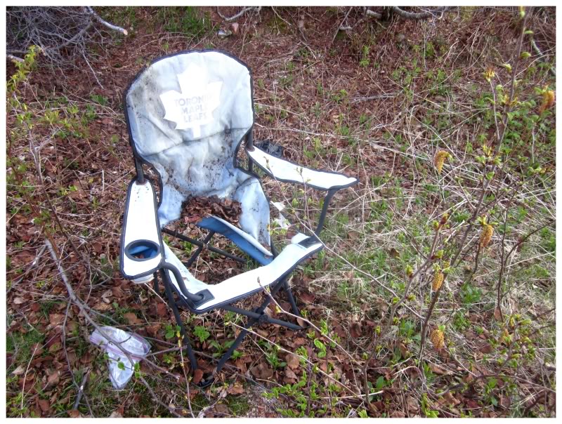
We found the cabins down this road, but then there was a segment with next to nothing. Bumping along through the potholes, I started to notice weird indents and cleared areas to our left. There was a decent enough spot to camp, so we pulled over to inspect...and then I realized that these were old campsites! We continued up the road & sure enough, there were a few more, but none of them occupied in the last 5-10 years.
An abandoned campground makes just about as good as a campsite as you can ask for! In addition, I went wandering up to the next site and I found an old camping chair in the woods!
(Although where I thought that last piece of fabric in the front would work fine, the chair was sort of uncomfortable without ass support.)
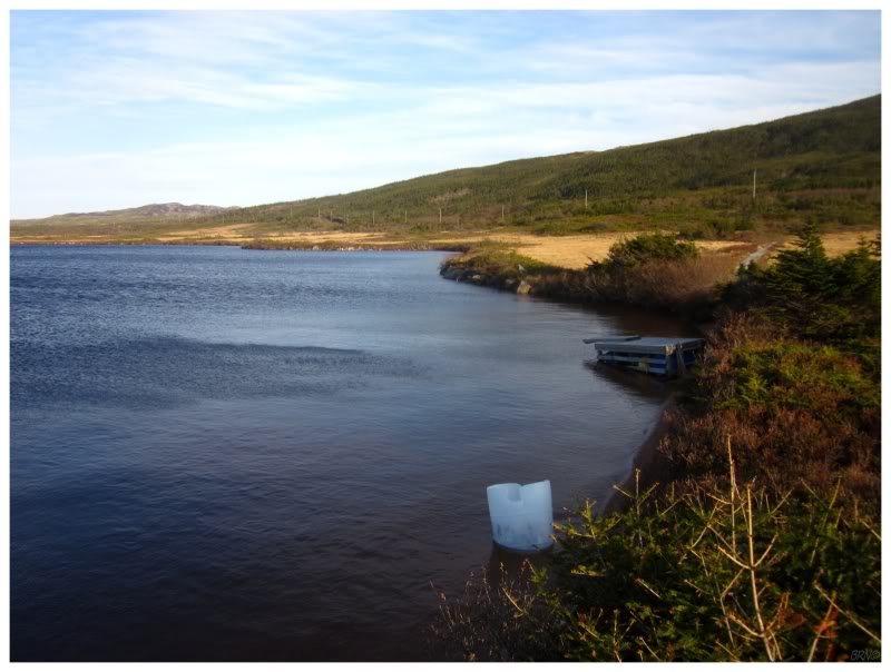
We crossed the road into a bog, where we noticed a boardwalk leading down to the lake. There was a toppled change room and docks where people surely dived & flopped into the drink. It was far too cold for any of that today though.
I know it is just an abandoned campground, but this was some serious land's-end-of-the-world stuff. We were very far from anyone else, and the only nearby community was extremely sleepy. This was intensified by the barren, empty and sprawling land; coupled with the chilly temperatures and slight winds.
My relationship with Newfoundland is tumultuous, but I do love these moments where it allows me to see extremely obscure slabs of the Earth.
There were foothills blocking the horizon, causing dusk conditions to arrive early at our stealth campsite. I asked if we should see how far we can go down this Pass Island Road, in hopes of reaching the tip of the peninsula where there is nothing to the west until you reach Quebec0.
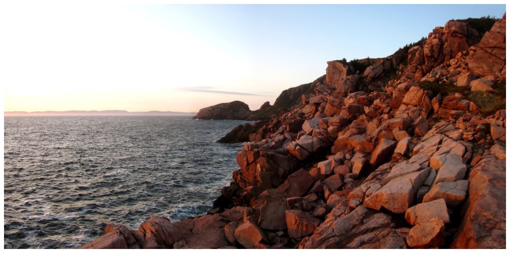
The road was passable nearly to the end, until we came across a washout that wasn't even an option to cross by car. Rushing the last 500m (1/4mi) out of excitement & love for the obscure, I moved quickly through the barren land until I reached the sea at Pass Island Tickle.
(According to the Dictionary of Newfoundland English: "Tickle - A narrow salt-water strait, as in an entrance to a harbour or between islands or other land masses, often difficult or treacherous to navigate because of narrowness, tides, etc." )
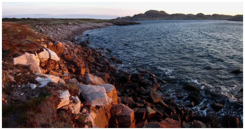
Another reason I loved it out here was that there used to be a lighthouse and a community on the island just across the tickle.
Pass Island (the community on the island of Pass Island) was one of the earliest places settled in this area. People had settled here as early the 1760s because of the great fishing banks off Fortune Bay and towards St. Pierre et Miquelon. By 1874, the population had grew to 215 people, resulting in the construction of a church and a school. A lightstation was also constructed to help with navigation. By the 1960s though, the South Coast, including Bay d'Espoir, was the location of many of the communities which resettled. Pass Island was strong & hung on though, getting a road constructed from Seal Cove outward to the tickle (this is the road we were camping on). Unfortunately though, with Grole resettling in 1971, this increased the isolation of Pass Island & they eventually decided to resettle in the summer of 1974. They were the last community to resettle under the program which encouraged resettlement1.
It wasn't until a couple of years ago that I learned the lighthouse was destroyed. I used to sit perplexed as to how in Sam Hell I was going to get a boat ride out here in such desolation.
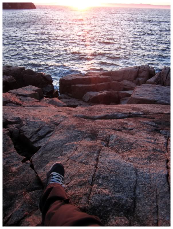
In addition to my joy at being so close to Pass Island, the sunset was no slouch either.
It lasted a long while, casting the sky in vivid reds and oranges. I watched the ocean crash on the rocks below me, and as the water drops shot into the air, they were coloured pastel red with the sun's setting light.
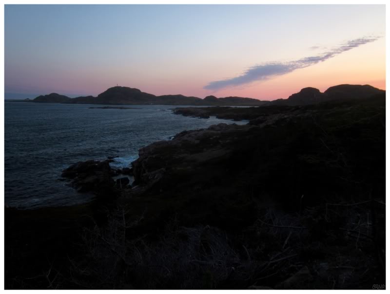
Eventually the sun would set & it was time to call it a night.
Part 2...