If you're doing something on the other side of the island, it's worthwhile to leave right after work & cover 3 or 4 hours of boring TCH driving before dark.
I had an idea of how far I wanted to make it this Thursday & pulled off the TCH near Gambo. I had always seen signs for Mint Brook Road during my drives across the island & I thought it made as good as any place to stealth camp for the night.
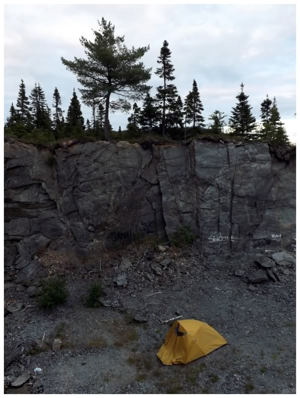
I also wanted to finally check off gravel pit camping from the Newfoundland to-do list.
In this province there are such empty swaths of land that it is generally easier to create a small gravel pit wherever roads are constructed. This methodology leaves behind quite a number of gravel pits, which people adaptively reuse as stealth campsites. Driving around the island you'll see plenty of campers and trucks pulled into these sites & plenty of people have saved considerable amounts by using this strategy to camp during their visit to Newfoundland.
Camping in a gravel pit is about as exciting as it sounds, but I tried cod tongues simply because they're a Newfoundland thing, so what was going to stop me from spending one night in a gravel pit?
Okay? Done.
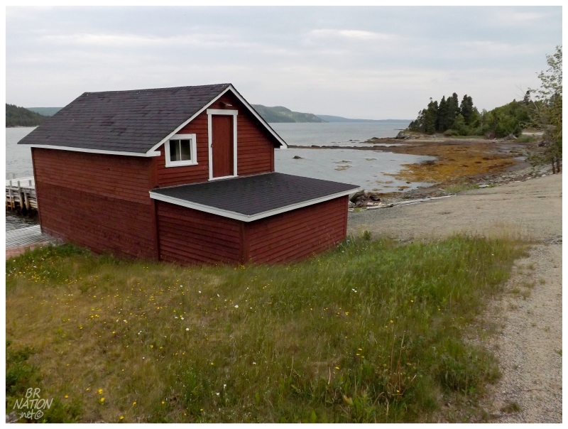
Pulling off of the Trans-Canada Highway in Glovertown, this allowed me to see Saunders Cove & Culls Harbour for the first time.
Culls Harbour was an interesting one, in that there's a one-lane bridge over the Northeast Arm of Alexander Bay, which gets you across to a seaside road with a few mid-century homes (and some newfangled modern homes as well).
Another neat little place that I probably wouldn't have noticed without studying maps.
Anyway, camping on the east side of the Island allowed me to get an early start towards the Eastport Peninsula - a small piece of land which is home to enough notable towns that it was my go-to answer for "Is there anywhere left on the Island that you haven't been?"
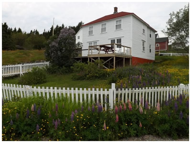
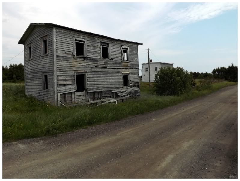
The above house is in the tiny Clay Cove.
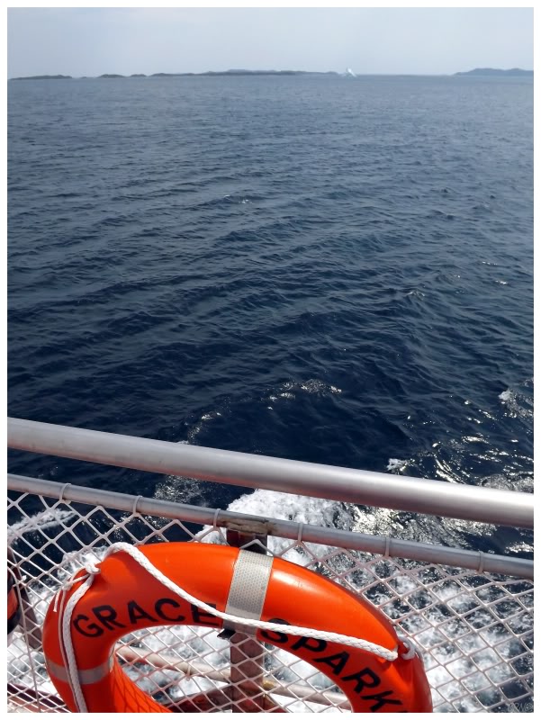
The first order of the day was to take one of the few coastal ferries I have left on this island.
I was more excited than normal for this ferry, as it carves through the numerous islands of Bonavista Bay, providing scenic views of 20-30 islands during a 45 minute voyage.
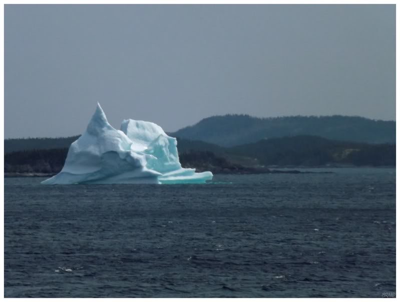
An unforeseen, delightful addition was the iceberg we crawled past as we neared our destination of Cottle Island.
I was surprised with the fact that Cottle Island had unpaved roads. With a respectable population size, modern ferry & close proximity to the Eastport Peninsula, I was expecting the 4 town island to be one of the more advanced ferry-to outports.
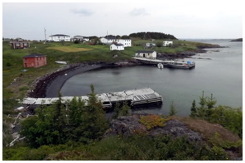
The villages of Cottle Island were scenic enough, even if the island was somewhat flat. The above village is Haywards Cove.
We cruised through the four towns, checked things out & made it back for the return ferry.
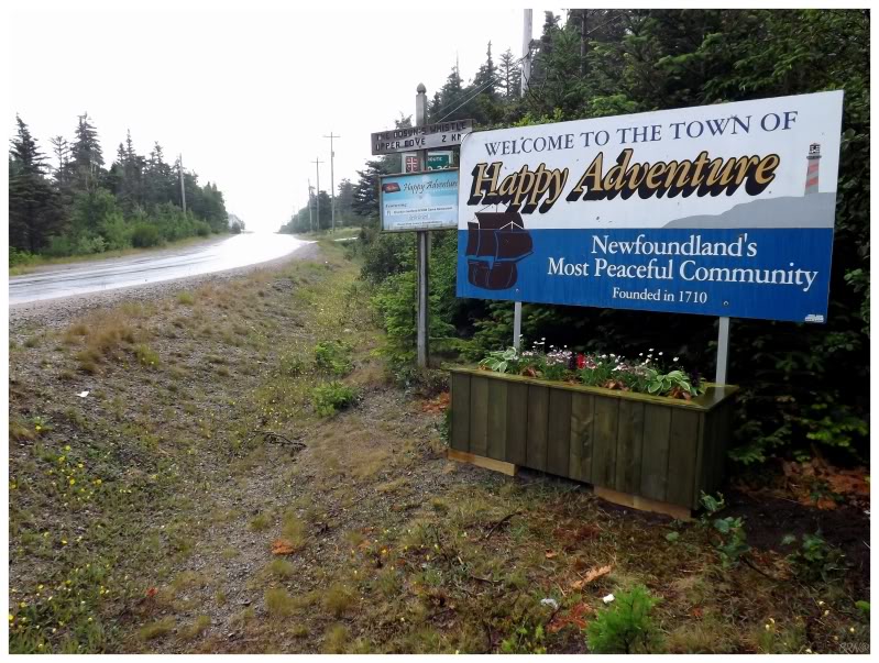
Back on the main island & towards the rest of the Eastport Peninsula, I finally made my way to the whimsically named Happy Adventure.
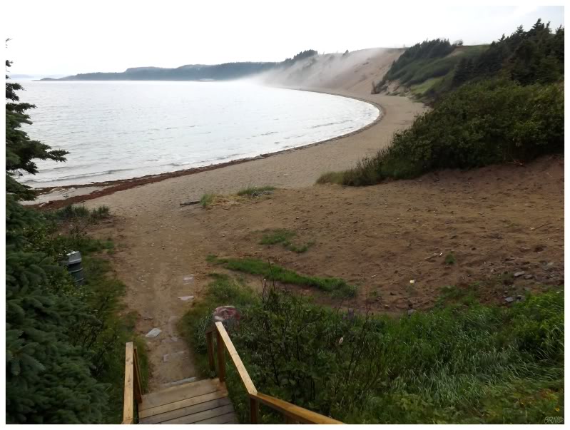
The Happy Adventure area was additionally enticing because of its proximity to Sandy Cove.
For how much time I spend on the internet looking at pictures of Newfoundland & for how much time I spend driving around this province, I only know of two impressive sandy beach locations - here at Sandy Cove & at the Sandbanks adjacent to Burgeo.
Even though a bank of fog was rolling up the sandy hills here on the Eastport Penn, it was satisfying to finally check off this more obscure beach.
I rolled up my pants and found that the water was still really cold.
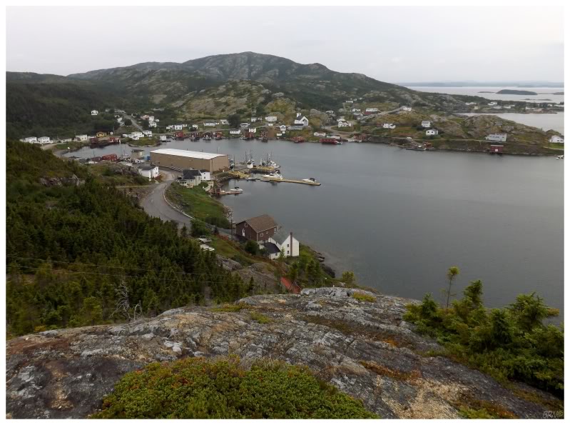
The last community on this peninsula is the village of Salvage.
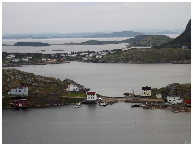
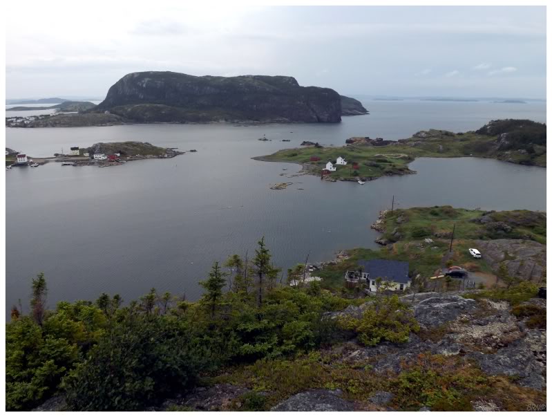
Driving along the plunging road to Salvage, you could surmise that the end of road community might be set upon a rugged landscape.
I had no idea that I would find one of the more picturesque communities on the island. Now that I've been to Salvage, of course I read about it being a photographer's paradise, but I never knew before coming on this day - I only knew about the community because it remained one of the few 'large' island towns I hadn't seen.
There is a lighthouse off of the rugged coast here, and catching a distant glimpse was my initial intention in climbing a dirt road to a lookout. Unfortunately the terrain put me in my place in terms of how far I would have to hike to see the lighthouse off of these shores - so I only went to the touristy lookout & peered over the beautiful community this day.
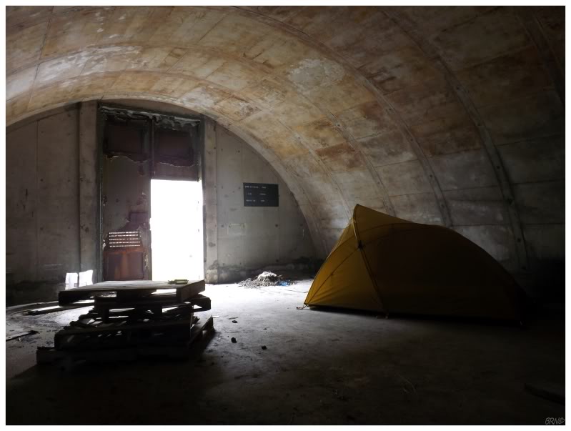
Leaving the Eastport Peninsula & making forward progress before the night came, rain started to fall but it didn't really matter - I had a bunker in mind as a place to camp. The wind & the rain whipped up noise outside, but a pile of pallets provided a perfectly fine place to relax before settling in for the night.
Part 2...