I was tired enough to ensure that I slept well, even as I had to squeeze my hips past the trunk every time I rolled over.
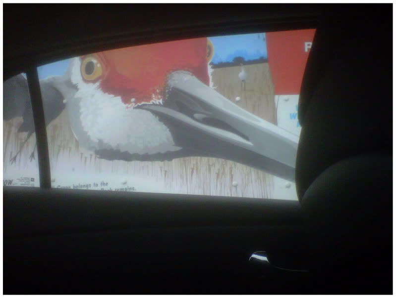
It was from that deep sleep that I opened my eyes to a threatening Sandhill Crane staring in the back window.
Startled yet groggy, I picked out my outfit from the pile of clothes I slept on the night before. I moved the car to the visitor centre to avoid paying $5 for a day's worth of parking at the campground; before making my way back down the road to the Kennicott River.
Nowadays there is a footbridge for passenger & vehicular traffic, but up until 2004 there was only a hand drawn tramcar providing access across the river into the Town of McCarthy. The cable and a tangle of wood/metal are all that remain of the tram car today.

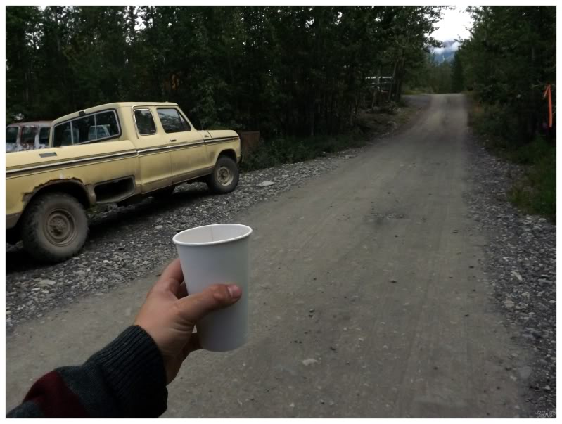
I was prepared for two full days of being self-sufficient, as I really underestimated the amenities of McCarthy. Walking into town & ready for a day without coffee, I found a busy restaurant much to my delight. Going inside, I tried to order a coffee, but the intimidating barista let me know that they don't have coffee, they only have americanos; explaining that an americano is just coffee and water.
I've always thought things like mocha frappucinos and triple-shot mocha lattes to be silly and unnecessary, but here I stood with one of those fancy drinks as my only choice. I begrudgingly accepted.
There weren't a lot of people kicking around McCarthy, and judging by the businesses, I imagined that they all were already out doing tours and guided hikes.
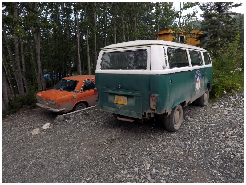
There were also a lot of old-school, strange vehicles. You often find these vehicles in the American West, so do the hippies bring them up to Alaska? Do they last up here for the same reason they last in the American West (the absence of salt usage)?
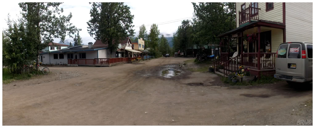
I continued to walk along the small gravel grid and found that I really liked McCarthy.
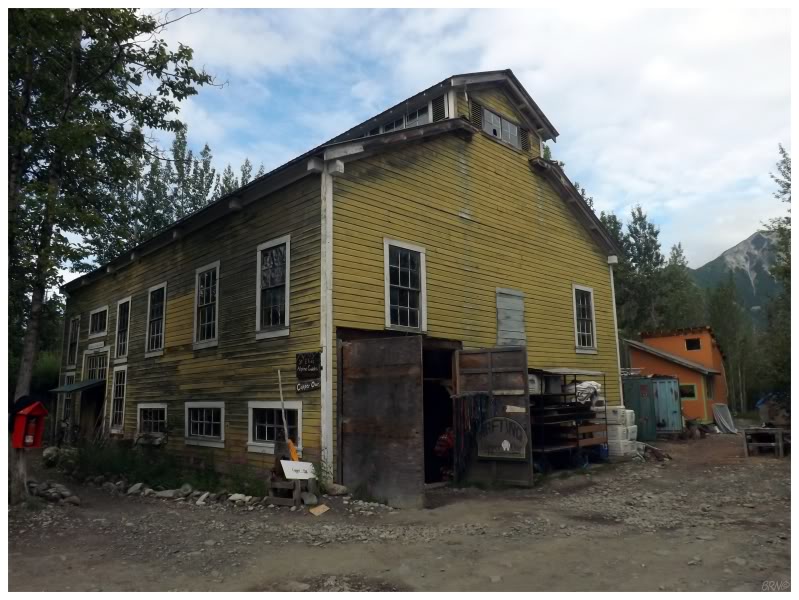
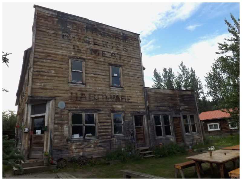
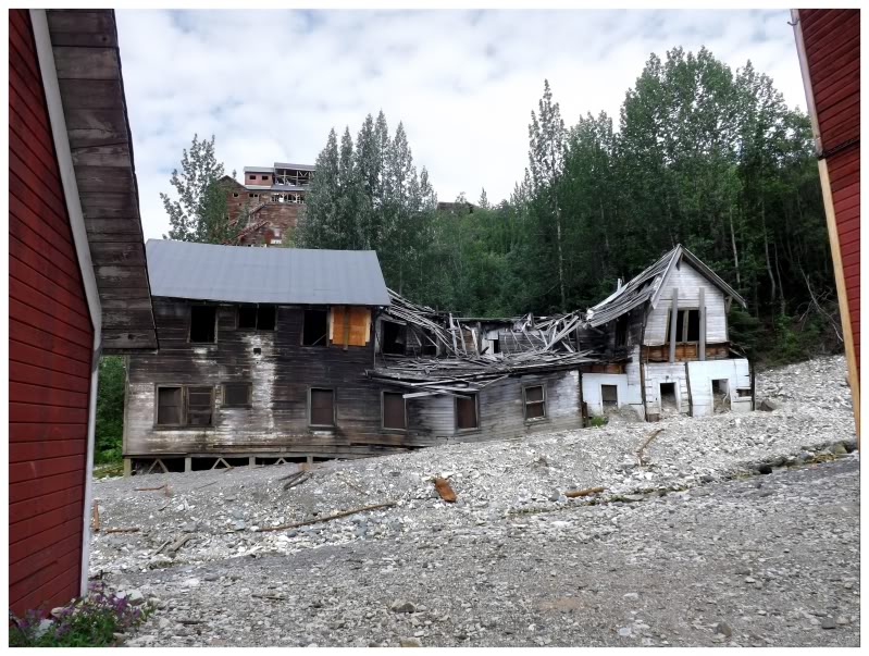
Instead of a place preserved for tourists, this felt more authentic, as if these buildings hadn't changed for decades & they just hang on. Buildings needed paint, there were collapsing buildings, and the vegetation wasn't perfectly manicured - it felt like I was actually in the 1920s, not like I was being presented with 1920s life in the eye of the National Park Service.
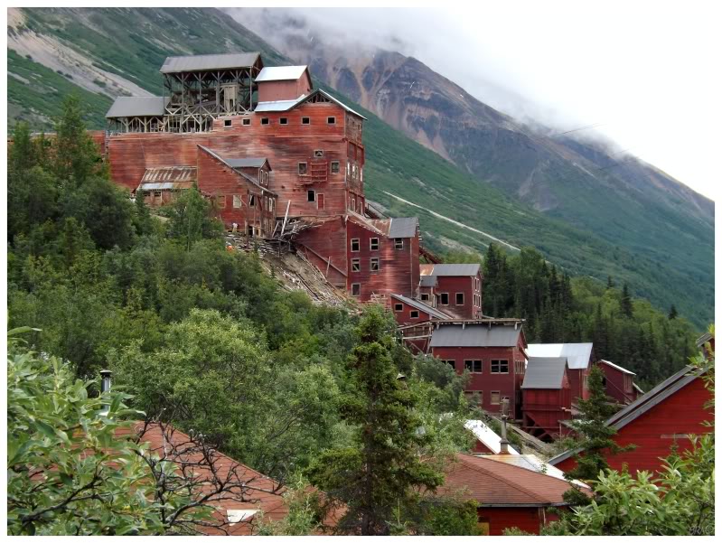
McCarthy came to exist out here in all of this wilderness to serve the Kennecott Copper Corporation.
During the last years of the 1800s, the Klondike Gold Rush led tens of thousands of men north in search of gold. The rush was initially towards the Yukon, but Alaska had a fluid border at the time & men spilled over into the Wrangell Mountains. This led the U.S. War Department & the U.S. Geological Survey to increase surveys of the area, to produce topographic maps for these prospectors. It was the U.S. Geological Survey's Oscar Rohn who in 1899, found copper ore in the Kennicott Glacier moraine and noticed geological similarities to the highly lucrative deposits of Michigan's Copper Country.
Two prospectors would soon follow the Kennicott Glacier to Bonanza Ridge and stake their claim. The video presentation I watched, claimed that the men went up Bonanza Ridge as it looked green from a distance and they were going to leave their horses there to pasture...but upon reaching the ridge, they discovered that the green ground was actually copper. This claim sounded a bit rich to me, but with the amount of money Kennicott would produce, it became hard to doubt the story's plausibility.
The prospectors would soon sell their claim to a mining engineer from New York, a one Stephen Birch, who was sent to Alaska on behalf of the incredibly wealthy Havemayer family, owners of Domino Sugars. News of this acquisition reached New York & soon enough, the enterprise had Guggenheim & J.P. Morgan money backing it as well.
The Kennicott Copper Corporation was formed soon after.
From 1907 to 1911, the railway from Kennicott down to Prince William Sound's Cordova was constructed. (The McCarthy road from Part 1 was a 60 mile portion I drove on from Chitina.) The fact that a 196-mile railway took 4 years to complete speaks volumes to the ruggedness of this land. Nevertheless, ole' Stephen Birch still managed to get enough mining equipment to the area before the train even arrived, so that when the completed railway finally reached Kennicott, $250 000 worth of copper was already waiting.
The Kennicott Copper Corporation moved the Havemayers, Guggenheims and Morgans from the wealthy to the filthy rich. Extracting copper from five nearby mines, the operation worked until 1938 and shipped over $200 million dollars worth of ore (a profit of $1,287,000,000 in 2012 dollars).
The last train left in 1938 once the high-grade ore bodies had been depleted. Schemes would come & go in the next decade, but it was no longer economically worthwhile to work the Kennicott mines.

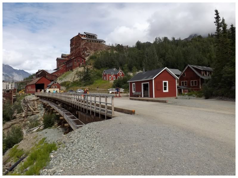
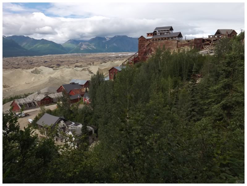
The Kennicott Mining Camp sits 6 miles from the town of McCarthy. There is a van which shuttles people back & forth, but that didn't sound like very much fun; then again, neither did walking 12 miles in addition to however many miles I was going to wander today.
Thankfully McCarthy delivered again as I noticed a sign advertising bike rentals! Inquiring inside the building, it was $25 for the daily bike rental instead of $15 for the van ride - sold! The granola girl gave me my helmet, some local tips for things to see on the way & then I was off towards Kennicott.
It was a bit of an uphill slog to start, but once I removed my sweater and burned off the early morning fog, I quickly knocked out the 6 miles.
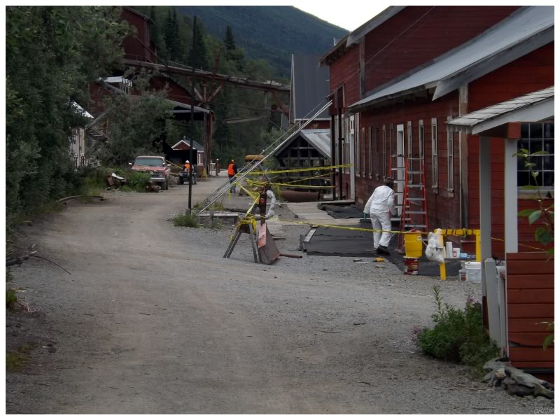
From reading this random guy's useful Alaskan blog and from Arntz's stories, I knew about the National Park Service being here in full force & the window of exploring abandoned buildings quickly closing.
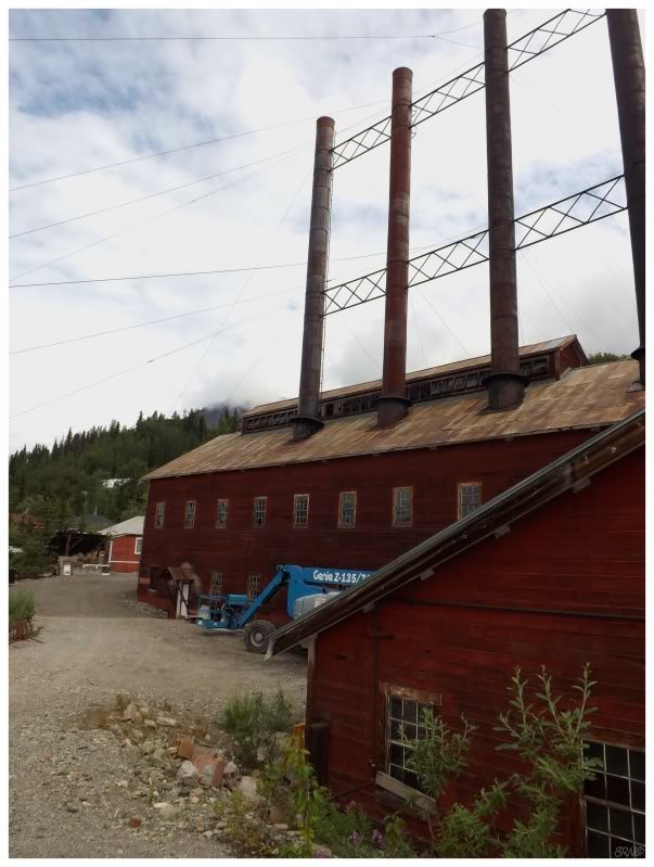
As I came into the center of the mining camp, I couldn't believe just how right they were. The number of workers milling about was incredible. A dozen of them were in the concentration mill stabilizing, a handful of them were fixing metal screens on the leaching plant & a pair of girls in hazmat suits scraped led paint off the powerhouse.
I went into a restored cottage, peeked into the power plant & climbed a small ridge to get a better picture of the surrounding area.
Was I only going to get inside restored & safe buildings today?
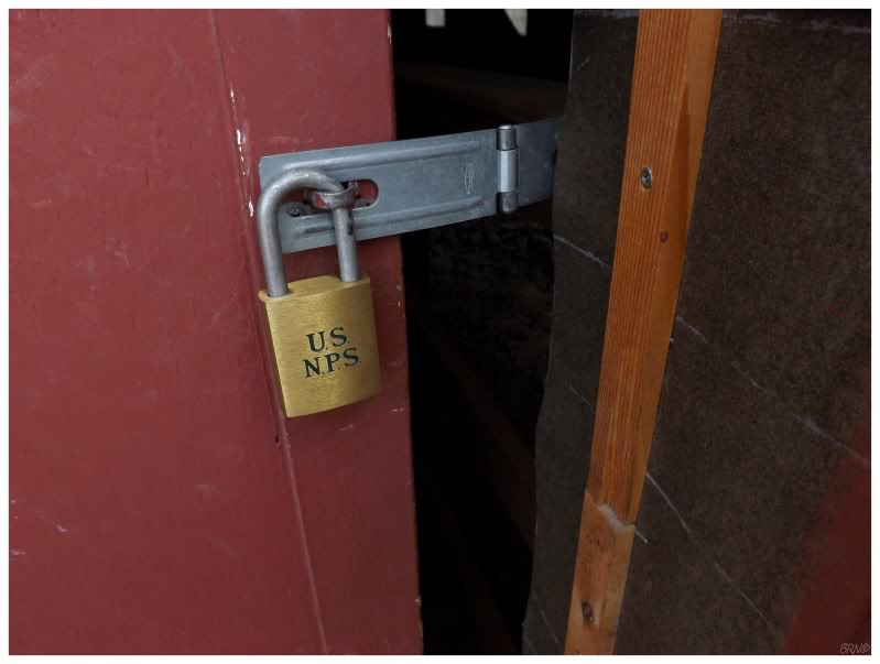
In that Alaskan blog I had been reading, Atom and his girl went into the East Bunkhouse. Seeing as this was one of the only buildings without workers milling about, I went up there to take a look...only to find shiny US NPS locks on the doors. Ha! Day late and a dollar short!
Hmmm, what about the hospital building?
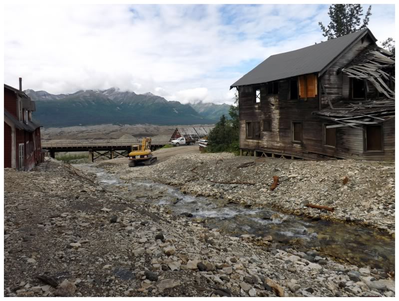
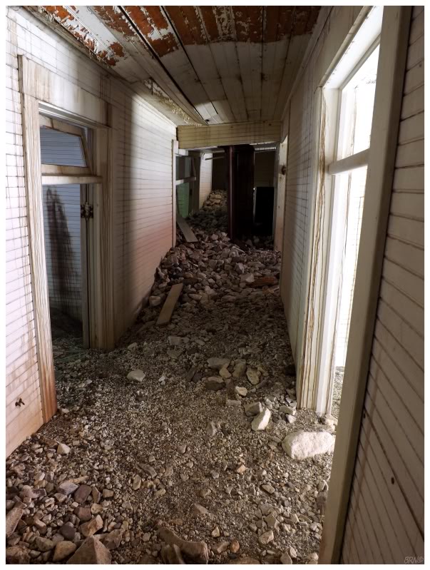
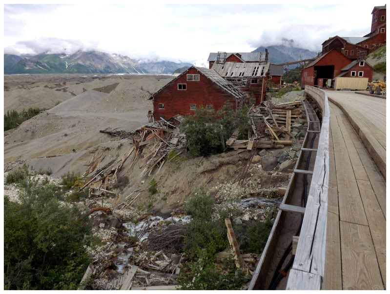
The two bunkhouses, the hospital & the sawmill all sit very close to National Creek, which bisects the mining camp. Normally quite gentle as it was on this day, apparently during extreme spring thaws this creek turns into a violent river, with a sediment load so great that it fills the basements and hallways of these four aforementioned buildings.
The Alaskan blogger discovered this in the bunkhouse & I quickly found it as I rounded the back of the hospital and saw the backside windows filled, in addition to seeing the hallway slant upwards with sediment once inside. I stood at the halfway point of the building and I had to crouch down, as there was that much of a sediment base on the floor below my feet.
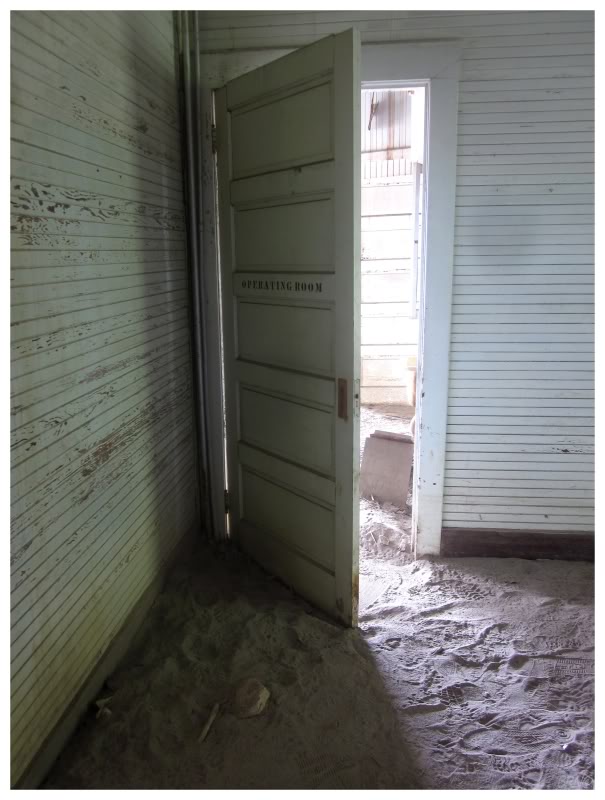
I found it pretty cool to see the operating room, even if the best picture I got was from the windowsill once I went back outside.
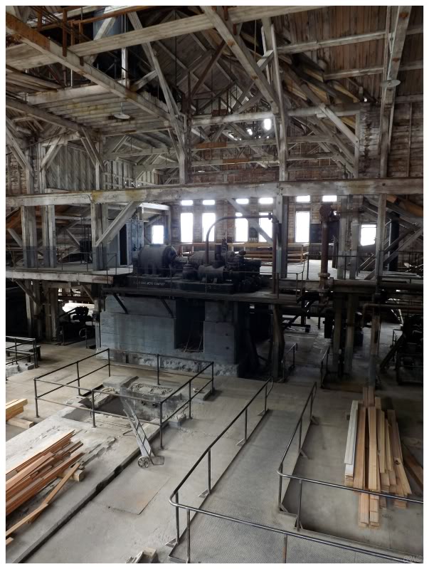
I was now satisfied that I had explored something here. I came into this day expecting to go on a tour of the concentration mill (that huge, main, 14-story building from the first few Kennicott pics), a tour which I didn't believe existed because of the ramshackle appearance of the building...but sure enough, they put the kybosh on the concentration mill tours just 20 days before I arrived in Kennicott.
Tours that have been going on for years...finally stopped...just 20 days...before I got there. Incredible.
So even though I was wearing my stealthy yellow shirt & I had to wait for an excavator to back up as I left the hospital, it had to be done.
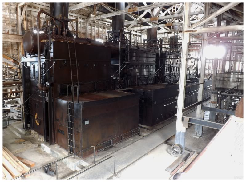
I walked down the road yet again, past the workers and up to the power plant. I wanted some time here without people surrounding me, so now that I noticed the observation platform was empty, I set up my tripod and snapped long exposures.
A couple of Russian touring motorcyclists eventually walked up behind me & loudly discussed the power plant. I was happy enough with the pictures I took & moved along.
I went back to the map board & examined it to see if I missed anything. It seemed that I had seen everything there was to see here along the bottom road, but I still didn't feel like I was doing due diligence.
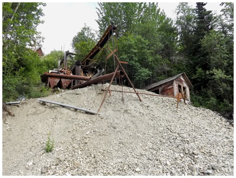
So I decided to climb some random waste pile behind the hospital. It was certainly sketch & certainly off the beaten path. A group of 6 teens walked by, but thankfully they couldn't see me once I stood in place & obviously went invisible.
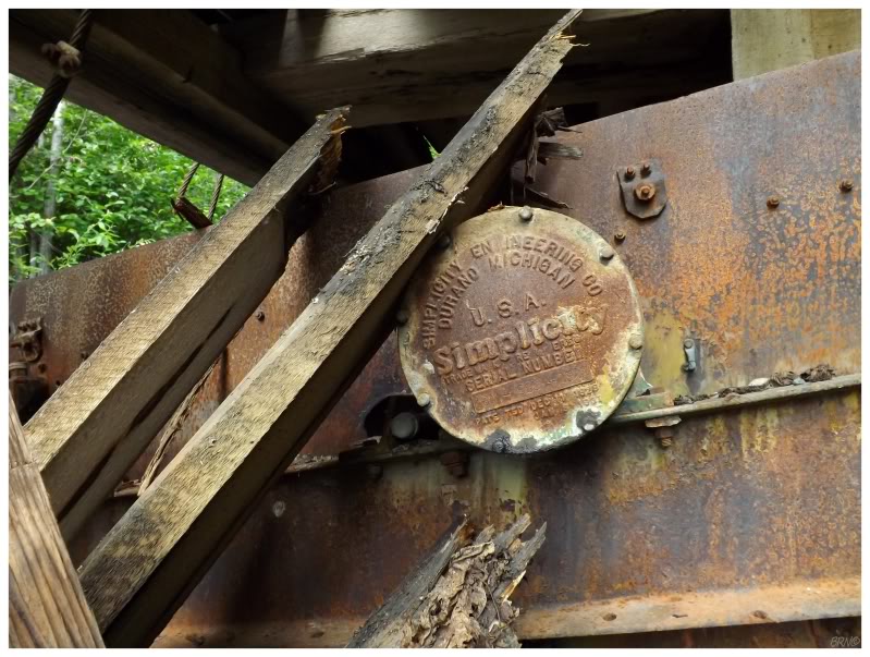
Climbing further up the waste pile, I noticed the tentacles of Michigan reaching all the way up here!
(I'm not sure of this machine's purpose. I'd guess it's some sort of sifter or sorter by the waste pile and the rock chutes from the concentration mill.)
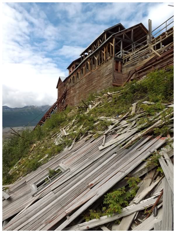
It didn't take very long for me to realize that the waste pile led up to the top of the concentration mill.
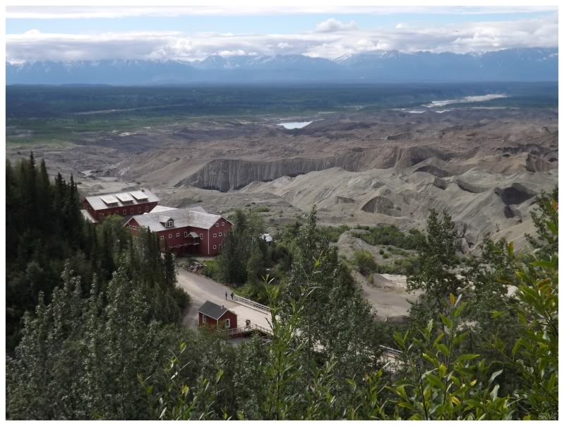
It was hard to decide what to pay attention to first - the top of the concentration mill or the view.
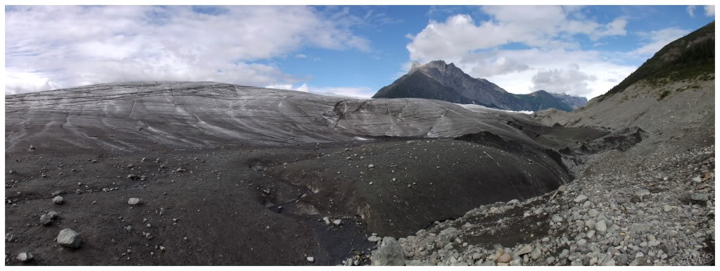
What you see here is the dirt & sand left behind in the Kennicott Glacier's moraine. The buildings in the view are the train depot (small building), store/post office (bigger, middle bldg) & another bunkhouse (the furthest bldg).
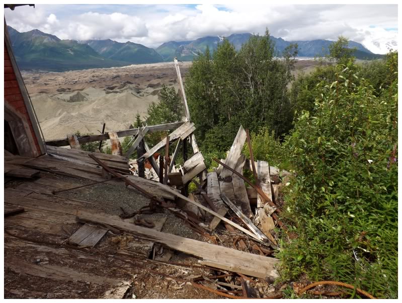
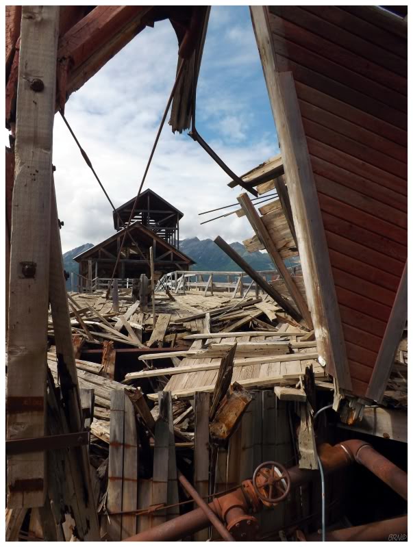
There was another locked metal door and metal grating up here, so no headway was going to be made into the concentration mill. I was fine with that though, as at least with being up here you could see more of the mill, instead of only the loading dock you see on the lower main road.
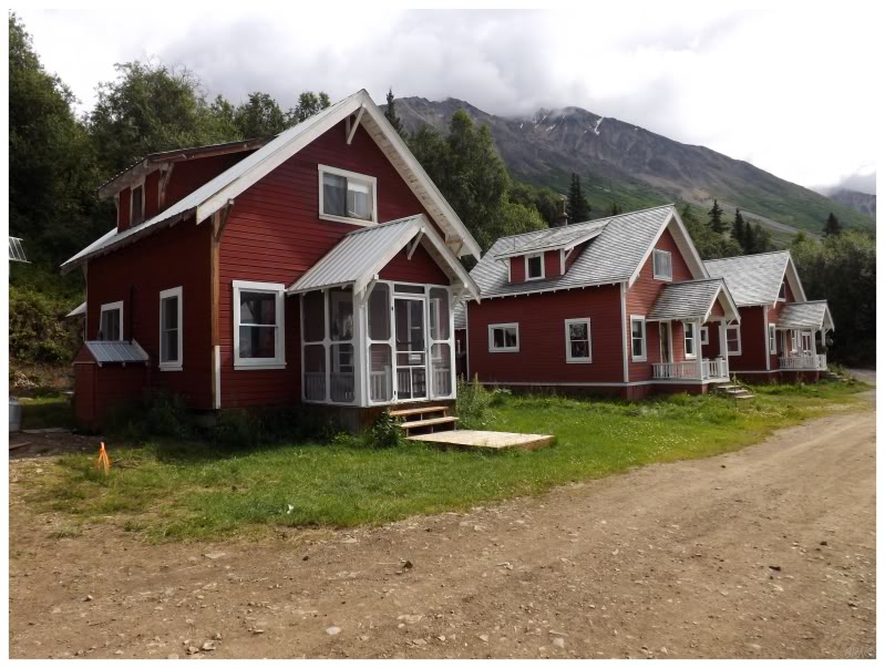
There was a path up here behind the concentration mill & I realized that the road from the map wasn't actually that arduous to reach. I followed it past private homes, half-buried wagon wheels and onto Silk Stocking Row, with its old private cottages. You can rent these cottages & I really wanted to do that, but it simply didn't work out with trying to get here from Anchorage & reaching Kennicott before nightfall.
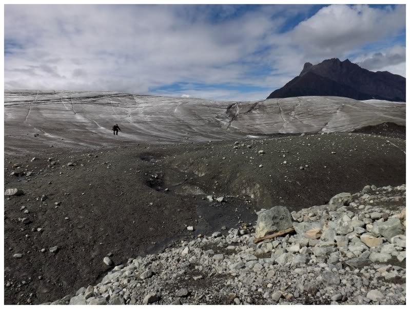
Now feeling like I had adequately covered the mining camp, the last agenda item was the Root Glacier Trail.
This is a easy 4 mile hike, although my feet were already hurting. Thankfully I had acquired this bike! The 4 miles were going to fly by!
I wasn't sure if I was actually supposed to be taking this rented bike on the trail, but I did do my best to avoid the larger rocks and skid around precarious corners. Nearly at the end, it became a bit too sketchy & I locked the bike to a stunted tree.
Walking over and stepping onto the glacier, I was pretty happy. I went back to setup the tripod, but as I rushed to beat the 10-second timer, I noticed a tour group coming over the glacial ridge. This was a NPS guide, so I just sat tight; as they were all wearing crampons and I had read countless warnings about the dangers of glacier walking.
So I sat down by my camera as the group came closer & closer. The group ended up being comprised entirely of women in their 40s, 50s and 60s; and I think they were from Michigan. As they discussed club soda and gingerly took off their crampons, I tried to sit with as much patience as I possess (not much).
Eventually one of the women asked what weather conditions I was waiting for & in my a lack of patience I blurted out, "no weather conditions, I just don't want to be scolded for walking on the glacier." The NPS tour guide wasn't amused, but she told me that I was free to walk on the glacier and that they only warn people because it is slippery.
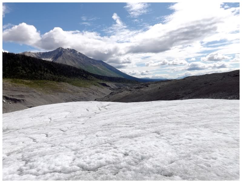
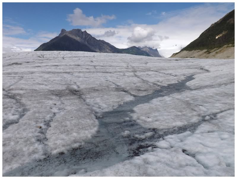
Well now that I had the NPS seal of approval, I actually walked a good kilometre on the glacier and explored a decent tract of ice. The funny thing being that I found the ground far less slippery than normal ice, since there's so much sand, dirt and divots.
Eventually leaving the glacier & cruising back to Kennicott, I passed all of the women separately as they were each hiking at their own pace. They were all very sweet about letting me pass with my bicycle.
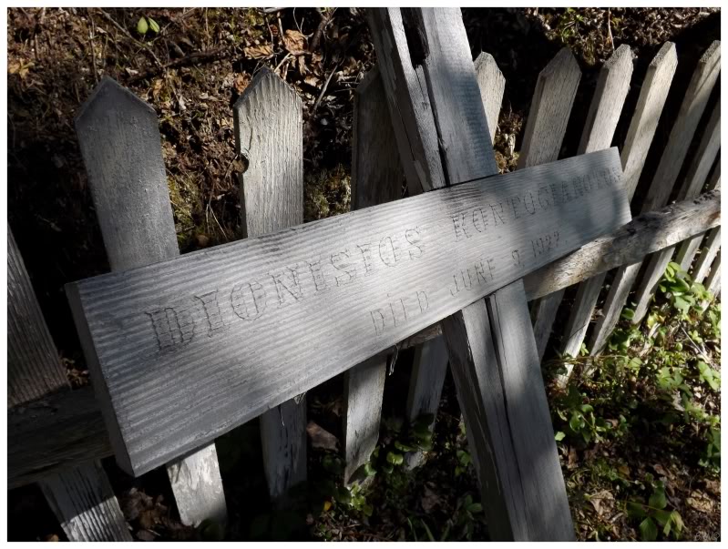
I rolled right past the town & gave it one last cursory glance to make sure I didn't miss anything. I then went behind the store/post office, as the bike-renting girl recommended that I take the Wagon Trail back since it went by the old Kennicott Cemetery.
The cemetery was indeed neat & it was nice to be on a different bike path, especially as I was now mostly going downhill. Continuing along, I slowed down as I found a couple women walking the trail, and then later on, I had to slow down again at a tree which I didn't think I could bicycle drift underneath. I skidded to a stop in both cases, as this wagon trail really descends and I was flying along to the point where I felt unsafe sitting down.
That was all alright though, as I was having a great time speeding through the forest. My enjoyment was immediately interrupted though, as I turned a corner and spotted a black bear running away into the woods!
I froze in place for a few minutes to give the bear its space and time to get lost. I realize black bears aren't even in the same danger discussions as grizzlies, but I still respect black bears and try not to force them into make hasty decisions.
After a lengthy pause, I moved forward at a more civilized pace, singing the song I happened to have in my head - Jay-Z & Young Jeezy, I Do - as a way of alerting any other forest creatures that I was on my way.

The bike return was as easy as hanging it up behind the shop, and then I made my way over to that McCarthy coffee stand where I had a delicious wrap & fries that rivaled anything I could get back in the place I live.
Thankfully the drive back over the McCarthy Road was uneventful and I was able to stay awake with my McCarthy coffee.
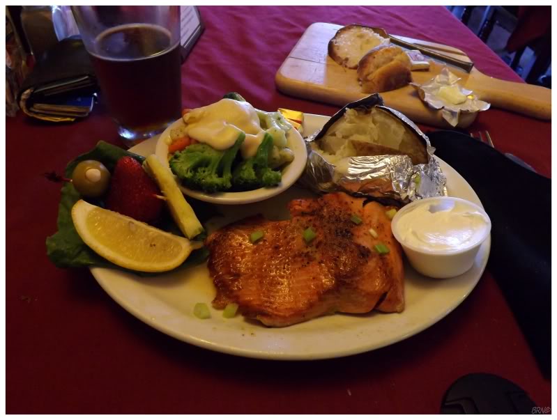
I rushed to Chitina in order to eat there, as I wanted to get some food before stealth camping & I wanted to get a more 'Alaskan' meal. Salmon with a pint of Alaskan Amber seemed to satisfy that - although I didn't find it to be the greatest salmon.

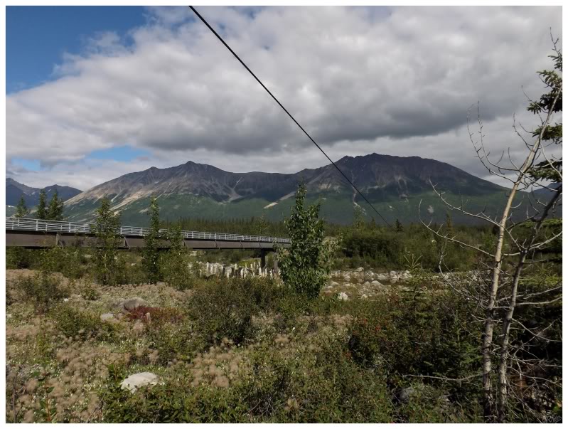
I set out to make western progress before the sun set, which thankfully takes forever during the summer in Alaska.
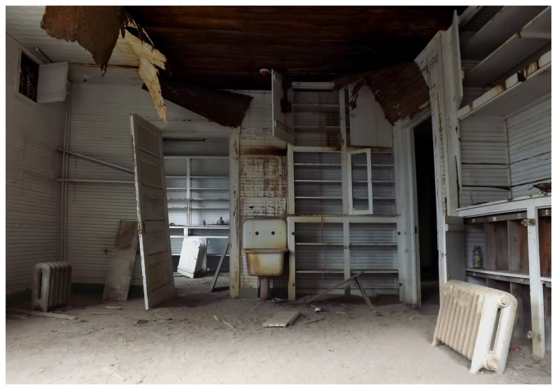
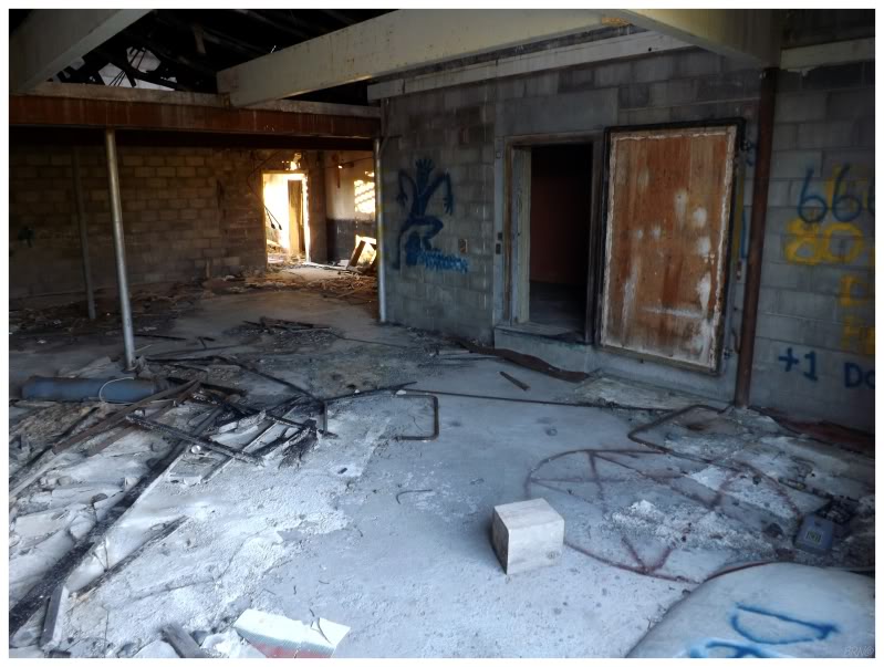
Driving for over an hour, I decided I wanted to stop before Glennallen. Noticing a promising rest area, I went for a drive around to ensure that this was a good spot to camp. This is where I noticed the above ruin, which I thought nothing of until I saw the strange aerial on Google, then figured out it was an old Catholic Boarding School!
Anyway, I was starting to draw the attention of the locals, so I returned to my rest area & made my bed of clothes. I cracked another Alaskan Amber and walked down to the raging Tazlina River, but the mosquitoes quickly told me to go back to my car.
Onwards to Part 3!