Near Corner Brook, the old Newfoundland Railway follows the bay through Curling and Mount Moriah, then heads south towards Spruce Brook, Gallants and eventually Stephenville Crossing. Being the closest portion to Corner Brook, I've always been intrigued by the rail-trail leading into the woods behind Mount Moriah. In addition, I had never seen the cabin community of Spruce Brook, which would give me a worthwhile destination for the day. Feeling like a degenerate of late because of how lazy and gluttonous I'd been, I decided to set out early one Saturday and tackle this 62 km (38.5 mi) bike ride. |
Driving up Serpentine Road in Mount Moriah, I found the T'Railway and pulled my car over into a good spot once the road turned to dirt. I parked the Intrepid there, got my bike out and headed south, following the red line you see above which marks the T'Railway's path through the province. (The T'Railway is the same pathway I followed in September of 2014 when I biked from Badger to Deer Lake.) |
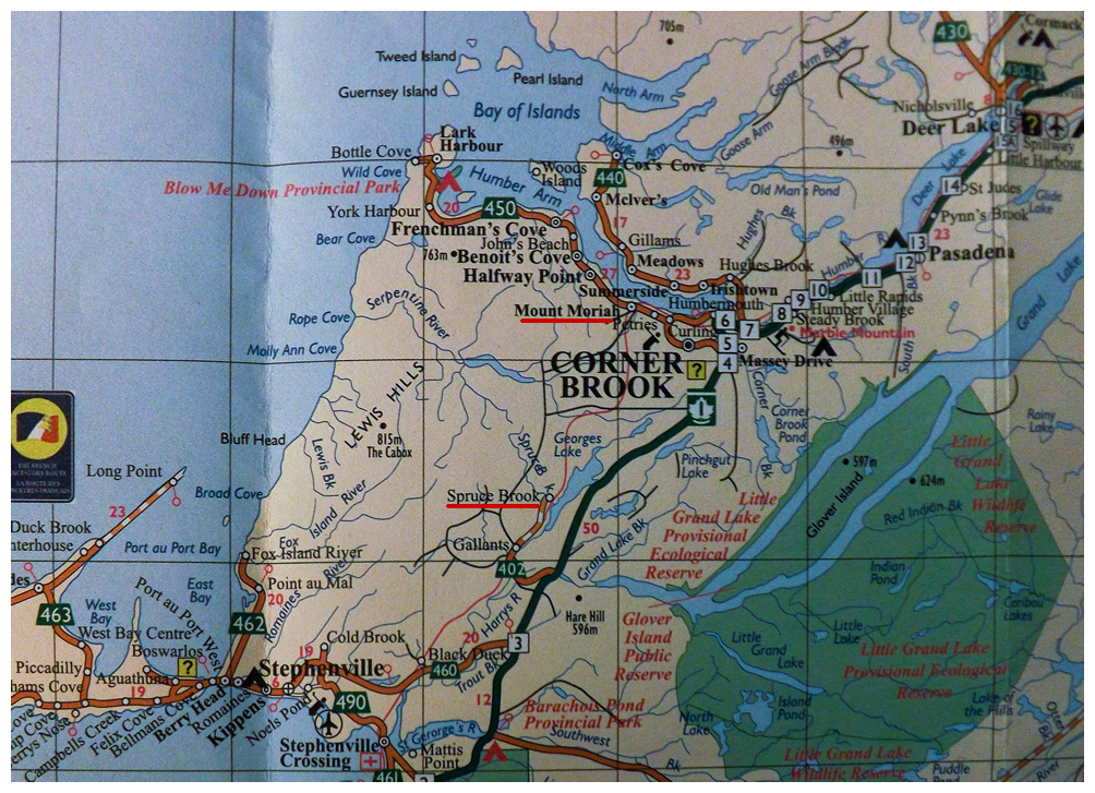
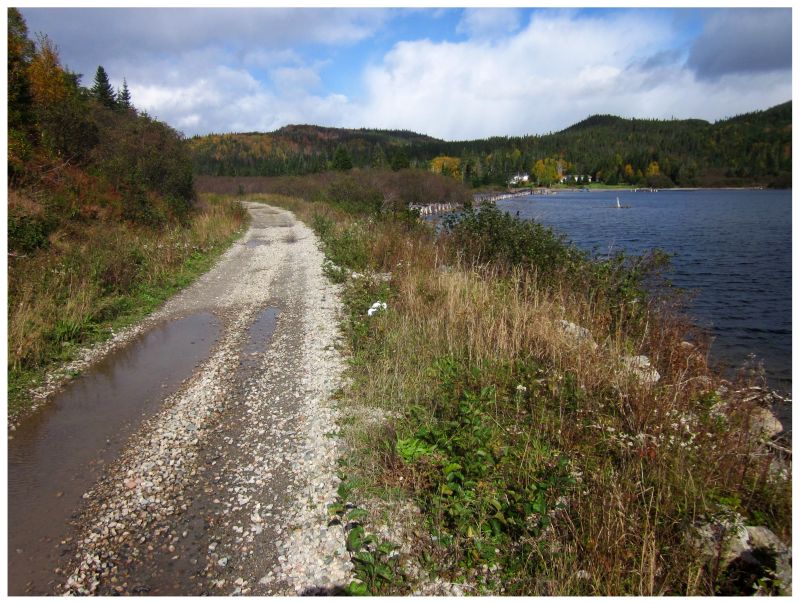
The first 10 km (6 mi) here follows Cooks Brook, which connects Big Cooks Pond into Cooks Cove just past Mount Moriah. The above picture shows the Cooks Brook Bridge, the first significant bridge I'd cross as I was about to come into view of a medium-sized lake. There wasn't much for cabins or activity up until here and that might've thankfully played a role in the trail not having too much gravel. Then again, I couldn't even take advantage of the lack of gravel, as it had rained the night before and the sticky dirt slowed my progress instead. |
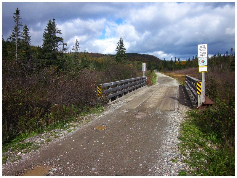
Big Cooks Pond had a few cabins on the southern end, but nothing overwhelming. Maybe 10 or 15 of them, with a few cleared lots as well. Not long after, I passed over Loggers School Road - a well developed and notable forest access road that I had cycled and driven previously. It was strange to cross over it from what was once a mysterious direction. It started to snow a bit here, while the trail grew soft with gravel and curved uphill. It being November, I was growing cold & I was also realizing that I should have brought more water. I wasn't at a place to turn around, but things were getting harder. Another half-hour would bring me to the old hamlet of Beaver, which is nowadays only a small number of cabins spread far apart around Beaver Pond. |
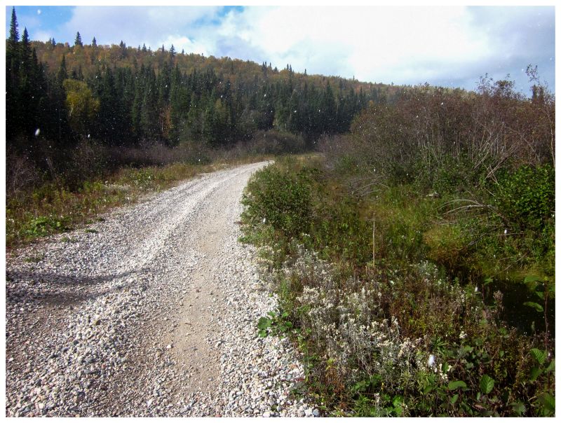
A flat 10 minute ride from Beaver would bring me to the opening of Georges Lake and what is marked as Serpentine on Google Maps. There were a handful of cabins around this initial cove, but I was more interested with the old wooden piles stretching from the T'Railway over to where the cabins are nowadays. |
For all of the random names on Google Maps, they don't have 'Howards', which I believe is the station marked by these wood pilings. Rails Across The Rock by Kenneth G. Pieroway explains that the station of Howards was the loading stop for pulpwood operations run by George Howe. Wood trains would have followed my exact cycling route up to this point, collected pulpwood here, then brought the load back to Humbermouth (where the Humber River empties out into the Bay of Islands at Corner Brook). |
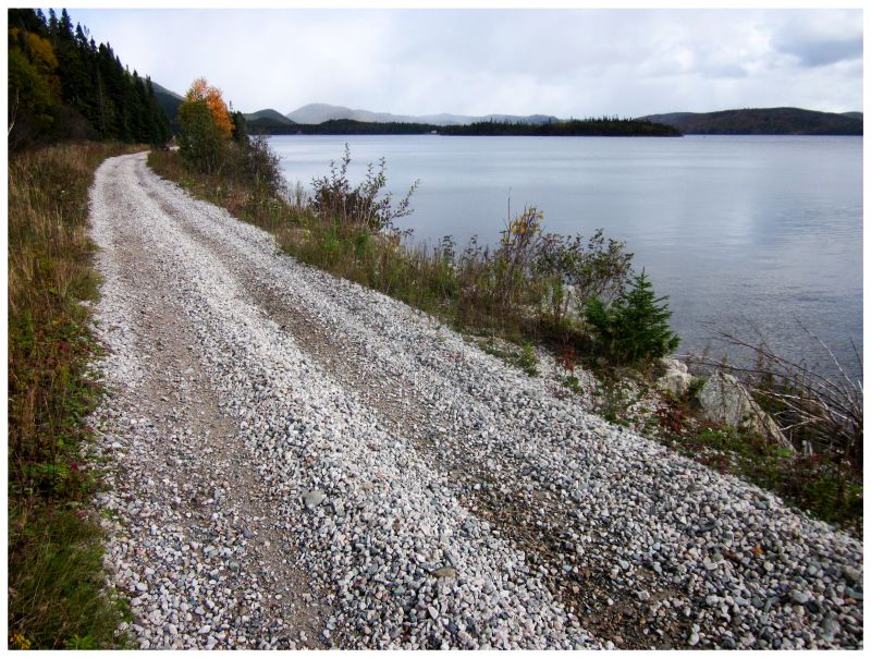
The T'Railway pleasantly followed the edge of Georges Lake for the next 15 minutes. Alongside this western edge of the lake there wasn't enough space for cabins for the most part. When you drive along the TCH, you drive alongside Georges Lake's eastern side. For all of the times I've did that, it was interesting to finally be on that far-off other side of the lake. I couldn't see the highway from here though. |
I would cross Spruce Brook Bridge and find myself at the day's destination. This joy came with trepidation, for I found the bike ride to be much more grueling than I expected up to this point and now I was awfully cold, thirsty and sore. There was a man burning some brush in a barrel & I did a second loop of his road, thinking about asking if I could warm up by his fire barrel; eventually letting my social awkwardness and embarrassment with lack of preparedness win out. |
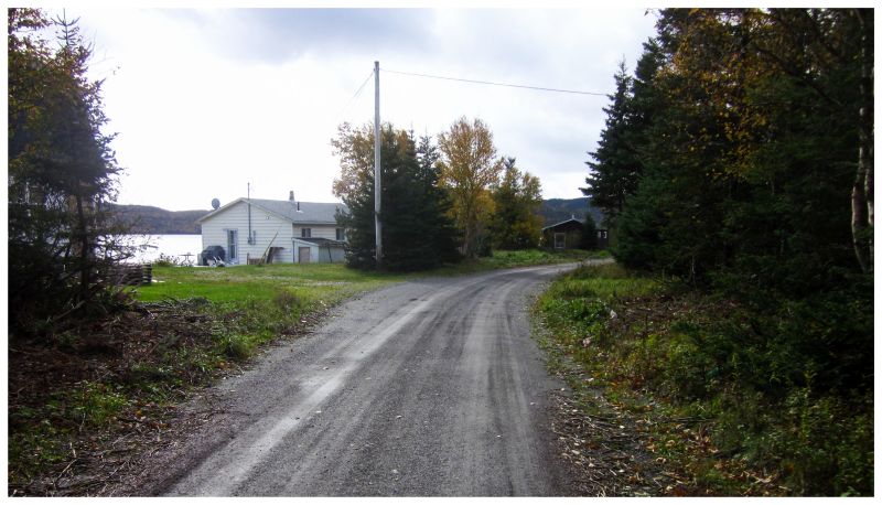
If you count the T'Railway as a road here, then you have about 3 streets to Spruce Brook. This area is accessible by a road from Gallants and was at one time a sizable village, lending explanation to its size as a cabin community today (as well as the fact that outdoorsy people like the nature of Georges Lake/the woods here). The Encyclopedia of Newfoundland actually says that 2 or 3 families were still living at Spruce Brook year round in 1991, making up a population of 18 for the village. I suppose there's nothing stopping families from still living here and driving 8km (5mi) up to Gallants for school, but Spruce Brook doesn't appear in the 2011 census (Gallants is listed as having 59 people). |
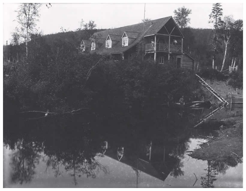
Spruce Brook. Log cabin [Hotel], Spruce Brook, ca. 1900.
Geography Collection - Historical Photographs of Newfoundland and Labrador
The land at Spruce Brook was uninhabited before the railway, although the clearing was along a well-used path for those travelling on foot from the Stephenville area to the Corner Brook area. The railway would bring a worker's house to Spruce Brook, ensuring that it was listed on the census for the first time in 1901 (pop. 10). The first non-railway resident would be Richard Whittington in 1913, a man who came along to build the Log Cabin Hotel, a pseudo-sportsmens lodge that attracted Americans and those from Great Britain to the area. The hotel was built like a log cabin to play into the popular destinations of the time, where American tourists had an interest in rugged wilderness. A second hotel, sawmill, nearby pulp operations and the coinciding growth of Gallants led to Spruce Brook's population growing to 141 by 1956. That would be Spruce Brook's peak, where in the 1950s the Log Cabin Hotel burnt down & railway personnel were reduced, then eliminated. The nearby pulpwood operations would die out & by then, people were leaving Spruce Brook for opportunities in Stephenville. The area transformed into more of a cabin community than a village. |
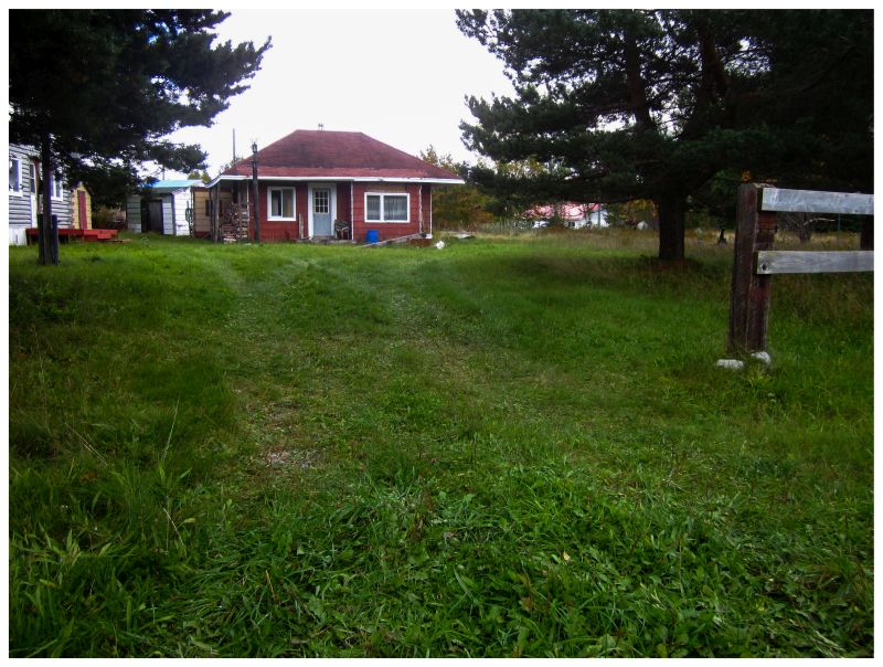
I didn't know it at the time, but I noticed this cabin and thought it looked strange and station-like. Sure enough, two residents bought and saved the old Spruce Brook train station & turned it into their private cabin. The building was moved back from its original location right along the T'Railway, into what used to be a field behind the station - this field also having been the front yard of the old Log Cabin Hotel. |
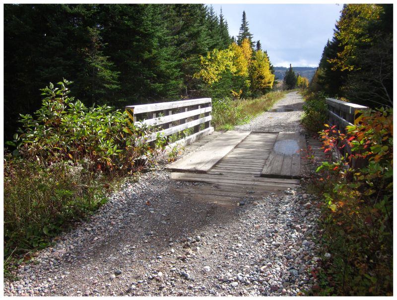
Howards Pond Bridge. The clearing up ahead is Georges Lake (view looking south)
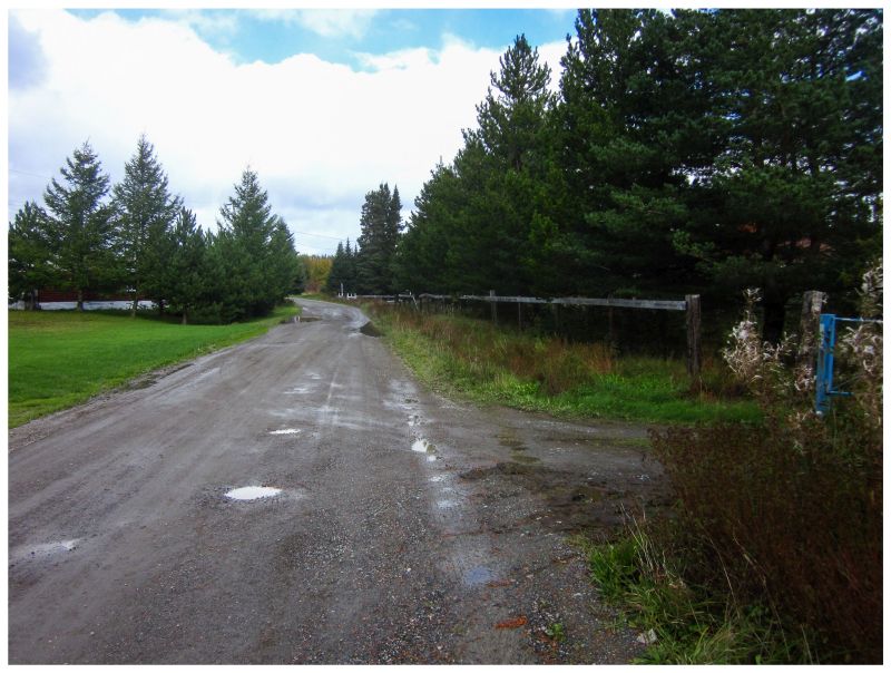
Even though it was a cold November day with intermittent flurries, there were still a lot of people out and about in Spruce Brook, making me feel weird about taking pictures of their cabins. I continued up the road towards Gallants to be thorough in terms of seeing this whole section of T'Railway, but thick gravel and my own tiredness led me to stop after about 4 km (2.5 mi) (near the old settlement of Georges Lake). Thankfully on the way back is when I ran into those two locals, who were gathering water from a spring for their cabin. Hallelujah! I could have made it back just fine, but being able to now frivolously drink water was going to help. It's also here that one of the two 50-year-old Newfoundland men declared, "You have some physical health b'y. Nowww, I don't know about your mental health, but your physical health - it's just fine." Getting a chuckle out of that, I set off and started my plod back, reaching the car as the day's light was just starting to fade. Where I normally can cycle 60km with relative ease, I guess it was the gravel and the cold here that ate me up? My friend Sarah was over at the house the next day and as I shimmied down the stairs one by one, she asked what the hell I did. I didn't really like saying that I guess I cycled too far. If you want to see Spruce Brook yourself, you can easily drive there from Gallants. I noticed the start of that road is now paved and I can't imagine there's much tough driving over the rest of the 8 km (5mi). |