The main line of the Newfoundland Railway once stretched 881 km (547 mi) from Port aux Basques down near the southwestern-most point of Newfoundland, through many towns of interest and over to St. John's. Completed in 1898, the regular passenger service lasted until 1969 and the remaining freight service would stop in 1988. The rails and railroad ties would be torn up within the next two years, where Newfoundland was then left with only a gravel corridor cutting a curving route across the island. From here it would only take another handful of years for groups to see the possible rail-to-trail recreational value. By 1997 the T'Railway Provincial Park was established upon the old train route. |
While much of the old railway closely follows the current Trans-Canada Highway (TCH), the one part that has always interested me the most, is the part where it cuts further south into the interior of the island; taking a route about halfway between the TCH and the Buchans Highway. Nowadays, where I can look at a road map and know the areas of the province I've visited by the orange lines indicating highways, there's a growing interest in the larger swaths of unexplored land. I had been on a woods road by Howley and explored that small ecological reserve to the south of Sheppardville, but here was a route to travel and slice the unexplored land right in half. In addition, there were places of historical significance along the way. |
Planning to be out in the wilderness for two days and one night, I packed my panniers and handlebar bag with all of the supplies I thought I would need and then squeezed my mountain bike into the backseat of the Intrepid. Stopping to pick up a fuel canister for my camping stove along the way in Steady Brook, I arrived in Deer Lake with little time to inhale my Burger King meal and catch the once-a-day bus. The plan was to leave my car here, cycling back to it from Badger on Sunday afternoon or Sunday evening (we'd see how my progress would go). For how much people here complain about the Newfoundland bus, I've been lucky enough on my two trips to have a quiet ride and a limit on passengers to where I could sit comfortably with an empty seat beside me. Lounging and listening to music instead of whatever movie that is in the above picture, the bus pulled away and I had just committed to this cycle that I'd been thinking about for years. Of course I could be silly and stay in a motel in Badger and just come back the next day, but ignoring that ridiculous option, I had finally got my act in gear and set off to see Millertown Junction, Quarry & the Topsails. |
An amazing coincidence happened as the bus stopped for the fourth time in two hours, this time at my stop in Badger. Exiting the bus and wrestling my bike away from the storage area underneath, a dude who was pumping gas came over and asked me where I was headed. After I explained my plans, he was critical of my skinny tires but then explained that he had ridden the entire T'Railway from Port-aux-Basques to St. John's last year on a fat bike, which jogged my memory of having read his blog and it being one of the few places that helped me out with what to expect here. So, this guy who happened to have cycled the T'Railway (pretty rare) happened to be pumping gas at this random gas station (somewhat random) at the exact time that the DRL bus pulled in and dropped me off? (Mmmmkay.) Neat. |
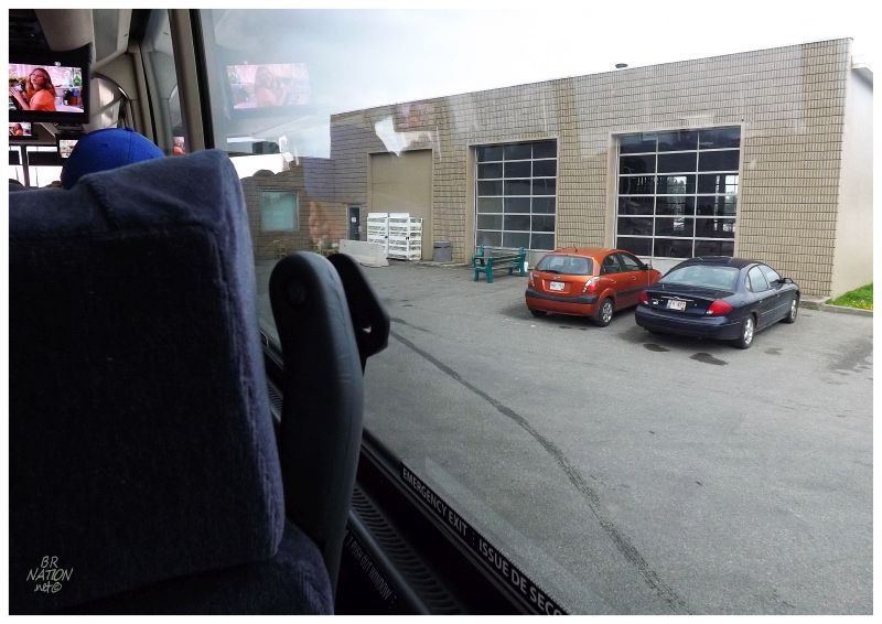
Once I broke the zipties and threw my front wheel on, I then crossed the TCH and winged it onto the Buchans Highway. I figured correctly that it would cross the old railway and I could start west. I must've only seen about 10 or 20 houses before everything dropped off and I was into the woods. A small creek limited the town's expansion to the east & once I crossed that creek, I said goodbye to Badger. |
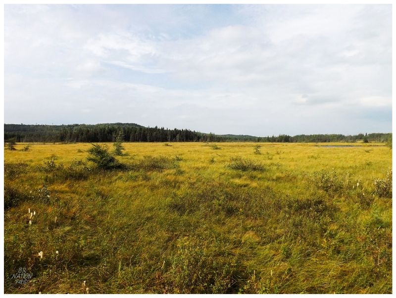
A side-by-side (i.e. a golf cart-looking ATV) approached within the first 20 minutes and the friendly man stopped to chat about where I was going and about the few people he's seen cycling this path. It was a nice encounter, but it happened so quickly that it made me wonder how much of a sideshow I'd be & how many people would stop to talk to me (the T'Railway is used by ATVers/snowmobilers/dirt bikes/side by sides the most - to either reach their cabin or simply go out fer a rip). Funny enough, he was the last person I'd talk to today. In fact, for the rest of today, he was the only person I'd see outside of two or three people off in the distance at their cabins. Settling into bobbing through the washboard surface and muscling my way through the gravel, there wasn't much to look at besides trees for the first portion. Things perked up outside the cabin area of West Lake, with glowing bogs and the odd cabin to check out as I slowly passed. |
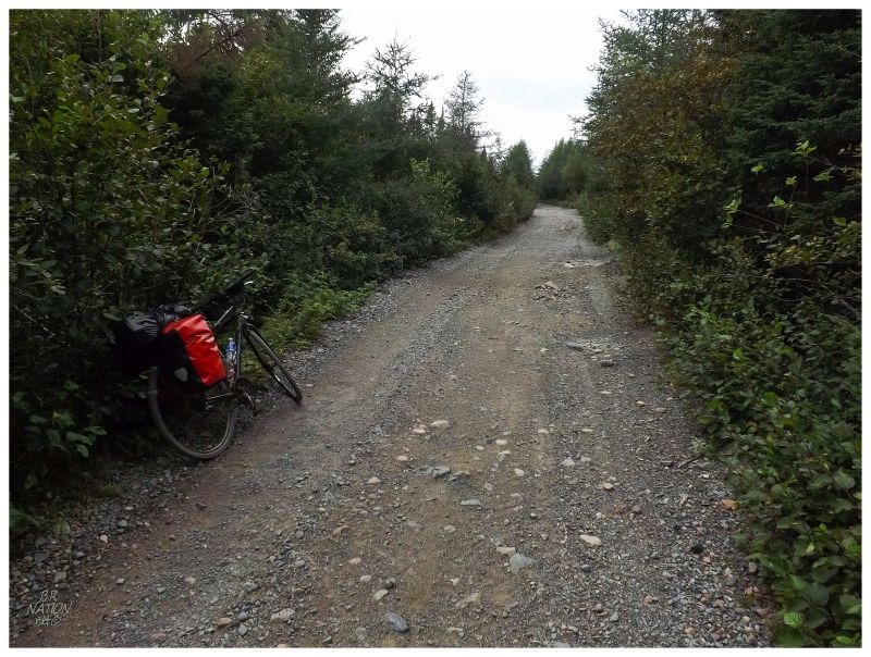
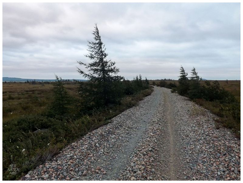
Through West Lake and afterwards, the T'Railway was surprisingly rough. It wasn't like a woods road with a hard dirt surface, but rather they had replenished the gravel, so your tires would slide and dig in, repeatedly eating up all of your forward momentum. Maybe this makes for a smooth ATV ride, but on a bicycle with small tires, it's a tough slog of pushing the pedals forward as you jerk the bike through the inch of gravel you have surrounding each wheel. Finally coming out of the forest tunnel at Millertown Junction, I was amazed and scared at how tired I was after only 25 kilometers (15.5 miles). I was now very happy to be on the smooth 'streets' of Millertown Junction. |
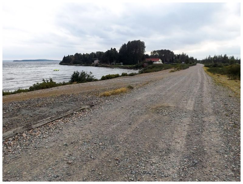
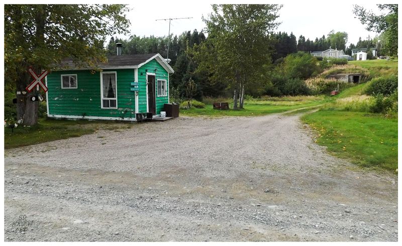
Millertown Junction is a pleasant community of cabins that have clearly been there since railway times. It's probably a place I should have already visited, but as it's only otherwise reachable via a 20km (12mi) unmarked woods road off of the Buchans Highway, I'd never got around to it. This added to the joy & satisfaction I felt at seeing another place from the Newfoundland road map & a pretty cool one at that; with its aforementioned quaint small cabins and diverging gravel roads set upon the large Joe Glodes Pond (a water body needs to be quite large for a Newfoundlander to call it a 'lake', although many of their "ponds" are plenty big enough to be considered lakes.) |
The sign says "The Howell's Place, Peter & Joan."
Millertown Junction was originally only a railroad siding until a branch railway was built to both nearby Millertown and its lumbering operations, as well as Buchans and its mining operations. Some pulp processing would come to Millertown Junction around this time as well, and along with the services needed by passengers and railway workers, Millertown Junction shot up from one family in the 1901 census, to a peak of 204 people in 1954. Of course with the decline and removal of the railway, as well as the Buchans Road being put through in 1956, there came a time when there wasn't much need for Millertown Junction anymore. The resettlement program moved about 150 people between 1965 and 1975. The population would then fall to 23 in 1981 and by 1990, there weren't any year-long residents left. Millertown Junction was a prime example of one of the historical settlements I was giddy with excitement to see along this journey. I longed to have more time here, but I had to keep moving. |
There was a posted sign of distances in Millertown Junction that was worrisome. I had an idea of the layout of things, but I hadn't looked into how far I was supposed to get tonight; only that I had to cover 130km (80mi) over the two days. That sign said that I had only made it 25 or 30 km from Badger. As the bus dropped me off at quarter to three, I must've only been cycling at 10-15 km/h because it was around five thirty or six o'clock now. In addition to my already-present tiredness, even if kept up this pace, I still wasn't going to make it halfway today. |
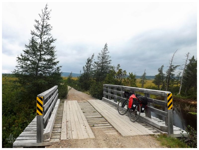
Patrick's Brook Bridge
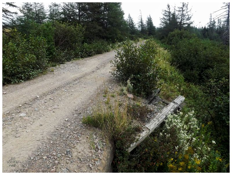
One thing that would help was that there was a slight improvement in the roadway after Millertown Junction. It was really bad right before town to the east, but the number of cabins here meant that the road was more like a woods road than a gravel trail. |
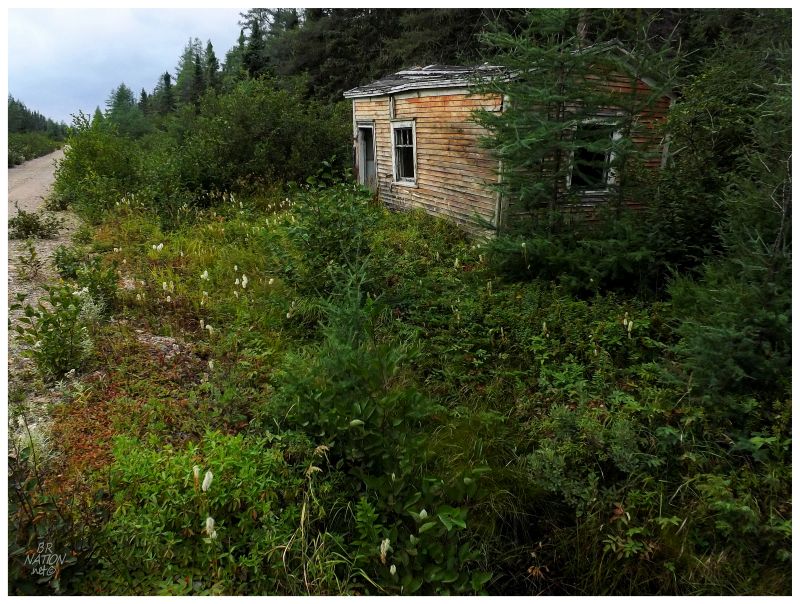
Putting in a good half hour of moving forward and chipping away, I obviously couldn't keep going once I approached this sight along the T'Railway. |
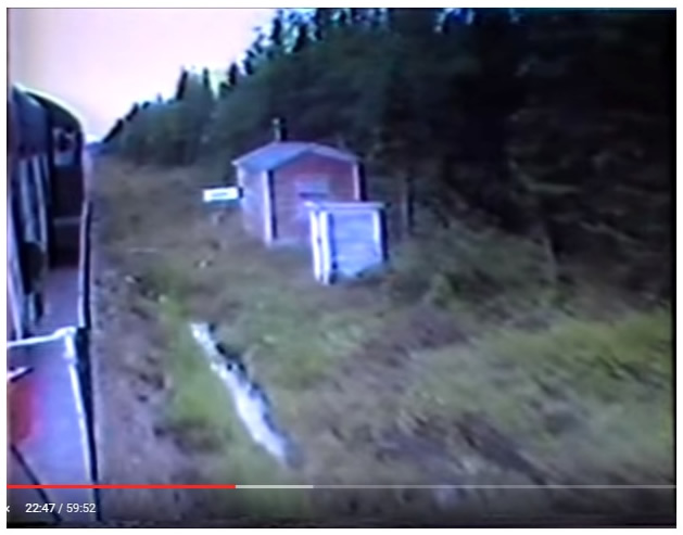
Screen capture from The Final Run, Sept 30, 1988.
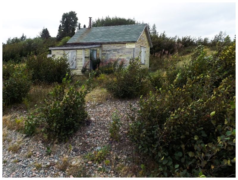
Kenneth G. Pieroway's fantastic book of then & now photos from the Newfoundland Railway - Rails Across The Rock - says that this place was known as Caribou (the white sign in the video says Caribou when you watch and it comes into focus.) He goes on to say that this building was a worker's shack and a cut-in house. A cut-in house being there in the emergency of a train losing contact with the train dispatcher, where someone here at Caribou could come out and wave for the train to stop before the dangerous Topsails. |
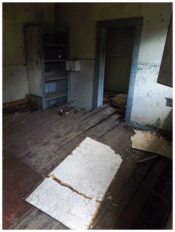
The elaborate shelving, proximity to the rail line & the layout of the shack all told me that I might be inside something that had to do with the railway. Pieroway goes on to explain that this shack was originally located at the Topsails, in order to hold men who would work to ensure that the line was free of snow. It was then moved about 20km (12mi) to Mary March, then to its final resting place here at Caribou. |
Although it's probably too far gone now, I paused and dreamed of coming to find the Caribou shack a few years earlier & also being in the market for a cabin in Central Newfoundland. What a small, fantastic utilitarian piece of history. |
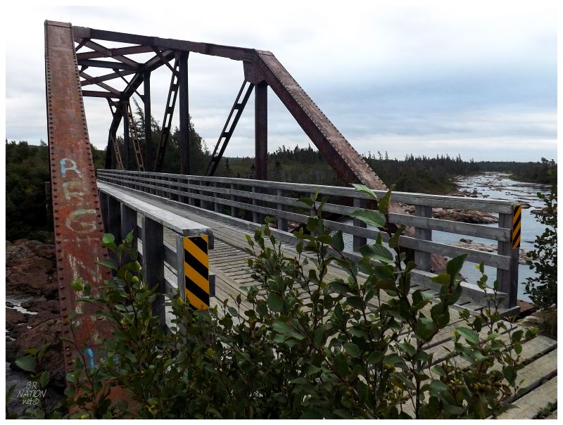
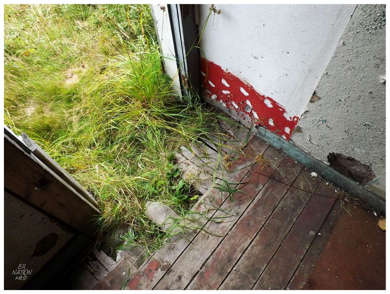
After the interesting building at Caribou, things continued to look up as I noticed a sign up ahead for a spring. While I had enough water to make it to Howley if need be, an available spring allowed me to frivolously hydrate myself. After walking a wet trail 50ft downhill & into the woods, I chugged down the frigid water that stung my throat because it was so close to being icy. Pausing to appreciate my surroundings, the spring and the creeks had made for a nice bit of forest. It was funny how I was now appreciating the forest once I went for a stroll into it off of the T'Railway. Climbing back up, it would only be another few kilometers on the bike when I came upon an impressive bridge, which I figured had to be the Mary March Brook Bridge. While I was excited for every bridge along my journey, the major train bridge relics were extra special. |
The trees really tapered out after I crossed Mary March and West Brook. By now I figured that I had maybe an hour of daylight left & thoughts were going towards where I would reach and where I would stop for the night. Slowly cycling along, the evening light wasn't a pretty sun setting into a cloudy sky off somewhere, but rather one of those gloomy evenings of indigo light and significant winds - wind that I was thankful was crossing over me instead of heading towards my face. It was one of those late summer evenings where the air is warm, but the feeling of fall coming dominates the mood. There was additional unease as I seemed to have come to an area of nothing but bogs. I considered going back to Mary March Brook. I wondered how long this area of a 6ft wide trail next to bog could continue. The long curve of this area led me to drop my head and pedal against the wind at times, while studying the horizon for what was coming. I passed a couple of spots where the trail spilled a couple of additional feet into the bog, but would this be enough space for my tent? And in this big, empty, moody area with no seclusion? |
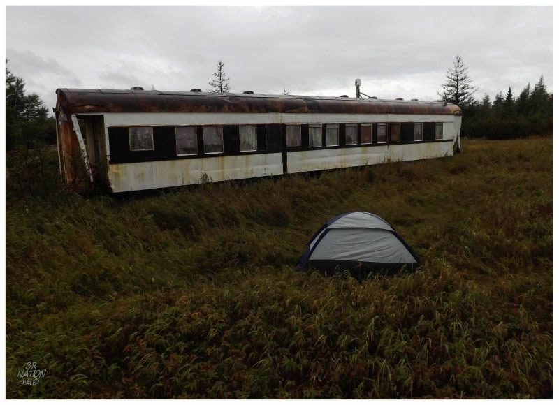
I can tell I was stressed about finding a place to sleep because I now see that this section of Mary March to Quarry is only 7.1 km (4.4 mi). It seemed like much more than this and now forms a much greater memory than any other 7 km section of this journey. Anyway, pedalling into a forested section of the T'Railway, there started to be a few better-looking options, but most of them were questionably wet or muddy. Worries lingered, but once I saw this old railway sleeper car converted to a cabin, I knew I had found the perfect spot. Whoever owns this property has their two-story cabin and shed about 20 feet behind my tent, but there was no one to be seen and the eerily quiet evening ensured me that I was probably out here alone. I'd set up my tent and store my food on hooks from the distant shed, before watching a portion of the night fall, but getting into my tent before my mind could work up imaginary fears coming out of the surrounding dark forest. Once I settled down and into my one-man tent, it was somewhat nice to be out here. To picture a map of Newfoundland and a dot where I was spending the night. To be putting forth the effort to see these hard-to-reach places & having a memorable outdoors experience camping outside this old work crew cabin car. I relaxed and listened to some Bill Burr podcasts, then fell asleep within an hour or two. Continue to Part 2! |