To bring a car on the ferry, even to bring yourself on the ferry, costs far too much money. Therefore, to break up the monotony of winter, I usually go on a trip to a nearby Newfoundland town with thoughts of nearby sights I can visit.

Exiting at Springdale, it was time for another coffee and to finally drive all of the 17 kilometers of Route 390 (instead of stopping 1 kilometer short like last time).
So there it was, 2 hours into the trip & I already checked off my 101st NF highway out of the 124 in this province.

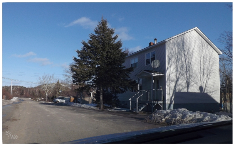
Driving north on Route 392, it was a bluebird day. I couldn't resist taking pictures of the village of St Patricks.

In trying to find this one hamlet I hadn't seen up here yet, I passed Coffee Cove again & couldn't help but turn into the community.

Driving to the end of the road, I thought I was about to get more than I bargained for as the car started to slide on this dirt track hardly wider than the car's width!
It should go without saying that your car sliding sideways towards frigid waters in isolated Newfoundland will get your blood start flowing at accelerated rates. The bad thing was that I had nowhere else to go once across, so I had to return over the same ice, thankfully with less incident.

I returned to what I knew as Shoal Arm, on account of having been here once when the government changed the ferry terminal & didn't post anything about the change online.
Shoal Arm remained on my list of communities I hadn't seen on this island because I couldn't figure out where any of the residences were - only a lame navigational aid and this old fishing shack.
Returning to the car, the roads were traversed yet again, but it wasn't exactly a complex system out here. Where was the actual town of Shoal Arm? Why hadn't I printed better directions? Why didn't I have a better map?
I gave up and sighed at the fact that I would have to return to this highway in the future, once I had a better idea of where this Shoal Arm was located.
Back on Route 392 and driving north, I craned my neck at the paths leading into the woods, until I just barely noticed a sign saying something obvious like "Shoal Arm Road", "Mine Road" or "Town Road". A-ha!
After a 3-point turn in the middle of Route 392, I then covered the 500m of Shoal Arm Road leading to two streets and about 12 houses. Community #712!

This was another example of where my quest to see every community on this island pays off. I knew that there was an abandoned open-pit mine nearby and then noted that some of the houses in Shoal Arm were twins & that they looked an awful lot like company-built homes.
For such a small mining operation, they had company built homes? Neat!
I wanted to walk to the old mine, but with snow still lingering and a decent valley between the road & the hill, I decided against it.
After being so dejected at having to return to Shoal Arm, I now look forward to the next time I find myself in the area.
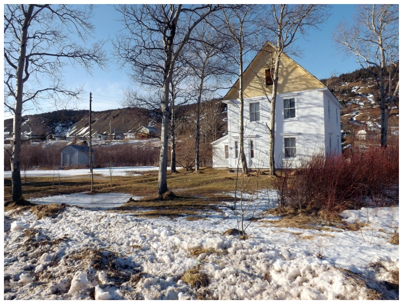
With time to spare, I drove to the end of Route 392. I had been to Little Bay before, but I quite liked the little community set between two hills, upon the flat land west of their large, dominating bay.
So I stopped to take a picture of the same house from 2010.
I also noticed a heck of a lot less snow here than back home. I may make this an annual trip simply to lift the spirits and inject some early spring into my life. Whereas plenty of people state that they love fall, I can't help but think of the impending winter during that time. I myself would vote for this time of year as my favourite, as I don't mind a little bit of snow, think the emerging vegetation is pretty & enjoy the idea of 7 months of good weather possibilities ahead.

Once Route 392 was over, it was a rush to Grand Falls-Windsor (GFW) to grab dinner and ensure that actual seat tickets were purchased for hockey (as opposed to standing room-only tickets like before).
Speaking of annual trips, GFW hockey has generally become that, as I love GFW and their built-in-1948 arena.
(I really should get around to making a dedicated update for said arena one of these years.)

Dilly-dallying in Grand Falls the next morning, it was time to finally see the inside of their impressive Roman Catholic church.
It now stands in my mind as more impressive from the outside.

I crept around their old paper mill for a bit as well, grabbing a few more pictures for the collection.
Soon enough it was time to drive the 248km/150mi home.