Whenever I set off for somewhere on this vast island, I usually take a look at the topographic map, fawning over the ability to possibly reach new places with interesting names and diverse land features. In looking at a map for this area of the coast, I noticed contour lines growing close (indicating hills) and the flat top of these hills marked as The Highlands. This area was 4 kilometers (2.5 mi) behind the village - a completely manageable distance when hiking the lovely landscape of rocky barrens down here.
At home, I told the rest of the group of how I wanted to walk atop The Highlands, but these plans were questioned with the boat's view on approaching the village on day 1, as these sudden, foreboding mountains appear from behind the community, with sheets of near-vertical rock faces, almost cartoonish in the same way an old abandoned house strikes fear in children on Sunday mornings.
"Those were the mountains you want to climb? Yeah?" was the voice I heard while we walked up the pathway to the church. As I'm not one to stress my intentions, I shrugged and let the point sit moot.
Come Sunday, I'd wake up to a sunny day where it was a simple case of one foot before the other.
Let's walk behind the church and into the dense shrubland. Oh there's a bit of a path? Well, we'll turn around once satisfactorily defeated.
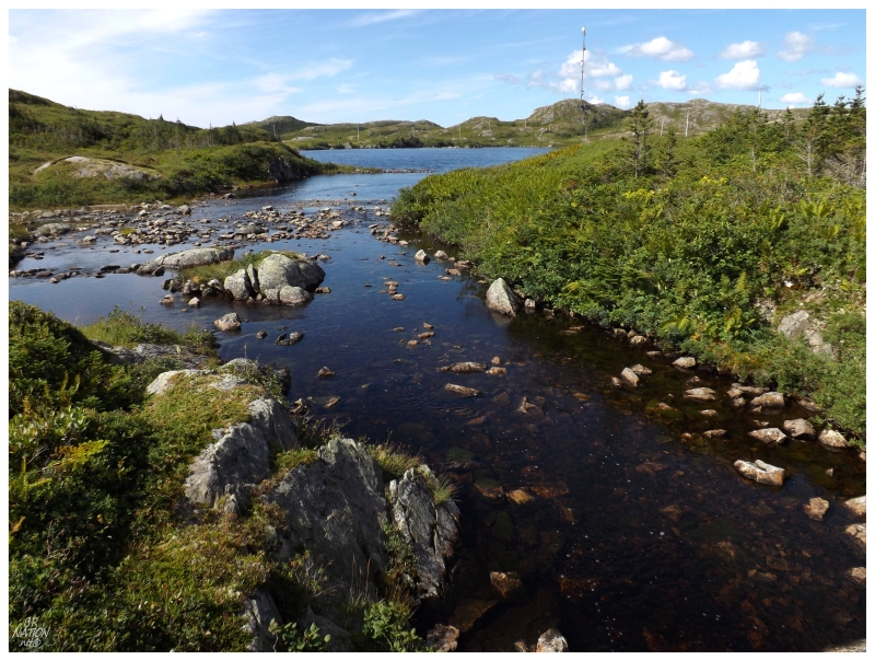
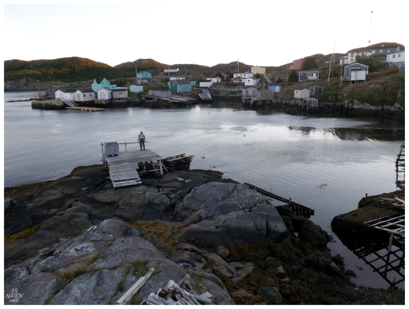
I carved to my right, leaving Christian & Natasha behind to the town pond and its floating dock. I followed the shore until coming to a river, which thankfully had a bridge. There was also a bit more of a trail here than I had expected.
While I was feeling under the weather following the rum showers last night, the presence of this deteriorated trail was a step towards actually getting something done today.
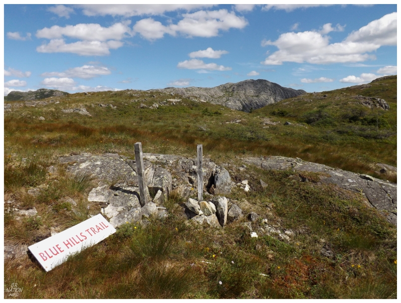
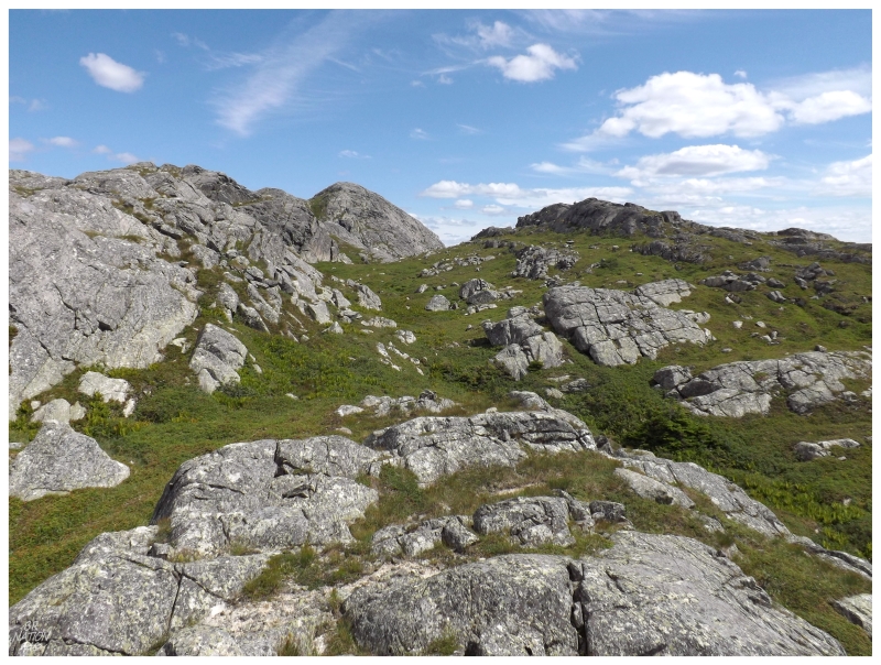
Then again, you shouldn't be fooled by the above picture, as while I may have managed to find the odd portion of the trail here and there, I'm pretty sure that I was bushwhacking or on a caribou path more often. The trail signs and posts simply helped in reassuring me that I was on the right path and taking what is likely the path of least resistance.
I pushed forward with the old hydro line off in the far distance, measuring my forward motion by the change in my angle to this stationary marker.
Until...oh my goodness!
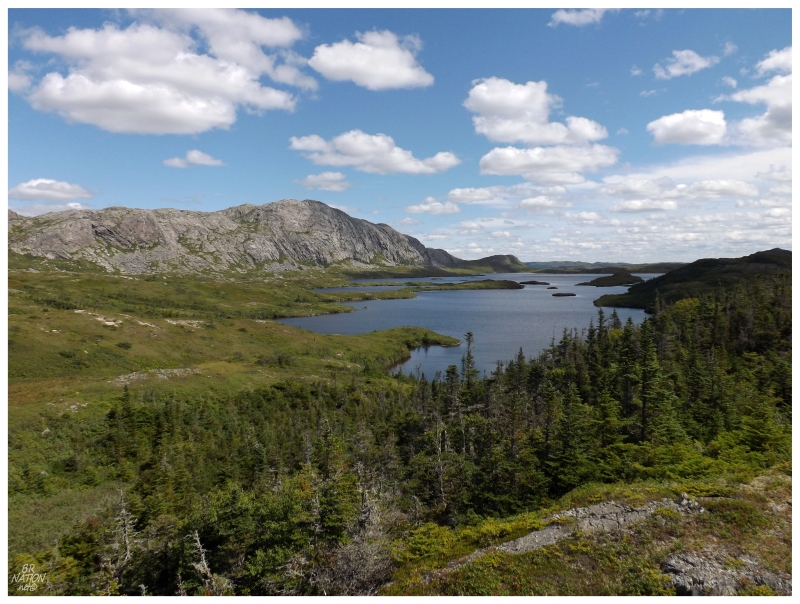
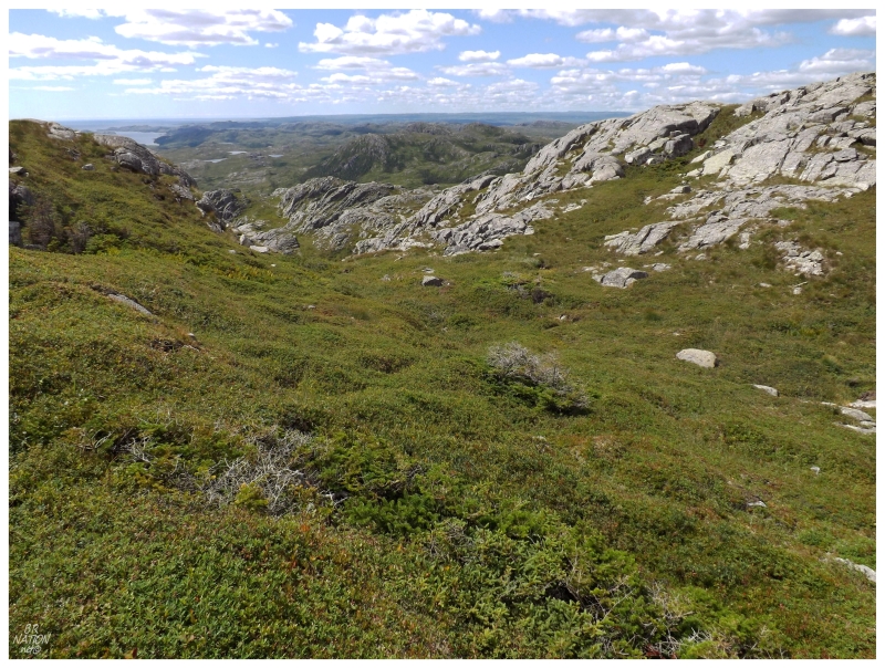
I figured that I had to have been walking for about an hour at this point, with small amounts of elevation change and the landscape a repeating wallpaper of small hills and ponds. I climbed the small hill before me, as I didn't see any trail posts off to my right, coming to the above view as I rounded the small knoll and stumbled forward on the flat top.
I couldn't turn around now, I would have to at least get closer to this scenic mountain.
Looking down and sizing up where to enter the small forest before me, I started downward and scarred away a moose in my path, managing to give myself a good scare in the process. The change from gleeful calm at the beautiful sight, to being startled by a 600-pound mammal was night & day.
The forest was a minor struggle and soon enough I was into a boggy area with small pools and even a little shoreline along the larger lake. I was questioning if I had enough water by this point, but as I had enough to keep going, that's what I did.
Coming to the other side of this valley, there was a steep hill which gave me fits, before I eventually stood at a higher elevation, closer to the vertical walls of the highlands.
I was tired, I had made it to a geographic feature (the pond above is marked as Gull Pond) and I had seen The Highlands. I wanted to call it an afternoon, but continued to tell myself, one foot before the other. This was only a 1800 ft. hill with minimal bushwhacking - you can do this.
(I could actually see a surprise waterfall off at a distance to the west, but let's not get crazy here.)
I inspected the hillside directly in front of me and accessed that it was too steep and too close to the cliffs. Fortuitously, there was a grassy valley separating this hillside and another hillside about 30 feet away.
The grassy valley was like nothing I had ever experienced before. It was actually a rock slide area, but so undisturbed that grass and shrubs had grown upon these rocks. You would step from place to place on to what looked like vegetation, but every now & again your foot would slide down the side of a boulder or into a hole created by the spaces between the rocks.
I would have been really nervous if I was with any one of my friends who have those easily rolled ankles. As I knew I was getting close to the summit - or at least I suspected I was - I took more time than usual, delicately placing my feet instead of scampering forward with my usual mindless gallop.
A young caribou stood ahead, seemingly annoyed that I hadn't yet turned around. He would have to navigate the same rocky terrain, although with much more familiarity than this human before him.
Feeling bad with nearing the caribou and having him move along three separate times, I was thankful that I finally found a satisfactory route to my right, which according to my map would lead to the summit of these highlands. I pushed forward and scrambled from rock to rock, excited by the thought of finally achieving the summit, but also nervous by the way the land fell away a hundred metes off to the south.
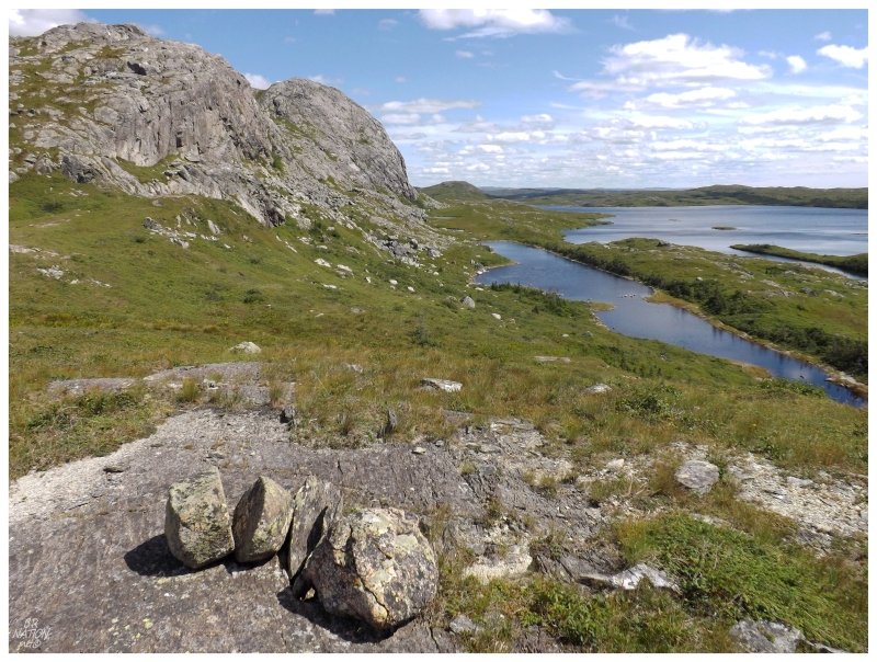
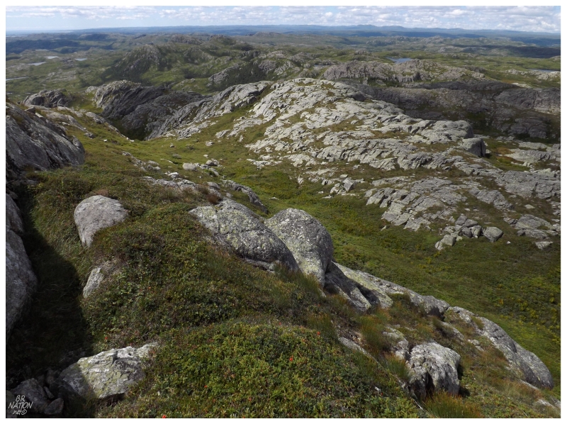
The above picture was taken from said cliff side, with the grassy valley extending from right to left, before falling away between the two hillsides.
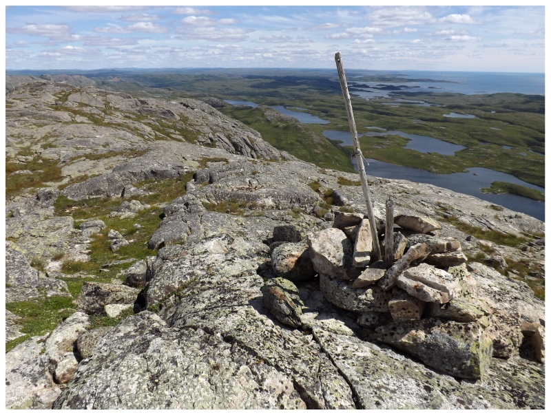
Reaching the top of the cliff and seeing a rock cairn up ahead, I finally sat down with an exhausted fist pump.
The sheer cliff to the south meant a fine view over the Atlantic and the various islands and coves all around. I wondered how far you could see down the coast, as I couldn't see the town where we left our car 40km (25mi) away.
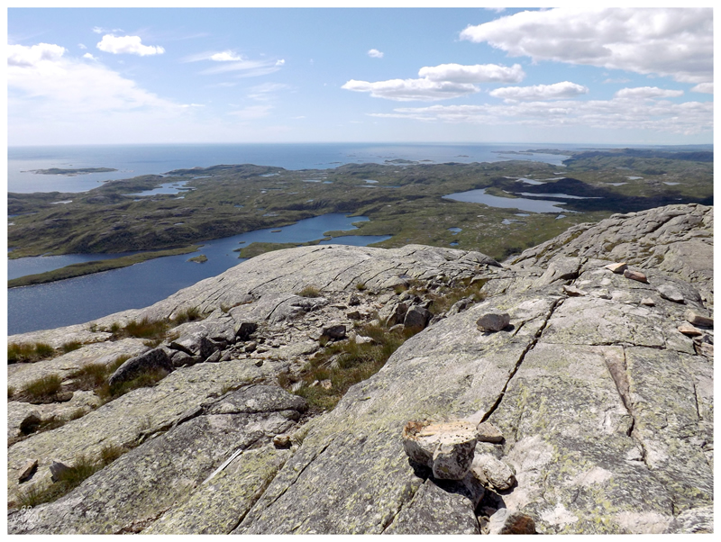
I couldn't really see the village either, a typical Newfoundland community tucked away on the seaside.
About the only thing I could see of the village up here was the radio tower (you'd have to zoom in on the original image to see this in picture form).
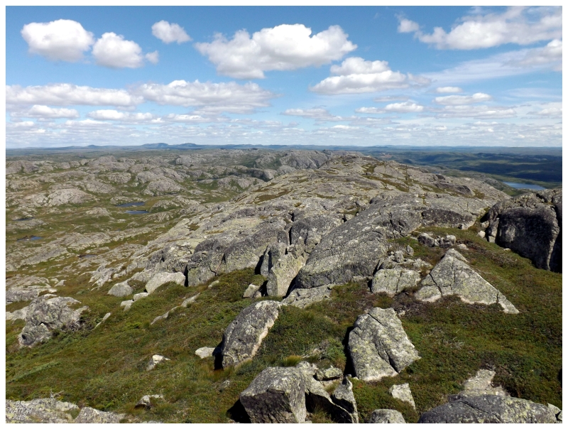
I gawked at the hills to the north, various ones that I've always noted and studied on maps while sitting in my room wondering about how to get out into this wilderness and atop them.
The geography nerd inside me that lusts for these obscure hills was plenty happy with summiting such a distant, obscure hill today. The picturesque grey rock, puffy clouds and the 30 kilometers all around were a thick icing on the cake.
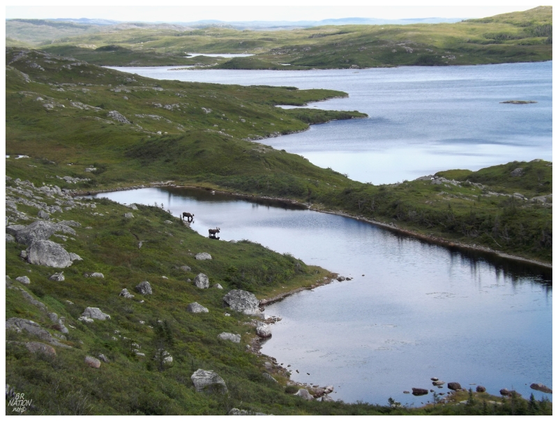
As I went west to test another route off of The Highlands instead of the steep, hill-hugging route I took up, I wandered over to the rocky, sheer face to the south and noticed a couple of moose lapping up water from a Gull Pond tributary.
I've always wanted to see a moose swim across a body of water - yes, I'm strange - so I sat down for a bit and hoped they'd swim away from me. Instead, they continued to cool their feet and hydrate themselves, while keeping a bit of an eye in my direction.
Back in the village, I learned that today was a much more popular day for visiting with 15 or 20 people stopping by. My anti-social self quickly connected the dots and declared it then a proper day for exploring the highlands!
As Christian savoured his last hours of daylight here, I asked what they got up to, with the aforementioned swimming, as well as finding a weathered dock and a caribou at the cove on the far western side of town (I never managed to explore this cove myself, with all of my poor time-management skills).
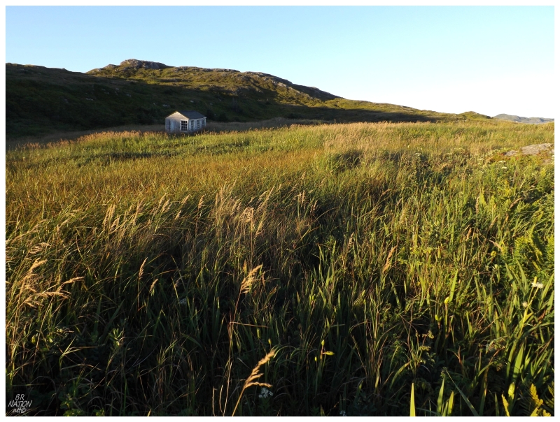
With the last fading light of our trip, I went about dotting the t's and crossing the i's, returning to the end of town where we first explored the cemetery, continuing along the coast to a lone shack out in the glimmering grasslands.
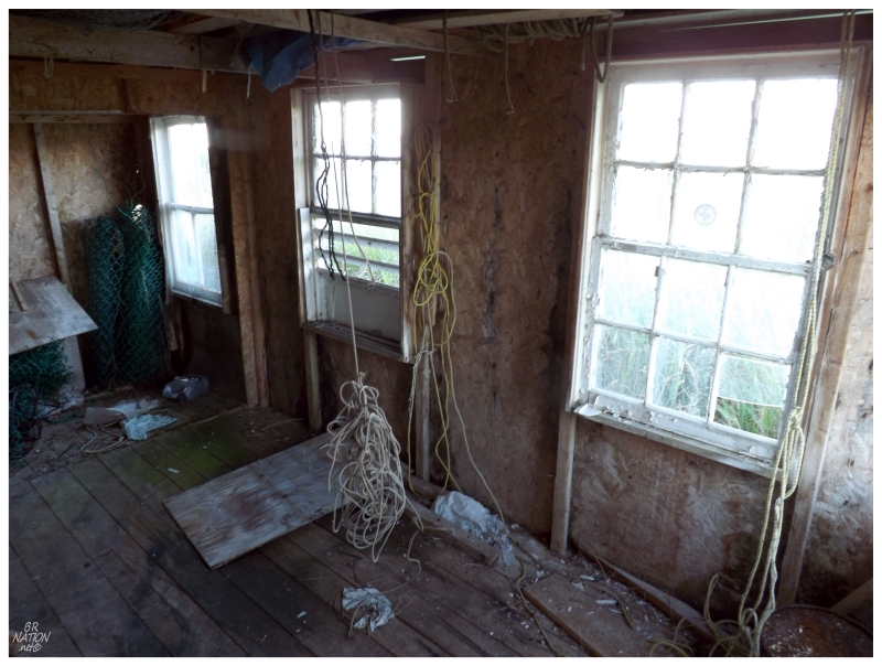
It was nothing more than a fisherman's shed - likely that of the brown house where I found my first sketchy stairs in this community - but it was a pleasing endpoint before the quiet night ahead.
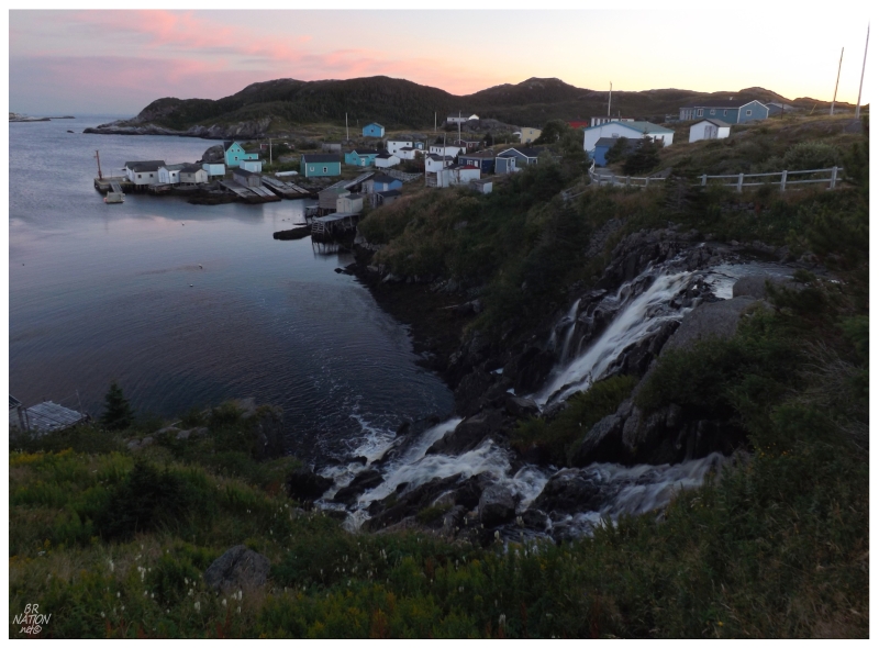
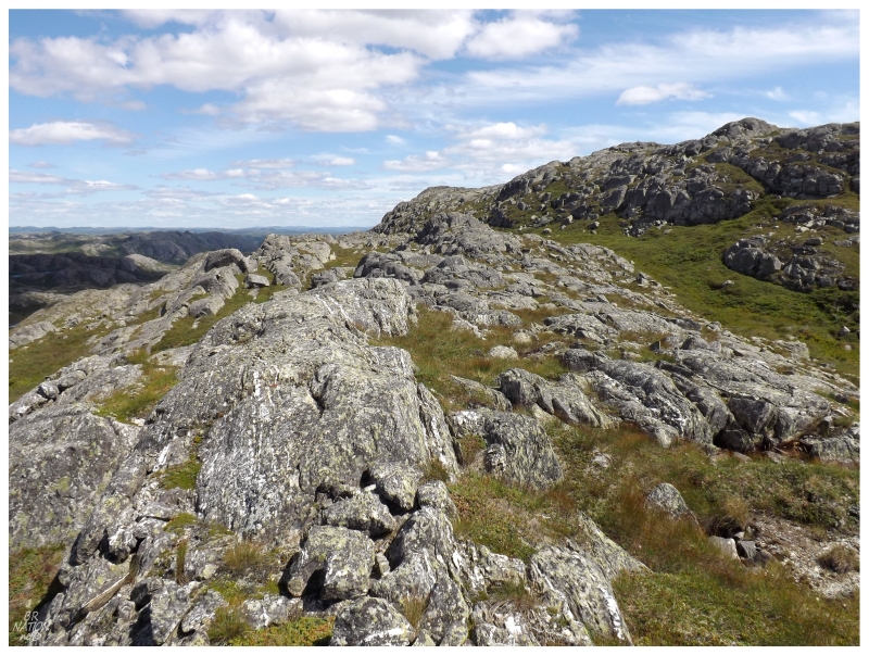
I didn't go anywhere elaborate for this last sunset, although I pondered going to the far hills on the east side of town (those that you see on the left side of the above picture).
Instead, I simply climbed atop the small rock next to the church and fire hall, savouring what would likely be my last sunset ever in this village, amazed by the fact that the days had vanished at such an unbelievably rapid rate.
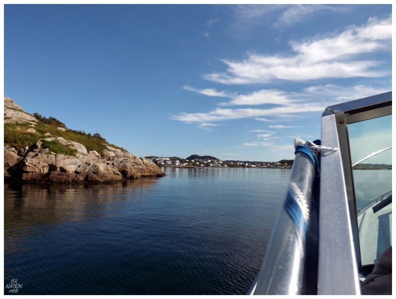
Our friend was back to get us early in the morning, with our stuff quickly down to the wharf and into the boat's cabin.
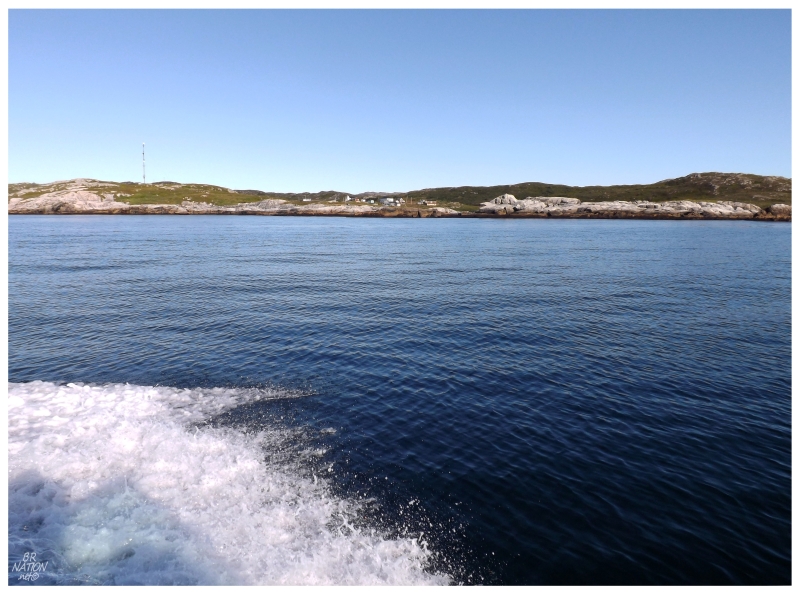
Before we knew it, the village, its radio tower & the highlands were racing away from sight.
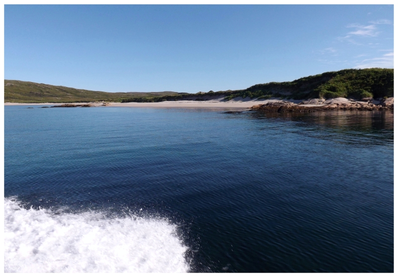
A nice sandy beach on the way back.
As luck would have it, we had positively scrumptious weather for the ride back. This time it wouldn't be a matter of quickly showing the most interesting bays and islands, but rather zooming in towards fantastic, isolated, sandy beaches and really taking our time to learn and explore what was before us (ex.: we passed Doctor's Harbour and the story goes that the name comes from the fact that a doctor used to live at this point of land, where traveling ships would stop there for the doctor to prescribe medicine for the various ills of the sailors).
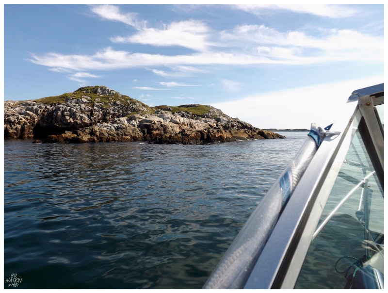
We passed by an island where there were about 30 seals resting on our way to the village, but of course in saying that I'd take a picture on our return leg, the seals were now nowhere to be found.
I truly valued our "big annual boat trip" to the Grey Islands last year, so it would be hard to say which of these were better, but thankfully, I find them different enough that they don't need to be compared.
With two of my friends leaving in 2014, this year may be the last one of these trips, and therefore, 2014's trip has its work cut out for itself to be in the same league as 2012 and 2013.
Lastly, I would go on my annual golf trip the next weekend, this year to Cape Breton. My friend Nick booked the cottages and motels for us, so as I opened the door to the second cottage of the trip, I didn't believe my eyes as what did I see...
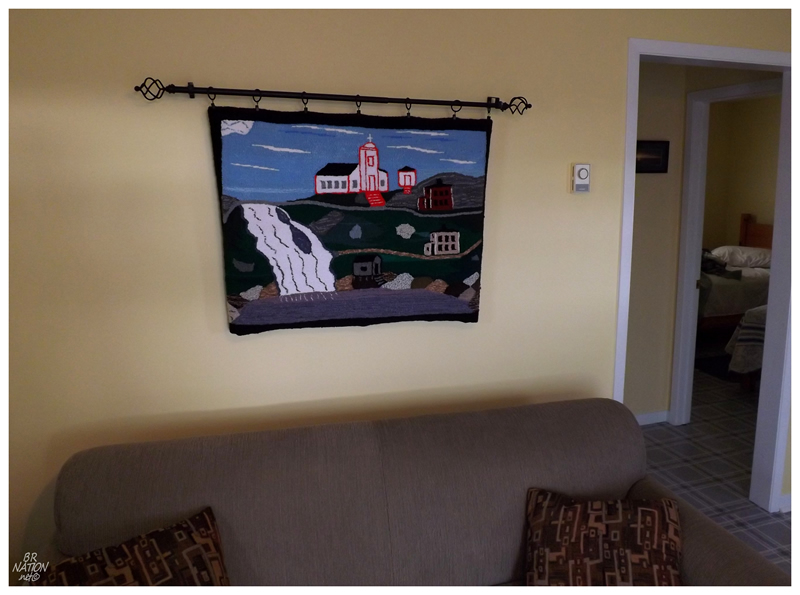
A hooked rug depicting the defining scene of the village.
What are the chances?