
Victoria Day weekend and the unofficial beginning of camping season was finally here. While I had just returned from Windsor/Detroit, I couldn't help but throw everything together to go sleep on an air mattress in some random quarry.
Trying to figure out just how far I could make it into central Newfoundland after work, I figured I'd stop somewhere around Norris Arm, about 30km past Grand Falls-Windsor. I looked at the logging roads and lakes around here, scouting out a promising area from the fuzzy Google imagery and unclear Google StreetView of the area.
Unfortunately my plan was thwarted by a dirt incline that only a large truck could go down. In the process of going into Norris Arm to see if there was another road into the island's interior, a road along Rattling Brook opened up to a gravel pit not very far from the main highway. With night quickly falling and this gravel pit far enough away from civilization, this would do the trick.
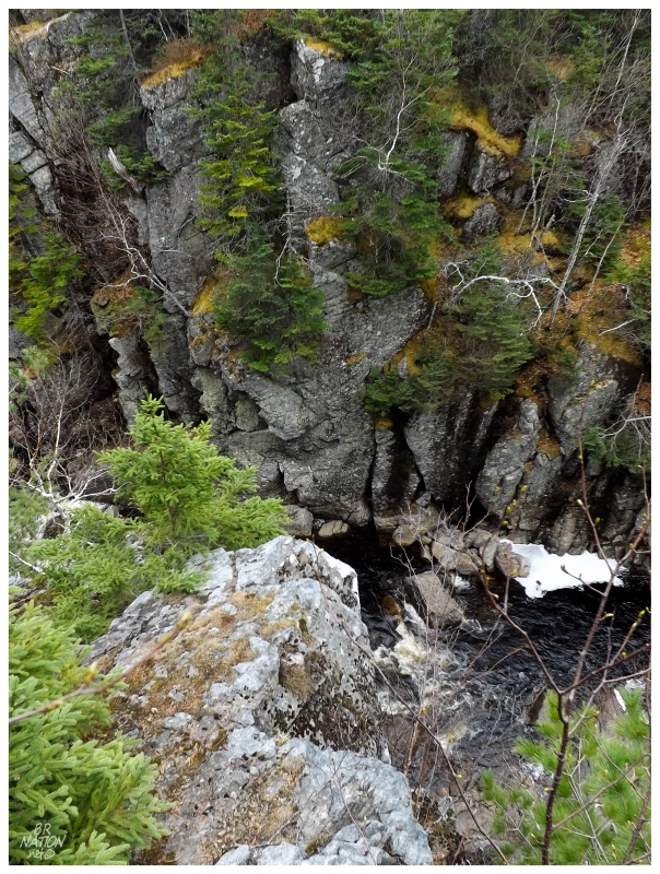
The tent couldn't have been more than a 100ft from Rattling Brook, something I noticed as I climbed a small ridge at sunset, before breaking onto a path into the nearby woods.
I wasn't in the woods for very long before coming out onto a rock with a precipitous drop down to Rattling Brook. Sitting on the edge to take this all in, I thought about how one of the best parts of Newfoundland is that there are so many beautiful locations, that a modest canyon bisected by rushing water isn't remarkable enough grow in popularity or be marked with signage. You can and do stumble onto places like this randomly without knowing about them.
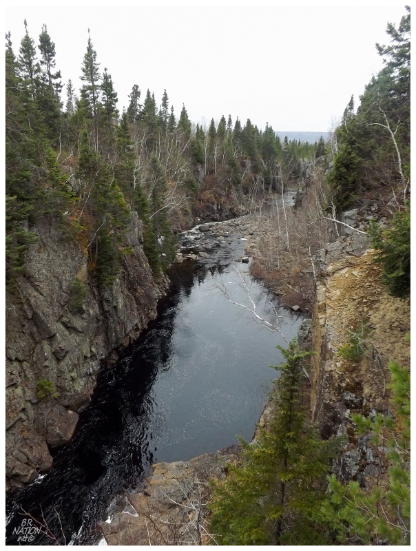
This canyon is all of a 10 minute walk from the Trans-Canada Highway and I must've driven the nearby section over 30 times without any knowledge of the surrounding area (except for what I've seen from the road in Norris Arm, Alderburn, Jumpers Brook, etc.)
A pleasant surprise for what I thought was a utilitarian gravel pit stealth camping spot.
On short notice & with a lack of preparation, this wasn't going to be a weekend of anything outlandish, but rather a simple excuse to get back into the Twillingate area to enjoy camping and the beautiful towns around here.
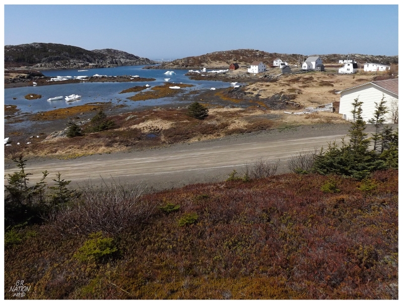
This is Valley Pond, which is around the Bridgeport/Moreton's Harbour/Chanceport area of New World Island on your way up to Twillingate.
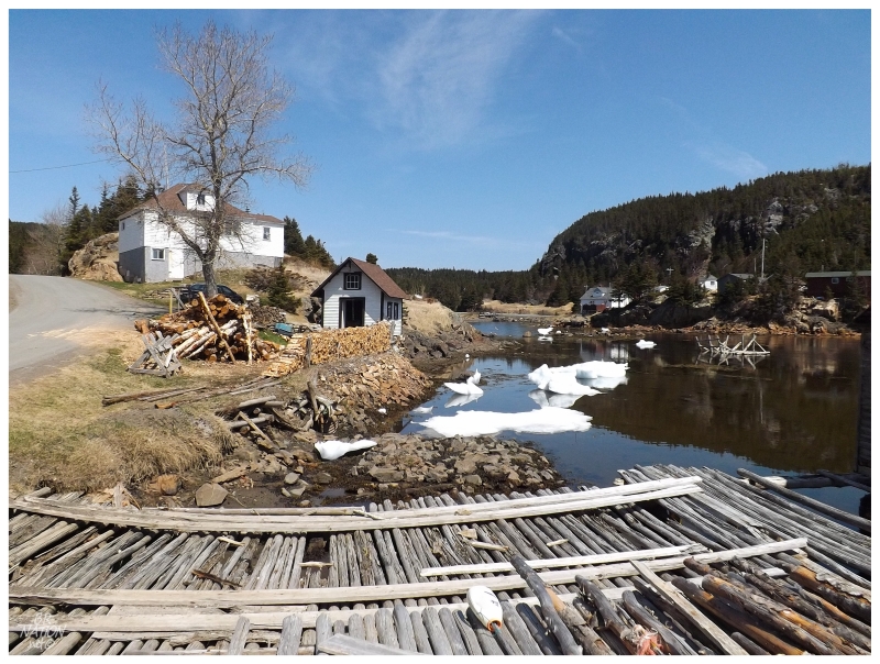
Pulling off the road in Moreton's Harbour on the way back, I noticed something special that I don't remember seeing elsewhere in Newfoundland. Where you used to have houses like this with a chicken coop and a shed and an outhouse and a cellar and etc., etc., a lot of these buildings were pulled down one-by-one over time. This spot in Moreton's Harbour seemed special in that the old occupant must've maintained and used all of these buildings on their property right until they had to abandoned it.
I wanted to take a closer look, but some neighbours were eying like hawks & my anxiety got the better of me. I swear I'm getting better!
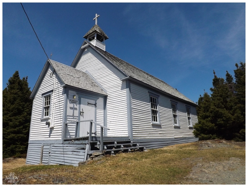
Although that homestead now frustratingly makes me want to drive out of the way next time I'm on my way to Twillingate, it paid dividends in that with the car stopped, I noticed a handsome church hidden up the hill in this the Taylor's Room section of Moreton's Harbour.
Unfortunately St. Philip's Church was locked, so no interior views for you or me.
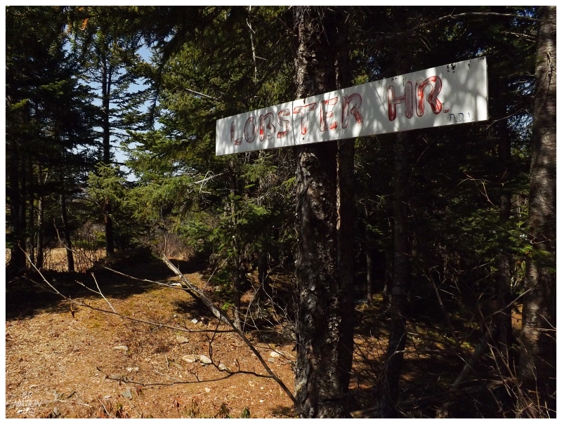
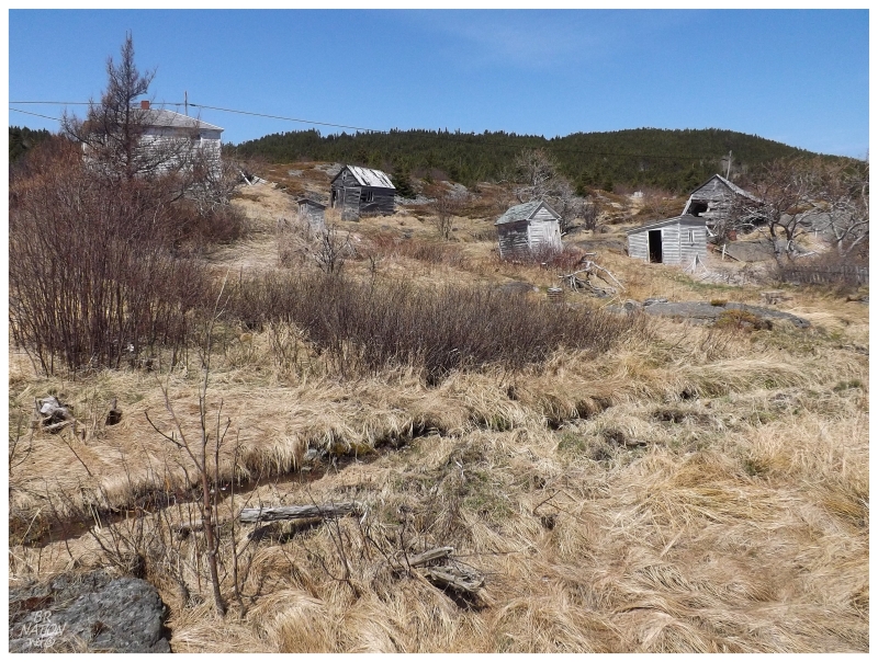
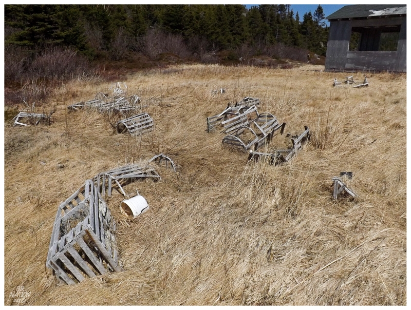
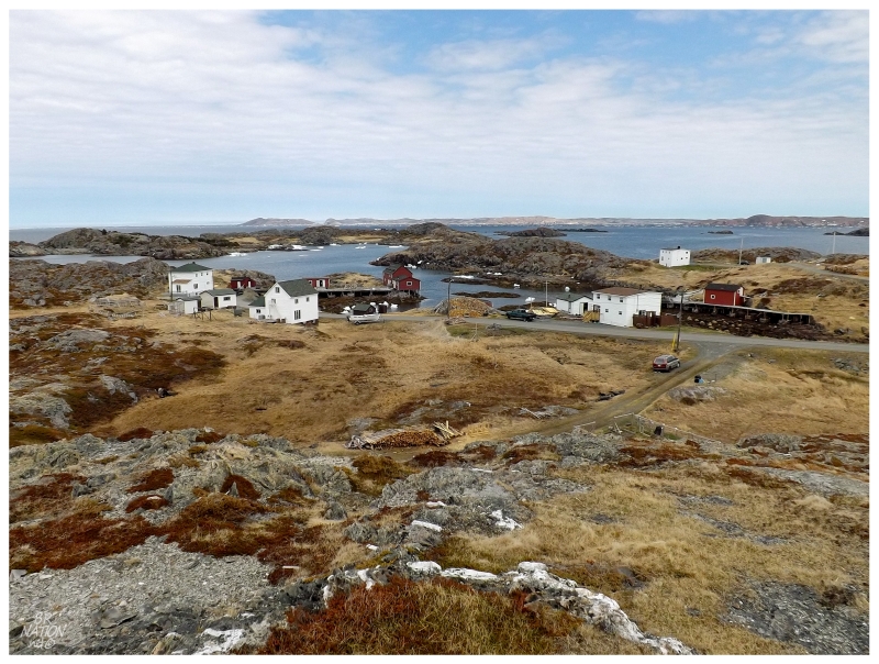
Continuing onward towards Twillingate, the next stop was at the ghost of tiny Lobster Harbour.
Looking for interesting places going into this trip, Google Maps got some points back for still showing places in Newfoundland that have been resettled for over 50 years. Confirming that Lobster Harbour appears on the map of Newfoundland Communities Resettled After 1960, I figured there wouldn't be much left behind since I had never even heard of the community.
As I inspected the satellite views in preparation, I noticed what appeared to be a pathway, along with a puny distance of about a half of a kilometer (3/10 mi). Obviously I couldn't pass up the opportunity to see another one of these resettled places, even if I popped out at their cove and saw next to nothing man-made.
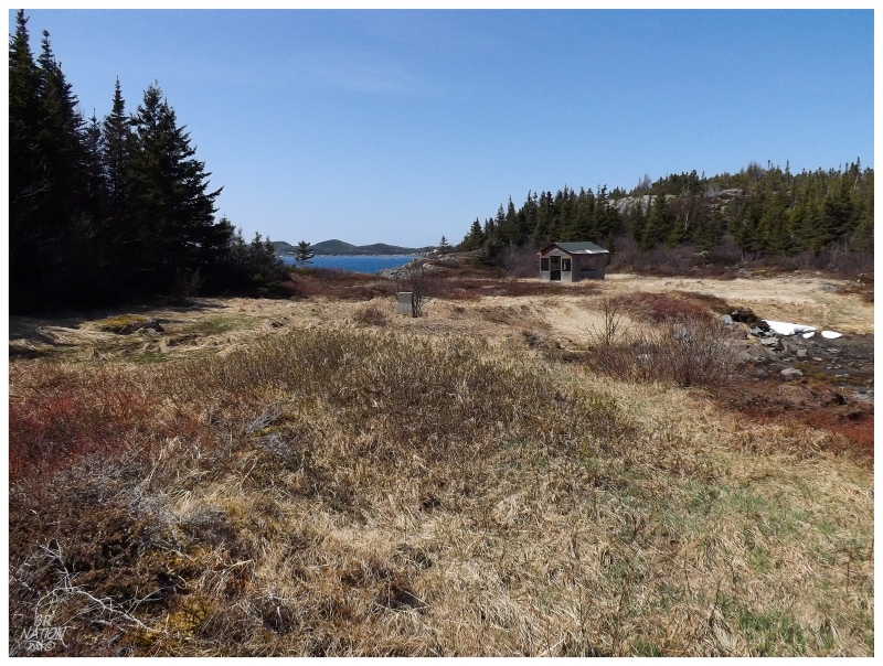
Inspecting the two coves of Lobster Harbour, it was hard to imagine that people found this to be one of the better coves in an area of such prosperity and undulating coastline.
Sure enough, if one goes back to The Newfoundland and Labrador Pilot put out by the Great Britain Hydrographic Dept for navigation, Lobster Harbour doesn't even have a bold typeface or larger font size. There is only a small blurb that reads, "Lobster harbour, fit for boats only, is a shallow inlet at the southern part of a small bight. Anchorage may be obtained in from 8 to 12 fathoms in the bight, and water may be procured from a small stream on the south side of the harbour."
Lobster Harbour would first appear as a community in the census of 1901, when two Methodist families had nine people living here. The population would peak in 1961 at only 14 people. Shortly after, when it was back down to 12 people, the residents would take the resettlement package. The Hicks, Mahaneys and Smiths of Lobster Harbour split up, with 10 people moving only a short distance to nearby Indian Head, while two went south to Lewisporte.
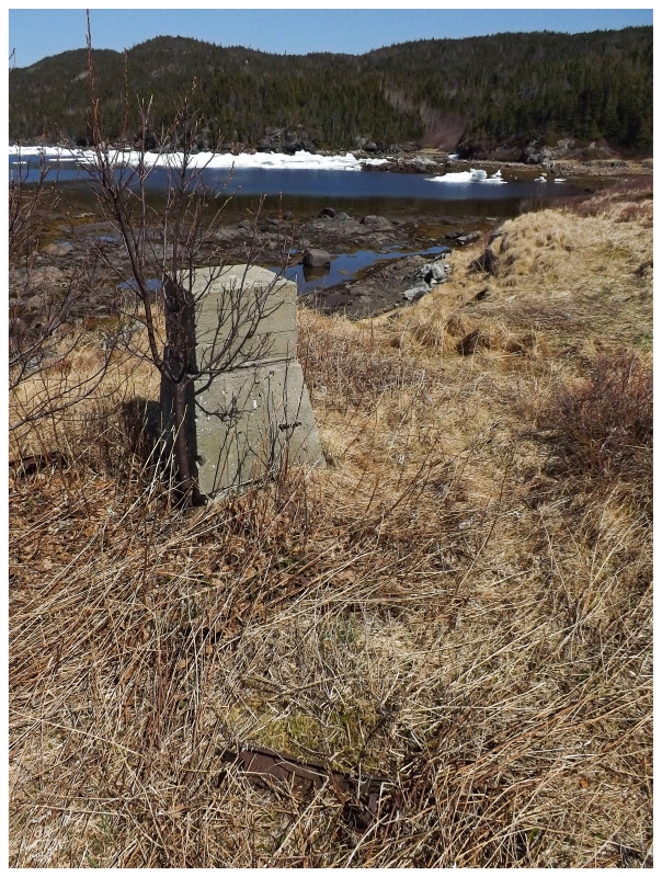
The only thing that looked like it could have come from the original Lobster Harbour was that concrete block. Even the typical vegetables and berries that you find at these resettled places were lacking.
Regardless of there not being much left behind in Lobster Harbour, I still appreciate the effort that someone made at some time to create a trail that led down here. Even with their picnic table flattened and the trail in slight disrepair, Lobster Harbour was nice and scenic enough to make everything worthwhile. I certainly noted the long meadows with thoughts of future stealth camping.
Anyway, another resettled community down, only 290-something more to go!
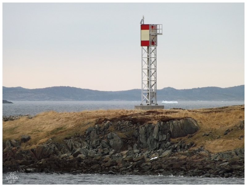
After Lobster Harbour I set my sights on one of the last lighthouses up here, one where I would need the help of a fisherman to get out to the island where the lighthouse was situated.
Yet again though I didn't call ahead, simply driving out of my way to amble around the community and pass up opportunities to talk to anyone about getting over to Bacalhao Island. No problem right? I have inexhaustible youth, money & time to drive up here again without getting it done? Again, I have to be better.
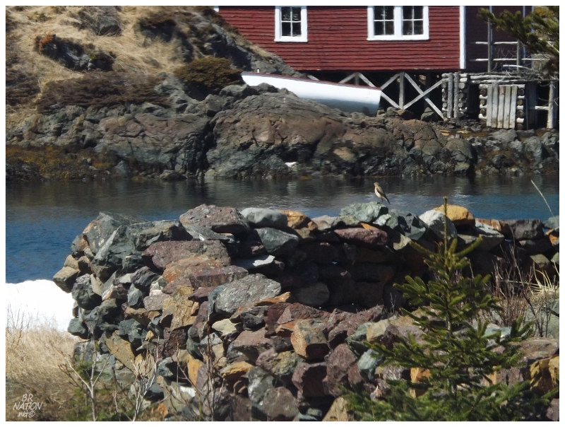
At least I saw a Northern Wheatear at Hatchet Harbour along the way - even if I only managed to get a 'record shot' before the Wheatear flew off.
At the end of the road, the view over Salt Harbour wasn't too bad either.
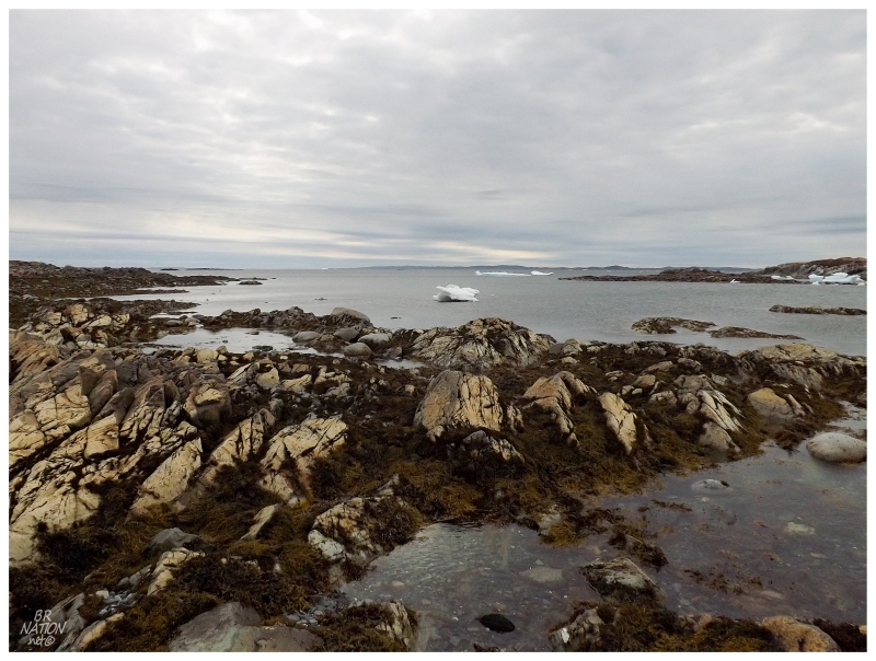
I love traveling in Newfoundland at this time of year because of how the yellow grass, blue sky and white houses visually work together. Being up here in iceberg country at this time of year, it was even better today with all of the bergy bits and growlers in each harbour.
Without going out to Bacalhao Island it wasn't all that late in the day now, but thoughts of making camp for the night came to mind, since I had a killer location lined up nearby.
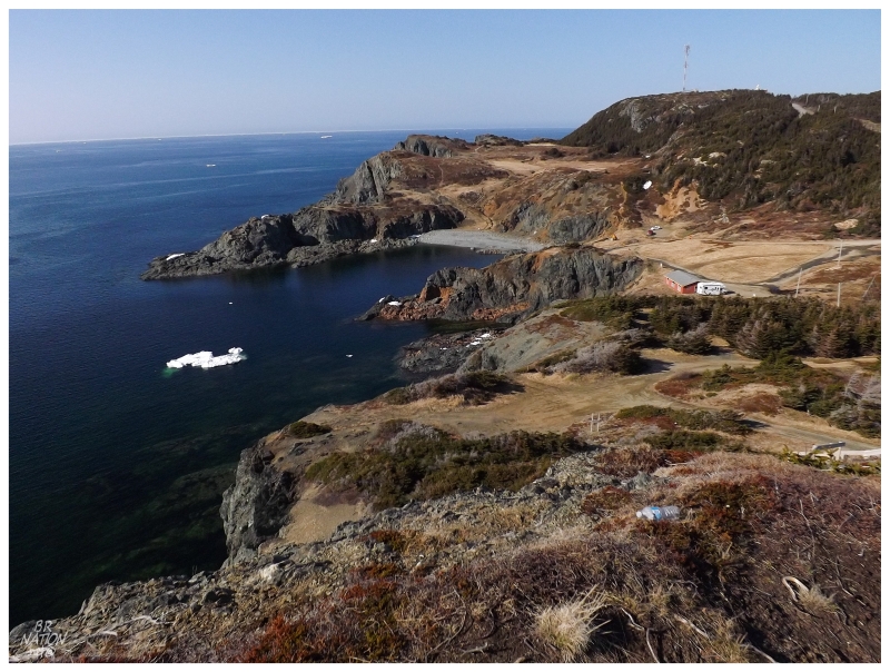
Finally making it to Twillingate, I went through town, through Crow Head & just about reached the Long Point Lighthouse at the end of North Twillingate Island. This is where you'll find Sea Breeze Park at Sleepy Cove, all of 600m from the end of the road, a big plot of land cleared with a good frontage on the ocean.
Where Twillingate is one of the most popular tourist stops on the island, I would write off stopping here at Sleepy Cove in July or August, but since it was only May 24, I figured it was worth trying our luck and seeing how many neighbours we would have.
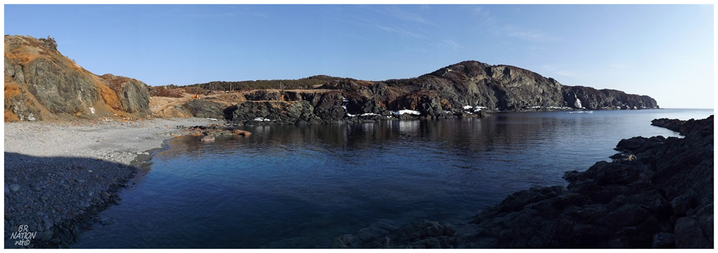
Save for an RV on the opposing hill that kept to themselves, Sleepy Cove was deserted. Newfoundland has some great stealth spots to camp, but the Sea Breeze Park was making many of those places look laughable in comparison.
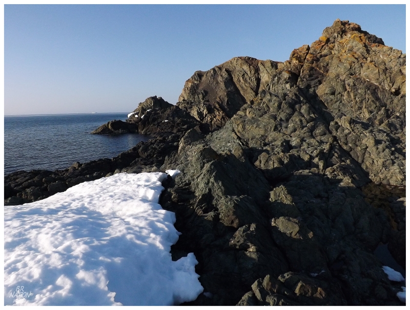
Walking out along the shore to the northern end of Sleepy Cove.
Sleepy Cove also has an interesting history as it was a copper mine long ago.
In 1906, Obediah Hodder returned from Pennsylvania to his homeland at Crow Head - the town between the lighthouse and Twillingate - as his father and brother had discovered a copper ore body and were willing to sell it to Obediah for $5000, plus $0.20/ton royalty.
Obediah would then spend an incredible $225,000 on the latest mining equipment, having it shipped up from Pennsylvania to Twillingate via steamships, then pulled overland from Twillingate to Sleepy Cove by horse & winter sled.
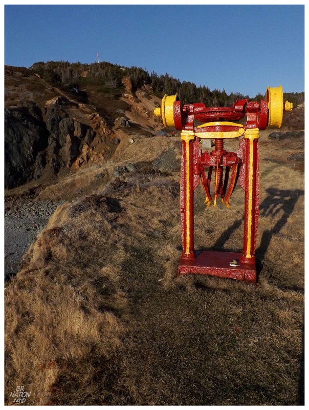
The Virtual Museum of Canada has pictures of the impressive mine. Many of Newfoundland's mines were small operations that didn't last very long, but these pictures show that Sleepy Cove wasn't a small operation.
It wouldn't last long though. After one shipment of 560 tons in 1910, another shipment was abandoned when the ore ship hit the rocks of Sleepy Cove during loading. A third shipment went to NYC, but couldn't sell until 1915 or 1916. Obediah abandoned the mine in 1917 to start a cooperage in Twillingate, until abandoning the island of Newfoundland altogether and returning to Pennsylvania within a couple years.
Sometime along the way, the Town of Crow Head painted the old machinery McDonald's Red & Yellow and provided a few pieces of additional equipment, creating a unique and funny playground for the local children. (There were three other random pieces of old mining wheels and miscellany painted and placed around the playground/campground.)
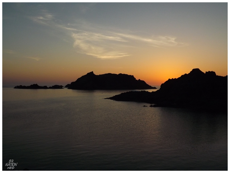
Even though I'm sometimes go-go-go and must do the greatest amount of things possible in the time allotted, Sleepy Cove was certainly the place to camp the rare instance of long before nightfall. The warm temperatures and calm wind meant long periods of relaxing on the bluff above the shore, enjoying only hearing the ocean without any worry of neighbourly intrusion.
In addition, I don't think anyone's coming close to my fine picture of Sleepy Cove Gull Island.
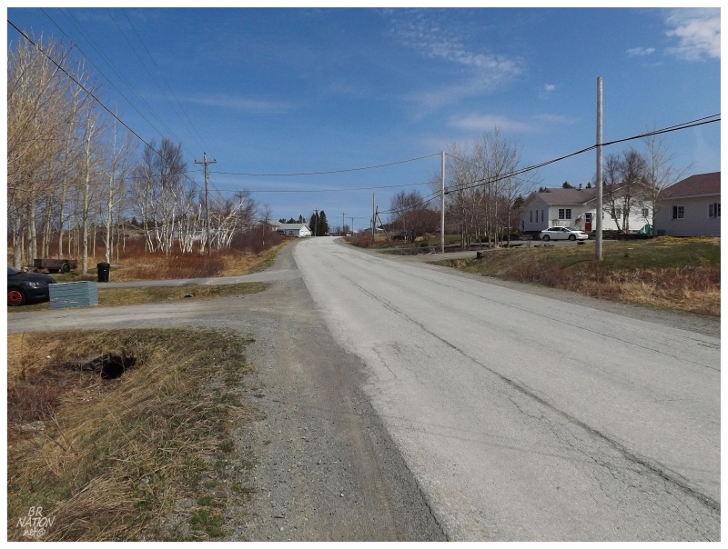
The next day I drove 25km out of the way to get one of the four remaining towns on this island I haven't seen. I have driven the NL-330 towards Musgrave Harbour a couple of times now, but never pulled off the road and drove the 1.8km loop road of Harris Point.
So here you go b'ys, the fourth last one: Harris Point.
As with all of the last 20-odd villages, I've started to cherish and pay greater attention to these disjunct places, finally checking them off and taking more time for pictures and exploration.
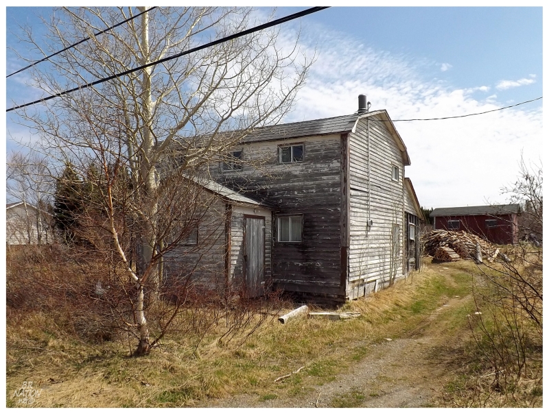
Harris Point might not have registered much of a memory if I originally drove this 1.8km (1.1mi) when I went to Frederickton back in 2009, but today, with stopping to take pictures and appreciate this gambrel roof beauty, Harris Point retains a small place in my memory bank.
The reason we drove to Harris Point from Twillingate was not only to pick up the last town I had left up here, but also to get closer to Farewell where the ferry would leave for the Change Islands.
I had been to the Change Islands once before in 2009, but as my friend hadn't, I had no problem returning to this beautiful isle.
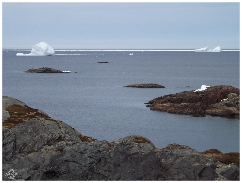
One bonus was that the Change Islands had real icebergs instead of simple bergy bits.
Unfortunately for me, there was still no icebergs trapped right in the harbour to create those stereotypical Newfoundland shots.
There were thoughts of camping on the Change Islands, but a combination of falling temperatures & exposed coastline made us think better of it. There were a few nice spots but they had next to no shelter, which can accentuate the difference between a 3°C/37°F night along the coast and a 10°C/50°F night inland.
After inspecting potential camping spots, there was no time left to run over to the Change Islands "lighthouse" before the ferry departed. The light appeared different from the boat, but I couldn't quite make out what I was seeing with the naked eye.
Sure enough, I looked at the zoomed in picture & realized that the Coast Guard had been here sometime in the last 5 years, replacing the cool, "old" modern tower, that once replaced the original Change Islands Lighthouse.
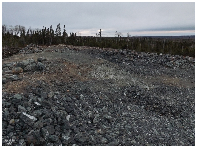
Back on the main island, the camping spots along the NL-330 back towards Gander didn't look very promising. After nearly driving to the big city, we finally went off the road at the sight of a gravel pit, finding a place that was simply good enough. There were plenty of other logging roads to search, but with being in various degrees of disrepair and the fact that the option of spending a ridiculous amount of money on a hotel in Gander was looking more and more appealing, it was best to get the tent set up hurriedly and settle in for the chilly night.
In addition, I was the one who remembered tent poles, but mine are for the cheapest tent you can buy - the splintering poles now held together by duct tape and even an ice cream scoop splint in one place. On this windy night, the swaying of the tent - even as it was in the windbreak of the car - put some fear into me, but the splintered poles, tape & ice cream scoop thankfully held up.
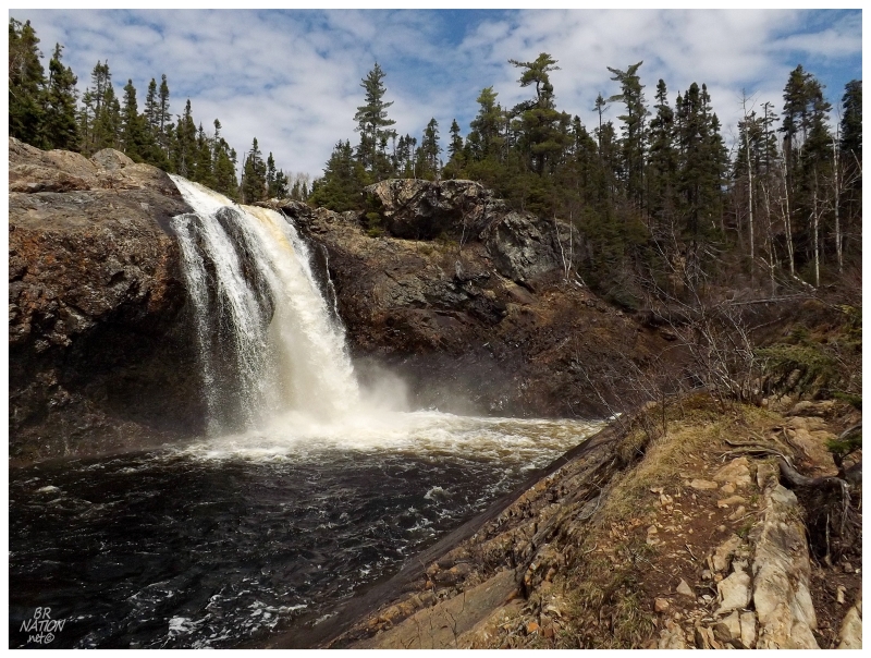
The next day there wasn't much to do and a whole day to do it. Driving back home would take about 4 hours, but with so much additional time, I stopped at the skatepark in Gander to ninja jump out of some stuck hangover toothpicks, then checked off things like this abandoned cabin near Grand Falls-Windsor, before finally stopping at their scenic Thunder Brook for the first time.
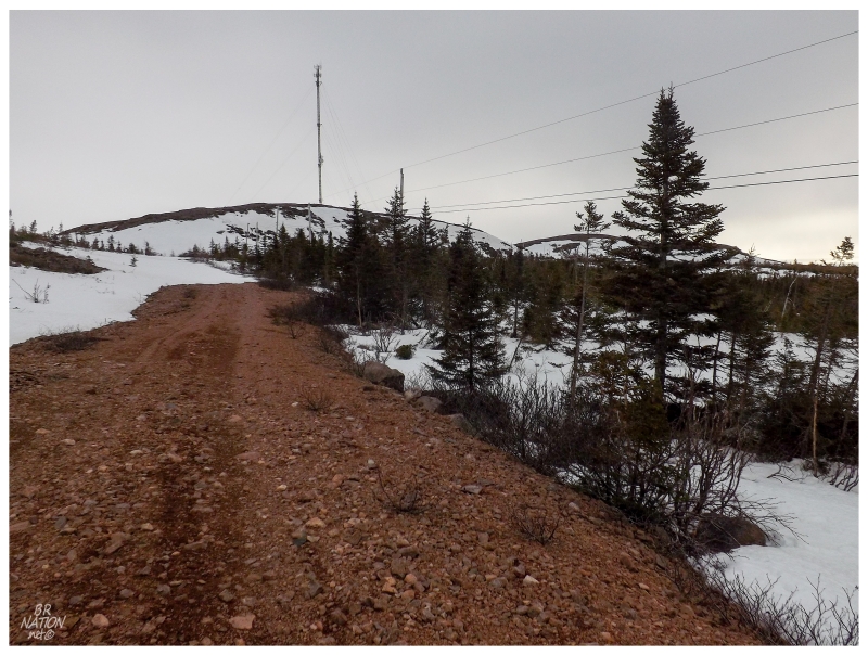
One last stop was at Mt. Seemore, a 1400 ft hill just before Sandy Lake, about halfway between Baie Verte Junction and Howley.
I had tried to snowshoe up the access road back in late April, but the steepness of the road slowed me enough that I felt bad for my friend waiting at the bottom.
Today was a much nicer day, so it was easy enough to sweat and pant my way up the tower access road without much of a break.
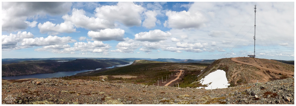
This view is looking east with Birchy Lake on the left side of the picture. The Trans Canada Highway would be right next to Birchy Lake, leading to Grand Falls-Windsor and eventually St. John's.
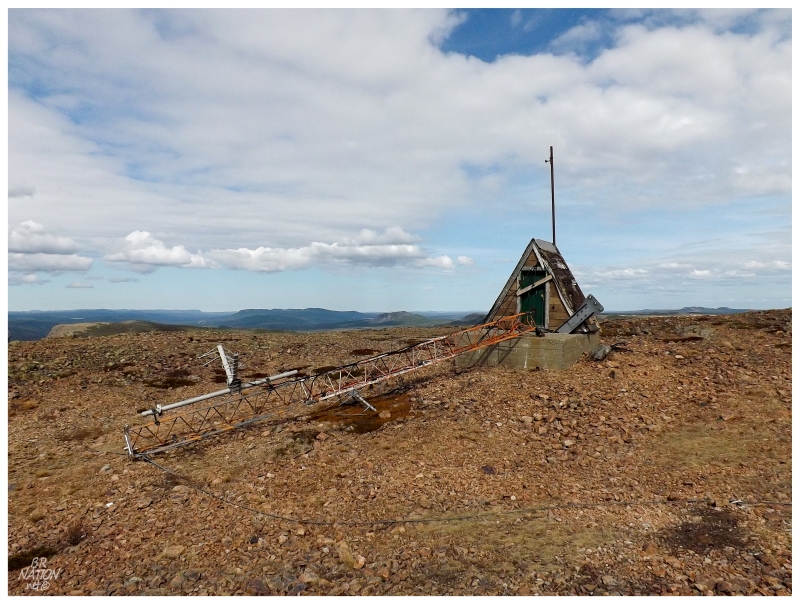
A fantastic, little, disused A-Frame hut near the communication tower.
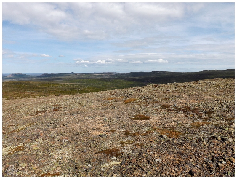
Unfortunately I couldn't find a big enough rock to stand on to capture the peaks in the background.
Looking south, it was also nice to get a view over the interior land that you never see from this stretch of the Trans Canada Highway. Somewhere out there is the old Newfoundland Railway train line that's been converted into an ATV path, but no, that small road would only provide access for logging operations.
I wanted to drive all of these roads and explore all of this barren plateau, but it was time to return to the car and eventually home.
Anytime you can camp all three nights of May 24 weekend here is a good Victoria Day weekend. This might not have been the most noteworthy one, but it was good nonetheless.