Now that I had successfully visited that lighthouse in the barrens, I had a free Sunday to do whatever I wanted on this long weekend.
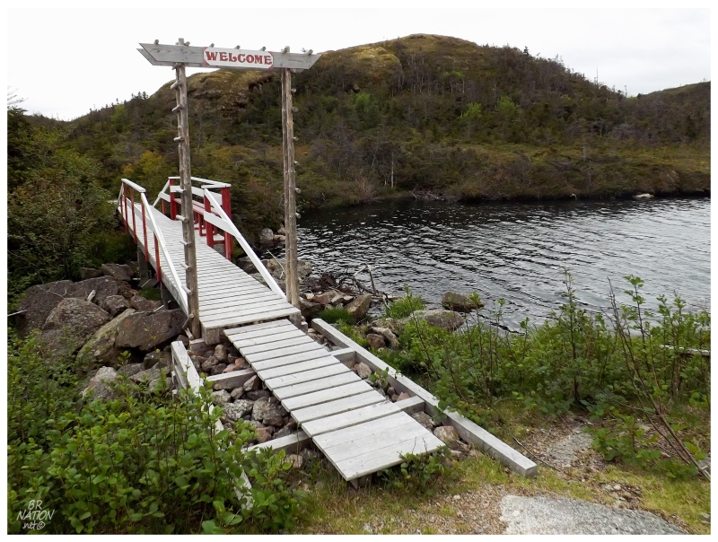
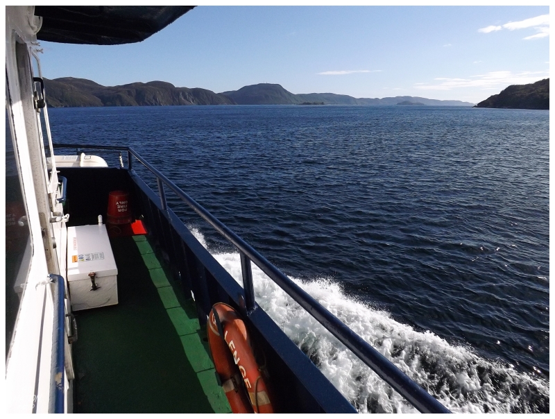
Waking up in Harbour Breton, everything was packed up and we made our way to the NL-364 and the town of Hermitage. Following the 20 minute ferry ride to Gaultois, it is then a 6km round trip hike to the resettled village of Piccaire.
The reason I didn't hike this trail on my first trip to Gaultois was that Gaultois itself was an afterthought following adjacent McCallum. After 6 hours in McCallum and coming back near 5 o'clock, I squeezed in a visit to Gaultois over the last two scheduled ferries of the day. There was nowhere near enough time in 2012 to hike to Piccaire.
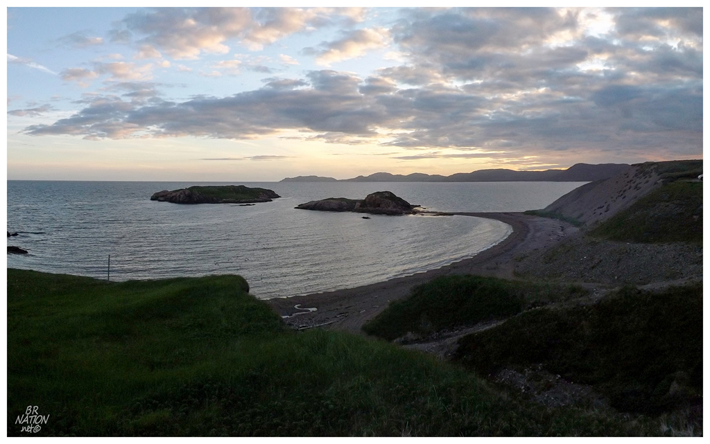
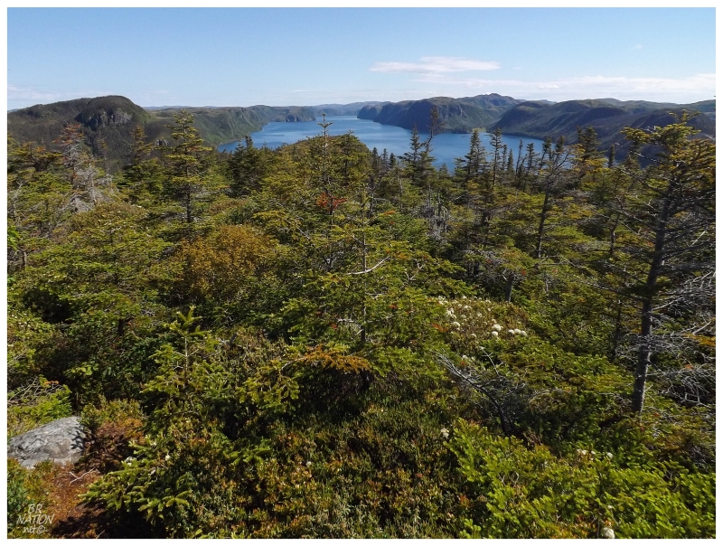
The Piccaire trail went forward with boardwalks over bogs, then muddy, worn trails so close to the small ponds that you'd fall in if you were looking at your smartphone. The scenery was nice but not the usual breathtaking scenes of the south coast because of cutting inland over this peninsula. The overcast skies didn't accentuate the forested hills either.
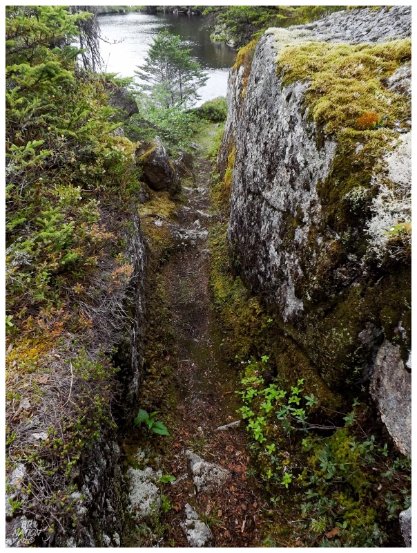
One of the neatest things about the trail was the multiple wide crevasses that the trail followed between high rocks. I couldn't remember ever being on a trail like this before, although in most places you'd only get a path like this with dynamite. In some places the trail was so narrow that I scraped my backpack on both sides as I made my way through.
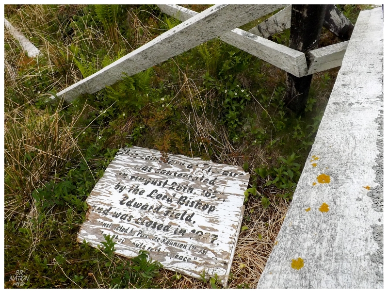
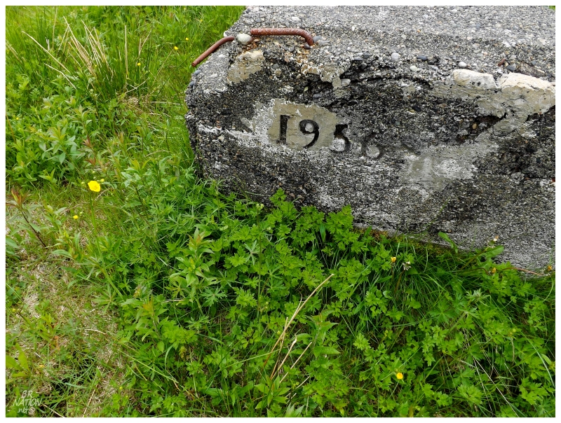
"The cemetery at Piccaire was consecrated on August 28th, 185(?), by the Lord Bishop Edward Field, and was closed in 19(?)7."
James Cook noted the unoccupied harbour of Piccaire in 1764. Seasonal fishing likely occurred out of Piccaire's narrow harbour and there's evidence that the Dorset Inuit people used the site long before that. The first ever Newfoundland census of 1836 notes that 35 people were living in Piccaire, most of the original settlers likely coming from Gaultois via the fishing firm of Newman and Co.
One of my favourite parts I read about the history of Piccaire came from the Methodist missionary William Marshall. Upon visiting Piccaire in 1839 via overland trail from Gaultois, he noted that the trail was "most shocking bad." I'm guessing the boardwalks weren't installed yet.
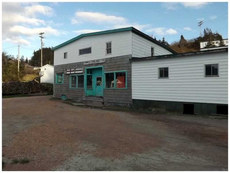
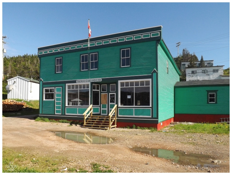
A Church of England combined school and chapel would be built in Piccaire in the 1800s, but residents continued to walk overland along this trail to church in Gaultois. The fisherman of the community would also walk this trail to sell their catches to Newman & Co., and then to their successor of T. Garland & Co.
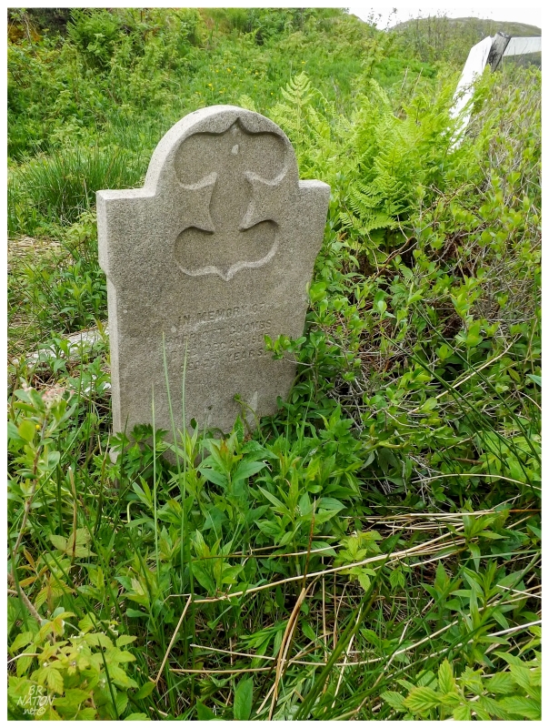
"In Memory of Harriett Coombs"
The population would stay around 30 to 40 people throughout the 1800s, until it finally increased to 54 in 1911 and 73 in 1921. This number would fall back down to 28 by 1951 though, as many of the residents felt the effects of isolation and working away from Piccaire at the Grand Banks. The opening of the fish plant in Gaultois would skyrocket the population back to about 100 people in 1963.
Piccaire would still be resettled shortly after. This is one of those cases where resettlement seems strange, but maybe the workers were tired of walking or boating to Gaultois for work? It was such a short distance that taking the resettlement money and "easily" moving to Gaultois was appealing? (Although some moved across the bay to Hermitage, down the coast to Burgeo and one family to Harbour Breton.)
Piccaire doesn't have the online presence of some resettled places, so I'm left wondering and speculating dangerously. The beautiful museum in Harbour Breton has a room focused on resettlement - even with great black & white Piccaire photos missing from this update - but I didn't know this when I was in Harbour Breton. Damn. The museum has a whole room dedicated to the nearly 50 resettled places around adjacent Fortune & Hermitage Bay, which seems like something I just might enjoy.
(The extra frustrating thing is that I tried to visit the museum once but I was there too early in the season.)
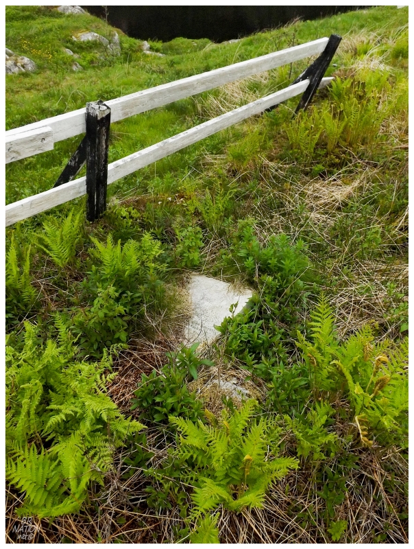
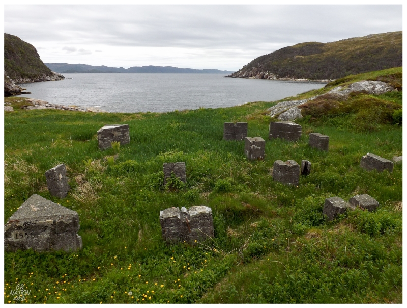
The most noteworthy remains of Piccaire are the cemetery, church ruins and a sidewalk. The cemetery is what I rushed towards but once inside the falling fence, there weren't very many headstones. I guess people went to Gaultois for funerals as well.
The fantastic Newfoundland's Grand Banks cemetery project website only has 8 headstones listed at Piccaire. I believe I found only 3, the others choked with intertwined branches and thick vegetation.
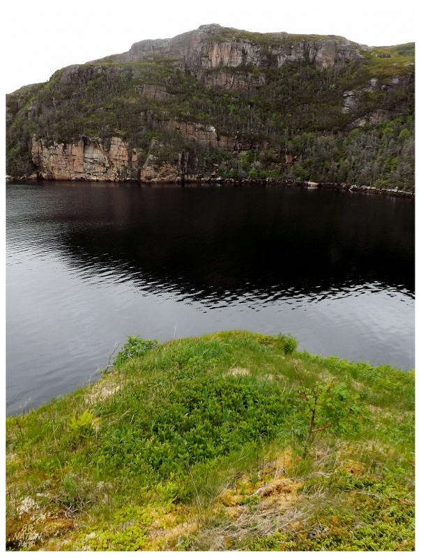
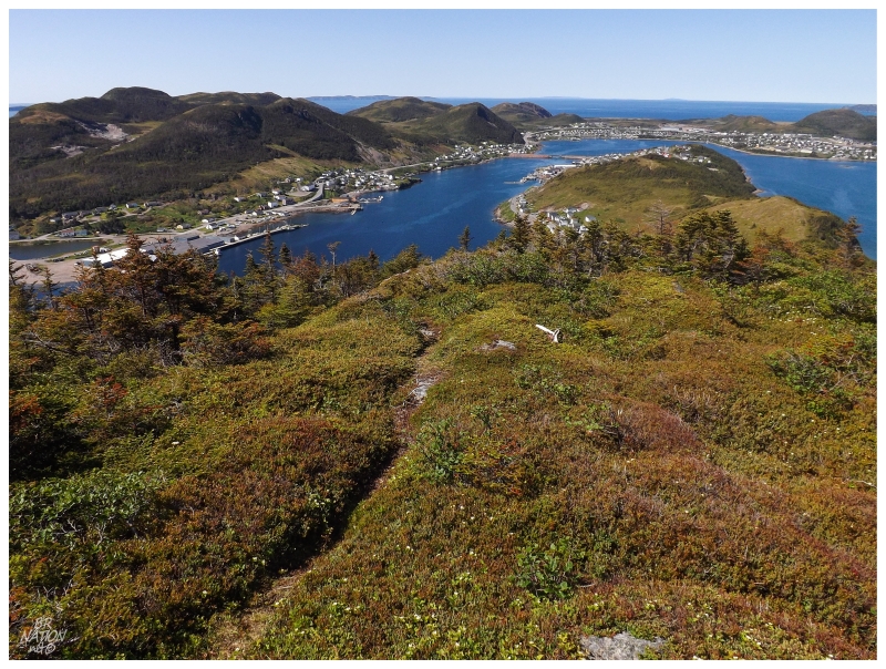
Moving towards the shore, the steep cliffs around the harbour made me appreciate the trail from Gaultois. Looking at these cliffs I thought I could see the maritime appeal of Piccaire, but Great Britain's Hydrographic Department warns of dangerous lady shoals right at Piccaire's entrance - "keep the west point aboard to avoid Mad Moll, Crazy Betty, and another shoal lying off the east point of the entrance."
The navigational guide does go on to say that good anchorage can be obtained at Piccaire's entrance, where the depth is 11 to 13 fathoms (66 to 78 feet).
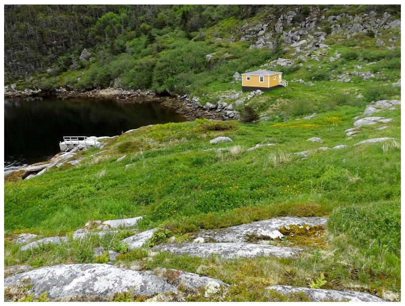
There is also a cabin at Piccaire, a building that I left alone out of respect for whomever keeps their getaway at this distant place.
The only thing is that a Jane Pittman is trying to bring a tourism renaissance to Gaultois, where she realized that many people like to hike to Piccaire when they visit. So they disassembled an old house in Gaultois and moved it to Piccaire, providing it as a "tea room" for visitors to take a break at.
Being able to photograph, relax within & explore an old home by myself out here...and I stayed away because I thought it was someone's cabin. D'oh!
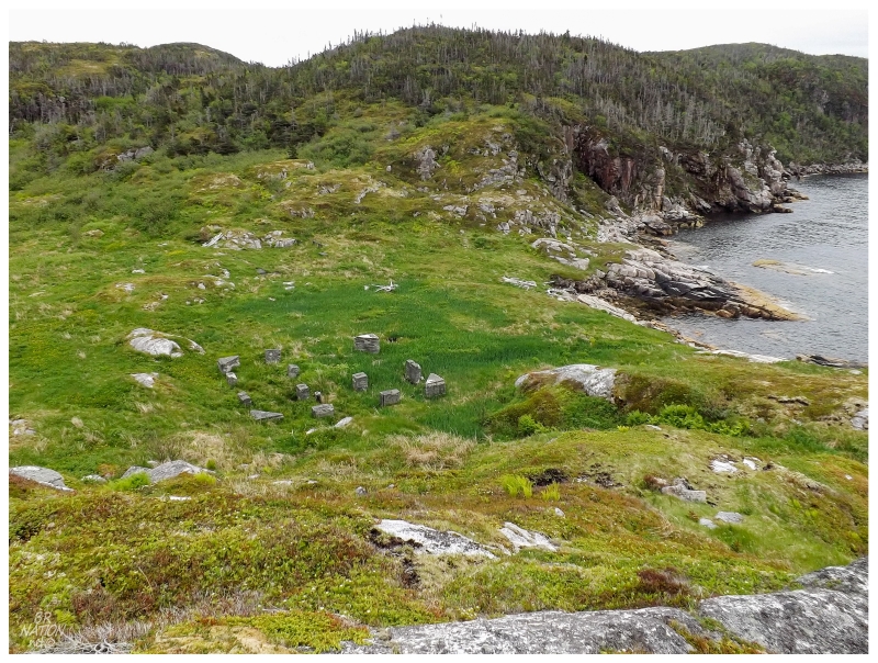
There was a small hill at the greatest width of Piccaire, so after looking through the cemetery I continued east for a short distance and came around the rock face to look down on where the church used to stand.
The Piccaire church was built 4 years after the fish plant in Gaultois opened.
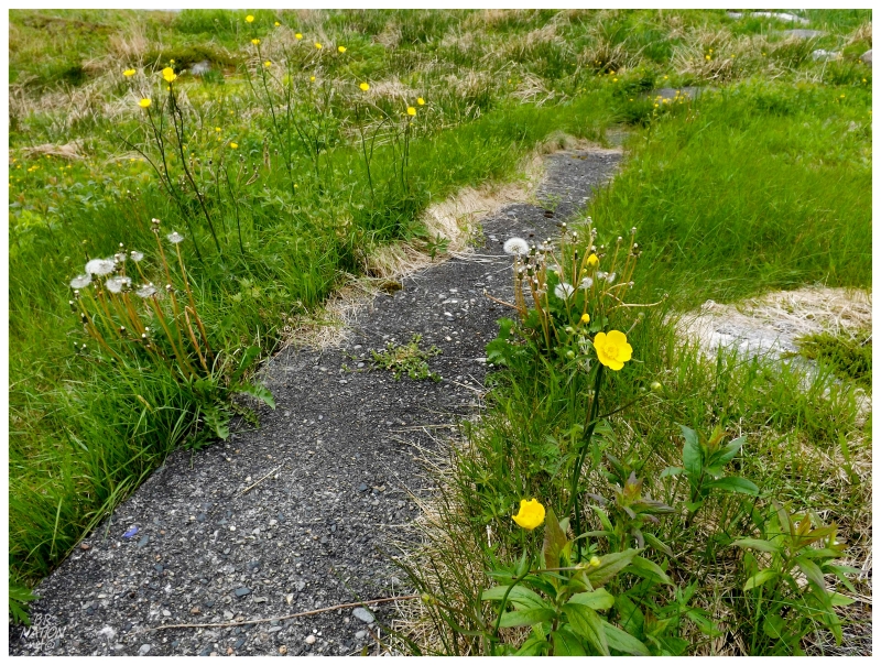
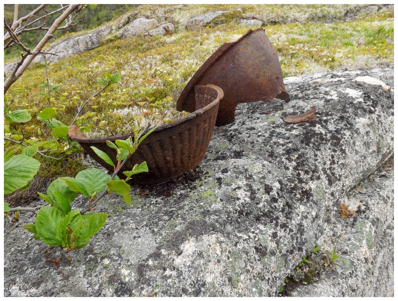
Next to the church was an old house area with a sidewalk and metallic miscellany left behind.
Normally these villages abandoned since the 1960s and 1970s have very little left in terms of housewares, so I was left to wonder if this was a more opulent house (see: the sidewalk), or if there was a house here that lasted some years post-resettlement. It was also very close to the church ruins, so maybe it was a rectory? The ground also didn't have very much vegetation, so maybe I was simply seeing more of the hearty items left behind than I can usually see in other places?
I'm left to wonder until I get to that resettlement display at the Harbour Breton museum.
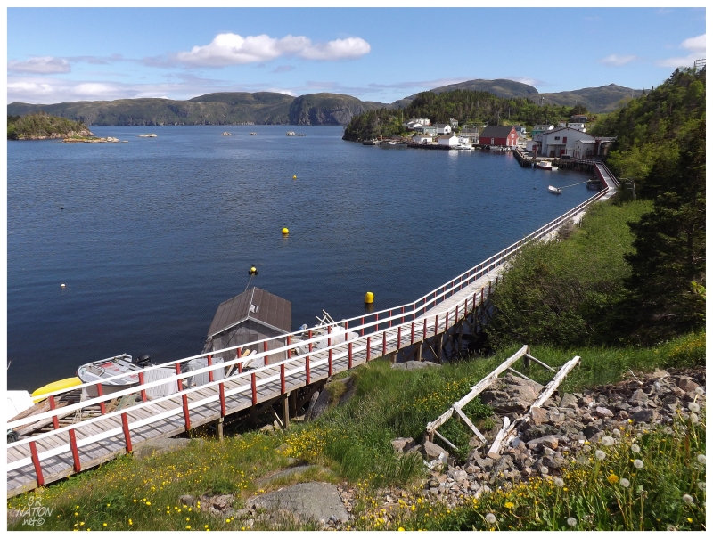
The sun broke through the clouds for a fleeting moment as we turned our backs on Piccaire, but quickly went away. It was only near the end of the 3km hike back to Gaultois that the sun came out and stayed out. Picturesque Gaultois shined in the midday light.
^Spring 2012.
^Back to Summer 2014.
In addition to the tea room at Piccaire, the Gaultois Inn now has a restaurant, the Customs House is undergoing renovations - looking much nicer today - and the Thomas Garland Store was also shining. From a decaying, sad building in 2012, the Thomas Garland Store looked a hundred times better today.
We had lunch at the Gaultois Inn where I'm happy to have supported this Gaultois tourist endeavour, but in reality I might've been thinking about a juicy burger after hiking to Piccaire.
The funny thing was thinking I was out of juicy burger luck at first. That is until a neighbour saw us checking out the Gaultois Inn & asked us to hold on so that she could get the cook to open up the place and make lunch.
As much as it was a touristic thing of having a nice meal in a place like this, Bay d'Espoir is well off the beaten path. It's the type of area that I'd like to know about when I'm personally visiting a place, but it's even somewhat rare amongst Newfoundlanders to have been down there. I wish Gaultois all the luck.
Sunday night was spent in Harbour Breton again, as this was where we needed to be for Monday's business. I also don't know how you pass up a campsite like this for $10, even more so when you consider that the only other person at the campground was holed up in a single RV.
To think of cramped cities spilling out on long weekends to jam-packed campgrounds, I have to appreciate Newfoundland in these instances. I've always said that one thing I'd truly miss about Newfoundland is sweet, summertime camping.
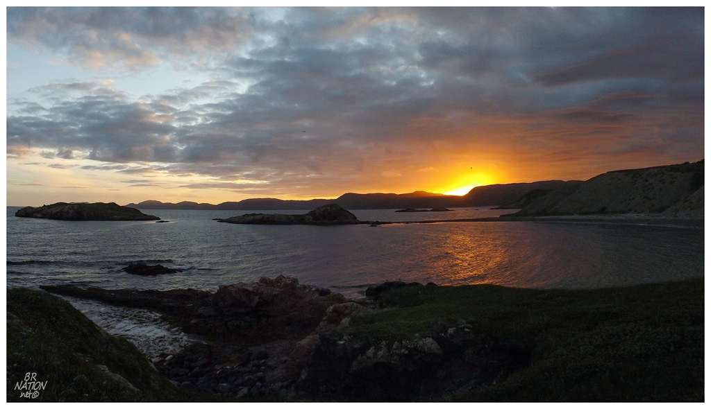
So anyway, some tall cans might've been carried out to the point of land here in front of Red Head at Deadman's Cove. The sun lit the sky on fire, I peered out at the distant, resettled island of Sagona, and sunset-seeking Harbour Bretoners came and went at the parked car lookout.
The following morning there was a lot of car traffic going up the gravel road next to the campground. Packing up the campsite, the trucks continued to rattle by & eventually we had to go down to the cove to see what was causing all of the commotion.
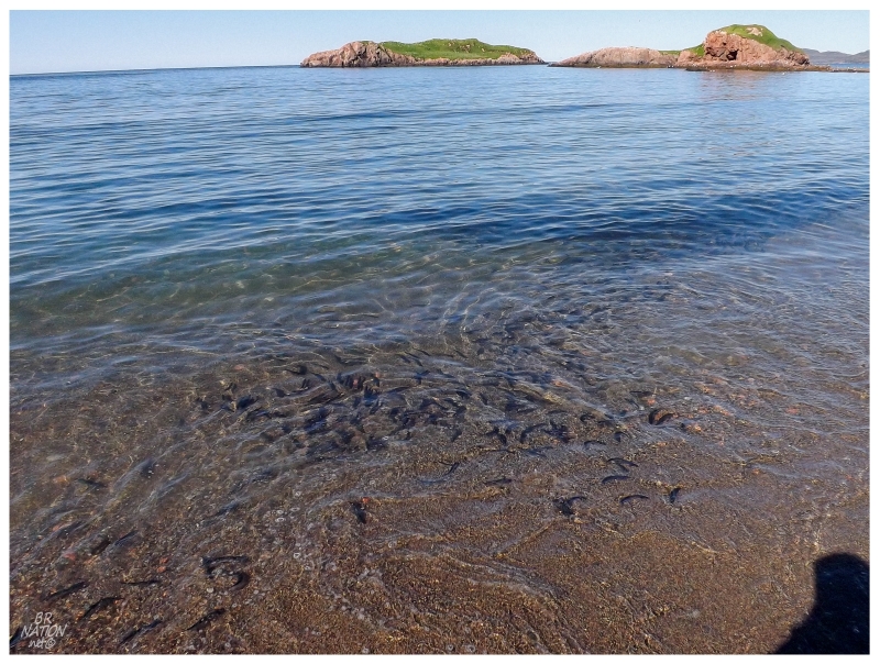
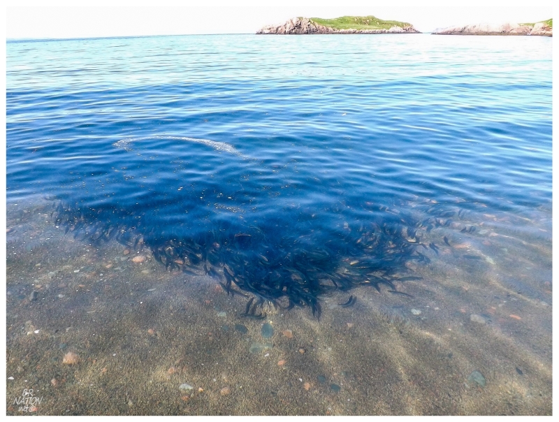
All of the commotion was coming from the fact that the capelin were rolling!
Each year in May or June, small smelt-like fish called capelin come into the coves and beaches here in Newfoundland. They spawn on the beach and wash into shore by the millions, rolling in the waves as the people and seagulls take advantage of their rolling. This is a big part of Newfoundland culture as locals have recreationally fished the capelin for hundreds of years, showing up in boots with buckets to scoop them out of the water for personal consumption. Having heard about capelin rolling for close on 6 years now, I was beyond excited to finally behold the spectacle myself.
So of course I took off my shoes and socks and waded into the water, letting the weird fish bump and crash into and over my feet. They would eventually move away from me, but their slimy bodies left me uncomfortable and moving while occasionally squealing. I'm pretty sure the Harbour Breton Newfoundlanders knew who the mainlander was that day.
Eventually tiring myself with chasing capelin, the thing I wanted to do in Harbour Breton would have taken a lot of time & there was obviously thoughts of having to drive 6 hours back to Corner Brook. The fish plant & harbour authority was also buzzing with activity, which made me hesitant to go down there and bother someone for a boat ride. Some fishery must've been on the go.
Deciding against bothering anyone, the boat ride will have to wait even longer, even though I already resolved to do this boat ride on this blog previously.
Unimpressed with letting my anxiety and lack of planning get me yet again, I decided to knock out Harbour Breton's Gun Hill Trail quickly before leaving town. The view was great, as was to be expected by hiking to the highest peak in a town settled around coves and valleys like Harbour Breton.
Afterwards it was back to the car and back on that long road home. Another year, another visit to a peninsula that was once described to me as the worst, most unappealing peninsula in the province. Hogwash.