Utilizing another late June long weekend, I drove 5 hours along the Trans-Canada Highway to reach Goobies & the turn off for the Burin Peninsula.
Not far from this turnoff is the former provincial park of Pipers Hole River.
Into the mid-1990s the number of provincial parks in Newfoundland & Labrador stood at an impressive 70. That would change with the government of the time, citing monetary losses & the need to create rural job opportunities, the government divested itself of 29 parks in 1995 and 19 parks in 1997. The government attempted to sell off these parks to interested individuals who wanted to take over the campground portions, but it seems that some of them were abandoned from the start.
In the case of Pipers Hole River, a private operator took over and continued its use as a campground, but this would fail by 2001.
Nowadays you have a rundown shack from the provincial park, the trademark red and white gates opened into the woods and a few provincial garbage cans about. The rest of the property is still used, but by anglers, hikers and tent/trailer squatters free of charge.
Knowing someone whose father took over one of these campgrounds on the west coast of Newfoundland, once the land is in private hands, it is apparently very hard to convince residents that they should pay money to use any part of their Newfoundland.
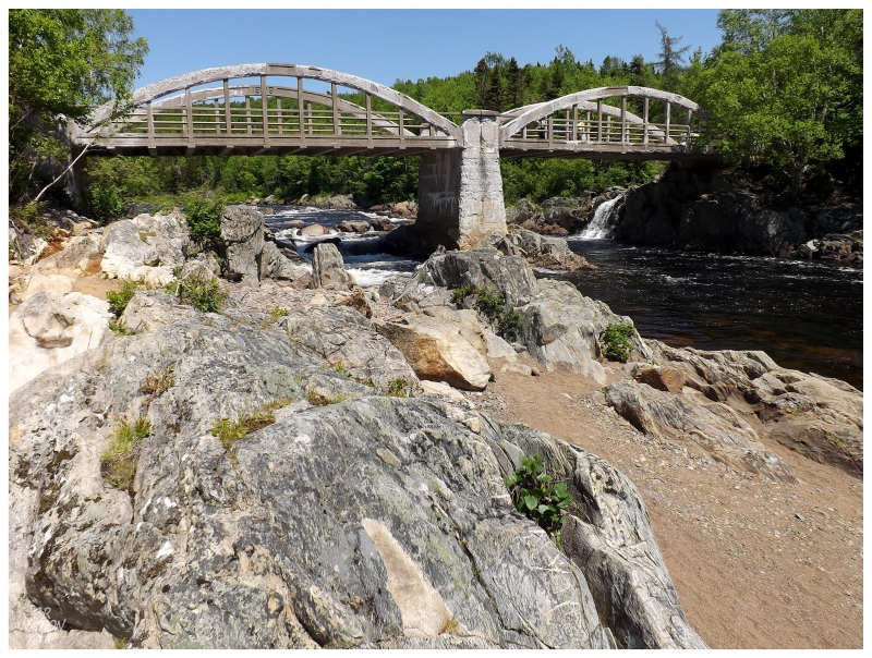
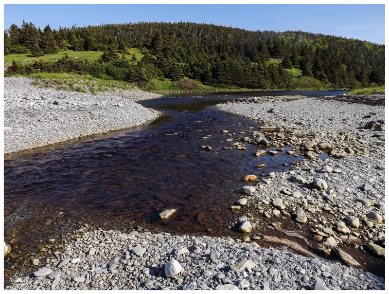
Pipers Hole River Provincial Park is now the type of place you pass on the highway without any idea that it's there. In fact, even though I knew the general location of the park, I still went too far & had to back up once I started to cross Pipers Hole River itself.
Pulling onto the gravel path and trying to avoid the potholes, there wasn't too much excitement, a few small creeks and some grass clearings that people were making use of. Pressing forward across a shoddy wood bridge to an eventual parking lot, there was only a very short trail to walk before Pipers Hole River's most impressive feature stood ahead.
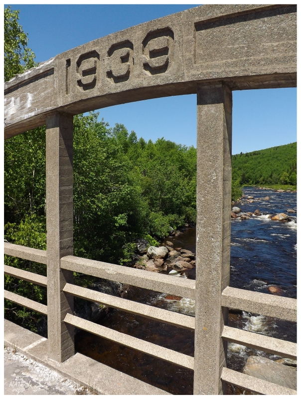
While nowadays there's only pedestrians and ATVs moving across it, I obviously loved that a 1939 bridge remained here.
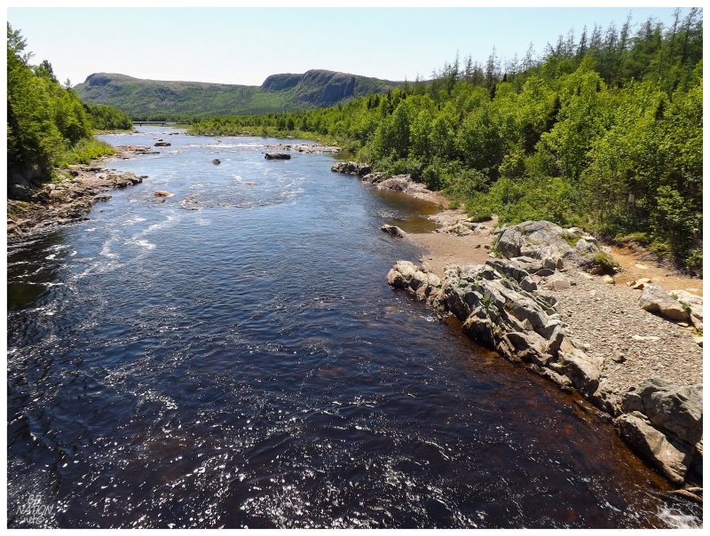
The scenery at Pipers Hole River wasn't half bad either. I cursed that it was only near noon because it was a shame that a camping site wasn't yet needed. I've never found myself in this area in need of a stealth campsite any other time, but I now have Pipers Hole River in mind for next time.
Then again, we shall see if anything happens with this property in the future. The current government has recently decided to outright sell off their vacated provincial parks instead of leasing them to operators (the current setup). So in cases where you have a private owner constructing buildings and providing great maintenance like Flatwater Pond (Baie Verte), Square Pond (Gambo) or Salmon Cove Sands, the current operators can propose a plan and the government can accept and sell the land. For abandoned parks like Pipers Hole River, someone would need to come along with the money & a plan to take over the land.
I've been to about 10 of these abandoned parks now, but the possibility of them suddenly getting snatched up makes me wish I was more proactive - especially thinking back to standing on this aged bridge before this fine scenery. Then again, one has to wonder how many of the abandoned ones will have investment operators lined up to bring the land back.
Another hour of driving brought me to Marystown and the turnoff towards the Burin Peninsula's southern shore. Continuing along, Tides Cove Point was only a short distance past my next destination.
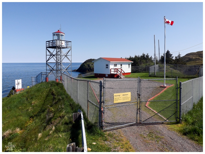
How could I not take a few minutes to visit the distant Tides Cove Point Lighthouse?
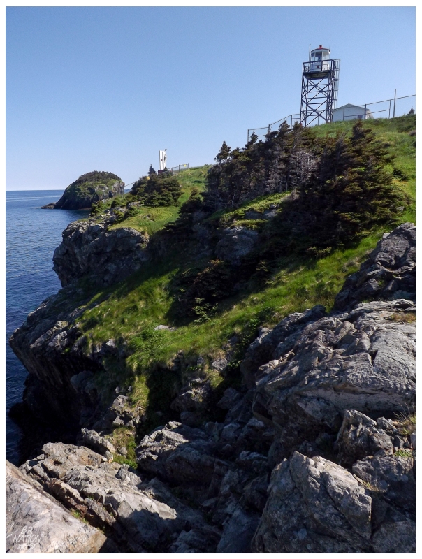
Today was nice in that I could dawdle about in the sunshine, climbing down onto the rocks and cliffs which this meagre lighthouse demarcates for passing ships.
This was yet another place along the coast of Newfoundland where I felt very small, as the large chasms and sharp cliffs put me in a place to carefully watch where each of my feet went with every step.
Tides Cove Point marks the land which separates Tides Cove from Croney Cove, with Duricle Cove being the next coastline indentation to the west.
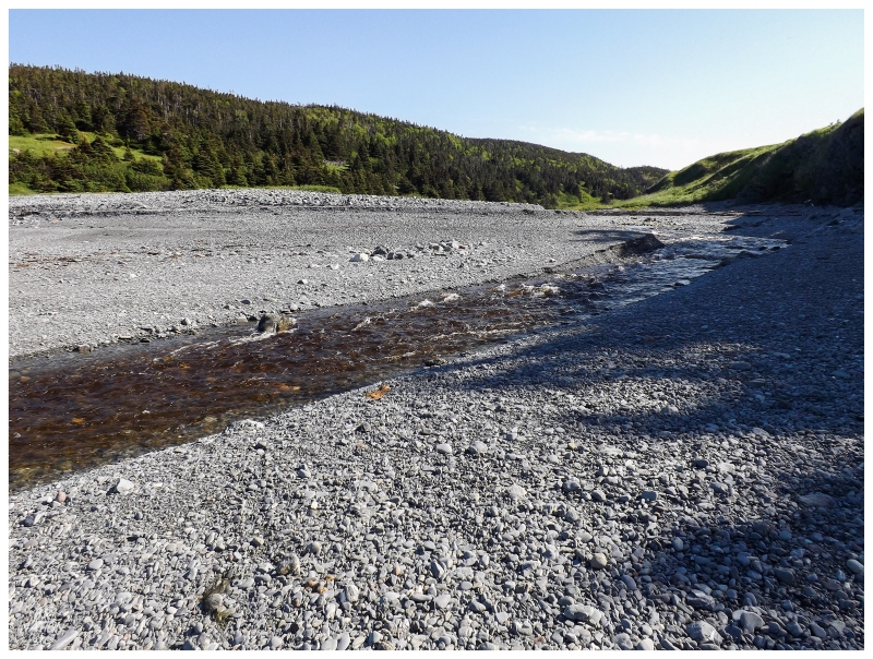
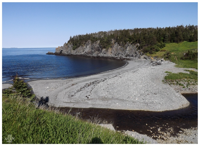
Duricle Cove is accessible from the highway via a 5km (3mi) trail (read: ATV path). And whenever you have a scenic cove plus the location of a former settlement, I will certainly walk an easy 5km to see such things.
The Encyclopedia of Newfoundland states "the coves and sheltered arms of the area were advantageous to early settlement", leading to settlements popping up at Fox Cove, Duricle Cove, Herring Cove, Tides Cove & Mortier, all within a short stretch of about 10km1 of coastline. Fox Cove & Mortier would be the focus of population explosions amongst the five coves, with the incoming Irishmen gravitating there instead of their other options. By the mid-1800s, 105 people were in Fox Cove, 70 were in Mortier and only four or five families lived in Duricle. Tides Cove and Herring Cove weren't included in the census.
Duricle was never big enough to have its own school or church, with the people who lived here going to Fox Cove for the structures erected there. Eventually residents would grow tired of the isolation along this Duricle path, so sometime between 1956 and 1961, Duricle and Herring Cove were organically abandoned (i.e.: they weren't resettled like many other places).
There were cabins along the way to Duricle, but with the ATV path continuing to Beau Bois up the coast, these could have been easily constructed out of convenience without any ties to Duricle.
There wasn't any indication of the former settlement at Duricle itself.
Duricle was another place I envisioned as a fantastic spot to set up camp.
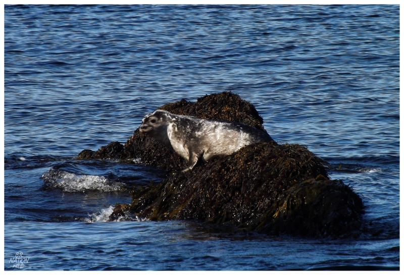
Just offshore, this seal thought Duricle was the bee's knees as well.
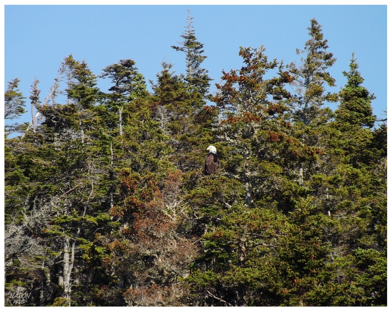
This bald eagle on the east side of the cove didn't mind Duricle either!
After Duricle, it was back to Marystown to put 50 attempts into an eventually successful bike trick at their mall; then all the way over to Grand Bank for The Thorndyke Dining Room.
In a place like Grand Bank where many of the B&Bs are in opulent old merchant homes, staying the night would be outside of my typical accommodation budget. A restaurant on the other hand, can often be a smaller, acceptable amount of excess spending. In addition, the Thorndyke restaurant has a creative menu with good reviews, so it was an easy decision to drive 50km (30mi) across the Burin Peninsula.
I could have sworn I took an exterior picture of the impressive Thorndyke House, if not today then on another day I walked around Grand Bank, but I can't seem to find any of these pictures. I guess I must've imagined this, so here's the TripAdvisor page for the B&B.
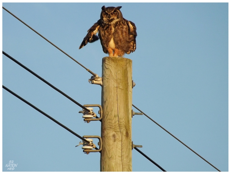
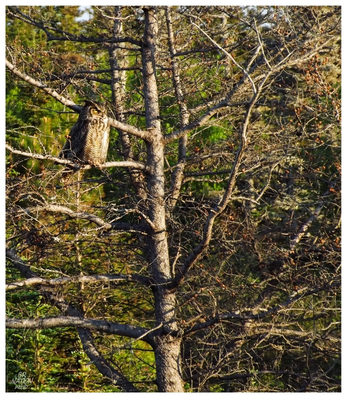
Heading back towards Marystown, and not 5 minutes outside of Grand Bank, I was forced to stop for pictures of this Great Horned Owl!
As you can see from the previous shot, he/she was initially in the tree, but after about 10 pictures the owl moved to this hydro pole. This was all outside of a different B&B, where I wondered if they had any clue about this giant, feathered visitor.
Add another type of owl to the birding life list!
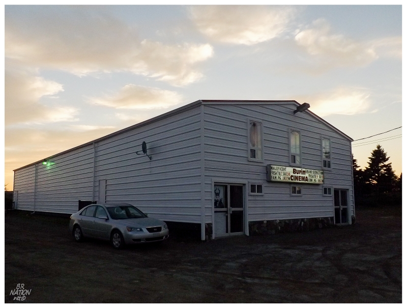
There was only so much time to watch the Great Horned Owl though, since my eyes had an appointment for 9pm in the town of Burin. Whereas last time I almost went to the premiere of Twilight due to how much I wanted to see Burin's tiny, intimate, quaint Burin Cinema; this time they weren't only showing something acceptable, they were actually showing something I wanted to see...The Grand Seduction!
I obviously had aspirations of taking interior pictures, but the lobby was so tiny that the woman working the ticket/popcorn was able to give me a hard time while I stood around awkwardly hoping to take a picture. As for the theatre itself, it was dark with brown wood, meaning that my camera couldn't come even remotely close to having enough light. There's some consolation in that the interior only resembled a simple elementary school gym though, not the opulence of the Garrick Theatre in Bonavista.
The Grand Seduction would end around 11pm and with all of the fine camping spots now dark, distant & questionable, a cheap motel was settled upon instead. Driving back to the motel in Marystown, it was funny to finally go through a Newfoundland DUI checkpoint, where the cop had a 5 minute conversation instead of the 2 or 3 questions and quick wave-through you get in Ontario. This might also have to do with being in quiet Marystown Newfoundland instead of busy Windsor Ontario.
Anyway, I didn't mind spending the night in Marystown since I had just found a cheap, old motel on my past visit. Unfortunately this would be the last visit to the Ville Marie Motel as it burned down 7 months later. I guess next time I'll be camping at Duricle.
Update: The Burin Cinema closed in November of 2014. I guess it is a good thing that I decided to make a Burin trip in 2014, as whenever the next time came it would have been closed. I'm thankful that the Twilight opening wasn't my one missed shot.
Continue to Part 2...