It was November of 2011 and one of those last days of autumn where the landscape is intensely beautiful before the coming awfulness of winter. Never happy with how much I've completed before annual snowbound shutdown, I typically push hard into these last days to try and see a few last things for the year.
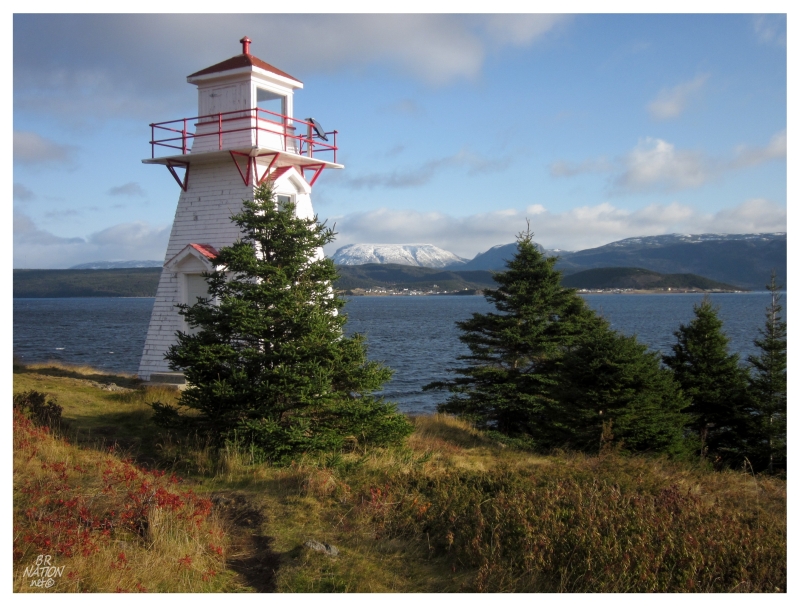
The above picture comes from Woody Point, about 2 hours north of Corner Brook. After driving to Woody Point, I then headed over the hill behind their town, across the valley floor adjacent to the Tablelands, through the settlement of Trout River, over a bridge above their namesake river, then onto a gravel road past a Gros Morne campground back here in the wilderness.
Leaving the familiar and touristic Gros Morne, I now felt like I was truly heading on my way to the resettled and remote Chimney Cove.
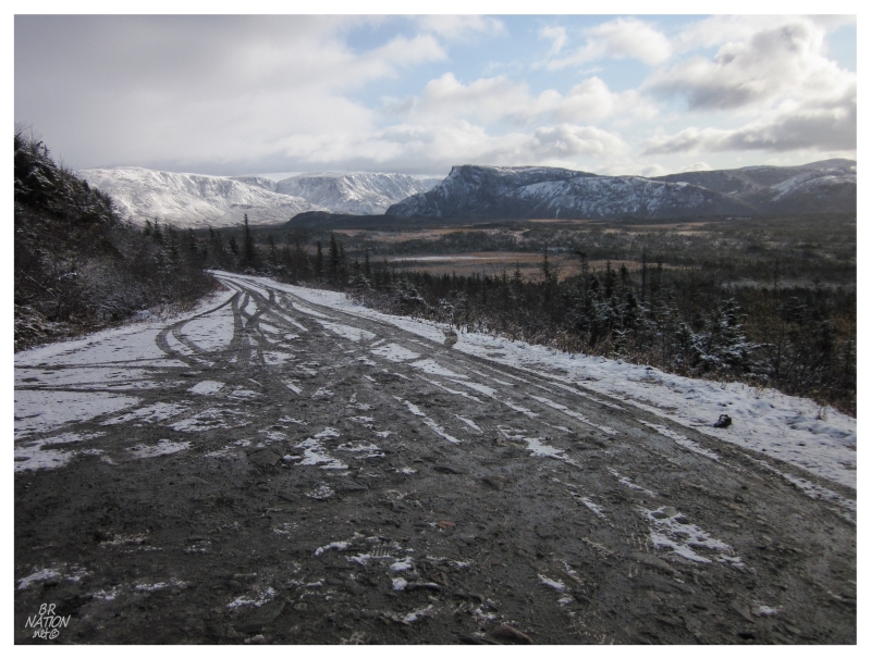
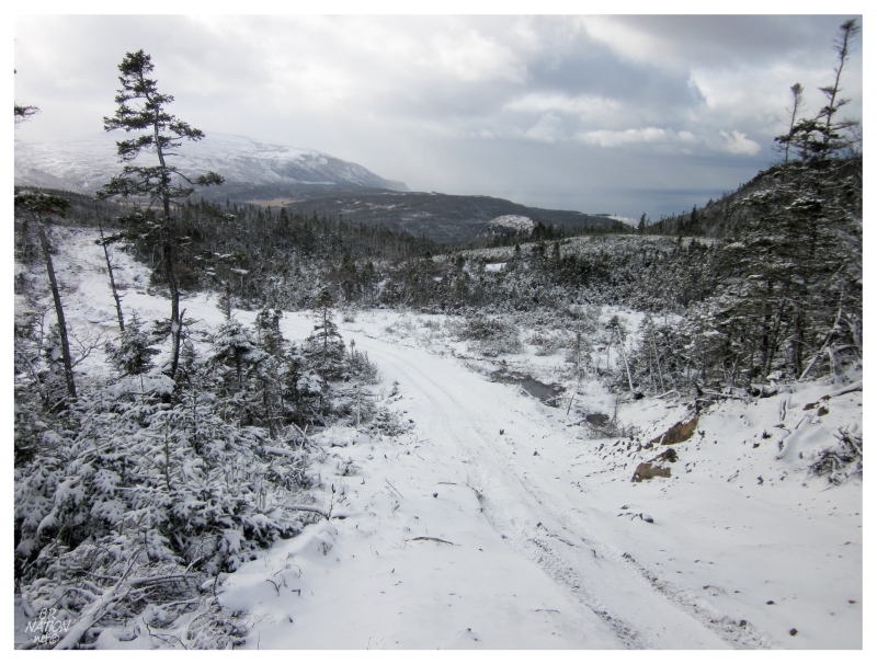
The gravel road up to the campground was well maintained on account of it being within the national park. After I drove past the campground, the road didn't quickly worsen like I expected it to, but rather continued south into the wilderness as a smooth surface. I had thought that the road after the campground would deteriorate into an ATV trail, so the discovery of a passable road meant more time driving and less effort spent mountain biking.
While maintaining its quality, the road was also gaining elevation and therefore a light dusting of snow.
It wasn't long past the national park boundary that the road split in two, with both routes looking in decent shape. While wondering where the left one headed1, I veered right onto a road with developed ruts and sloppy edges. It was now an exercise in sizing up each hill, whether the rocks would smash the Intrepid's undercarriage or if my non-winter tires would be able to ascend and later safely descend. Whereas I didn't mind the snow previously because of the good road conditions, I was happy here that it was only a 1/2 inch of the white stuff, allowing me to assess the craters and dangerous rocks.
The Intrepid wouldn't travel very far on Chimney Cove Road. I'd be surprised if I made it 2 kilometers (1.2 miles) before there was a hill sizable enough to alert my mind to the possibilities of a breakdown with an aging car - aging gracefully though - in the backcountry, back here on a day where it looked like a storm could come on at any time.
Pulling my bike out, pouring some water into a bottle & covering my extremities, it was now time to zip up and down the undulating road under my own power. Instantly, thoughts of bike riding disappeared as I saw a couple on an ATV headed towards me, my mind filling with thoughts of how much of a nutjob I must look like on a bicycle in snow on a rough woods road.
During our brief exchange I was ecstatic that the couple simply shook their heads and found me amusing. Unfortunately, replacing talk of cycling in the snow, the conversation went to how I wouldn't be able to cross the Gregory River today. "You'll be able to get almost right to Chimney Cove on dis road, but ya aren't getting across today on that (nodding at bicycle)."
The snowfall and subsequent melt meant that the river was flowing mightily and you were only getting to Chimney Cove by boat today. The couple must've been coming from another cabin along this road, but before the Gregory River.
While I was aware of having to wait for the Gregory River to die down and allow you to ford the river in May or June, it never occurred to me that after the spring thaw, you also had another period where you couldn't cross.
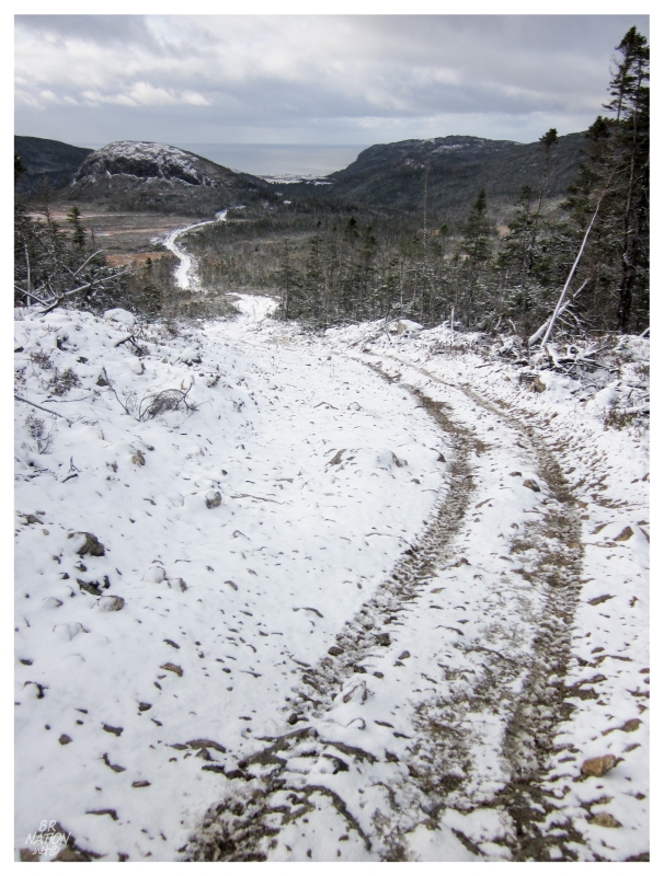
Regardless of whether I was going to make it to Chimney Cove today, I said my goodbyes to that couple and continued on, since I'd driven all of this way anyway. I was curious about the route regardless & the distant scenery up here wasn't half bad. The road ahead started into a tiny switchback with a steep hill, halting me into an awkward complete stop, where I had to fight falling backwards on my bike like a turtle in the same situation (a turtle riding a bike up a hill of course). I put my bike in the woods and continued on foot.
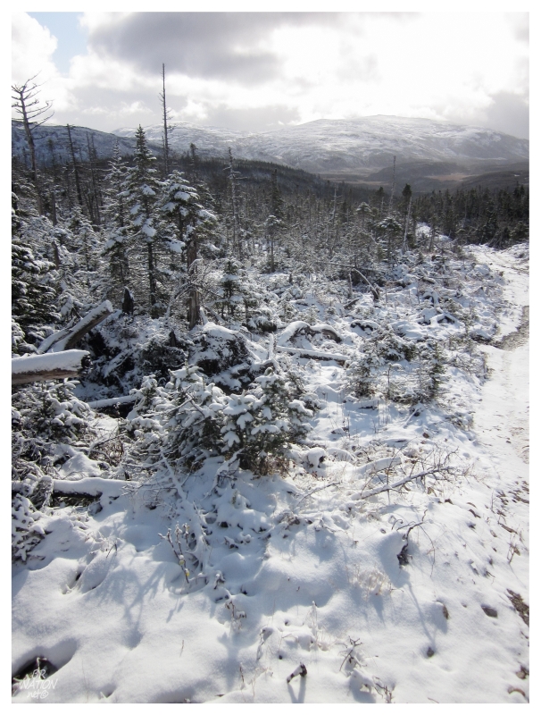
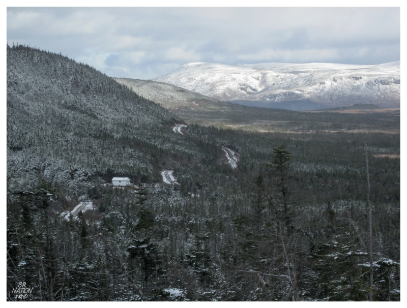
The trail brought sweat to my brow even without pedaling, until I found myself atop a plateau approximately 850 feet above sea level. The barrens here had the deepest snow as parts almost reached my ankle over the top of my hi-top hiking shoes.
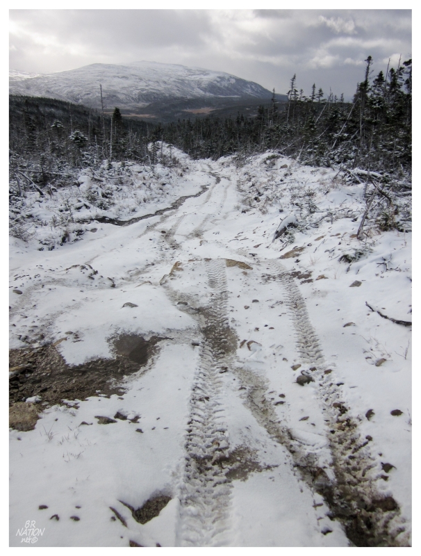
Once I crossed over the barren hilltop, it was smooth sailing downhill while gawking at Mt. St. Gregory to my left and Chimney Cove to my right. Considering this area - the Corner Brook/Goose Arm/Gros Morne area - to be quite familiar, the geographer and adventurer in me was ecstatic to finally put a picture to these features and fill in the gaps of this mysterious, uncharted area of the map.
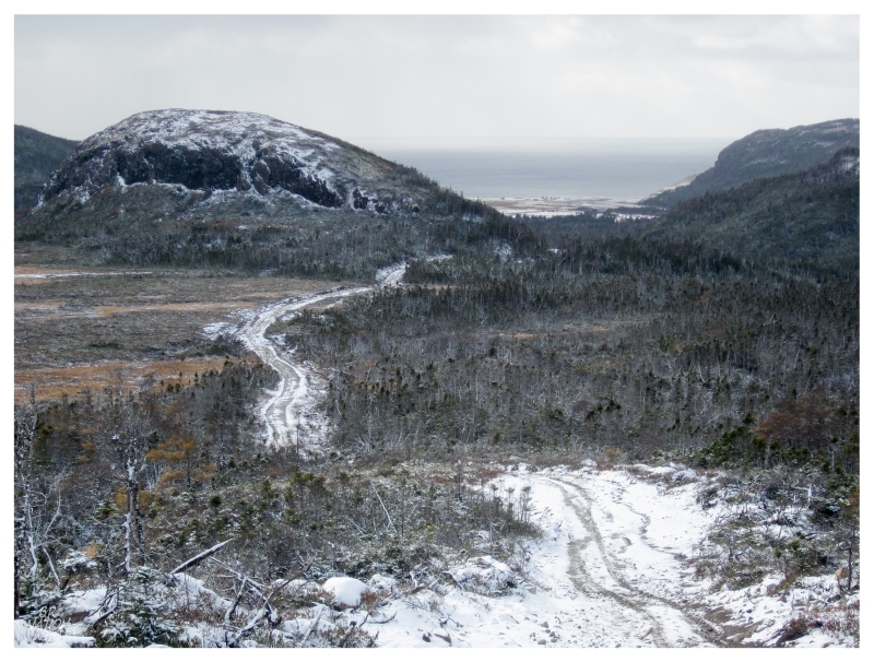
Chimney Cove stands in that grassy flat where the Gregory River empties out into the ocean. A place that would fear climate change, I could make out the fishing stages and shacks clustered along the beach, looking like they were almost level with the Atlantic.
I started to think about how much the Gregory River could really be flowing from a little snowfall. The white devil doesn't die as easily in the mountains either, so how much snow would be melting, really?
It was also growing later in the day, so there were thoughts of getting back, storms hitting that plateau, the distance back to the car, etc., etc.
Worries of returning and mishap were all nonsense though, as I found myself passing cabins along the improved ATV trail. Unable to see certain spots, there were still those moments of stepping into a hole or stepping with too much force where you don't expect a rock to be there, but this hiking wasn't any more challenging than your average trail.
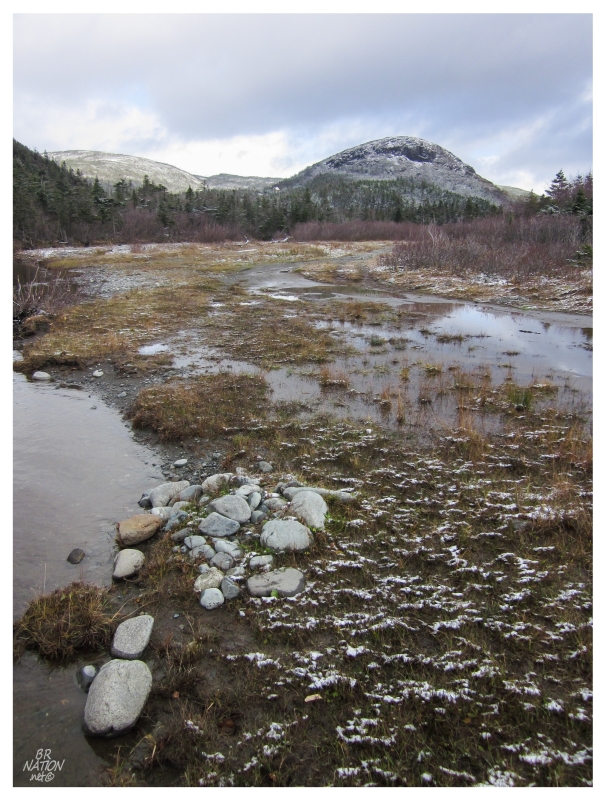
Reaching the banks of the Gregory, dancing from frozen plant to frozen plant and rock to rock, I slipped past a few small streams and outside channels.
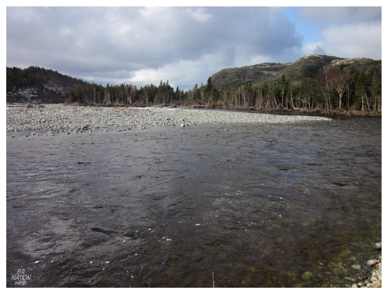
The rock islands were quite small in the braided Gregory, so as I jumped to one and took a few steps forward, I suddenly realized that the man on the ATV knew what he was talking about. Especially on a November day, this wasn't the time to test out how deep it is in the centre, or the strength of the current. Chimney Cove would have to remain a mystery on the other side of those trees at centre.
Even if the river was at a lower level, it would have still been an gamble in trying to rush across and get warm socks/shoes back on.
I slogged back up the hill, across the snowy plateau & down the other side, retrieving my bike and making my knees happy by using the descending road for free travel instead of fighting against it.
Noticing a picturesque cabin up ahead, I took one last picture and smiled because I couldn't complain about this scenic scouting mission.
Continue to Chimney Cove Part 2...