Nova Scotia is home to approximately 150 lighthouses and a good number of them exist on offshore islands. I've given passing thought to these island lighthouses, but with enough island work at home in Newfoundland, the thought usually ends there.
One island would emerge from this list of Nova Scotia island lighthouses after I came across an enticing photo set. In addition to McNutts Island's Cape Roseway Lighthouse, a full set of lightstation buildings stood abandoned, there was a WWII fort & a history of civilian settlement on the island.
All of this on one island?! Sign me up!
So I marked McNutts Island in Google Earth and added it to the to-do list, but it would linger since I don't often find myself in Halifax, let alone another 2.5 hours to the southwest in Shelburne.
Of course I now found myself back in Shelburne for the first time in 7 years. After visiting Sandy Point Lighthouse in the early morning, I bought groceries & was now sitting in my rental at the Shelburne wharf, slathering my face and neck with sunscreen.
Walking down to the docks of Shelburne, I found the sizable ship that advertised the Shelburne Harbour Boat Tour. Today wasn't a day of paying a fisherman to drop me off via a cod-catching aluminum boat, but rather taking a regularly offered charter with swanky digs and fancy railings. And in a place like Nova Scotia or Maine or New Brunswick where I fear the costs of boat tours, somehow this boat tour was only $35!
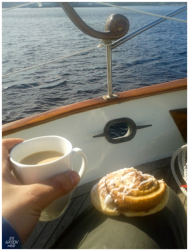
Sitting at the helm and watching Sandy Point Lighthouse pass by, life was already quite fine when I then learned that there was coffee and cinnamon buns available. "Well, yeah, I will sit out on the deck with light winds, warm air, foreign lighthouses and delicious breakfast treats."
The best part of all this was that of all the days in the year, my friend Christian happened to try and impress me with a text message picture of his breakfast this one single morning in 2014. He was at a loss for words when he got the above picture in return.
There was initial luck involved in this trip, in that I was going to be here on the day before their tours started for the year. There was nothing the tour operators could do about it, they simply weren't going over to McNutt's yet. They were only going the next day.
Thankfully I would find an email a few days later, stating that the captain decided it would be a good day to go out and clear the pathways and get various things ready for the upcoming season. As it would happen, three other women wanted to go this Saturday as well, meaning that they actually had 4 paying customers for a day they didn't initially plan on operating.

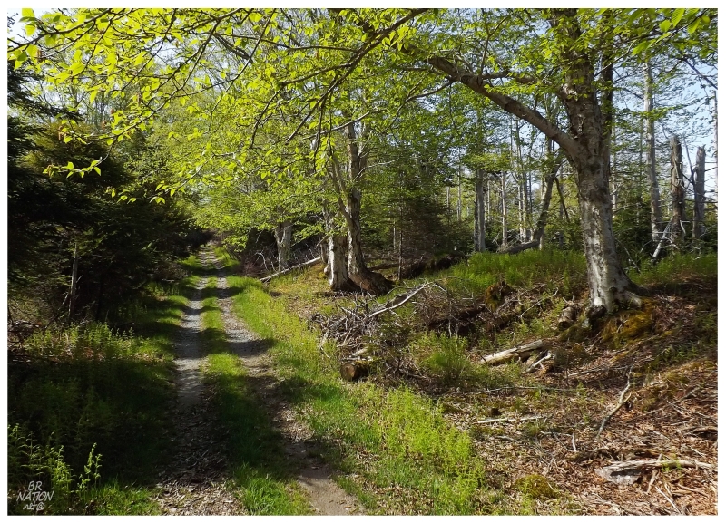
Tying up to the island's wharf, I had about a 6km hike across the island to the Cape Roseway Lighthouse. As the operators alluded to their possibly being buildings in an abandoned and dangerous state, I moved quickly off the wharf and into the woods to give myself alone time, to climb in windows or walk across spongy floors if I so desired.
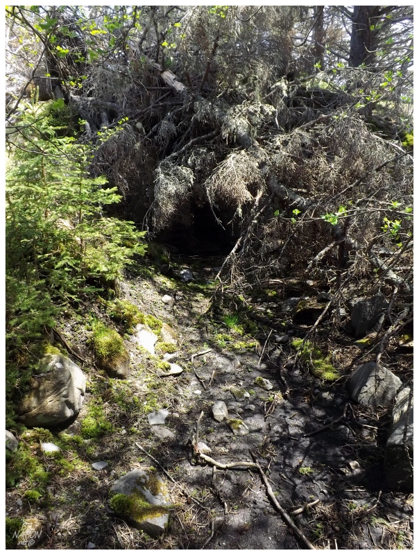
Passing Nova Scotia's largest and oldest Yellow Birch - its been confirmed by their Department of Natural Resources - there were also a bunch of hokey, islander signs for various turnoffs and wacky minutiae like stuffed moose or old phone booths. After a while, the road cut away from the settlement and the sea, leading inland over small hills and past wet forests with intermittent streams. Without any flies bothering me & the road a nice, casual walk, I was happy to be on another Nova Scotia island again. This island of McNutt's was reminding me of the rural parts of nearby Tancook Island, which I had visited about 8 years ago now.
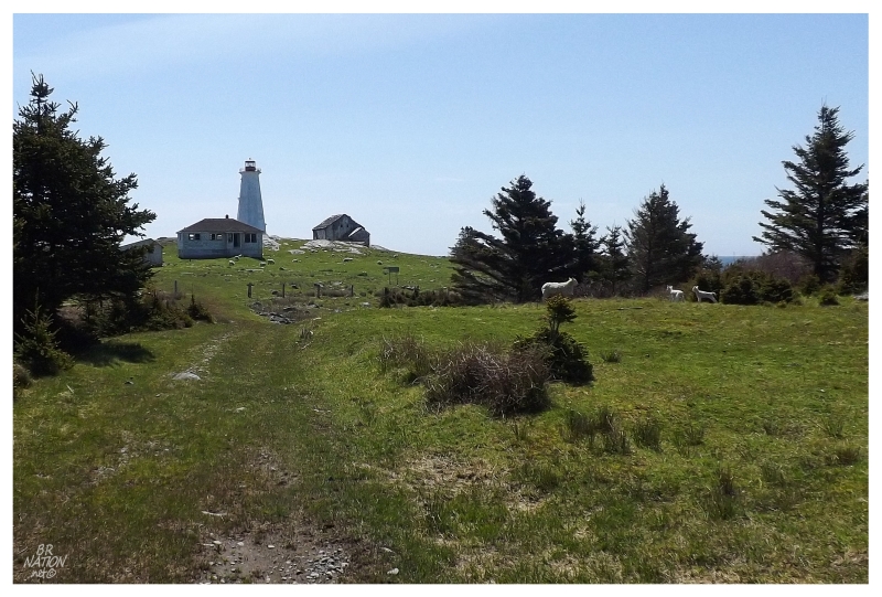
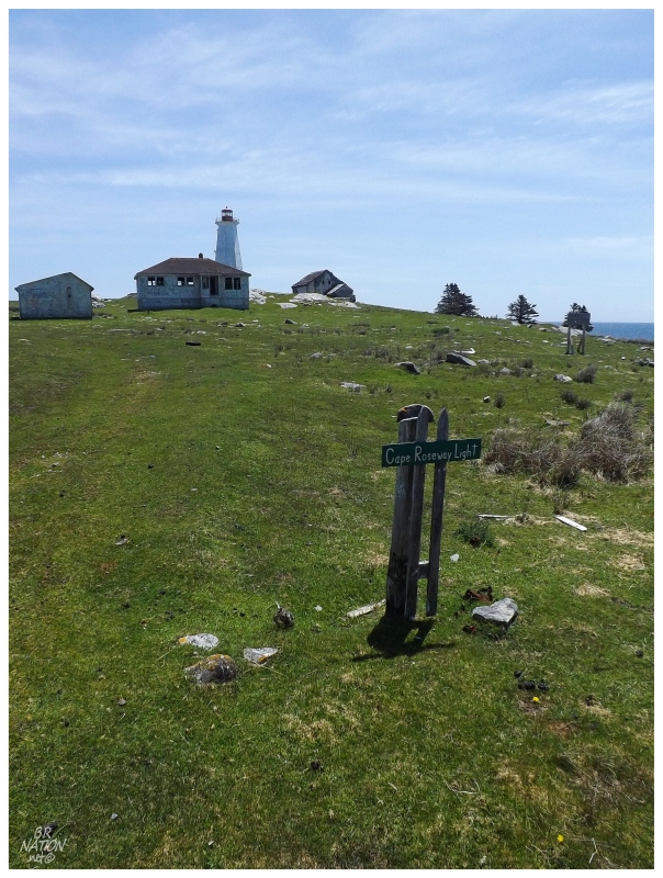
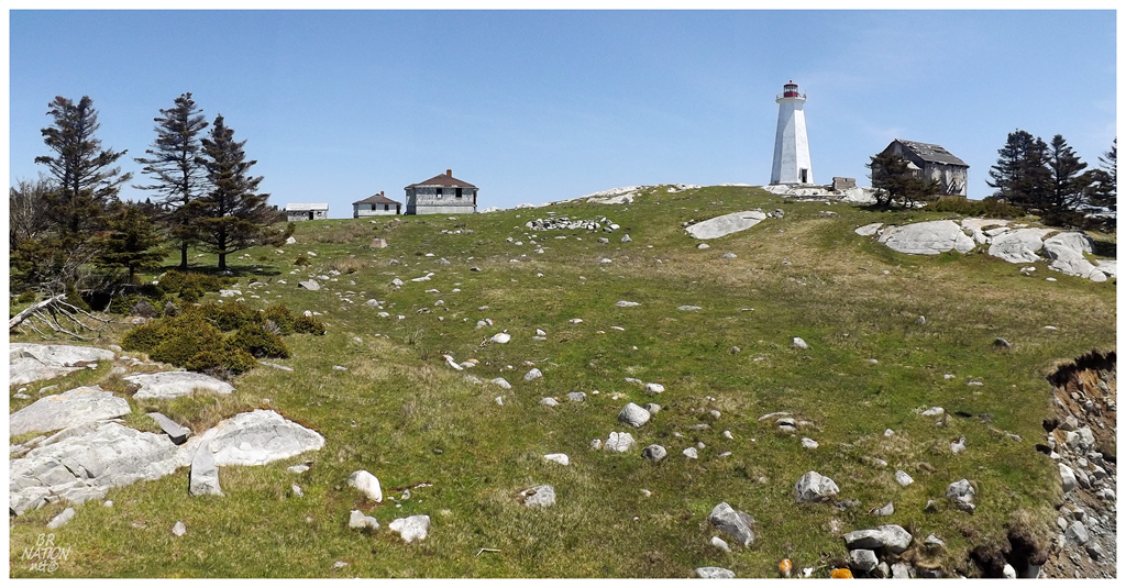
I raced past offshoot paths to give myself the maximum amount of time at Cape Roseway. As the trees started to thin at the windswept southern end of the island, I rounded one of the last turns to see a tower peaking out above the stunted vegetation.
A sheep and her two lambs were eating and frolicking outside the lighthouse fence, but after I noticed them while taking a picture of an old bicycle, they didn't give me much of a window to take their portraits; their skittish demeanor pushing them back into the woods in a hurry. As I approached the lightstation itself, there had to be 30 sheep feeding to the right of me, who also all hurried into the forest at the strange sight I presented.
Cape Roseway isn't just another lighthouse - it was the 3rd lighthouse built in all of Canada. After Louisbourg NS (1732) and Sambro Island (Halifax) NS (1758), Cape Roseway was next in 1788. While Louisbourg was important because of the French fortress and Halifax was important because of its status as a major city, it would today seem that sleepy Shelburne getting a lighthouse was a random decision.
On the contrary, for a brief few years in the late 18th century Shelburne was the 4th most populous city in white man's North America. From a place along the coast where there was the odd farmer trying to feed his family, then to a few immigrant New England fisherman and a few Acadians, Shelburne would take off when Americans loyal to the British crown - United Empire Loyalists - were provided with land, food and tools, as compensation for abandoning the States to settle poorly tamed portions of Nova Scotia. 5000 Loyalists arrived in the spring of 1783, followed by the Black Loyalists - Africans who escaped slavery to be transported by the British to adjacent Birchtown - followed by a second wave of settlers late in 1783. All of these loyalists would swell Shelburne's population to 17000, putting it in a class with cities like Boston, a place that had 18320 people in 1790.
Shelburne wouldn't last as a place more populous than Halifax or Montreal. Within a few years, the British stopped providing the people of Shelburne with welfare, leading to a mass exodus of who people no longer had any reason to live in this place of poor soil and distance.
This brief period of importance was still long enough to bring Shelburne a considerable housing and business stock, in addition to the lighthouse marking the entrance to its harbour.
The first Cape Roseway Lighthouse was started in 1788 and finished in 1791. Unlike the modern notion of moving supplies to where a lighthouse is to be constructed, Cape Roseway was built like its predecessor on Sambro Island - by quarrying and shaping nearby rocks, then shoring up the interior with fallen timber from the closest forests.
Any other supplies that were needed were carried 6km from the far end of the island over a rudimentary path. The keeper at the time hired men to do this & desperate men would be the ones who would come out here for such arduous work and meagre compensation.
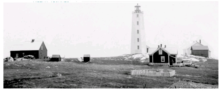
Cape Roseway, 1930s. Clara Dennis, NS Archives.
During an 1857 visit from the superintendent of lighthouses - how do I apply for this job? - the superintendent reported that the lighthouse was poorly visible from sea, the lantern was in poor condition, rain and snow leaked onto the light from the lighthouse roof & that the keeper's house should be abandoned or that it could be inhabitable for a few more years with much-needed repairs. The keeper at the time, Alexander Hood Cocken, was living in the same keeper's house from the year the lighthouse itself was built. A house that he would complain leaked at its additions and the superintendent reported to exist in a very poor state.
The 1930s picture above shows a more handsome scene, leaving one to question if repairs came or if the picture is misleading. In any manner, Alexander Hood Cocken was in his 42nd year as the main lighthouse keeper when the superintendent visited, after being an assistant of sorts to his father from 1787 to 1812, then the main keeper from 1812 until 1857. He would retire in 1860 after an amazing 45 years of service at head lightkeeper on McNutts Island.
If the lighthouse in the historic photo looks different from the lighthouse of today, it's not because of an exterior sheathing, it's because the original 18th century lighthouse was struck by lightning in 1959. The energetic force cracked the mortar, dislodged slabs of granite and ignited the supporting timbers inside the structure.
The Coast Guard saw it as a total loss & demolished the 1788 Cape Roseway Lighthouse shortly after.
A temporary lighthouse was created by putting a light atop the fog alarm building for two years, until a replacement lighthouse could be constructed in 1961.
This 1961 lighthouse is the current lighthouse.
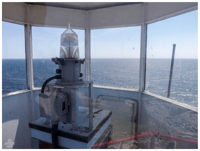
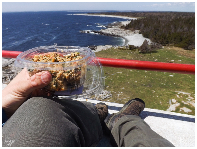
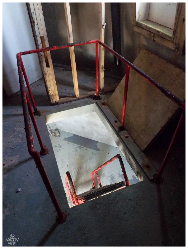
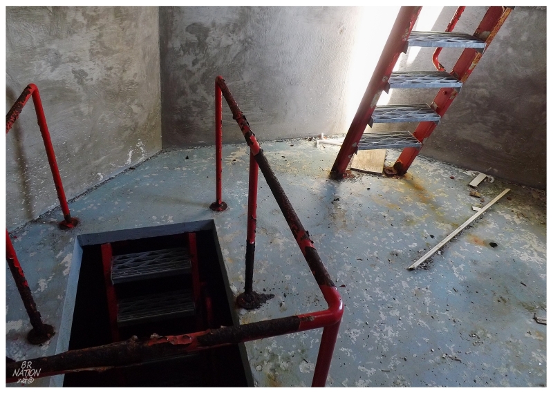
I helped myself to a tour of this current Cape Roseway Lighthouse, finding my way out onto the nerve-wracking balcony and its fun downward slope towards a 45-ft drop, the whipping wind angrily blowing up here on the cape. Crouching and shuffling out to reach the balcony, I quickly squatted down against the wind, moving carefully until I happily found the lantern room's wind shadow and the couscous I bought back at Sobeys.
Now this is the life!
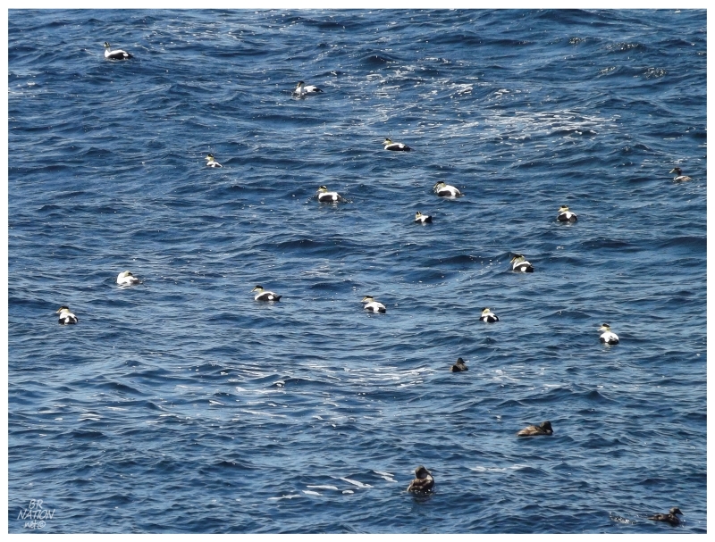
I would later learn that Eider ducks were near the southern tip of Cape Roseway, but while sitting outside the lantern room, they simply looked like white dots bobbing about.
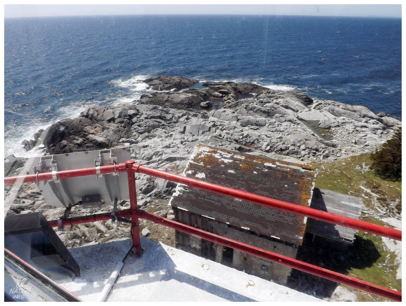
Almost right below me, the closest building to the ocean is the fog alarm building.
This is the building that I mentioned was the temporary lighthouse.
I sat up on the balcony for quite a while, savouring the scenery and enjoying one of the best Saturdays I was going to have this year. In fact, I sat up there for so long that I was shocked that the three ladies hadn't yet made it to the lightstation. Figuring they must've stopped at the fort ruins or some of the houses, I made my way down and started to check out the other abandoned buildings.
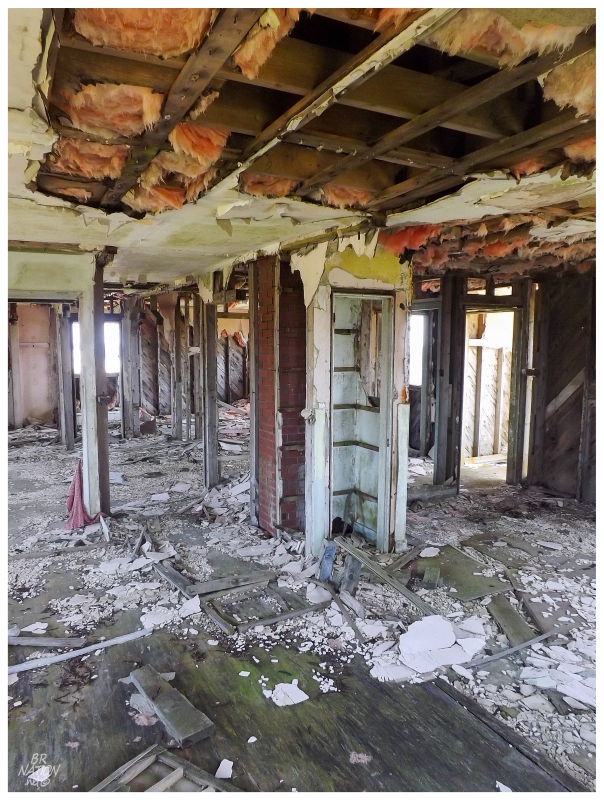
As the fog alarm building wasn't a cookie-cut keeper's house, I was most excited to find my way into this structure from 1916. Cormorants or gulls had caused orange lichen to line the fringes and peak of the roof, but the grey building remained stately, a handsome structure of flat walls with wooden siding, fitting right into this Maritime environment.
The exterior ended up being much more attractive than the interior. Bags of insulation clogged the floor and most of the walls were missing. Next to nothing remained from the fog alarm building's previous life.
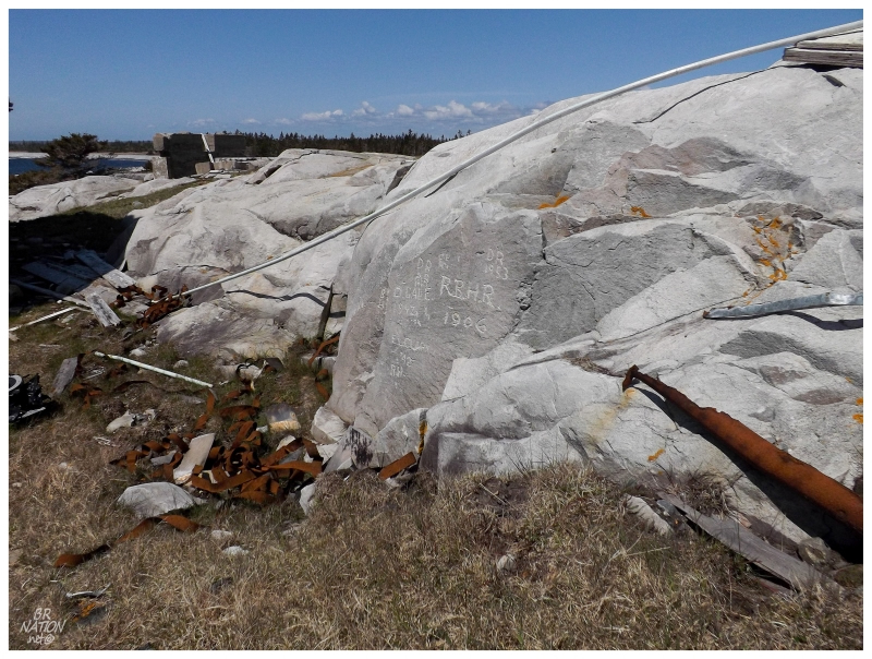
Visiting various points along the shore, I noticed old graffiti while passing some of the rocks near the lighthouse. Scratching the rock myself, I found it to be easily marked, later learning that this is because of its high Feldspar content.
In these situations I always envision some teenager making up all of these tags and years, but it seems that the markings here at Cape Roseway are legit. Apparently somewhere there's accurate Mikmaq writing on account of those who manned Fort McNutt - I wish I knew this beforehand - there's even graffiti from one of the lightkeepers, with a front and rear drawing of the lighthouse and the lightkeeper's initials.
In researching this update, I found a fantastic blog from a couple who came to Fort McNutt from America and lived on the island for a few years. It's from this blog that I learned almost everything I include here, including the fact that the graffiti seems legit. In addition to the graffiti I mention, the blog's author has a fine post of tons of graffiti I missed, where she also looked up local genealogical records to match the names to people of the past.
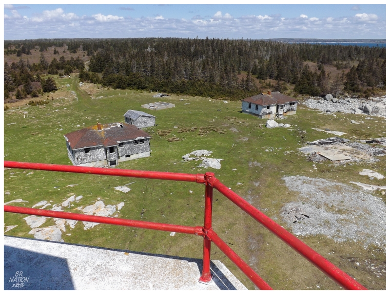
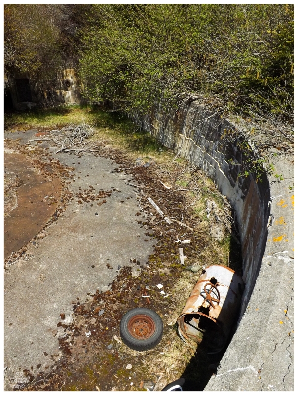
After wandering about the cape, one building foundation, lighthouse and fog alarm building, I went towards the keeper's houses in order to be thorough.
From the outside they looked just like the one(s) I'd already seen at Cape Anguille, Francois, Cape St. Mary's, etc., etc..
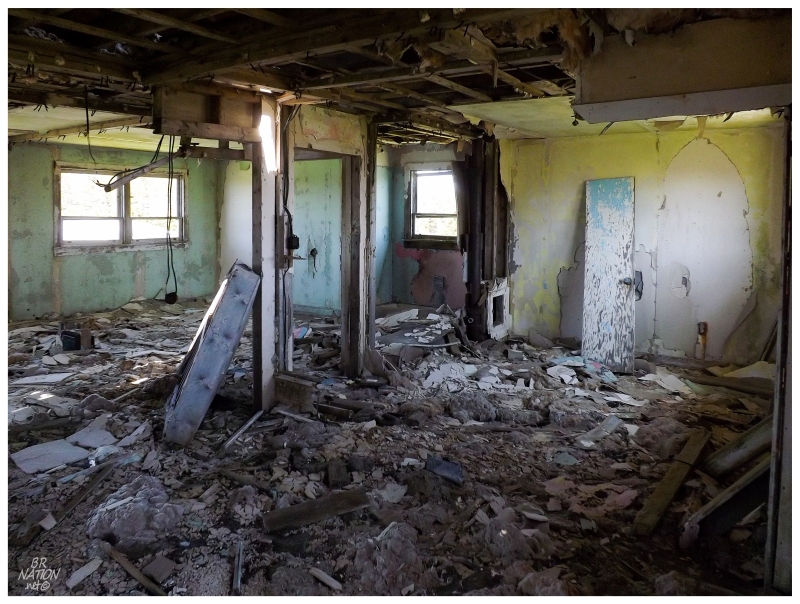
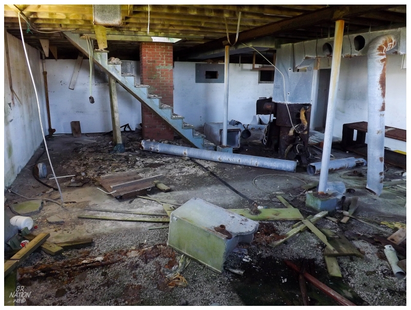
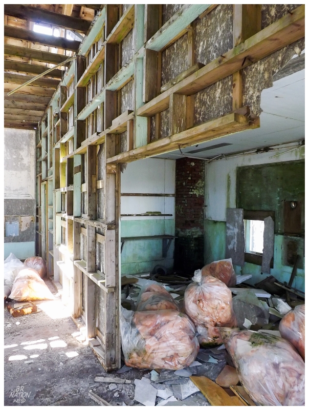
The keeper's houses here were picked over & destroyed to a greater extent than I had seen anywhere else. As much as I say I only went inside them to be thorough, it was interesting to know the layout of these places, then be able to put it all together without walls or furniture.
The second house I went inside involved a sketchy pull-up to a flimsy floor...and then a similarly destroyed interior. Knowing that the Coast Guard spends money to demolish remote keeper's houses in Newfoundland, I find it amazing that these remain here in this state. They've been like this for a while too, as the keepers left in 1986, then by 2000 the buildings were sitting "in an abandoned state", then "in ruins" by 2009.
Five years on & through additional tropical storms, vandals and freeze-thaw cycles in a place that lines up with Portland Maine, you can understand why the houses are in this state.
Various sources list a "barn" as the oldest building left standing at the lightstation. If the barn was more of a chicken coop than a stable, then the above building must be the oldest building left at Cape Roseway. (The inside was absent of walls and only had a small stove at one end.)
I couldn't find anywhere that listed an age for the barn's construction, only that it was older than the fog alarm building.
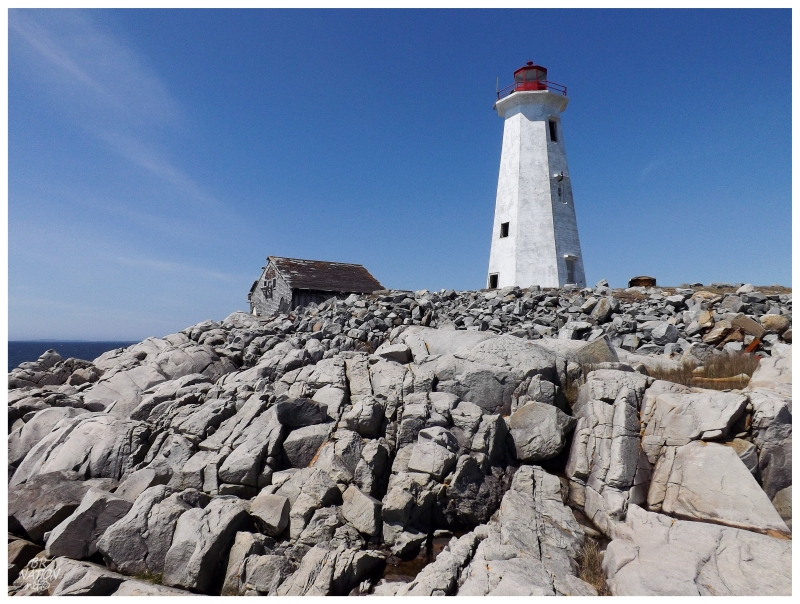
With an intact lighthouse and five related buildings, this is Nova Scotia's best standing example of a full lightstation. The problem with any thoughts of preserving history here is the obvious remoteness of having to take a ferry & the fact that you have a replacement 1961 lighthouse instead of the original. From my experiences I've found that most people aren't picky about lighthouses unless they are enthusiasts, but even the most untrained eye will appreciate a 1788 lighthouse more than a cookie-cut 1961 example.
The 1758 Sambro Island Lighthouse still stands and has enough trouble acquiring funding for upkeep, that it makes one skeptical of anything but years of ruin coming to Cape Roseway (or completely necessary spending of taxpayer money on demolition, right?).
The recently released list of 74 newly designated heritage lighthouses in Canada includes 14 in Nova Scotia, but Cape Roseway isn't on that list.
After finally slowly saying goodbye to Cape Roseway, I passed the three women just as they were about to make their way to the lightstation.
Heading back, I didn't make it very far because Fort McNutt sits within a kilometre of Cape Roseway.
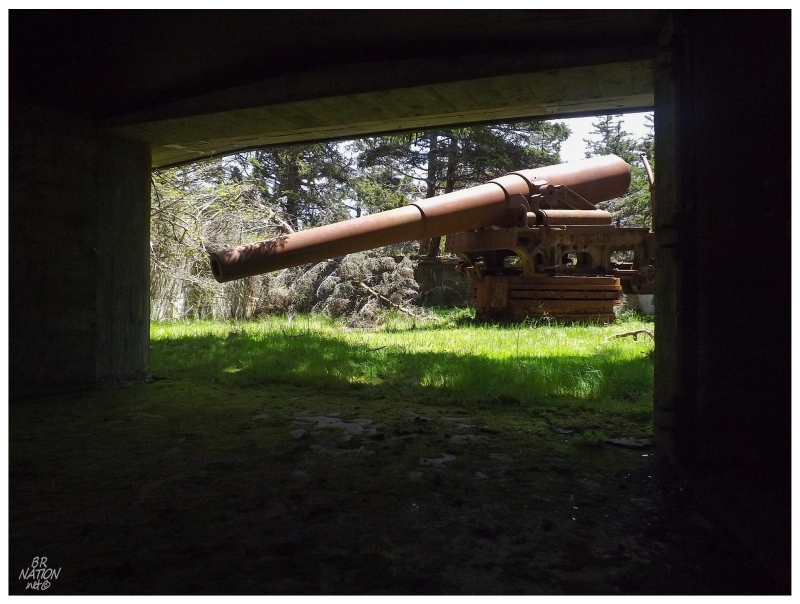
Fort McNutt was constructed in 1941 - after the expulsion of the island's residents - so that the Canadian government could protect this harbour and other interests from the threat of German submarines.
In case ze Germans took over Halifax or rendered it useless, Shelburne was the backup safe harbour.
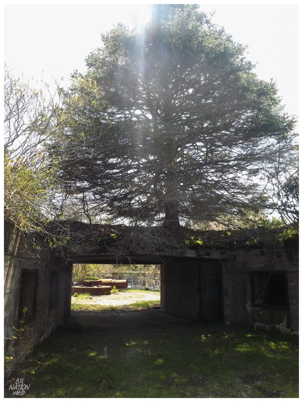
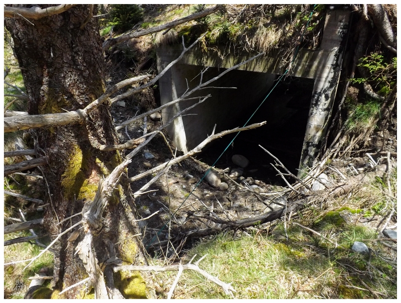
When a fort has been abandoned for 70 years, trees have an opportunity to take over.
After Fort McNutt was abandoned following WWII, the residents were allowed to move back, but nowadays no one lives on the island year round. One of the other women on the tour had spent a few of her early years on the island, so it was interesting trying to eavesdrop some of her childhood tales.
Exploring around the fort, even though I had scared away a small snake, I was happy that I hadn't acquired any ticks from this notoriously tick-ridden area of Nova Scotia.
I continued going 'just a bit more, just a bit more' down embankments and through tunnels of cement and tree. As I was nearing the ocean and had seen the major points of Fort McNutt by now, I had to be coming to the end of the ruin land.
I've seen enough WWII forts, that in high tick areas, I'm happy to cash out before setting up a survey with a perimeter and repeatedly walking east - west lines.
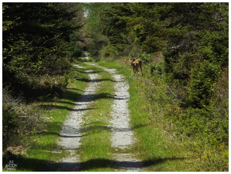
Plodding back to the wharf, I noticed a deer up ahead checking me out.
Hilariously enough, it was less skittish than the sheep!
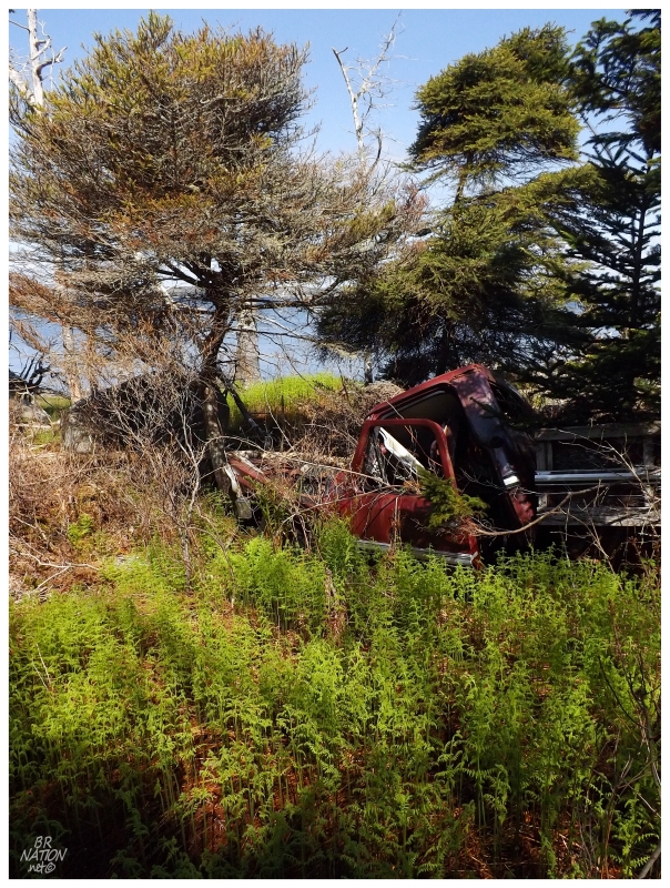
I now had time to take the other pathway, one that led to an area of waterfront cabins and sheds.
There was settlement and residents on McNutts Island almost as far back as there was settlement at Shelburne. The majority of the residents who weren't tied to the lighthouse congregated along the shores at the north end of the island, near the wharf where I disembarked earlier in the day.
The island's name comes from the McNutt brothers, where Alexander McNutt led a scheme to bring Ulster Irish to Shelburne, meanwhile giving a piece of property to his brother Benjamin on this island. Alexander would later live here as well, along with approximately 10 other families separated about the coast.
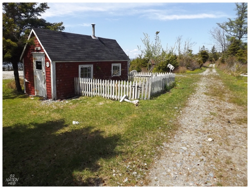
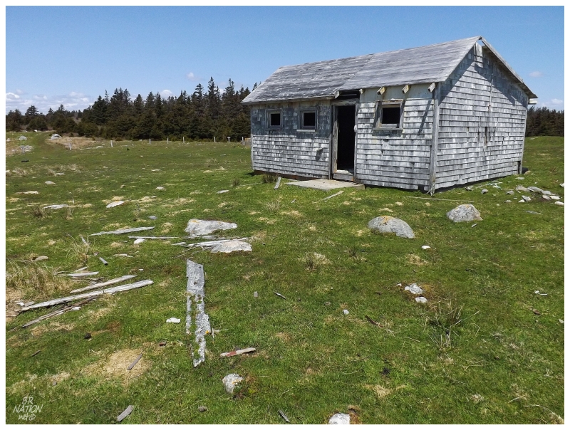
A Church Map from 1882 shows 9 homesteads on McNutts Island, where the McNutts Island bloggers (Nova Scotia Island Journal) renovated and occupied the only home from this time that remains standing today. As I was admiring this beautiful red shed and picket fence in the above picture, I had skipped over their historic structure of a home.
By now I had walked about 15km/9mi on the day - in addition to climbing stairs and decrepit porch pull-ups - so I was getting pretty tired. The road I was on led towards a far, rocky beach and a few more houses, but not knowing exactly how far I was away from the wharf and how long it would take to get back, I decided to call it a day.
The coffee, the view & resting my tired feet on the sundeck was all much welcomed.
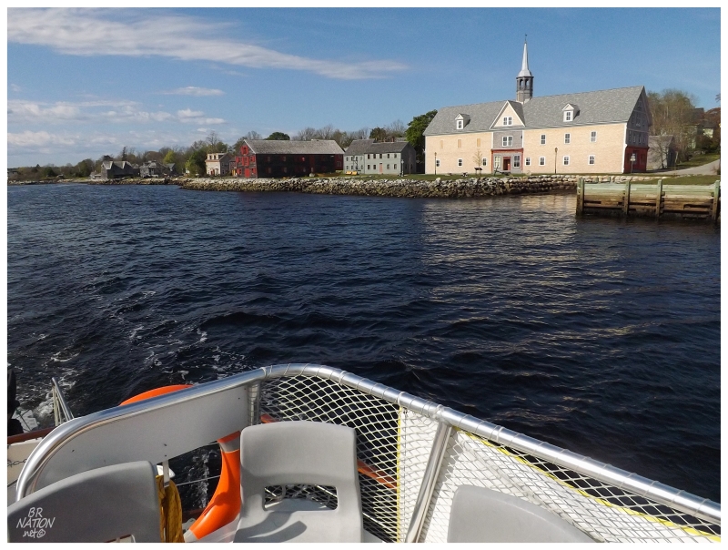
On the boat ride back, we went slightly past the Shelburne wharf to get a better harbour view and learn about the town. Historic buildings remain, but the community appears especially old-fashioned as this is where they filmed The Scarlet Letter. Because of this, the film production crew paid for tunnels to be built in Shelburne in order to put all of the electricity underground and eliminate modern hydro poles from their 17th-century film set!
Anyway a marvelous day on the water was complete, and at $35, I would go back to McNutts Island if I had the chance. I thanked Ken & Sherri and went on my way. It was time to grab more coffee and to see all of the non-insular lighthouses between here & Yarmouth.
Continue to Part 3!