I was looking around the internet one day when I came across a picture of a weather-beaten old home set upon a wide meadow. Lock's Cove? I'd never heard of Lock's Cove before, but I suddenly wanted to go. I googled the place and as it often happens with Newfoundland, no travelogues, websites or other pictures existed in the first few hits. I opened Google Earth to look at the land and measure how far one would have to bushwhack, where I then found a line leading from the NL-430 directly to the cove of interest! Looking at StreetView from the Great Northern Peninsula Highway, sure enough a slot in the forest showed that a trail of some sort left the road here. |
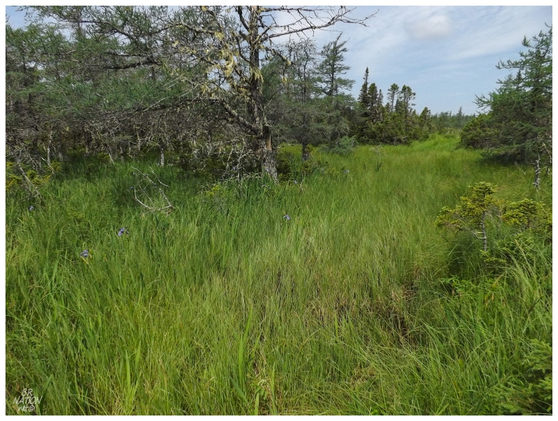
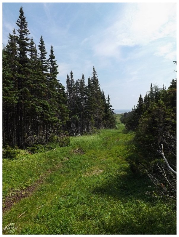
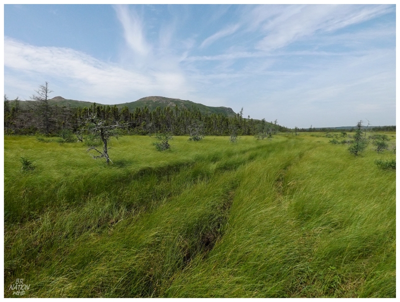
Fast forward a couple of years & I finally found myself on the Northern Peninsula with a free afternoon. About halfway between Eddies Cove & St. Anthony, we parked the vehicle along the highway where a total of five cars would pass in the 5 minutes of getting ready. Diving into the forest, the path had us immediately questioning the difficulty of this jaunt. It was one of the hottest days of the year & hadn't rained in days, but the thick vegetation and forest cover preserved wet bog holes and deep mud. Thankfully this section was short enough that once you started to dread the thought of hiking 4 km (2.5 mi) of boggy path, you already found yourself in a wide clearing with tall grasses, a small brook and the odd tangled shrub. The going here was much easier but now there was confusion about the path. What looks like a defined route in the satellite image doesn't exist in these wide meadows, where people aren't forced to congregate and beat down the vegetation in one place. |
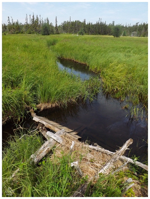
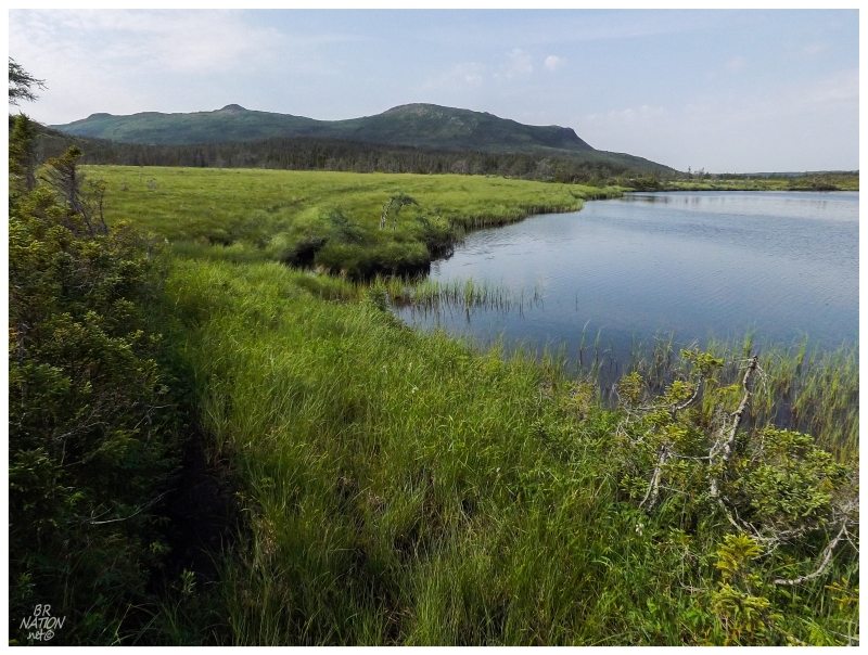
Needing to go directly south & seeing a break in the trees up ahead, this opened into a larger meadow, this time with a river cutting through the land. The river would lead down to Howe Harbour, but in a meandering path with remnants of old trail maintenance. The hike here became a game of where to cross the river and the worth of whether to cross back to make life easier. |
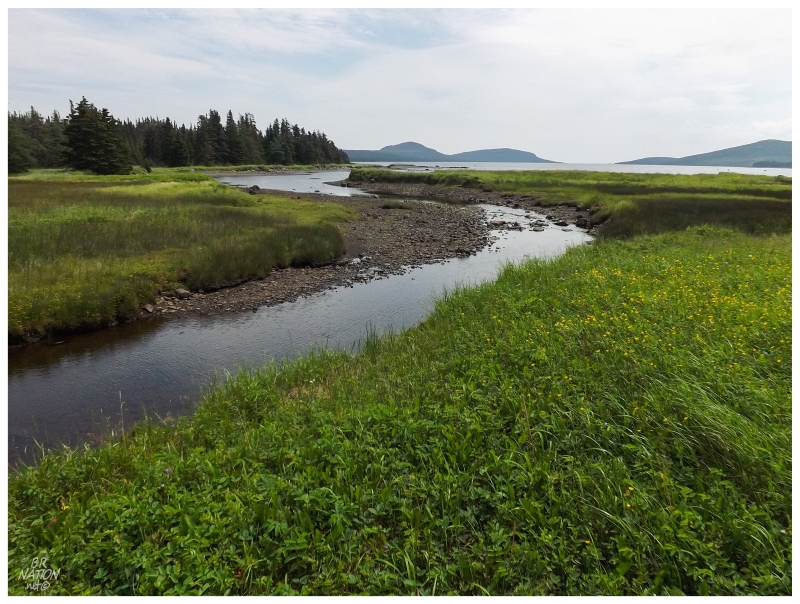
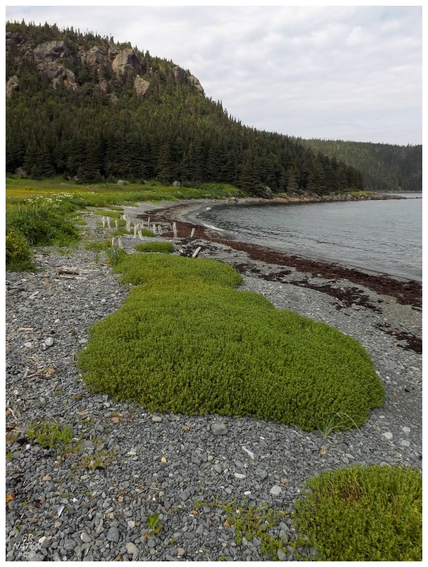
Things relaxed down by Howe Harbour when we could see the direction that the wide river was going up ahead. Being able to follow the river without worrying about braided streams & knowing that the ocean shore was right there, this was also the first point of appreciating the beauty here, with this scenic river spilling into a calm harbour lined with green foothills and treed grasslands. The majority of the hiking I've done on the Northern Peninsula was atop barren coasts, so streams, lakes and lush vegetation was a change for up here. It wasn't just a change from the Northern Peninsula either, this landscape and the vegetation made me feel like I was outside of Newfoundland, save for the foothills in the distance. |
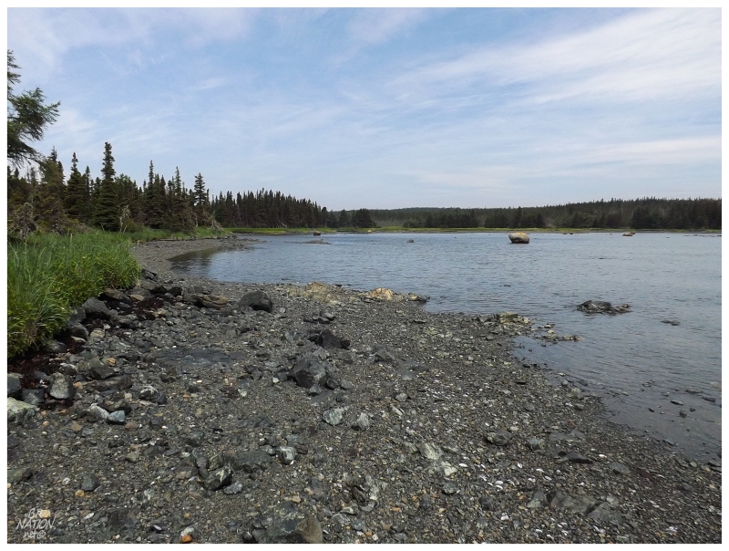
The heat is worth mentioning again here, for my God it must've been the hottest 2014 day of the year on the Northern Peninsula. Even down south in Corner Brook, this would have been one of the 5 days of the year that's actually humid and sweat-inducing. Reaching down into the river with my tilley hat, I poured some of the cool liquid on my head and back. And then once I reached Howe Harbour, I increased the amount I poured so much that it drenched me, but I soon wasn't all that wet. Also, even though this is technically the ocean, with Howe Harbour as a safe and shallow bay, the ocean water wasn't nearly cold enough to be totally satisfying. I dreamed of the exposed coastline and frigid waters at Lock's Cove. |
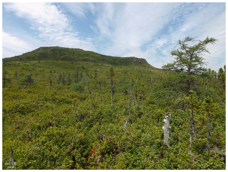
Continuing on the trail there was an offshoot towards Mount Mer, the distant hill lacking vegetation and seeming like you could pop right up to the summit. At only just over 600 ft, if it wasn't for the limited amount of water and time, I would have did just that. The unexplored & barren hills up here have always interested me, and studying topographic maps Mount Mer was one of the ones that seemed possible (I've gawked this way towards these hills for the last 4 or 5 years of coming up here). Now that I have seen how easy it appears, it is on the to-do list for the future. |
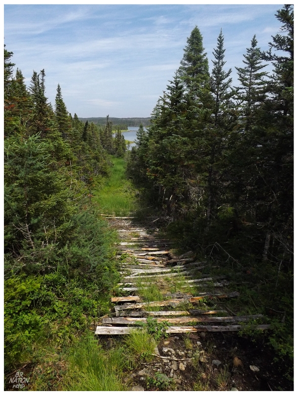
Today we would keep to the south though, following the cut through the forest & discovering pallets, simple bridges and firewood wagons along the way. |
Leaving Howe Harbour, it's another 20 minutes before a small unnamed pond is off to the east. Again I pulled off my tilley hat, this time carefully stepping on the marshy land and shrub branches until I found a spot where I could crouch down close enough to fill it up and thrash the water upon my head. This was about 2/3rds of the way to Lock's Cove and about the point of no return for a hike, so I relished in three or four dips of my hat and soakings of my scalp, face, neck & chest. On the way back we'd use this same pond again, along with deciding to swim in Howe Harbour instead of only using the tilley hat. For all of the flak I get from Shahlene & Steve about my tilley hat and whether "I'm going on an adventure today!!", it was invaluable on this scorching day. |
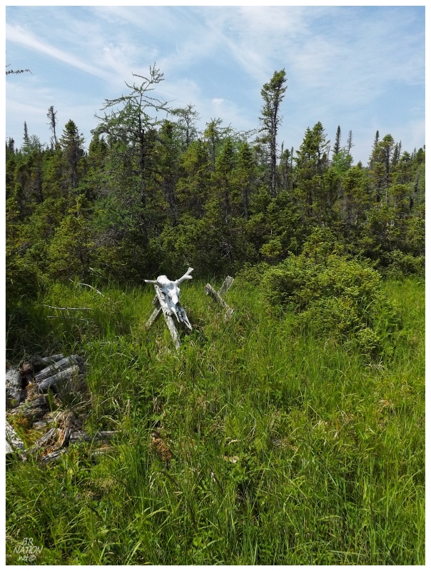
^Moose Skull.
There were enough trail blazing signs but also enough deterioration, to make one wonder why this trail was one time maintained so well but had now fallen into disrepair. Would there be a disused cabin at Lock's Cove? The product of someone unable to drive their ATV from the road anymore? Or was this simply the case of a trail leading into the woods from the road, but also a trail leading into the woods from Lock's Cove for the cabin owners there? Had we followed one trail until grassy meadows led us to the other? There wouldn't be anyone at Lock's Cove to ask, so I was left to wonder while the trail sharpened, had fewer weeds and greater woodpiles. |
Running out of area on the satellite image & the trail becoming quite good, finally the clearing of Lock's Cove was visible up ahead. Rushing down to the cabins here, suddenly I felt stinging as I moved my exposed calves and shins through the waist-high weeds. This stinging was annoying & without knowing anything more, I figured that it had to do with some plant. I scurried towards the ocean to relieve the pain. The funny thing was later telling a friend about this and him saying, "Must've been Stinging Nettle? Yep, good call getting into the salty ocean with all of those tiny cuts." This was my first experience with the stinging plant & whenever I feel that slightly annoying rash-like burn again, I guess I'll reminisce of times in Lock's Cove. |
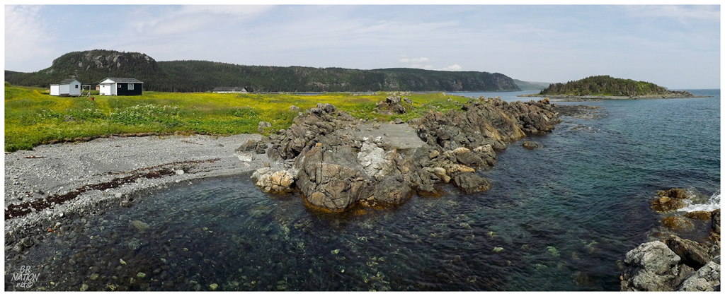
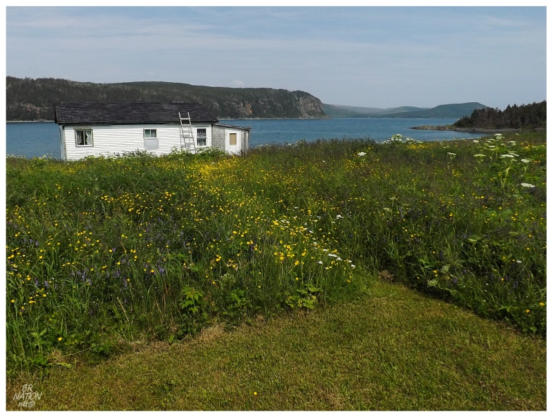
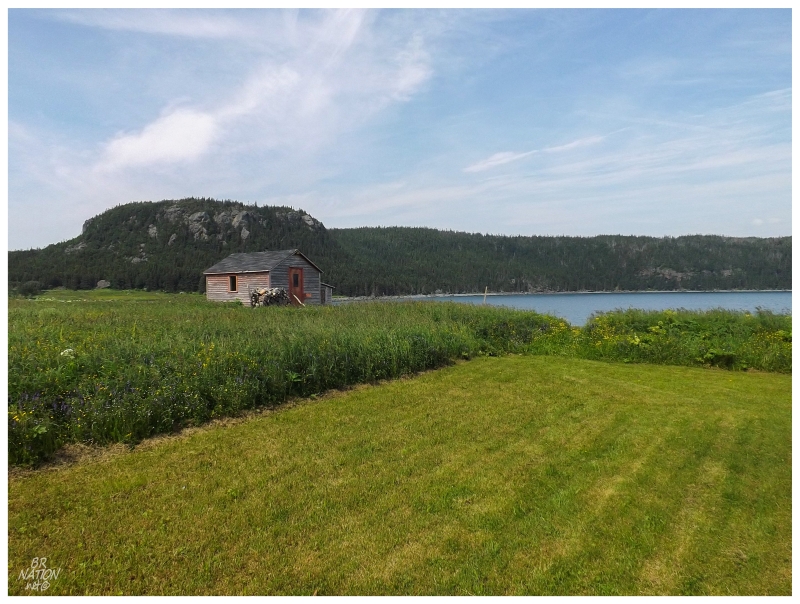
With my legs now only slightly stinging, I surveyed my surroundings. All that's left at Lock's Cove today is what you see above: three well-maintained cabins situated upon trimmed lawns. I imagine the owners of these cabins come by boat, but there aren't many close communities - 17 km from Main Brook? 25 km from Goose Cove? 32 km from St. Anthony? You wouldn't hear arguments from me though, as I'd happily boat 17 km from Main Brook if this was my cabin. Lock's Cove is plenty scenic and peaceful, and the Northern Peninsula is my favourite area of this province. |
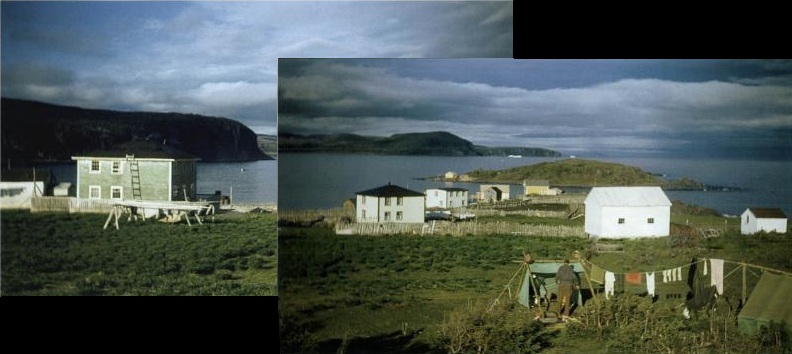
^Two 1949 pictures merged together from
Lives and Landscapes, Elmer Harp Jr., 2003.
Comparing the two pictures above, you can see the small community of Lock's Cove that used to exist. The tip of the island in the modern picture is the same island in the picture from 1949, and the hill in the background is also useful for gathering your bearings. The cabin in my picture is right along the shore of the ocean, while the 1949 picture is taken from further back where the three foreground houses must be about 80 feet from the ocean. I also like how Lock's Island was deforested 65 years ago. Even though I initially didn't find anything by searching for Lock's Cove on the internet, I'd later turn up Lives and Landscapes on Google Books, discovering a great read where the author led archeology expeditions up here long before the road went anywhere past Norris Point (about 250km/155mi south of here). It provided a fantastic window into places like Lock's Cove that don't at all resemble what they did 65 years ago. |
^Old pillars for the wharves and stages of Lock's Cove.
The eastern side of the Northern Peninsula doesn't lend itself to a multitude of communities because of the sharp, high cliffs found throughout much of its coastline. Even upon the large, rectangular Hare Bay (about 30km/19mi east-west & 11km/7mi north-south), there only ever existed 4 sizable communities - 2 that exist today (Main Brook/Burnt Village & Goose Cove) and 2 that no longer exist (Lock's Cove & Ireland's Bight). At Lock's Cove, the land was probably used seasonally by the French in the 1700s, as they had a heavy presence in this area of Newfoundland. Lock's Cove would appear in the census first in 1874 with 33 people, 3 of whom were English. Back then the French controlled this shore and the English weren't allowed to permanently settle, although you had a few that did here & there. Eventually the English would push further into the French Shore, raising the population of Lock's Cove to 64 by 1901. This would result in a church & school being built here. |
^An old snowmobile sits amongst the
buttercups
and Stinging Nettle of Lock's Cove.
The crash of the salt cod industry after WWI brought Lock's Cove back down to 12 people, but soon the new residents found timber work in Roddickton or Main Brook to supplement their lives when fishing times were tough. Regardless of this new means to put food on the table, Lock's Cove's isolation still presented the same problems that were found through much of outport Newfoundland. It was hard to get teachers to come here, people were having less children & as children grew they would often move away. In the late 1960s, enough of the 82 people of Lock's Cove saw the writing on the wall & decided to take the government's monetary package to move. 14 families went to St. Anthony & the remainder went to Cooks Harbour or Main Brook. The Encyclopedia of Newfoundland states that by the 1980s, Lock's Cove was being used as a summer fishing station. |
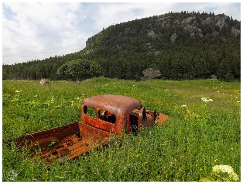
^An old truck sits further up from the old snowmobile.
Lock's Cove's claim to Newfoundland history is stronger than many other outports, for the men of Lock's Cove went out to sea & rescued Sir William Grenfell in 1908. Grenfell was an English medical missionary who brought emergency services and modern medicine to a wide expanse of the Northern Peninsula & Southern Labrador. He was so prolific and focused that he has a historic campus of buildings in St. Anthony & the college in Corner Brook is named the Grenfell Campus in his honor. Anyway, Grenfell was on one of his famous jaunts taking a dogsled from St. Anthony down to Canada Bay (near Roddickton) to provide medical care to an ill boy. Trying to cut across Hare Bay, the ice broke apart & suddenly Grenfell found himself floating out to sea on an ice pan. After being out there long enough to have to put down a couple of his dogs for warmth, the boys back at Lock's Cove spotted him & took their boats out to rescue Grenfell. Sir Grenfell's work would grow to the point where he formed the International Grenfell Association in 1912. He would be knighted in 1927. None of his work he was doing during this time would have happened without the residents of Lock's Cove heroic measures to save his life. |
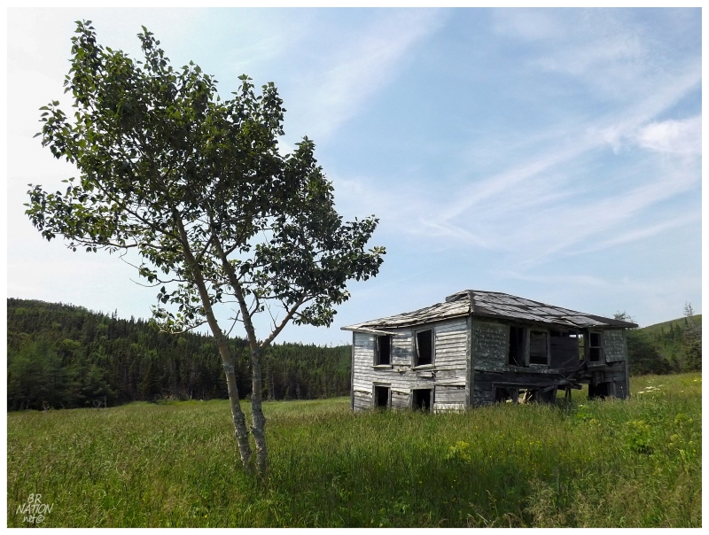
Unsure of the age of the cabins here at Lock's Cove, I know for sure that one monument still stands to pre-resettlement time. Of course I would hike to a place simply to see a cabin along a scenic coast, but it was the sight of this house on Panoramio that made me immediately look into how to get to Lock's Cove. I had my doubts that the harsh winters up here would leave this house without a collapse much longer, especially as the Panoramio picture was from 2008 and I only discovered it in 2012. It speaks to the craftsmanship of these old places when six winters haven't done extensive damage to a place now open to the elements. I was very happy to see the house still standing and standing proud through those long Januarys & Februarys. I'd even say that I look more aged after 6 winters than this house does! |
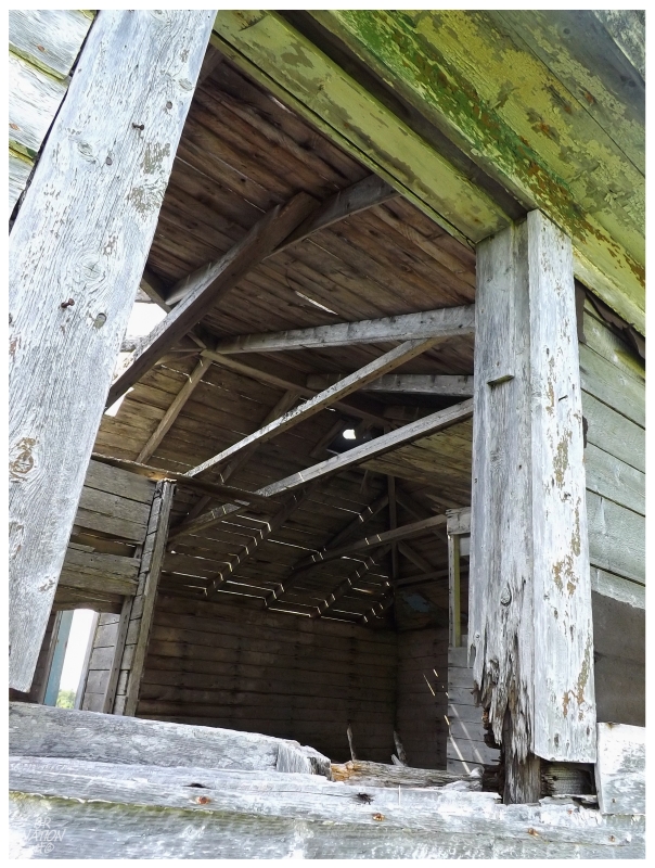
Approaching the house and peering up, a few green flakes remained under the awning. I pictured all of this grass cut and the old fence marking off a garden from roaming sheep & the odd cow. Opening the front gate, you stand there before this fine house, immersed in Lock's Cove & surrounded by just about all of the small village. |
I excitedly moved toward a doorway, curious to see the inside after all of these years of looking at that Panoramio picture. Long, thick grasses and plenty of fallen boards made my life difficult, but if I wanted to peer inside, it seemed like I could lean forward and simply look down to make sure my feet didn't meet any sharp objects or depressions. |
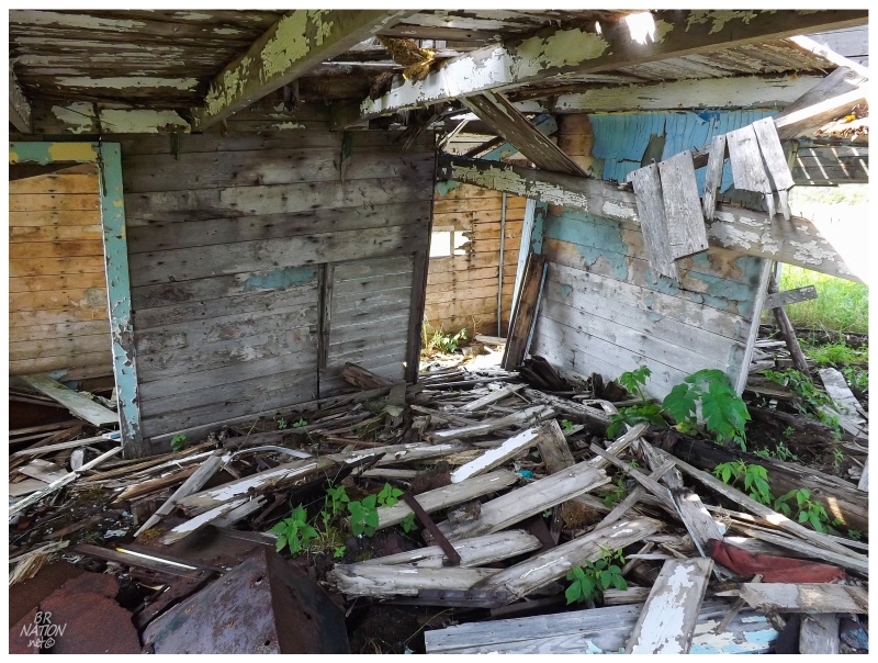
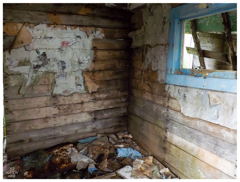
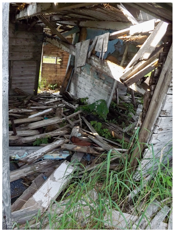
The staircase was nowhere to be found, so I was resigned to the first floor where there were so many nails and brittle boards that I couldn't even move from room to room. The most interesting find had to be how one of the bottom floor rooms was the bedroom of a young boy. The wallpaper of speeding trains and switch towers taking you back to a small Lock, Elliott or Carroll child dreaming of locomotives in this tiny room (even though the Newfoundland trains never came up the Northern Peninsula :) ). |
The old Lock's Cove house is set far back from the harbour & it's the first thing you come upon at the end of the inland trail. Although I presented the cabins down at the shore first, I actually came to that house first. So anyway, back down at the shore I also loved the look of Ray Elliott's cabin. I'd love to know when this one was built, because it didn't look like it was yesterday. And if you're wondering how I know it's Ray Elliott's cabin, it's because looking on Flickr there's a grand total of 4 Lock's Cove results - one of which is a Guy Elliott posting a picture of this cabin and stating that he's had a few cups of tea here (which makes me jealous and also makes me wonder why we didn't bring any tea!) |
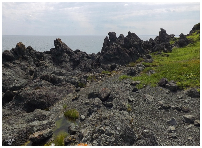
I also noticed the nasty & craggy rock at Lock's Cove. This rock was coarse enough that it scrapped the rubber from my soles and commanded my attention as I climbed along. Eventually I made sure to get down to the water before taking my shoes off. Afterwards I put one foot atop these rough cliffs again and took in the Hare Bay view, appreciating being able to see landforms off in the distance, while trying to guess what I was seeing (I think the left piece of land is the Brent Islands (Hare Bay Island Park Reserve), while the right piece of land would be the main island of Newfoundland around Ardoise Point). |
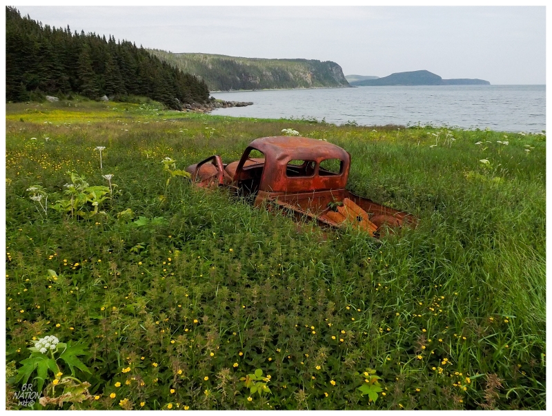
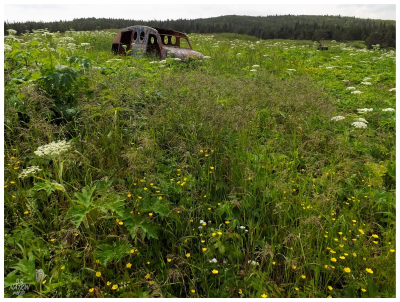
After visiting the cabins, I followed the northeastern shoreline to the old vehicles, deciding to dive into the stinging nettle near this old truck. I know Lives and Landscapes states that Lock's Cove was small, but I guess it was big enough to have a truck? Of course the truck would serve a purpose of replacing horses and hauling wood, but regardless, it's interesting to think of this place as a place with roads and a motor vehicle. Anyway, the truck was the last thing before taking another look at the old house and returning to the path leading away from Lock's Cove. There was somewhere to be this evening & we had to leave quickly enough to ensure that we got back in time. |
The walk out was uneventful, save for swimming in Hare Harbour, which was quite nice. It was impressive how far out you had to go just to get to knee or thigh depth, the shallow harbour of warm water showing why the earlier tilley hat challenges weren't all that refreshing. Soon enough it was back to the car and thoughts while driving away to St. Anthony. Between being able to climb Mount Mer and camp by the ocean on this exposed point, I've obviously thought about hiking into Lock's Cove again in the future. This would also add the benefit of being able to photograph that old house at sunset or sunrise instead of high noon in July. Save for the Stinging Nettle, this might be a good idea that I'll put into action in the near future. I worry about that old house though & I wouldn't want to give winter too many more opportunities to turn her into a one-story. |
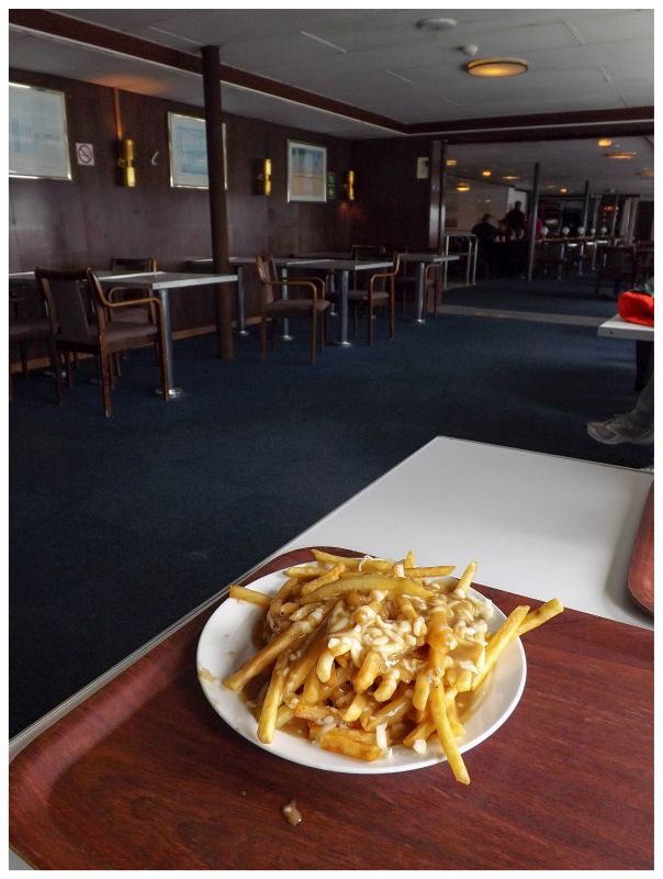
After a successful trip to Lock's Cove, I soon celebrated the fine hike & rewarding outport visit with a good ole Labrador ferry poutine. |
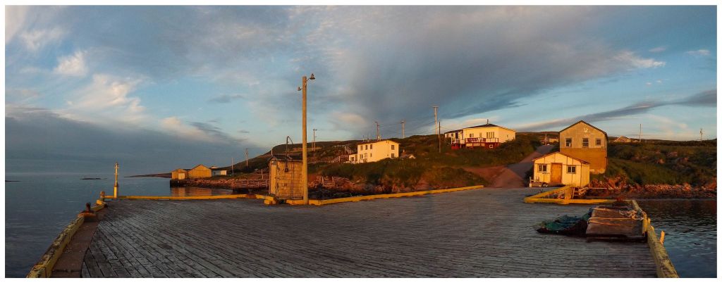
And continued the celebration by getting up to watch the sunrise from the wharf in West St. Modeste, Labrador. |

It was a stunning scene & made pretty pictures, but this is what's funny about photography. I had gloves on, my pants tucked in & my hoodie pulled tight to the point of only my eyes and nose being exposed. The number of annoying, infuriating & buzzing black flies was something else and you wouldn't know it from this picture. One black fly even got me on the eyelid, where Christian helpfully pointed out that I then looked like some guy from the Goonies? Sloth, I guess? I had to laugh later at the Robin's Donuts when I could feel my eye not opening all the way. Anyway, enough celebrating. |