My favourite time of year in Newfoundland comes in mid to late May. It's usually around the long weekend that nighttime lows finally climb enough to make overnight adventures and sleeping outside desirable. At this point a whole camping season is ahead and as someone who loves planning and reaching distant locales, there is excitement with every wanderlust-motivated internet search. Keeping an eye on the forecast and seeing predicted lows around 5°C/41°F, it seemed like it would even be before the May 24 weekend that the temperatures would be warm enough. The night would be cooler if somewhere along the sea was chosen, but the thought and effort of staying warm through the evening adds an extra layer of fun to camping in the fringe months. |
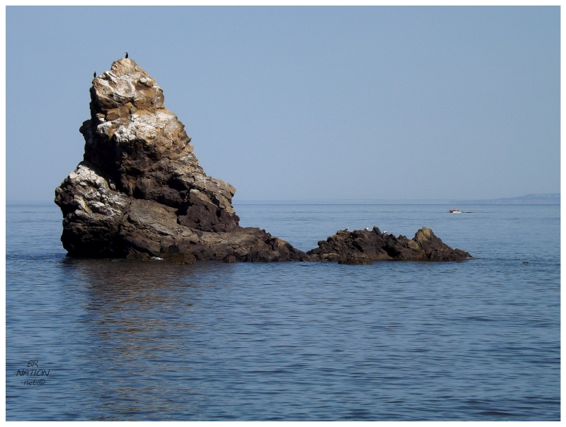
I've known about a sea stack down in the St. Fintan's/Highlands area for years, although I'd never read or heard any accounts of what the road was like, if there was hiking involved, what was around the site, etc. It was similar to many local Newfoundland spots, where you need to know someone or put a lot of time into research. Figuring out where the sea stack was, I looked at Google Maps and the road which led down here. I'd driven down the gravel road to the end of the houses of Highlands before, but simply not far enough. I'd even parked my car at that point and walked a bit further on, but obviously not far enough to see the sea stack. If all of these photographers were getting out here, surely they weren't all using dirt bikes and lifted Jeeps. I concluded that the road must be in decent shape. (I previously tried to walk it in the late winter, where my vehicle was stopped by snowpack, not road quality.) |
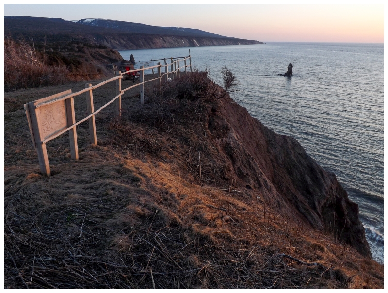
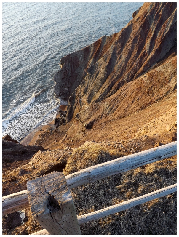
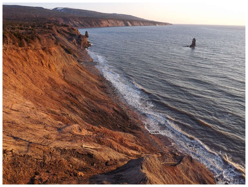
The road was totally fine, save for a 15-foot interruption where a culvert was overwhelmed with water and the road was a muddy mess. Even if I was still driving the Intrepid, I was certain that I would have given it a go & ended up out here. Driving along after the muddy mess, I figured I was getting close, but it was only the amount of infrastructure that let me know the sea stack must be near. Handrails, staircases, a spot that looks like it had seen some cars parked, even a little stone monument base that was 2 or 3 feet tall. I immediately wondered whether this was a well-known spot in the past, a failed park project or a make-work project that's simply deteriorated. Anyway, leaving work on Friday afternoon and with the 2 hour drive down here, I was content that there would be about an hour or 90 minutes to set up the tent, then relax in our camp chairs on this bluff overlooking the sea stack and the setting sun. Not a soul drove past in the whole time we sat up here, and yet again Newfoundland proved its worth in this regard, to be able to peacefully have a spot like this all to yourself. |
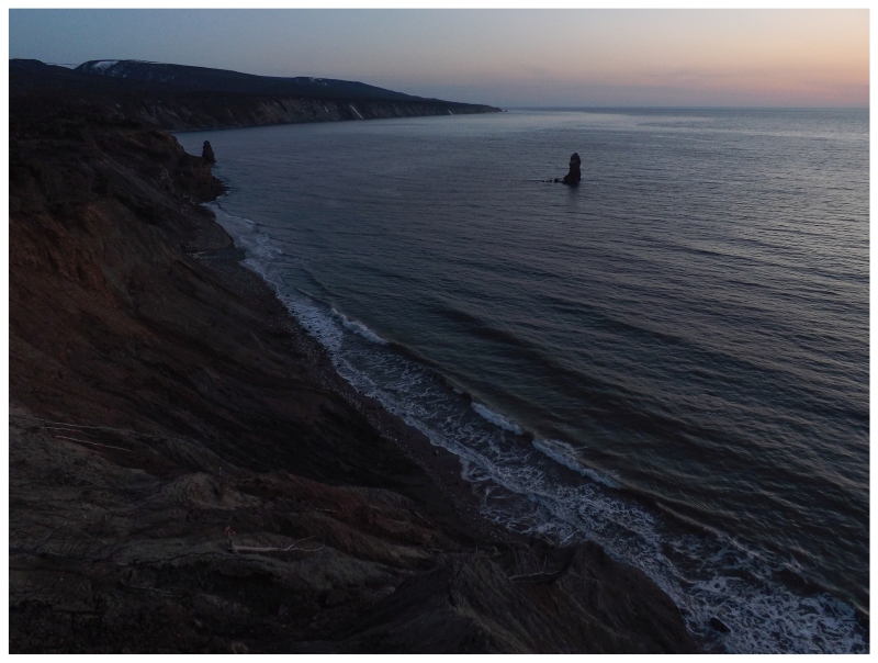
The surrounding air certainly wasn't balmy, but thankfully the wind was almost nonexistent. It was more of a cold that snuck up on you, and when you're a silly man who only drinks beer in these situations instead of whiskey, irish coffee or hot toddies; this is especially true. Keeping up the spirits through the cold temps, this point of land at Seal Cove provided a nearly 180° unimpeded view of the setting sun. From the moment the sky started to change colour into the golden hour, right until our adjusted eyes were still seeing the last remnants of the day. The sea stack stealth camping spot had cemented itself amongst my favourites. |
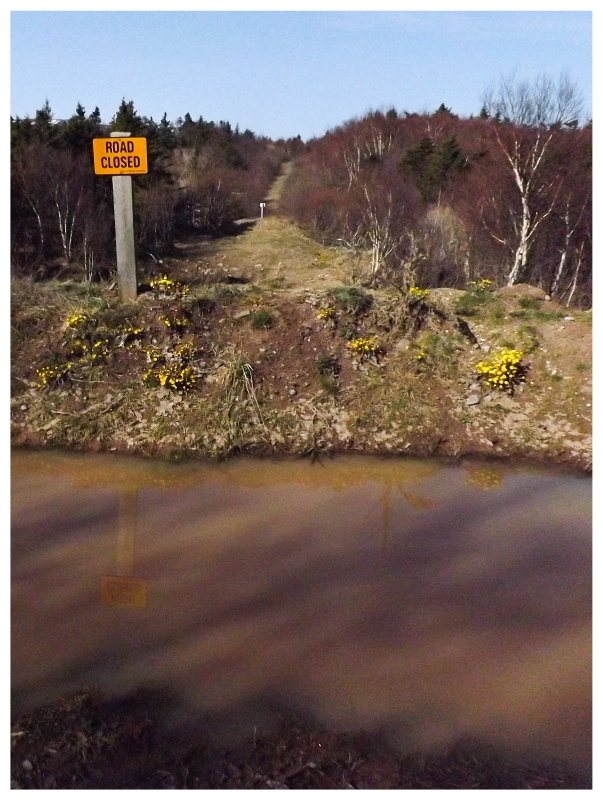
We stayed up late enough that the last light of day led me to turning up the ISO on my camera, trying to take pictures of the last oranges and yellows setting somewhere over the Port au Port, Magdalen Islands or Anticosti. You can see the effects of groggily waking up and forgetting about the ISO above. This picture comes from getting up a bit early to continue on foot down the road, exploring what was out here on this well maintained road. I eventually came to this road closure or washout, after not being able to even see any cabins as they were set back amongst the plentiful trees. Overall, it was a smooth road with good views of the Anguille and Long Range Mountains, leaving me with thoughts of one day cycletouring down here. |
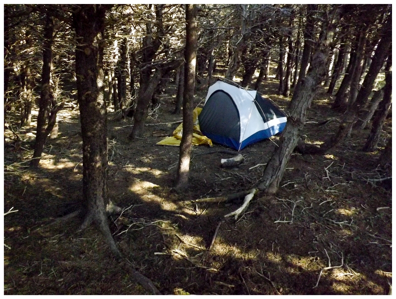
There was a small piece of forest between the widened road and the cliffs down into the ocean. Thinking about the west wind, we decided on setting up the tent in this wind shadow, trying to avoid the cold coming off the sea last night. Waking in the morning, I was amused with one of the tent's more unique settings, in this forest of stunted trees at the last clearing before the tuckamore grew too thick. |
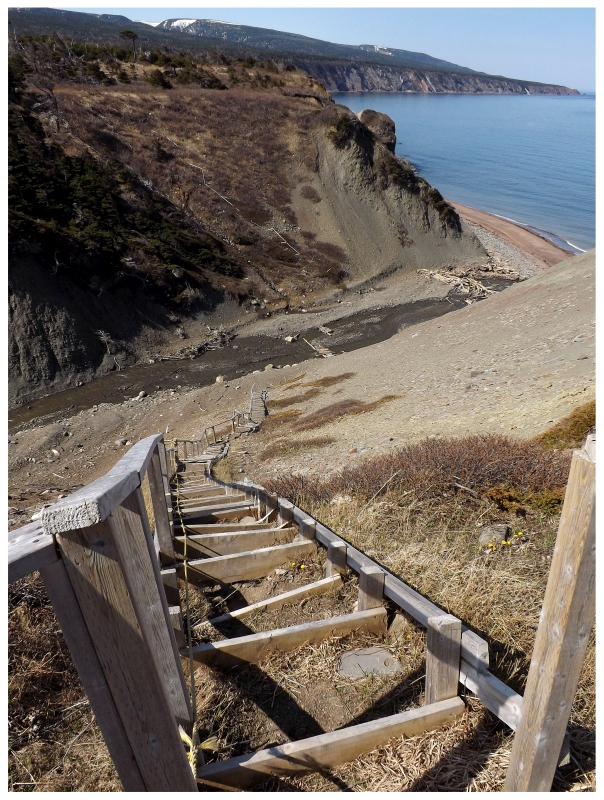
I crossed a river while walking down that woods road this morning, a fact I noted because I thought it might provide us with the best way to bushwhack and fight our way down to the sea stack. Lo and behold, a fine staircase and safety rope provided a much easier way. There was even a raft-like bridge of nailed together fence posts or small trees across the river. |
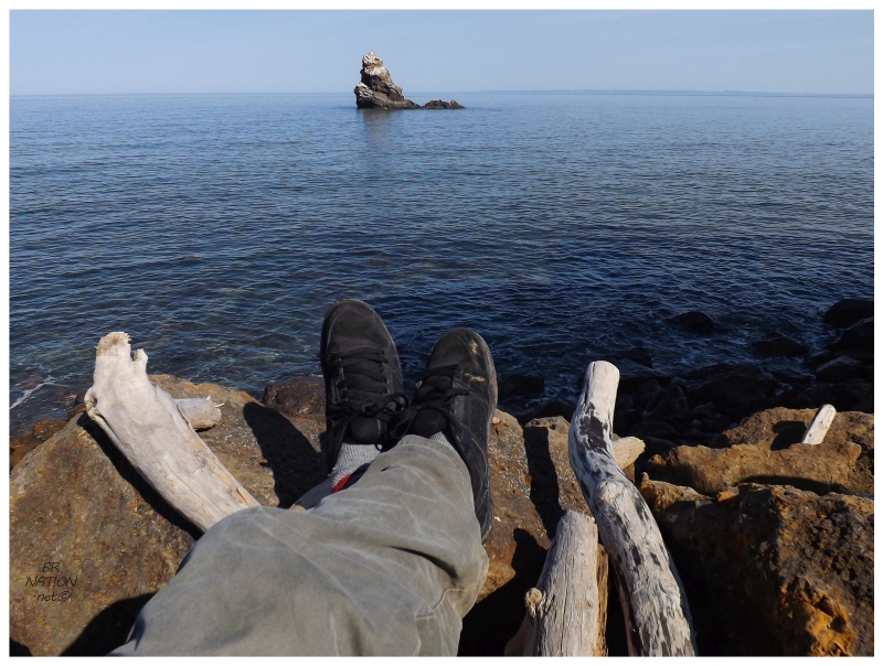
Soon enough, y'know, just chilling with my sea stack. |
A couple of fishermen were out doing their thing as we simply sat in the most comfortable rock curves we could find. We stayed here for much longer than normal, letting the unfiltered sun in the cloudless sky warm our frozen bodies from the previous night. This was also the first day where the temperature finally climbed into the teens, so there was also some unthawing from the never-ending winter. |
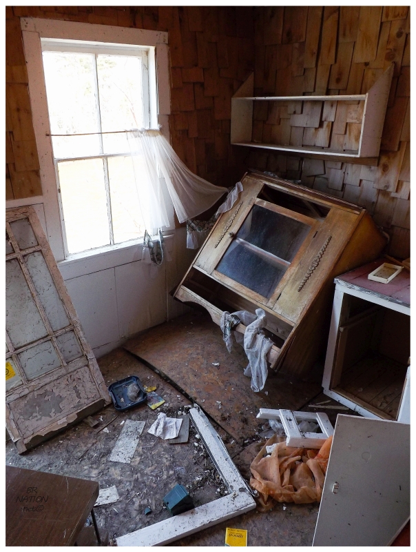
Eventually it was time to get on with our Saturday and returning to the vehicle, we continued on down to the southwest. Seeing a couple of abandoned cabins for maybe the 10th time, I finally pulled the vehicle over for a closer look. |
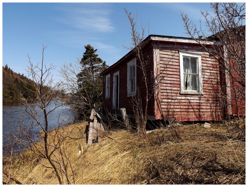
Even though the cabins were wide open, I instead enjoyed their exterior setting along the babbling, shallow brook out back. I would pick somewhere more obscure than along the TCH, but otherwise I couldn't knock this cabin owner's choice of land. |
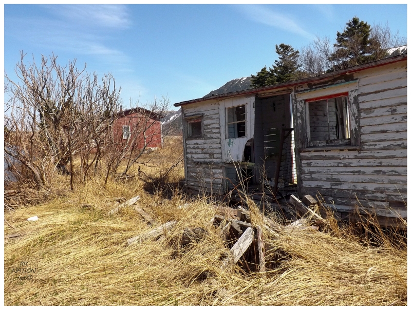
As for the other cabin, it wasn't painted picturesque red and stepping into the doorwell, I found there wasn't much excitement inside either. |
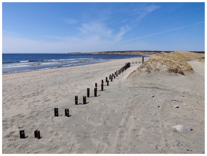
In addition to finally stopping at those cabins, I also finally stopped at J.T. Cheeseman Provincial Park. Now while the provincial park system has started charging too much for camping in my eyes, Cheeseman was nice enough that it made me reevaluate this stance. I have to admit there were some nice campsites within a pleasant wooded setting along a river (as well as fine beaches). The funny thing about the beach was that while we lingered at the sea stack and enjoyed the warmth, Cheeseman's beach was exposed and the cold wind didn't leave us feeling the same way. There was a reason we were on the only people here. As for what those metal things are? I have no idea. They were sturdy and I could jump from post to post, but that conclusion doesn't help me any. Sea wall? Fence supports for dune protection wall? Boardwalk base? |
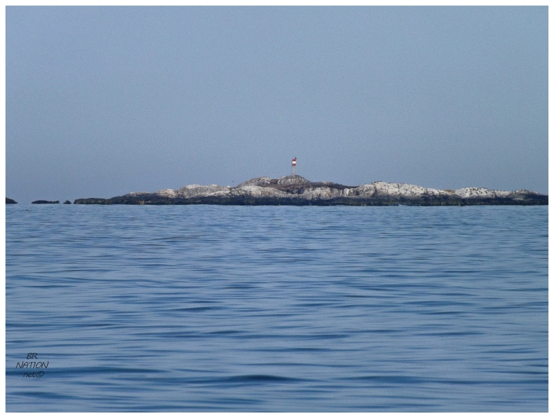
Leaving Cheeseman, we had lunch in Port-aux-Basques before rounding down the NL-470 towards Rose Blanche. Shelloo hadn't visited La Poile before and as she is a lover of provincial ferries, it was time for me to take the 1½ hour ferry for the 3rd time (2011 visit, 2012 visit). The only difference was this time I now had a better camera with a much better zoom lens. This allowed me to get out on the deck as we neared La Poile, zooming all the way in to take a better look at Ireland Island, where there used to be a fine lighthouse but it was burnt down in the 1990s. |
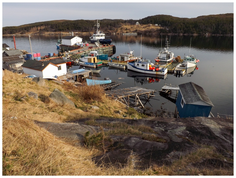
With the ferry leaving La Poile at 10am the next morning and not wanting to stay another full day, the evening was simply spent checking out the scene in town, setting up the tent and cooking some dinner behind the local school. It was a fine evening of comfortable temps, light winds and my favourite scenes with the yellow grasses not yet green with rain or sun. |
^Photo from 2011
^Photo from 2012
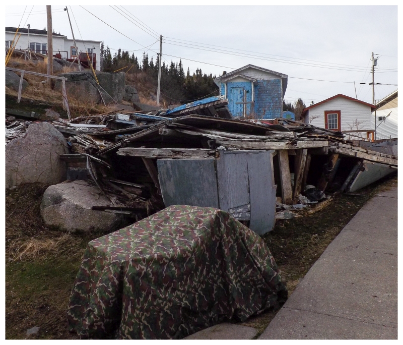
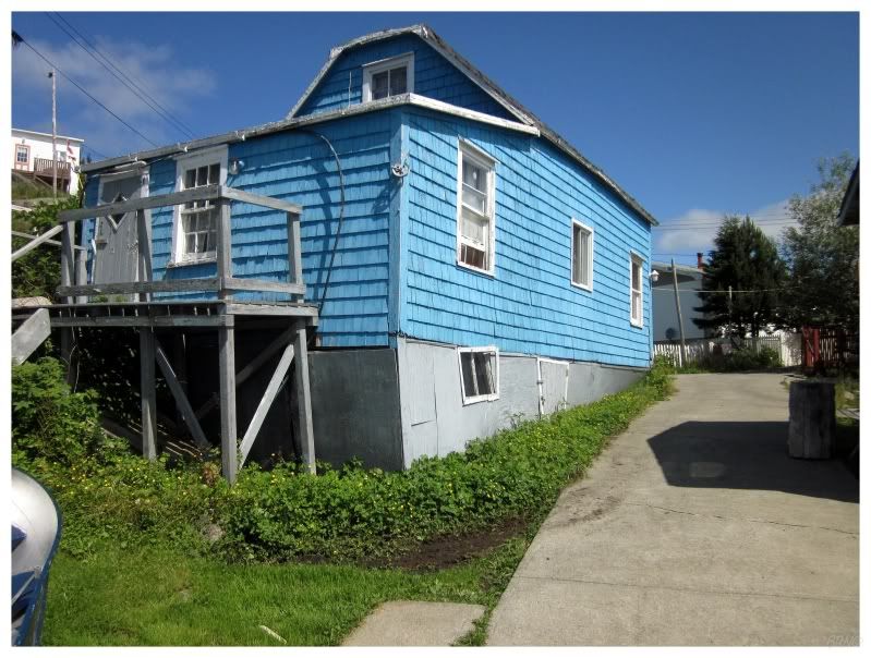
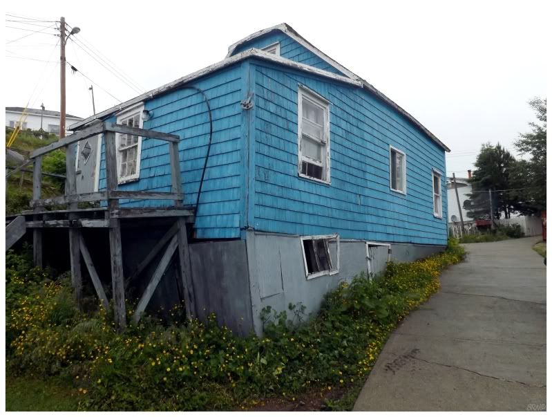
I was amazed to find that the sky blue La Poile house I photographed and noted on previous trips was now torn down. I remembered pondering how it would look in 10 years time, since you rarely find "eyesore" glaringly abandoned houses in these ferry-to places. Walking the uphill path and looking down where the house used to stand, I envisioned returning here yet again in a couple of years, finding only a spot of a few exposed rocks and some grasses. An old section of town-style vacant lot amongst this rural village. |
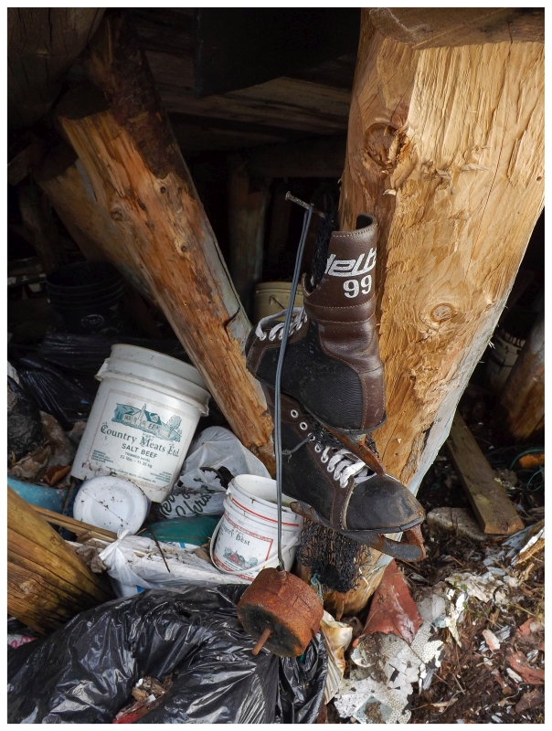
^Ancient skates still hung from the supports of the unrazed basement.
Walking back from the sky blue house on the other side of town, I was happy to run into my friend that I made from the time Johan & I spent in La Poile. Without hesitation, he told us to grab some beers at the store and head down to his stage whenever. It ended up being a great time where I thought about how much I love having beers and hanging out in spots like this. If only I was more outgoing with how much I'm out in these little communities, but regardless, I love knowing my friend here in La Poile & it also made me think of my other similar friend in Belleoram. Laughing a bit, I also wondered if I could make some more outport friends in harder to reach places, haha. Maybe next time I'm on the Burin or in Francois! Or hey, how about Cartwright Labrador! |
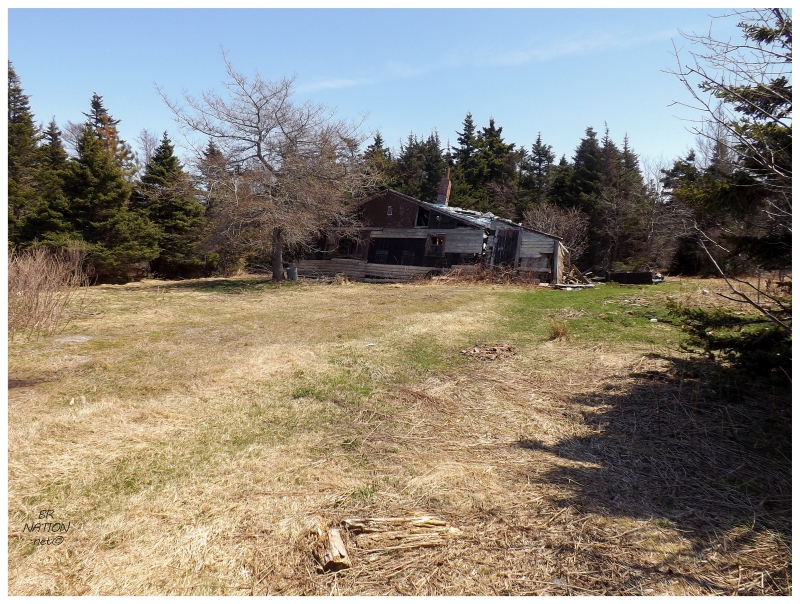
Rising in time to catch the 10 a.m. ferry come Sunday morning, we were back in Diamond Cove (Rose Blanche) before we knew it. With yet another fine day, we drove into the Codroy Valley to take advantage of the conditions and also being so far from Corner Brook. Noticing the old, falling down home I covered before, I pulled the vehicle over for an update. |
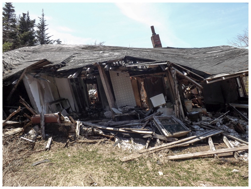
Walking 10 feet into the yard, some random truck drove by and stopped asap. They didn't reverse the vehicle or say anything at first, but why else would they have stopped so immediately? I found the house had heavily deteriorated, so I snapped my couple of pictures and went back towards my vehicle while the truck then backed up down the road. In the end they didn't say anything, but their unimpressed glares weren't very warm either. No big deal though, I was on my way almost immediately. |
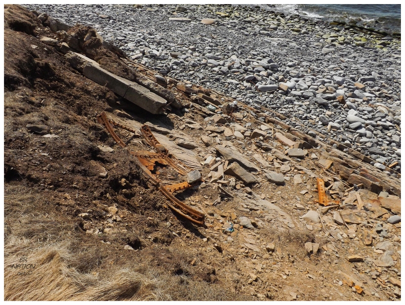
The reason we drove into the Codroy Valley initially was to take a spin out to the lighthouse at Cape Anguille. This might've been the 5th time I'd been out here now, so I expanded my exploring circle to more than just the lighthouse area this time. Noticing something down on the beach, I turned my feet and slid down the gravelly embankment towards the flat rocks and this foreign steel. |
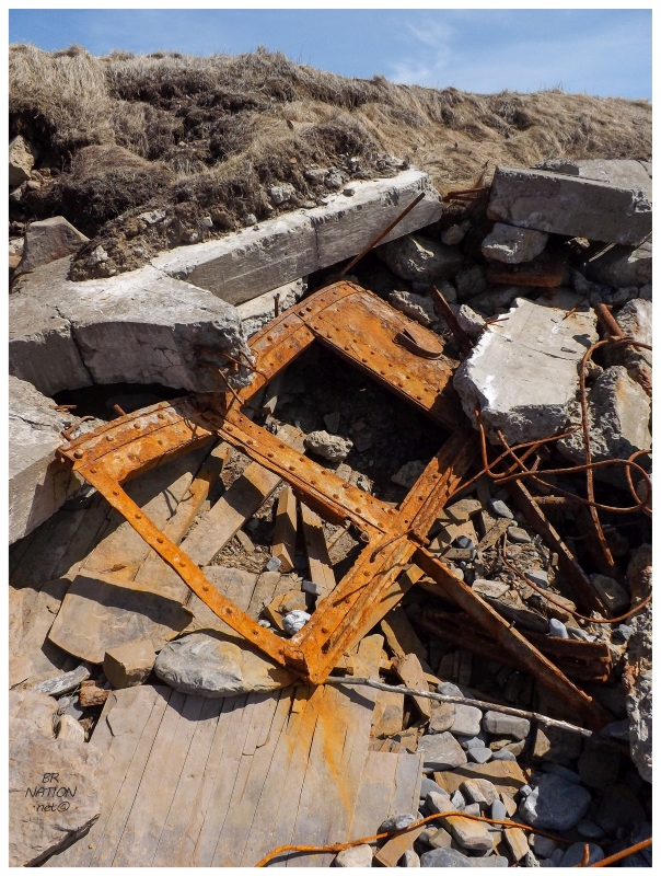
The metal sure looked like the frames from an old lighthouse lantern room. Maybe the pieces that either hold the glass or encircle the balcony? The thing is, is that it has to be one or the other. There aren't glass sections in the metal base of the lantern room and there's usually not a solid panel in the glass section. Also, when you look at LighthouseFriends' picture of the old, demolished lighthouse, it's a flying buttress lighthouse that doesn't have any pieces like this. |
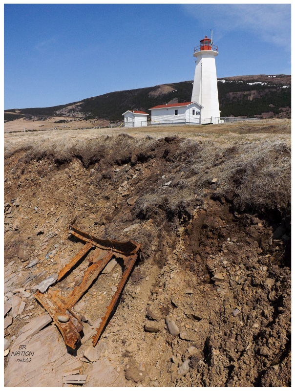
Alas, quelling my initial excitement at thinking I found pieces of the flying buttress lighthouse, I found out that these are actually pieces from the S.S. Mareotis; a 330-ft cargo ship that wrecked at Cape Anguille while carrying a load of lumber from Quebec to Liverpool. |
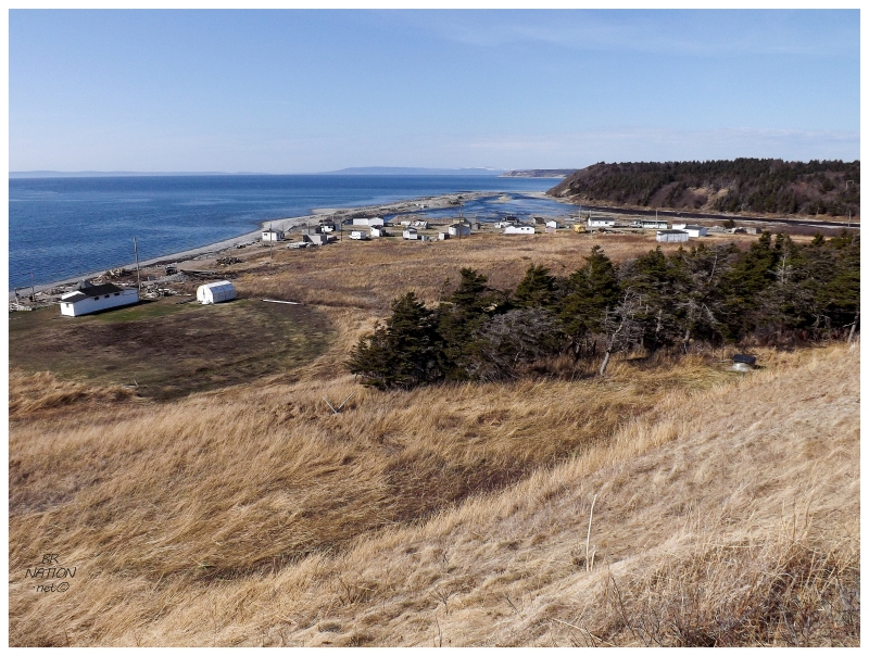
Lastly we spun up into the St. Fintan's/Highlands area again, to drive north on their gravel road to the 'resettled' community of Fischells. As I have this on my list of communities in the province, the excitement of Shelloo getting La Poile meant that she wanted to keep going and check another one off the list. I couldn't complain either, as this is one of my favourite places on the island and I was never happy with my pictures from back in 2010. I'm much more happy with the above. |
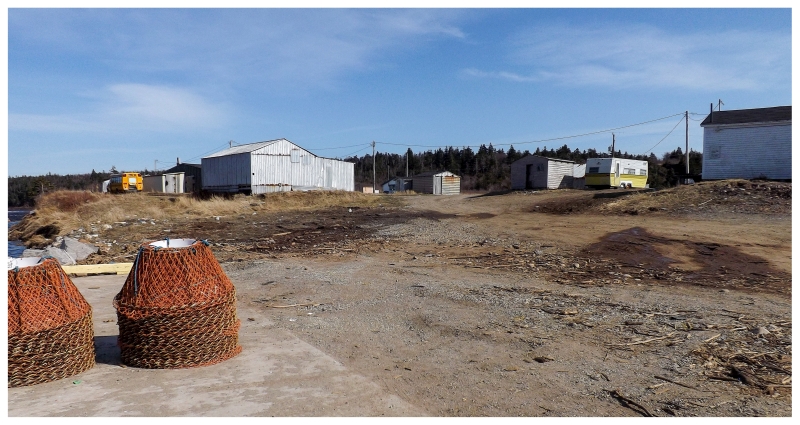
Fischells is one of those funny 'resettled' places where some people were paid to leave, so it's listed as resettled and shown on those maps of abandoned Newfoundland communities. It's a prime example of why I chuckle at those who get so excited at maps of "300 Abandoned Newfoundland Communities" when I know there are ones like this. Little hamlets that are still active to the point where I couldn't even get much of a picture down on Fischells main street, on account of how many people were here even on this early spring afternoon. Pulling back up the hilly gravel road out of Fischells, there was a brief stop just outside of town at the sight of some whales, before it was then time to head back to Corner Brook after one heck of a good first camping weekend. |