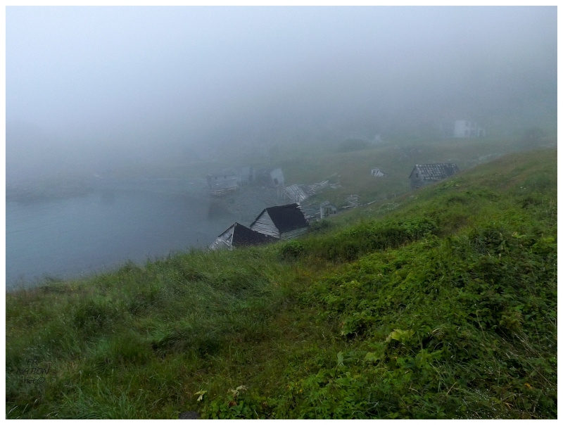
I opened my eyes in the early morning hours wanting to sleep longer, but also wanting to see what it was doing outside. Rolling out of my angled position in this short bed, I found an early morning fog had settled in over Indian Burying Place. |
The fog dissipated and thickened and repeated this cycle, while I stood there and the rickety porch wobbled with my every weight adjustment. For how much I liked the idea of being the rare human who had visited that waterfall and/or Bobby's Cove, I now wondered how many non-residents had seen the early morning hours here. I was glad I got out of bed. |
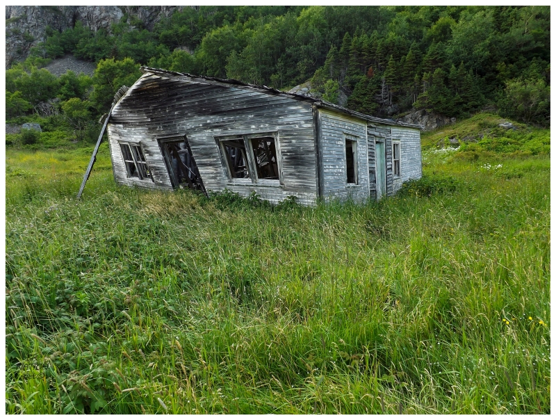
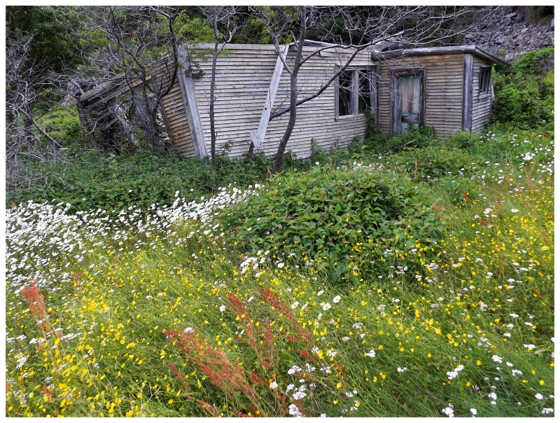
I thought of the fog, low light & how tired I was, deciding that I would take pictures in the sunshine in a few hours. I stood on the porch for about 10 minutes, before going back to bed with plenty of time left to explore things before eventually leaving today. A few hours later, moving from the bed to the daybed in the living room, I munched on a breakfast of trail mix. Afterwards I made my way across the creek and over towards one of the other substantial houses still standing here. Along the way, I passed the ruins of a two-story house that looked like it would have belonged with these other houses. Nowadays only the staircase supported what was left of the walls. |
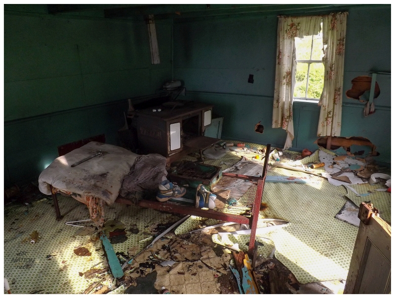
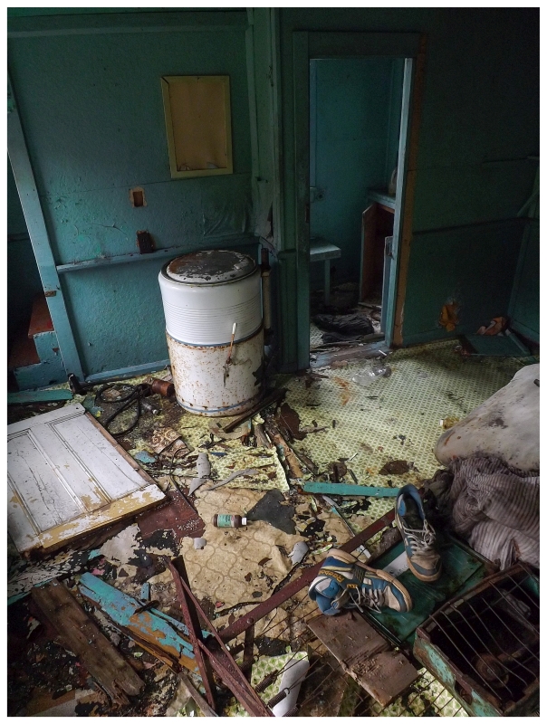
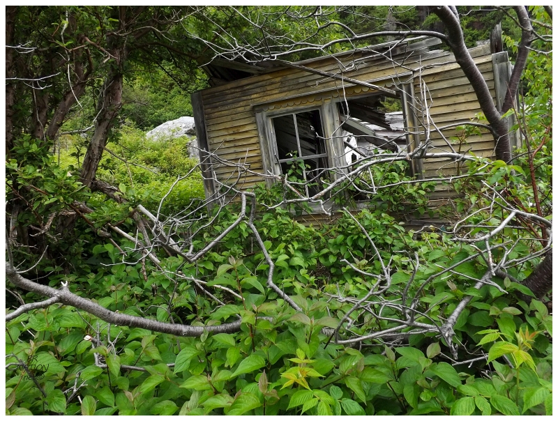
Inside of said house from the previous picture.
The Encyclopedia of Newfoundland explains IBP's unique name in that tradition states the first settlers were attacked by native Beothuks because this was "the burying place of the Red Indian tribes, a number of birch coffins being dug up close by." The July-August 1992 edition of Decks Awash counters that some older residents refer to a massacre here as a more macabre explanation of it being the Indian Burying Place. The Intangible Cultural Heritage Inventory interviewed Susie Prole, great-granddaugther of James Prole, the first known settler at Indian Burying Place. This interview was conducted in IBP in 1968. She recalls claims of Beothuks mending their canoes nearby and sometimes there being a ruckus - whether a bedroom window being shot out or an arrow flying between mother & daughter ("...an h'arrow was shot from that hill, and the old grandmother and daughter were on the flake splitting feesh..."). She also says people claim they found lots of bones when they tried to dig new graves in the upper cemetery about 20 years prior to her being interviewed. In the end, she doesn't know with certainty - just like everyone else - the specific reason the first settlers came to call this spot Indian Burying Place. |
Same house, #2. View from Scott Walden in 1998.
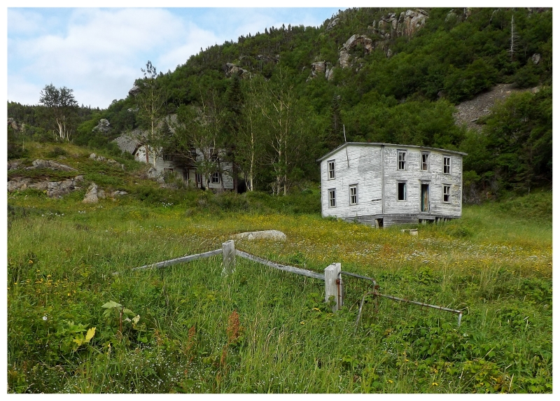
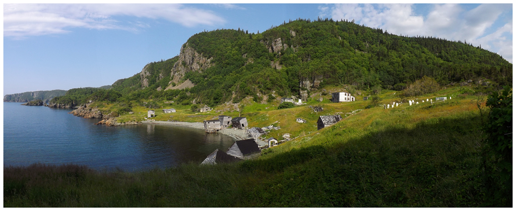
The Newfoundland Encyclopedia goes on to say that five families resided at IBP in 1836, when it first appeared in the census with 42 residents. Back then it was known as Indian Burial Ground, which is why the cove here is still known as Indian Burial Ground Cove, while the village itself is Indian Burying Place. The 1836 census listed IBP as the third largest place along this coast (after Shoe Cove & Nippers Harbour), but this was still so early in the settlement of Newfoundland that people from IBP likely had to go across Notre Dame Bay to Twillingate for supplies. This fact would only last a short while, as Nippers Harbour soon grew into the regional centre for the area. I've always found this coast to be intriguing in that Nippers Harbour (the regional centre) applied for resettlement in 2013, Indian Burying Place is in the state shown in these pictures & Betts Cove (another place for supplies) has been abandoned for nearly a century. Tilt Cove & Round Harbour are struggling along as well. It's not hard to imagine a day in the near future where this coast will be empty from Shoe Cove to Smith's Harbour (near Burlington). |
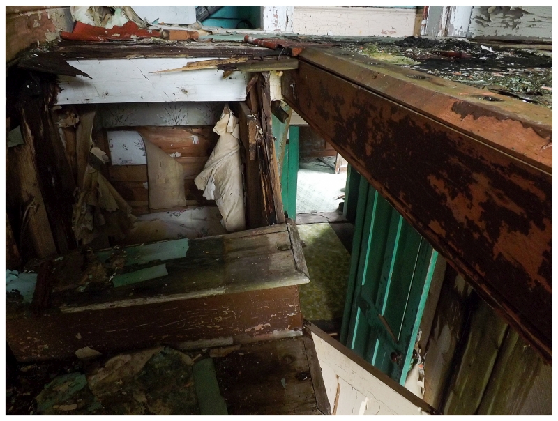
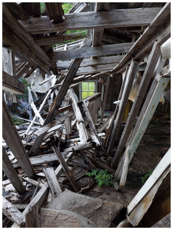
Same house, #3. I tried to go upstairs, but the floor had some scary holes. It's only
after looking at the washing machine in the above picture that I realized this is
the same
house featured in many photos in Scott Walden's Places Lost. This is amazing in
two ways: how his pictures show a place that looks like someone
just left & secondly, how
little has changed in the past 17 years besides a small amount of decay.
Indian Burying Place's population peaked in 1874, with Adams, Bowers, Giles, Proles, Stoodleys and Whites being the family names of the 128 people. This peak in population corresponded with the successful mining boom in Betts Cove. Betts Cove copper mine was overworked though & the mine would physically collapse in 1885, with no more mining completed after that. This affected Indian Burying Place, and along with the failing fishery of the time, the population tumbled down to 67 in the 1880s. The isolation and reliance on the fishery would continue to be a problem for people, as the population dipped to 39 in 1935. The Encyclopedia of NL says that most residents were determined to relocate at this point. Indian Burying Place (and Bobby's Cove) were resettled in the first wave of resettlement between 1954 and 1965, where if every household in the community agreed to move, then the government would pay their expenses (this was later changed to $150/family and then $600/family)0. The Encyclopedia says that 8 families left IBP at the time of resettlement, with 4 headed to Nippers Harbour, 3 to Harry's Harbour and 1 to La Scie. After a Prole was the first settler here, a family of Proles was the last to leave. If we go back to the recorded audio from Susie Prole, near the end she talks about being the last family & spending 4 winters at Indian Burying Place alone, although finding it not too bad. Regularly they'd stay up together, listening to the radio, her brothers playing the accordion and having a time. They continued to get mail by 'Ned' going over to Snooks Arm every week, but she also finally admits that it wasn't good to be that isolated and alone. Lastly, she says that the house they're being interviewed in & that she'll soon be leaving, was built by her father 60 years ago (circa 1908), after which his old house was taken down. Ms. Prole is then asked what is the oldest house in IBP, but isn't too sure. She points to a half-taken down house & figures it to be about the same age as her house. 0 - The government would do this because |
A similar view from Scott Walden in 1998.
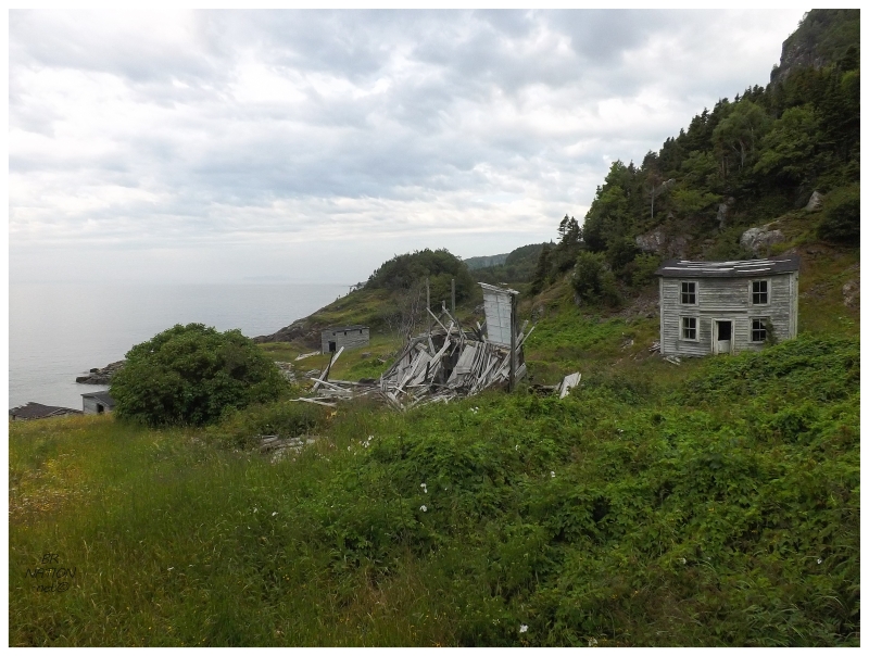
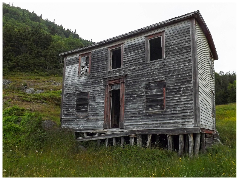
Next up was the last of the four substantial houses left here, located just up the hill from the previous house. Approaching from below, I picked my way through the wet grasses to the missing front door. Appreciating the door surrounds and unique glass pieces atop the entryway, I pulled myself up into the house. |

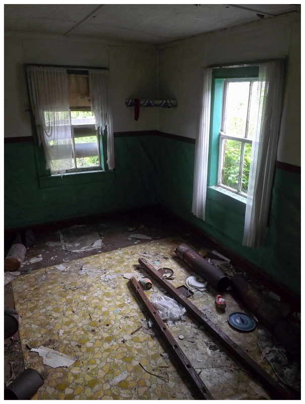
This house was the most ruinous of the four and I found little to explore as I stretched my legs into areas where I felt safe. Entering the backroom, there were the pencil scribblings of various visitors like JR Foster Aug 1 1996, Melanie Robinson, Aug 8 2001; Hedley, Karen, Steve, Rebecca Aug 96 and Bob/Brian Aug 6 1998. Were all these names written after the house was abandoned? 20+ years of abandonment seemed about right for the state in which I found the interior today. It would also seem that August is the most popular time to visit. |
I briefly entertained the idea of going upstairs as the staircase was surprisingly solid, but a leaking roof and missing windows meant that the floor up there was a mossy, soft mess. |
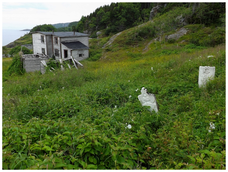
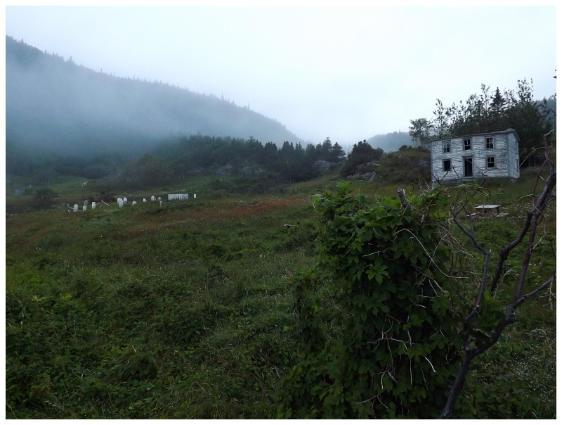
Walking clean through the house and out the backdoor, I also checked out their two sheds which were little more than 2 walls at this point. Continuing up the hill, it seemed like the headstones went on and on, with every little area having another couple of them. It wasn't always the easiest to see them because of the thick, voluminous vegetation, but I continued to discover them. It was interesting that there were these stray headstones away from the main cluster of them in the centre of the town. I would guess that the main cemetery ran out of room at some point. |
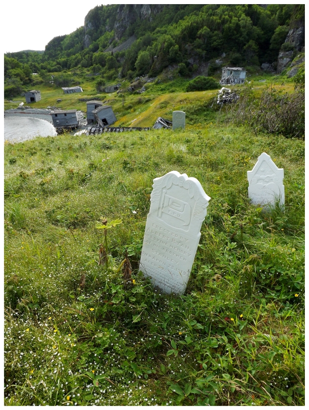
The midtown creek led up to a waterfall, which I briefly picked around, but the thick vegetation wouldn't let me get close without risking going into the actual creek and/or waterfall. So I plodded my way back downhill to the main cemetery, hoping to get a better look at the headstones now that the flies were momentarily only a minor irritant. In the above picture you have the grave of Stanley Ryan, aged 23 1/2 years and a member of the Fisheries Protective Union. In the back there is the headstone for Caroline Ryan, erected by husband Thomas Ryan, who died on May 28th, 1913 at the age of 50. |

I didn't have much time for reflection or observation as the flies had now discovered me out here in the open. I noted a few older headstones, but most were around the early 1900s/1910s. I really wanted to crouch down and slowly inspect each one, but blackflies irritate me far too much. The only other thing I appreciated was the still standing fence & surrounding lupines growing upon the grave of Mary Studley, who died on March 9th, 1908 at age 29. I have a friend who loves these flowers and their annual springtime appearance & I thought about how much she'd appreciate this garden. The only other place the lupines were growing was just outside the fenced area. |
I also went for a stroll back to the smaller houses I missed on the south side yesterday. I idled about here last evening before I knew I could rush to Bobby's Cove, so I still wanted a better, longer look at these structures. |
Not much to explore in this one. Peeking into another open window to my right, there was more of a room, but inside was only an old stove and the frame of a bed. |
Nearby was another house in a similar state, although this one looked like it may have once been a typical, 2-story Newfoundland home before being decapitated of its second floor. I tried the door but it was still locked, haha. Looking into the window, it wasn't worth pulling myself up and in. |
Walking about, I loved the repeating circles cut into the top of each piece of window trim. I wondered if it was the work of a local handy carpenter, or if they were bought from some other place and brought here. |
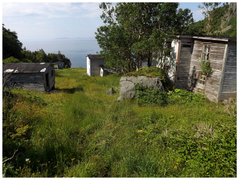
Those two smaller houses are all there is to that end of town, so returning towards the cabin, I looked up towards the two houses I first explored here (and posted pictures of the background house during the first update). In above picture you can also see a bit of fence, where Indian Burying Place wouldn't have always been one big, open field. |
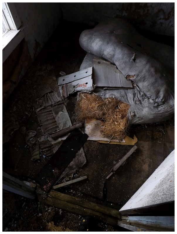
The second of these two houses was also the house in the second best shape (not counting the cabin). Other than a back room which was falling apart, this house still had good bones. |
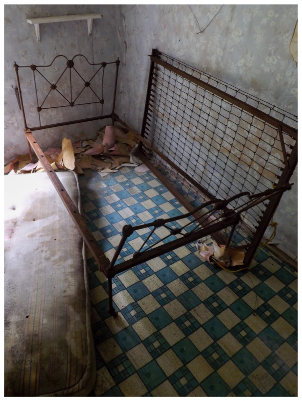
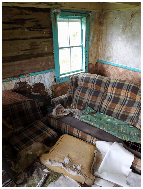
It was also home to great linoleum patterns just like the first home. Even though there was a lot of variance in that first house, this blue pattern was my favourite of all the houses here in Indian Burying Place. |
One of the home's mattresses was ripped open by something...to reveal wood clippings? I've heard of horse-hair mattresses, but the use of wood clippings was new to me. Now that I think about it, it sure felt like I was sleeping on a wood clipping mattress last night. I may be wrong, but the filling could be crushed down without slipping and it also didn't feel very soft. (It sure beat sleeping on a Thermarest though!) |
Scott Walden's view from 1998 gives an idea of the buildings lost.
Just as I was getting back to the cabin, the sun finally fully broke through and did away with the dreary day. While I fear a day like this increases the chances of visitors joining me, I couldn't help but stand at the window and think about IBP looking this pleasant throughout my visit instead. |
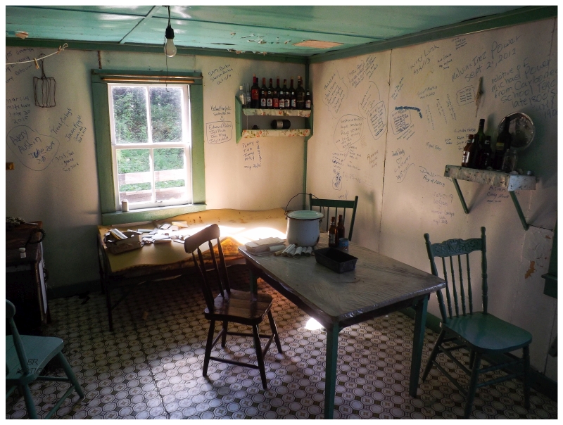
I began packing up my stuff to get ready to leave. On the daybed inside the living room there was a box of letters addressed to Indian Burying Place, which I now took a few minutes to look through. These letters were from the Newfoundland Federation of Fisherman and addressed to Mr. Henry May with 4¢ attached for postage (some were postmarked 1951). Of course with no road ever being put through to IBP, these would have come by boat. It was pretty neat that someone rescued or found these letters somewhere & laid them out for visitors to look through. |
I leaned my backpack against the cabin, then closed and latched the door before surveying my surroundings one last time. After so much work to get out here, I wondered if I would ever stand here again. What would still be standing whenever I returned. I thought about whether I should hang around simply because it's questionable whether I would ever put in the work to return here. Eventually picking up my pack and heading up into the valley, I was now leaving Indian Burying Place by the standard route, and with that, I couldn't believe how quickly I was engrossed in forest and unable to see the village. It felt like I passed through a portal into these familiar woods of the Baie Verte Peninsula's eastern shore. Taking this route back, I encountered lakeside places with big hills and respectable climbs, where eventually I got back to the recognizable parts and was happy with how quickly I popped back out on to the road. I would have some nice, cooked food (Subway) in Baie Verte, before starting the long drive home. I was tired, but also feeding off the adrenaline and dopamine of making it out here. There was a smile on my face as I rolled down the Baie Verte Highway on this sunny Sunday. |