Dinner was much nicer than I imagined on account of technology actually working for once. Somehow I figured out the problem that plagued me and my MSR Whisperlite stove on Anticosti Island: the clip where the fuel line connects to the burner HAS to be facing up. It's something that seems like it would make no difference at all, but my hours of fiddling with the stove had now proven otherwise. |
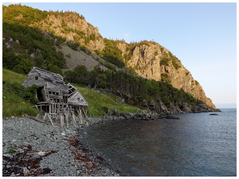
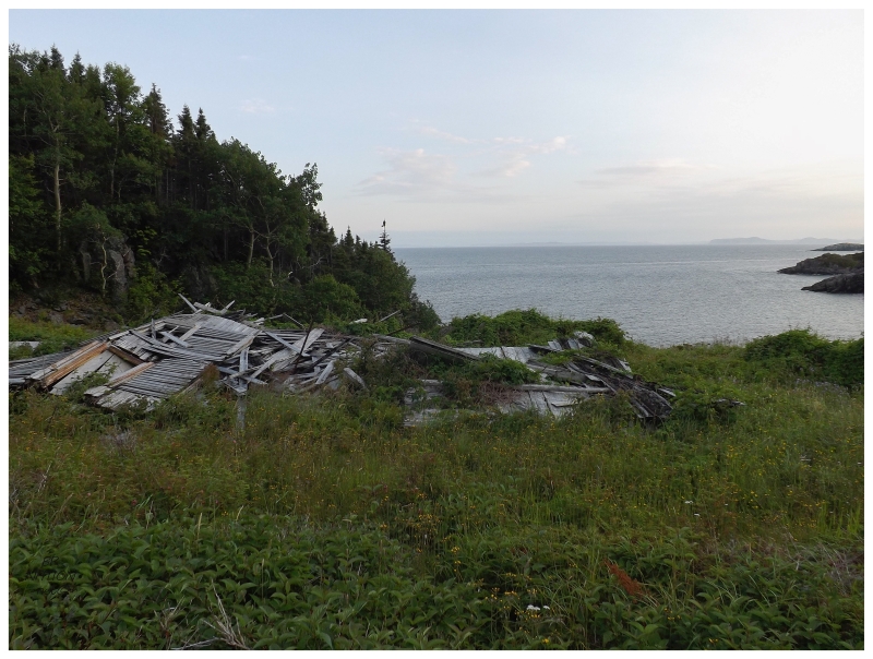
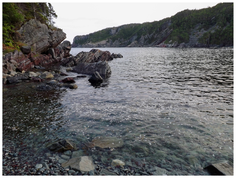
I sat nervously at the convenient picnic table, hoping that the stove would stay lit long enough to heat my pasta. Eventually I realized the stove wasn't going to go out, so I also put on some coffee as I excitedly scarfed down the warm, buttery mac n' cheese. This was the first real meal of the day & it would be hard for it to taste better after all of the hard work. Walking back to my cabin with my coffee, it didn't seem like anyone was going to show up now. It wasn't long before the sun started to fall and cast shadows over buildings while still illuminating the hilltops. As there was no way I was going to simply relax in the cabin until tomorrow morning, I decided to walk over to the smaller buildings on the other side of town where I first came down the dry creek. Along the way I checked out the fishing stages along the small, rocky beach; while looking back to the northeast and the aquatic route you'd theoretically take back to Snooks Arm. There was some desire to climb this hill for a view over Indian Burying Place, but the rockslides and cliffs would take far too long to conquer during this short visit. |
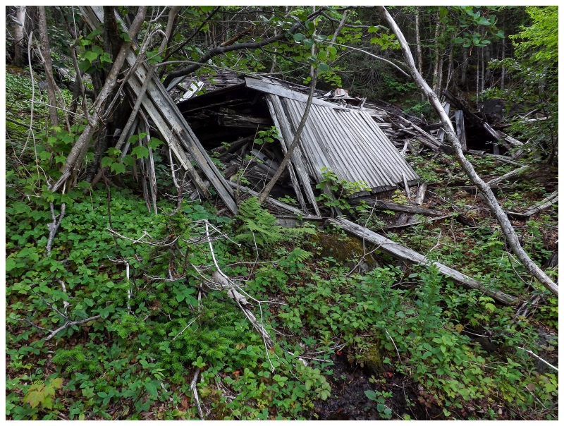
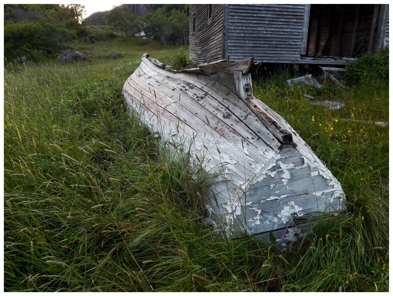
In addition to the buildings along the shore, there were also a few sheds along the bisecting creek of Indian Burying Place. If there was a building I would buy and keep as a cabin here, it would be the northern of these two sheds. It's not the one in the above picture, but there was another that was much bigger, still remarkably sturdy & looked like it belonged in a historical village. It was a very basic, handsome little structure and I loved it. |
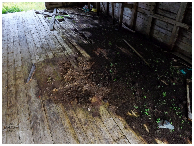
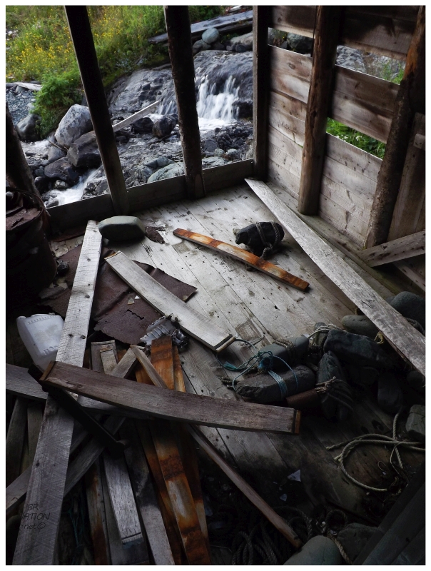
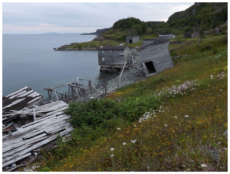
I stepped or peeked into four other large fishery buildings along the shore, appreciating the wood logs from these forests used as attic supports and also the one building that was housing a dirt floor with plants beginning to sprout. In older blogs about this place, there was a resident of Snooks Arm who kept horses out here to graze for the season. Going into today, I had no idea if I would pop out of the forest and spend the night out here with 4 or 5 horses, but upon arrival, the horses were nowhere to be found. The only evidence of their previous occupation was horseshit in this building down by the ocean. (Scott Walden recalls in his Places Lost... book, that he went down to the shore to cook dinner, then looked back at his tent to see a horse biting into the main pole supports. He then had to scurry up the hill and chase the horse away, haha.) |
Another account of IBP comes from Bishop Feild. The Bishop of Newfoundland and Bermuda from 1844 to 1876, Feild was a man renowned for his travels back and forth to the old country, up to Labrador, down to Bermuda & around Newfoundland. On one of his trips around the Island of Newfoundland, Bishop Feild visited Indian Burying Place and held services in a fishing store similar to those still standing today. He doesn't paint a particularly appealing picture of this visit, remarking on both the heat and the fish smell that emanated throughout his time in this building. Regardless of finding the loft an unpleasant place to be, he still baptized several IBP infants and held 3 services on that afternoon in 1865. Further down the coast he would find the same mosquitoes and biting insects as me, noting that Nippers Harbour was appropriately named (for the nipper, aka. the mosquito). |
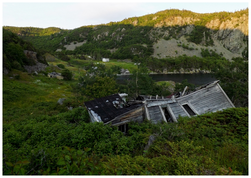
I continued to the eastern end of Indian Burying Place and another indent of the coast, at a little unnamed cove after not walking very far at all. There was the remains of another house and with a view about 30 feet above the ocean down below, I pictured pleasant mornings and whipping storms from this very viewpoint. As much as I would think about setting up my tent right in 'downtown' IBP if the cabin was uninhabitable, this little slab of land held its own appeal as well. |
Circling & examining the pile of broken walls and stairs, I looked over to find an opening into the woods marked by a piece of flagging tape. Now the topographic map for the area shows a trail leading to the neighbouring community of Bobby's Cove here, but I had figured the trail to be like the trail to Indian Burying Place: long since overgrown and forgotten. Without plans to go very far, I approached the woods to check out the topography and thickness of the vegetation. |
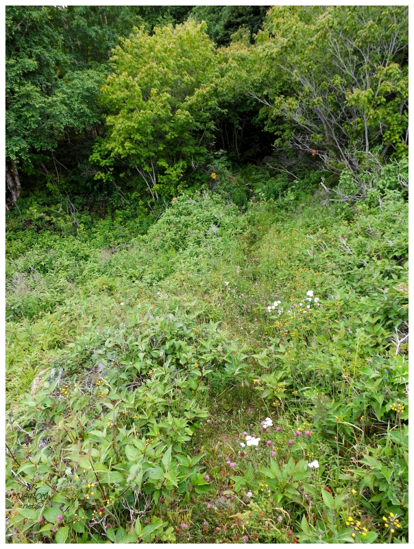
I had written off visiting nearby Bobby's Cove for a multitude of reasons: I'd never seen pictures to think anything was left there, I would have my hands full with getting to Indian Burying Place & I would arrive not looking for additional bushwhacking. I couldn't envision being up for another kilometer of trail-less navigation to a place that was smaller and abandoned for longer than IBP. But instead, I found a fantastic trail. I don't know if the relatives of Bobby's Cove stayed on the Baie Verte Peninsula and visit frequently, or if a found unfinished building foundation beat down the path while transporting supplies, but I couldn't believe this worn and wide path. It was better than some of the trails I've walked in present-day, populated communities. After a few minutes, I noticed an old building about 10 or 20 feet off the path. I didn't have time to investigate further, but it looked more substantial than a house or a shed. It'll have to remain a mystery until I run into someone with ties to Indian Burying Place. |
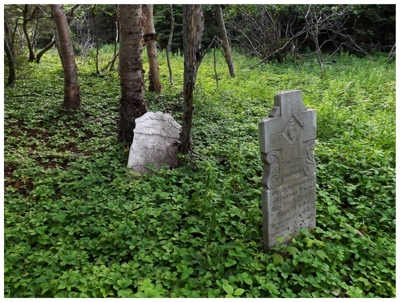
I was then startled by a few headstones as I rounded a turn. Ensconced in vibrant greens and within 5 feet of the trail, this was a beautiful and remarkable sight amongst this treed grove. In addition, I was past the part of the trail that followed alongside the seaside cliff - here the trees were relatively spread out and natural light shined down onto this forgotten cemetery. There's a good cemetery transcription site for Newfoundland and I'll generally look up any cemeteries before going out on journeys, but the layout of Indian Burying Place isn't really explained on there. The website only lists everything on one page, while they typically divide up the cemeteries for every little plot of land. Apparently this was the Anglican Cemetery of Indian Burying Place. |
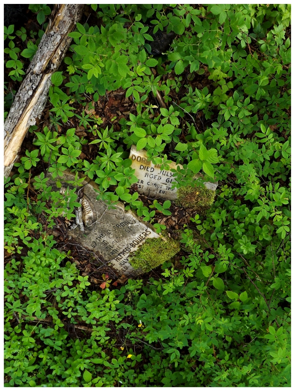
Looking around quickly, I noticed about 10-15 headstones1 in various repair. Poor old George Alfred Bowers headstone having cracked some time along the way. Googling Mr. Bowers, the first record is a baptism list of Methodist children, stating that he was born on Oct 20, 1879 to Thomas & Joannah (née Foss). He would go on to marry Dora Minnie Giles of Bobby's Cove. Apparently they decided to settle in Bobby's Cove, as George is listed as the head of a family of a 26yo female, 25yo male, 18yo female and 16yo female in the 1935 census. |
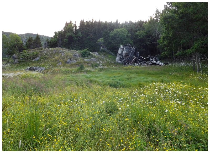
Only spending a few minutes amongst the headstones, the trail then went slightly uphill before opening out into an expansive clearing (the above picture doesn't even show the half of it). As evening was continuing to pass & I could see faint trails in the direction of Bobby's Cove, here I had this boggy meadow that you could frolic in for an afternoon and never need to enter the forest. (As I look at a satellite image of the area I see that it's more than half lake, but with the tall grasses I couldn't tell this at the time.) While I pictured a lovely scamper in golden fields, it was much harder than I imagined. I was worried about getting to Bobby's Cove with time to explore, so as I found thick grasses hindering my movement, I exhausted the calories from dinner with trying to hurry. This land was also cut with meandering creeks, which were good at keeping solid ground beneath foot instead of bog, but the creeks were hidden by grass. I was trying to hurry ahead towards this stately classic Newfoundland home, but I was also trying not to step into a muddy creek. |
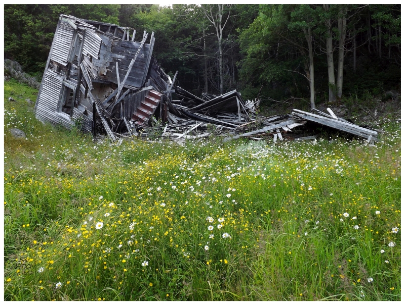
This settlement was never a very large place, no matter what the above house would lead you to believe. First appearing in the census of 1845, there were two families of 10 people living at Bobby's Cove. It wasn't until 1872 that a land grant was given to one Joseph Fosse, but no subsequent construction occurred between 1869 and 1874 (the Newfoundland Encyclopedia speculates that the first families could have been only prospecting the area, since it was located between two profitable, sizable mines at Betts Cove & Tilt Cove). The 1884 census listed 43 people at Bobby's Cove, with cod, herring and capelin fisherman as the professions instead of prospecting. Of these 43 residents, there were 9 children & they were recorded as attending school. The peak population would come in 1911 at 62 people, who in the next decade were recorded as also salmon fishing, logging and running a small sawmill. The Newfoundland Encyclopedia has Bobby's Cove being abandoned sometime between 1945 and 1951. Indian Burying Place would have been struggling as well during this time, so one wonders if the families would have left this area entirely. |
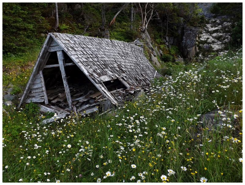
I walked up to the old house, but there obviously wasn't much exploring to do. Regardless, I was happy it was still standing to this extent, since it gave me a window into how substantial at least one of the houses was out here. In only a few short years, that last part is going to get knocked down by wind & snow, leaving even fewer clues unless that staircase somehow sticks out. Instead of diving into the foreboding forest behind the house, there was a little valley leading down to Bobby's Cove (the water feature, not the village), punctuated with a rustic shed top collapsed into a field of daisies. I wanted to quickly see if there were anymore houses around & I figured going down to Bobby's Cove would provide the best vantage point. |
I stepped out onto a very small, rocky beach, craning my neck to see a few piles of clapboard in the next clearing over. There was a beach of tire-sized rocks between me and the main site of Bobby's Cove, but with concerns about time and being out here without a flashlight - after all, I never expected to even try to get to Bobby's Cove - I decided against it. As I looked forward across the bay, there was another cool thing out here in a rock layer that had been uplifted and sheared off. Diagonal lines of iron-rich red rock were sandwiching a shinier grey portion. I think I've seen something like this along highway cuts in New Brunswick, but not out in nature like this in Bobby's Cove. Standing here I had to calm myself down as I wanted to "cash in my chips" and get back to IBP safely before nightfall. The thing was that I knew I had a few minutes at least, so I stood here for a second and thought about the isolation and awesomeness of this. Not only was I in a hard to reach, resettled place along a quiet, empty coast of Newfoundland, but I had found a path to an even more remote, more obscure little cove, even further away from the populated center of Snooks Arm. I was far away from any other human being at this very point in time and the solitude both scared & excited me. |
I turned back and clearly returned to Indian Burying Place in plenty of time. I know it's better to be safe than sorry, but looking at these pictures and the satellite images of Bobby's Cove is killing me. I totally could have popped over there. |
With that extra jaunt to Bobby's Cove, I was now tired and ready to relax for the night. I plodded through town, across the creek and finally up the hill and through the flowers to the rickety deck which led inside. I thought about how lucky I was to make it out here, especially with the added bonus of Bobby's Cove and that interesting Anglican Cemetery. At this moment, in no way was I disappointed with not exploring more of Bobby's Cove. |
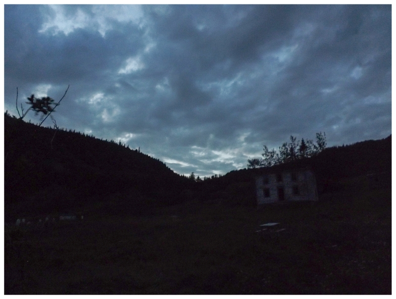
One of the things I was worried about going into this was the point of no return. If I hiked out here & it creeped me out too much to stay out here, I could just turn around and head back out - probably at an unsafe, scurrying speed - but, if I were to settle in, eventually a point would come where there wouldn't be enough daylight to leave. Going into this I pictured this point plenty of times, thinking that I was going to have to verbally calm myself down while sitting out here alone. The weather did me a favour as a spectacular sunset would have had me outside, in my own head, watching the spectacle unfold. Instead, there was nothing great about my cloudy sunset. As I was preoccupied with making my bed and finding lights and candles, I didn't spend much time watching the last light of day disappear. It seemed like it happened quickly as I busied myself. |
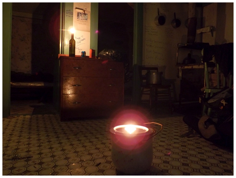
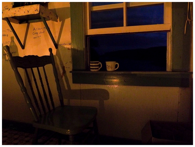
I didn't bring any candles out here myself - only 2 or 3 flashlights - one of which I planned to shine into a jar while I sat up at night. Finding that the cabin had a few candles on the shelf, I placed them around the room and now had interior electricity, but with better ambiance. As I relaxed in my chair that I pulled up to the window to overlook everything, I was extremely appreciative of whoever left these candles behind. |
And with that, I read for a bit and also listened to some music and podcasts. I couldn't handle when Radiohead would come on & needed to change that creepy alien music (I only have The King of Limbs on my phone), but still, there weren't any noises outside. I wondered how this would be if those equine rascals were still around, trying to stick their heads in windows or neighing out in the night. I also temporarily thought about a bear showing up, but generally, it was more peaceful and enjoyable than I ever imagined. Unfortunately the clouds blocked out the moonlight and it quickly grew dark outside, but I was reminded of the special place I was staying whenever I'd have to go out the front door to use the facilities. Standing there with only the lapping shore on this calm night, I slowly scanned the buildings and thought about the isolation I had put myself in. A few kilometers from Snooks Arm and their 100 residents, but nothing south of here until Nippers Harbour; only the people at nearby Nugget Pond Gold Mine and then a wide expanse of empty, uninhabited land between the NL-414 La Scie highway & the NL-415 Nippers Harbour road. With that thought a bit of fear would come, but that was to be ignored for the joy in being in Indian Burying Place. I stayed up a couple of hours doing much of the same, then hit the hay about 2 or 3 hours after sunset. Continue to Part 3... |