The tracts of land that I haven't explored in this province intrigue me. Places like the interior near Maelpaeg Reservoir, large islands like Merasheen and the Horses; as well as long stretches of uninhabited coastline like the eastern side of the Northern Peninsula. The western side of the Northern Peninsula is covered by the NL-430 secondary highway, but almost all of the harsh eastern side is empty and hard to access. You used to have sizable communities like Canada Harbour, Williamsport and Hooping Harbour, but with the resettlement and termination of the ferry to Great Harbour Deep in 2002, all of these places were gone and there was suddenly over 100km (60mi) of coastline inaccessible from Jackson's Arm to Englee. In the north at Englee, you have Canada Bay blocking you from heading south down this coast. (There's a few woods roads near Roddickton, but they don't even manage to go further south than Englee.) |
Coming up from the south, you can turn off the Trans-Canada Highway onto the NL-420 and head up to coastal Jackson's Arm where the highway ends. It's from just before Jackson's Arm that I've always been curious, as a gravel road leaves the highway and heads up towards the Cat Arm Dam. Knowing that dam's require periodic visits, I always thought about bringing my bike up here and cycling this road, but after putting that off for years, this week I'd finally decided to see if it was passable by Jeep instead. Within the first 10 minutes, a significant bridge crossed Rattle Brook and a pretty sweet swimming hole. I didn't know how long this drive would be today so we skipped the swimming, but this adventure was already paying dividends by adding to my mental collection of swimming spots in this province. |
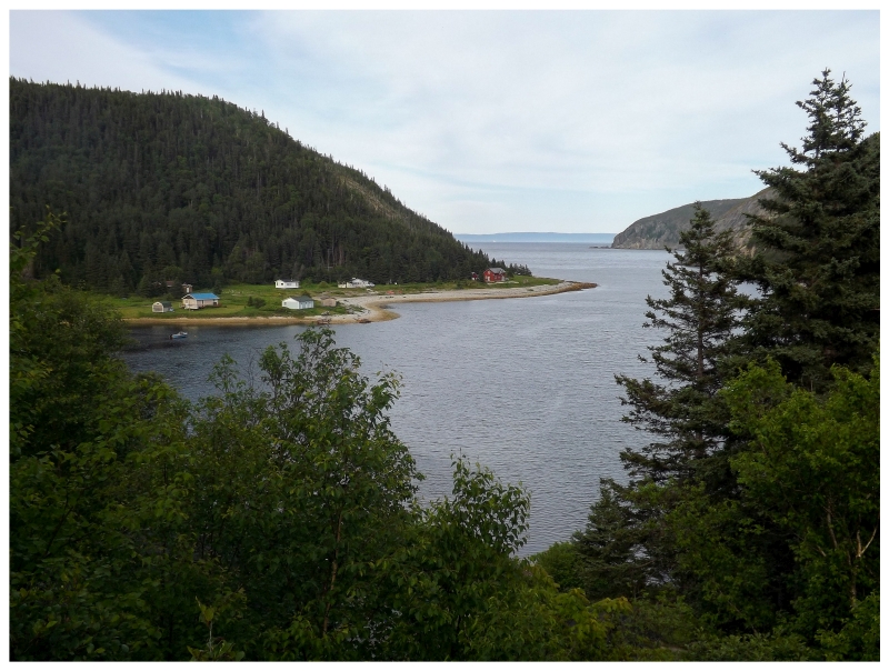
Even if we didn't make it to the dam or gain any great knowledge of this coast today, another reason for doing this was that we'd pass by the resettled community of Coney Arm. This is another of those communities that you'll find on the list of Newfoundland ghost towns, although there wasn't an abandoned house to be seen. Coney Arm has instead turned into a cabin community for those wanting to get away from the hectic pace of life in nearby towns. |
I'm happy enough to check out a former community even if it has turned into one of these cabin communities, but I also figured Coney Arm had to be scenic. I knew the striking country up here at Jackson's Arm, Westport & Wild Cove, and I couldn't see how Coney Arm would be forgettable. The little protected arm of water here didn't disappoint with its grassy plains, waterfalls and surrounding high hills. Coney Arm isn't that far from Corner Brook and I daydreamed about owning a cabin here. (One of the places we drove by was listed on the Remax site for $49,900.) |
Coney Arm was never that large of a community, reporting its population as 56 in 1921. Even before that, a fisheries report from 1872 reported that families were spread out and while the land might've worked for basic agriculture, the families instead attained these things by trading their cod and seal catches with visiting St. John's merchants in the fall and spring. The population numbers would plummet after the 1920s, and the Raisons, Gales, Ralphs and Sacreys would eventually all leave sometime between 1935 and 1954. Many of these families would simply move a bit south to Jackson's Arm - especially the Ralphs, who are listed as a prominent family name in Jackson's Arm by the 1990s. |
I was obviously hoping for a Coney Island Restaurant in Coney Arm, but apparently the town is named for a Coney or Cony, which used to be the name for a rabbit - not the Coney that is a chili, onion and mustard hot dog from Michigan. I'd much rather name my town after a delicious hot dog, but I guess there were only rabbits to be found here. We steadily climbed out of Coney Arm until we curved inland, up a substantial and nerve-racking valley wall, then cruised back down the other side once over the valley's brook. This left us at the gate guarding the hydroelectric plant at Devil Cove on White Bay, with our vehicle at an elevation similar to what we were at back in Coney Arm. |
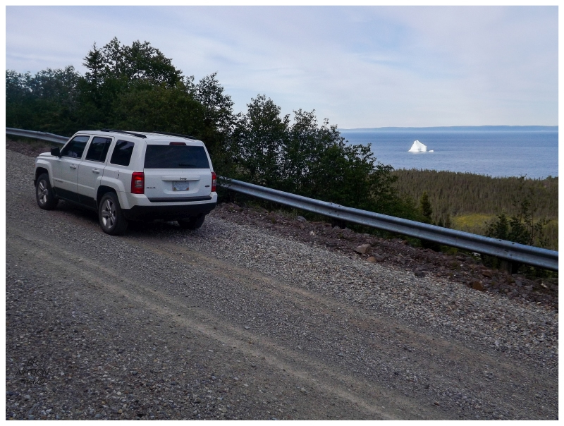
Iceberg along the way.
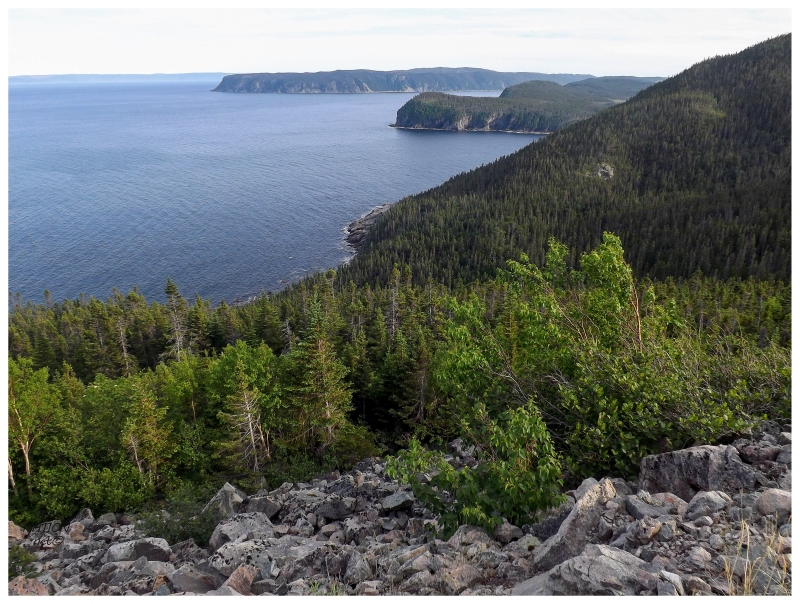
Although this dramatic road was going to let me drive up to 50 kilometres (30mi) past Jackson's Arm, we'd leave the coast and head inland at this Devil Cove hydro facility. From here the road continued to the inland dam, and this drive of 26km (16mi) was all that we were going to see of the Northern Peninsula's eastern coastline. It was time to climb the hill in front of us and head west. |
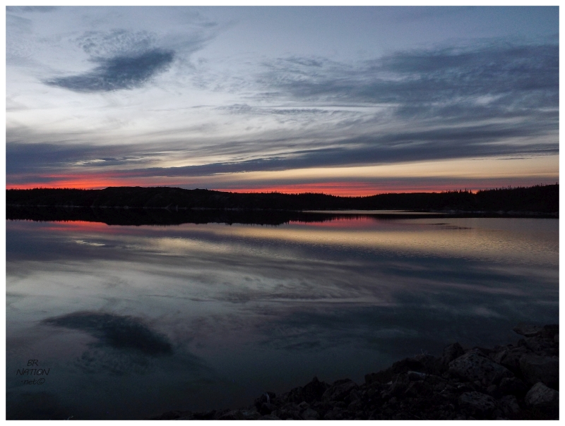
The worry with these woods roads is always whether to accept a camping spot you just passed, or keep driving and gambling that there will be a better place ahead. This is accented with late day worries of daylight and the fact that the drive seems so long when you're weighing stopping any minute. We snaked and climbed from 160m (520ft) outside Devil Cove, quickly up to 400m (1310ft) and the first dam that blocks water from flowing down to White Bay. There was a great parking spot here, along with the long flat dam that we could sit atop with a distant view of the iceberg. |
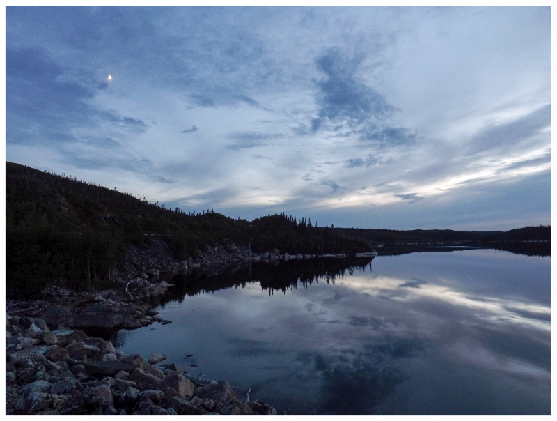
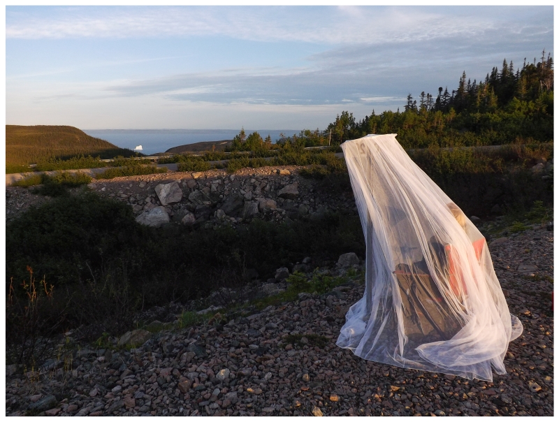
We drove up the road a bit more since I always want to gamble that things could be better, but the land flattened out as we got atop a plateau. There were only views of close by lakes and reservoirs, absent of any good options for parking and setting up the tent. I was dreaming of some ridge that would overlook all of the remote land up here, but we didn't find it in the first 10 minutes so we gave up and went back to the original dam site. After getting everything set up, the last item was a mosquito net that I recently purchased at Canadian Tire and amusedly pictured using in the buggy Newfoundland wilderness. You can see from the picture though that it was pretty silly. It was also silly to drive up here to take in the scenery, then look at it through a mosquito net. |
White Bay and its iceberg would grow dark, but the small reservoir behind us remained illuminated without trees blocking the light or clouds darkening the sky. I thought about how I would miss this type of exploring if I ever moved, as there's nowhere close in Ontario where I could drive and feel like I'm exploring remote areas & expanding my coverage of the province. Trips like this are one thing I love about living here, trips that expand the areas I've seen out here on this Atlantic isle. (Nailhed finds some pretty remote stuff in Michigan, even in the Lower Peninsula, so this feeling wouldn't be totally lost with relocating to Windsor I suppose.) |
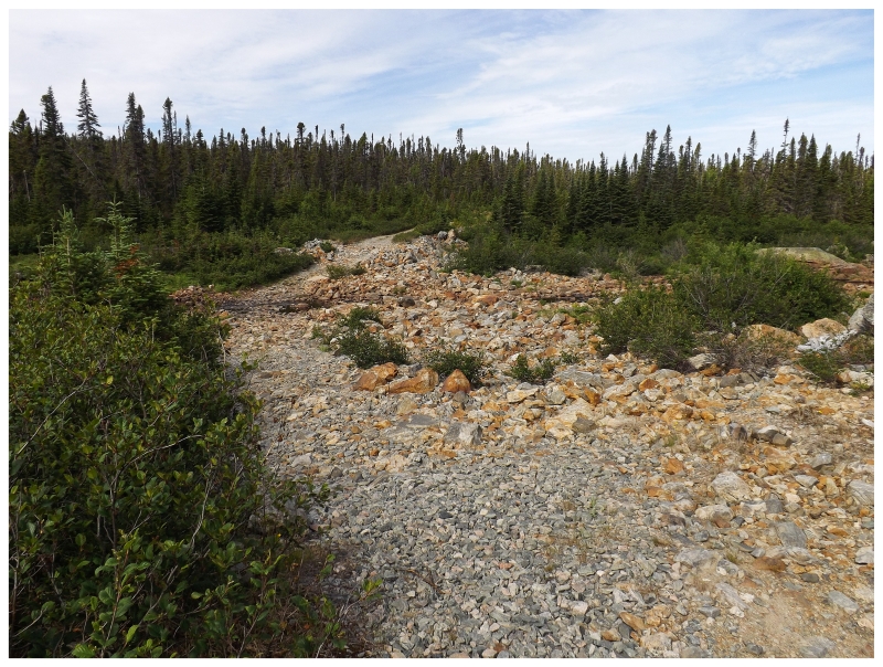
We woke up the next morning and it was already warm outside. Instead of heading back to civilization, it was time to see how far this road went and maybe check out the main dam if we could get there. The drive was fine for about 15km (~9mi) until the alders closed in and the road had standing water of questionable depth and hidden rocks. I didn't think the road went for very much further, so I got out of the car and jogged until I found the above scene. If this was 1km from the highway and promised something useful, maybe I'd try to drive through, but looking at the flowing stream and large rocks, we had reached the end of how far we were going to go on this Cat Arm Road. (I'm such a geography nerd that I sometimes fantasize about driving up here with my bike just to cycle this extra 7km up and into the Northern Peninsula from here. (This road eventually, definitely ends at another small dam in 7km.)) |
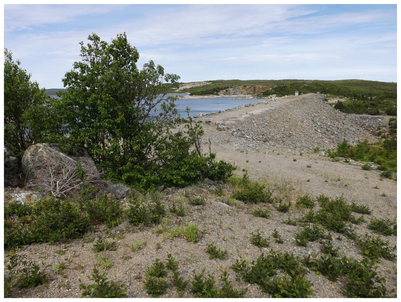
Turning around, we parked the car on the access road which would've let people drive across the main dam at some point, which was now blocked off with a guard rail. We'd walk across. |
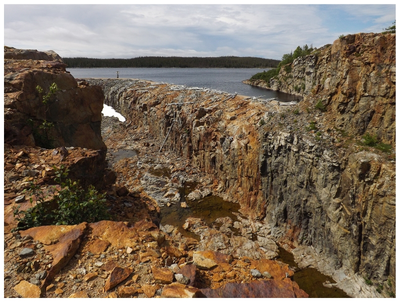
The Cat Arm Dam is made up of 7 smaller dams and this one large dam. By blocking off the Cat Arm River here at this elevation, a reservoir of 53 km²/20 mi² (above) was created and 127MW of energy is produced every year. This project was started in 1982 and came online in 1985. Walking across the dam, I started to question what exactly was up ahead, first thinking it was a breakwall, then some sort of rocky peninsula, then eventually realizing that there was depth and a central hole around these rocky sides. Climbing a nearby hill, it was intimidating enough to look down at the possibility of falling into the water of the reservoir, let alone when I came around the hill and suddenly the fall was further than the water and down into this pit instead. |
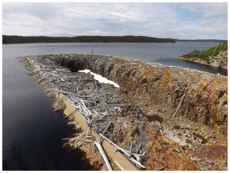
What a unique overflow feature. A friend chirped me around this time and asked if I was going to suddenly take up visiting dams, and while that wasn't the plan, I was happy I put in the effort to stand before this unique scene (for all of her chirping, I was clearly winning here). I know that you can stand near a lot of dams and see water held back by the dam structure, but it's usually an artificial concrete wall, not this seemingly natural rock wall here at Cat Arm. |
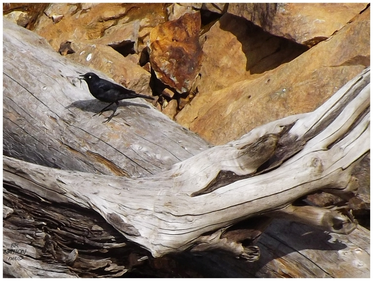
Standing atop the hill and taking in all of the wonder of this view, I noticed a bird below and Shelloo looked puzzled before telling me to take a picture. It turns out this is a Rusty Blackbird, which is a rare bird for the province. Score! A new lifer & in a really obscure place to get it, which I love. (I hadn't even heard one of these birds before.) |
Getting back to the car, we had reached our endpoint and started heading back. There was only one road which branched off of Cat Arm Road & following it north to an unnamed pond, we found another campsite with a crude fire pit surrounded by tall trees and a rock wall. Even with this discovery, we definitely had a much better camping spot up near the first dam last night. |
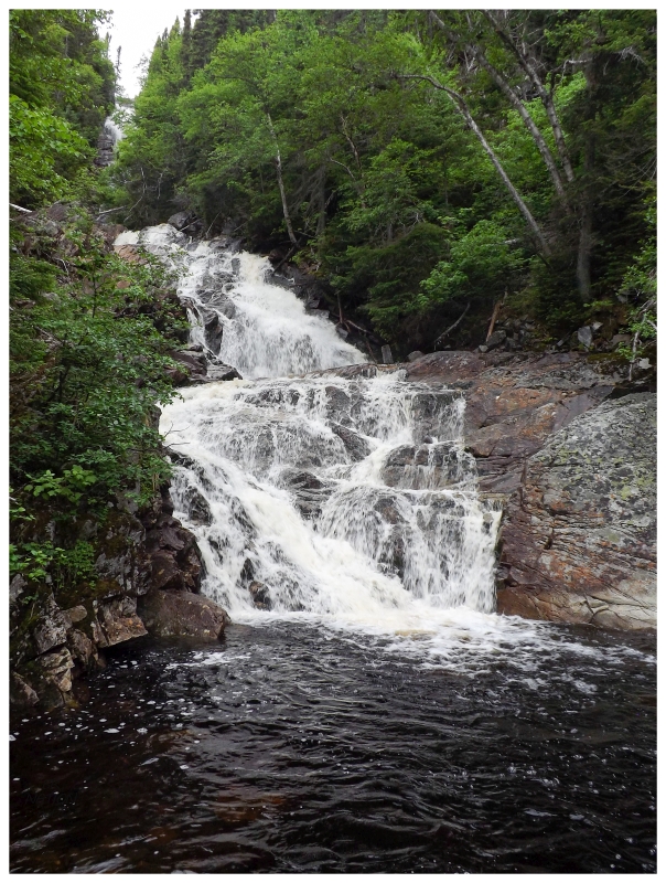
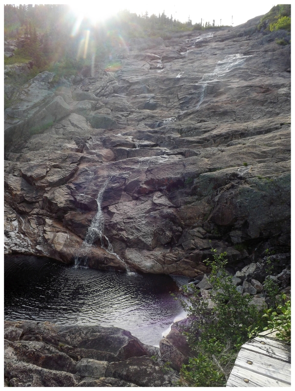
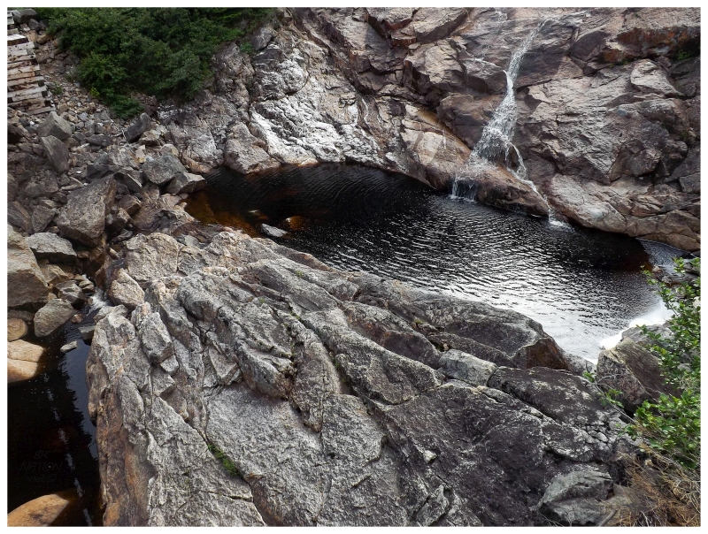
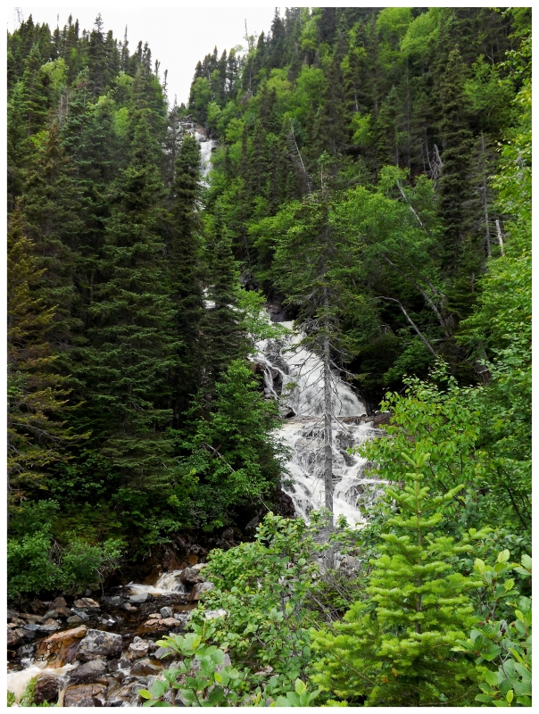
We stopped in the resettled village of Coney Arm again, taking time to pull aside and scramble down to the falls of Eastern Brook and another great swimming hole. The only problem was that it had grown overcast over the last few hours & by the time we got to Coney Arm, the temperature had went from 60°F (16°C) at the dam, down to a brisk 45°F (7°C) here in the village. Yesterday's thoughts of going for a swim on the way back were quickly squashed. |
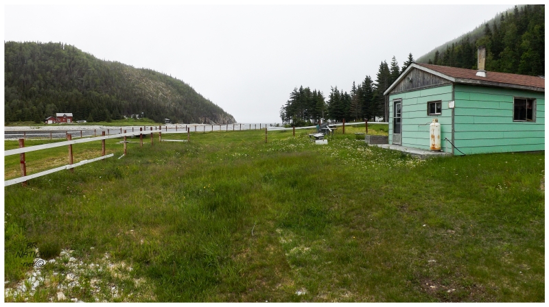
I stopped on the other side of Coney Arm this time, where Cat Arm Road cuts above and there's one road that goes to the south side & one road that goes to the north side (of Coney Arm). Often I won't push my luck with wandering around these cabin communities, but yet again there wasn't anyone outside & very few people around anywhere in the whole village. We pulled down into a grassy meadow and wandered a bit out to sea, appreciating the setting here. |
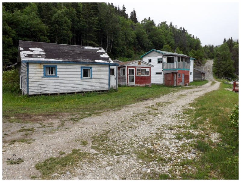
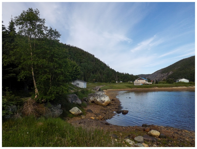
Sometimes these cabin communities seem like the newcomers and descendants have plowed down everything & built all new cabins, but Coney Arm was winning me over by looking like some of the old places survived. I particularly liked this grouping of houses on the south side. The great clapboard place on the left has to be an original from more than a few decades ago. From Coney Arm, it wasn't long until we were back on the NL-420 and headed towards the Trans-Canada Highway, daydreaming about one day coming back for those swimming holes and seeing the last 7km of Cat Arm Road. |