It was time for my annual trip to Southern Labrador and the Northern Peninsula. In addition to Shelloo, our friend Holizko would be tagging along this year, since he had never seen Labrador and was set to leave the province within a few weeks. |
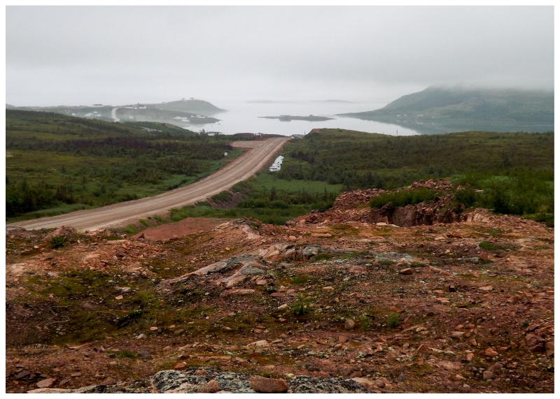
Shelloo and I laughed with resignation at how these trips to Southern Labrador usually always have gorgeous weather, while of course the only time Holizko comes it's mostly overcast, foggy & dreary. For what it's worth Holizko didn't seem to mind, especially as we drove in moody weather over the first 10 kilometres of the real Trans-Labrador Highway that starts after Red Bay. And seeing how this highway should be paved soon, he got to see it while it still had some of its trademark unpaved character and ruggedness. (This is the gravel road I drove 350km each way in the Intrepid to Cartwright a few years ago.) |
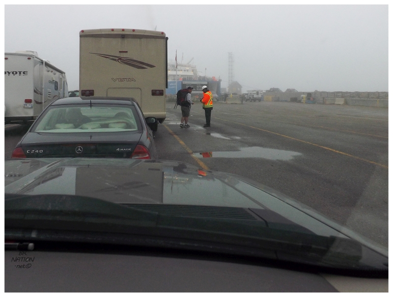
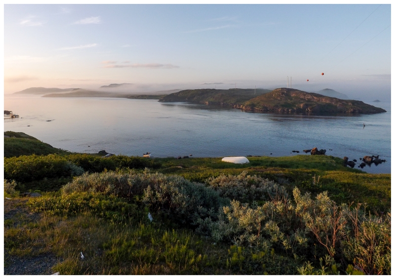
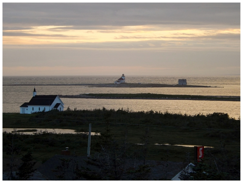
Of course as it usually goes, once we said goodbye to Holizko at the ferry terminal, we had gorgeous weather shortly after and the rest of the way. The above view comes from the village of Quirpon, looking out towards Quirpon Island. |
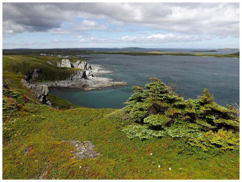
The next day we parked in nearby Hay Cove to hike the Cape Raven Trail. What looks slightly intimidating from the road, I knew the trail couldn't be that bad when the provincial website said it's only a 45 minute hike. |
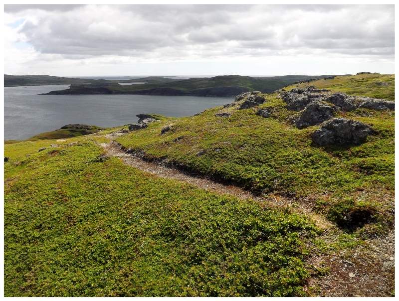
This trail loops around and connects to Spillars Cove, but we were only hiking out to Cape Raven itself. Today wasn't going to be the day to go through the forest into Spillars Cove and then take the road back to Hay Cove. |
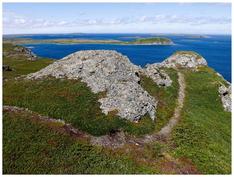
I'm a sucker for the Northern Peninsula, especially up here in the windswept & barren northernmost portions, but I still anyone would find this trail worthwhile. We sat atop some rocks right out at Cape Raven, looking out at all the great islands like Great Sacred Island, Quirpon Island and Little Sacred Island, as well as the grassy knoll beside L'Anse-aux-Meadows. It was peaceful and raw and we only saw one other group of people just as things were wrapping up. We mostly had the Cape Raven Trail to ourselves and it felt like all of the people were left behind in Hay Cove while we lazed about and watched the ocean ripple in the strong winds. |
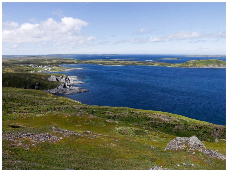
Looking back towards the village of Hay Cove (population: 32). |
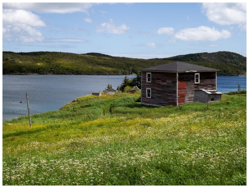
About 5km (3mi) from Hay Cove is Gunners Cove. As we were driving through, I thought about how I count Gunners Cove as a village I've seen here, but I really should drive down one of the side streets to further my claim. Additionally, I thought about this abandoned house I've passed countless times over the years. So a brief stop was made to walk down a short street and photograph the abandoned house of Gunners Cove. I would have liked to take a closer look, but Shelloo was still in the running truck & didn't have the greatest spot to pull off the highway. |
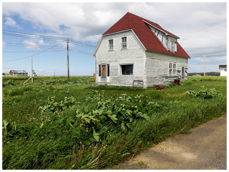
We also went over to Raleigh, where I took a bit more time photographing one of my favourite houses on the island. The manicured lawn, the somewhat-grid of nearby streets, the jerkinhead profile and the enlarged attic giving it a funky shape. All of it comes together here in one of my favourite places. |
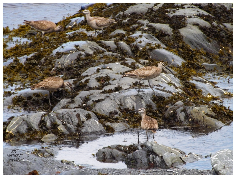
I like Raleigh - maybe on account of how rarely I get to this village that's 5.5 hours from Corner Brook - so I insisted on driving around and savouring being up here. Pulling onto the coastal road on the backside of town, we parked the car and found a contradiction of Whimbrels using their large bills to get at critters in the tidal flats of Ha Ha Bay. Having only seen Whimbrels in Blanc-Sablon Quebec, I was happy to get a record of them on the island. |
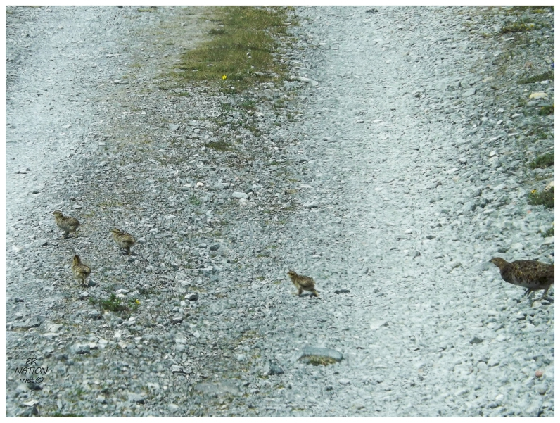
While in Raleigh, I also wanted to drive over to Burnt Cape Ecological Reserve, a place I inexplicably hadn't been before. Driving on to the reserve and worried about pushing uphill on a gravel road, we had to suddenly stop at the sight of this grouse and its chicks crossing the road! |
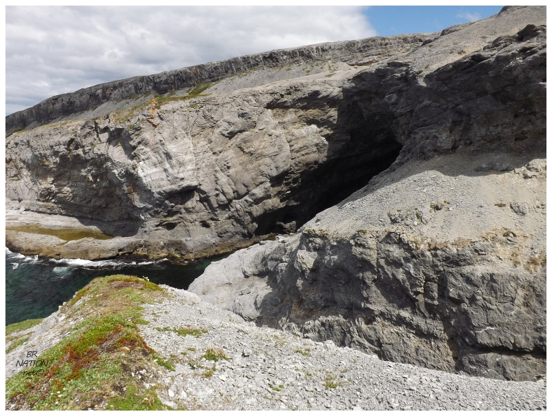
I was especially interested in Burnt Cape because of its mammoth sea cave. Knowing the area isn't that big, I didn't look up exactly where the cave was but thankfully Shelloo had actually been to the cave before. The only thing was that it was a long time ago. So we ended up guessing a bit and wandering about, which led us to the Small Oven sea cave while we were looking for the Big Oven. |
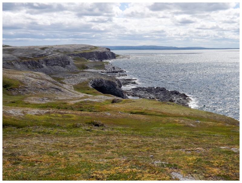
Being at the Small Oven told us the direction of the Big Oven though. En route from the parking lot towards the giant coastal indent we passed little ridges on the ground that were frost polygons, a geomorphologic feature I knew nothing about. Frost polygons are a result of the freeze-thaw cycles that affect the thin layer of soil here. As this slab of land is exposed to the sea in northern Newfoundland, it has one of the shortest growing seasons and harshest climates on the island (resulting in lots of freezing and thawing). This means that frost polygons, usually only found in the arctic, are found here alongside arctic plants. |
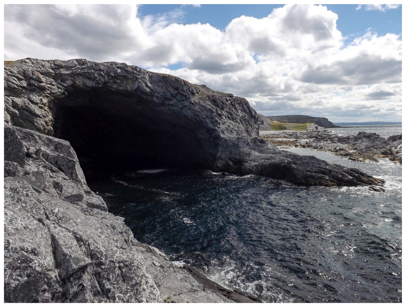
Enough frost polygons though, this cave was what I was talking about! I initially discovered the Big Oven (also known as the Whale Cave) from an online description and only pictured a mere dip in the coast like many "sea caves" around here. It was only with Googling that I realized this was a serious business marine cave. |
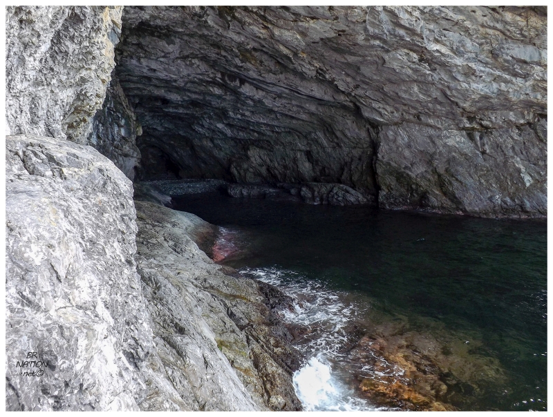
Of course I tried to make my way down and into the cave, but it didn't take long to get to a point where my feet were bigger than the ledge I was standing on while I looked down at the water flowing in and out of the cave. I could have sprung forward and went for it, but I couldn't help but think about how I have no idea how tides and currents work in a sea cave and I did not want to fall into the water here. Maybe another day, where I don't have my hiking boots on, but rather some kicks that grant a few more points to dexterity. |
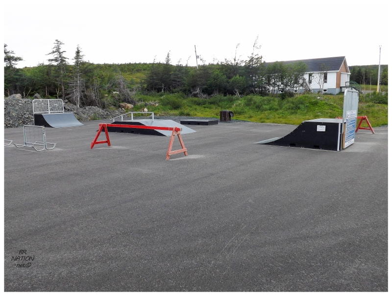
About the only other thing of note was the discovery of the new St. Anthony skatepark, where I begrudgingly put my bike together to do a couple smith grinds in the spitting rain to check it off. This is all while being amused that they installed the skatepark on a sloping lot, which certainly helped when I'd half-ass my double-peg 180s. I'd just wait a minute and then start rolling down the parking lot at a good pace. Regardless of my overall opinion of the park, I'm happy for the teens of St. Anthony. These rural Newfoundland towns are all gravel lots and beat-up, weathered stairs. I can only think of 2, maybe 3 street riding spots in all of St. Anthony - and we're talking about a brick run-up 3 stair as a "street spot" - so this skatepark, while crappy to you & I, will greatly improve their life. |
Late Day in Flower's Cove.
From St. Anthony, there was another day spent at Western Brook Pond, Cow Head and the cabins around St. Paul's. One last funny thing happened as I left Cow Head with a takeout poutine, as it was only once I was on the highway that I realized they forgot both the curds and the gravy. Nothing like some plan, average fries for the ride through Gros Morne and onwards towards home. |