There was no time to waste following my Lake Superior trip. It was already the last long weekend of the year where the weather is usually good enough to plan an overnight camping trip involving a boat. Rewind a couple of months and plans came together one night while chatting with my friend Rosie about the remaining Newfoundland lighthouses I have yet to visit. At the mention of Exploits, she roared with laughter and then exclaimed that two of her friends were spending the summer on Exploits, two friends who we might be able to visit. |
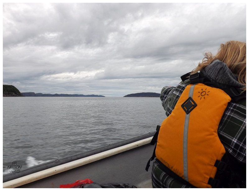
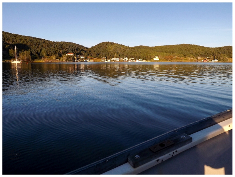
Before I knew it, Shelloo and I were leaving Corner Brook one morning for the 3.5 hour drive to Lewisporte in Central Newfoundland. There we'd meet Dirk & Alli in nearby Little Burnt Bay, a small town situated at the tip of a peninsula which juts up into the Bay of Exploits. It didn't take long to move all of our food & gear from the cars and into the boat. Pushing off, we were motoring through and past various islands in no time. It's about 20 km (12.5 mi) from Little Burnt Bay out to Exploits, and when you add in Dirk's knowledge of the islands and some meanderings, there were also a few added kilometers. |
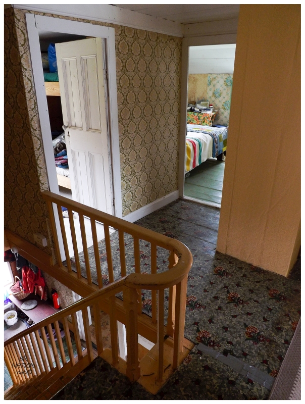
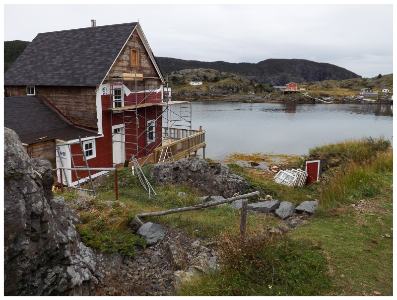
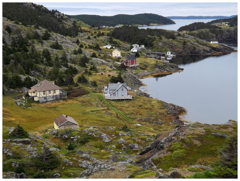
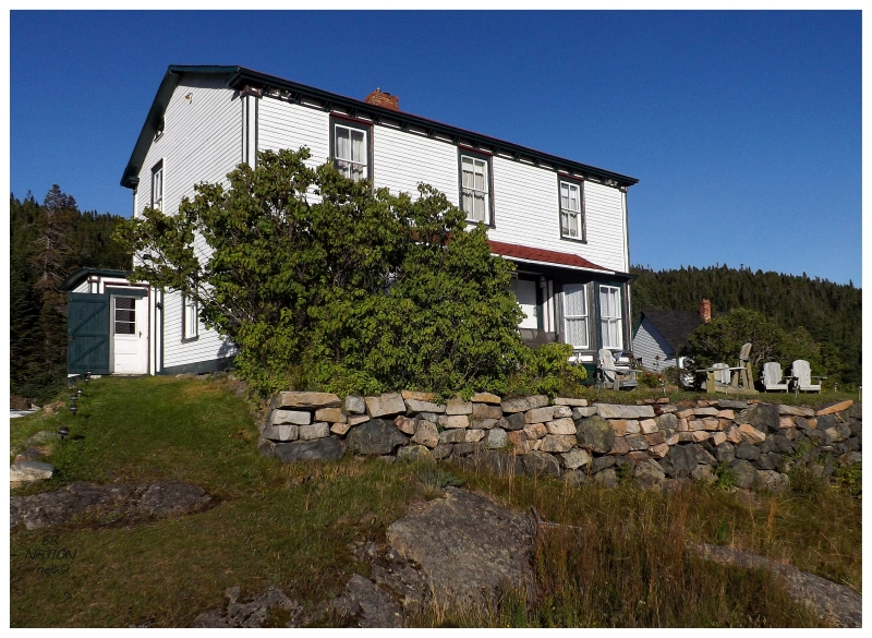
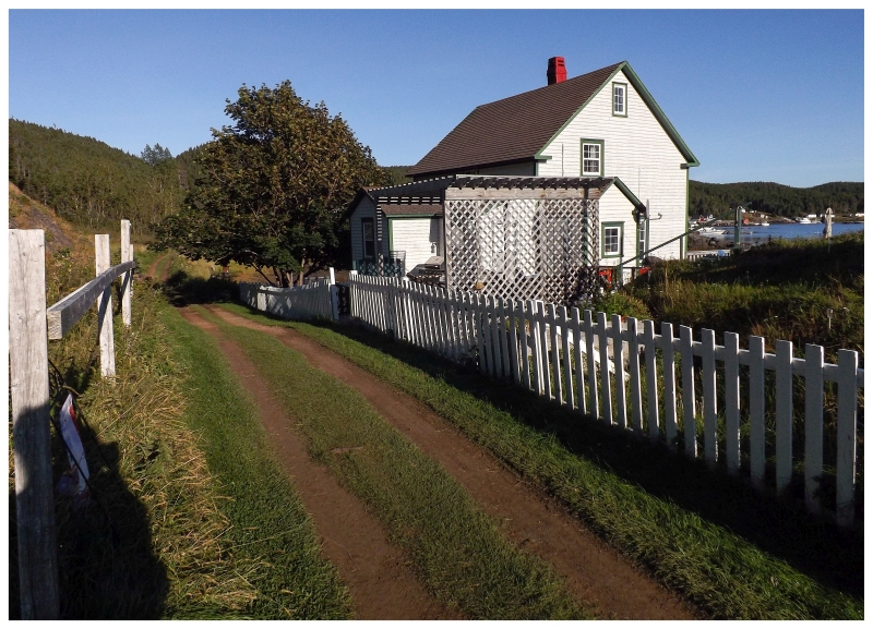
The old community is actually on two separate islands shaped like a shattered dinner plate; the two island slabs separated by a narrow crack. We were pretty close before I even saw any of the houses, but once there, the size and history of this place was apparent from the number of aged and substantial old Newfoundland homes. Pulling up to a dock just about in the middle of it all, we unloaded and checked out the awesome house where Dirk & Alli were spending the summer. This wasn't a new cabin built upon the footprint of an old home, but rather one of the old homes incredibly brought back to life. A photo from 1996 shows a house looking like one that certain people declare too far gone, although that clearly wasn't the case. It was in great shape as I nosed around today. |
After setting up our tents, I took the chance to wander north, down Arnold's Hill and next to Arnold's Cove, over to Exploits Lower Harbour. |
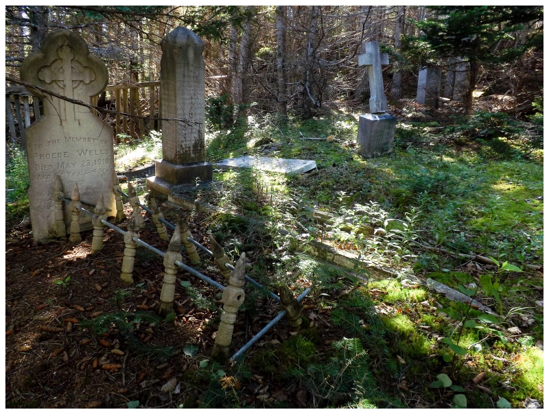
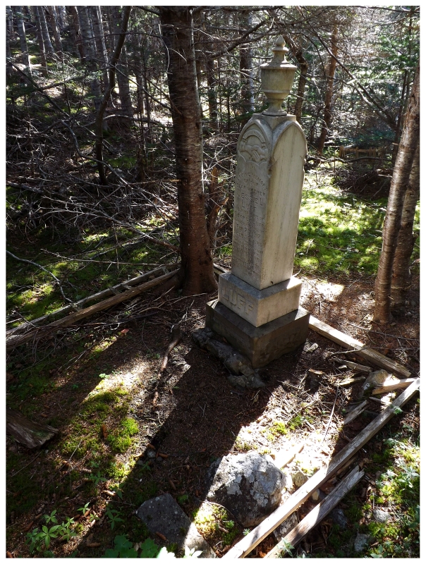
I passed three or four smaller, modern cabins, but there was also three or four, well-maintained old homes. The above one was especially handsome. My friends' house was great & I loved it, but I think it might be second to the above beauty. Continuing down the hill, I didn't know it at the time but there was an infamous headstone here in the Exploits Lower Harbour Cemetery. If you go back two or three centuries, Newfoundland's native people, the Beothuks, were centered along Red Indian Lake and the Exploits River that empties Red Indian Lake into this bay. It's in this area of Newfoundland that skirmishes with white settlers were prevalent. As Beothuks retreated inland to avoid the Europeans, they lost access to the seals and fish they ate to provide nutritional variety from the caribou herds. This hardship, along with their susceptibility to disease, frequent deadly conflicts and possible genocide, killed off many Beothuks and led to the point where there were only a handful of known Beothuks by the 1810s and 1820s. Near the end, a group of Beothuks were suspected of stealing a boat and some tools from one John Peyton Senior. An expedition was led by his son, up the Exploits River and into Red Indian Lake. It's along Red Indian Lake that the Europeans found their boat and about a dozen fleeing Beothuks. The Europeans pursued and were able to detain some of the Beothuks, who were hampered by the deep snow. One of these Beothuks was Demasduit, who was taken captive and brought to Twillingate and then St. John's, but not before Peyton's men killed her husband as he argued for her release. No one from Peyton's party, Peyton himself, or any white man was ever convicted of killing a Beothuk though. Eventually attempts were made to bring Demasduit back to her people, but she died of tuberculosis at Botwood on January 8, 1820. |
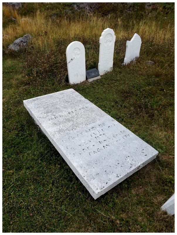
A few years later, the likely last three Beothuk women, including Demasduit's niece Shanawdithit, were starving as they made their way along a river and approached a white settler. The three women were taken into captivity, where Shanawdithit's sister and mother soon died, and then Shanawdithit was shipped off to St. John's. Shanawdithit would survive and was brought here to Exploits Island, where by her given white name of Nancy April, she was a servant in the Peyton household for 5 years. John Peyton's grave is shown in the above picture. By 1828, Newfoundland explorer William Cormack had established his Beothuk Institute and hearing of Shanawdithit living on Exploits, he asked if she could be brought to St. John's to learn about her people and study the woman herself. Shanawdithit went on to produce drawings of customs and Beothuk life, which she explained to Cormack in a mix of Beothuk & English, also teaching Cormack some of the Beothuk language in the process. Unfortunately, even with treatment from St. John's doctors, Shanawdithit would finally succumb to tuberculosis on June 6, 1829. The last of the Beothuks was gone. |
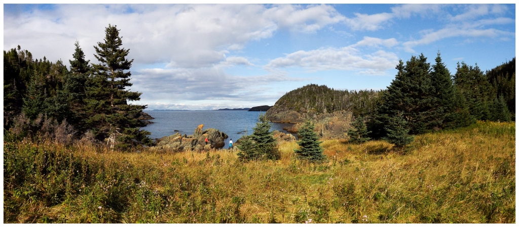
I knew none of this history at the time, so I simply read a few headstones and continued to one of the northernmost indents on Exploits (Winsor Gulch), before then heading uphill to Lookout Hill and Red Flower Hill. Familiar with this part of Newfoundland to an extent, I looked seaward towards the towering cliffs that reminded me of nearby Twillingate (the next point with a lighthouse east of here); and then looked back at the homes in the grassy lowlands, which I found similar to Fortune Harbour (the village located in the next suitable harbour to the west). I appreciated filling in this little gap in my knowledge of the Newfoundland coast. |
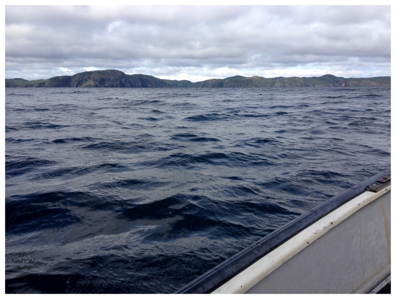
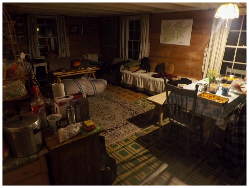
Heading back to the house, it was time for a feed alongside the customary Kraken spiced rum that I bring on Newfoundland adventures. It wasn't a very late night & before I knew it, I was awakened by Dirk's hollering about coffee. Opening the fly to my tent, a headless hand shot inward with a steaming cup of Joe. The hand departed and then lying back on my sleeping bag in the warm sunny breaks, I smiled and figured that I could get used to this. There wasn't time to laze about though as it was time to go catch some cod. The only problem was that the sea was a bit angry, but sizing up the 6 of us heading out in the boat, I decided to rely on someone else saying we needed to turn around before I would have to. We headed north through the main channel, into the unbuffered sea where the last land to the north would be Greenland. The boat slammed up and down over the heavy seas & having been in this situation, I thought about how you just have to endure this to get somewhere calmer sometimes. Although, we were simply headed out to sea, not to a cove or a sheltered side of the island. This was almost immediately after leaving the harbour of Exploits as well, as I looked back and was shocked by how little distance we'd made it from the towering northside cliffs. The waves grew as the people's concerned faces did too, but just like I hoped, someone let Dirk know this was a bit much. We headed back into the tickle between the two islands of Exploits, where emerging from the south end, we found much calmer seas and the ability to fish. |
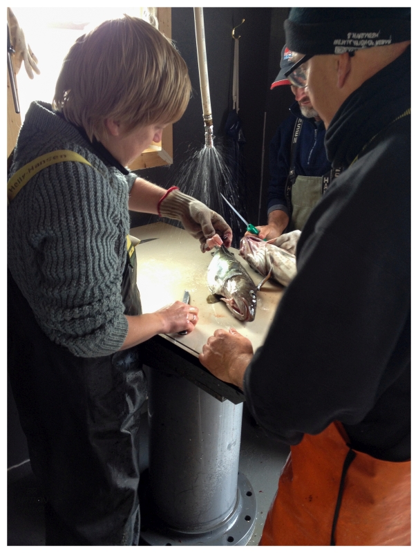
Having caught cod before and not being much of a fisherman anyway, near the end there was some encouragement for me to switch boats and head back early. The two boats were brought close and I hesitated like an unsure cat, with the cold North Atlantic opening up and outboard motors chewing up the water below. As much as I wanted to make the hop across, my hesitation made them change their minds and abandon the plan. There would be no jumping over open, cold, dark North Atlantic waters for me. Returning to Exploits eventually, we headed over to this hilarious fellow's stage, where there was cold beer and a perfect cod cleaning station. Rosie was all over the opportunity to gain more experience filleting cod. |
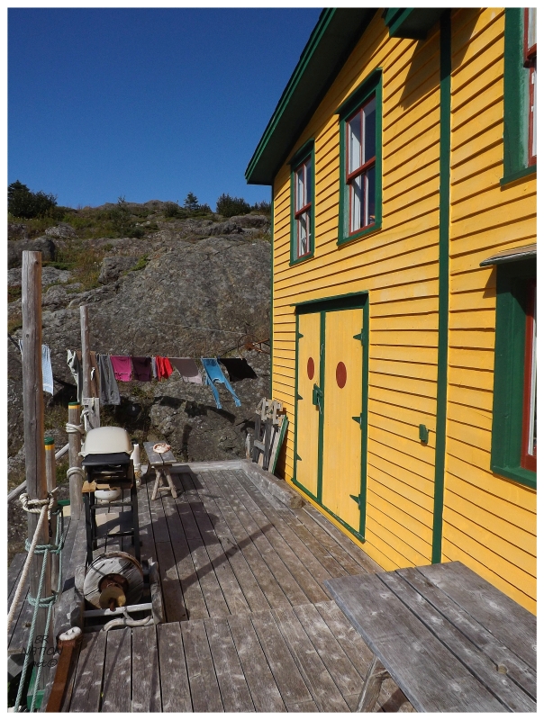
Dropping off the fish, the sun had come out and their yellow house was shining. Maybe I like this one more than the grey/red one? It's really a question where there's no wrong answer. |
The sun was great for photographing houses and experiencing Exploits, but of course it had to come out as we were heading inland into the thick forest on a hike to an overgrown cemetery. Then again, the Exploits Anglican Cemetery was so overgrown that it was hard to convey the size and number of headstones anyway. |
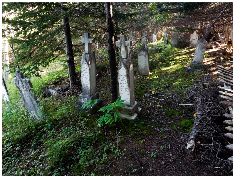
While the Lower Harbour Cemetery was impressive because of the very old headstones, this Anglican Cemetery was impressive because of the apparent wealth and social status that brought about these sizable monoliths. |
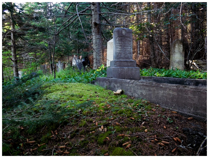
I've probably been to a dozen cemeteries on the northeastern coast of Newfoundland, but usually cemeteries from small communities and/or communities of modest wealth. I certainly haven't seen many with such elaborate headstones (although I'm sure they exist in Twillingate, Fogo, etc.). |
Without fences or brush clearing, the graves seemed to be in a random pattern where we explored for a half hour and kept finding more and more in each direction. I struggled to think of a cemetery more neat that I'd seen on the island. |
In addition to the Anglican and United Cemeteries, our path continued to a cove on the island's northeast side where there used to be a very small village (more of a hamlet than anything). This was Gull Island Cove, at one time home to about five houses. While my friends oooed and aahed at the cove with its gnarly rocks and wavy sea, I poked about in the grasses for any fallen down walls, old stoves or cellars. I found a couple of walls but they looked quite small, maybe belonging to old sheds instead of old homes. Yet again I wished I'd taken the time to learn the basic garden plants that you find in these old communities, like rhubarb and such. Without knowing that, I went down to the cove to climb the tallest rock there. |

On the way back, we barely made it up the hill out of Great Gull Cove before hooking a right into the forest. There was a bit of a trail here, but there were also times where things broke down into us fighting through trees. So much so, that it reminded me of solo bushwhacking adventures at South Head and Indian Burying Place. Eventually we'd get on top of some of that easily-traversed Newfoundland landscape, where there's only small shrubs, soft grasses and exposed rock for you to walk upon. Curving around the headland to Nanny's Hole Head, we were all enjoying the scenery even as the skies started to spit and the winds picked up. Cracking our Keith's we'd saved for this point in the hike, it was almost as if the Earth knew we needed to see this scenery in sunlight. Clouds moved off and High Gull Island glimmered alongside the ocean far below. Almost comically, there were also whales rounding this side of Exploits, with Mother Nature now just being a showoff. (As I've seen whales before, I was instead enamored with seeing remote Gull Island to the east of La Scie far off in the distance, haha.) |
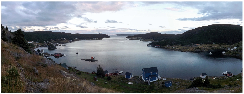
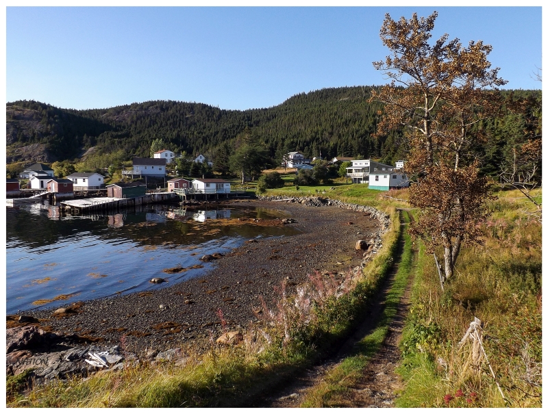
I'm always amazed at how the days slip away in resettled places like Exploits, Peckford Island and the Grey Islands. Following a bit of cod fishing and a short hike, it wasn't very long before the day’s light started to fade after our return to the house. I took the opportunity to climb a small hill behind us and look out over the main area of Exploits Upper Harbour. Even without a bridge to walk over to the other side, there was still so much I hadn't explored out here. |
Looking back down at the house, our tents (out on the point) and Exploits Lower Harbour. The old schoolhouse, soon to be an artist retreat, is in the foreground. |
In addition to the cod, we also picked some chanterelle mushrooms along the way to Gull Island Cove. And although we were also having some non-Exploits corn, I still loved how two-thirds of tonight's meal came from the land here. |
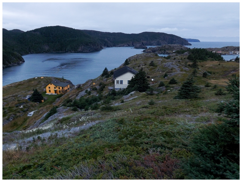
The next morning meant another cup of tent coffee, then a trip inside the house to check the problematic weather report that was threatening to cut our trip short. This morning and afternoon featured great conditions though since the weather system was still a ways off. We headed across the harbour to the other main Exploits Island, to hike to a point of interest that I'll cover in the next update. Returning from our trip and again crossing the harbour, everyone wanted to get back and started on dinner, but I was very grateful that Dirk dropped me off on the south side of our Exploits island, allowing me to walk back through the main collection of houses. This would help me see just a bit more, now that our time was going to be cut short. |
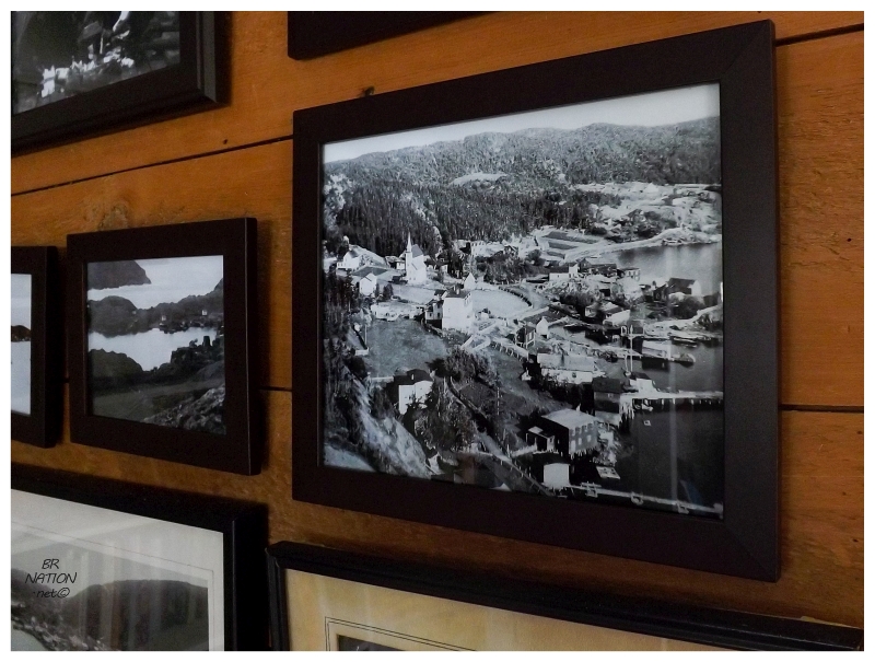
One of the main areas of Exploits is shown in an undated picture. This is a
southern view of the same area in the previous picture.
Exploits was first recorded in the census of 1836 with a population of 220, although it is known that merchant George Luff kept boats and supplies here as early as 1815. In addition, there is an account of a captain named Scott who built a fort here in 1762, although he was soon after killed by native peoples. The census of 1845 reported that there were 326 people at Exploits, with the growing and substantial community being home to 62 fishing ships and 4 inshore seal ships. In addition, sealing ships returning from the fall harvest would overwinter at Exploits to position themselves closer to the pack ice and seals in the spring. This growing population also brought about a school and a church, with the church being built in Lower Harbour in 1820 and lasting for 150 years (although it survived as a barn in its later years). |
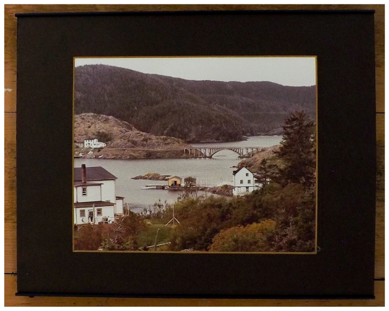
Photo on the wall in the house. Unsure of the original photographer, bridge looks concrete, so likely post-1945.
The population continued to grow with each coming census. 474 by the mid-1850s, 535 in 1869 and 623 in 1874. You had 92 fishing vessels, 52 fishing stages, 9 seal hunting ships and 2 merchants taking part in selling fish to the markets of Spain & Portugal. There was even a drawbridge constructed between the two islands (1877), then a wooden bridge (1899) and finally a concrete bridge (1945); all of these bridges connecting the two slabs at their narrowest point, a distance of about 50 feet and located almost right where we were camping. |
The Devon House. Over 150 years old, this house was a B&B into the 2000s.
A few dead websites still listed it as a B&B, something I discovered while trying to get out to Exploits in the past.
By the turn of the century, Exploits was also showing its value in terms of proximity to the Labrador fishery. Seven ships with seventy men (plus some women and children) would head up to the Labrador fishery, catching nearly 100,000 kg of fish between all seven ships. There was also a lobster packing operation, an inshore fishery catching about 26,000 kg of codfish, and Exploits timber being used to construct numerous seafaring vessels (7 schooners and 13 fishing boats). The Great Depression would coincide with the decline of Exploits. As times grew tough, the appeal of relocating to better job opportunities caused many people to leave. And by the end of WWII, the population was down to 289, then 217 by 1951 and finally 135 by 1961. The United Church had its last service in 1969, captured in a picture on Memorial University of Newfoundland's resettlement page. |
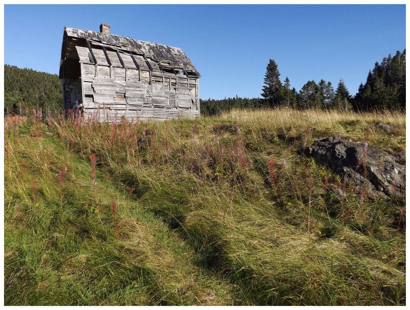
Exploits Island was also a place of refuge for some draft dodgers, likely caused by a surplus of empty houses and isolation from anyone trying to find them. It's here that a few Americans looking to get away and disappear during the Vietnam War, bought up houses and lived quietly while they were supposed to be in Southeast Asia. There was a house in total ruin that Dirk pointed out as one of the dodger houses, but then he didn't drop me far enough down the harbour to check it out. As much as I was kicking myself for not checking out the actual dodger house, this other abandoned house would have to do. |
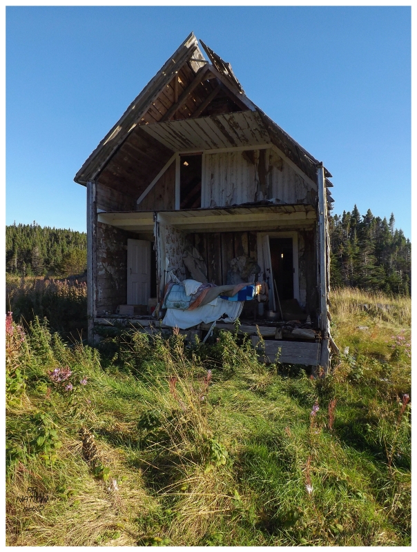
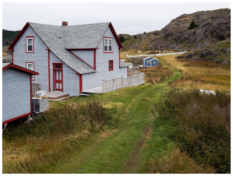
These resettled places from the 1960s and 1970s don't have that many houses still standing nowadays, and in the case of Exploits, this abandoned house was only 1 of 4 that I noticed. In the case of Exploits, it's a matter of having such a great original housing stock due to its importance and size, plus the fact that Exploits has continued on as a strong summer community (not to mention, the 2-3 holdout persons who never left after resettlement). Looking around today, there were some lovingly restored and maintained old homes, but there were also plenty of modern, modest cabins; as well as some outport, pretty-much-a-house-sized cabins. |
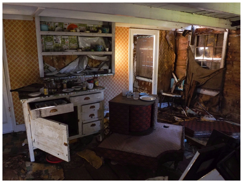
Even though this place was dollhouse'd, I had to climb inside. There was some amazing old wood furniture, along with the centrepiece to an old school couch (the burgundy thing in the middle). My friend Sarah has one of these awesome couches, where the middle spins around to reveal a little shelf inside. The odd time I'm at her house I'm usually so enamored with it, that I put my water on it while wishing I had a 40 to store on it instead. You could put a 40 in there, spin it closed, then go about grabbing some Intense Pickle Doritos, invite someone over, sit down and put on something romantic like the Bruins game, then slyly spin that bad boy to reveal a cold Olde English? That would be livin’ like James Bond or Puff Daddy b’y! |
Like I said, there weren't many abandoned houses here and in fact, most of the houses in the main area were so well-maintained that walking through them felt like walking through Newfoundland long ago. It's not as if I personally know what it was like to walk in an outport 75 years ago, but so many pictures and videos involve worn cart tracks and well-maintained fences, featuring kids running and older folks rumbling along. I half expected some old feller to turn around the next corner, muscling along an old wooden wheelbarrow. |
Following my walk, it was time to quickly take down the tent. Tropical storm remnants were coming & sadly they were going to cut our trip short. There was a chance we could make it back to the Island of Newfoundland tomorrow morning, but we all agreed to play it safe instead of missing work while stuck on Exploits Island for days (although that certainly wouldn't be the worst thing). |
Exploits is just visible as the few white dots near the centre-left of the above coastline.
Even though we weren't going to be out here for that long anyway, this was making it feel even shorter. It was a cool September evening as we motored along with the sunset and passing golden isles. It was the type of scene that brought about reflection anyway, even if we weren't leaving such a special place. And while I would have loved to have explored more of Exploits' rich history, I also was so happy to have finally seen this place. Arriving back in Little Burnt Bay, we all expressed our gratitude while hurrying to offload our belongings. Soon enough, Dirk & Alli motored away with the sun already below the tree line and maybe some darkness ahead of them when they neared Exploits. |

Since we all had our supplies for another night of camping, it was a pretty easy decision to find somewhere to tuck away. And as if we were going to go our separate ways to each end of Newfoundland by leaving at 7 p.m. anyway. I might've went for splurging on one of the expensive motels of Lewisporte if that's what the group wanted, but I was happy that we were all prepared and willing to camp. In addition, we got a recommendation for a great little pulloff near Little Burnt Bay, the location turning my frugal happiness into camping joy with this fine spot. |
Once again I had returned to the easily-accessible coastline of Central Newfoundland, looking out on the Bay of Exploits and knowing Exploits Island was somewhere out there to the north. At least now I knew I had been out there and I was content. Click here to read about the point of interest we hiked to on Exploits. |