I'd known about the Lomond Sinkhole for a handful of years now, but it seemed like other people were visiting it much more often of late. After one failed attempt in 2015 stopped our truck on a rutted old track, it was now time to give it another attempt. |
Sure enough, nowadays it's a matter of taking a well-marked road and a couple of turns, while travelling 14km (8.5mi) down forest access roads. The roads were in really good shape and there were even signs at the turns indicating the direction of the sinkhole. |
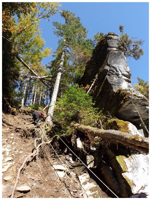
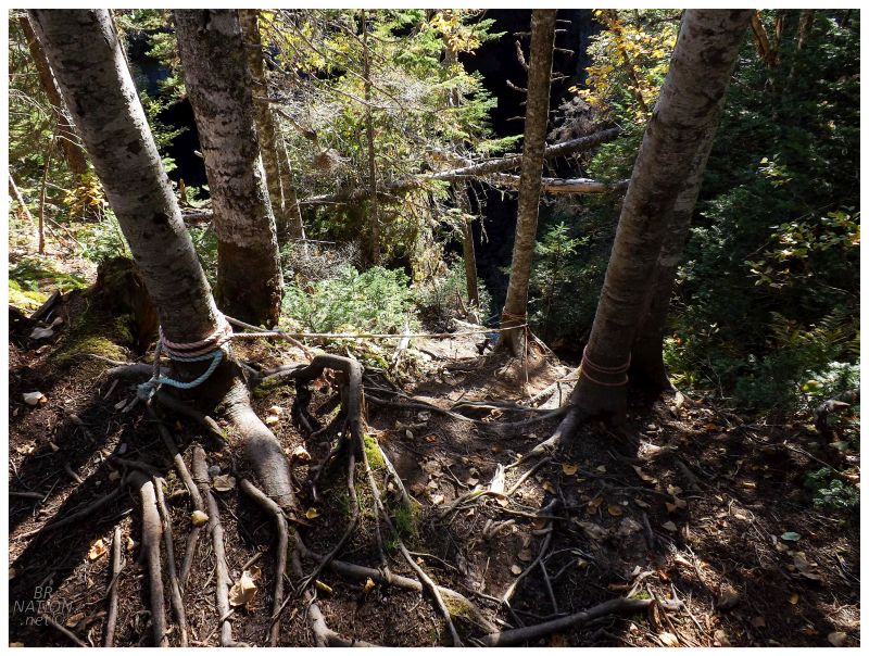
Coming to one last sign, the arrow pointed towards a road that was meant for ATVs. We were really close though and after walking all of 2km (1.25mi), the road split and there up ahead was a signboard telling the history of the sinkhole. To our right was a series of ropes leading down, which we noticed because of a couple of middle-aged folks slowly muscling their way up. Once they were up, it was time to go down into the 100x150-foot pit. |
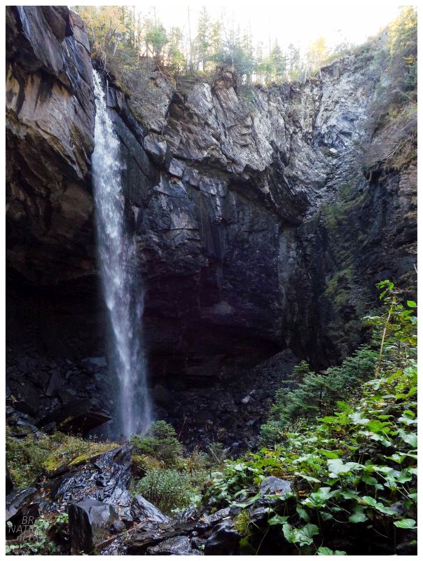
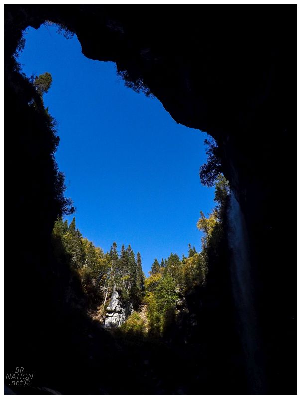
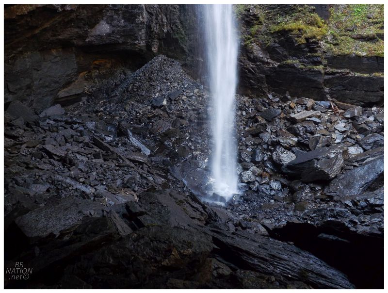
The Lomond Sinkhole formed by bog-sourced water attacking a large underground area composed of limestone, where the acidic water washed away enough of the rock that the slate roof eventually collapsed down into the newly-formed cavity. A sinkhole this large would be worthwhile to check out anyway, but the Lomond Sinkhole is made extra special by a waterfall that spills over the surrounding countryside. |
As for human activities, this area was first logged in 1957 by Nicholas Brake, under contract to Bowaters Limited. Brake had a small sawmill very close to the modern-day signboard, allowing him to throw scraps, sawdust and wood slabs down the hill and into the hole. Corner Brook Pulp & Paper would come along in 1978 and start their first pre-commercial thinning activities in the area around the sinkhole. They again logged the area in 2010 - which is probably why some of the roads are so good - this time leaving a 50m buffer around the sinkhole. |
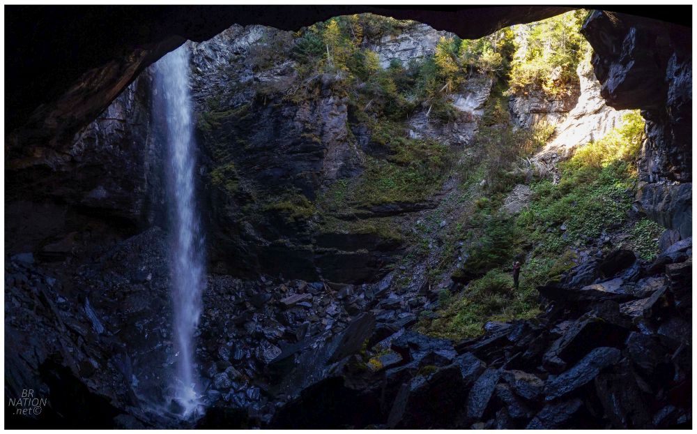
Just as we were getting down near the waterfall, another family was leaving and we'd have this whole experience to ourselves. The waterfall wasn't crashing on the rocks in a booming display, but the walls were high enough that I felt very small and almost claustrophobic while standing here. This was really cool and unlike anywhere else I'd ever been. The whole experience was certainly worth the effort of following some woods roads and hiking a couple of kilometers. |
If you want to visit the sinkhole, you need to turn on to Whitewash Road, immediately north of Bonne Bay Pond @ 49.3655, -57.5821. Drive for 6km, then make a right, follow the road for 3km, then another right, then drive for 5km and park at 49.3611, -57.6893. Follow the signs up the trail, or continue to follow your GPS to 49.3641, -57.7163. |
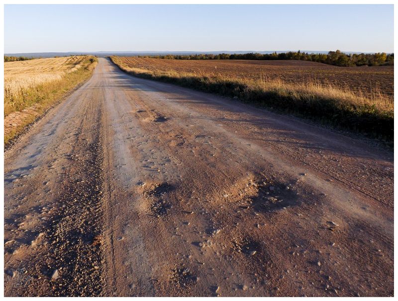
Being out here, y'know all of 1 hour away from Corner Brook, I was excited about camping tonight. This was also helped by the forecasted unseasonal balmy night time temperatures, plus the grasses and leaves already turning gold & brown (which I think is the prettiest time of year in Newfoundland). Hanging a left on the NL-422 towards Cormack, I pulled onto a woods road I had in mind because of all the rolling hills of farmland. My heart was loving this land that looked like home (or at least the area up past Dutton/West Lorne - about 1.5 hours from Windsor). |

We'd end up driving and driving some more on this Wights River Road, since there weren't any great farmland clearings & then the land turned to clearcut, where there also weren't any nice little spots to tuck away and camp for the night. Google tells me we only drove 11km (~7mi) on the woods road, but after the clearcut, this was more of a typical Newfoundland woods road. It was a matter of weighing going back or pushing just a bit further on the rough passage, in hopes of finding somewhere exciting to camp. This was supposed to be fun & exploratory, and it was going to be neither of those things if we ended up camping in a moist bog only 1.2 hours from Corner Brook. Thankfully as we neared darkness and the peak of our worry, there was a promising little road off to our left. I was ready to settle for anything and simply saw it as a good enough place to get off the woods road and away from any traffic, but running up the hill to scope out the scene before driving my car up, I found a fantastic cleared plateau. This'll do! |

And so we setup the tent, cooked some dinner and then lazed about in the darkness. There wasn't any time to explore, but I was enjoying camping in a new area of the province, adding coverage to the map of wild camps on the island. We were only about 20km north of Deer Lake Airport and we initially thought this would mean plenty of air traffic, but the sea of planes in Newfoundland's night sky comes from Transatlantic flights which travel over Port-Aux-Basques or Burgeo. We both thought there might be a flight coming in from Goose Bay directly to Deer Lake, but it never flew overhead and therefore the skies were pretty quiet. |
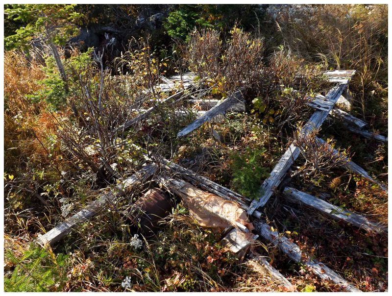
I was also geeked about the ruins of a small shack up on this hill. Shelloo wasn't impressed as we needed to get going in the morning, so while she broke camp, I was over in these weeds photographing paint cans and fallen pieces of wall. |

This was another place where I wondered about who owned this cabin, what good times happened up here, how long did the cabin stand, etc.. Give me a place of real historic importance and I don't think about those things. Give me a random shack or an elementary school and my brain is working overtime. |
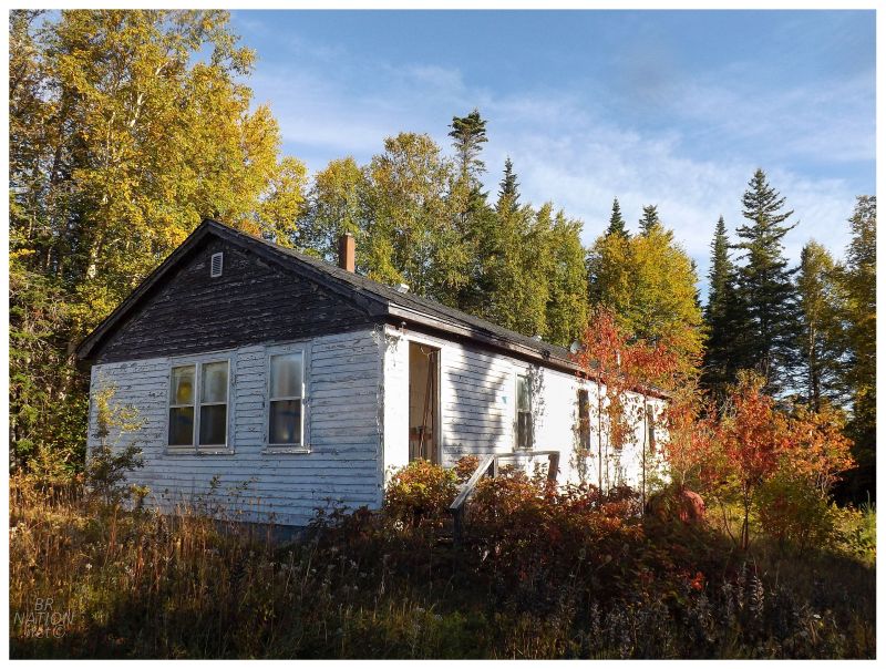
On the way home I spotted this abandoned house and I'll include it so I'm not only bringing you pictures of a pile of lumber that was once a shack 30 years ago. |
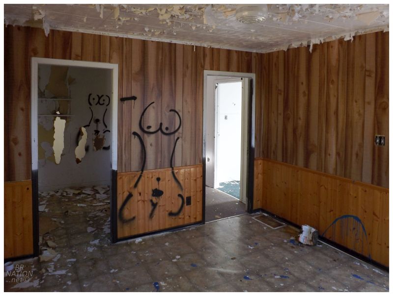
Although sorry, but just about the only interesting thing inside was these lady outlines that were everywhere, haha. |