
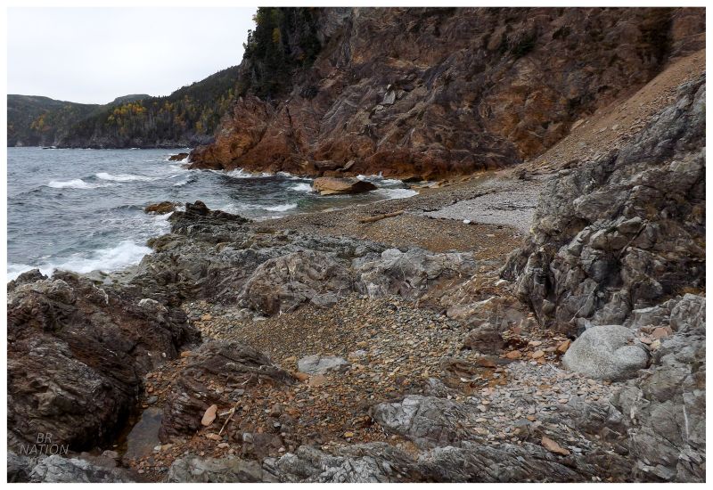
Shoe Cove
About two hours away from Corner Brook lies one of my favourite areas in the province, the peninsula of Baie Verte. And if you head east on the Baie Verte Peninsula for another 45 minutes, you'll find yourself in Shoe Cove. On a previous trip to Shoe Cove, I was intrigued by the short trail up and over a steep hill to the resettled site of Shoe Cove Bight. The only problem was that the trail starts out with staircase after staircase, climbing up the sharp cliffs that hem in Shoe Cove. We only made it to the first overlook before I left my friend behind while trying to quickly run to Shoe Cove Bight. Unfortunately, things were taking too long & I would have to come back some day. |
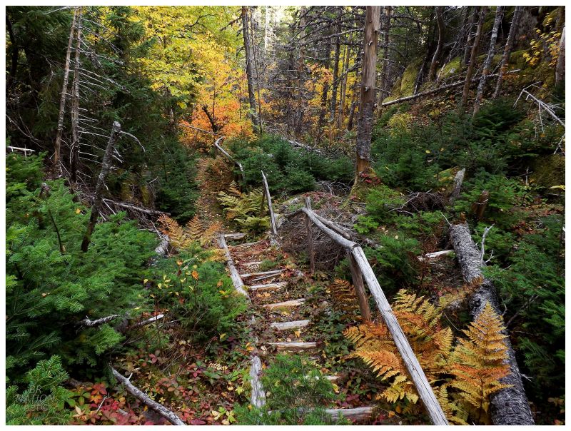
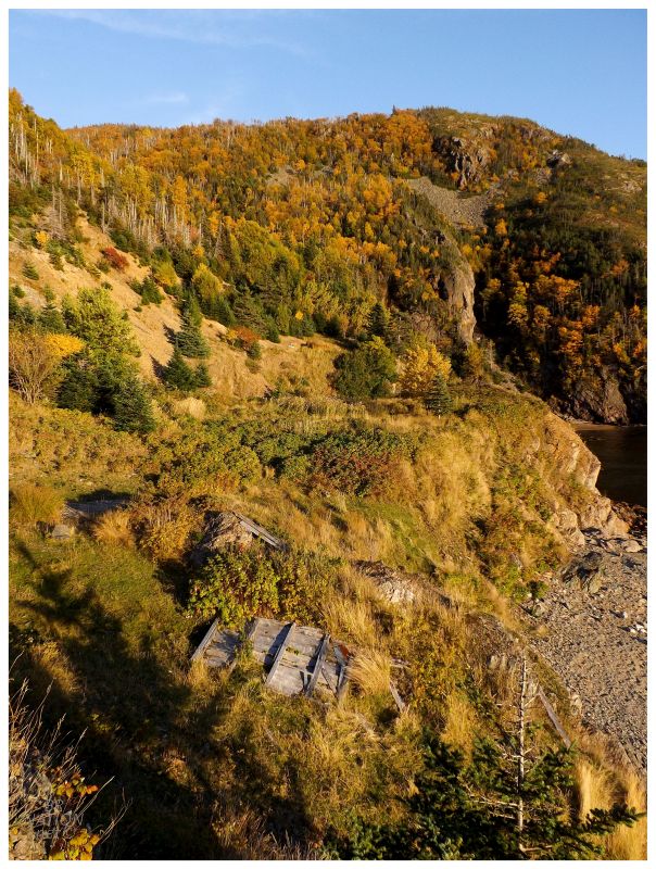
Today would be that day as I already had my sleeping bag, tent, food & water packed into my 70L pack, ready to jump out of my vehicle and head up the hill. I made short work of the staircases up the hill & happily found the worn, backside stairs leading down to Shoe Cove Bight. Judging by the overgrown stairs, most people come here simply to hike up to the overlook of Shoe Cove, while less people continue on to Shoe Cove Bight. |
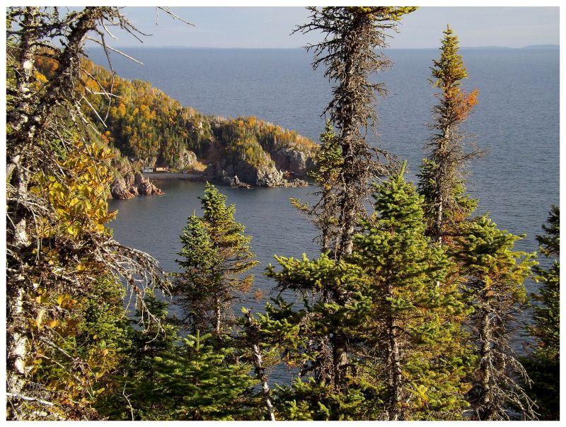
Walking out to a second overlook platform, I could already see a few cabins and a little indent in the coastline up ahead. Continuing along, I knew this place wasn't one of those resettled places with 20 or 30 abandoned homes, but I love the landscape of this area & the views were already paying dividends. Adding in expected peacefulness and a grassy cove to put up a tent for the night by myself? I stood excited for this, even if it wasn't the craziest resettled place. |
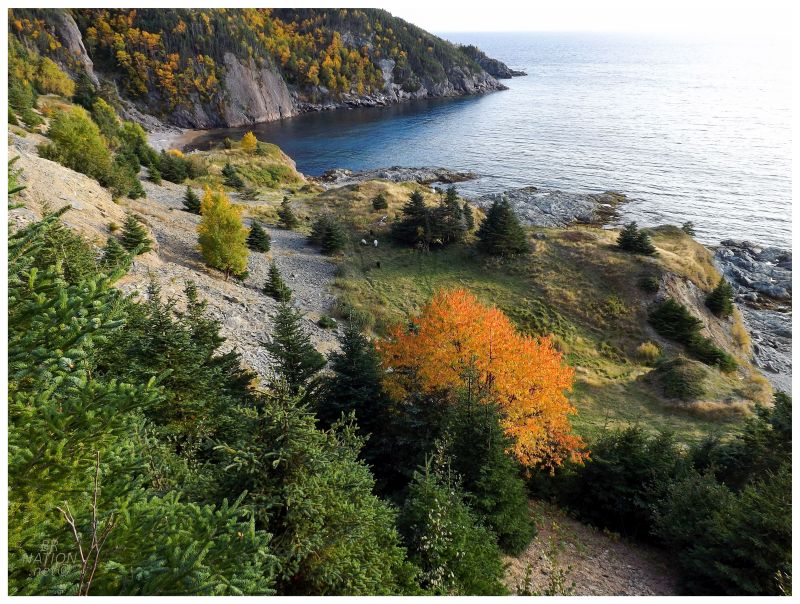
Those cabins concerned me, but also confused me, since I didn't think there were supposed to be any in Shoe Cove Bight. Once I was getting close & I was at the last of the staircases, I looked down at actual Shoe Cove Bight to find zero cabins and the only residents a small herd of grazing sheep. Looking out at the coastline, those cabins must've been tucked into that miniscule cove around the point of land out there. By now it was turning into a fantastic evening, with the late day sun gorgeously colouring the pair of orange-leaved trees here in the Bight. I happily trotted downward, ecstatic with how well this was all working out. |
The sheep had no interest in me & were already to the south as I stepped off the last set of stairs. Making my way over to the middle of town, I threw my pack down beneath a golden birch tree. Newly unencumbered, I took a few steps north and found what looked like pretty nice beach below. It seemed like a pretty great place for dinner & a fire later. |
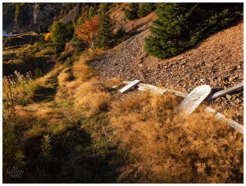
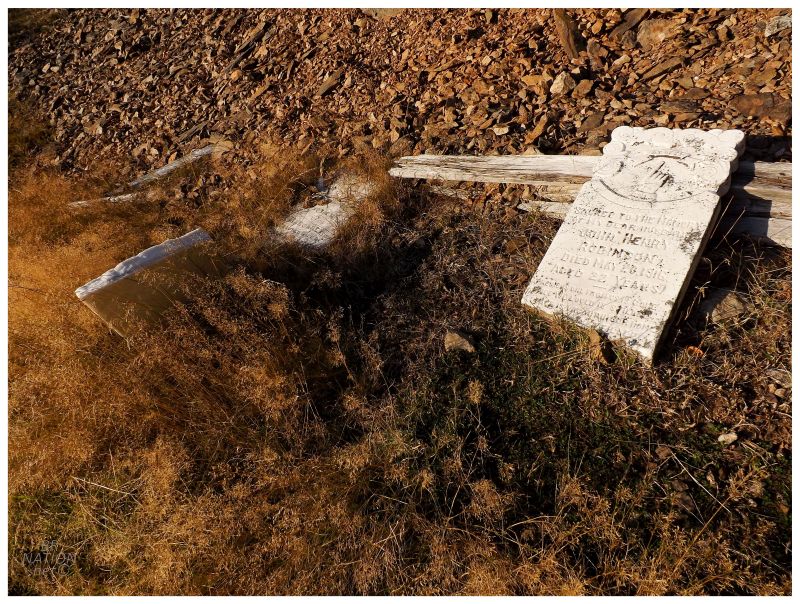
Right in the main area there were about a half-dozen headstones; while there was also a trail that led up the hill, lined with additional headstones. I followed the path until it petered out, but I wasn't sure if the trail was done or just overgrown. Nevertheless, I decided against diving into the thick and sharp bushes to look for any additional graves. (The remarkably thorough Newfoundland cemetery transcription site - which has had every other cemetery I've ever seen on this island - amazingly doesn't have this one. Maybe I should have kept going!) |
Many communities along the Newfoundland coast include the name bight, which is defined as a bend in the coast that creates a bay or cove. At the small cove created here, you originally had 5 places with residents: Stage Cove, The Bight (modern-day Shoe Cove Bight), The Brook (modern-day Shoe Cove), Caplin Cove & Beaver Cove. Beaver Cove was closer to Tilt Cove, but altogether these places only covered about 4km of coastline. Shoe Cove was never appealing because of its harbour, but rather because of its proximity to Cape St. John and the fishing off of its headlands. Even when the French boundaries were redrawn for Newfoundland in 1783, there was animosity amongst the newly-arrived English who now fished out of Shoe Cove (south of the Cape St. John boundary) and the French who fished out of La Scie (north/west of the Cape St. John boundary). British naval ships frequented Shoe Cove to make sure the French didn't encroach on these grounds and to keep fishing activities occurring without conflict between the two parties. |
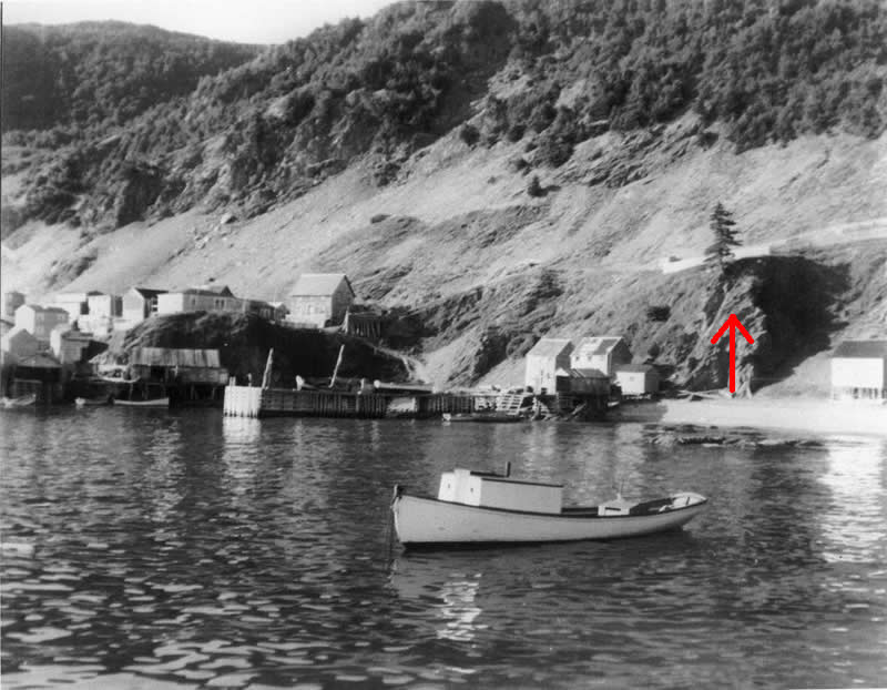
A 1950s photo from an unknown source shows Shoe Cove Bight.
An example of the relative size of the 5 Shoe Cove places is given by censuses around the turn of the 20th century. The census of 1884 lists the population of Shoe Cove Bight as 133, Shoe Cove (The Brook) as 99 and Stage Cove as 27. The census of 1891 adds to this that 30 people were living at Caplin Cove & 39 people were living at Beaver Cove. |
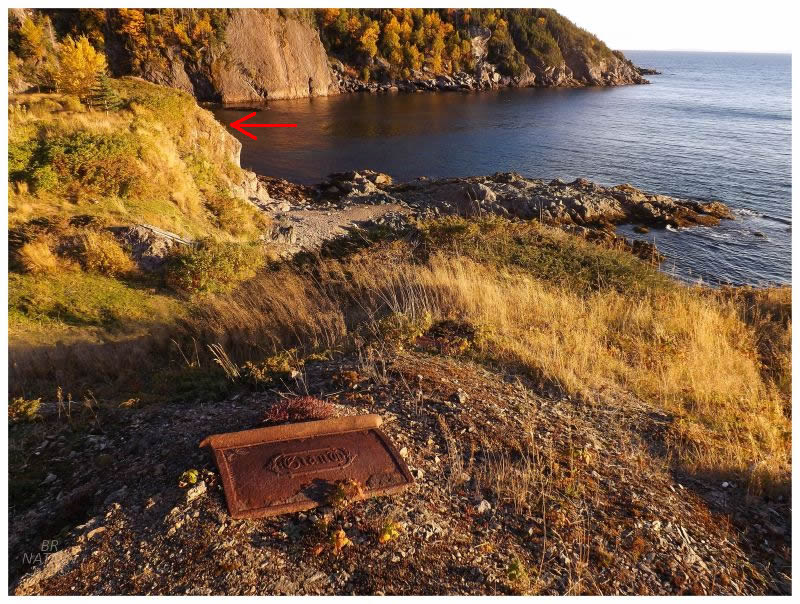
The red arrow indicates the same rocky outcrop from the 1950s photo. I would have
been standing where the house stands near centre in the old photo.
Motorized boat engines cut down the need to live in Shoe Cove by allowing people to live further up the bay and away from fishing grounds. The three smaller settlements (Caplin, Stage & Beaver Cove) were all abandoned by full-time residents by 1945 and slowly became places where people instead had their cabin. Of course some people simply moved over to The Brook or The Bight, but again by 1945, Shoe Cove Bight was down to 48 people. |
By the 1950s, the government decided that La Scie would be the "growth centre" in the area, a place with increased services where they wished residents of smaller communities would relocate to. In addition, there just so happened to be a new fish plant that opened in La Scie around this time. Shoe Cove's proximity to La Scie meant road improvements that allowed their children to attend La Scie's high school, and Shoe Cove residents to work at La Scie's new fish plant. |
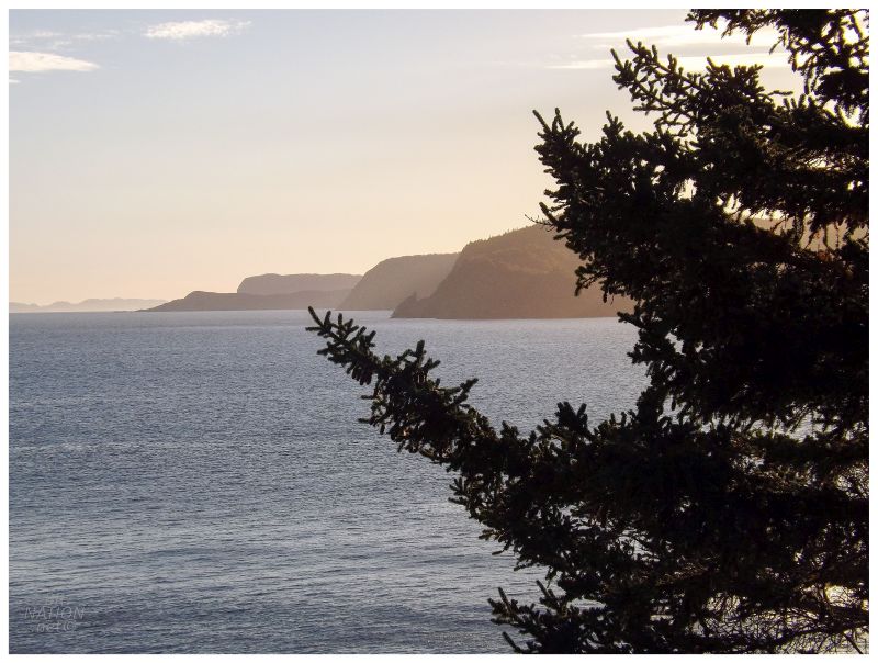
Looking down the shore towards Round Harbour, Snook's Arm & Indian Burying Place
Meanwhile, the government identified Shoe Cove Bight as a target for resettlement. The last families living there would receive their government resettlement package in the late 1960s. (A few online obituaries of people who were born in Shoe Cove Bight state that they relocated to King's Point at an early age. I'm now curious how many people chose to go up the bay to King's Point instead of to the local growth center at La Scie.) |

Looking around 50 years later, there wasn't much but there were some telltale items. The headstones, that stove door, a metal pot, a half-collapsed shed and the wooden wall of some other structure down by the shore. There were enough artifacts to know a sizable settlement existed here at one time, but these artifacts were worn and limited. There wasn't much left from that 1950s picture of Shoe Cove Bight. |
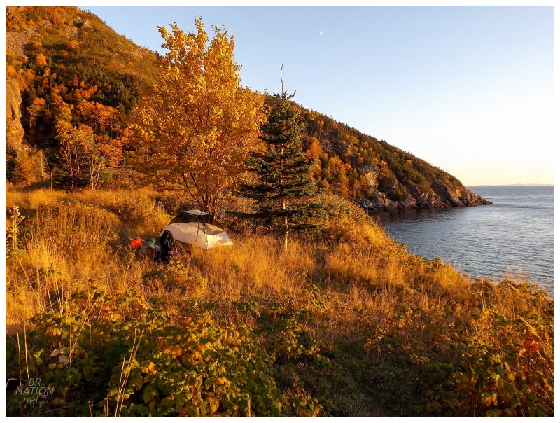
Setting up my 1-man tent took no time at all, and afterwards I looked around more & simply took in this spectacular setting. Around this time I got a trolling text from my friend Rosie, letting me know that our other friends Walt & Hollis were at a Taco Bell in Oshawa and clearly trying to get a rise out of me. While my mouth watered for a chili cheese burrito, and as much as I like to be a curmudgeon about being removed from mainland things, I couldn't complain about where I found myself at all. |
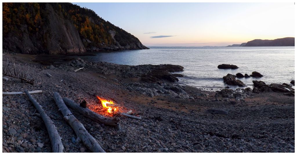
Shoe Cove Bight was changing my mind about the resettled sites where there isn't much still standing. I'm sure the weather, fall leaves and scenery didn't hurt either, but this place didn't need the appeal of being widely known in the province, or littered with empty buildings, for this to be a great time. As I stood on the beach with my small fire and the gentle waves, I was already contemplating when I would come back here. |
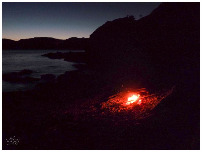
I brought a book because I thought I might want to read for a bit, but between taking it all in, cooking dinner & relaxing by my fire, I read a grand total of 14 pages. Stretching my legs, I could just see the last house where the brook of Shoe Cove meets the ocean; the house lights out there like a lighthouse that doesn't have a flashing pattern. I wondered if anyone was even home & if there was anyone there, could they see this fire? It was no worry if they could, so my mind wandered to how I enjoyed being the sole light out here and up the shore. I also thought about how that Shoe Cove house was comforting. It was a beacon that reminded me I wasn't that far removed from help or safety. I also thought about the viability of modern-day Shoe Cove. There's an abandoned house right next to the one with lights & its easier to imagine a place becoming vacant when its next to a place that's already forgotten. Would it be soon where you could camp at Shoe Cove Bight have no visible lights back at Shoe Cove? (n.b.: The occupied house looks quite healthy and cared for in my old pictures of the abandoned house. My mind didn't recall this fact as I stood this night on the beach.) |
Waking up in the morning, a late fall day had now descended upon Shoe Cove Bight. Skies were gray, waves were crashing and the sheep still hadn't come any closer. I packed up my stuff in short order and was back in Shoe Cove in no time. A woman stopped and checked out what I had been up to, quite surprised to learn that I hiked over and camped in Shoe Cove Bight, "by yourself? I'd never do that!" Haha. |
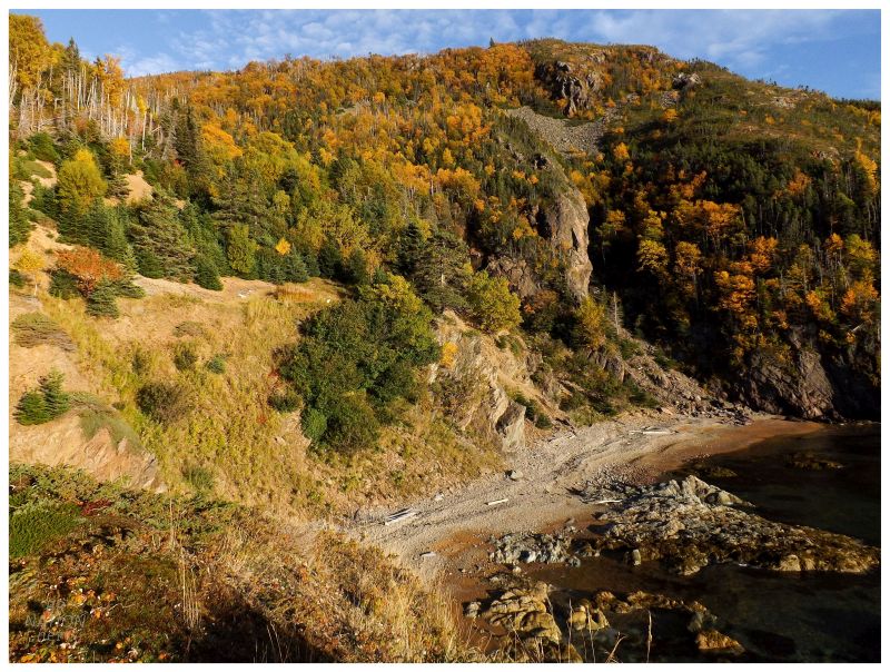
Although I went for a boot around La Scie & Brent's Arm, the only other noteworthy thing I did was finally sort out the location of the Black Brook Falls. Going back a few years, the province used to have a great website that broke down each highway while listing lesser-known attractions and the characteristics of the villages along the way. Of course with the internet trends of modern day, the new provincial site is mindlessly simple and designed for a cell phone, but I still remembered the listing for a set of falls just 5km off of the Trans-Canada Highway. |
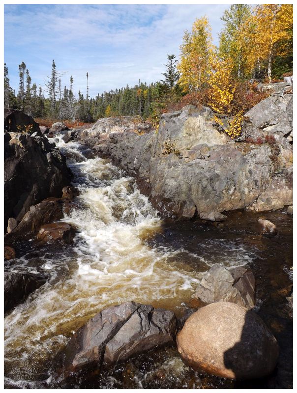
For all of the credit I give that old provincial website, the road you want is actually on your right, 6.7 km up the Baie Verte Highway, not 5 km. Once I simply took the next road off to my right, it was only a short walk & voilà, there were the Black Brook Falls. |