It was about a year since I'd found a post on some trail app website about a resettled community up in my favourite country near the northern tip of the island. Instantly adding "Fortune, Newfoundland" to the todo list, finally the day had come to set off for a thousand kilometre (620mi) weekend. |
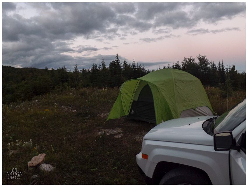
We were disorganized and left Corner Brook late, putting us in a pickle when it came to getting through nearby Gros Morne National Park. There was no way I was paying $36 to camp in the national park, so instead we called it early and pulled off on some random woods road near Bonne Bay. Taking a few forks and rounding some hills, we quickly found a wide clearing that seemed like it would work great as a place to put up our tent. There were 2 or 3 trucks that went by heading to their cabins, but no one really seemed to care and things quieted down afterwards. This was one of the more random places we've stealth camped, but it ended up being quite good in terms of how close it was to the highway & how it had an old quarry that gave us a good view over the surrounding landscape. |
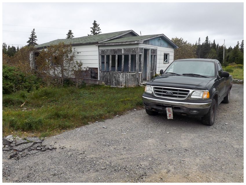
The next day we had 4.5 hours of driving on secondary highways to do, so I decided to break it up by finally stopping at this abandoned house I'd been eyeing (and skipping) in Eddies Cove West for years. |
One of the smaller villages on the Northern Peninsula, Eddies Cove West has a listed population of 41 on the Great Northern Peninsula's tourist page. I've stopped in this fishing village previously just to stretch my legs and check out the stages and fishing sheds by the shore. This was never a large community and only ever reported a population at most of 105, never building a church and long ago closing their school (1965) and salting plant out on offshore St. John Island (1963). |

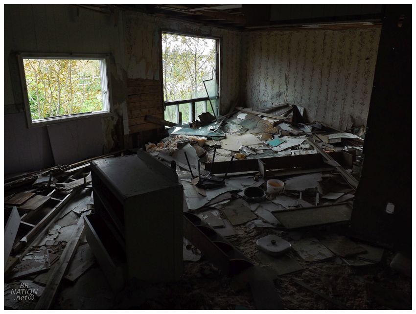
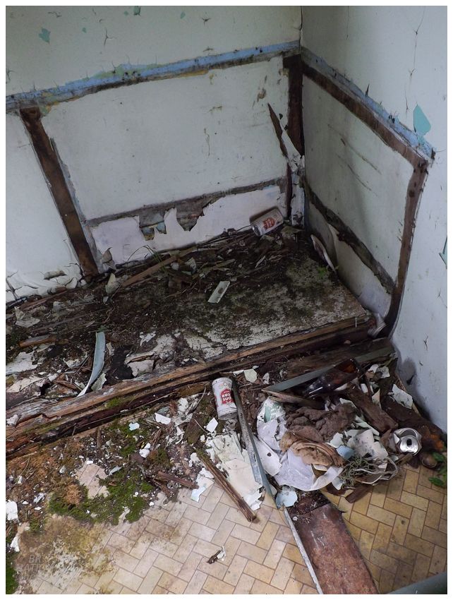
Maybe I should have stopped to see this house before all the insulation fell out of the ceiling, but there were still interesting items like a sombrero, hockey cards and dart trophies amongst the fading, soggy slop. |
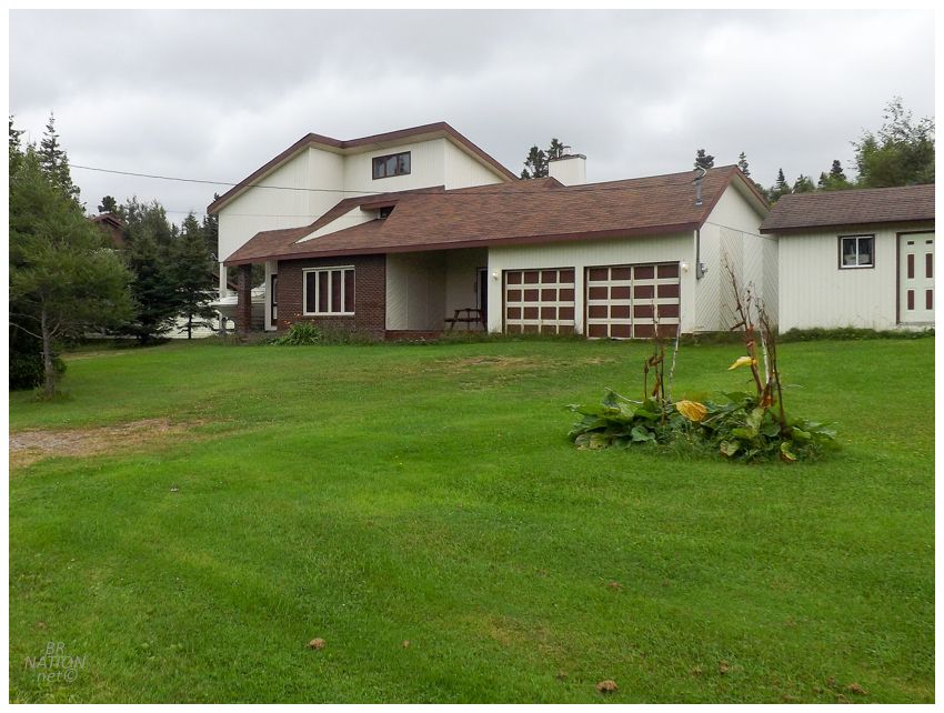
Since people sometimes complain that I only show the community "eyesores" that "should be torn down", here's a fun, occupied house I enjoyed in Eddies Cove West. |
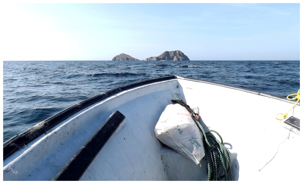
Continuing up the coast, we now had about 2.5 hours of driving ahead of us, plus a stop for any last provisions. Eventually getting off the main highway of the Great Northern Peninsula, we headed towards St. Lunaire and then L'Anse aux Meadows, before making the turnoff for remote Quirpon. Driving past the houses and around all of Quirpon's coves, we then passed the last home and eased onto a gravel track, finding a little parking spot amongst the grasses that looked flattened by marauding teenagers or elderly berry pickers. Pulling out our packs and ensuring we had the absolute key camping items, we finished our current water bottles and started across the creek that spills into Noble Cove, heading over to an ATV trail. |
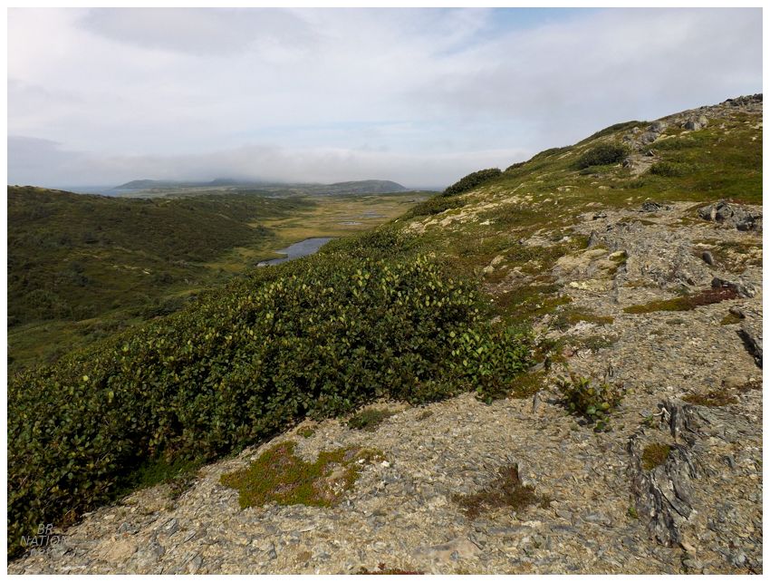
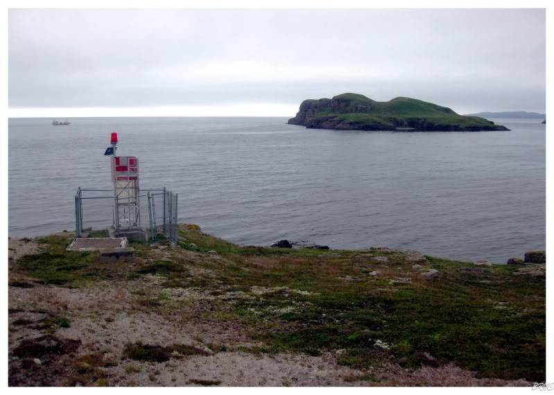
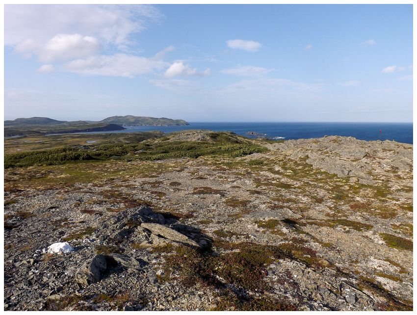
Today wasn't a matter of taking a marked trail, but rather following what quad and walking trails existed, until they petered out and we'd have to decide on a bushwhacking route up to the top of the hills. Down below was bog that threatened the dryness of our shoes, while the hilltop was a natural trail of exposed, flat rock. We were helped by the fact that I'd walked some unknown percentage of the path to Fortune a couple of years ago. Without having the time to make it all the way that day, at least now I knew that it was easy enough to leave Quirpon behind, get atop these hills and start moving south. |
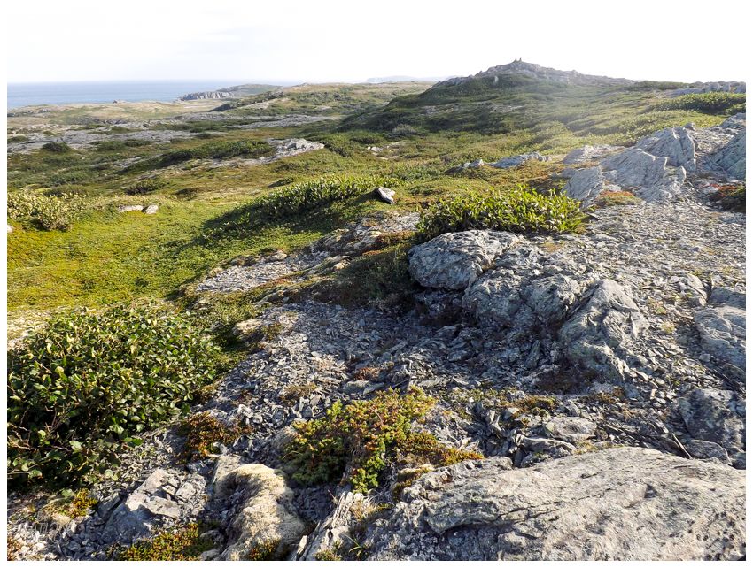
God I love this landscape. Not only is it remarkably gorgeous, but the lack of trees means you can walk about easily, while appreciating all of the islands and coves around you. We continued south, slightly worried that 6km of bushwhacking would eventually derail us even as we made good progress. The most challenging part would come when our hill dropped off and the choices before us were either a tangle of trees, a bog, or a shrubby hollow. No longer could we stay out of the vegetation, but there also wasn't much land left here - Fortune had to be very close and whichever option we chose wouldn't, or shouldn't, last very long. |
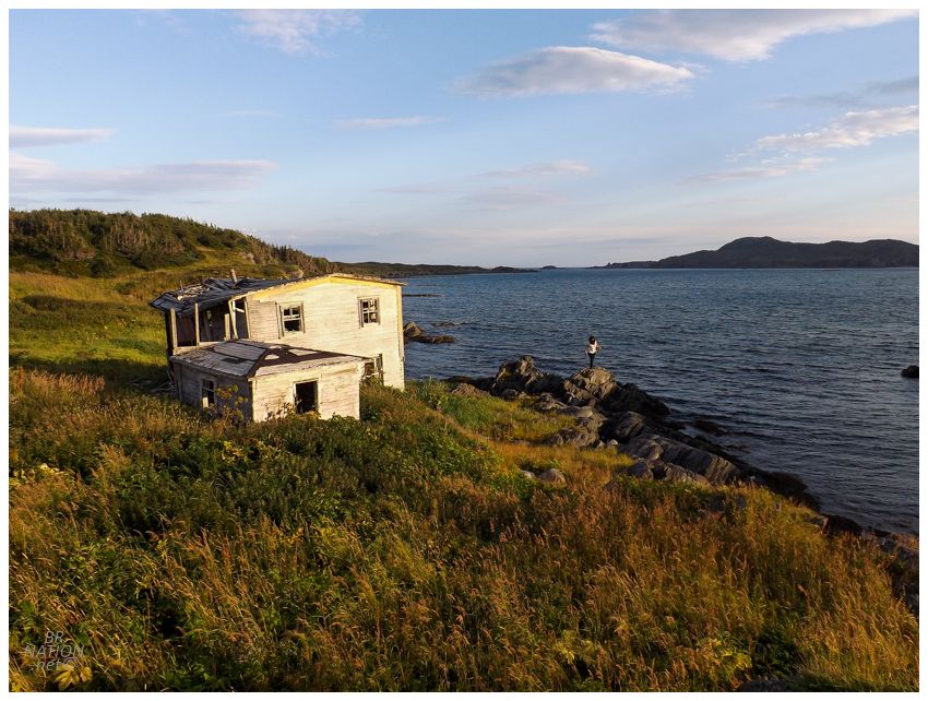
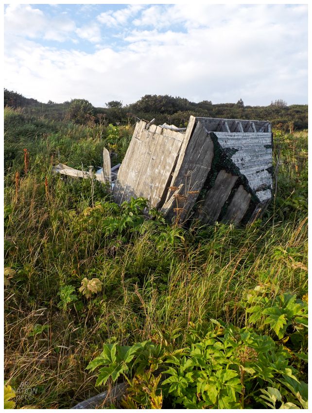
Skirting around the bog, there looked to be gaps in the trees up ahead and we pushed towards there. And then as these gaps squeezed closed, we had to pick our way through the tangled masses until we crested one last gentle ridge. Down below was the last house that still stands in Fortune. We still had to watch our step around the piles of lumber from old houses, as well as the Stinging Nettle, but we had made it. Both of us were excited to get down to the cove and drop off our packs in the little grassy patch where we'd camp. |

I obviously wasted no time in checking out the house, although with the whole back of the house sloughing off, there wasn't going to be much to check out on the second floor. |
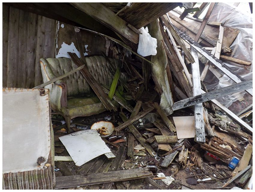
Whoever's house this was, they had a pretty baller couch! I thought about how cool it would be if you had a boat and refurbished this beauty. Plus, you'd have an interesting talking point whenever it came to your living room furniture. |
Around back, I peered into the old bathroom and was confused to find Lone Star beer cans. I know growing up in Ontario that we had this Texan beer at The Beer Store, but I thought Newfoundland always had the same selection of limited beer options. I'd later learn that the Newfoundland Beer Strike of 1985 brought an influx of cheap beer imported from America while the three breweries on the island went on strike. With Newfoundlanders being fiercely loyal to their specific beer brand - be it Blue Star, or Molson Canadian, or India, or whatever - this left many people heading out based on rumours, trying to find the last vestiges of their beers before whatever store or pub ran out of its remaining stockpile. Those unwilling to drive 4 hours to some dive bar for a Dominion had to accept the only thing available - cheap American swill! The American beer never went over well, as it was the cheapest and lightest brands available, like Milwaukee's Best and Lone Star. In fact, when the beer strike ended, these American brands were so heavily discounted in order to get them off of store shelves, that they were priced cheaper than Pepsi or Coke. |

And here I thought a random Texan had visited or lived in this house at some point. Still though, how did those Lone Stars get there? Was the home owner cheap? Did he or she not care about beer and just bought whatever? Was it teenagers who didn't have much money? Or maybe it was a visiting Texan! How would you know it wasn't? |
I continued up the hill, where the church's peak lay on its side, the rest of the building an indistinguishable pile of graying boards all around. The Encyclopedia of Newfoundland, which seems to list every little cove where a couple of families settled, instead lumps Fortune into the blurb about nearby and sizable Quirpon, where Quirpon had 212 people in 1985. |
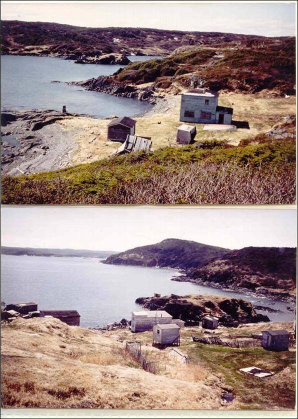
Undated photo of Fortune.

Undated photo of Fortune. The house still standing is in the foreground on the left. You can see the church behind it.

Under the encyclopedia's entry for Quirpon, there's a brief mention of how the town expanded in the 1880s because of families coming to nearby L'Anse au Pigeon on Quirpon Island, as well as those who decided to stay year round in Fortune. The only other time that Fortune is mentioned is when the encyclopedia states the remaining final residents of Little Quirpon, Fortune and Jacques Cartier Island (Quirpon Island, I think?) all left their villages and resettled to Quirpon by the end of the 1960s. This was around the time that Quirpon was finally connected to the road network of Newfoundland. |
Coming down from where I'd climbed on the southeast end of the cove, we finally took out our dinner and settled in for the night. By morning, the day was gray and foggy as we realized we forgot bowls and needed to live with heating up cans this one time. Not in any hurry to leave this peaceful place, we sat by the cove and each read our books for a long while, making sure to get our fill of a site that's just a bit far from Corner Brook to return to regularly. The funny thing is that since we visited Fortune, Quirpon has developed a marked loop trail that goes into their surrounding barrens with a little offshoot trail to Fortune. It's not like it was terribly hard to bushwhack here when we did it, but now you don't even need a map or GPS. Now there's trail markers and it's all a much easier and simple endeavour! |
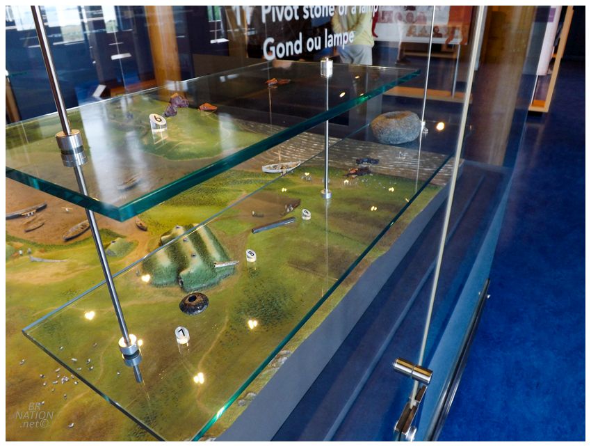
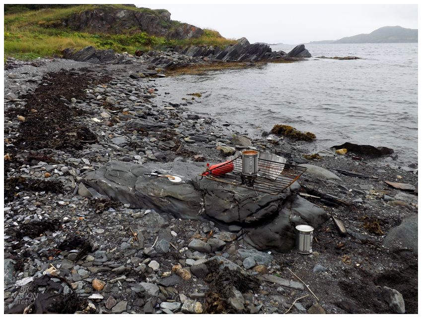
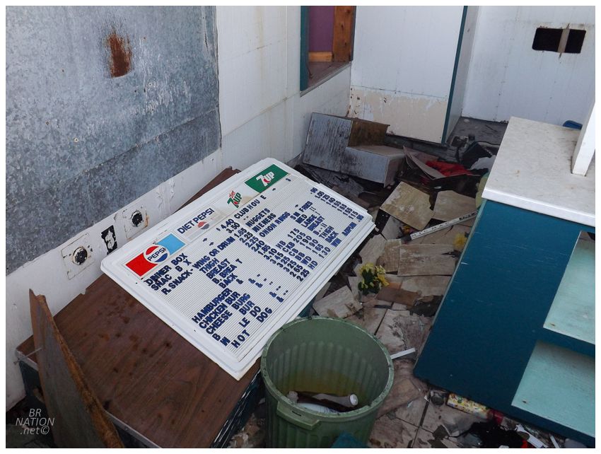
Found artifacts.
Back in Quirpon, since we were all of 10 minutes away from L'Anse aux Meadows, I figured that Isy should see it for the first time and she felt the same way. As the location where archeologists found evidence that Norsemen once landed here nearly 500 years before Columbus, we went to the recreated Norse village with the period actors, blacksmiths and sod-roofed longhouses. I'd walked around this area out of season before, but never paid for the entire experience where you go in the buildings and talk to the people. There's also the National Historic Site's visitors centre up here, which we also visited to see nordic artifacts, ship models and maps of the routes and possible explorations. Checking out an exterior porch with a view out over the National Historic Site, there was an excited couple looking into the tower viewer, who said there was a moose and the device was fixed right on it. The man told us that if we were careful not to move the viewer at all, we could take a look and eventually see the moose as it was really far off. Without thinking, Isy and I took turns doing this for a minute, but after the couple left we simultaneously thought about why we were scanning the landscape on the offchance of finding a distant moose when we live alongside Newfoundland's 150,000 moose everyday. It was also raining. We moved along. |
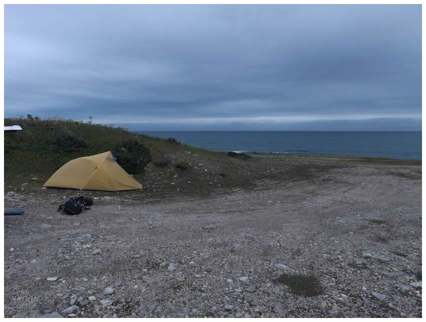
After L'Anse aux Meadows, we needed to make some progress south to set us up for a shorter drive tomorrow. Having always wanted to camp along the exposed northwest coast that continues upwards after the main highway curves inland at Eddies Cove, we drove down to said village of Eddies Cove, and then onto the rough, rocky track out of town. This rocky track was proving problematic, as I didn't want to put our tires over an excess of its sharp, tabular rocks - but at the same time, it was windy and we couldn't just camp anywhere. We could go with the smaller, more modest tent instead of the giant wind sail tent, but it was still a moody, windy evening where we needed to find somewhere to tuck in a bit. Who knew that Newfoundland's roughest, most weather-beaten coast would provide such problems? |

Consulting the forecast and observing the conditions, we had a little disagreement about getting the tent set up and whether it would make it through the night, but in the end, we were already here and it was time to simply pour up a Doc Oc (Kraken rum & Dr. Pepper) and roll with things. |
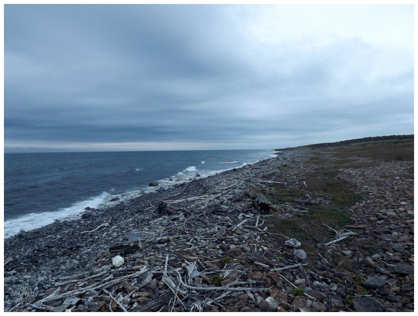
This spot and these conditions were the desolation and end of the world feeling that the Great Northern Peninsula frequently presents & I devour voraciously. There was little chance anyone else was going to drive by on this road and ruin our solitude. (In the end, the wind and light rain that was in the forecast never came. The tent held up fine.) |
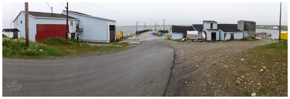
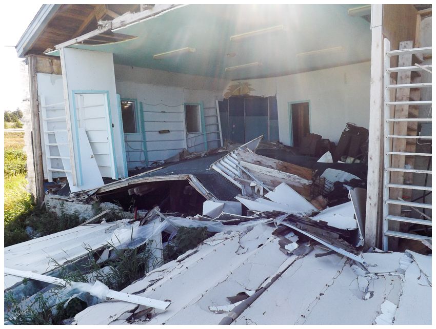
The next day we stopped in Sandy Cove, as I'd noted a few weeks earlier that their fish plant looked closed and not long for this world. |

A local politician states the Northern Peninsula's extensive list of closed fish plants as "Green Island Brook, Green Island Cove, Sandy Cove, Savage Cove, Flowers Cove, Bear Cove, Englee and other communities." And that's not to mention the Black Duck Cove fish plant that was still operating recently, but has since burnt down. With the collapse of the cod fishery, these buildings have had to turn to other fish and things like shrimp, but there's still an excess of fish plants in relation to the work. Therefore, you have a lot of closed fish plants and empty, or underused, wharf-side buildings. |

These Sandy Cove buildings would only last another six months, as the local harbour authority finally managed to get them torn down after nearly a decade of phone calls to politicians and funding sources. The Sandy Cove fish plant had closed in 2009, but the owners also folded & there was no one left to be held accountable. In the end, the province and the feds split the $281,000 demolition cost. |

The property here was made up of two buildings, a cold storage facility and a fish plant, along with a portion of the wharf. The fish plant was actually well sealed and looked really wavy and unstable, so we only explored the cold storage plant portion. |

Not making it far from Sandy Cove, I also pulled over at the former convenience store and gas bar in Savage Cove, after seeing one end of the building had fallen off. |
Things were tightening up in terms of time, so I didn't really have a window to climb over this debris and try to get inside. There was also another opening, but it had no floor to stand on and the basement was a couple of feet down. At least it was interesting to learn that the far end of this building was a former video store. I could still see the "Children" sign marking their section on the back portion of the far wall. |
I'd like to stop here again, but it's now been 2 years that I haven't been back & it was pretty ramshackle even in 2018. We shall see. |