Fløwers Island.
Winter 2008
Beyond one mountain pass and after one hour of driving from my house lies the Northern Peninsula of Newføundland. This is a section of Newføundland that I particularly enjoy because it actually has some character and it is also run down.
The drive over the length of this Northern Peninsula is composed of 7 hours of fishing villages along the coast, an hour of barrens and then another hour of fishing villages before the tip. In the 1990s, the Canadian government put a moratorium on the cod fishing industry and it crippled a lot of these villages. Newføundlanders may be resilient and willing to fight through poverty to live somewhere, but the lack of money does prevent some things - like renovating island lighthouses.
In October, when I first arrived in Newføundland, I drove a bit of the Northern Peninsula, then turned around; then returned, then returned again and finally, one day, drove the 9 Google hours to the Northern tip. During this climax trip of reaching the tip, about at the end of the 7 hours of fishing villages, I was passing the town of Fløwers Cove and noticed a lighthouse along with what appeared to be the light keeper's house.
I pulled off into the town and drove down the streets, trying to figure out how to get to the damn lighthouse, until I reached the end of land and REALIZED IT WAS AN ISLAND LIGHTHOUSE! Stupid me!
I put my car in park and surveyed the water before me. This peninsula also had a gazebo and a few educational signs about the lighthouse. I read both of the signs and learned the history of the lighthouse, along with the fact that it is currently under renovation. Still though, that keeper's house was boarded up and it was an island lighthouse - that's tasty enough and I need to get over there, but how?
Kayak? - far too sketchy! This was the North Atlantic Ocean were talking about here. Also, I've never kayaked, plus I don't have a means of transporting a kayak either.
Pay a fisherman to drop me off? - This may have worked, but then I would have to explain myself to him; Id have to deal with trying to get him to leave and I'm also really anti-social - forget that noise.
So...how?
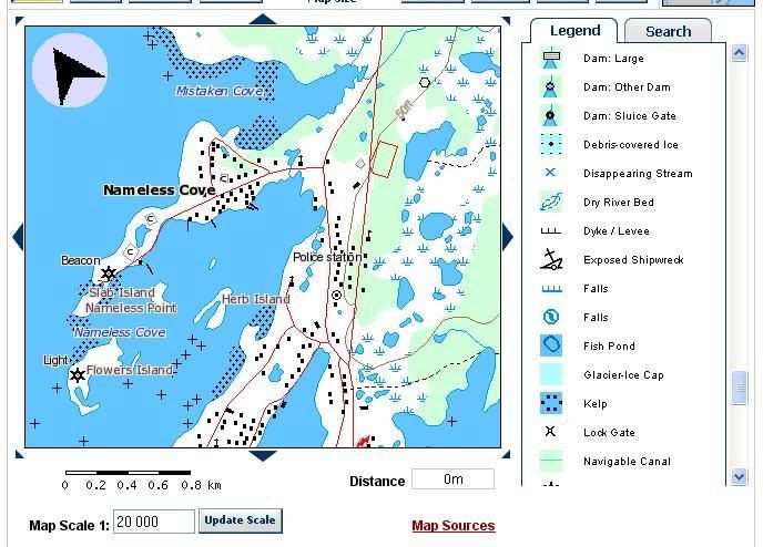
Map courtesy of The Atlas of Canada: http://atlas.nrcan.gc.ca/site/english/maps/topo/map
One random day, I was reading about how polar bears sometimes cross over from Labrador to the Island of Newføundland and it hit me like a Mack truck - cross the sea ice to the island!!!
I am not a deductive person, so solving this problem was reminiscent of my struggles through first year physics. Nevertheless, I was psyched about finding a solution and I asked the one person at my office who knows the outside-of-the-office Navi; whether this would indeed work. She said she would ask a person she knew (she's a born Newføundlander) who works in the area. She quickly got back to me that her friend told her that, "yes, the ice usually freezes enough, that in late March, you could theoretically cross over to Fløwers Island."
Planning and plotting was months in the making, until the day had finally come. I was up at 7 a.m. on a Saturday morning. I filled up on Kraft Dinner and hit the road.
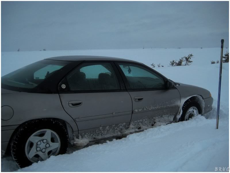
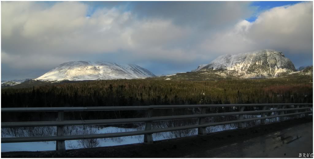
There was drizzle and freezing rain on the way to the mountain pass, then a fair snowstorm and some sketchy roads through it. My car had been making some noises just recently, but I asked a few friends and they reassured me that it was fine - this was good, because this weather was certainly of the kind where you don't want to have car troubles.
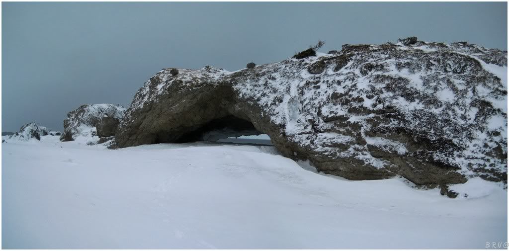
Once through the mountain pass of Gros Morne, it was up north along Highway 430. The snowstorm had weakened and now it was mostly some gentle flurries. Nevertheless, the freezing rain, the snowstorm and the overall slippery conditions had worn on me and I needed to get out of the car. The towns are small and few and far between, so I decided to stop and finally check out The Arches Provincial Park, which I had passed a couple times before, but never stopped.
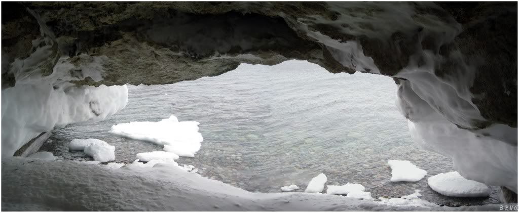
The highlight of The Arches Provincial Park is the three natural sea arches created by tidal action. Each of the arches is 15 feet in height during the summer, but the winter had built up enough ice where I had to crouch a bit. This ice allowed me to have an up close look at the interesting rock ceiling of the Arches. (Yes I'm aware that I am a nerd, thanks.)
The Arches are only about 5 minutes off the road and take about 15 minutes to see - so I was back to car shortly and ready to tackle the remaining 4 hour drive to Fløwers Island.
During that 4 hour drive, the weakened snowstorm turned to rain as I drove along the coast instead of in the mountains. I started to move a little quicker and reached Fløwers Island sometime around 2:30.
Having been to Fløwers Cove previously, I knew that the town wasn't built on a grid or a street network based upon the topography of the landscape; the street network of Fløwers Cove is simply a collection of meandering roads which connect buildings in a nonsensical fashion. It reminded me a lot of the paths you find in forests of your youth, which curve and go in different directions, meeting up with other paths and resulting in any number of resulting paths. The town layout is definitely not the same as the modern communities which you're used to with either a grid or a spoke wheel layout.
Therefore, the streets and avenues of the town are especially difficult to navigate for someone who doesn't live in said community - even more so, when said out-of-towner tries to navigate the roads in the winter.
I pulled into the town and tried to straight path travel to the point nearest to the lighthouse. I made a right turn toward the lighthouse and ended up on 'Anglican Church Access Road', which was plowed haphazardly, and that's putting it lightly.
The Intrepid promptly halted its forward movement and I promptly let loose with some F bombs.
My stubborn mule of a self wouldn't ask for help, so I got out with my hockey stick and started backhanding and wrist shooting snow chunks from beneath my car. After about 25 minutes, including 5 car driving attempts, the Intrepid was making some progress and slowly, slowly, slowly, poof! ...it broke free from its snow tomb and was suddenly going 20 miles an hour backwards up this Anglican Church Access Road. Once I got to the main road, I backed it into a convenience store parking lot and tried to go forward, but I was stuck again and let loose with more F bombs.
This time it only took a minute or two as I wasn't stuck as bad as before. Eventually I made off onto the 'main' road.
Frustrated with constantly getting stuck, I began to slow down and examine each fork-in-the-road decision. Doing this, I reached the ring road of houses where the lighthouse access road is. The lighthouse road was blocked with an 8 foot high pile of snow, so I parked in front of some random house and bundled up: t-shirt, long sleeve shirt, sweater, ice fishing jacket, long johns, jeans, one pair of regular socks, one pair of wool socks, boots, toque and another sweater wrapped around my face like a bandana.
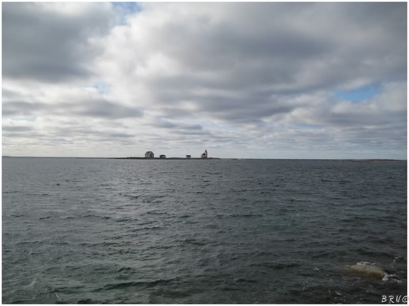
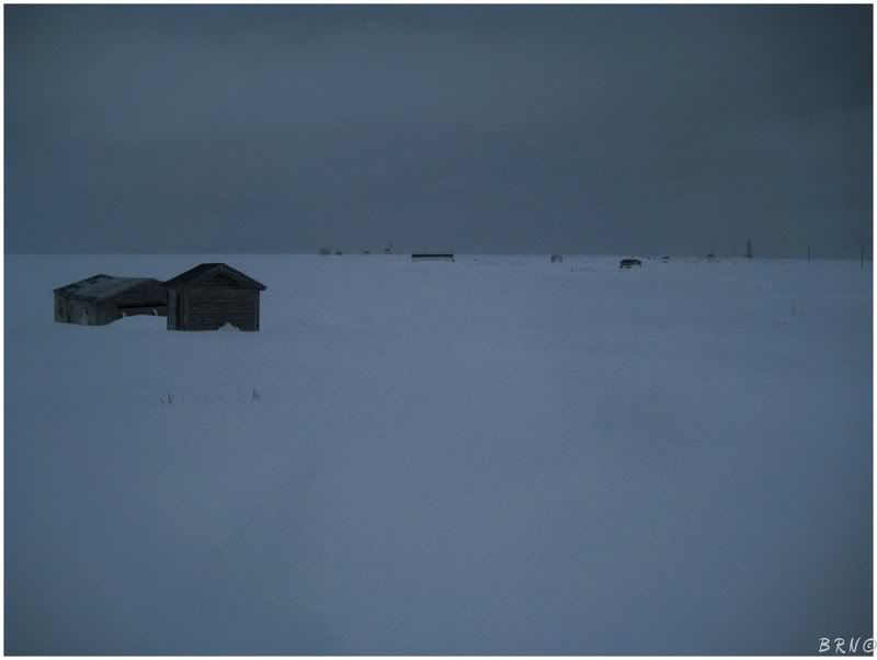
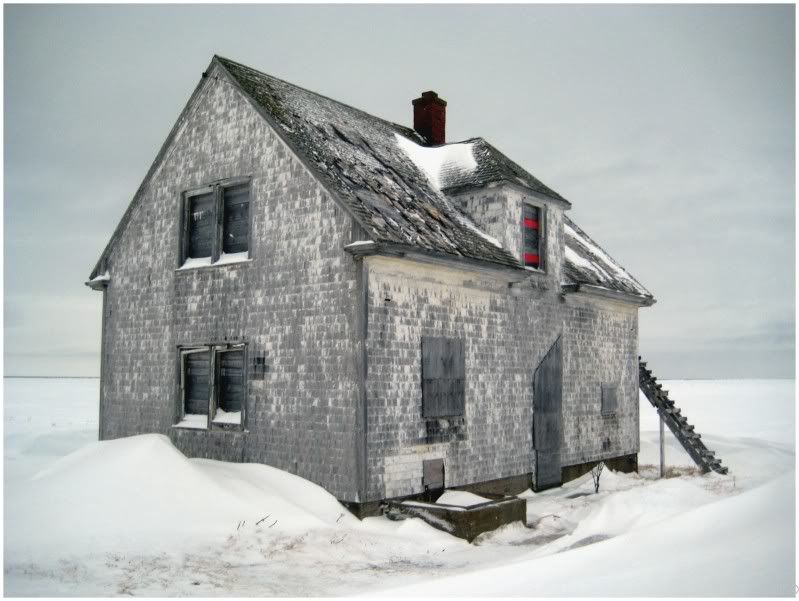
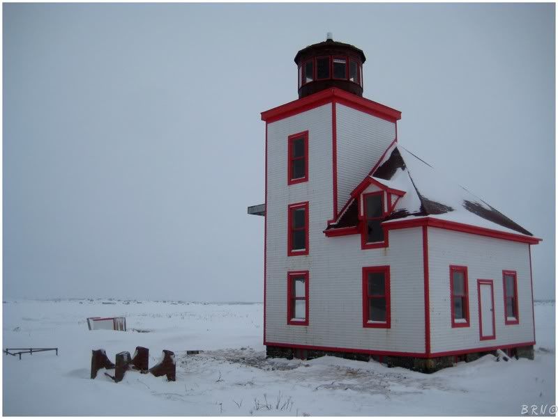
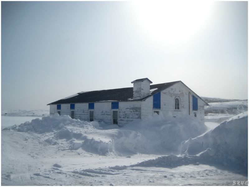
I grabbed my backpack and left the car, taking the above picture showing the view from the road. The lighthouse is just to the left of the centre structure.
I walked through someone's yard, pass their snowmobiles and lobster traps and onto the lighthouse access road. There were points with only a 1 inch layer of ice on the road and there were points with 3 foot snow drifts to trudge through. Once pass a cemetery and some boats, I reached the endpoint of the mainland, near the red shack which you can barely see on the right in the above photo.
I paced around for a bit, read the sign for the lighthouse and thought about the task at hand.
I stood disturbed at the edge of the land for a good 5 minutes, pondering things. Another reason I was uncomfortable was that there was a foot of snow atop the ice and I couldn't see the ice surface itself. There were plenty of excuses, and as per usual I was taking full advantage trying to convince myself to get back in my car and give up.
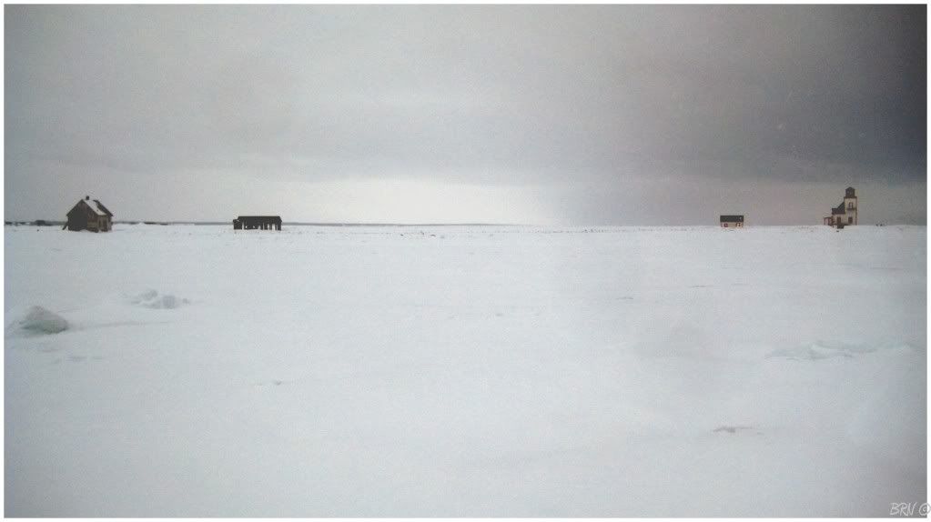
I could see Slab Island though, only a mere 150 feet away. (Slab island sits slightly out to sea, but between Fløwers and the tip - if you want it to be). I thought about how I've checked the weather for the last 2 months and knew that Fløwers Island was below -1.8 Celsius0 (~30 Fahrenheit) every single day. I remembered how that guy said it was safe...but he wasn't here, it was just me and a decision whether to walk out onto the ice or go the fuck home.
I took a step forward and kept it moving. I'm not saying this for literary effect, but my heart was racing. I was never the first to test out the ice as a kid and I only saw the ocean for the first time at age 23 - it still scares me and I don't feel comfortable with it.
Nevertheless, Slab Island wasn't very far and I kept it moving. My ears were tuned like a piano and I didn't hear any cracking of ice. I freaked out for a moment as I heard what I thought was cracking, before realizing it was the pieces of ice cracking atop the snow (the freezing rain had left a thin layer of ice atop the snow which sat atop the sea ice itself).
I made it to Slab Island and didn't want to stop to think. I walked Slab Island until I found the point with the shortest distance to Fløwers Island and continued on. As I came within 30, 20 and 10 feet of Fløwers Island, my heart raced and I just wanted to be back on land; the feeling similar to a rollercoaster where you just want it to end and you want to step off onto solid Earth.
I plopped into a snow pile with some sort of plant and realized I was on Fløwers island. I had made it. I breathed a sigh of relief and settled down a little, wondering just how many of the townsfolk were watching the 'townie be a moron for walking out to dat der island'1
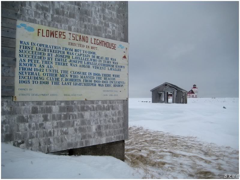
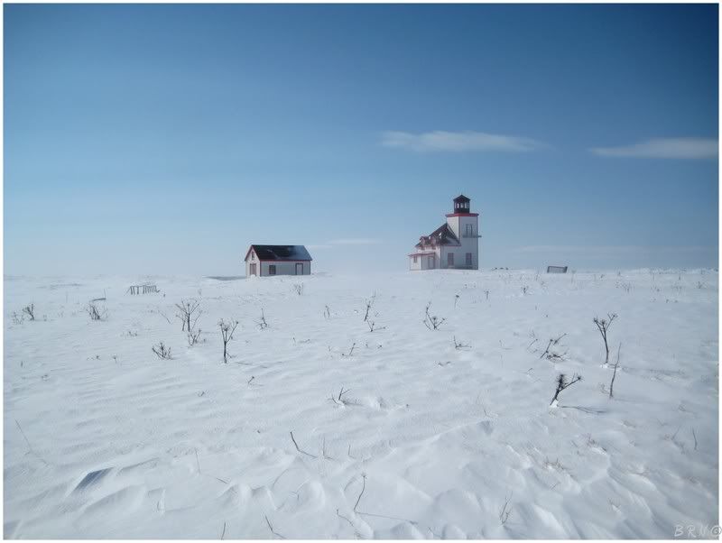
The first thing I did was take a walk around the keeper's house as it had me the most excited. The hand painted, Fløwers Island Lighthouse history sign was really swell.
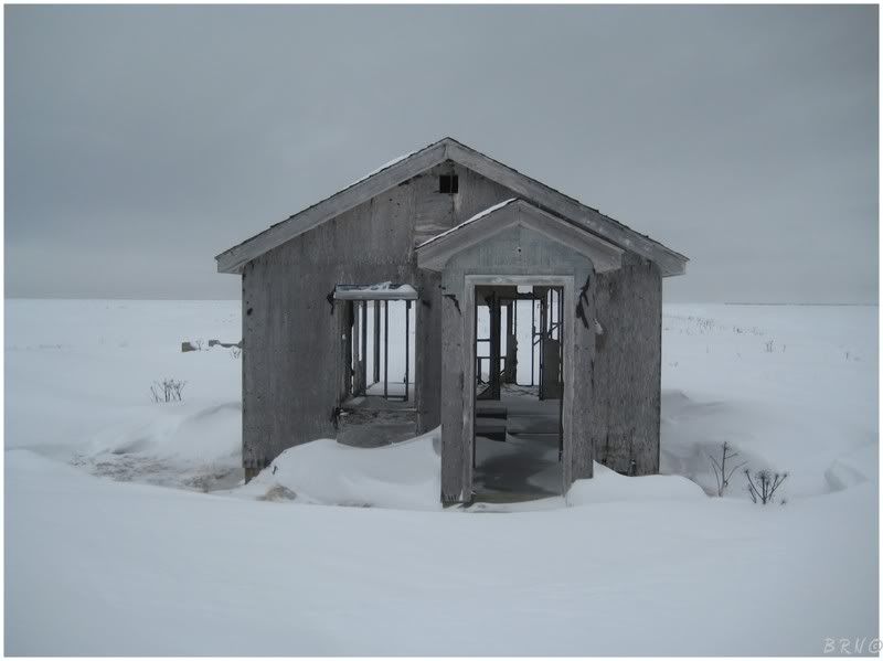
I read that there was also a garage and a chicken coop on the island, so this has to be one of the two. All that remains today are two rectangular cement platforms and a few pieces of drywall.
I walked through it just to run up my count of buildings. Take that Don!
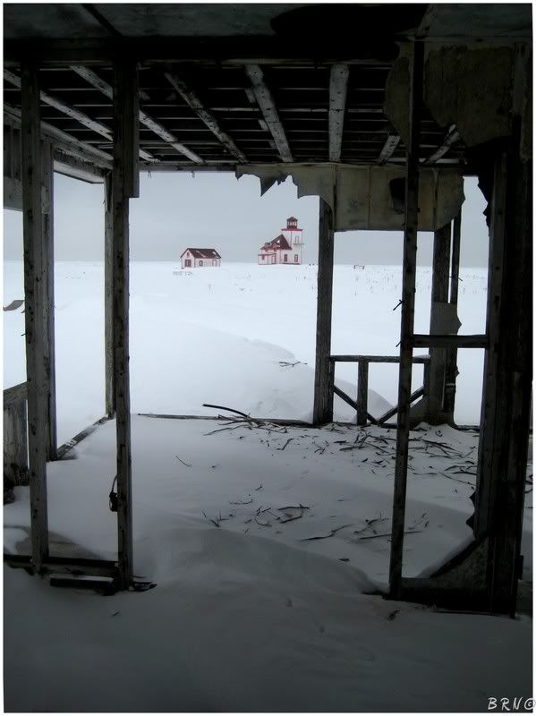
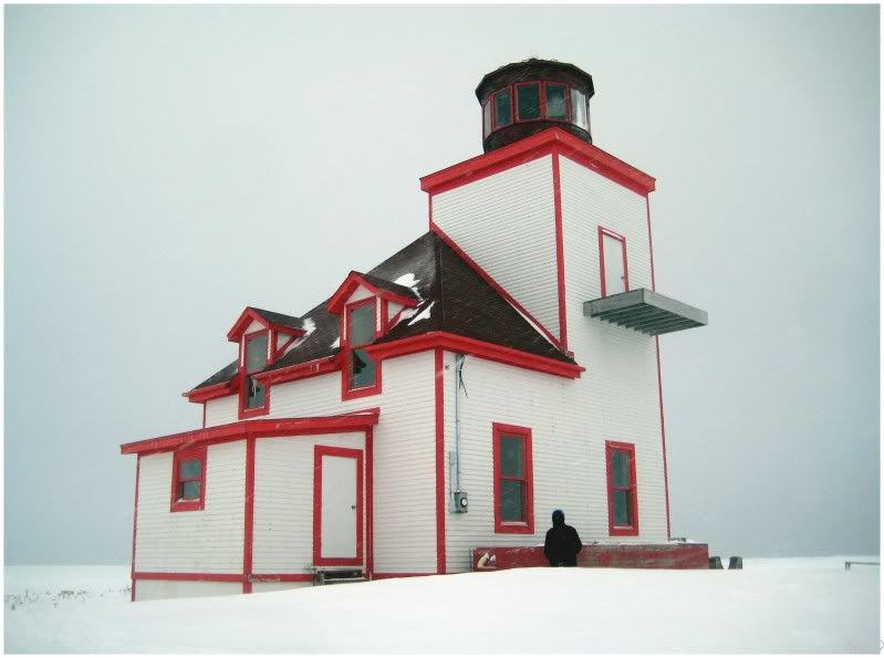
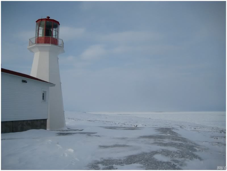
I walked around to the far side of Fløwers Island so that I could get the backside picture of the lighthouse that those who shoot from the mainland can't take. From there, I cased the joint and tried doors to no avail. I was really hoping for it to be open due to its aquatic isolation, but unfortunately that wasn't the case. It is an active restoration, but are there that many people coming to the island that the lighthouse requires locking?
This made me question how unique my visit really was.
 ________________
Images copyright Department of Fisheries and Oceans Canada
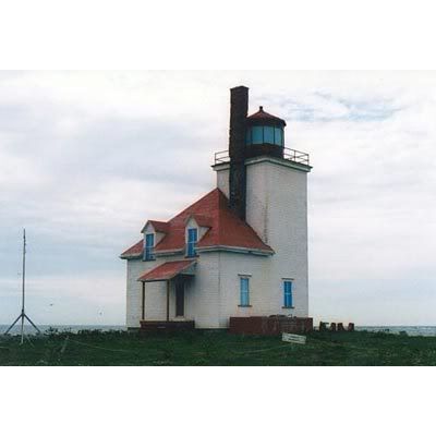
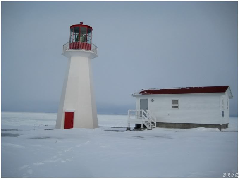
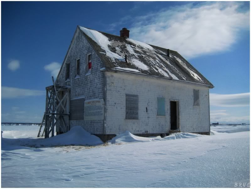
Fløwers Cove Lighthouse was built in 1899 and remained active until 1969. It stands in at 51 feet.
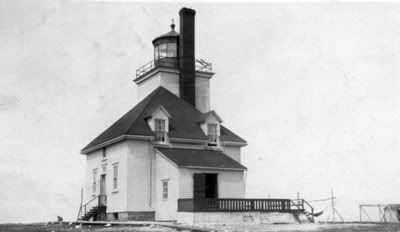
I only saw the two above historical pictures afterward, but look how much sexier she used to be! Damn!
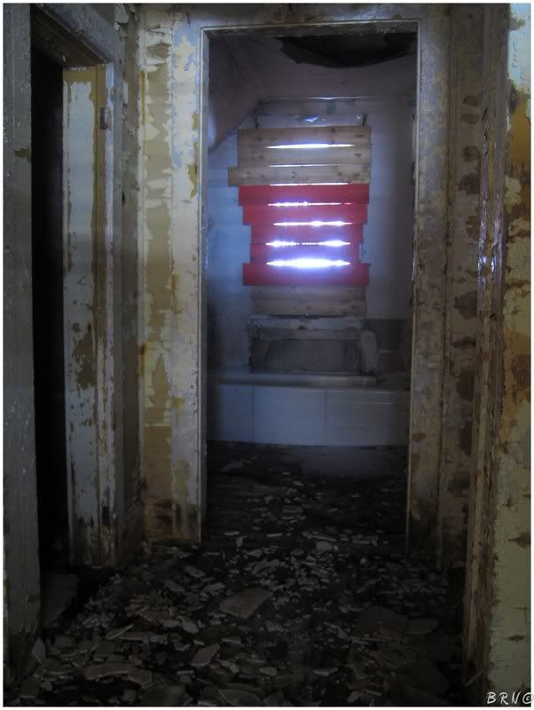
This is what the lighthouse interior looked like through every window I peered into.
It wasn't very exciting; although I bet the view from the top would have been enjoyable.
I popped over to the lighthouse keeper's house for a second, but I didn't really feel like getting out the tripod. I was also getting nervous about the amount of time I was spending out here since I thought some of the locals were probably watching me.
Therefore I took a few quick snaps and headed off Fløwers Island and onto the Island of Newføundland.
Since I was already 7.5 hours from home, I decided to drive the 1.5 hours more so I could spend the night in St. Anthony - near the northernmost point of the Island of Newføundland.
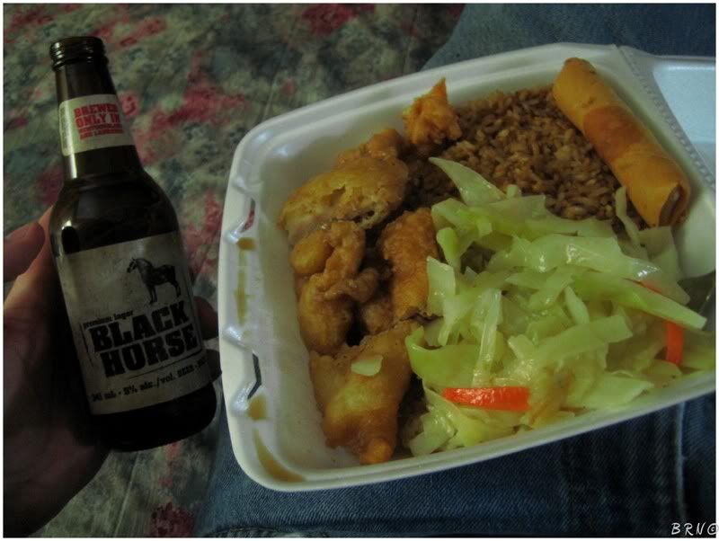
I went out and bought some Chicken Soo Guy from Far East restaurant (which was mediocre) and some Black Horses (which are always mediocre). I turned on the television and there was a show about the Edmund Fitzgerald - a pleasant improvement from mediocrity.
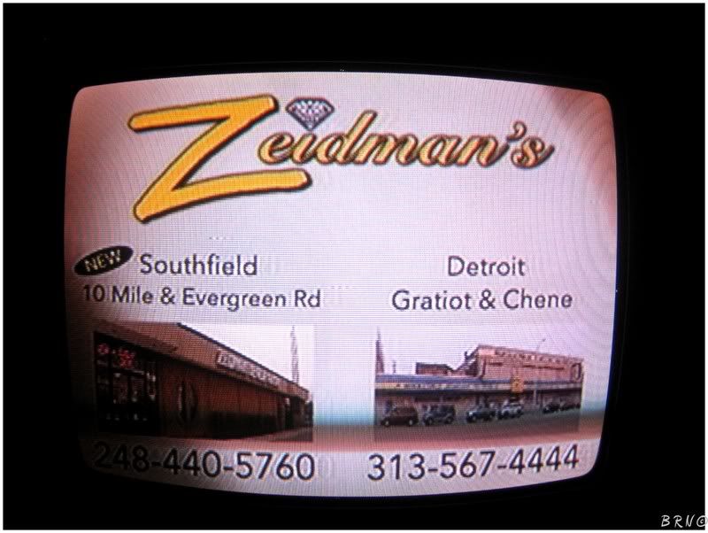
I also noticed it was the local station from Detroit!
I don't know what is with small town Canada stealing Detroit stations, but I find it crazy. These tiny Canadian communities must be absolutely frightened of the Motor City from the news which they could watch daily. I definitely need to lay the mack down in some of these isolated places with my clothing and stories of my rough upbringing in the proximity of Detroit.
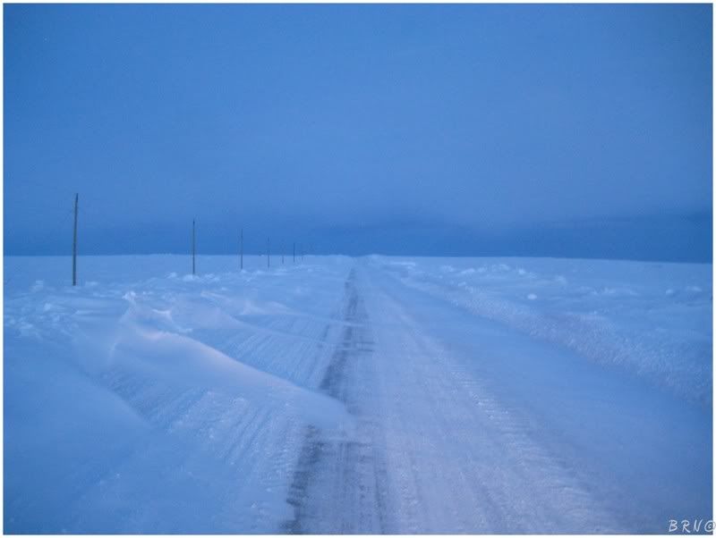
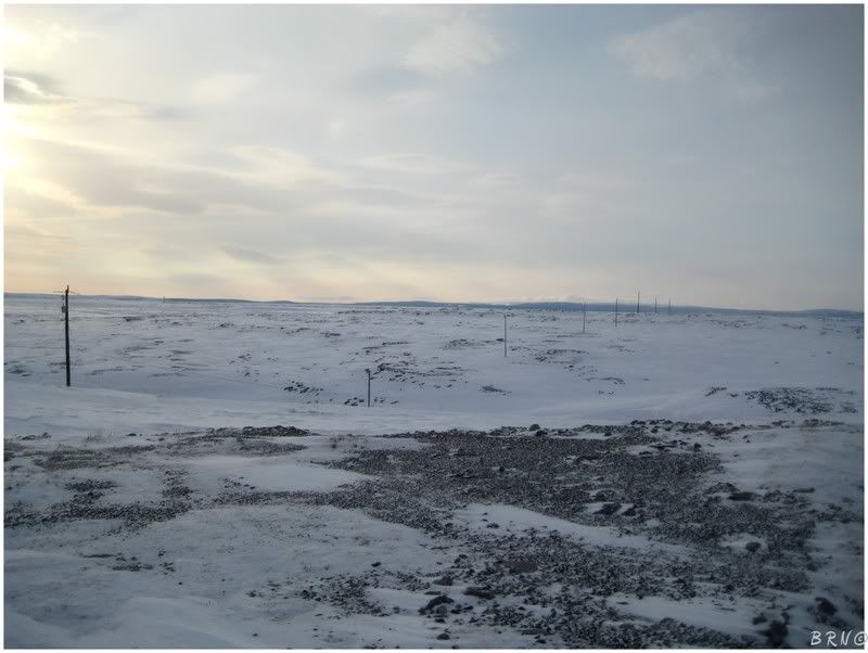
Another reason I spent the night in Northern Newføundland was for North Boat Harbøur. North Boat Harbøur isn't abandoned or anything, but I find a place slightly fascinating when it is above the tree line and it is more desolate than you can imagine.
I set my alarm for 5 a.m. to get there slightly before sunrise for some night shots. I forgot about daylight savings time and pulled into the northwestern-most community in Newføundland around sunrise.
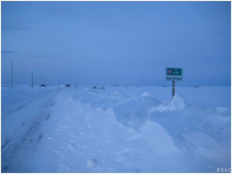
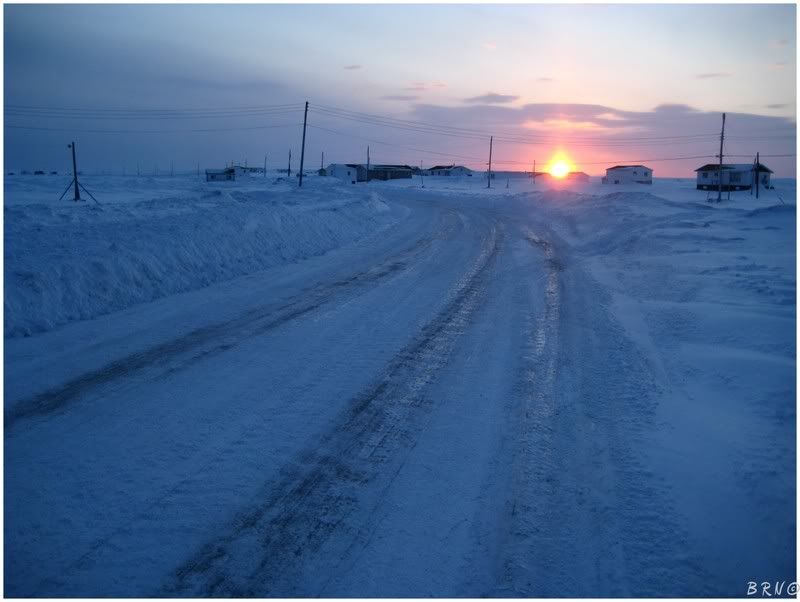
I got out of my car and there was ABSOLUTE silence besides the wind. I walked around town and during this entire time, the only other sound I heard was a guy pass me on a snowmobile with a rifle on his back.
What a unique place.
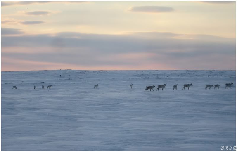
About a kilometer (0.6 miles) outside of town, I noticed this herd of caribou on the side of the road. While I was in town, there were 3 or 4 caribou about 200 feet behind someone's house.
I also stopped at the nearby Cape Nørman lighthouse because I was unsure if I would ever return to this place.
Which was more of a fiasco and grueling trek than Fløwers Island. The lighthouse is along the road out to North Boat Harbøur, but it is located at the end of a lighthouse access road, not right on the road.
Of course the lighthouse access road wasn't plowed very well, so I parked my car on the highway and walked over.
In the above picture, my car is beyond that far hydro pole and the conditions included gusty winds, 1-2 feet of deep snow and rocky terrain. Fun, fun, fun at 8 a.m.
The keeper of the Cape Nørman lighthouse (this one is still active), looked at me like I escaped the asylum when he came out to snow shovel.
I also drove around the tip of Newføundland for a bit because I had another island lighthouse on the docket.
The problem was that I was now sweat soaked from hiking to Cape Nørman and I also had something else I wanted to do on the way back. That lighthouse (and a few other tasty things - see above), would have to wait. The conditions were considerably worse at the northern point and I wanted to make sure I completed the task I had planned for the ride home...
...that task?
Fløwers Island again!
It was complete b.s. that I braved that ice and proved its strength for a couple of lame flash shots and no real exploring of the house.
If I was going to brave that sea ice, then I needed to be a man about it and do the job properly!
I don't know what I was thinking and the conditions also questioned the worth of this second trip. It was considerably windier and I was forced to simply lower my head and trot over to the island, wind loudly opposing my forward movement.
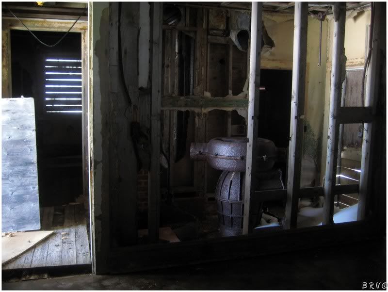
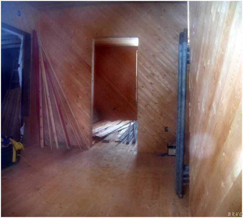
I strolled into the house, incredibly skeptical of the floor stability. This was until I realized that some were concrete and I made my way over to what used to be the kitchen.
Looking back towards the vestibule I walked through, I snapped a picture of the one ground floor item left - the keeper's stove.
Behind me, the kitchen window was boarded in the old school, 2x4 fashion.
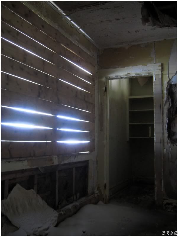
Out of the kitchen, past the door I entered, was a room where the floor was completely non existent - just a clean drop out of the hallway, 8 feet to the basement below. To my right, and next to the front door, was a room that had me baffled at the time; but I'm now thinking was a bin for chopped wood.
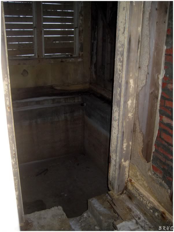
I was excited about the looks of the basement, so I took the sketchy stairs downward, only to find a cellar which didn't make the Navi height requirement.
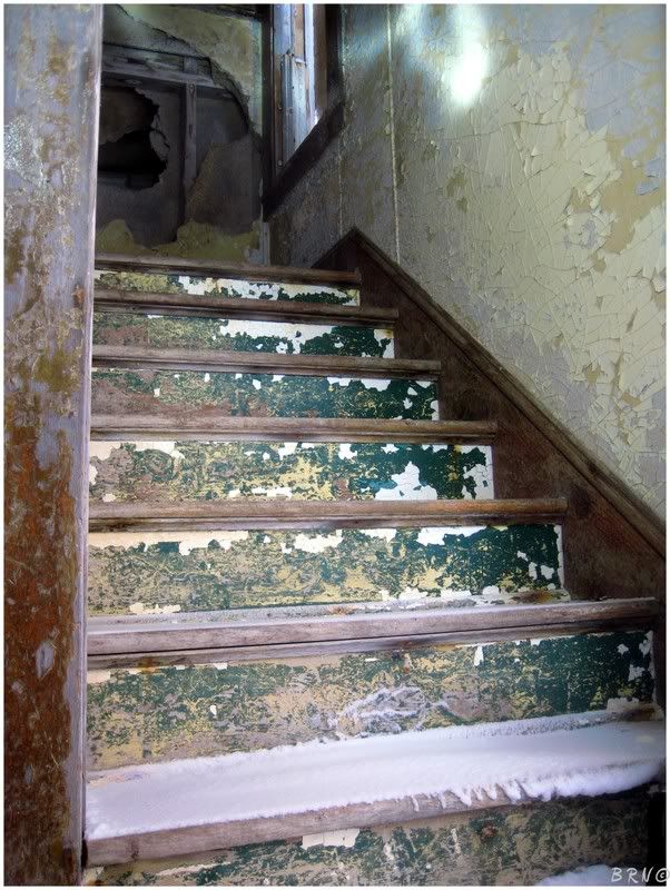
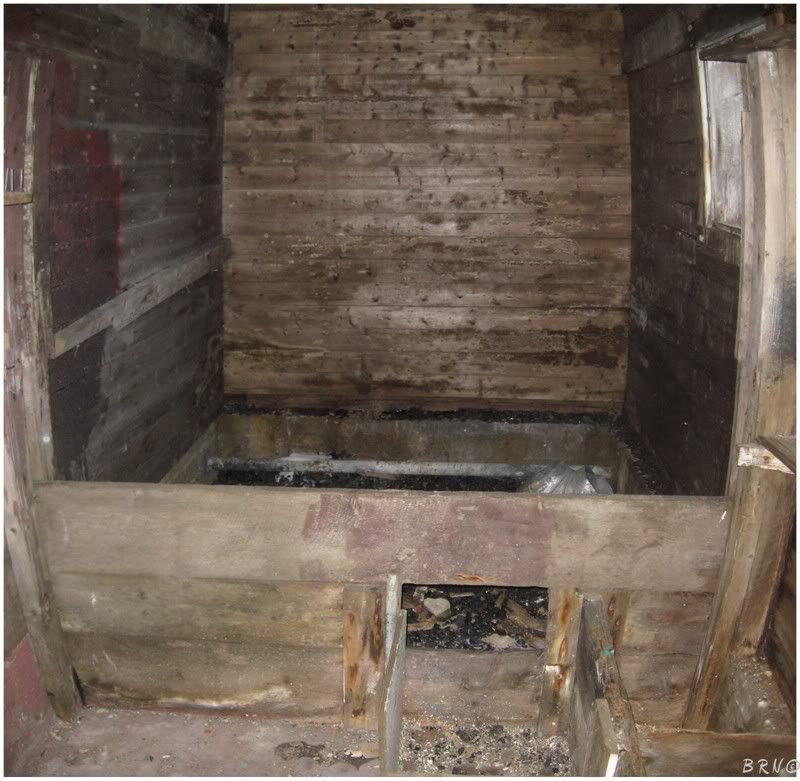
Growing cocky, I decided to test my floor luck further by checking out the upstairs...and I was rewarded with item #2 of the house! A bathtub! Oh glorious day!
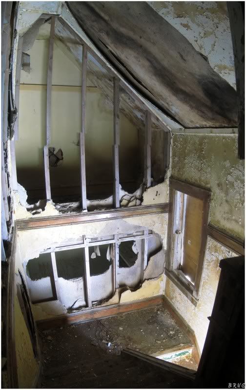
Looking back down the stairs, you'd think this house might have had a hint of elegance at some time.
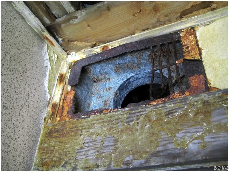
The house was empty and the sketchy floors limited my travels within it. I came back down to the exit and pondered if I was done here. I stood and thought about it for a second, while reaching up to play with the heating vent bars. As I barely touched them, they broke like pretzel sticks; glaringly weakened by the sea salt of the last 30 years.
I decided that I had covered the house thoroughly. Out the door, across the ice, down the road and into the car. I was tired from the hike yesterday, the stress of walking on that ice, the hike to Cape Nørman, the hike back today and waking up at 5 a.m.
I decided to get on my horse and head home. Thankfully, Newføundland provided some better weather and the mountain pass was a little more enjoyable this time.
Navi
Thanks to my friend CS and her friend who knew the ice would be safe. The best time I've had in Newføundland is a direct result of you.
Sources
1 - Fløwers Island Lighthouse - Lighthouse Explorer Database