I was already in a confused fog from being up so early. I asked GW to get me to the airport 90 minutes in advance, as I'd be going to America today!
Destination...Seattle? I certainly wasn't staying in Seattle, but as I wandered the airport in an early-morning daze, these West Coast and Great Plains destinations I found on the arrival screens and heard over the announcements were all very foreign to me.
There was one which held substantially more weight when I heard it over the speakers though - Anchorage.
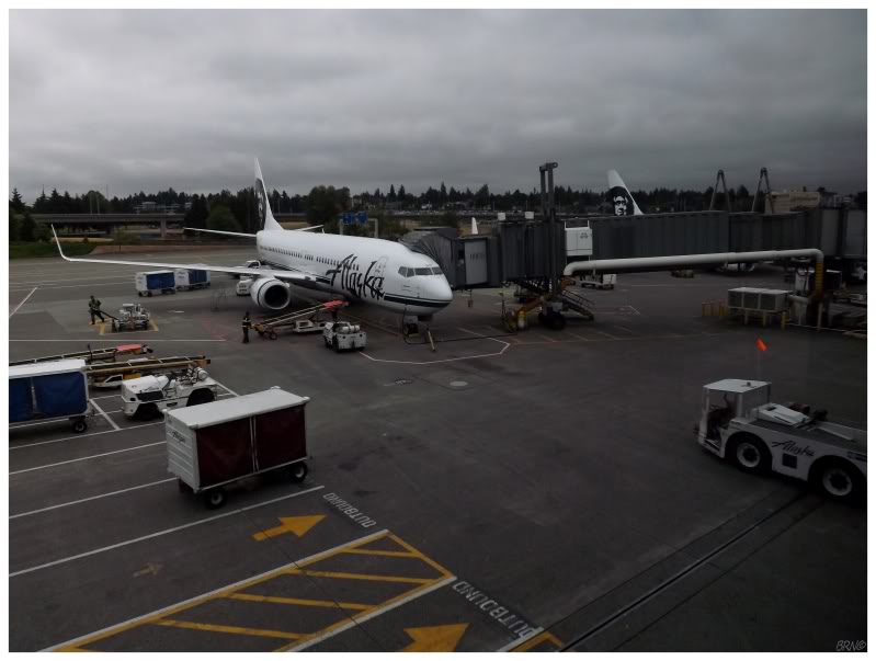
I found my gate and mowed down an unhealthy breakfast. Peering out the windows here at Sea-Tac, Alaska Airlines planes were in the vicinity & I wondered which one would bring me to this storied destination.
It wasn't very long before I boarded AS flight 113 & intently observed all of the differences of this new airline. I needed sleep, but I tried to fight it off. This was pointless though, as I quickly failed while we went north over British Columbia.
I awoke a couple of hours later & gazed out the window. I instantly rubbed my eyes, as I couldn't believe the view - we were high above the clouds and you could see two mountains poking out. Judging by our flight path & the distance left until Anchorage, I think these peaks could of have been Mount Saint Elias (N.A.'s 4th highest peak) and Mt. Logan (N.A.'s 2nd highest peak, Canada's highest peak).
In my early-morning stupor, in my romantic glaze at approaching Alaska, and in my sudden surprise at the sight before me; I sat in awe and appreciation. It was a sight which I don't foresee soon forgetting.
I was so excited to get going, that I simply ate at the nearest Taco Bell, bought a few CDs at the Best Buy & hit Alaska Route 1 eastbound.
The first portion cut through some coastal lowlands with a large water arm beside me & hills to my right. I was impressed with the honest-to-goodness freeway here, where I wasn't expecting such a road outside of Anchorage.
This was only for a short portion though, as soon enough I was in a river valley on an undivided road, flanked by the towering mountain ranges of the Talkeetnas to my north & the Chugachs to my south. Up & down I went with the road through incredible curves, all-the-while craning my neck at the braided river with its rock bars and marshy islands. Even though it was a rainy day & I had Alaska so hyped-up beforehand, the scenery around the Matanuska River was doing its best to meet these sky-high expectations.
About 2 hours into my drive, I beheld the first glacier of my life. Pulling over to appreciate the music & the scene before me, it was one of those moments where you look at where you stand and think about how you got there.
This glacier was the Matanuska Glacier, which I had read about in my pre-trip research. It costs money to visit without hiking a great distance...and it still isn't any short hike once you pay the fee to get close. There were actually so many glaciers along my planned route, that it wasn't very hard to plan on skipping Matanuska.
With the off-and-on rain, in addition to the cloudy, murky skies; I was happy that this glacier wasn't the one I picked.
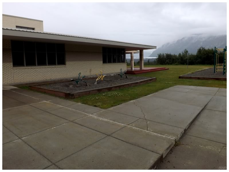
Further up the road, I would pull off the highway at the Glacier View School in Chickaloon, delighted with the fact that these kids go to school with a glacier behind the building.
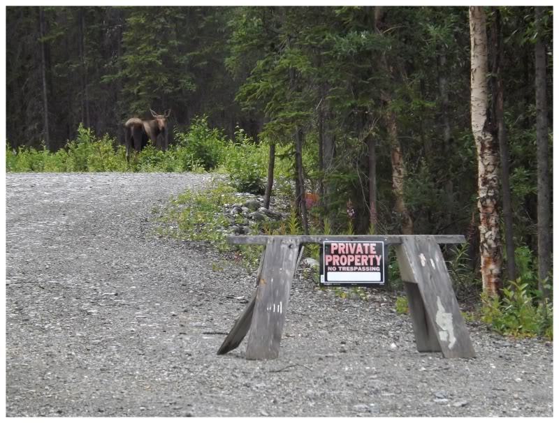
This is where I saw a trespassing moose - which I figured to be a good Alaskan omen.
It would be funny if I didn't live in NF and see moose on the regular...since it took me all of 3 hours to see one in Alaska. (I didn't see another one this entire trip though.)
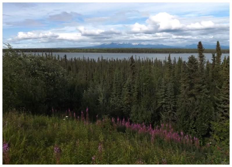
Continuing along the AK-1, I left the Talkeetnas & Chugachs behind as I moved into the Alaskan Interior - an area that reminded me of the forests & bogs of northern Newfoundland and southern Labrador. I pulled off the highway here & even though it was only 2 or 3 in the afternoon, the lack of sun & the stiff wind combined to give that late evening feel in a desolate land.
I finally reached another town when I hit Glennallen, where they have a grocery store, gas store, bank, motel and even a Thai-food chip wagon.
I didn't know this until I got home, but when I turned around in their high school parking lot, I marked the most north I'd ever been at 62.11°N. This was a little bit better than my previous record of 53.71°N in Cartwright, Labrador. A total gain of 8.4°.
To put that into perspective, Detroit is approximately 8.4° north of Atlanta, Georgia.
Alaska is really up there.
Glennallen would bring the first turn in 3.5 hours as I left the AK-1 behind. It would continue on towards the Yukon, as I turned south onto the Richardson Highway, before shortly moving to the Edgerton Highway, AK-10. The Edgerton Highway was hard to beat as well, as it followed the mighty Copper River for the majority of its course, bobbing up & down to provide varying views of the scenic river deltas and impressive volume of this river which drains an area the size of West Virginia.
I was also impressed with the fact that I found a really good burger out here. I was surprised enough with finding a closed restaurant, then after I skipped a seedy-looking place, I was sure that I would be stuck with the supplies I bought back at the grocery store in Palmer - but nope, along came a 3rd restaurant! Or more accurately, a cabin at a campground that served food, where they made better food than I often have back home.
I completed the Edgerton section in a steep-sided river valley that led to the village of Chitina. The 250 miles0 that I had already driven was impressive, but certainly nothing you could describe as nerve-wracking.
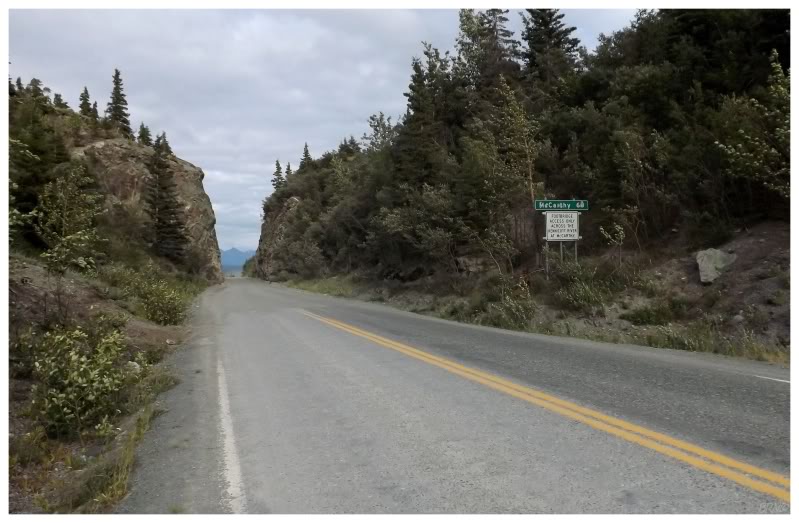
Things were going to get intense after Chitina though, as this marks the start of the McCarthy Road.
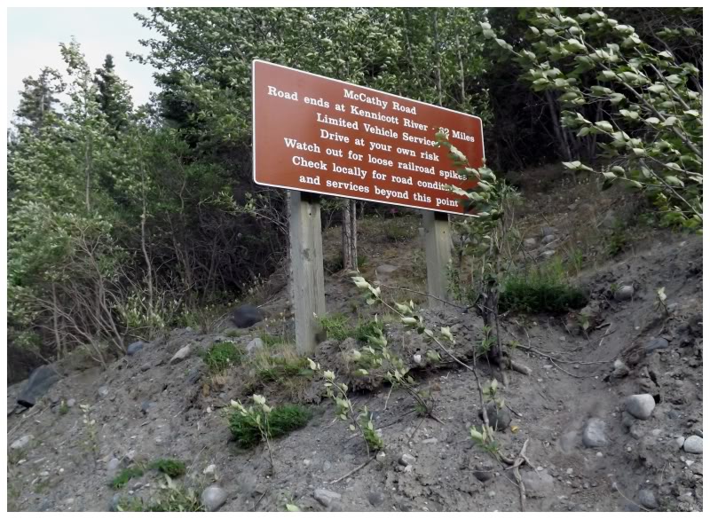
The Copper River I mentioned was given that name for a reason, as the copper here was so plentiful that they built a 196-mile railway to the town of Cordova simply because of its presence. These copper mines were abandoned in 1938 though, but renewed interest in the 1970s brought about the creation of a 60-mile gravel road, built atop the former railway portion between Chitina and McCarthy.
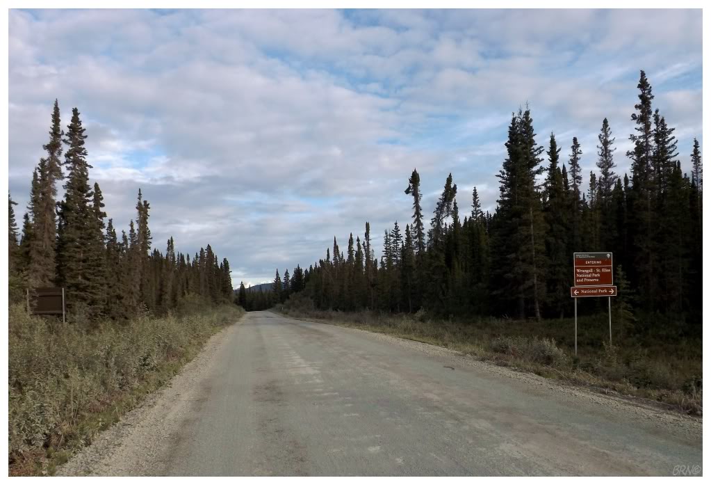
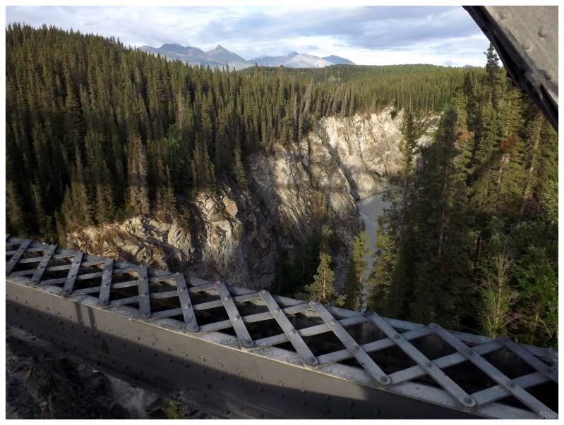
There are only two roads which lead into Wrangell-St. Elias, America's largest National Park. The McCarthy may not look too bad in the above picture, but they recommend allowing 3 hours for travel each way - and even though I'm hard-headed & impatient, I have to admit it took close to that amount of time. It's not the worse gravel road in existence, but there are washboards & when a sign warns you that there are still railroad spikes here & there, you tend to watch the oncoming road with eagle eyes, trying to save your vehicle.
I was incredibly stressed for the first 5 miles, but I slowly settled myself down, by acknowledging that this would be an awfully long evening if I spent the next 3 hours stressed to the point of breath shortness.
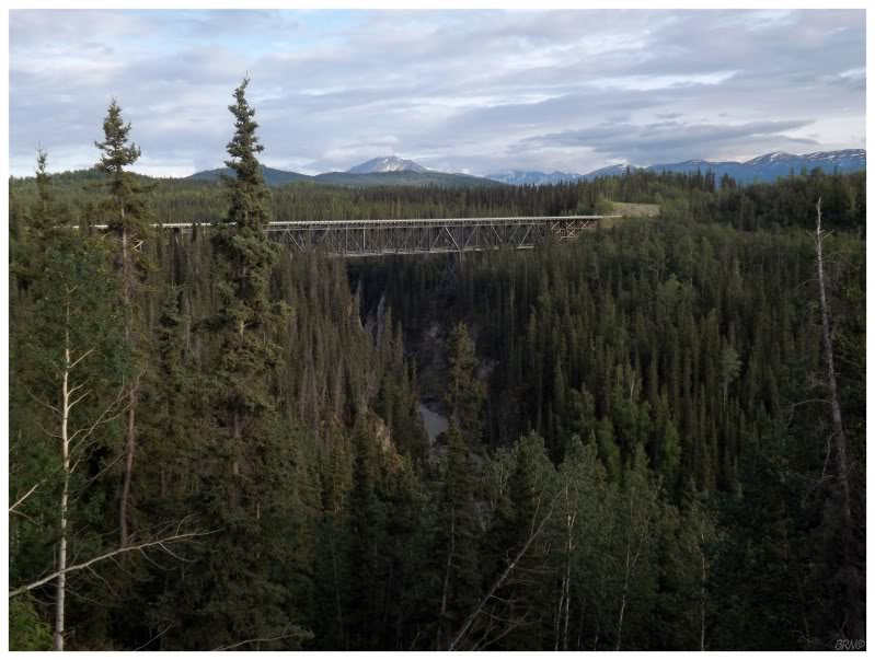
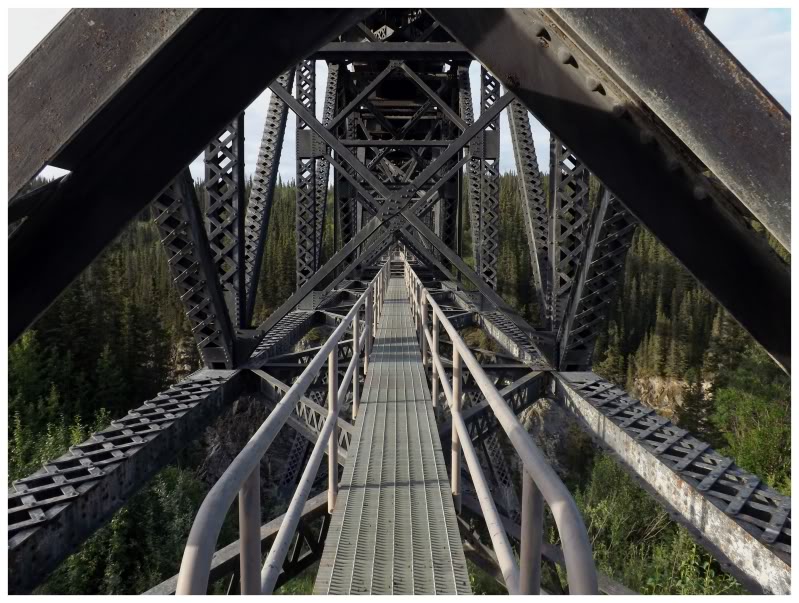
It was a good thing there weren't any railroad spikes at mile 17, as I locked the wheels into a stop upon seeing the Kuskulana Bridge. I didn't commit much time to researching what was actually along the McCarthy Road, so this was entirely a surprise to me - a 525 ft-long steel bridge, set 238ft above the Kuskulana River below.
Two random Kuskulana Bridge facts: apparently this bridge was built in the winter of 1910...and it didn't have guardrails until about 10 years ago!
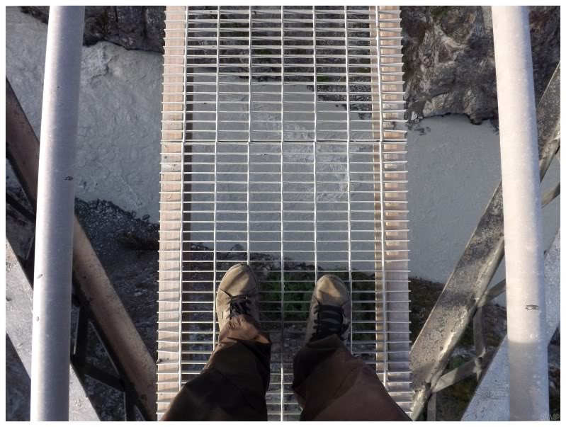
Yep, it really was 238 feet to the Kuskulana below.
The miles kept melting away & I was happy to have avoided car problems. Throughout the drive, I was passed by a handful of people & had about 20 cars going the opposite direction - only once passing a car which was broken down.
This ratio of broken-down cars to moving cars was comforting.
I started to relax a bit and take in the scenery to a greater extent. The remoteness of this road, the desolation of the land around me & the scenic views were all combining to make a greater impression as the day went on. This was really hitting on that experience I expected Alaska to provide.
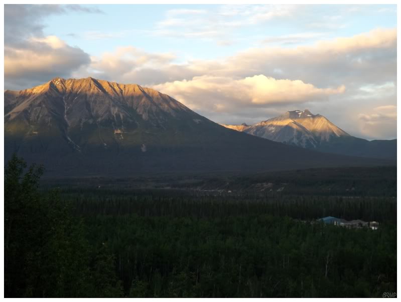
As for the weather, I couldn't complain about the rain staying in Anchorage & the interior. The setting sun illuminated the western Wrangells in a fantastic light that challenged me to keep my eyes on the narrow McCarthy Road.
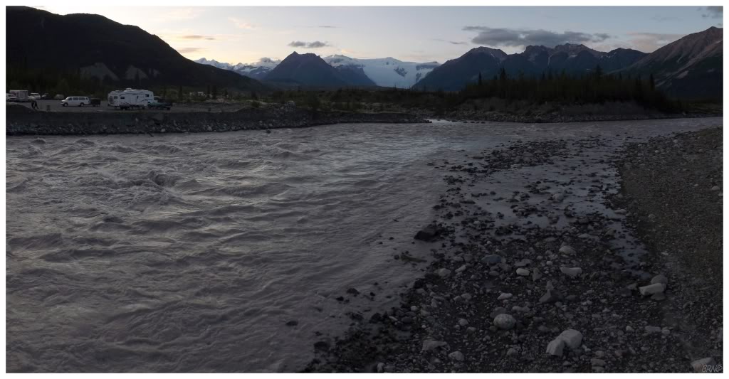
I had left the airport at noon & it was about 10 o'clock when I finally reached McCarthy. The road actually ends without a crossing over the Kennicott River, as you're left to park your car at the visitor centre, at one of the two campgrounds, or at one of the few lodges.
Paying for my parking space in lieu of a tent, I was happy that I was finally done driving for the day & that I could explore for a bit. I crossed the footbridge into the village of McCarthy & found some path into the trees which led to an overlook over the Kennicott River. There were a lot of dudes clad in Goretex & granola-type hippies around, so it was nice to find solitude & take in this glacial-fed river & dusk scene without social awkwardness.
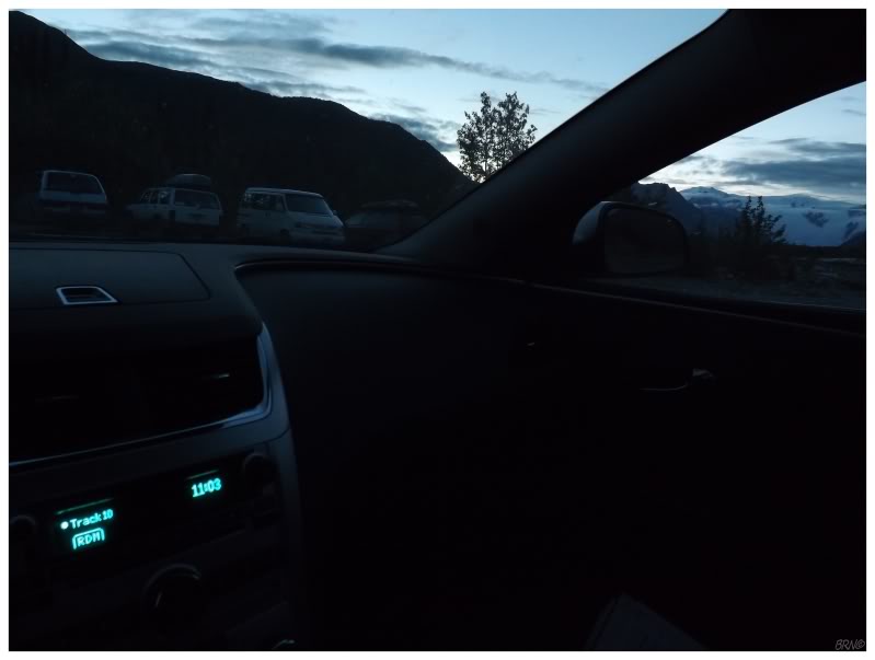
Nevertheless, I had big plans for tomorrow & there wasn't much point in staying up once it got dark. I made a bed out of my spare clothes and settled into the back of the Chevy Malibu.
As I sat there & had an Alaskan Amber while listening to some tunes, I thought about the fact that I was experiencing one of those famously-long Alaskan summer nights. The above shot was (obviously) taken at 11:03pm & it was still (obviously) somewhat bright outside. My camera was at ISO-200, which isn't all that light-sensitive of a setting (it's actually what I use about 1/2 of the time in broad daylight).
This marginal amount of light wasn't going to keep me awake though. I was out within minutes.
Continue to Part 2...