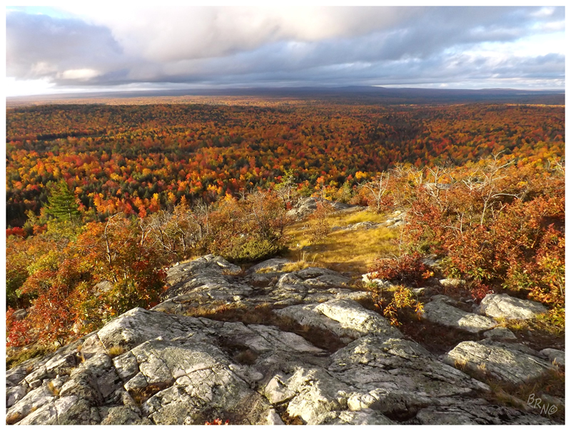
We started out the day by groggily moving back up the short path to the summit of Bald Mountain. The sunset wasn't bad last night, but the sunrise & early morning light today was fantastic.
This is the view to the southwest, showing Mt. Arvon (Michigan's highest point) off in the distance.
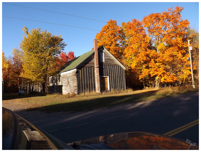
It didn't take us very long to get back to Erick's Bridge, and once there, civilization was incredibly close as we drove down Skanee Rd. We didn't hang around the paved roads though, leaving at the sign indicating the direction to Michigan's highpoint.
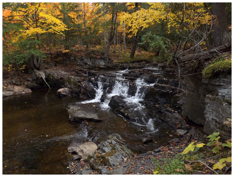
We would find these waterfalls along the way.
These are the Black Slate Falls & I bring them to you because I fell in the creek to get this picture. There was a giant boulder which I was trying to Spiderman alongside, but I lost my footing and whoop! Up to my calf in Northern Michigan water!
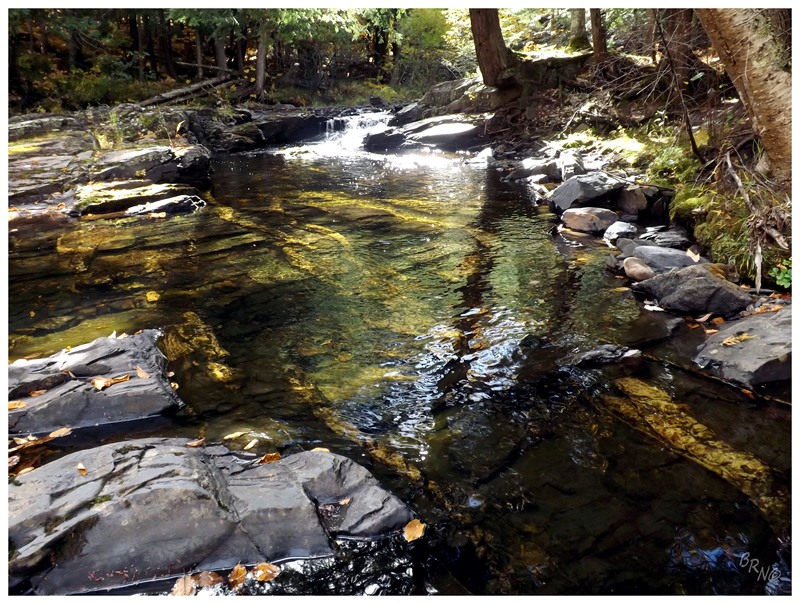
I looked back to discover that Nailhed was quite amused with the whole fiasco.
Not only were these falls neat because of their namesake black slate, but also because of the shiny quartzite veins running beneath the water.
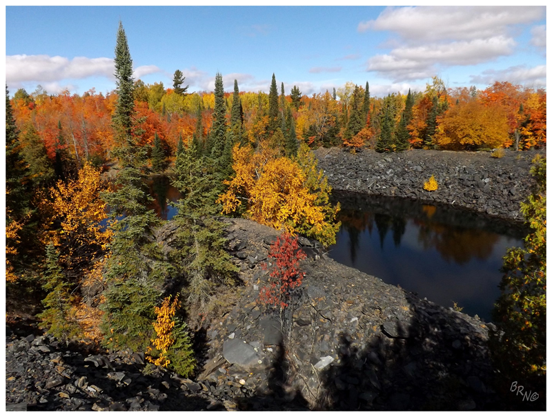
Speaking of black slate, not 5 minutes from the falls we found the Arvon Slate Quarry.
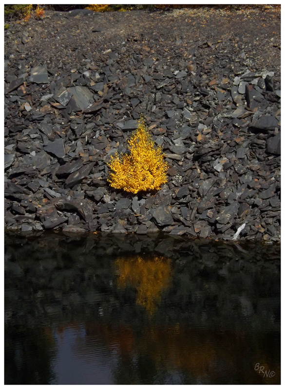
Abandoned quarries rank just about last in my hierarchy of cool abandoned things, but the Arvon Slate Quarry earned its keep with a few small stone walls, colourful trees against black backgrounds & just about the most exquisite weather this Earth can create.
Nailhed was being far more thorough than I, but I had no problem taking a seat & enjoying this beautiful day.
There were tracks into the back of the quarry and empty bottles laying about, as the local youngsters must come here to party.
(Or maybe it's just weird older dudes who like to check out abandoned things.)
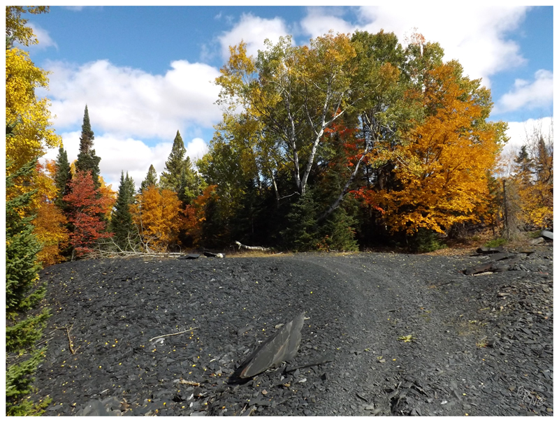
And now, on to conquering Michigan's highest point!
Judging by the number of people who get this highpoint, I figured that the road would be decent. I had read that it might be problematic in certain cars, but that a truck shouldn't have any problems.
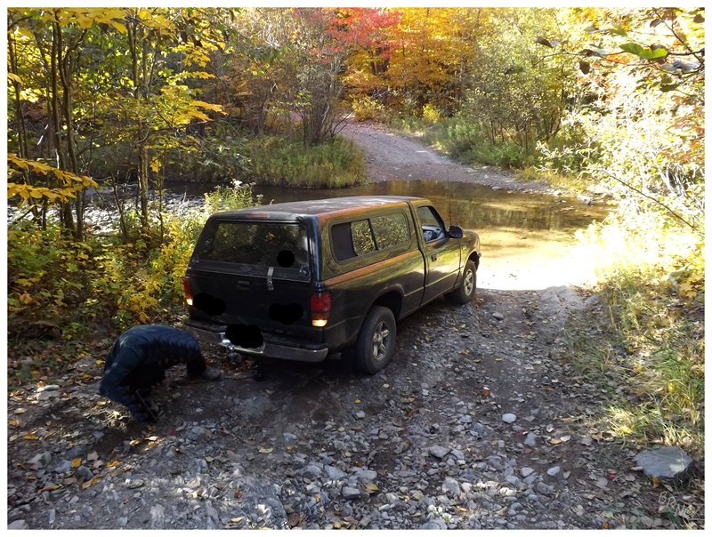
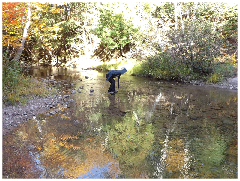
The fact that there were decent signs at Skanee Road, led me to further believe this to be true. The thing was that we only saw two signs for Mt. Arvon, then no more. We ended up at forks and decision points, but were left without any indication which way to go.
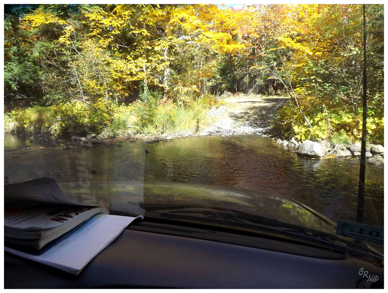
So we ended up at a couple of scenes like you see in the above picture. Nailhed would get out, put one hand on his hip and the other atop his fluffy hair, sizing up the situation and whether his truck could handle the crossing.
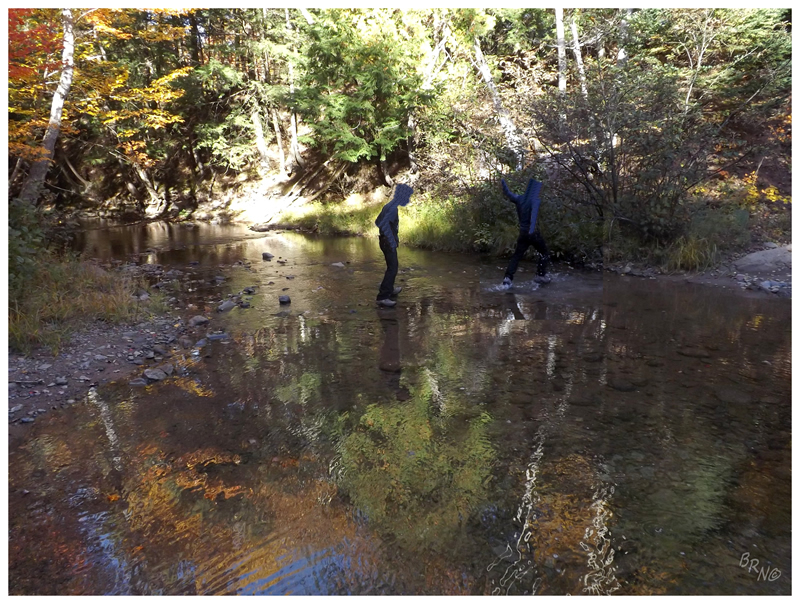
We crossed the above creek which was unnecessary, then crossed another creek before finding the road to...
Mt. Arvon!
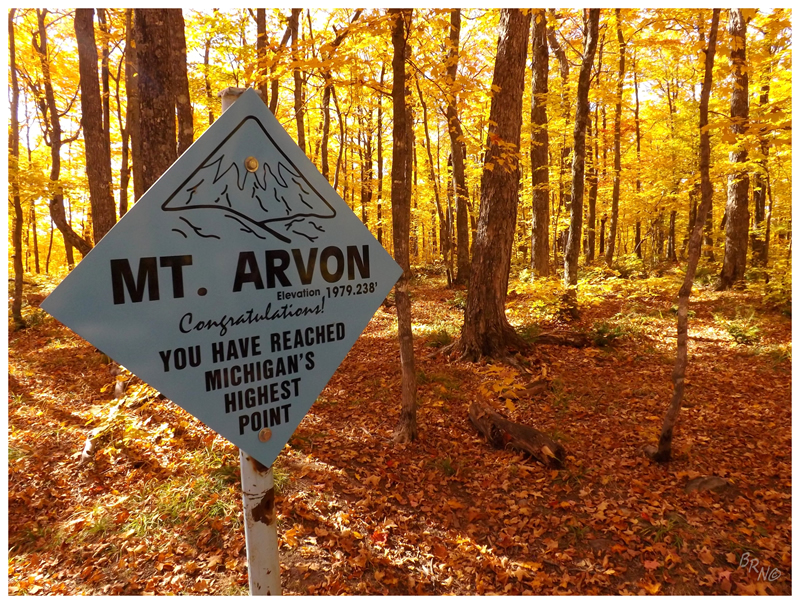
The website I use for highpoints has Michigan's highpoint in the difficulty 2 section, but that must be out of date. The two of us parked our car in the sprawling gravel lot, then strolled the entire 1/2 mile over to the 'summit', shockingly without taking a rest.
The reason you see the elevation listed as 1979.238' is that up until 1982, Mt. Curwood was thought to be Michigan's highest point, but a survey that year revealed Arvon to be 11 inches taller!
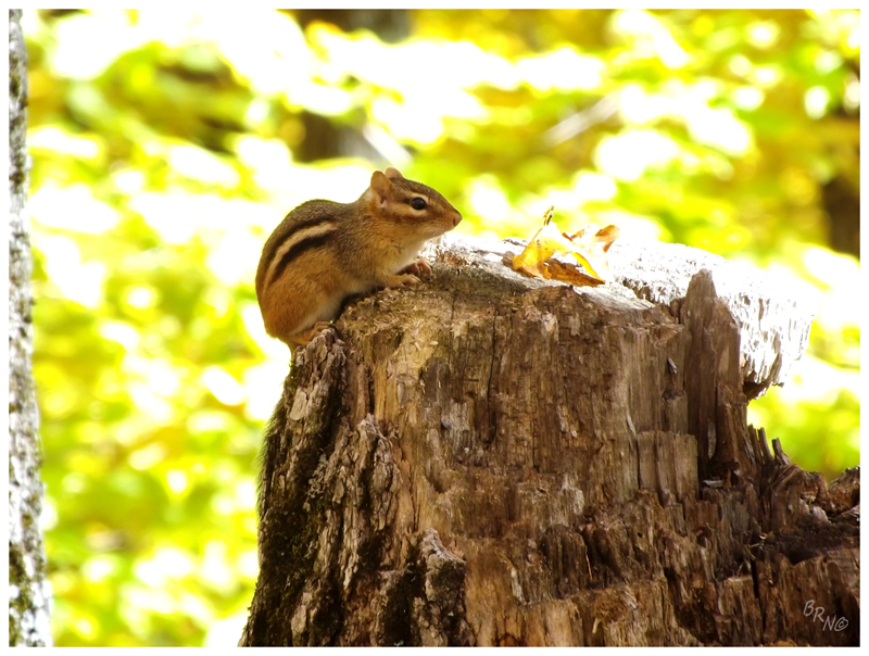
Standing atop the geological survey benchmark for Mt. Arvon, I looked to my right and noticed the highest chipmunk in Michigan!
:D
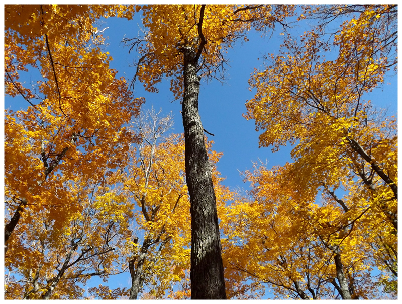
Looking skyward from the roof of Michigan. The entire forest was a sea of gold, like a 2011 Stanley Cup parade.
If you're wondering about the actual view, this area is owned by a paper company & they've cleared one swath of land so you can look out at something besides forest. It really wasn't that great in the middle of the day - or more accurately, I should say it wasn't as great as looking out from Bald Mountain.
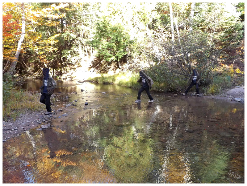
Crossing two creeks to reach Arvon the first time, we tried to leave via the actual designated route to avoid such water displacement on our return leg.
The funny thing being that as Nailhed was slowing down to look at the above situation, he actually got himself stuck before we even got to the creek!
At least it's funny now, because we were able to get ourselves out and move along. The truck had become stuck at the spare tire by the truck jamming up against a jutting rock. This wedged the truck off the ground & we had to get the jack out to push the truck up & over said rock.
After crossing that creek, we had been driving for a good 1/2 hour when Nailhed went to take a picture of an abandoned church & realized he didn't have his jacket - he forgot it on the ground when he went to dislodge the truck!
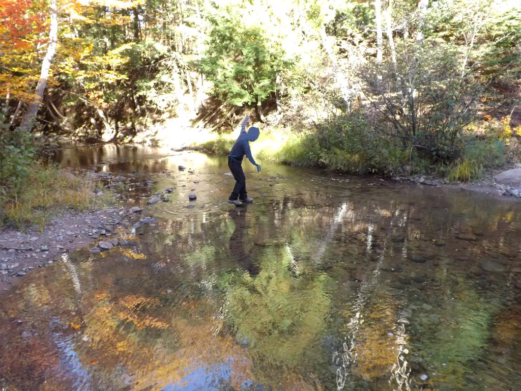
We return to that creek!
He obviously wasn't about to drive his truck across the creek, so...
I made myself useful by standing on the shore & pointing at his jacket, while making sure to document yet another creek crossing!
The Sub-Zero leg sweep, to the fully submerged foot, to the happy jacket retrieval.
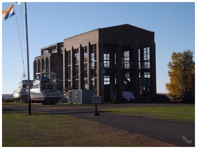
I was quite excited for the next stop in Pequaming, but grew disappointed when I saw that the abandoned powerhouse was being used for boat storage. There was a campground right where I took this picture & I thought it would be a great opportunity to photograph this building later - but the promise of a motel bed for the first night in 4 nights was too great. We moved along.
(Pequaming has an interesting history in that it was one of the first lumber operations to really thrive along Lake Superior. Eventually the owners were approached by Henry Ford, who wanted to buy the lumber stands because of the amount of wood used in the construction of his Ford Station Wagons. Ford would construct this powerhouse, improve operations and establish his $5 work day here in Pequaming. A lot of the buildings remain to this day, including the Ford Motor Company water tower and Henry Ford's old residence which you can stay at! (Their website is piss poor and I didn't feel like calling to find out the rates which were likely out of our budget range.)
Here is a 1920's picture of the above powerhouse, with the sawmill still intact.
The last action item for the day was a visit to Point Abbaye.
This excited me greatly as the Abbaye Peninsula was a small sliver of land that had escaped Nailhed's comprehensive Upper Peninsula explorations of the past - this was all new territory to him.
(The above picture is an abandoned community hall along the way through the middle of the peninsula.)
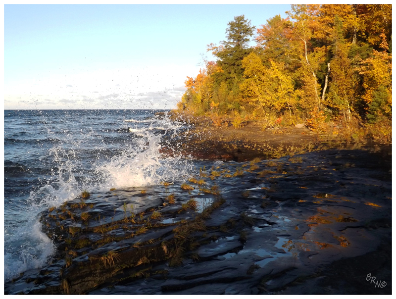
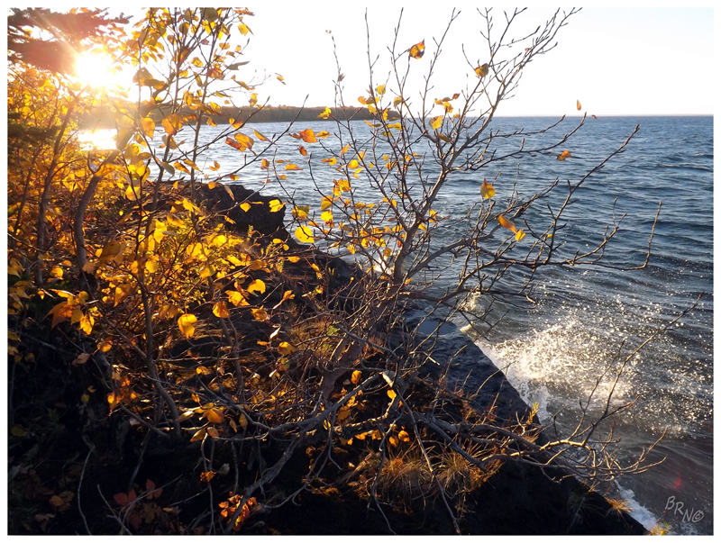
After driving the last bit along rough, dark, forested roads, we finally caught glimpses of Lake Superior and we were at the parking lot momentarily. A couple of trails lead out to the actual Point Abbaye, but we simply moved to the shoreline & worked our way east.
For a long time I've wanted to swim in all of the Great Lakes & I can't say I didn't consider getting Superior today, but it was down into the 40°s by this point, with a whipping onshore wind and tumultuous waves.
So I stayed bundled up as we walked along. Looking far ahead, I noticed a white dot amongst the colourful trees & pointed out the bald eagle to Nailhed. The bird would then soar off, not letting us get even remotely close.
After having seen about 50 bald eagles in Newfoundland over the years, it was about time I saw one in the land of freedom...
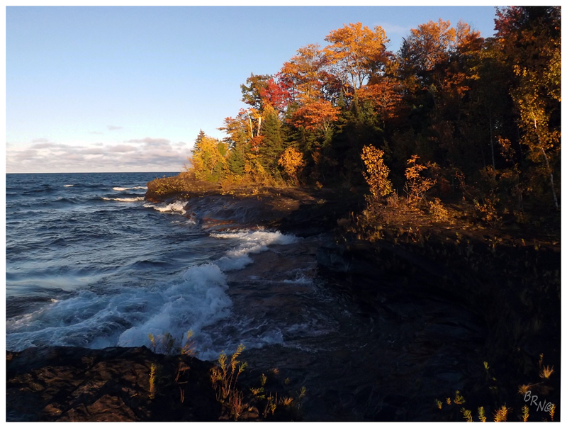
It wasn't so cold that I wanted to rush back to the car, but it was still cool enough to set a desolate tone & remove those memories of the calm lake from yesterday. This reminded me of stark Newfoundland coastlines & I was eating it up.
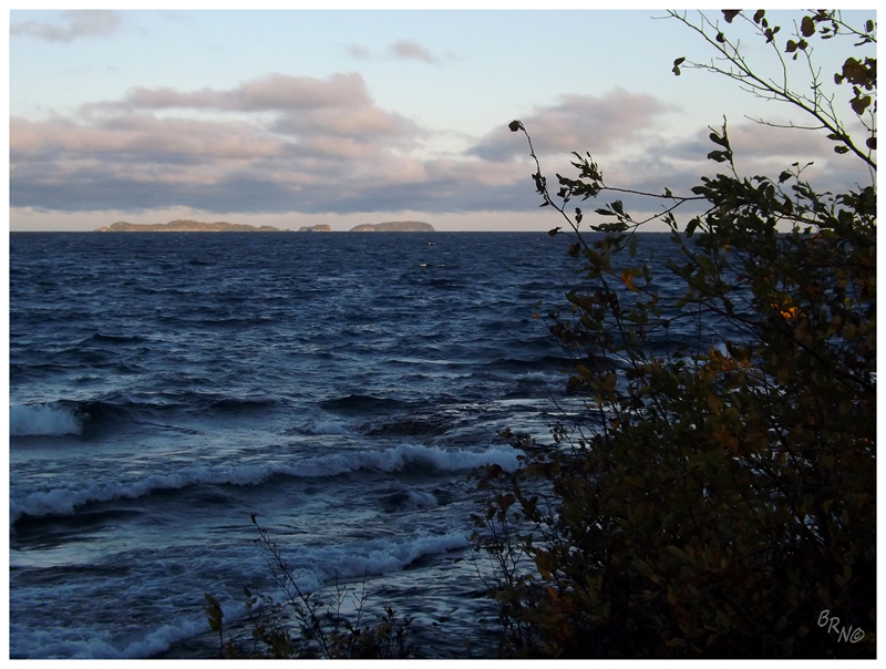
Reaching Point Abbaye, you could see the Huron Islands off in the distance (above), plus the Huron Mountains to my right, including Bald Mountain from last night.
The shoreline was growing dark, so we decided to get going. Motoring back down the Abbaye Peninsula, grouses and deer fled to the side while we flew along. We were going to L'Anse for the night, to get some dinner at a local bar and clean up at whatever motel they had.
Not so fast.
Pulling into L'Anse, nothing appeared to be open except for a video store, a Citgo and a BK. Comically, even the Night Owl Restaurant was closed for the night. We went to their two motels, but neither had vacancy.
Oh what in the living hell.
We drove to L'Anse's neighbouring city of Baraga, but couldn't find anything worth eating there either. In addition, they only had shitty chain hotels like Best Western where it would surely cost an arm and a leg - so it was a good thing they didn't have any vacancy either!
"Sorry, there's a conference in town. No vacancy anywhere" the proprietor told me. "Doesn't this town have a fleabag motel?" "Nope."
I wondered if Baraga doesn't have a fleabag motel anymore because Best Western put them out of business and jacked up the rates for this neck of the woods.
We ended up eating Burger King in the thought that we better get something before it closes. We then drove west into the Ottawa National Forest and pulled the truck over into a clearing.
And here I had got myself all excited to lodge in L'Anse.
Continue to Part 4!