Driving west from Corner Brook out along the oceanside NL-450, you will find yourself on a coastal road with pleasant scenery, that takes a turn for the dramatic after only 20 or 30 minutes of driving. Once you approach Frenchman's Cove, where the impressive Lewis Mountains and the island of Wee Ball/Guernsey reappear, you've come upon some of the most spectacular scenery this island has to offer. Those living in Corner Brook are spoiled with this drive, until they remind themselves with the occasional drive out to Lark Harbour.
It's not just the Lewis Mountains and Guernsey Island either, you have spectacular Bottle Cove, Little Port Head, the Murray Mountains, Copper Mine Falls, Copper-to-Cape Trail, etc., etc.
I've made it to the Rattler, albeit on a disgusting day, and also the Murray Mountains on account of trying to get to South Head, but there are lots of gaps here. The thing is that I've always leaned towards saving these places for the winter. At a time of year where it's too costly to get a motel every night and the days are very short, these places are close to home & make good winter targets with shorter drives.
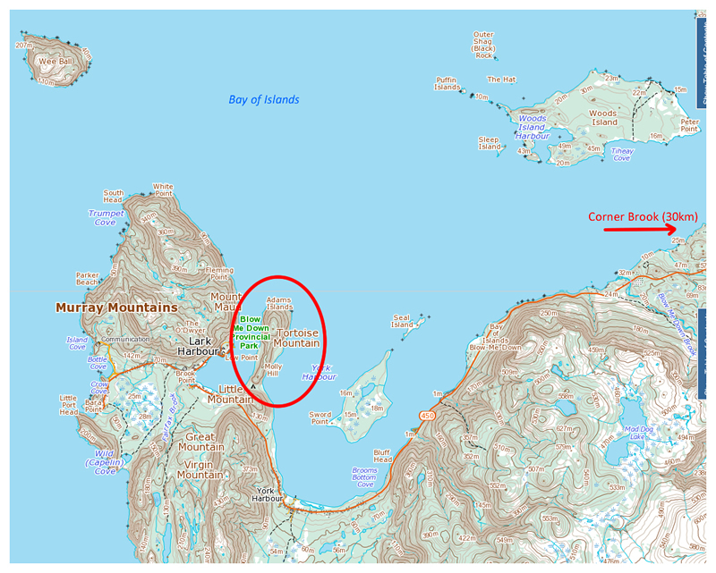
Returning to Newfoundland after the holidays, on my first weekend back I set out towards Blow Me Down Provincial Park. This is a campground and hiking trail, slapped down on the initial lowland of a small peninsula that divides York & Lark Harbour. From the near-sea level campground, trails lead up to Tortoise Mountain, an 846 ft round hill marking the other end of the peninsula.
If one is to walk through the campground then along the shore, it isn't very long until you come to the Governor's Staircase, something I've posted a picture of here four years ago. I wouldn't take the Governor's Staircase today, but I can assure you that the other staircase I took had just as many stairs, along with varying amounts of snow, where patches of minimal snow made places awkward in snowshoes, while drifting stair corners made for sweaty upward handrail pulls in knee deep snow elsewhere.
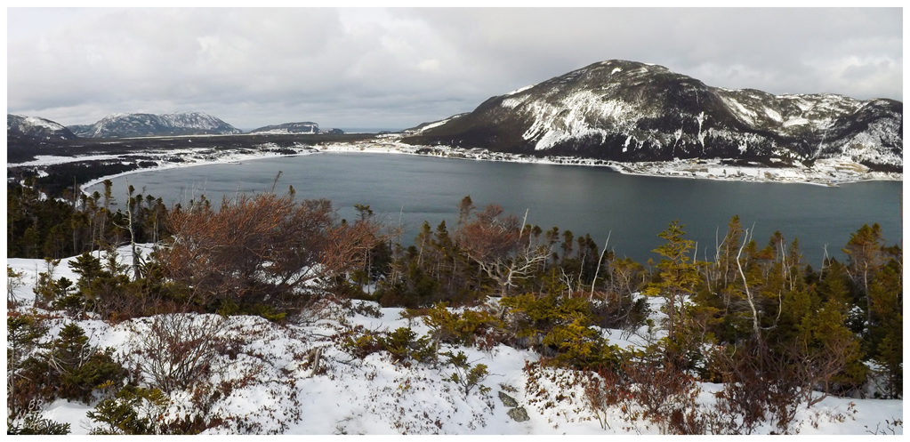
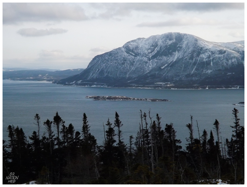
It wouldn't take very long before I came to an observation porch on Molly Hill, one of the other hills listed along this peninsular ridge (along with Flapper Hill). The above picture comes from the top of Molly Hill, looking back over Lark Harbour's inner harbour.
A path seemed to continue into the woods from here, a welcomed sight since I was going to continue on to Tortoise Mountain regardless of the presence of a trail.
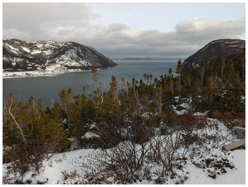
Looking out towards the Bay of Islands, South Head and its new lighthouse would be around the front of that landmass on the left. On one of my 7 attempts to get out to the old lighthouse, I had waded in the water and climbed along the rocks out there; so as I walked along, I wondered about how far I actually got out alongside the ocean.
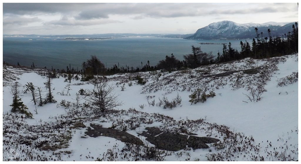
This Lark Harbour Head Trail cuts through the forest out here, providing only passing glimpses of the beauty around while you're immersed in the thick trees. Rounding the eastern side, then following the curving path up the side of Tortoise Mountain, the trail eventually spits you out into treeless clearings, with rocky barren at the highest and most exposed points.
I still couldn't see South Head from here, as it's located on the western side of its headland. Seeing as the lighthouse was there to provide guidance for ships entering the Bay of Islands, this all makes sense.
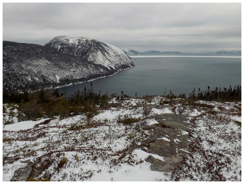
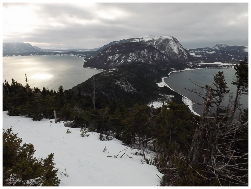
Looking east, the Bay of Islands delivers on its namesake promises, with relatively flat slabs of land dispersed throughout the view.
Blow-Me-Down Mountain's 2125 ft dwarfs little ole' Seal Island.
There's nothing like a decent picture of an obscure geographic feature to make me happy: "Seal Island is nearly joined to the east extreme of Governor island, and is continued east one cable by rocks awash at low water." :)
Also note in the above picture, that you can see the NL-450 secondary highway along the base of Blow-Me-Down Mountain. Now I always wondered why they at one time resettled the small village of Little Port, out past Lark Harbour. It makes much more sense now in knowing that the NL-450 was only finished in the 1960s, meaning the three localities out here were much more isolated prior to that (especially considering that daunting mountain). The road's construction would allow people to commute to Corner Brook much more easily for work and supplies, breathing extra life into these settlements out here in the outer Bay of Islands.
Looking back over the peninsula from where I came, the foreground curving trail is the one that cuts up Tortoise Mountain. The road here slides between those two high hills you see at centre, where you hook around the lower one and enter the provincial park to the right.
The two taller mountains in the back are Great Mountain & Virgin Mountain, two hills which I always think about climbing while looking at topographic maps, but then again, I can't even commit to climbing Blow-Me-Down Mountain which has a maintained trail.
Even with the gusto from which I returned from the holidays, this would be only time I'd snowshoe out here in York/Lark Harbour during the season.
Until next year, when we might meet again.