My friend was headed up the coast on a work trip & I decided to tag along. To head up to one of my favourite areas of Newfoundland was an easy decision. One of the reasons I like the Northern Peninsula is because it's relatively obscure, even more so when you're talking about winter trips.
There were also three communities I had left to see up here.
Speaking of that goal to see all of the communities on this island, my friend has started to tell more people and I've now started to get questions about whether I have a picture from every community. The answer to that is a reserved no, since there are a lot of highways in this province that turn into the main road of communities. I usually estimate that I have pictures from somewhere around 400 of the 792 communities I have visited.
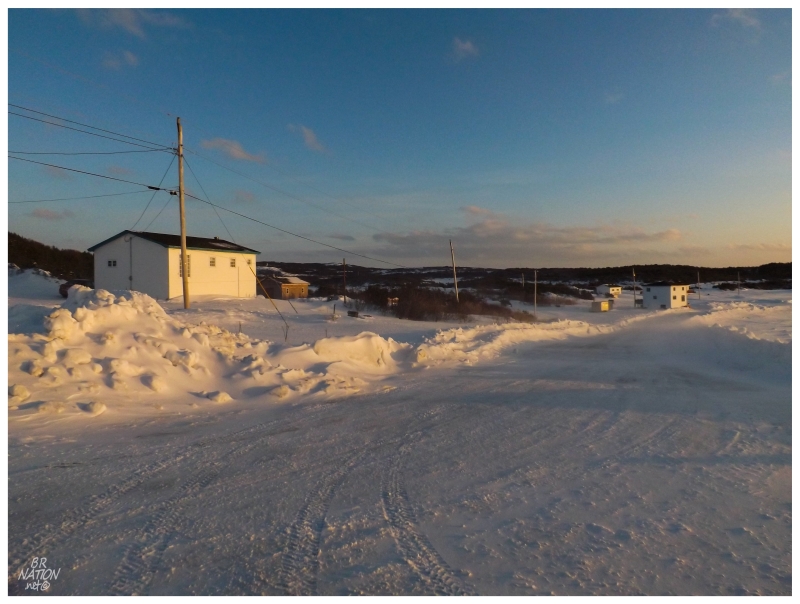
This has contributed to me stopping to take a picture in a few more of the communities you drive right through - communities like Deadmans Cove.
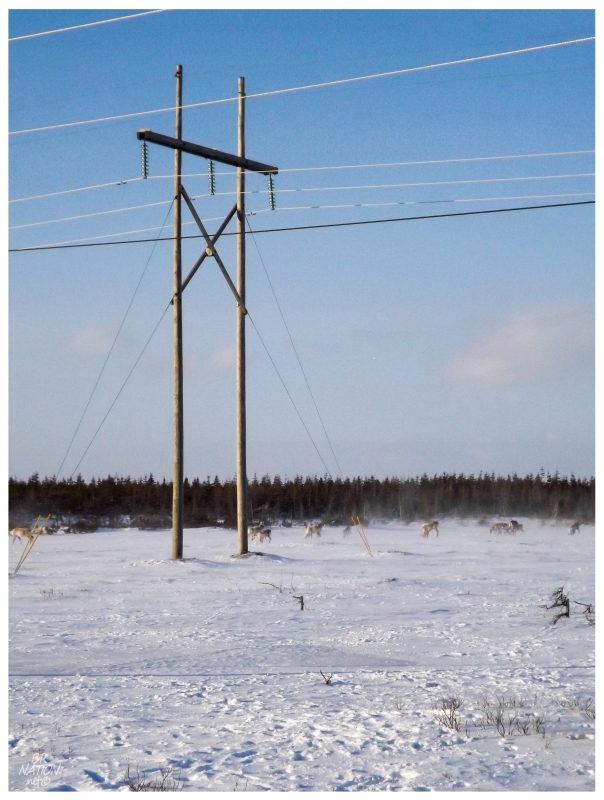
Leaving Deadmans Cove, the remainder of the drive up to St. Anthony was uneventful just like the first half, until we neared the airport and noticed a small herd of caribou.
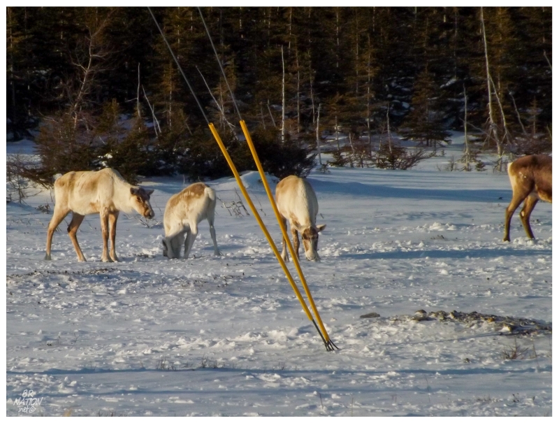
While it might look like a nice day because of the sunshine, it was blustery as I stood in awe of the caribou's ability to survive in such conditions.
While my friend's boss might have thought the priority of today was site visits, it was actually to get me to a few of the seven communities I had left to see.
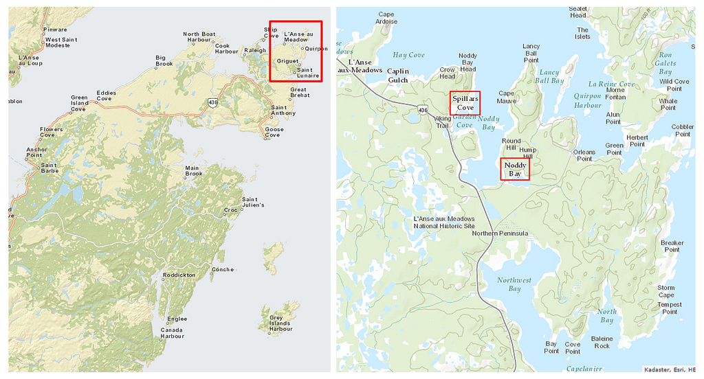
The setting sun stewed an uneasiness in my belly as I thought about not seeing these places during daylight, but as we hooked onto the NL-436 towards L'Anse aux Meadows, even with this low winter sun, I estimated that we'd get there while speeding through St Lunaire-Griquet.
It was here that even though I've been to L'Anse aux Meadows 4 times and Quirpon an additional time, I hadn't managed to turn off the road and drive the 600m/2100ft into either Noddy Bar or Spillars Cove. I had nearby Caplin Gulch from my trip with Kristen, but not Noddy Bay or Spillars Cove.
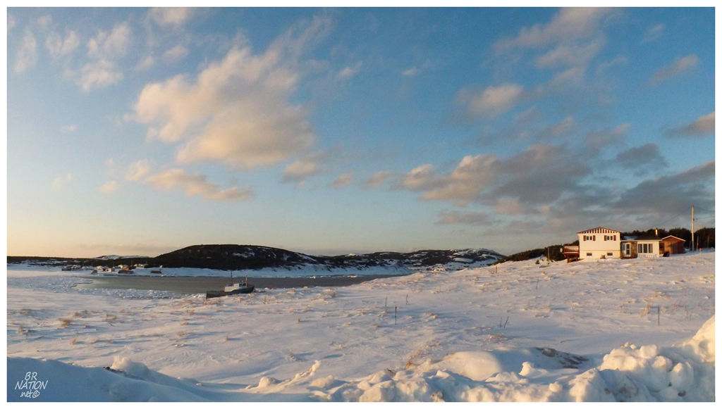
Driving along the NL-436, Noddy Bay's main street dipped down from the road, curved around the bay with a houseless stretch, then ended at a cluster of houses.
Woo-hoo! Number 793! And right at sunset!
I love this quest to get every town, not only because it brings me to obscure places, but also in later learning the history since I was too busy and/or uncommitted to look it up beforehand.
The interesting history comes in the origin of the name Noddy Bay. While saying it aloud, one might think it's the more interesting Naughty Bay, but it's actually interesting regardless since it was named for the Atlantic Fulmar, a seabird which bobs its head in flight, nodding along, leading to its colloquial name of a noddy (these birds were caught for use as a bait in the 1700s when this bay was settled and named).
The population at Noddy Bay was recorded in 1986 as a mere 87 people. Seeing as that was six years before the cod moratorium, even though the people here took seals and grew gardens to support themselves, you'd have to wonder what that number would be today, as you pause about the quiet community.
(The census only lists "L'Anse aux Meadows to Quirpon" nowadays. The figure for that range is 282 people (down from 379 in 2006).)
Seeing Noddy Bay at sunset meant seeing Spillars Cove just afterwards.
In another instance of learning about a place after visiting, Spillars Cove is now known as Straitsview due to confusion with the Spillars Cove near Bonavista. Here I had assumed it was the modern-day need to forget communities and create sprawling, meaningless municipalities.
As much as I wanted to remember Noddy Bay because of its avian name origin, standing next to the icy, glowing Spillars Cove while a neighbouring dog bothered me, this cove probably ended up being more memorable than the bay.
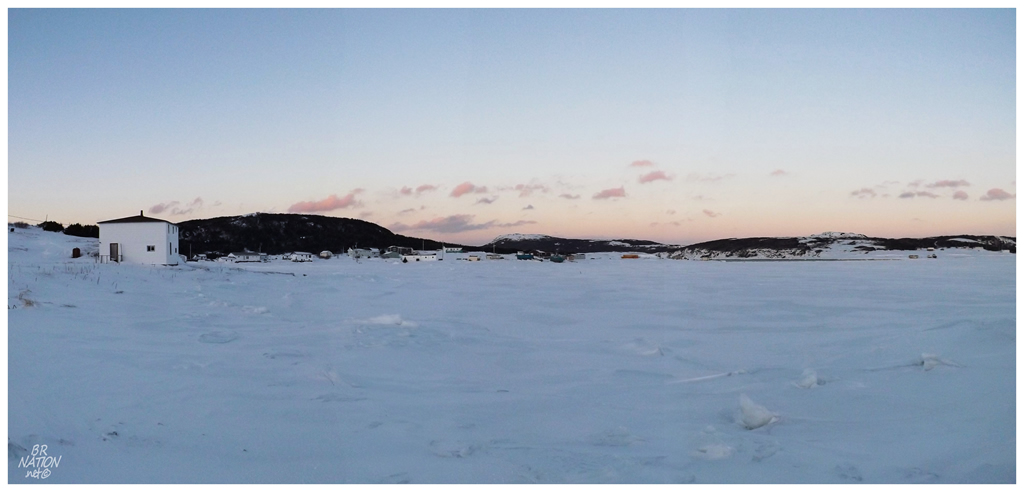
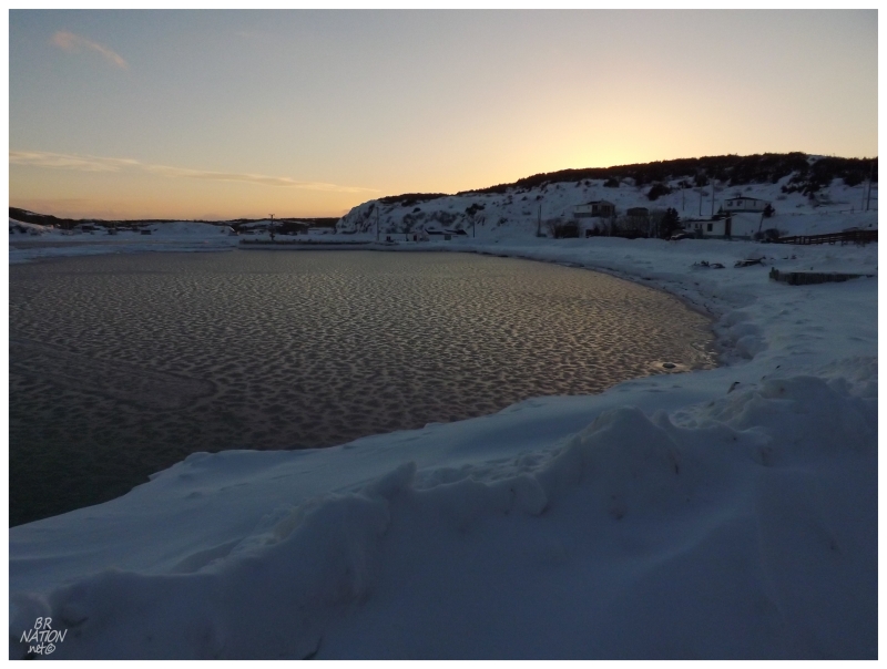
That night our accommodations were back in St. Barbe, a fortuitous coincidence that allowed me to walk a short distance to get one of the 5 communities I had left - Pigeon Cove, 795!
I was left wondering whether I should count Pigeon Cove since there wasn't a break in the roadside houses at any point. It's only in reading the history of Pigeon Cove that I realized why it used to be more of a community.
Pigeon Cove would never have more than 30 residents & usually the number was in the single digits or the teens. The small cove was enough for these people, while they walked to St. Barbe or Black Duck Cove for schooling and supplies. It was only in the 1970s when a road was built to Pigeon Cove, that people started to build houses along this short roadway, blurring the lines between St. Barbe and the village.
You could surely find similar old coves or settlements in the more elaborate Newfoundland towns like Twillingate or Burin, bringing up questions about whether I might have missed other places on the same scale as Pigeon Cove. I insist that I did my best to make sense of the curving roads, multiple coves and mishmash of old village names in places like Burin or Twillingate, places larger and more complex than St. Barbe.
Doing things like going out of my way to see tiny Pigeon Cove leaves me in good faith that I've legitimately seen 795 settlements here.
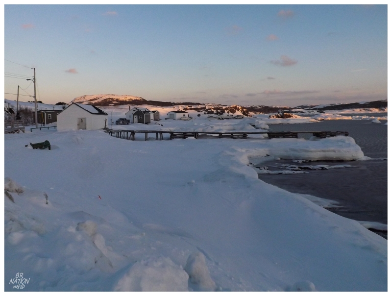
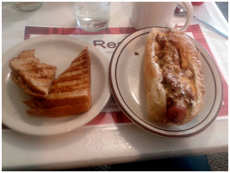
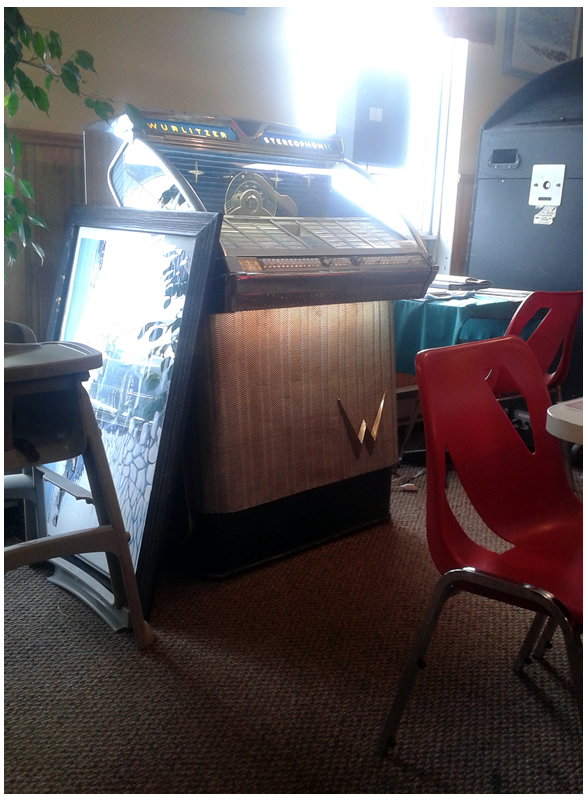
There was no hurry to return home the next day, so after lunch in Flower's Cove, we went for a spin around one of my most beloved towns on the island.
And no, it's not one of my most beloved towns because of their chili cheese dogs or Wurlitzer jukeboxes (although that doesn't hurt...)
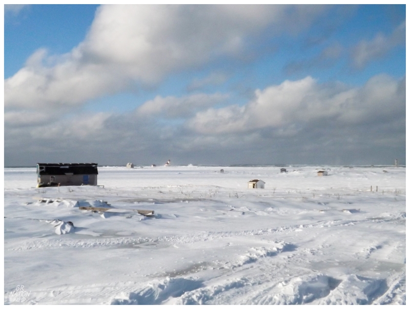
This is the place where I walked out on the sea ice to the lighthouse, a memory which always puts a smile on my face whenever I find myself back here.
I actually have trouble keeping the town name straight as I always want to call it Flower's Island.
Every time I come here in the winter, I subsequently size up the ice, wind & temperature conditions.
I'm also sad to see they must've torn down the abandoned shed I explored.
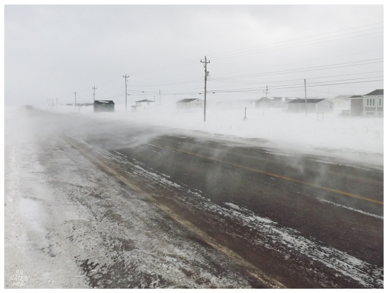
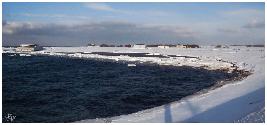
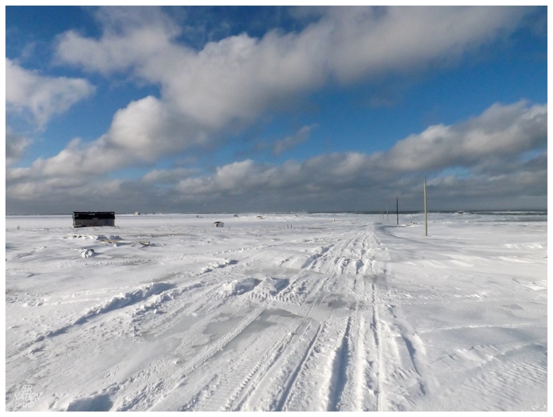
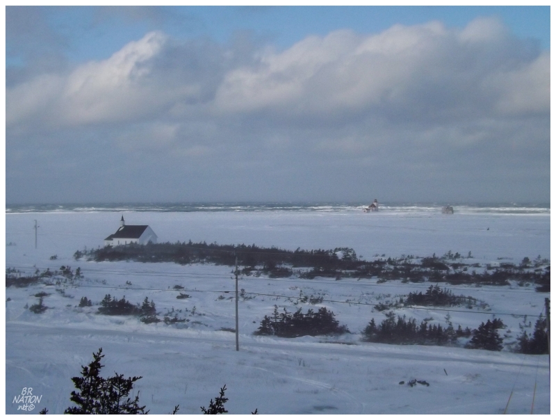
Leaving Flower's Cove, the long, oceanside NL-430 is a highway that'll show you varying weather throughout your trip.
As my friend Steven Twodamncute commented, the snow ghosts were heading north in Deadmans Cove.
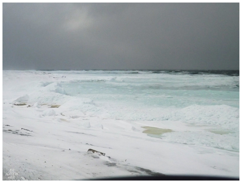
One of the neat things in stopping to get out in this nasty weather was that it was a northeast wind, where the coves and shores were straddled by rolling waves of turquoise ice chunks.
Unfortunately, I couldn't translate the scene with my camera very well.
From Deadmans Cove, there was only one more stop to go, one which I'll cover separately in the next update.