The main reason I found myself on the Burin Peninsula was because of my goal to see every Newfoundland community. If I was going to check off the last few & complete this goal within 6 years of living in Newfoundland, then a Burin 2014 trip had to happen.
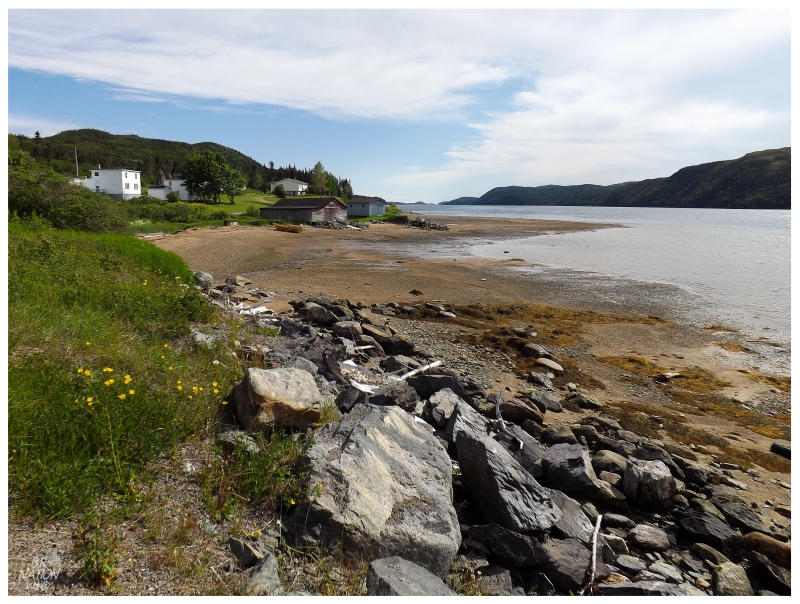
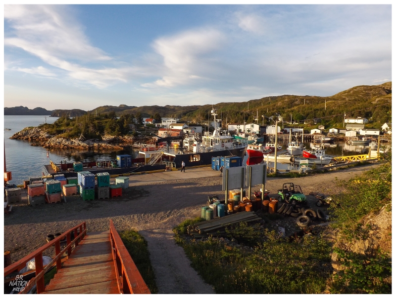
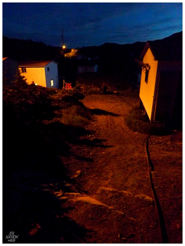
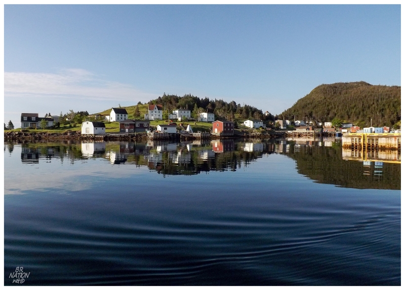
40 kilometers north of Marystown, back along The Heritage Run to the Trans-Canada Highway, the NL-215 meanders 26 kilometers east over rugged terrain and deep inlets before ending at the village of Petite Forte. The two communities of Boat Harbour and Brookside (Brookside is shown above) occur within the first 5 kilometers of this highway.
Once you continue on to Petite Forte, you realize why the road didn't go any further than Brookside when it was constructed in the late 1960s. Over a hill, then across a long bridge spanning a wide inlet, then over another hill, and another, before another long bridge spanning a wide inlet...it becomes apparent that this wasn't your standard road building exercise. In a place like Newfoundland where most roads don't come easy, the NL-215 stands out as one that had to have cost extra time, resources & money.
The remaining 21 km to Petite Forte wasn't connected to Brookside until 1992. The government initially tried to resettle Petite Forte, but was only successful in resettling nearby places like Port Anne. By Petite Forte hanging on and supporting itself through the fishery, the residents were finally rewarded with a road and a slightly easier way of life.
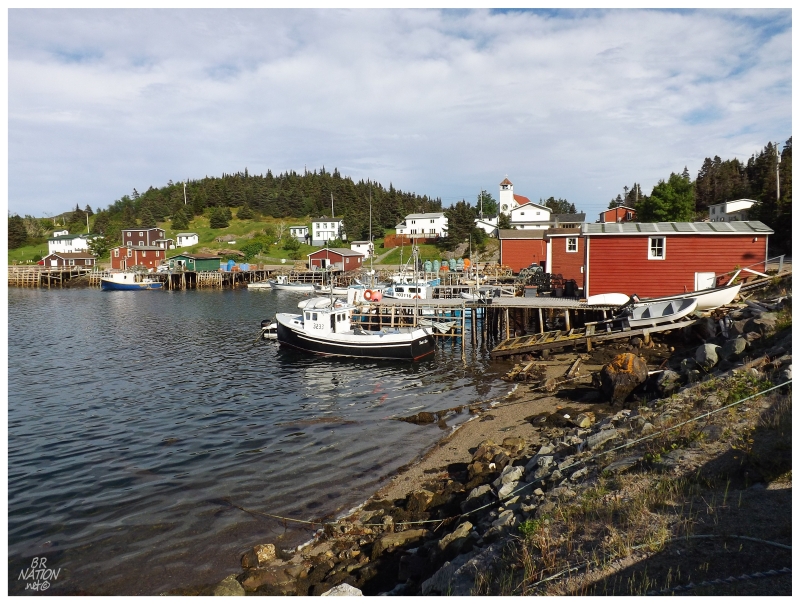
Of course I had been to Petite Forte before, coming all this way with thoughts of getting on the ferry that I was about to board today. The only problem was that in 2011, I got into one of my lonely & sour moods where traveling on a ferry as the weird stranger to what I envisioned as this closed community, wasn't exactly what the doctor ordered. So after driving my aging Intrepid over the rugged NL-215 to Petite Forte, I took a few pictures and turned right back around to head home.
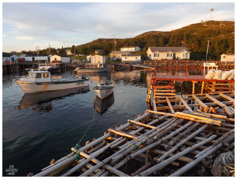
Today that wouldn't happen again. Even though we just missed the ferry & now had about 3 hours to kill in this village of 40 houses, we would manage.
I started out by walking around and discovering the back bay area of Petite Forte that I had never seen before. Then the car was cleaned out. And then since my bike was outside all of the clutter, I spent a good half hour trying to crank arm grind one of those foot-high, wharf-side mooring bollard (i.e. that metal thing a ship ties its rope to in order to dock).
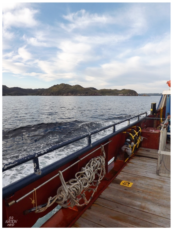
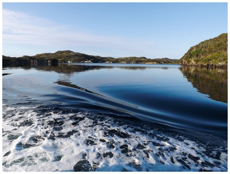
As you can see the boat eventually came. The sharp cliffs and foothills that make up the attractive south coast scenery of coastal places like McCallum, Gaultois, Pool's Cove and Rencontre East was also present along here. I could see how the initial settlers would come to call this Paradise Sound.
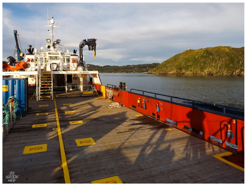
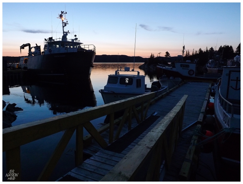
Another noteworthy thing was that my last ferry on this island might have been the most unique. I felt like I should be down in the States crossing some gentle, Southern waterway with this flat, wooden area taking up 2/3rds of the back of the boat. This didn't seem like the same seafaring, squat boats that bob about in the nasty seas of Newfoundland. I guess that the Ramea ferry has a long back section like this but it's a car deck. There's no roads in South East Bight to drive cars upon, therefore this is only a passenger ferry.
I wouldn't behold the seaworthiness of the M/V Norcon Oceanus anyway, since it was an exquisite evening. I spent almost the entire 30 minute crossing out on the wood deck, peering ahead at South East Bight, studying Long Island where there used to be a lighthouse & Marticot Island where there still is a lighthouse.
I went inside for a minute to use the washroom & during this time, absent of the intimidating and weird guy (me), someone came up and talked to Shahlene about our South East Bight plans. This was to be expected as this was the last ferry of the day, where people will generally check-in to make sure strangers realize they're "stuck" in the remote outport overnight.
The great part about all of this was the mention of how we didn't know where we'd camp. South East Bight didn't seem to have an assigned camping area like Francois, but it also had much more land and choices than McCallum. We were simply playing it by ear & going to walk along until we came to some secluded, flat area.
The woman on the boat offered, "well, my sister's house is just about right where you get off the boat. She's not in South East Bight right now, so feel free to set up camp at her house."
This was fantastic news to hear upon returning from the washroom! The friendly South East Bighter took away all of the worry about where to camp & whether it would be okay. We had permission now!
Walking off of the ferry, I had an internal conflict as the boat arrived at 730pm and the westward hills meant that the golden hour was here & going fast. Of course it's slightly annoying to set up camp in the dark, but...
Making the right call, the gear was dropped off in the camping spot/front yard and we'd deal with breaking camp later.
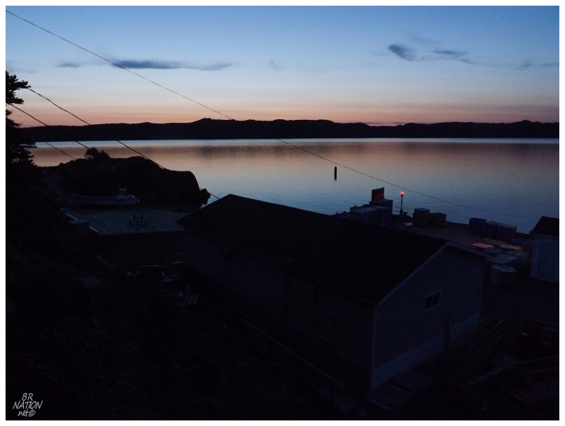
Walking around, it was amazing how quickly silence enveloped the village. South East Bight was different from other ferry-to places in that it seemed healthy with a sizable fishing fleet and 11 children - but, from the excitement of the ferry to nightfall, everyone went back to their homes and the place went quiet. It would have been eerily quiet if not for the tranquility of it all.
If you're wondering how I knew there were 11 children in the community, it's because of one of my favourite CBC stories where Santa comes to South East Bight via the RCMP boat every year. After Santa listens to some songs, cheers along some jigs and enjoys a Christmas feast, the people of South East Bight have enough and/or are willing to sacrifice enough to send Santa and the police on their way with coats, gifts & food items for the needy.
It's funny that this was the one only reachable by ferry place where I grew worried and let that worry defeat me. The few people I had met so far, including this lady who offered up her sister's front yard, were all very friendly and welcoming. There wasn't even that feeling of being a weirdo and having your motives questioned for wanting to come to an isolated outport. (Most Newfoundlanders are extremely proud of their towns & this only tends to be a younger person's question, where they wonder why someone would spend the time/money to come see a place.)
Back in the front yard/camping area, setting up the tent and blowing up the air mattress, eventually it was time to sit back and relax. And boy did we have a great spot. It was isolated enough, but with a great view over the harbour.
It was also funny because a woman came to check up on the house near nightfall, which made me feel a bit uncomfortable as if I was imposing or taking advantage; but she had very little to say while closing the living room windows for the night, other than dismissing our worries about being in the way. Our presence in the front yard was no problem at all.
The front yard had just about enough space for a tent between the porch and this exposed rock that fronted the 'street' (concrete walkway) that passed by. The tent and the grass area had a good enough view, but it didn't take long to climb up and use the natural seats made by the different levels of this big rock. During the next entire hour of sitting there, only two men walked by on the concrete path below.
Going for a walk later in the night, it seemed that the town was quiet and everyone was settled into whichever house they were occupying for the night. Without a flashlight or knowledge of the path network, there was only so much exploring to do on the pitch-black streets.
Making the way along grassy paths by cell phone light, finally we curved back to the front yard/camping spot to find the tent.
The next morning, with the ferry leaving at 830am, I woke up early to get in one last walkabout of South East Bight.
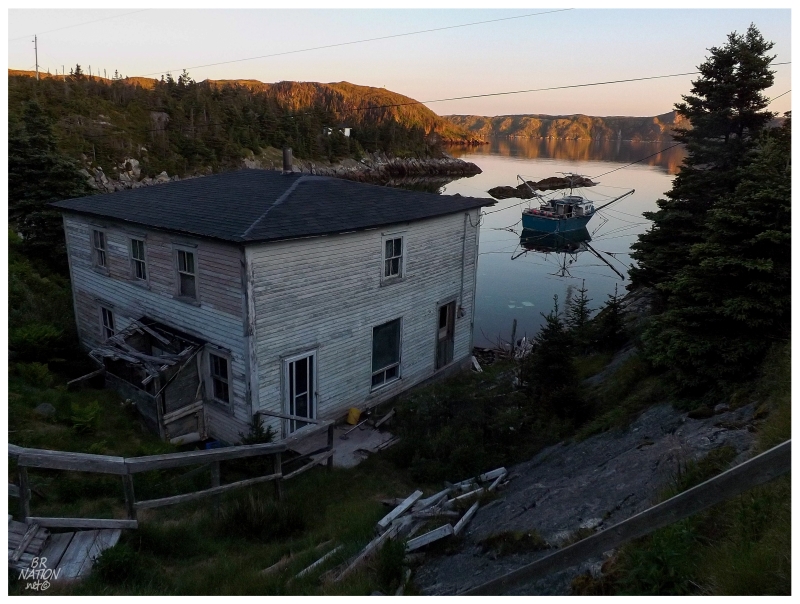
As I sped past the boats, main streets, school & church, finally I circled around to follow the shoreline back away from the inland features. It was here that I found winding dirt paths leading to a couple of hidden coves, with additional boats out in the water and a pair of old homes dominating the landscape of each coastal indent.
If I thought it was quiet last evening, this morning was competing for the title.
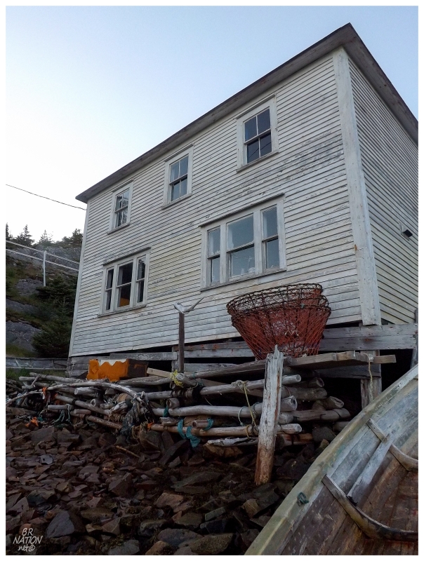
I picked my down the slippery rocks to the shore beneath the crab pot house, the only noise the slightest wave lapping at the sea's edge and the odd time I moved a rock enough to clank against one of the others.
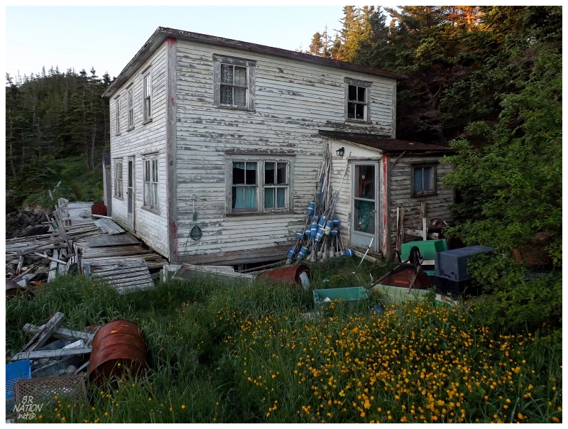
Needing to get back soon, I hurried along the grass path to the next tiny cove, where a very similar house claimed the waterfront. Whereas the last one seemed to exist as someone's guest house nowadays, this one was filled to the gills with fishing supplies.
The wood pallets and old porch flexed under my weight though, so who knows how many crabs or cod the fishing equipment sees nowadays.
And then that was all of the time I had in South East Bight. Slapping together the tent & squeezing flat the air mattress, there was only about 10 minutes to spare when we boarded the boat. Having walked into yards at the north end of town, along with two go-rounds of the inland circle to the grassy paths beside the coves, I left South East Bight feeling that I had done my due diligence and visited what there was to visit.
This all changed when we pulled out of the harbour.
I knew there was a maintained ATV trail to a cabin/resettled community about 5km away from here, but mistakenly thought our road had turned into that ATV trail and there was nothing more to see - we actually stopped far too early & missed a whole neighbourhood of South East Bight! A big area with some of the oldest homes that belong to the community! And a home from resettled Darby's Harbour that was disassembled and reconstructed here! Gah!
Oh Petite Forte, here I was back again feeling emotional. Unfortunately for my agitated self today, the ferry only runs 2 or 3 times per day so it wasn't like we could just pop back over. The next boat going to South East Bight today was staying there for the night.
So in the end it's a good thing everyone was so friendly & welcoming, because now I'll be headed back to South East Bight one of these years.