Returning from South East Bight, I had now visited the 3rd last village I had yet to see on the island of Newfoundland - and the other two were along the way back home.
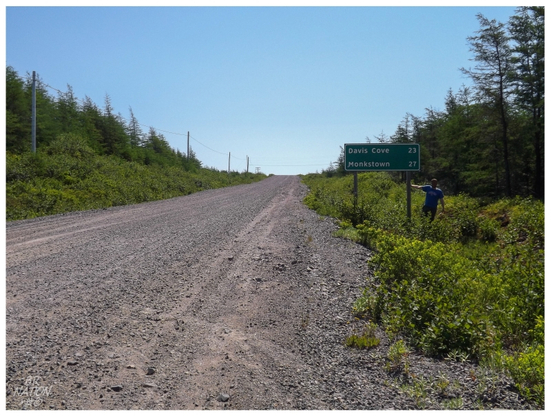
I headed up the Burin Highway towards the Trans-Canada, eventually leaving most of the Burin Peninsula towns and their highway signs behind. After passing the Jacques Fontaine turnoff, there's only 4 more turnoffs over the remaining 100km, with two of them clumped together up by Swift Current and Goobies. I've turned west towards Terrenceville before, but what I was interested in today was the large green sign for an eastern turn to Davis Cove & Monkstown.
There's two main reasons why these two villages remained. One is that I've always wanted to size up a ridiculous hike or see about getting a boat out of Davis Cove or Monkstown. After hearing that not much fishing goes on out of Davis Cove anymore, I half gave up on ever visiting the islands or isolated coves of surrounding Placentia Bay. The other reason would be for the five times I've visited the Burin Peninsula, if I didn't focus on the rugged towns around Jacques Fontaine, then I focused on the many short highways of the isthmus near Marystown. If I didn't focus on those, then I focused on driving around the boot of the peninsula. Davis Cove & Monkstown were simply left for the next trip because of the long road only leading to two villages, in an area where you have plenty of other long (and plenty of short) roads leading to a glut of communities.
It also didn't help that these two isolated communities are only connected by a gravel road. On the Burin Peninsula where every other secondary highway is paved, you have these two solitary villages a 27 km/17 mi drive down a dirt road away.
Well, today was finally the day I'd see Davis Cove & Monkstown.
After lunch along the highway, I pulled onto the NL-215 and bumped along, the first few kilometers leading one to imagine the long, remaining 20-odd kilometers. The road was lined with bogs, small ponds and not much else. Once in a while the road would reach a height where you would get a good view over the surrounding barren lands, which revealed that it wasn't just the road that seemed empty. It was quiet out here and stark. Over the whole drive, one car passed us going the other way & one car was parked along the road to hike in for berries or whatever. Picturing tiny settlements at the end of this road, this quiet added to the feeling of isolation.
The NL-215 forks at about 5 kilometers (3 miles) from Monkstown and it was here that I decided to leave Davis Cove for last; figuring my friend Steve Davis would enjoy that Davis Cove was the last one.
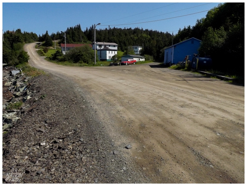
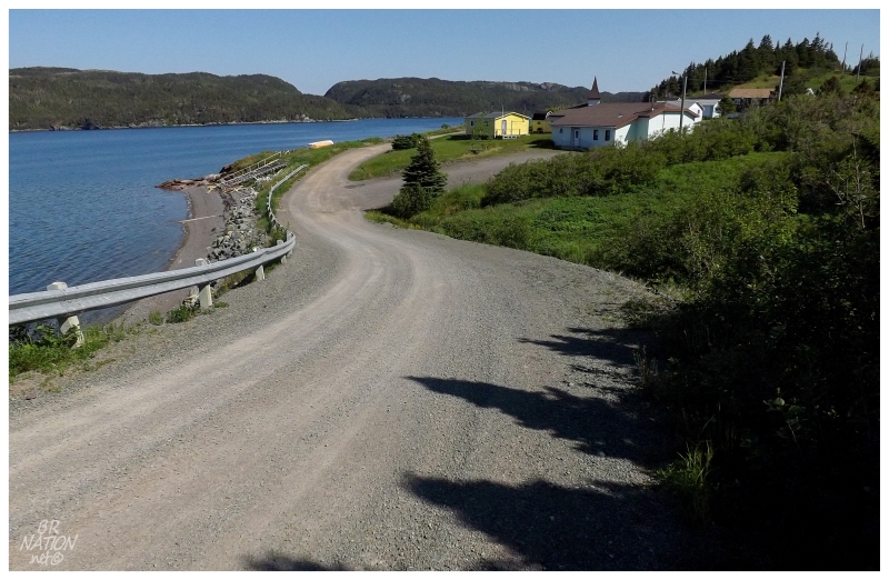
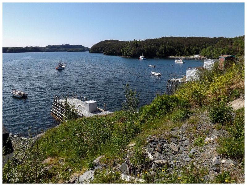
Continuing along the NL-215, the welcome to Monkstown sign came as forests lined the road and driveways led off towards fleeting glimpses of nice, kept up, modern places. Thankfully the road would spill out next to the ocean, where a short drive allowed views of some of the older homes and the fishing activity of Monkstown. The cliffs weren't out of this world like they can be at some other Burin Peninsula places, but Monkstown was pleasant and tranquil. A calm, sunny day with little wind didn't hurt either.
Monkstown is in the Placentia Bay area and Placentia Bay was one of the worst hit areas by resettlement. The surrounding rugged landscape and the number of island communities led to great movement and abandonment in the 1960s and 70s. One doesn't need to go very far south from Monkstown & you'll see the map dotted with tens of names of places which used to exist.
It's these old places that used to swell Monkstown's population in the winter, as there were a few summer residents, but many people only came to Monkstown to take advantage of the forests for cabin logs, fuel and main trunks for their fish flakes. The forests of Monkstown were so good that they also brought about a sawmill here in 1896, providing wood to places like Davis Island, Petite Forte, Great & Little Paradise. There was even a English company that employed 200 men here in wood harvesting in the 1920s, albeit only for a brief period.
The population would peak at 164 in 1956, but even that number couldn't wrangle a highway connection. It wasn't until 1980 that the road I drove today was put in from the Burin Highway to Monkstown.
The population would fall to 90 in 1986, then continue steadily decreasing all the way down to 30 by 2011.
For how small & remote Monkstown is, with this declining population, I haven't seen a news article about them considering modern day resettlement.
Leaving Monkstown prematurely in a bit of excitement, it was now finally time to visit Davis Cove and have seen them all. One might think there'd be a complete wave of excitement over me here, but I was somewhat conflicted, since there wouldn't be any more new towns to see. I comforted myself in that I'd never get to every resettled place & there's hundreds of cabin communities for me to visit (plus of course, things that aren't communities, in addition to taking time to see more of the places I've already been...)
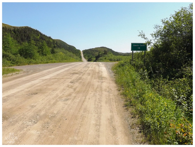
Anyway, enough of that - 3.2 KILOMETERS (2 MILES) TO DAVIS COVE!
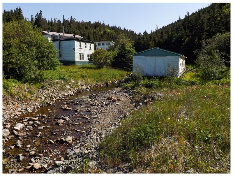
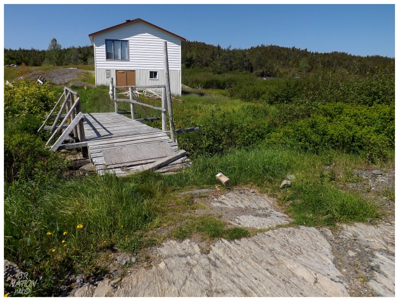
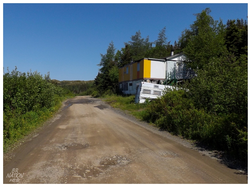
The short Davis Cove road was much of the same, with the only addition of passing a large lake and its eastern rock face. The homes and cabins would start a fair bit before the cove of Davis, as the road lazily winded along the relatively flat ground. There was more than enough room for even the most introverted person to have a cabin by themselves.
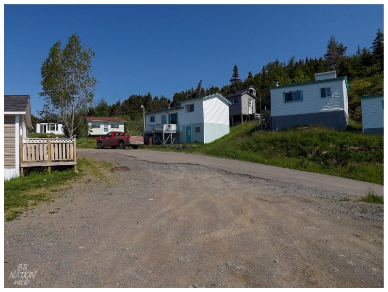
The above picture shows downtown Davis Cove, the only place in the 22-home community where you actually feel squeezed in and surrounded by houses. Just as soon as this came, a wide harbour turnaround was up ahead (you can see the dirt of the turnaround in the foreground of the above picture).
Considering how small and sleepy I always pictured Davis Cove to be, there sure were enough people outside or peaking outside at the raucous that was a car approaching the village. I had a celebratory Keith's lined up to walk around and leisurely explore while taking pictures, but it suddenly seemed like we were very much the focus of Davis Cove's excitement.
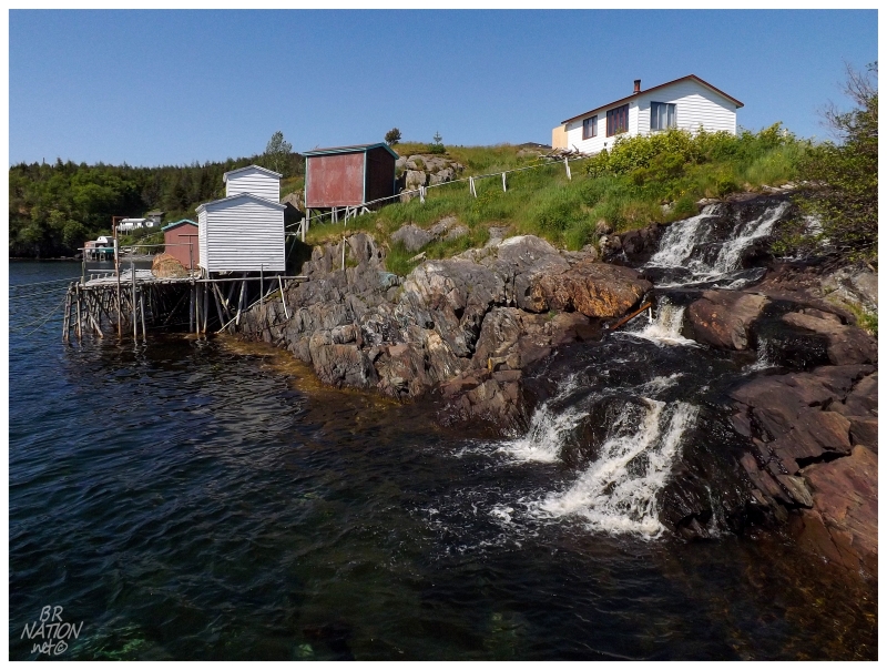
It worked out in a funny way in that I walked down to the wharf to get away from the houses, only to discover a waterfall spilling out into Davis Cove. How nice.
I'm pretty sure I wouldn't have walked down to the wharf unless I was spending much more time in Davis Cove - it actually would have been one of the last places I'd normally explore.
I took all the pictures I could from the turnaround at Davis Cove, since it seemed to be the one place away from people. This is obviously another case where no one would have cared what I was up to, but I work up the worst scenarios in my mind and picture having to explain why I'm in Davis Cove. I live in a place with the friendliest people ever, and I really need to remind myself of that sometimes.
Maybe Davis Cove can be that reminder (even though I was initially hoping it would be a reminder of lazing about sunny Placentia Bay without rushing anywhere else).
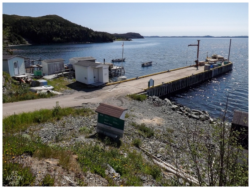
Looking east from Davis Cove.
Davis Cove first appeared in the census of 1845 with a population of 35 people. As there is a Davis Island nearby, and Davis Cove, and in 1928 one of the more popular family names was still Davis, you can see where the name originated.
Those who lived in Davis Cove were fisherman, making their living by the inshore cod fishery. This must've been a decent living for those who lived here, or people simply wanted to live at Davis Cove, because the population ballooned to 183 in 1956 and 206 in 1961. That's enough people & children to allow a Roman Catholic schoolhouse to be built here.
Looking south.
The reason Davis Cove is so especially sleepy and depopulated today is because it was focused upon by the resettlement program of the 1960s. All but 6 households decided to leave the lack of roads and remoteness behind, with 209 people leaving Davis Cove for St. John's, Swift Current, the Placentia area, Southern Harbour, Arnold's Cove, Long Harbour or Stephenville.
Today Davis Cove is down to 15 people, a substantial drop from 42 in 2006. Knowing the population figures for many of these places that I visit, a number in the teens (15) is very low, especially for a place at the end of a lengthy road. I now wish I would have talked with some of the residents to hear what they think the future holds for Davis Cove, as I certainly wonder what this place will look like in 5 or 10 years time.
Driving away from the water in Davis Cove, I wanted to stop on the other "side" of town, but the hamlet is so small that I was at the last (first) house before I knew it.
I paused to think for a second, wondering if I'd ever return to Davis Cove.
It wasn't long before we were back at the fork, then almost back at the main Burin Highway. Stopping near the start of the NL-215, it was time for a celebratory picture.
Monkstown #790. Davis Cove #791. I had been to them all after 5 years and 9 months of living here.