Two of our good friends had just abandoned us for PEI a few weeks prior0, leaving six of us in Corner Brook with only a couple of summer weekends left. I can't remember if it was Labour Day or just a weekend where we all happened to have time off, but the group of us made plans for an overnight trip. Ever since I went to Francois in 2010, all of my friends here have had to listen to my songs of its worth. Once again proposing a visit to the stunning south coast outport, the time had finally come where I was going to impress them with my recommendation. |
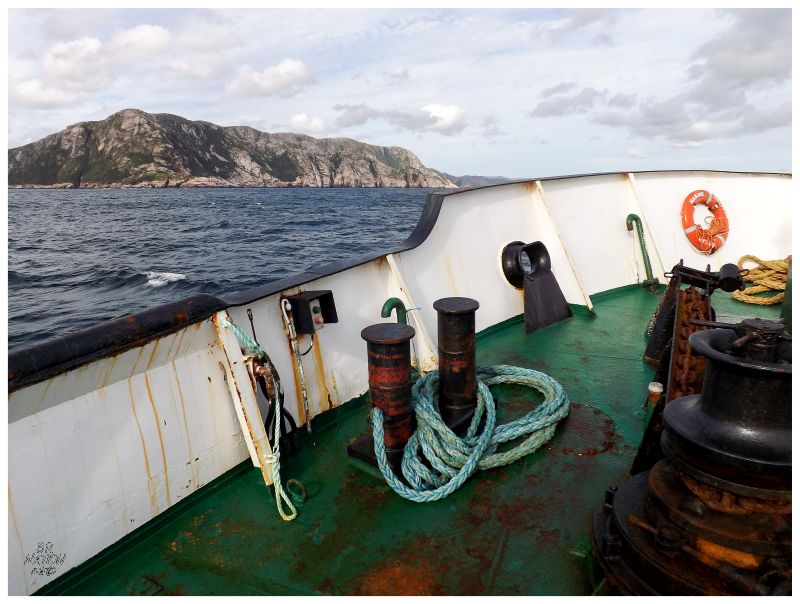
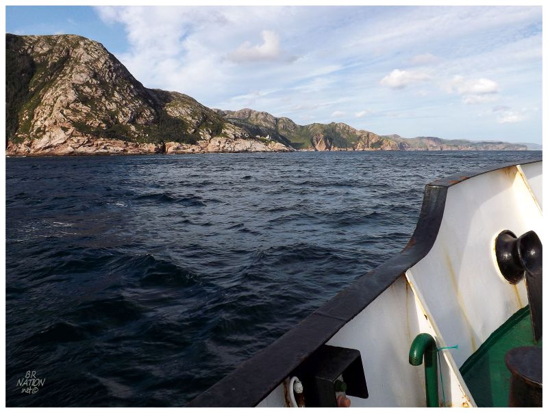
We drove down to Burgeo and camped at Sandbanks Provincial Park, affording us plenty of time to get our stuff together for the 1:45 boat to Francois the next day. Squeezing our 10-15 bags between the narrow poles and ropes of the gangway, soon enough we were pulling out of the Burgeo Harbour. The relatively calm seas saw us napping atop the crane platform and luggage trunks, moving from the wide view of the top deck to the action at the front of the boat, while foremost enjoying the beautiful day and luxurious $8.25 cruise. It's these calm seas that allowed me to behold the incredible coast between Grey River and Francois. Of course I'd been to Grey River on a day where the sea was like glass, but the one time I continued to Francois the sea was so rough that I didn't go out on the deck on the way there or the way back, outside of the 5 minutes intervals inside the harbours of Francois & Grey River. |
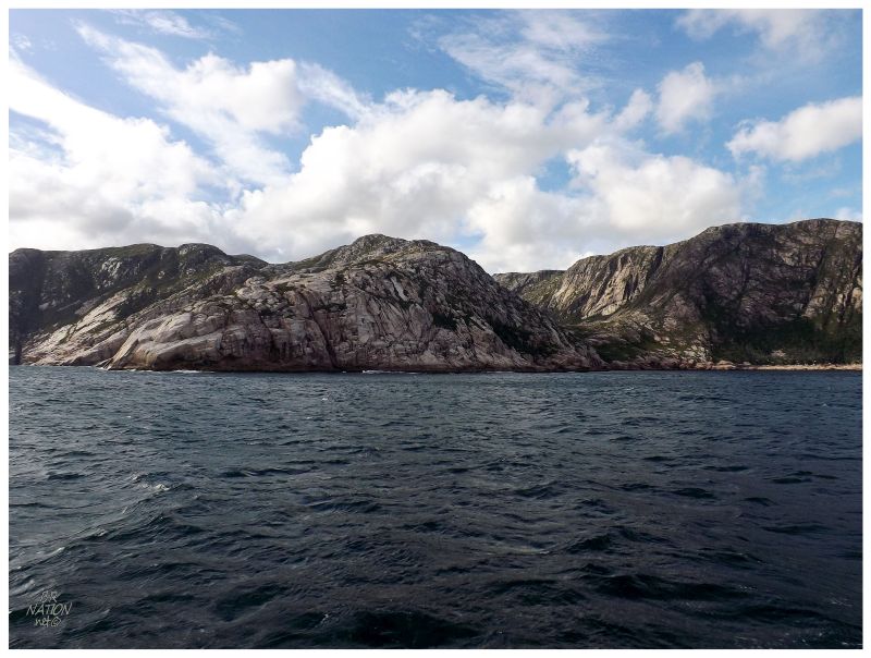
I knew what the coastline immediately around Francois was like from hiking around there, but everything from about halfway between Francois & Grey River was a marvelous discovery, which made me want to look up when the boat continues to McCallum (Thursdays). It was also enough that it made me envious of those with personal boats and cabins along here, or those who've kayaked this unforgettable coast. |
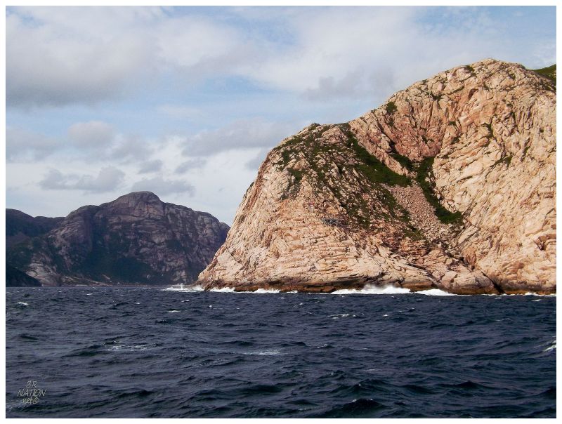
As we passed Cape La Hune, a tiny modern aluminum light structure was pointed out to me & I was daunted by the thought of how you'd ever reach this point if there was an actual lighthouse standing here. I have some crazy lighthouses left if I plan on one day getting every lighthouse in Newfoundland, but a theoretical Cape La Hune Lighthouse that would actually count would be one of the hardest. (In my picture it's hard to make out the modern light, but you can make out the grey two-by-fours of the helipad near the centre of the picture. The 'light' is up and to the left of the helipad.) |
Cape La Hune.
Cape La Hune made me think about how a trip to the namesake, now-resettled community behind the cape would be pretty high on my Newfoundland wish list. I also thought about the effort in getting to Francois and then getting a boat from Francois - but to motor along on that ferry and pass the beauty of Cape La Hune, it's the type of scene that enchants you into putting forth extra effort. |
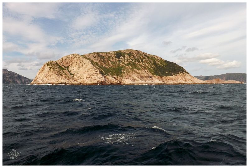
Through daydreams, hanging with friends and the joy in standing before this beautiful coast, I found Francois up ahead in what seemed like less than 4 hours on the government ferry. The white dot you see along the coast at centre is the West Point Lighthouse, the one I made it out to on my previous trip to Francois. I was happy to see it still standing there & I happily pointed out my hike to it in a chesty fashion to whomever would listen. |
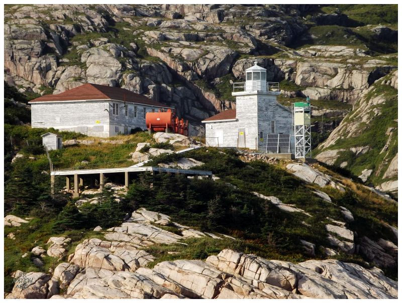
It seems that the Coast Guard had paid a visit in the years since Nicole & I had visited. It was great to see them taking care of a federal heritage lighthouse in now sealing it to trespass, although I'd later sadly learn that they were planning to remove the background keeper's house sometime in 2015. |
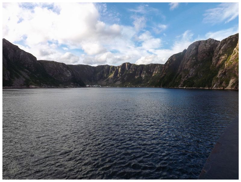
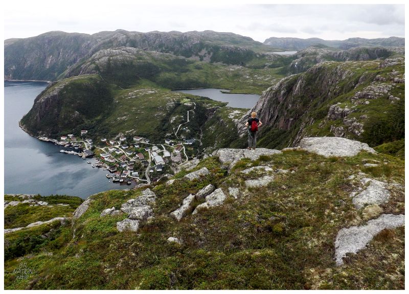
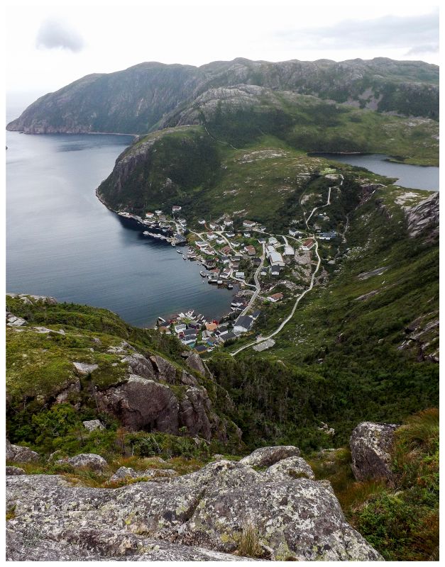
Moving past the lighthouse, the group was pretty impressed when we pulled into the hidden harbour of Grey River, then impressed again in a different way when we pulled into the fjord-like harbour of Francois. |
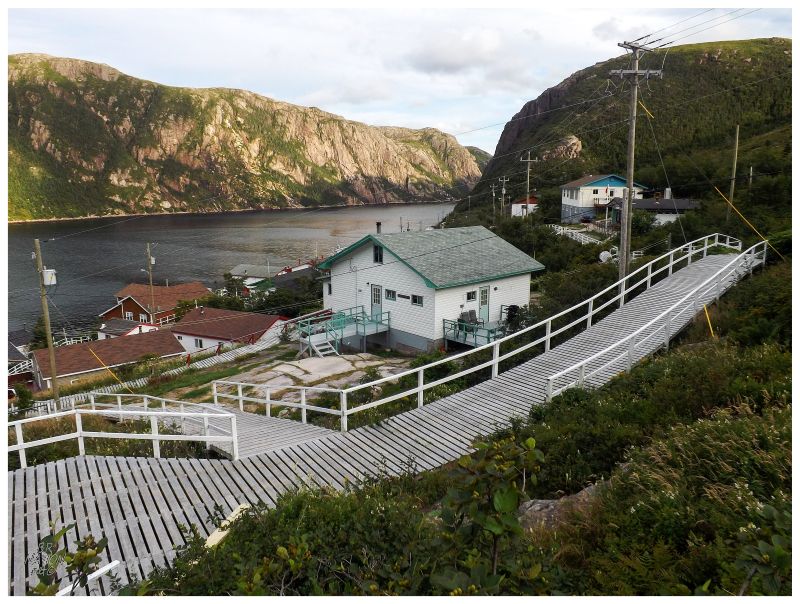
Away from a few locals, the only other passenger on the boat was a 20-something year old young lady coming to teach here for the year. An ATV pulled up and helped her with directions and offloading, while we carried our stuff past them and up the hill. Walking the boardwalks through the small town, I thought about how an ex-girlfriend of mine tried to break through with teaching and would get offers like Grey River and Francois as well, since the teaching opportunities here are slim in the cities but they can always use people in the distant villages. My ex-gf never took a job outside Corner Brook & I pondered what life would be like for this girl through a long winter here where the ferry is halted by rough seas. As much as I think it would be an interesting experience, I wasn't sure I could commit a year of mine like she had done. |
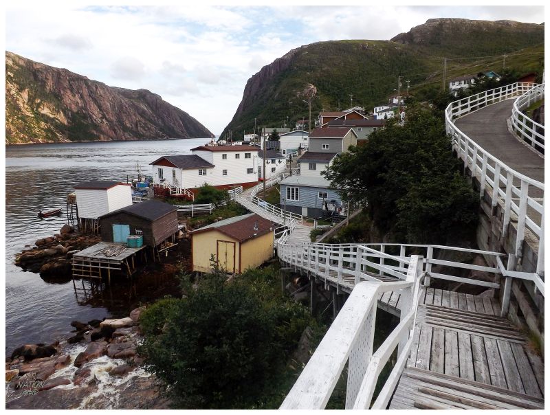
Dropping off our bags of crap at the camping spot, we brought a huge tent and all of us planned to sleep together, so there wasn't much setup to do. Leaving camp for a walk, where I had spent little time in actual Francois back in 2010 - it took all day to hike to the lighthouse - there wasn't much that felt familiar. There wasn't the feeling of outports like Long Island or La Poile where the town was where I focused most of my memory and effort (in Francois I'd argue I got those feelings as we went past the lighthouse). |
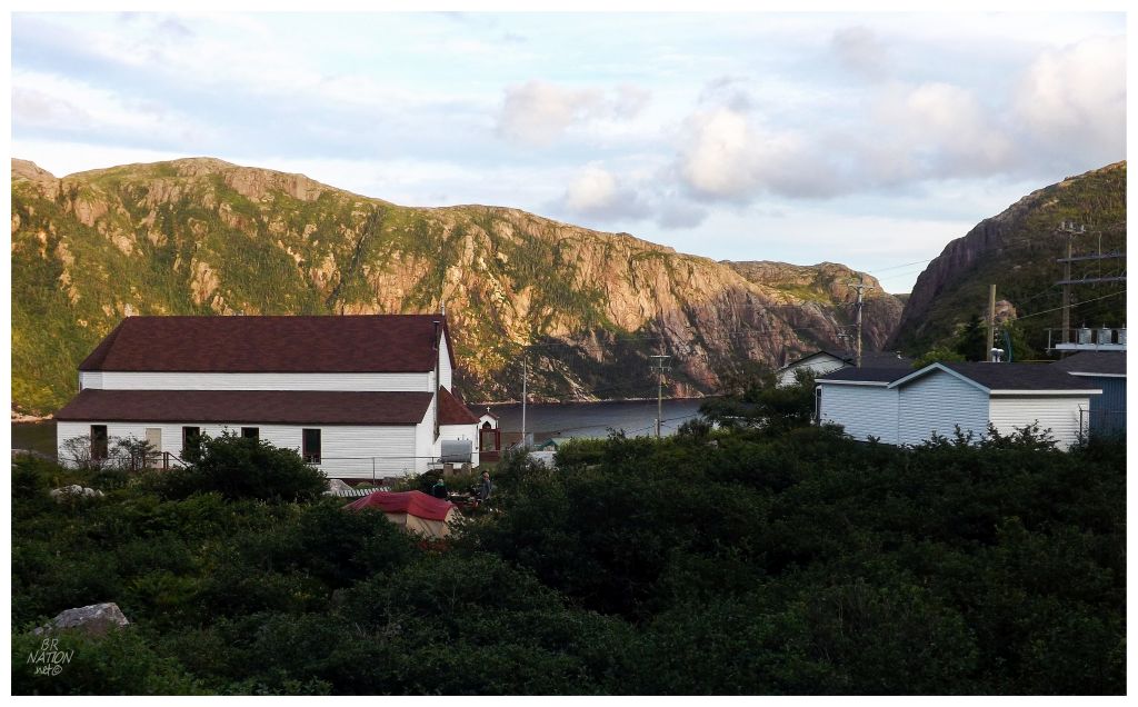
I returned to camp and scampered over the rock fall behind it, where you can see the red and beige of our tent set up in the community camping spot behind the Anglican Church. Whereas last time we had paid to stay at a house for accommodations and dinner, this time there was less of a community feel. Especially as Francois has several boardwalks and the popular ones seem to be lower down by the water. |
The next day we wouldn't hike out to the lighthouse, but rather we tackled the trail to The Friar. Stepping uphill past the cemetery and towards the community boardwalk pond trail, we then cut north and sliced varying directions as we only knew we had to "find the trail and get atop the hills behind Francois". |
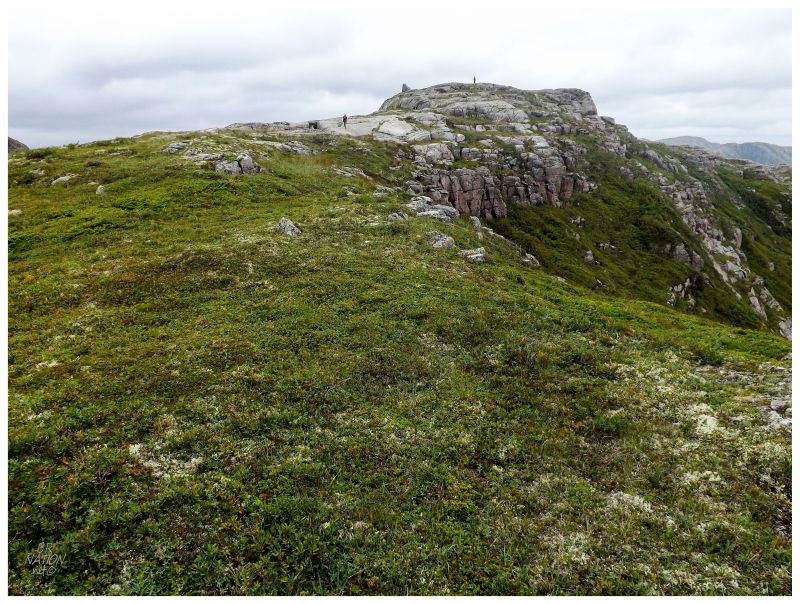
We went too far to the bigger pond behind Francois, before making our way towards the rocky hills, rounding further north than we needed. Thankfully the hiking back here is forgiving and soon enough we were on flat, smooth hilltops, making upward progress towards the peaks we saw up ahead. |
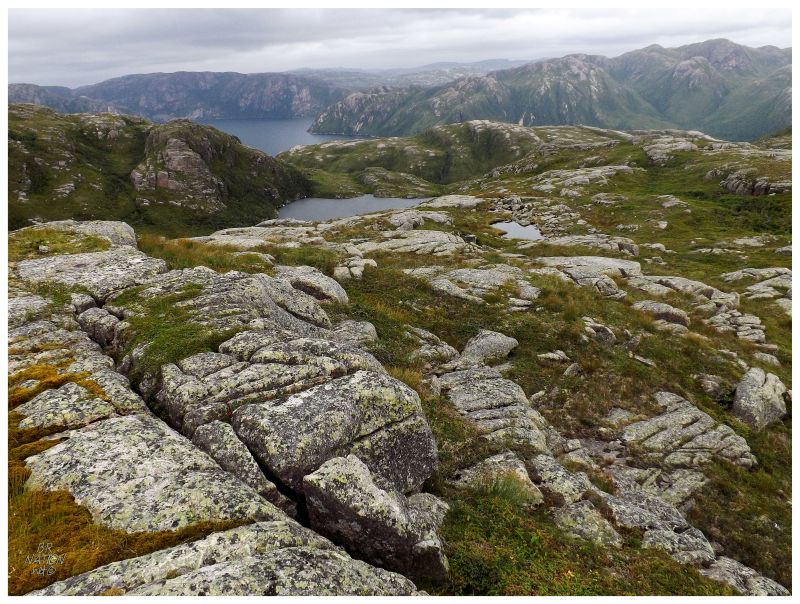
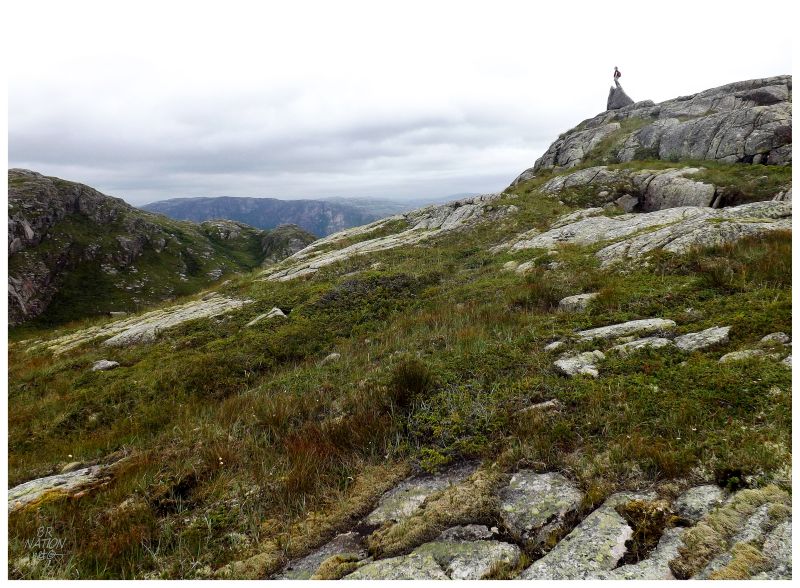
As I said last time I was in Francois, and as I always say along the southern coast of Newfoundland, the treeless smooth barrens are an explorer's dream of being able to go whichever direction and cover healthy distances. The six of us sat atop this 800ft unnamed mound and while others breathed in the scenery, I fantasized about all of the bays, coves & named hills you could hike to from here. |
Atop that 800ft hill to Francois' west, we lost a couple of people before four of us continued on through a slippery valley of tuckamores, then up another rocky, mossy hill. The rain started to sprinkle here & I knew it was supposed to increase, so this forward progress would have to do. I think we only made it to the rock face to the northwest of Francois, not to The Friar directly to the north, but I wasn't about to risk my backside while unprepared for rain in terms or clothes or a GPS unit. Stevie continued on by himself and came out where I think The Friar is, so maybe you should follow his blog instead of mine, haha. |
The precipitation would increase from drizzle to light rain as we made our way back, this time trying not to go so far out of our way & being rewarded with a steep, thickly treed valley instead. We'd keep it moving until we giddily put on warm & dry clothes back at camp, settling into a gloomy evening with good food, company and rum. The wind and the rain increased while the tent made a telltale sound, but the only one who would pay for it was the one who worked the hardest today, since Steve was jammed into the end where the flimsy tent swayed and engulfed him with every gust. The rest of us kept a 4-ft ceiling thanks to a glut of central tent poles. The next morning came early with a 7:30 ferry call and we were gorging ourselves with Chinese in Burgeo before noon. In addition to happily showing my friends this magical place, I was also happy to have seen it for a second time, even if I only reached the rock next to The Friar. I thought about the time and effort as we drove homeward back up the Burgeo Highway, but the crowd seemed to think it worthwhile. |